This district elects one MLA. Voters mark one name on Saturday, October 24, 2026, and the candidate with the most votes wins the seat.
Vancouver-Point Grey is a provincial electoral district on the west side of the City of Vancouver, beside the Strait of Georgia. It takes in Point Grey, the western part of Kitsilano, part of Dunbar, the University Endowment Lands and the University of British Columbia campus. The 2021 census counted 56,810 people in it, and the Electoral Boundaries Commission gives its area as 41 square kilometres.
Vancouver-Point Grey lies on the west side of the City of Vancouver. The Electoral Boundaries Commission's 2023 final report says it includes the UBC Endowment Lands, Point Grey, the western part of Kitsilano and part of the Dunbar neighbourhood north of King Edward. The report says the Strait of Georgia forms its northern, western and southern boundaries, and that its eastern boundary follows Camosun Street, W King Edward Avenue, W 16th Avenue and Balsam Street. Vancouver-Quilchena lies to the south and takes in the Musqueam 2 reserve. Vancouver-South Granville lies to the east. The commission counted 56,818 people in the district, 5.7% from the average district size, and gives its area as 41 square kilometres.
Much of the land is shoreline and forest. The University Endowment Lands cover 1,200 hectares by the account of their administration, and 763 hectares of that is Pacific Spirit Regional Park. Metro Vancouver lists more than 55 km of walking trails there, and the City of Vancouver places Camosun Bog inside the park. On English Bay the City names Jericho Beach and Spanish Banks as the two popular beaches of West Point Grey. Metro Vancouver lists Chancellor Boulevard, University Boulevard, 16th Avenue and SW Marine Drive as the transit routes to the park.
Most people reach the university by bus. TransLink says the 99 B-Line on the Broadway corridor carried up to 60,000 customers a day in 2019, and that UBC had a daytime population of 80,000 people that year. TransLink is studying a SkyTrain extension from Arbutus with stations at Macdonald, Alma, Jericho and the UBC Trolley Bus Loop. The 2021 census counted 56,810 residents, of whom 37.4% are immigrants, and 20.3% of working residents are in educational services, the largest industry group. Owners hold 50.1% of homes and renters 49.9%.
Musqueam, Squamish and Tsleil-Waututh territory, and the village at Jericho
Three Nations describe the shores of English Bay and the Fraser River estuary as part of their territory, each in its own words. Musqueam, whose name for itself is xʷməθkʷəy̓əm, says its ancestors lived throughout the Fraser River estuary and looked after it for thousands of years. Its territory page lists the UBC Endowment Lands among the places that today bear other names within its territory. The Squamish Nation, Sḵwx̱wú7mesh Úxwumixw, gives its territory as 6,732 square kilometres that stretch from Point Grey in the south to Roberts Creek in the west. Tsleil-Waututh Nation, səlilwətaɬ, calls itself the People of the Inlet and gives its territory as 1,865 square kilometres.
UBC's archives say the Point Grey campus stands where Coast Salish peoples lived, in particular Musqueam, and give the Musqueam name of Point Grey, written in English letters, as Ulksun. The same page says Squamish and Tsleil-Waututh people also used the land and its resources. The City of Vancouver names the Musqueam village at West Point Grey as Ee'yullmough. Its Jericho Lands page writes the three Nations' name for that site as ʔəy̓alməxʷ, and Bayview School says it stands near a former Musqueam village that the school writes iy'a'l'mexw.
The City adds that Musqueam people long revered Camosun Bog, which it calls 2,000 years old and places within Pacific Spirit Regional Park, as a portal to the spirit world. The Musqueam reserve itself lies in the next district, Vancouver-Quilchena, according to the commission's 2023 report.
Spanish names, a logging camp and a beach settler, 1791 to 1897
The City of Vancouver says that the Spaniard Jose Narvaez and his crew rediscovered the site in 1791 and named it Langara Point. The next year Captains Galiano and Valdez met Captain Vancouver off the same shore, and that meeting gave Spanish Banks and English Bay their names. UBC's archives say that in the 1860s the British government made Point Grey a colonial Admiralty reserve, and that in 1865 a 21-year timber lease on the point went to the Vancouver Island Spar, Lumber and Sawmill Company, later the Hastings Sawmill Company.
The City says Jeremiah Rogers set up the first logging camp in 1865 and cut large fir trees for ship spars, and that others ran a whaling station in the 1870s. It says Rogers named the place Jericho after the Biblical Jeremiah. The Vancouver Heritage Foundation gives another account: Rogers's company, Jerry and Co., cut timber for Hastings Mill, and the name is thought to join the company name or Jerry's Cove. The City says the Vancouver Golf Club was set up in 1892 on the sand dunes of Jericho Beach and played with tomato cans for holes.
On the Kitsilano shore the City names Sam Greer as one of the first non-native settlers. He lived on the beach from 1882 until 1890 and lost a land title dispute with the Canadian Pacific Railway, which had been given the land in 1885. The City says tent campers lined the beach in summer, and that it was then called Greer's Beach after him. By 1897, the City says, only 54 property owners at Point Grey had set up homes.
The City of Vancouver Archives records that the Corporation of Point Grey was established on 1 January 1908 under letters patent of 18 December 1907. Until then the land had belonged to the District of South Vancouver since 1892. The Archives places its first boundaries south of 16th Avenue, from about Camosun Street to Cambie Street, and says Point Grey joined the City of Vancouver on 1 January 1929.
The City says the new council brought water service to West Point Grey in 1908, began work on Northwest Marine Drive and saw the Jericho Golf and Country Club open that year. A one-room school was built in 1909 for the area's 24 children. The Vancouver School Board says Queen Mary Elementary dates from 1909 and was called West Point Grey until 23 August 1915. After a tax on unimproved land, the City says building permits worth $250,000 were issued in 1912, and by 1924 forty shops lined 10th Avenue between Tolmie and Trimble Streets.
In its Dunbar-Southlands page the City says the streetcar reached Clare Road, now Dunbar Street, in 1913. Point Grey passed what the City calls the first zoning by-law in Canada in 1922, which allowed only homes and their outbuildings. Lord Byng Secondary opened in 1925 and was named for the Governor General of the time, the Vancouver School Board says. The school page adds that a wing which began as Langara Elementary in 1927 is now École Jules Quesnel.
Kitsilano: the railway company, the streetcar and a high school, 1885 to the 1960s
Kitsilano Secondary School's history page says the neighbourhood is named after Xats’alánexw (Khahtsahlanogh), a family headman of the Squamish Nation, and that his title passed to his grandson at a potlatch in 1893 at the village of Sen̓áḵw on Kitsilano Point. The City says the Canadian Pacific Railway owned most of the land east of Trafalgar Street, that the B.C. Electric Railway ran a streetcar along 4th Avenue to Alma Street, and that the Burrard Bridge, built in 1932, also made the area easier to reach. Residents lobbied for sewers and tram service as early as 1907.
The City dates the Craftsman-style houses of Kitsilano to the building period of 1910 to 1912. Kitsilano was not fully built south to 16th Avenue until the late 1940s. During the Second World War, the City says, most old estates and many single-family homes on the slope above Kitsilano Beach became rooming houses, and they stayed that way until the 1960s, when university students and young people from across North America had made the area popular.
The school page dates Kitsilano Secondary to 1917, when overflow classes from King Edward High School moved to Cecil Rhodes School. The first temporary wooden buildings went up in 1920 at Trafalgar Street and 12th Avenue, and the present building opened in 1927. The City says the Kitsilano branch of the Vancouver Public Library, also opened in 1927, is the oldest branch in the province.
The university and the Endowment Lands, 1907 to 1929
UBC's archives say a 1907 Act funded a provincial university through the sale of Crown land, and that the University Act of 1908 established UBC. After a province-wide survey Point Grey was chosen as the campus site in 1910, with 175 acres of Crown land reserved. In 1912 the federal government agreed to cede its rights in the Point Grey reserve of the 1860s to the province. Building began in 1914, the First World War stopped it in 1915, and UBC opened that year in temporary quarters in Fairview.
In 1920 the Act was amended to exchange Crown lands in the interior for 3000 acres next to the campus site, which became known as the University Endowment Lands. In 1922 students organised the Pilgrimage, later called the Great Trek, from downtown Vancouver to Point Grey, and a petition with 56,000 signatures went to the Speaker of the Legislature. The government then authorised a loan of $1.5 million to resume construction.
The UEL administration says the first residential lots were sold at public auction in 1925. UBC's archives say that year the province removed the campus, University Hill and the Endowment Lands from the Municipality of Point Grey and began to administer them directly. UBC opened its Point Grey campus in 1925. In 1927 Musqueam agreed to sell its last house posts to the UBC Alumni Association on condition that they stood on the campus next to the Musqueam reserve, and University Hill's secondary school graduated its first class. When Point Grey joined the City in 1929 the campus, University Hill and the Endowment Lands stayed outside the city.
The campus, the neighbourhoods and Pacific Spirit Regional Park, 1945 to 2013
UBC's archives say that in 1945 fifteen abandoned army and air force camps were shipped to Point Grey and their huts became classrooms, laboratories and residences, and that enrolment reached 9,374 in 1947. The new Museum of Anthropology, designed by Arthur Erickson, opened in 1976. The First Nations Longhouse opened in 1993, and in 2006 UBC signed a Memorandum of Affiliation with Musqueam that recognises the Point Grey campus as lying on Musqueam territory.
In 1988 UBC founded a real estate corporation whose first project was Hampton Place, a residential development near the south end of the campus. The archives say it later planned a series of neighbourhoods around the campus, known together as University Town. The Vancouver School Board says that University Hill Secondary moved in January 2013 to 3228 Ross Drive in the Wesbrook Village neighbourhood at UBC, and that its earlier building on Acadia Road had opened to students in 1954.
The UEL administration says 280 hectares have been subdivided and sold since 1925 as residential, commercial and recreational property, and that the remaining undeveloped land was conveyed in 1989 by the Province to the Greater Vancouver Regional District for Pacific Spirit Regional Park. It states that UBC has its own governing legislation and administration, separate from the Endowment Lands.
Jericho: air station, park and the Jericho Lands, 1921 to 2025
The City says construction of the Pacific Coast Station of the Royal Canadian Air Force began at Jericho Beach in 1921, and that when the federal government decided in 1967 to move the station the future of the land became an issue. The Vancouver Heritage Foundation says the base grew onto the former golf course and the grounds of Aberthau during the Second World War, and that from 1948 to 1973 the City assembled the land into a park. Aberthau has been the West Point Grey Community Centre since 1974.
The foundation says the park hosted the 1976 Habitat Forum, and that the Vancouver Folk Music Festival, founded in 1978 in Stanley Park, moved to Jericho Beach Park a year later. It also says Musqueam, Squamish and Tsleil-Waututh Nations and Canada Lands Company acquired the rest of the former military reserve, south of the park, in 2014.
The City describes that site as the 90-acre Jericho Lands, owned by a partnership of the three Nations and Canada Lands Company. Its page says Council approved a policy statement in 2024 and an Official Development Plan on April 22, 2025. The plan provides 30 acres of park space and public open space, and the City says the UBC SkyTrain extension will have a station serving the site. TransLink lists Jericho among four proposed stations.
The first name in this line is Richmond-Point Grey. Elections BC's volume for 1871 to 1986 lists the Constitution Amendment Act of 1923 as creating it, and prints George Alexander Walkem as its member for 1924 and Samuel Lyness Howe as its member for 1928. The same volume says the Constitution Amendment Act of 1932 split Vancouver City into four districts, among them Vancouver-Point Grey with three members. Its first results for that name are the election of 1933, won by Stanley Stewart McKeen, George Moir Weir and Robert Wilkinson, all of the Liberal Party.
The district kept three members through the election of 1963 and had two from 1966. In 1966 Patrick Lucey McGeer received 17,400 votes and Garde Basil Gardom 13,507, both Liberals, ahead of Robert William Bonner of Social Credit with 11,494. In 1986 Avril Kim Campbell of Social Credit won with 19,716 votes (23.24%) and Darlene R. Marzari of the New Democratic Party with 18,311 (21.59%), while McGeer, by then a Social Credit candidate, received 18,256 (21.52%). The volume for 1987 to 2001 prints Campbell's resignation on 27 October 1988 as the reason for the by-election of 15 March 1989. Tom Perry of the New Democratic Party won it with 14,132 votes (52.91%).
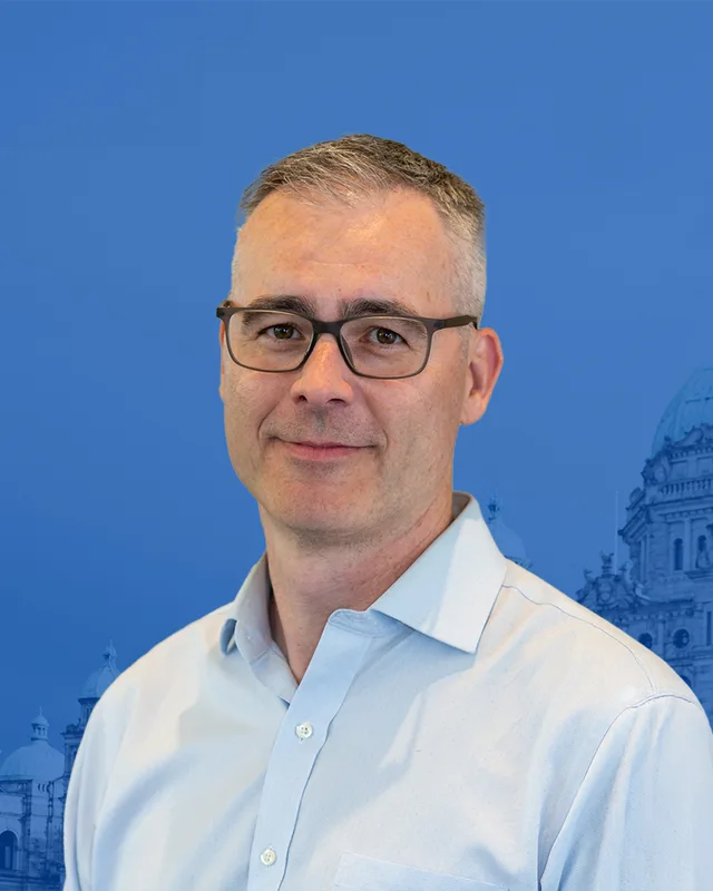
Single-member districts began with the general election of 17 October 1991. Marzari won Vancouver-Point Grey with 12,076 votes (49.26%) against 9,022 (36.80%) for Barry J. Burke of the Liberal Party. Gordon Campbell of the Liberal Party, who had won the Vancouver-Quilchena by-election on 17 February 1994, took the seat in 1996 with 12,637 votes (48.86%) and held it in 2001 with 13,430 (56.14%), in 2005 with 12,498 (45.98%) and in 2009 with 11,546 (50.38%).
For the 39th Parliament the two records differ. The legislature's record names Christy Clark for this district and lists no Campbell. Elections BC prints Campbell as the winner of 2009 and prints his resignation on March 15, 2011 as the reason for the by-election of May 11, 2011. The Province's notice of the by-election gives the same date. Clark won that by-election with 7,757 votes (48.73%) against 7,193 (45.19%) for David Eby. This profile prints both records and chooses neither.
Eby won in 2013 with 11,499 votes (47.59%) ahead of Clark with 10,436 (43.19%), and again in 2017 with 14,195 (55.94%), in 2020 with 12,602 (51.32%) and in 2024 with 12,538 (56.77%). The Province's release says he was sworn in as British Columbia's 37th premier on 18 November 2022 at the Musqueam Community Centre. The 2024 election used the boundaries of the commission's 2023 report, and Elections BC's table matches 55 of the district's 59 voting areas to the earlier Vancouver-Point Grey and 4 to Vancouver-Quilchena. The commission says it moved Dunbar south of 16th Avenue out of Vancouver-Point Grey and into Vancouver-Quilchena, and decided not to extend the eastern boundary into the western part of Vancouver-South Granville.
“Elected as” is the affiliation Elections BC printed with the winning result. The last column is the party the legislature’s records give for that parliament, which differs when a member changed party while in office. A row with that column empty is a winner Elections BC prints whom the legislature’s records leave out. Source: Legislative Assembly of British Columbia (opens in a new tab)
Boundaries since 2024
Vancouver-Point Grey has 59 voting areas. 55 of them overlap the district of the same name used from 2017 to 2024.Others overlap these districts from 2017 to 2024: Vancouver-Quilchena (4).
The commission that drew the boundaries counted 56,818 people in the district, 5.7% above the average for a district, over 41 km².
Vancouver-Point Grey is a provincial electoral district on the west side of the City of Vancouver. The Electoral Boundaries Commission's 2023 final report says it includes the UBC Endowment Lands, Point Grey, the western part of Kitsilano and part of Dunbar north of King Edward. The Strait of Georgia forms its northern, western and southern boundaries, and the commission gives its area as 41 square kilometres.
Which neighbourhoods are in Vancouver-Point Grey?
Vancouver-Point Grey includes Point Grey, the western part of Kitsilano, part of Dunbar north of W King Edward Avenue and the University Endowment Lands, according to the Electoral Boundaries Commission. Elections BC's 2024 voting places also show the University of British Columbia campus and University Hill inside the district, with polling at the AMS Student Nest, University Hill Secondary and the University Golf Club.
Who is the MLA for Vancouver-Point Grey?
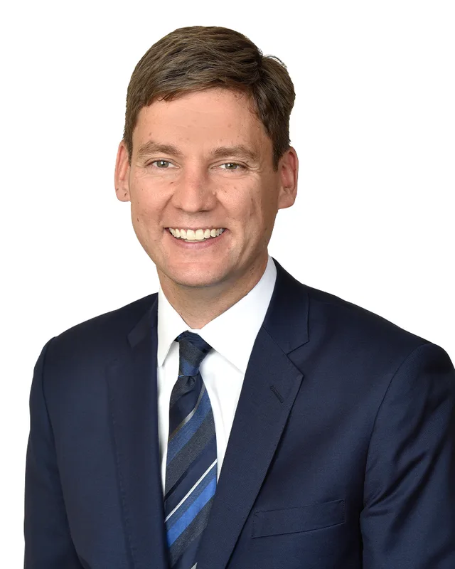
David Eby of the BC NDP is the member for Vancouver-Point Grey. He won the seat in 2024 with 12,538 votes, which was 56.77% of the valid votes. He has won it in 2013, 2017, 2020 and 2024. The Province says he was sworn in as British Columbia's 37th premier on 18 November 2022 at the Musqueam Community Centre.
Who held Vancouver-Point Grey before David Eby?
Christy Clark held Vancouver-Point Grey before David Eby, after winning a by-election on May 11, 2011, with 7,757 votes (48.73%). The by-election followed the resignation of Gordon Campbell, who had won the seat in 1996, 2001, 2005 and 2009. Eby won the seat from Clark in the 2013 general election with 11,499 votes (47.59%).
How did Vancouver-Point Grey vote in 2024?
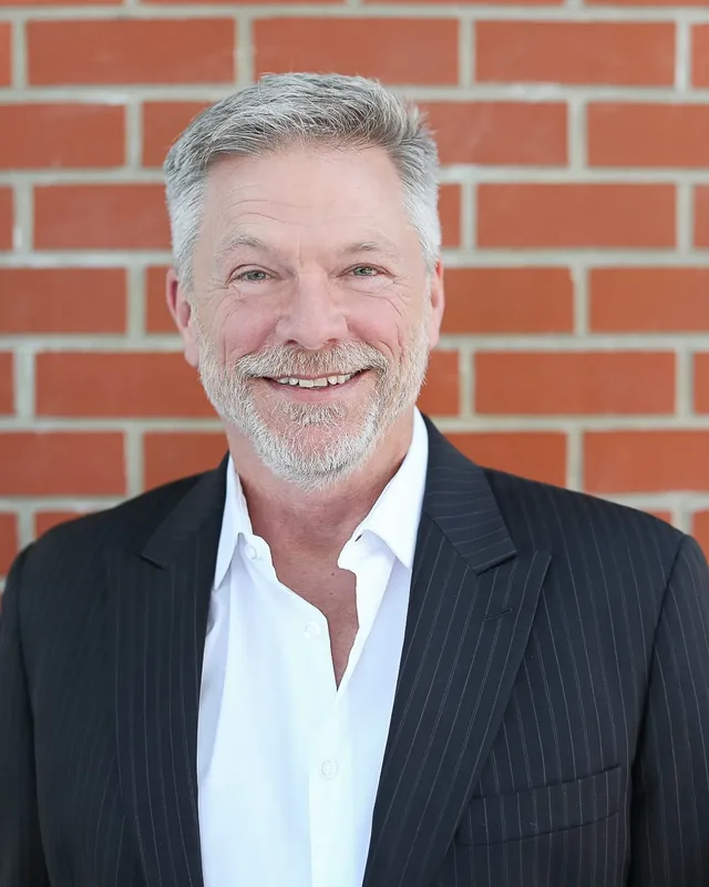
In 2024 Vancouver-Point Grey elected David Eby of the BC NDP with 12,538 votes (56.77%). Paul Ratchford of the Conservative Party received 7,622 votes (34.51%) and Devyani Singh of the BC Green Party received 1,925 (8.72%). Turnout was 63.43% of the 34,880 registered voters, according to Elections BC.
How did the 2023 boundary change affect Vancouver-Point Grey?
The 2023 boundary change kept most of Vancouver-Point Grey and moved some land to Vancouver-Quilchena. Elections BC matches 55 of the district's 59 voting areas to the earlier Vancouver-Point Grey and 4 to Vancouver-Quilchena. The commission's final report says it moved Dunbar south of 16th Avenue out of Vancouver-Point Grey and into Vancouver-Quilchena.
How many people live in Vancouver-Point Grey?
The 2021 census counted 56,810 people in Vancouver-Point Grey. The Electoral Boundaries Commission counted 56,818 people over 41 square kilometres, which is 5.7% from the average district. Of residents, 37.4% are immigrants, and 50.1% of homes are owned while 49.9% are rented. Educational services employ 20.3% of working residents, the largest industry group.
Whose traditional territory is Vancouver-Point Grey on?
Vancouver-Point Grey lies on land that three Nations describe as part of their territory. Musqueam lists the UBC Endowment Lands among the places in its territory. The Squamish Nation says its territory stretches from Point Grey in the south to Roberts Creek in the west. Tsleil-Waututh Nation describes a territory of 1,865 square kilometres. The Musqueam reserve lies in the next district, Vancouver-Quilchena.
What are the University Endowment Lands in Vancouver-Point Grey?
The University Endowment Lands are the legacy of the University Endowment Land Act of 1907, which set up a lands trust to raise money for the founding of the University of British Columbia. Their administration gives their area as 1,200 hectares, of which 763 hectares are Pacific Spirit Regional Park. The first residential lots were sold at auction in 1925. The University of British Columbia has its own governing legislation, separate from the Endowment Lands.
When did Point Grey stop being its own municipality?
The Municipality of Point Grey joined the City of Vancouver on 1 January 1929. The City of Vancouver Archives records that Point Grey was established on 1 January 1908, after belonging to South Vancouver since 1892. UBC, University Hill and the Endowment Lands stayed outside the city in 1929.