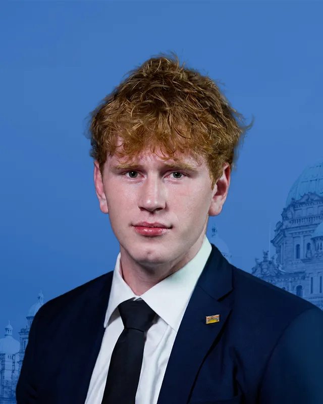
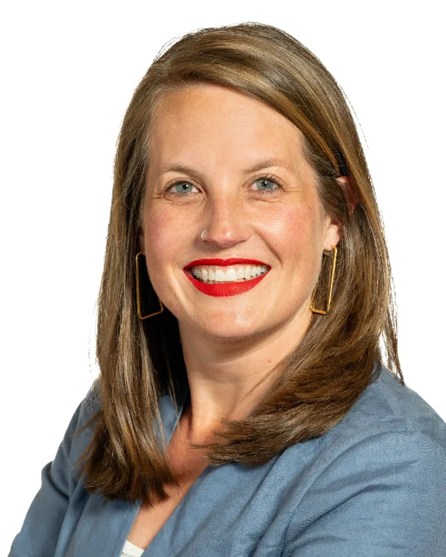
Vancouver-Little Mountain. 3 candidates, one seat.
This district elects one MLA. Voters mark one name on Saturday, October 24, 2026, and the candidate with the most votes wins the seat.
Vancouver-Little Mountain is a provincial electoral district in the middle of the City of Vancouver. It is centred on Queen Elizabeth Park and takes in South Cambie, Oakridge, Olympic Village and Mount Pleasant west of Kingsway, as far south as 49th Avenue. The 2021 census counted 57,030 people in it, and the Electoral Boundaries Commission gives its area as 10 square kilometres.
Vancouver-Little Mountain lies in the middle of the City of Vancouver. The Electoral Boundaries Commission's 2023 final report says the district is centred on Queen Elizabeth Park and includes the neighbourhoods of South Cambie, Oakridge, Olympic Village and Mount Pleasant west of Kingsway. It extends as far south as 49th Avenue. Its northern border runs along False Creek and Terminal Avenue, its eastern boundary follows Fraser, Prince Edward and Ontario Streets, and in the west it follows Oak and Cambie Streets. The commission counted 57,034 people over 10 square kilometres.
The district takes its name from the hill inside Queen Elizabeth Park. The Park Board gives the park's height as 125 metres above sea level and calls it the highest point in Vancouver. The City describes South Cambie as lying between Queen Elizabeth Park and Shaughnessy, and says the area is known for its medical facilities, among them BC Children's Hospital and BC Women's Hospital and Health Care Centre. The City's page on Riley Park, the neighbourhood around Nat Bailey Stadium, lists Douglas Park Community Centre, Hillcrest Community Centre and the Terry Salman library branch among its local services.
In 2024 Elections BC listed nine voting places inside the district. They include General Brock Elementary, General Wolfe Elementary, Simon Fraser Elementary, Annie B. Jamieson Elementary, Sir William Van Horne Elementary, Sir Charles Tupper Secondary, Douglas Park Community Centre, Creekside Community Recreation Centre and the Ukrainian Orthodox Auditorium. TransLink's SkyTrain timetable lists four Canada Line stations in a row, running south from Waterfront: Olympic Village, Broadway - City Hall, King Edward and Oakridge - 41st Ave.
Three Nations describe the land around Burrard Inlet, English Bay and the Fraser River as their territory, each in its own words. The Musqueam Indian Band, whose name in its own language is xʷməθkʷəy̓əm, says on its website that its ancestors lived throughout the Fraser River estuary and looked after it for thousands of years. It lists Vancouver among the places that now stand on portions of its territory. It also says that on 10 June 1976 its elected leadership and membership signed the Musqueam Declaration, which describes the boundaries of that territory.
The Squamish Nation, Sḵwx̱wú7mesh Úxwumixw, publishes a territory of 6,732 square kilometres that stretches from Point Grey in the south to Roberts Creek in the west. It names parts of present-day Vancouver, Burnaby and New Westminster in that territory, together with all of English Bay and Burrard Inlet. Tsleil-Waututh Nation, səlilwətaɬ, calls itself the People of the Inlet and describes a territory of 1,865 square kilometres that reaches north to Mount Garibaldi. None of the three pages names a street or a hill of this district, so this profile assigns no part of the district to one Nation. The City of Vancouver's page on the Little Mountain housing site says the site lies on the traditional territory of the Coast Salish People.
Logging, a quarry and the first roads, 1874 to 1911
The City of Vancouver says the first non-native settler in South Cambie was William Mackie, a logger and gold miner, who in 1874 claimed 65 hectares around what is now Douglas Park. The next year Jeremiah Rogers built a road up Little Mountain to reach the timber that covered it. Once the logs were gone the land served as an oxen pasture and then as a small milk ranch, and from 1910 it was used for Chinese vegetable farming. The City says South Cambie is named after Henry Cambie, an engineer with the Canadian Pacific Railway.
On the east side of the hill, the City dates the origins of Riley Park to 1893, when pioneers logged Little Mountain and cut trails around its base. The Vancouver Heritage Foundation says the Canadian Pacific Railway owned the hill and ran a basalt quarry on it from 1890 to 1911, and that rock from the quarry formed the road beds of much of South Vancouver and all of Shaughnessy Heights. The City adds that quarry workers made up most of the scattered community on upper Main Street, and that the area had its first post office by 1911. The Foundation says the City dug two reservoirs at the top of the hill in 1911. The City's own page places the conversion of a quarry into a reservoir in the 1920s, so the two sources give different years.
In the north, the City says the high ground above False Creek was named Mount Pleasant in 1888, after the Irish birthplace of the wife of H.V. Edmonds, a clerk of the municipal council in New Westminster who owned much of the land. Brewery Creek supplied the water. By 1904 Mount Pleasant had a tannery, two slaughter houses, four breweries and a train station.
South Vancouver, Point Grey and amalgamation, 1892 to 1929
The City of Vancouver Archives records that the District of South Vancouver was established on 13 April 1892 and covered all areas south of 16th Avenue. On 1 January 1908 the larger part became the separate Corporation of Point Grey, and South Vancouver kept the east side from Cambie Street to Boundary Road. The Archives places Point Grey's boundaries between Camosun Street and Cambie Street and states them as an approximation. Land between Cambie and Oak Streets therefore lay in Point Grey, and land east of Cambie Street lay in South Vancouver. South Vancouver and Point Grey both amalgamated with the City of Vancouver on 1 January 1929.
Schools came with the first houses. The City says the 1908 Brock School at 4860 Main Street is the best preserved of three identical schools designed by the architect W.T. Whiteway, who also designed the Sun Tower. The Vancouver School Board says General James Wolfe Elementary, at 4251 Ontario Street, was built in 1910 and gained two wings two years later. The City says the land that became Douglas Park was designated a park in 1926 and that houses dotted the area around it by that year.
During the First World War the tidal flats of False Creek from Main Street to Clark Drive were filled for two railway terminals and yards, and the City says Mount Pleasant lost half of its waterfront. The Vancouver Heritage Foundation says the City bought Little Mountain from the Canadian Pacific Railway as a park in 1929, the year of amalgamation. The property had first been offered to the City in 1919, but the Park Board had no budget to act.
Queen Elizabeth Park and the Bloedel Conservatory, 1936 to 2010
The Vancouver Heritage Foundation dates the idea of turning the quarries into a sunken garden to 1936, when the BC Tulip Association made the suggestion to the Park Board. The park has carried the name Queen Elizabeth Park since April 1940, the year after King George VI and Queen Elizabeth visited Vancouver. The arboretum began in 1948 under an agreement between the Park Board and the Canadian Pulp and Paper Association, and the quarry gardens were officially launched on 20 October 1951.
In 1966 the Park Board's superintendent Stuart Lefeaux and his deputy Bill Livingstone proposed a conservatory as a Canadian centennial project, according to the Foundation. Prentice Bloedel, a co-founder of MacMillan Bloedel, gave 1.4 million dollars, which the Foundation calls the largest gift the City had received to that date. The architect McKinley Underwood designed the triodetic dome, and the Foundation's plaque text says it opened on 6 December 1969. The Park Board describes it as a domed garden with more than 500 exotic plants.
In 2009 the Park Board voted to close the conservatory after the 2010 Winter Olympics because of falling attendance and repair costs. Groups including Friends of the Bloedel Association opposed the closure, and the Foundation says that in 2010 the VanDusen Botanical Garden took the conservatory into its care. The Park Board now lists it as jointly operated by the Park Board and the Vancouver Botanical Garden Association.
A ballpark, public housing and a pool, 1951 to 1960
The Vancouver Heritage Foundation says professional baseball has been played at Nat Bailey Stadium, at 4601 Ontario Street, since 1951. The stadium opened as Capilano Stadium and replaced Athletic Park at 5th Avenue and Hemlock Street. The City's page on Riley Park dates the opening to 1952, so the two sources differ by a year. The Foundation says the Park Board renamed the stadium for Nat Bailey, the owner of the White Spot drive-in chain, five days after his death in 1978. During the 1950s and 1960s fans who did not buy tickets watched from a slope of Little Mountain known as Scotchman's Hill.
In 1954, according to the City, Little Mountain became home to the first large-scale modern social housing project in Vancouver. The federal government built and managed it as apartments and rowhouses, with no shops on the site. The City says residents took part in creating the Little Mountain Neighbourhood House and the Riley Park Community Centre. In 1960 Percy Norman Pool opened next to the stadium, and the City says it later began to apply the name Riley Park to the surrounding area.
Oakridge, a shopping centre and a school, 1950s to 2026
The City says Oakridge stayed in its natural state until the early 1950s, when the Canadian Pacific Railway developed its land there for homes and shops. The first shopping centre in Vancouver, built in 1959 on a 32-acre plot at 41st Avenue and Cambie Street, took the neighbourhood's name. In South Cambie, the City says, the last raw land north of 41st Avenue had served as army barracks during the war and was released by the federal government for development by the mid-1950s. Sir Charles Tupper Secondary, at 419 East 24th Avenue, opened in 1959. Its own history gives 650 students in grades 7 to 9 at the start, and 1,700 students in grades 7 to 12 six years later, and calls both figures approximate.
The City says Council approved the rezoning of Oakridge Centre in 2014 and that its owners, QuadReal Property Group and Westbank Development, are carrying out the redevelopment. The commission's 2023 report says the redevelopment was underway and expected to add to the neighbourhood's population, and for that reason moved Oakridge from Vancouver-Langara into this district. The City's page, as archived on 22 September 2026, lists a community centre, a library, a performance area and a childcare facility with an anticipated completion of summer 2026, and a 22-storey affordable housing building with an anticipated completion of winter 2026.
The City records that the federal government transferred ownership of the Little Mountain housing site to the provincial government in early 2007. In July 2007 the two governments signed an agreement whose conditions included a City-led planning process and the replacement of all social housing on the site. In May 2008 BC Housing selected Holborn Properties Ltd. as developer, and in September 2009 BC Housing and the City signed a letter of understanding. The City's page says that most residents had been relocated and that demolition of all but one building was complete. Council approved a planning program in November 2009.
Council approved the policy statement for the site on 27 June 2012, after two-and-a-half years of consultation and design work. The rezoning application of 30 October 2015 proposed buildings of 3 to 12 storeys, 234 replacement social housing units owned by BC Housing, of which 53 were already built, and a City-owned building with a new Little Mountain Neighbourhood House, a childcare facility and 48 units of additional affordable rental housing. Council approved the rezoning application on 26 July 2016.
The City's backgrounder of 28 April 2014 records that Council enacted the Official Development Plan for Southeast False Creek in July 2005 and in April 2006 chose Millennium Properties Ltd. as developer of the Olympic Village. It says the village was handed over in phases to the Games organizing committee from November 2009, that the village housed 2,800 athletes and officials during the 2010 Winter Games (a figure the City calls approximate), and that the committee returned it to the City in April 2010. The backgrounder also records that the developer's lender stopped advancing money in September 2008, that the City bought the loan in February 2009, and that the City announced a receivership for the project in November 2010. Creekside Community Centre opened in May 2012.
The Province announced that the Canada Line, with 16 stations between downtown Vancouver, Richmond and the airport, opened on 17 August 2009. The Vancouver Heritage Foundation reports that by early January 2010 the construction projects at the reservoir on Little Mountain and along Cambie Street, which had started in 2003, had been completed. The commission's 2023 report records that it kept Olympic Village in this district after hearing mixed views on whether the area has closer ties to South False Creek or to Yaletown, because moving it would have required dividing neighbourhoods such as Chinatown and the Downtown Eastside.
Elections BC's volume for 1871 to 1986 prints Vancouver-Little Mountain as a district with two members, first used at the 1966 general election. It lists the Constitution Amendment Act of 1966, which received royal assent on 1 April 1966, among the laws that created it. The volume prints Leslie Raymond Peterson and Grace Mary McCarthy of the Social Credit Party as the winners in 1966 and 1969, Roy Thomas Cummings and Phyllis Florence Young of the New Democratic Party in 1972, McCarthy and Evan Maurice Wolfe of Social Credit in 1975 and 1979, and McCarthy and Douglas Lyall Mowat of Social Credit in 1983 and 1986.
The volume for 1987 to 2001 says the Electoral Districts Act of 1990 replaced multi-member districts with 75 single-member districts, first used in the general election of 17 October 1991. Tom Perry of the New Democratic Party won Vancouver-Little Mountain that day with 10,383 votes (45.43%), ahead of Michael K. Stebner of the Liberal Party with 8,180 (35.79%). On 28 May 1996 Gary Farrell-Collins of the Liberal Party won with 12,036 votes (50.25%), and Margaret Birrell of the New Democratic Party received 9,390 (39.20%). The volume prints no result under the name for 2001 and lists Farrell-Collins that year in Vancouver-Fairview. The legislature's record lists Perry in the 35th Parliament and Farrell-Collins in the 36th, the same two people.
The name returned with the commission's 2023 report, which renamed Vancouver-Fairview as Vancouver-Little Mountain. Elections BC's conversion table matches the district's 69 voting areas to the 2017 to 2024 districts: 31 in Vancouver-Fairview, 13 in Vancouver-Langara, 10 in Vancouver-Kensington, 9 in Vancouver-False Creek and 7 in Vancouver-Mount Pleasant. George Heyman of the New Democratic Party won Vancouver-Fairview in 2013, 2017 and 2020, and Christine Boyle of the New Democratic Party won Vancouver-Little Mountain in 2024 with 15,636 votes (62.11%).
For the Fairview years the two records differ. The volume for 2002 to 2013 prints Gregor Robertson of the New Democratic Party as the winner on 17 May 2005 with 13,009 votes (46.59%), prints that he resigned on 15 July 2008, and prints Jenn McGinn of the New Democratic Party as the winner of the by-election held on 29 October 2008 with 5,752 votes (46.98%). The legislature's record for the 38th Parliament lists McGinn alone for Vancouver-Fairview and lists no Robertson for that district. This profile chooses neither account.
Members for Vancouver-Fairview, which covered 31 of this district’s 69 voting areas before 2024
Parliament
It sat
Member
Elected as
Party on the legislature’s record
42nd
2020 to 2024
George Heyman
BC NDP
BC NDP
41st
2017 to 2020
George Heyman
BC NDP
BC NDP
40th
2013 to 2017
George Heyman
BC NDP
BC NDP
39th
2009 to 2013
Margaret MacDiarmid
BC Liberal Party
BC Liberal Party
38th
2005 to 2009
Jenn McGinn
BC NDP
BC NDP
38th
2005 to 2009
Gregor Robertson
BC NDP
“Elected as” is the affiliation Elections BC printed with the winning result. The last column is the party the legislature’s records give for that parliament, which differs when a member changed party while in office. A row with that column empty is a winner Elections BC prints whom the legislature’s records leave out. Source: Legislative Assembly of British Columbia (opens in a new tab)
Boundaries since 2024
Vancouver-Little Mountain has 69 voting areas. They overlap these districts from 2017 to 2024: Vancouver-Fairview (31), Vancouver-Langara (13), Vancouver-Kensington (10), Vancouver-False Creek (9), Vancouver-Mount Pleasant (7).
The commission that drew the boundaries counted 57,034 people in the district, 6.1% above the average for a district, over 10 km².
Vancouver-Little Mountain is in the middle of the City of Vancouver. The Electoral Boundaries Commission says it is centred on Queen Elizabeth Park and extends as far south as 49th Avenue. Its northern border runs along False Creek and Terminal Avenue, and in the west it follows Oak and Cambie Streets. The commission counted 57,034 people in it over 10 square kilometres.
Which neighbourhoods are in Vancouver-Little Mountain?
Vancouver-Little Mountain includes South Cambie, Oakridge, Olympic Village and Mount Pleasant west of Kingsway, according to the Electoral Boundaries Commission. Riley Park, around Nat Bailey Stadium and Queen Elizabeth Park, also lies inside, because General Brock Elementary at 4860 Main Street was one of nine voting places Elections BC placed in the district in 2024.
Who is the MLA for Vancouver-Little Mountain?
Christine Boyle of the BC NDP is the member for Vancouver-Little Mountain. She won the 2024 provincial general election in the district with 15,636 votes, which was 62.11% of the valid votes. The legislature's record lists her in the 43rd Parliament. The district name was last used before 2024 in the 1996 election, which Gary Farrell-Collins won.
Who represented this area before Vancouver-Little Mountain existed?
The largest share of the area, 31 of the district's 69 voting areas, came from Vancouver-Fairview, which George Heyman of the BC NDP won in 2013, 2017 and 2020. The Electoral Boundaries Commission renamed Vancouver-Fairview as Vancouver-Little Mountain in 2023. The other voting areas came from Langara, Kensington, False Creek and Mount Pleasant.
How did Vancouver-Little Mountain vote in 2024?
Vancouver-Little Mountain elected Christine Boyle of the BC NDP in 2024, with 15,636 votes (62.11%). John Coupar of the Conservative Party received 7,704 votes (30.6%) and Wendy Hayko of the BC Green Party received 1,833 (7.28%). Turnout was 61.16% of the 41,259 registered voters in the district.
How did the 2023 boundary change affect Vancouver-Little Mountain?
The Electoral Boundaries Commission renamed Vancouver-Fairview as Vancouver-Little Mountain in its 2023 final report and moved Oakridge into the district from Vancouver-Langara. It said the Oakridge redevelopment was projected to increase the neighbourhood's population. The commission also kept Olympic Village in the district instead of moving it to Vancouver-Yaletown.
Why is the district called Little Mountain?
The Electoral Boundaries Commission chose the name Vancouver-Little Mountain to reflect the inclusion of the Little Mountain neighbourhood. Little Mountain is the hill inside Queen Elizabeth Park, which the Park Board gives as 125 metres above sea level and calls the highest point in Vancouver. The Canadian Pacific Railway ran a basalt quarry on the hill from 1890 to 1911.
When was Queen Elizabeth Park created?
The Vancouver Heritage Foundation says the City of Vancouver bought Little Mountain from the Canadian Pacific Railway as a park in 1929. The park has been called Queen Elizabeth Park since April 1940, the year after King George VI and Queen Elizabeth visited Vancouver. The Bloedel Conservatory on the hilltop opened on 6 December 1969.
Whose traditional territory is Vancouver-Little Mountain on?
The City of Vancouver says the Little Mountain housing site lies on the traditional territory of the Coast Salish People. The Musqueam Indian Band, the Squamish Nation and Tsleil-Waututh Nation each describe a territory that includes parts of present-day Vancouver. Musqueam says its Declaration of 10 June 1976 describes its boundaries, and the three Nations' pages name no street of this district.
What was the Little Mountain housing project?
Little Mountain was a social housing site in Vancouver-Little Mountain, built by the federal government in 1954. The City calls it the first large-scale modern social housing project in Vancouver. BC Housing selected Holborn Properties Ltd. as developer in May 2008, and Council approved the rezoning application for the site on 26 July 2016. The application of October 2015 proposed 234 replacement social housing units.
How many people live in Vancouver-Little Mountain?
The 2021 census counted 57,030 people in Vancouver-Little Mountain, with a median age of 37.6 compared with 42.8 for British Columbia. The Electoral Boundaries Commission counted 57,034 people over 10 square kilometres. Of the district's households, 49.2% own their home and 50.8% rent, according to the census figures printed on this page.