This district elects one MLA. Voters mark one name on Saturday, October 24, 2026, and the candidate with the most votes wins the seat.
Vancouver-Langara is a provincial electoral district in the south of the City of Vancouver, beside the Fraser River. It takes in Langara, Marpole and the western part of Sunset, between the river and W 41st and W 49th Avenues. The 2021 census counted 55,720 people in it, and the Electoral Boundaries Commission gives its area as 12 square kilometres.
Vancouver-Langara lies in the south of the City of Vancouver, beside the Fraser River. The Electoral Boundaries Commission's 2023 final report says it includes Langara, Marpole and the western part of the Sunset neighbourhood. The Fraser River forms its southern boundary, and W 41st and W 49th Avenues form its northern one. On the west the boundary follows Angus Drive and Granville Street, and on the east it follows Inverness and Ross Streets. The commission counted 55,724 people over 12 square kilometres.
The commission ran the boundary with Vancouver-Quilchena along 57th Avenue and Angus Drive, so that the historic centre of Marpole lies entirely in this district. The boundary with Vancouver-Kensington is E 49th Avenue. That line crosses the Punjabi Market, whose northern edge the City's community plans place on E 48th Avenue, and the blocks south of E 49th Avenue belong to Vancouver-Langara.
The City of Vancouver describes Marpole as a slope that runs south into the Fraser River, with a mix of housing that includes low-rise apartments and shopping along Granville Street. Three bridges and a rapid transit line cross the river there. The City places Sunset in south-central Vancouver, east of Langara Golf Course, on a slope that runs from Mountain View Cemetery down to the river, with independent shops and restaurants along Main Street and Fraser Street. The Park Board says the golf course is 50 hectares of open space and that its clubhouse stands within 500 metres of the Langara-49th Avenue Station on the Canada Line.
Elections BC's results file for the 2024 election lists 11 places where people voted in the district: seven elementary schools (David Lloyd George, J.W. Sexsmith, John Henderson, Pierre Elliott Trudeau, Sir Wilfred Laurier, Sir William Osler and Walter Moberly), Sir Winston Churchill school, Langara College, the Marpole Oakridge Community Centre and the Sunset Community Centre.
Musqueam describes its ancestors as people who lived throughout the Fraser River estuary and looked after it for thousands of years, and it says that portions of its territory are today called Vancouver. The Squamish Nation states that its territory takes in parts of present-day Vancouver, Burnaby and New Westminster. Langara College says that its campus stands on Musqueam territory.
Marpole holds c̓əsnaʔəm, a Musqueam village on the shore of the Fraser River. Musqueam says the village is more than 4,000 years old, that it was Musqueam's largest village 2,500 years ago, and that most people later moved to xʷməθkʷəy̓əm, Musqueam's present community, as the delta grew and the mouth of the river moved. The City of Vancouver says workers found the midden, the buried heap of shells, tools and other remains left by the village, in 1889 while Granville Street was being extended. Parks Canada records that Charles Hill-Tout excavated it in 1892 and that the work encouraged the study of other shell middens on the Pacific coast.
Parks Canada designated the Marpole Midden a National Historic Site of Canada on 25 May 1933, as the site of one of the largest pre-contact middens on the Pacific coast of Canada. A cairn and a plaque in Marpole Park mark it, the City says. Parks Canada adds that urban expansion had altered the land by 1955, and that undisturbed deposits lie under much of the built-up area.
The City of Vancouver says non-native families first settled Marpole in the 1860s and that the settlement was first called Eburne Station, after Harry Eburne, the area's first storekeeper and postmaster. The Marpole Museum and Historical Society adds that George Garypie and James Mackie had claimed the river frontage in the 1860s. It says Eburne arrived in the early 1870s and opened a store near the foot of Hudson Street, next to a Methodist church built in 1871. The Sea Island Heritage Society records that Eburne moved his store across the river to Sea Island in 1891 and that the post office there was officially named the Eburne Post Office in 1894, so the name was used on both banks.
The City says Eburne grew at the start of the twentieth century with the Vancouver Lulu Island Railway and the BC Electric line that ran trains between towns, and that business owners saw the value of the riverfront, so sawmills, shingle mills and sand and gravel companies followed. The Marpole Museum and Historical Society says that in the 1920s the neighbourhood held sawmills and canneries as well as the families of managers and office workers, who rode the streetcar up Oak Street. The Richmond News places the Eburne Sawmill on the west side of Hudson Street, on the river. In 1916 the area took the name Marpole, after Richard Marpole, General Superintendent of the Canadian Pacific Railway, the City says.
Two municipalities and the buildings of 1889 to 1928
The City of Vancouver Archives records that the District of South Vancouver was established on 13 April 1892 and covered the land south of 16th Avenue. On 1 January 1908 the larger part of it became the Corporation of Point Grey, and South Vancouver kept the east side from Cambie Street to Boundary Road. Both municipalities joined the City of Vancouver on 1 January 1929. The archives place the line between the two at Cambie Street, which crosses this district.
The Vancouver School Board's heritage pages say the first school in Marpole opened in 1889, in what was then South Vancouver, and that Point Grey took it over in 1908. The school became the Eburne Superior School in September 1912 and the Marpole and Eburne High School in September 1913. In 1921 it moved to its present site at 8370 Cartier Street and took the name David Lloyd George. The Vancouver Heritage Foundation records that the 1921 building was completed by the architects Twizell, Birds and Twizell. Heritage Vancouver says a gymnasium wing by the architect Duncan McNab was added in 1954.
The City names other buildings of the period. The Grand Central Hotel was built in 1912 at Hudson Street and Marine Drive, and in 1917 it reopened as the Provincial Home for Incurables, which cared mainly for elderly tuberculosis patients. Abbeyfield House at 67th Avenue and Hudson Street was built in 1912 as a private home and became the city's first Children's Hospital in 1928. In the summer of 1928 Nat Bailey opened the first permanent White Spot restaurant at 67th Avenue and Granville Street. The Vancouver Heritage Foundation says the fire hall at 1305 W 70th Street opened on 22 October 1922 as Point Grey Fire Department No. 4. It became fire hall No. 22 of the City in 1929 and closed on 18 June 1982. It now houses Marpole Place, which the Association of Neighbourhood Houses made a neighbourhood house in 2018.
The south slope and its community centres, 1892 to 1956
The City of Vancouver says Sunset was one of the earliest communities settled in the Vancouver area. Its first families came to the North Arm of the Fraser River to farm, fish and log, and early residents called the area South Hill. In 1893 South Vancouver had 500 male voters, which the City says was enough to persuade the BC Electric Railway to build a one-track streetcar line down Fraser Street. By 1911 land bought for a dollar an acre was being sold as lots for $5,000 along the 10 blocks of Fraser Street between 41st and 51st Avenues.
After amalgamation in 1929 the area kept a rural character until the Second World War, the City says, and in the late 1940s farmland was used to house returning veterans. The Sunset Memorial Community Centre was completed in 1950 after five years of lobbying by residents. On the west side, the Marpole-Oakridge Community Centre opened on 1 December 1949, and the City calls it the oldest community centre in Vancouver. The Vancouver School Board says Sir Winston Churchill Secondary School, at 54th Avenue and Heather Street, first opened in 1956 and founded its International Baccalaureate Diploma Program in the mid-1980s.
The Richmond News reports that the Marpole Bridge, a low bridge that swung open for boats and carried vehicles and people, was built in 1901 at the foot of Hudson Street and also carried the electric streetcar line to Steveston. The Oak Street Bridge opened in 1957, and the Marpole Bridge was taken down later that year. The Richmond News says the new bridge charged tolls until 1959. The City says the business district along Hudson Street and Marine Drive declined as traffic moved to Oak Street. The Marpole Museum and Historical Society says that more than 50 stores at Hudson and Marine stood empty and that the new road up Oak Street divided Marpole in two.
The Arthur Laing Bridge opened to airport traffic in 1975, and the City says commercial activity then moved back to Granville Street. The Richmond News says the bridge stands where the Marpole Bridge stood, at a greater height and without a section that swings open. The Province of British Columbia announced on 17 August 2009 that the Canada Line, a rapid transit line with 16 stations between downtown Vancouver, Richmond and the airport, had opened. The Park Board names the Langara-49th Avenue Station on that line.
The railway golf course and the college, 1926 to 2016
The Vancouver Park Board says the Langara Golf Course was built in 1926 by the Canadian Pacific Railway, was purchased for a public park in 1973 and was designated a Permanent Park by Council in 1993. Thomas McBroom redesigned the course in 1994. The Board describes the site as 50 hectares of open space, with a perimeter path of 2.7 kilometres.
Langara College's library department records that in 1963 the Vancouver School Board's proposal for a city college was accepted and that a site at 49th Avenue and Ontario Street was chosen for an uptown campus, to be called Langara. Courses began in 1965 at the King Edward Centre, at 12th Avenue and Oak Street. The Richmond Sentinel reports that the new campus was built on land bought from the Canadian Pacific Railway and that the name Langara comes from the Spanish admiral Juan de Lángara. Students and staff walked from the old centre to the new campus on Tuesday 13 October 1970, and Langara became an independent public college on 1 April 1994.
On 11 January 2016 Musqueam gave the college the name snəw̓eyəɬ leləm̓, which means house of teachings in hən̓q̓əmin̓əm̓, the college says. It describes the ceremony as the first time a public post-secondary institution in British Columbia was given an Indigenous name. Musqueam gave the college a rock from one of its original village sites, and a plaque on the rock stands at the centre of the campus.
Protection of c̓əsnaʔəm and plans for Marpole, 2012 to 2018
Musqueam says that in 2012 development on another portion of the site unearthed ancestral remains, that members held a vigil there for more than 200 days, and that an agreement was reached under which Musqueam bought the parcels under immediate threat. It also says it bought the Fraser Arms Hotel property in 1991. Raven's Eye, the news service of the Aboriginal Multi-Media Society, reported that months of protest against a five-storey project on the site ended when the provincial ministry of lands and forests said it would not extend the developers' permit. Archaeology Magazine reported on 2 October 2013 that Musqueam had purchased the two-acre parcel and that it would be protected as a park.
In 2018 Mayor Gregor Robertson moved that City staff report on transferring the City's land at 8902 Milton Street to Musqueam for one dollar. On 16 October 2018 the City and Musqueam announced that the City had returned the parcel. Musqueam describes it as a portion of c̓əsnaʔəm and says the land went to a company owned entirely by the Band, so that it can be protected as heritage property.
The Georgia Straight reported that City Council approved a 30-year Marpole community plan unanimously on 2 April 2014. City staff told Council that it includes 6,800 new homeownership units, 835 rental units, 1,085 units of social housing and a 10-acre park near the Fraser River. The City lists the Pearson Dogwood lands among its Marpole sites. They form a 10-hectare site bounded by W 57th Avenue, Cambie Street, W 59th Avenue and Heather Street. The City says the owners applied in January 2016 to change its land-use rules and that Council approved the change on 25 July 2017.
Elections BC's volume for 1871 to 1986 prints no district named Vancouver-Langara. Its volume for 1987 to 2001 shows the name first at the 35th general election, held on 17 October 1991, the first British Columbia election held entirely in single-member districts. Val J. Anderson of the Liberal Party won with 7,241 votes (36.95%). Peter M. Kendall of the New Democratic Party received 6,774 (34.57%) and Russell G. Fraser of Social Credit received 5,374 (27.42%).
Anderson won again on 28 May 1996 with 11,038 votes (60.20%), ahead of Ragini Rankin of the New Democratic Party with 5,515 (30.08%). On 16 May 2001 he won with 11,800 votes (66.90%), and Peter G. Prontzos of the New Democratic Party received 2,999 (17.00%). The legislature's record lists Rev. Val Anderson as the member from the 35th Parliament, which met from 17 March 1992, to the 37th Parliament, which ended on 19 April 2005.
The two records differ for 2005 to 2009. Elections BC's volume for 2002 to 2013 prints Carole Taylor of the BC Liberal Party as the winner in 2005, and its results file gives her 11,181 votes (56.55%), ahead of Anita Romaniuk of the BC NDP with 6,520 (32.98%). The legislature's list of members, as saved for this page, has no member for Vancouver-Langara in the 38th Parliament, which ran from 12 September 2005 to 14 April 2009, and no entry for Carole Taylor. This page chooses neither record.
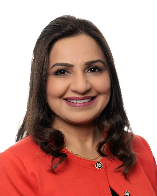
Moira Stilwell of the BC Liberal Party won in 2009 with 10,615 votes (58.87%) and in 2013 with 10,234 (52.60%). Michael Lee of the BC Liberal Party won in 2017 with 10,047 votes (47.46%) and in 2020 with 9,888 (48.51%). The legislature lists Lee's second term under the party name BC United, while Elections BC's results file prints the party as BC Liberal Party. Sunita Dhir of the BC NDP won in 2024 with 8,506 votes (48.43%), ahead of Bryan Breguet of the Conservative Party with 8,087 (46.05%) and Scottford Price of the BC Green Party with 969 (5.52%). Turnout was 51.83% of 33,961 registered voters.
The commission's 2023 final report reshaped the district. After people said the preliminary report divided the historic community of Marpole, it ran the line with Vancouver-Quilchena along 57th Avenue and Angus Drive. Between its preliminary and final reports it also moved Oakridge out of the proposed Vancouver-Langara and into Vancouver-Little Mountain, because the Oakridge redevelopment was expected to add many residents. It set the line with Vancouver-Kensington on E 49th Avenue. The former Vancouver-Langara counted 64,192 people, 11.7% from the average district, over 15 square kilometres. The district now counts 55,724 people, 3.6% from the average, over 12 square kilometres. Elections BC's conversion table places 51 of its 58 voting areas in the former Vancouver-Langara, 6 in the former Vancouver-Fraserview and 1 in the former Vancouver-Quilchena.
“Elected as” is the affiliation Elections BC printed with the winning result. The last column is the party the legislature’s records give for that parliament, which differs when a member changed party while in office. A row with that column empty is a winner Elections BC prints whom the legislature’s records leave out. Source: Legislative Assembly of British Columbia (opens in a new tab)
Boundaries since 2024
Vancouver-Langara has 58 voting areas. 51 of them overlap the district of the same name used from 2017 to 2024.Others overlap these districts from 2017 to 2024: Vancouver-Fraserview (6), Vancouver-Quilchena (1).
The commission that drew the boundaries counted 55,724 people in the district, 3.6% above the average for a district, over 12 km².
Vancouver-Langara is a provincial electoral district in the south of the City of Vancouver. The Electoral Boundaries Commission's 2023 final report says it includes Langara, Marpole and the western part of Sunset. The Fraser River forms its southern boundary, and W 41st and W 49th Avenues form its northern one. The commission counts 55,724 people in it, over 12 square kilometres.
Which neighbourhoods are in Vancouver-Langara?
Vancouver-Langara covers Langara, Marpole and the western part of Sunset, according to the Electoral Boundaries Commission. The City of Vancouver places Sunset east of Langara Golf Course and describes Marpole as the slope that runs south to the Fraser River. Elections BC's 2024 results file lists voting places at Langara College, the Marpole Oakridge Community Centre and the Sunset Community Centre.
Who is the MLA for Vancouver-Langara?
Sunita Dhir of the BC NDP won Vancouver-Langara in the 2024 provincial election with 8,506 votes, 48.43% of the valid vote. Bryan Breguet of the Conservative Party received 8,087 votes and Scottford Price of the BC Green Party received 969. Turnout was 51.83% of 33,961 registered voters. The legislature's records list Dhir as the member in the 43rd Parliament.
Who represented Vancouver-Langara before Sunita Dhir?
Michael Lee represented Vancouver-Langara before Sunita Dhir. He won for the BC Liberal Party in 2017 with 10,047 votes and in 2020 with 9,888 votes, and the legislature lists his second term under the party name BC United. Moira Stilwell of the BC Liberal Party held the seat before Lee, after winning in 2009 and 2013.
How did Vancouver-Langara vote in 2024?
In 2024 Vancouver-Langara elected Sunita Dhir of the BC NDP with 8,506 of 17,562 valid votes, which is 48.43%. Bryan Breguet of the Conservative Party received 8,087 votes, 46.05%, and Scottford Price of the BC Green Party received 969, 5.52%. Turnout was 51.83% of 33,961 registered voters, according to Elections BC's results file.
How did the boundaries of Vancouver-Langara change in 2023?
The commission's 2023 final report placed the historic centre of Marpole entirely in Vancouver-Langara by running the line with Vancouver-Quilchena along 57th Avenue and Angus Drive. It set the line with Vancouver-Kensington on E 49th Avenue. The former Vancouver-Langara counted 64,192 people over 15 square kilometres, and the district now counts 55,724 people over 12 square kilometres.
Who lives in Vancouver-Langara?
The 2021 census counted 55,720 people in Vancouver-Langara, with a median age of 40 compared with 42.8 across British Columbia. Immigrants made up 53.8% of residents. English was the first language of 32.4%, Yue (Cantonese) of 15% and Mandarin of 12.3%. Renters made up 54.2% of households, and the median household income was $76,000.
Whose traditional territory is Vancouver-Langara on?
Vancouver-Langara lies on Musqueam territory, according to Langara College, and the Musqueam Indian Band says that portions of its territory are today called Vancouver. The Squamish Nation states that its territory also takes in parts of present-day Vancouver. In Marpole, within the district, stands c̓əsnaʔəm, a Musqueam village on the shore of the Fraser River.
What is the Marpole Midden in Vancouver-Langara?
The Marpole Midden marks c̓əsnaʔəm, a Musqueam village in Marpole, in Vancouver-Langara. Musqueam says the village is more than 4,000 years old and was its largest village 2,500 years ago. Parks Canada designated the midden a National Historic Site of Canada on 25 May 1933. In October 2018 the City of Vancouver returned a parcel at 8902 Milton Street to Musqueam.
When did the area of Vancouver-Langara join the City of Vancouver?
The land of Vancouver-Langara joined the City of Vancouver on 1 January 1929, when South Vancouver and Point Grey amalgamated with it, according to the City of Vancouver Archives. The archives place the line between those two municipalities at Cambie Street, which crosses the district. The City says Marpole took its present name in 1916, after Richard Marpole of the Canadian Pacific Railway.