15 days to goBritish Columbia votes on Saturday, October 24, 2026

Get in front of undecided British Columbia voters
MLA · BC PROVINCIAL 2026

Surrey-White Rock.
6 candidates, one seat.

This district elects one MLA. Voters mark one name on Saturday, October 24, 2026, and the candidate with the most votes wins the seat.

Surrey-White Rock is a provincial electoral district on Semiahmoo Bay, in the southwest of Surrey. The Electoral Boundaries Commission says it takes in the City of White Rock and the Surrey neighbourhoods of Ocean Park and Crescent Beach, with the Canada-U.S. border as its southern boundary. The 2021 census counted 59,535 people in its 68 square kilometres, and the median age is 54.

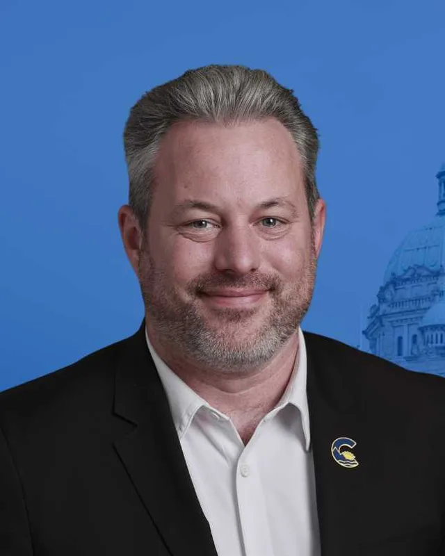
The candidates

In alphabetical order
People, 2021 census
59,535
Area
68 km²
Registered voters, 2024
45,467
Turnout, 2024
61.90%
Median age
54.0
Median household income, 2020
$82,000
THE DISTRICT

Where Surrey-White Rock is

68 km² · 59,535 people

Surrey-White Rock lies on the shore of Semiahmoo Bay, in the southwest corner of the Lower Mainland. The Electoral Boundaries Commission's 2023 final report says the district includes the City of White Rock and the Surrey neighbourhoods of Ocean Park and Crescent Beach. Its southern boundary follows the Canada-U.S. border and its western boundary follows the municipal border with Delta. Its northern boundary follows 24th Avenue and its eastern boundary follows Highway 99. The commission counts 59,586 people in 68 square kilometres, which is 10.8% from the average district.

White Rock is a separate city inside the district. The Encyclopedia of British Columbia says Surrey surrounds it on three sides, and gives its population as 21,939 in the 2021 census. BC Geographical Names places White Rock on the east side of Boundary Bay and Crescent Beach just northwest of it. The Semiahmoo First Nation gives its address as 16049 Beach Rd, Surrey, and writes that its members live on the Semiahmoo Reserve in South Surrey. The Tyee placed the Nation's community between White Rock and the U.S. border in April 2021.

The Canadian Register of Historic Places describes Crescent Road as a 4.5 kilometre road that joins Crescent Beach to the Semiahmoo Trail, King George Highway and Highway 99 corridors. The 2021 census shows an older population than the province as a whole: the median age is 54 against 42.8 for British Columbia, and 32.6% of residents are 65 or older against 20.3% provincially. Elections BC lists 14 places where people voted in this district in 2024, among them Semiahmoo Secondary School, Kent Street Activity Centre and Star of the Sea Community Centre.

  • White Rock
  • Ocean Park
  • Crescent Beach

Sources: British Columbia Electoral Boundaries Commission (opens in a new tab), Harbour Publishing (KnowBC) (opens in a new tab), BC Geographical Names Office (opens in a new tab), BC Geographical Names Office (opens in a new tab), Semiahmoo First Nation (opens in a new tab), The Tyee (opens in a new tab), Parks Canada, Canadian Register of Historic Places (opens in a new tab), Elections BC (opens in a new tab)

HISTORY

The history of the area

Checked Thursday, October 8, 2026

The Semiahma and Semiahmoo Bay

The Semiahmoo First Nation calls its people the Semiahma. Its website describes a trans-boundary nation with lands in both Canada and the United States, and says its people have lived across Washington state, the Strait of Georgia and the Lower Mainland of British Columbia for thousands of years. The Nation names North Straits Salish as the language that ties it to the Lummi and Nooksack in the United States, and writes that before European settlers arrived its way of life was oriented to the sea. It says the Oregon Treaty of 1846 made it a trans-boundary nation, and that before 1850 its people spent winters at Drayton Harbour, Birch Bay, Crescent Beach and Semiahmoo Bay.

BC Geographical Names says Semiahmoo Bay is named for the Semiahmoo First Nation. The entry quotes Andrew Scott's Encyclopedia of Raincoast Place Names, which says the word is reported to mean half moon and calls that translation dubious. The Canadian Register of Historic Places adds that the Snohomish and the Semiahmoo used the Crescent Beach area as a fishing camp. The White Rock Museum and Archives writes se’mya’me (Semiahmoo First Nation) in its land acknowledgement, and says the museum stands on the Nation's traditional unceded territory.

Sources: Semiahmoo First Nation (opens in a new tab), BC Geographical Names Office (opens in a new tab), Parks Canada, Canadian Register of Historic Places (opens in a new tab), White Rock Museum and Archives (opens in a new tab)

Crescent Road and Crescent Beach, 1860s to 1909

The Canadian Register of Historic Places, which draws on the City of Surrey's heritage files, says settlers began farming and logging along the Nicomekl River in the 1860s. Until 1875 the Semiahmoo Trail was the only passable land route between New Westminster and Blaine, Washington. After Surrey was incorporated in 1879, the municipality could pay for local improvements, and a road from Elgin to Crescent Beach was surveyed and cut. The register says James Holt completed it in 1882 and that more work on the road followed from 1910 to 1923. It adds that Crescent Beach became popular as a tourist and beach resort after the Great Northern Railway was completed in 1909.

BC Geographical Names records that Crescent Lodge Post Office opened on 1 May 1907, was renamed Crescent Post Office on 1 April 1909 and became Crescent Beach Post Office on 23 December 1951. The entry says land owners and subdividers chose the name from the crescent shape of Mud Bay, because they disliked the name Blackies Spit, which was then used for the area. The entry adds that the form of the name was changed to Crescent Beach (community) on 24 November 1980.

Sources: Parks Canada, Canadian Register of Historic Places (opens in a new tab), BC Geographical Names Office (opens in a new tab)

The railway reaches the shore and White Rock begins, 1909 to 1912

The White Rock Museum and Archives publishes an excerpt from community historian Lorraine Ellenwood's book Years of Promise 1858-1958. It says homesteaders reached Surrey's seafront near the international boundary as early as 1890, but settlement stayed slow until the Great Northern Railway line was rerouted along the Semiahmoo Bay shoreline in 1909. Canada Customs placed its ports of entry at least one mile from the border, and the excerpt says the customs office at White Rock fixed the place where the community would grow.

In 1910 Henry Thrift, a farmer from Hazelmere, built his home Bella Vista on the hillside facing the sea and subdivided his land. A New Westminster real estate firm marketed the original White Rock townsite the same year. The excerpt notes that the streets of that townsite run at a different angle from the grid used elsewhere in the Lower Mainland, and that by 1912 White Rock had three newspapers and daily bread delivery.

BC Geographical Names says the White Rock Post Office opened on 16 August 1910. The name comes from the large white rock on the beach, which was conspicuous enough to guide passing vessels. The City of White Rock says the Great Northern Railway began service along Semiahmoo Bay in 1909 and that the station was built in 1912. It lists the Campers Special, a three-car train that ran between Vancouver and Blaine from July to October, from 1911 until 1925.

Sources: White Rock Museum and Archives (opens in a new tab), BC Geographical Names Office (opens in a new tab), City of White Rock (opens in a new tab)

Ocean Park and Kwomais Point, 1900s to 1925

The Encyclopedia of Raincoast Place Names says the Methodist minister William Pascoe Goard chose the name Ocean Park, and that the realtor Henry Thrift may have suggested it first. Goard bought land there in the early 1900s for a church retirement community and a waterfront retreat, and the Ocean Park Syndicate, a group of Lower Mainland Methodists, later held it. The same book says the name Kwomais Point was adopted in 1946. It reports that the historians Philip and Helen Akrigg took the word to mean dog face in the Halkomelem language, while the camp's proprietors preferred to translate it as a place of vision.

The City of Surrey's heritage register lists two buildings from these years. The Crescent Park Annex at 2378 124 Street stands on land that the pioneer Benjamin Stevenson gave in 1916 on condition that it be cleared for a school. The school opened in 1918, and the register says it is the only one-room schoolhouse in Surrey still at its original location. The Ocean Park Community Hall at 1577 128 Street was built in 1925 to serve a place that the register says had grown from a summer resort into an established community.

Sources: Harbour Publishing (KnowBC) (opens in a new tab), Harbour Publishing (KnowBC) (opens in a new tab), City of Surrey (opens in a new tab), City of Surrey (opens in a new tab)

Camp Alexandra and the Crescent Beach church, 1918 to 1972

Three buildings of Camp Alexandra, at 2916 McBride Avenue in Crescent Beach, are on the City of Surrey's heritage register, all entered on 2 November 1998. The Stage House is the earliest and dates from 1918. The Wigwam, a bungalow built as a nursery, followed in 1919. The Lodge was built in 1920 as a dining hall, as part of the Alexandra Orphanage, which the register says was established in 1918.

The register also lists the Church of the Ascension Anglican at 2770 McKenzie Avenue. It was built in 1931 in the Gothic revival style with Tudor influences. The last church service was held in 1972, and the building is now a day care and Montessori school.

Sources: City of Surrey (opens in a new tab), City of Surrey (opens in a new tab), City of Surrey (opens in a new tab), City of Surrey (opens in a new tab)

A hospital, a city and a station museum, 1954 to 1975

The Peace Arch Hospital Foundation says the hospital opened in August 1954 with 50 beds, five doctors and 10 nurses, and that it was built entirely on land that the community donated or bought. White Rock was then part of Surrey. The Encyclopedia of British Columbia says White Rock was incorporated as a city on 15 Apr 1957, when it seceded from Surrey, and BC Geographical Names gives the same date.

The City of White Rock says rail service to the town dwindled and then ceased in 1975. In that year the station building was ceded to the city, and it became the home of the White Rock Museum and Archives. The museum is at 14970 Marine Drive. The city says its ticket office has been restored to its 1954 appearance, and railway history is one of the museum's core themes.

Sources: Peace Arch Hospital and Community Health Foundation (opens in a new tab), Harbour Publishing (KnowBC) (opens in a new tab), BC Geographical Names Office (opens in a new tab), City of White Rock (opens in a new tab), White Rock Museum and Archives (opens in a new tab)

The White Rock Pier and the storm of 2018

The City of White Rock says its pier was built in 1914 and 1915, extends 470 metres into Semiahmoo Bay and was restored in 1977. On 20 December 2018 a windstorm with gusts of 91 kilometres an hour, heavy rain and a heavy tide broke the pier in two. The City says it destroyed a third of the structure and the western wharf and floats. The Province of British Columbia gave $1 million toward the repair, the middle section was rebuilt for $4.3 million, and the pier reopened to the public on 27 August 2019. The official reopening was held on 21 September 2019.

On 10 February 2020 the community group Friends of the Pier presented the City with a cheque for $400,000 toward rebuilding the rest of the structure. The City's pier page now says the remaining two thirds are approaching the end of their service life and need full replacement. It reports that the Government of Canada's Building Communities Strong Fund has approved the project in principle, with a federal contribution of $25,935,000.

Sources: City of White Rock (opens in a new tab), City of White Rock (opens in a new tab), City of White Rock (opens in a new tab)

Water and a land code for the Semiahmoo Reserve, 2005 to 2025

Indigenous Services Canada says a long-term drinking water advisory for the Semiahmoo First Nation was set on 13 October 2005 and lifted on 31 March 2021, after the community was connected to the water system of nearby Surrey. The Government of Canada invested more than $15.5 million in the project, and all 40 houses now have safe drinking water. The Tyee reported that the Nation had bought water from the privately owned White Rock Utilities in the 1990s and that its first drinking water advisory was issued in 1996.

Surrey City Council voted on 23 July 2018 to let the Mayor sign a water service agreement and a sanitary sewer service agreement with the Semiahmoo First Nation. The minutes record Chief Harley Chappell telling Council that the servicing agreement process had been under way since the 1970s. The Nation's website gives 24 July 2025 as the date of its Land Code vote. The First Nations Land Management Resource Centre reported on 27 August 2025 that the Nation voted to establish its Land Code, regaining governance over its reserve lands, natural resources and environment.

Sources: Indigenous Services Canada (opens in a new tab), The Tyee (opens in a new tab), City of Surrey (opens in a new tab), City of Surrey (opens in a new tab), Semiahmoo First Nation (opens in a new tab), First Nations Land Management Resource Centre (opens in a new tab)

THE SEAT

Who has held the seat

Legislative Assembly records, 35th Parliament onward

Elections BC's volume for 1871 to 1986 shows that the Constitution Amendment Act of 1985 (SBC 1985 c. 3) altered the boundaries of Surrey and created Surrey-White Rock-Cloverdale. In the 1986 election William Earl (Bill) Reid of the Social Credit Party won it with 19,200 votes (57.45%), ahead of Michael James Villeneuve of the New Democratic Party with 10,287 (30.78%). The Electoral Districts Act (SBC 1990 c. 39), assented to on 27 July 1990, set out 75 single-member districts and took effect when the 35th Parliament was dissolved on 19 September 1991.

The 1987 to 2001 volume prints Surrey-White Rock for the first time at the 35th general election, held on 17 October 1991. Wilf Hurd of the Liberal Party won with 11,008 votes (38.84%), ahead of Donna Osatiuk of the New Democratic Party with 9,063 (31.98%) and Chip Barrett of the Social Credit Party with 8,062 (28.44%). Hurd won again in 1996 with 18,039 votes (58.04%). The volume records his resignation on 2 May 1997. Gordon Hogg of the Liberal Party won the by-election of 15 September 1997 with 10,497 votes (51.73%), ahead of David Secord of the Reform Party of British Columbia with 5,298 (26.11%). Hogg won in 2001 with 18,678 votes (68.70%) and again in 2005, 2009 and 2013. Tracy Redies of the BC Liberal Party won in 2017, and Trevor Halford won in 2020 for the BC Liberal Party and in 2024 for the Conservative Party with 14,667 votes (52.31%).

The commission's report of September 24, 2015 said its proposed Surrey-White Rock largely matched the existing district, and added the community west of 128 Street, including the Crescent Beach neighbourhood and marina. Its tables, which use 2014 population estimates, list the proposed district at 58,588 people in 68 square kilometres and the existing one at 55,585 people in 61 square kilometres. Bill 42 of 2015 lists Surrey-White Rock among 87 electoral districts and gives effect to that report.

The commission's 2023 report lists 59,586 people in 68 square kilometres for Surrey-White Rock in both its table of the 87 current districts and its table of the 93 proposed ones, with a deviation from the average of 3.7% in the first and 10.8% in the second. The report says it makes significant changes to all but one of Surrey's ridings. Elections BC's matching of voting areas lists 86 voting areas in common between the 88 of this district and the Surrey-White Rock of 2017 to 2024. Bill 25 of 2023, passed at third reading on 25 April 2023, lists Surrey-White Rock among 93 districts and takes effect when the 42nd Parliament is dissolved.

Sources: Elections BC (opens in a new tab), Elections BC (opens in a new tab), Elections BC (opens in a new tab), Elections BC (opens in a new tab), Elections BC (opens in a new tab), British Columbia Electoral Boundaries Commission (opens in a new tab), Legislative Assembly of British Columbia (opens in a new tab), British Columbia Electoral Boundaries Commission (opens in a new tab), Elections BC (opens in a new tab), Legislative Assembly of British Columbia (opens in a new tab)

Members for Surrey-White Rock
ParliamentIt satMemberElected asParty on the legislature’s record
43rd2025 to 2026Trevor HalfordConservative PartyConservative Party of BC
42nd2020 to 2024Trevor HalfordBC Liberal PartyConservative Party of BC
41st2017 to 2020Tracy RediesBC Liberal PartyBC Liberal Party
40th2013 to 2017Gordon HoggBC Liberal PartyBC Liberal Party
39th2009 to 2013Gordon HoggBC Liberal PartyBC Liberal Party
38th2005 to 2009Gordon HoggBC Liberal PartyBC Liberal Party
37th2001 to 2005Gordon HoggBC Liberal Party
36th1996 to 2001Gordon HoggBC Liberal Party
35th1992 to 1996Wilf HurdBC Liberal Party

“Elected as” is the affiliation Elections BC printed with the winning result. The last column is the party the legislature’s records give for that parliament, which differs when a member changed party while in office. A row with that column empty is a winner Elections BC prints whom the legislature’s records leave out. Source: Legislative Assembly of British Columbia (opens in a new tab)

Boundaries since 2024

Surrey-White Rock has 88 voting areas. 86 of them overlap the district of the same name used from 2017 to 2024.

The commission that drew the boundaries counted 59,586 people in the district, 10.8% above the average for a district, over 68 km².

Sources: British Columbia Electoral Boundaries Commission, Final report, April 3, 2023 (opens in a new tab), Elections BC, Voting area conversion table, 2017 to 2024 (opens in a new tab)

PAST RESULTS

Every result since 2005

From Elections BC
2024 Provincial General ElectionTrevor Halford, Conservative Party, 52.31%
CandidateAffiliationVotesShare
Trevor HalfordElectedConservative Party14,66752.31%
Darryl WalkerBC NDP12,69845.29%
Damyn TassieLibertarian6712.39%

28,036 valid votes · 106 rejected ballots · 45,467 registered voters · 61.90% voted

2020 General ElectionTrevor Halford, BC Liberal Party, 39.51%
CandidateAffiliationVotesShare
Trevor HalfordElectedBC Liberal Party10,71839.51%
Bryn SmithBC NDP10,49438.69%
Beverly (Pixie) HobbyBC Green Party3,86214.24%
Megan KnightIndependent1,6075.92%
Jason BaxLibertarian4431.63%

27,124 valid votes · 266 rejected ballots

2017 General ElectionTracy Redies, BC Liberal Party, 49.87%
CandidateAffiliationVotesShare
Tracy RediesElectedBC Liberal Party14,10149.87%
Niovi PatsicakisBC NDP8,64830.59%
Bill MarshallBC Green Party4,57416.18%
Tom BryantIndependent9503.36%

28,273 valid votes · 123 rejected ballots

2013 General ElectionGordon Hogg, BC Liberal Party, 58.09%
CandidateAffiliationVotesShare
Gordon HoggElectedBC Liberal Party15,09258.09%
Susan KeepingBC NDP7,18027.63%
Don PitcairnBC Green Party2,3048.87%
Elizabeth Morales PagtakhanConservative1,3015.01%
Jim LaurenceBritish Columbia Party1050.40%

25,982 valid votes · 74 rejected ballots

2009 General ElectionGordon Hogg, BC Liberal Party, 62.05%
CandidateAffiliationVotesShare
Gordon HoggElectedBC Liberal Party15,12162.05%
Drina AllenBC NDP6,66827.36%
Don PitcairnBC Green Party2,1188.69%
David Charles HawkinsBC Reform4641.90%

24,371 valid votes · 116 rejected ballots

2005 General ElectionGordon Hogg, BC Liberal Party, 57.86%
CandidateAffiliationVotesShare
Gordon HoggElectedBC Liberal Party16,46257.86%
Moh ChelaliBC NDP7,51126.40%
Ashley Brie HughesBC Green Party3,05110.72%
David James EvansConservative1,3404.71%
Ronald Edward DunsfordDR BC870.31%

28,451 valid votes · 125 rejected ballots

The boundaries changed before the 2009, 2017 and 2024 elections, so a result under the same name can cover a different area. Sources: Elections BC, Provincial Voting Results (opens in a new tab), Statement of Votes, 2024 Provincial General Election (opens in a new tab)

PEOPLE · 2021 CENSUS

Who lives in Surrey-White Rock

59,535 residents · British Columbia beside each figure

Age

Median age
54.0BC 42.8
  • Under 1512.0%BC 14.3%
  • 15 to 6455.4%BC 65.3%
  • 65 and over32.6%BC 20.3%
  • 85 and over5.5%BC 2.4%

Households

Households
25,955
People per household
2.2BC 2.4

Who lives together

  • Couples with children21.0%BC 22.7%
  • Couples without children29.2%BC 26.4%
  • One-parent families7.7%BC 7.6%
  • Multigenerational households2.4%BC 3.7%
  • People living alone33.8%BC 29.4%

Household size

  • 1 person33.8%BC 29.4%
  • 2 persons36.7%BC 35.3%
  • 3 persons12.3%BC 14.5%
  • 4 persons11.2%BC 12.6%
  • 5 or more persons5.9%BC 8.2%

Homes

Median home value
$1,100,000BC $785,000
Median monthly rent and utilities
$1,500BC $1,370
Median monthly cost for owners
$1,070BC $1,320

Own or rent

  • Own their home74.4%BC 66.8%
  • Rent their home25.5%BC 32.8%
  • Home provided by a local government or First Nation0.1%BC 0.5%

Type of home

  • Single-detached house46.3%BC 42.4%
  • Semi-detached house2.2%BC 3.1%
  • Row house4.8%BC 8.3%
  • Apartment or flat in a duplex10.5%BC 12.2%
  • Apartment in a building that has fewer than five storeys29.6%BC 20.4%
  • Apartment in a building that has five or more storeys6.1%BC 10.9%
  • Other single-attached house0.1%BC 0.2%
  • Movable dwelling0.2%BC 2.5%

When the home was built

  • 1960 or earlier6.4%BC 12.5%
  • 1961 to 198026.0%BC 27.0%
  • 1981 to 199028.8%BC 14.2%
  • 1991 to 200016.6%BC 16.5%
  • 2001 to 20054.8%BC 6.0%
  • 2006 to 20104.7%BC 8.0%
  • 2011 to 20155.2%BC 6.6%
  • 2016 to 20217.6%BC 9.1%

Housing costs

  • Renters paying 30% or more of income on housing46.1%BC 37.8%
  • Owners paying 30% or more of income on housing22.3%BC 19.3%
  • Renters in core housing need33.0%BC 24.7%
  • Owners in core housing need10.8%BC 8.0%
  • Renters in subsidized housing8.7%BC 11.0%
  • Owners with a mortgage48.2%BC 57.5%

Income

Income is for the year 2020.

Median household income
$82,000BC $85,000
After tax
$73,500BC $76,000
Median income per person
$42,400BC $40,800

Living on a low income (after-tax measure)

  • All ages11.6%BC 10.8%
  • Under 1813.0%BC 11.3%
  • 18 to 6411.5%BC 9.7%
  • 65 and over11.1%BC 13.8%

Languages

First language learned

  • English71.0%BC 67.1%
  • Mandarin9.3%BC 4.1%
  • Punjabi (Panjabi)2.7%BC 4.9%
  • German1.6%BC 1.0%
  • French1.1%BC 1.2%
  • Yue (Cantonese)0.9%BC 3.9%
  • Korean0.9%BC 1.2%
  • Spanish0.8%BC 1.2%
  • Tagalog (Pilipino, Filipino)0.8%BC 1.7%
  • Russian0.6%BC 0.6%

Spoken most often at home

  • English82.2%BC 78.5%
  • Mandarin7.9%BC 3.3%
  • Punjabi (Panjabi)1.5%BC 3.8%
  • Korean0.7%BC 0.9%
  • Yue (Cantonese)0.5%BC 2.8%
  • Spanish0.4%BC 0.6%
  • Tagalog (Pilipino, Filipino)0.4%BC 0.9%
  • Russian0.4%BC 0.3%

English and French

  • English only89.4%BC 90.1%
  • English and French8.1%BC 6.6%
  • Neither English nor French2.5%BC 3.3%

Immigration

Born outside Canada (immigrants)
31.2%BC 29.0%
Non-permanent residents
1.3%BC 3.5%

Where immigrants were born

  • China25.0%BC 15.3%
  • United Kingdom15.6%BC 8.2%
  • India8.1%BC 13.8%
  • United States of America5.0%BC 4.2%
  • Philippines4.6%BC 9.2%
  • Taiwan3.7%BC 2.8%
  • Germany3.2%BC 2.2%
  • Korea, South2.3%BC 3.3%
  • Oceania and other places of birth1.8%BC 2.3%
  • Hong Kong1.7%BC 5.5%

When immigrants arrived

  • Arrived before 198030.6%BC 19.7%
  • 1980 to 19909.9%BC 11.5%
  • 1991 to 200014.0%BC 21.0%
  • 2001 to 201021.5%BC 22.2%
  • 2011 to 202124.0%BC 25.6%

Generations in Canada

  • First generation33.8%BC 33.7%
  • Second generation23.7%BC 21.7%
  • Third generation or more42.5%BC 44.5%

Identity and origins

Indigenous identity
2.5%BC 5.9%
Visible minority
27.5%BC 34.4%

Visible minority groups

  • Chinese13.0%BC 11.2%
  • South Asian6.7%BC 9.6%
  • Filipino2.0%BC 3.5%
  • Korean1.1%BC 1.5%
  • Black1.0%BC 1.3%
  • Latin American0.8%BC 1.3%
  • Multiple visible minorities0.8%BC 1.2%
  • Japanese0.6%BC 0.9%
  • Arab0.5%BC 0.6%
  • Southeast Asian0.5%BC 1.5%
  • West Asian0.2%BC 1.4%
  • Visible minority (other)0.2%BC 0.4%

Ethnic or cultural origins reported most often

  • English25.0%BC 20.7%
  • Scottish17.3%BC 15.8%
  • Irish14.5%BC 12.8%
  • Chinese11.9%BC 10.5%
  • German11.6%BC 11.0%
  • Canadian8.5%BC 9.3%
  • French6.5%BC 6.4%
  • British Isles5.6%BC 3.9%
  • Ukrainian5.1%BC 4.3%
  • Indian (India)4.3%BC 5.6%

Religion

  • No religion49.3%BC 52.1%
  • Christian41.7%BC 34.3%
  • Sikh3.8%BC 5.9%
  • Muslim1.4%BC 2.6%
  • Other religions1.2%BC 1.0%
  • Buddhist1.1%BC 1.7%
  • Hindu0.8%BC 1.7%
  • Jewish0.6%BC 0.5%
  • Traditional Indigenous spirituality0.1%BC 0.2%

Education

Highest level completed, ages 25 to 64.

  • No certificate, diploma or degree4.6%BC 8.0%
  • High school diploma24.3%BC 25.8%
  • College, trades or other certificate below a bachelor’s degree31.6%BC 31.2%
  • Bachelor’s degree or higher39.5%BC 35.0%

Work

In the labour force
53.0%BC 63.3%
Employed
48.6%BC 57.9%
Unemployment rate at the census
8.3%BC 8.4%

Industries with the most workers

  • Health care and social assistance11.8%BC 12.3%
  • Retail trade11.0%BC 11.6%
  • Professional, scientific and technical services9.9%BC 9.2%
  • Educational services9.3%BC 7.4%
  • Construction9.2%BC 9.0%
  • Transportation and warehousing5.6%BC 5.5%
  • Public administration5.5%BC 5.5%
  • Manufacturing5.3%BC 5.9%

Kinds of work

  • Sales and service occupations25.1%BC 25.6%
  • Business, finance and administration occupations18.9%BC 17.1%
  • Trades, transport and equipment operators and related occupations15.6%BC 18.0%
  • Occupations in education, law and social, community and government services14.3%BC 11.9%
  • Health occupations7.5%BC 7.7%
  • Natural and applied sciences and related occupations7.3%BC 8.0%
  • Occupations in art, culture, recreation and sport5.3%BC 4.2%
  • Legislative and senior management occupations2.5%BC 1.2%
  • Occupations in manufacturing and utilities2.1%BC 3.4%
  • Natural resources, agriculture and related production occupations1.3%BC 2.8%

Getting to work

Where people worked

  • Worked at home27.3%BC 22.6%
  • Worked outside Canada1.1%BC 0.4%
  • No fixed workplace address13.5%BC 15.3%
  • Worked at a usual workplace58.1%BC 61.6%

How commuters travelled

  • Car, truck or van85.2%BC 79.9%
  • Public transit5.4%BC 9.3%
  • On foot6.4%BC 6.5%
  • Bicycle0.5%BC 2.0%
  • Other method2.6%BC 2.3%

Length of the trip

  • Less than 15 minutes27.1%BC 31.8%
  • 15 to 29 minutes26.0%BC 34.0%
  • 30 to 44 minutes26.9%BC 19.7%
  • 45 to 59 minutes11.7%BC 7.3%
  • 60 minutes and over8.4%BC 7.2%

Moving

Where residents lived five years before the census.

  • Lived at the same address56.4%BC 56.2%
  • Moved within the same municipality14.7%BC 16.1%
  • Moved from elsewhere in BC20.9%BC 17.0%
  • Moved from another province3.4%BC 4.6%
  • Moved from another country4.6%BC 6.1%

Counts in the census are rounded to the nearest 5, and shares are worked out from those counts. Source: BC Stats, from Statistics Canada tabulations, 2021 Census Profile for BC Provincial Electoral Districts (2023 Redistribution) (opens in a new tab)

QUESTIONS

Questions about Surrey-White Rock

10 answers

Where is the Surrey-White Rock electoral district?

Surrey-White Rock is a provincial electoral district in the southwest of Surrey, on Semiahmoo Bay. The Electoral Boundaries Commission's 2023 report gives its boundaries as the Canada-U.S. border in the south, the Delta municipal border in the west, 24th Avenue in the north and Highway 99 in the east. The commission counts 59,586 people in 68 square kilometres.

Which communities are in Surrey-White Rock?

Surrey-White Rock includes the City of White Rock and the Surrey neighbourhoods of Ocean Park and Crescent Beach, according to the Electoral Boundaries Commission's 2023 report. The Semiahmoo First Nation's Semiahmoo Reserve lies between White Rock and the U.S. border, according to The Tyee, and the Nation gives a South Surrey address. White Rock is a separate city, and Surrey surrounds it on three sides.

Who won Surrey-White Rock in the 2024 provincial election?

Trevor Halford of the Conservative Party won Surrey-White Rock in 2024 with 14,667 votes, or 52.31%. Darryl Walker of the BC NDP received 12,698 votes (45.29%) and Damyn Tassie of the Libertarian Party received 671 (2.39%). Turnout was 61.9% of 45,467 registered voters. Halford had also won the district in 2020 for the BC Liberal Party.

Who held the Surrey-White Rock seat before Trevor Halford?

Tracy Redies of the BC Liberal Party held the Surrey-White Rock seat before Trevor Halford, after winning it in 2017 with 14,101 votes. Before her, Gordon Hogg of the BC Liberal Party held the seat. He won the 15 September 1997 by-election and then won in 2001, 2005, 2009 and 2013, which is four wins in a row.

How have the boundaries of Surrey-White Rock changed?

The boundaries of Surrey-White Rock changed most recently in the 2015 report of the Electoral Boundaries Commission, which added the community west of 128 Street, including Crescent Beach. The 2023 report lists the same 59,586 people and 68 square kilometres for the district, and Elections BC's matching shows 86 of its 88 voting areas in common with the earlier district.

Who lives in Surrey-White Rock?

The 2021 census counted 59,535 people in Surrey-White Rock, with a median age of 54 against 42.8 for British Columbia. Of residents, 32.6% are 65 or older, compared with 20.3% across the province. English is the first language of 71%, Mandarin of 9.3% and Punjabi of 2.7%. Immigrants make up 31.2% of the population, and 2.5% identify as Indigenous.

Whose traditional territory is Surrey-White Rock on?

Surrey-White Rock includes land that the Semiahmoo First Nation, whose people call themselves the Semiahma, describes as its territory. The Nation says its people have lived across Washington state, the Strait of Georgia and the Lower Mainland for thousands of years. The White Rock Museum and Archives acknowledges that the museum stands on the Nation's traditional unceded territory.

Why is White Rock called White Rock?

White Rock is named for a large white rock on its beach. BC Geographical Names says the rock was conspicuous enough to guide passing vessels. The Encyclopedia of British Columbia describes it as a 437-tonne boulder on the waterfront, painted white to serve as a landmark. White Rock, which lies inside the Surrey-White Rock district, was incorporated as a city on 15 Apr 1957.

When was the Surrey-White Rock district created?

The name Surrey-White Rock first appears in Elections BC's records at the general election of 17 October 1991. It followed the Electoral Districts Act of 1990, which created 75 single-member districts. Before that, the 1986 election used a district called Surrey-White Rock-Cloverdale, which the Constitution Amendment Act of 1985 had created. Wilf Hurd won Surrey-White Rock in 1991.

How long is the White Rock Pier and when was it built?

The White Rock Pier is 470 metres long and extends into Semiahmoo Bay from the White Rock waterfront, in the Surrey-White Rock district. The City of White Rock says it was built in 1914 and 1915 and restored in 1977. A windstorm broke it in two on 20 December 2018, and it reopened to the public on 27 August 2019.


SOURCES

Where this page comes from

Figures read Thursday, October 8, 2026
  1. 2021 Census Profile for BC Provincial Electoral Districts (2023 Redistribution) (opens in a new tab)BC Stats, from Statistics Canada tabulations · read Thursday, October 8, 2026
  2. Provincial Voting Results (opens in a new tab)Elections BC · read Thursday, October 8, 2026
  3. Statement of Votes, 2024 Provincial General Election (opens in a new tab)Elections BC · read Thursday, October 8, 2026
  4. Voting area conversion table, 2017 to 2024 (opens in a new tab)Elections BC · read Thursday, October 8, 2026
  5. Final report, April 3, 2023 (opens in a new tab)British Columbia Electoral Boundaries Commission · read Thursday, October 8, 2026
  6. Members of the Legislative Assembly, 35th to 43rd Parliament (opens in a new tab)Legislative Assembly of British Columbia · read Thursday, October 8, 2026
  7. Final report, April 3, 2023 (opens in a new tab)British Columbia Electoral Boundaries Commission · read Thursday, October 8, 2026
  8. Final report, September 24, 2015 (opens in a new tab)British Columbia Electoral Boundaries Commission · read Thursday, October 8, 2026
  9. Bill 42, Electoral Districts Act, 2015 (opens in a new tab)Legislative Assembly of British Columbia · read Thursday, October 8, 2026
  10. Bill 25, Electoral Districts Act, 2023, third reading (opens in a new tab)Legislative Assembly of British Columbia · read Thursday, October 8, 2026
  11. Electoral History of British Columbia, 1871 to 1986 (opens in a new tab)Elections BC · read Thursday, October 8, 2026
  12. Electoral History of British Columbia, Supplement, 1987 to 2001 (opens in a new tab)Elections BC · read Thursday, October 8, 2026
  13. Electoral History of British Columbia, Supplement, 2002 to 2013 (opens in a new tab)Elections BC · read Thursday, October 8, 2026
  14. Provincial election results by voting area (opens in a new tab)Elections BC · read Thursday, October 8, 2026
  15. Voting area conversion table, 2024 to 2017 (opens in a new tab)Elections BC · read Thursday, October 8, 2026
  16. Statement of Votes, 2024 Provincial General Election (opens in a new tab)Elections BC · read Thursday, October 8, 2026
  17. Semiahmoo First Nation (opens in a new tab)Semiahmoo First Nation · read Thursday, October 8, 2026
  18. Land Code (opens in a new tab)Semiahmoo First Nation · read Thursday, October 8, 2026
  19. White Rock, BC Geographical Names (opens in a new tab)BC Geographical Names Office · read Thursday, October 8, 2026
  20. Crescent Beach, BC Geographical Names (opens in a new tab)BC Geographical Names Office · read Thursday, October 8, 2026
  21. Semiahmoo Bay, BC Geographical Names (opens in a new tab)BC Geographical Names Office · read Thursday, October 8, 2026
  22. White Rock, Encyclopedia of British Columbia (opens in a new tab)Harbour Publishing (KnowBC) · read Thursday, October 8, 2026
  23. Ocean Park, Encyclopedia of Raincoast Place Names (opens in a new tab)Harbour Publishing (KnowBC) · read Thursday, October 8, 2026
  24. Kwomais Point, Encyclopedia of Raincoast Place Names (opens in a new tab)Harbour Publishing (KnowBC) · read Thursday, October 8, 2026
  25. The History of White Rock (opens in a new tab)White Rock Museum and Archives · read Thursday, October 8, 2026
  26. White Rock Museum and Archives, home page and land acknowledgement (opens in a new tab)White Rock Museum and Archives · read Thursday, October 8, 2026
  27. History of Rail (opens in a new tab)City of White Rock · read Thursday, October 8, 2026
  28. Pier and Promenade (opens in a new tab)City of White Rock · read Thursday, October 8, 2026
  29. City of White Rock reopens Canada's longest pier on Aug. 27 (opens in a new tab)City of White Rock · read Thursday, October 8, 2026
  30. City of White Rock thankful for $400,000 donation from Friends of the Pier (opens in a new tab)City of White Rock · read Thursday, October 8, 2026
  31. Crescent Road, Canadian Register of Historic Places (opens in a new tab)Parks Canada, Canadian Register of Historic Places · read Thursday, October 8, 2026
  32. Crescent Park Annex, heritage register (opens in a new tab)City of Surrey · read Thursday, October 8, 2026
  33. Ocean Park Community Hall, heritage register (opens in a new tab)City of Surrey · read Thursday, October 8, 2026
  34. Camp Alexandra Dining Hall, The Lodge, heritage register (opens in a new tab)City of Surrey · read Thursday, October 8, 2026
  35. Camp Alexandra Dormitory A, The Stage House, heritage register (opens in a new tab)City of Surrey · read Thursday, October 8, 2026
  36. Camp Alexandra Nursery, Wigwam, heritage register (opens in a new tab)City of Surrey · read Thursday, October 8, 2026
  37. Church of the Ascension Anglican, heritage register (opens in a new tab)City of Surrey · read Thursday, October 8, 2026
  38. Corporate Report R167, Servicing Agreements with the Semiahmoo First Nation, July 23, 2018 (opens in a new tab)City of Surrey · read Thursday, October 8, 2026
  39. Regular Council Public Hearing minutes, July 23, 2018 (opens in a new tab)City of Surrey · read Thursday, October 8, 2026
  40. Progress update on the Government of Canada's commitment to clean water in First Nations communities, April 1, 2021 (opens in a new tab)Indigenous Services Canada · read Thursday, October 8, 2026
  41. Semiahmoo First Nation Lifts 16 Year Boil Water Advisory, April 1, 2021 (opens in a new tab)The Tyee · read Thursday, October 8, 2026
  42. Semiahmoo First Nation votes yes, 125th Framework Agreement signatory to ratify their land code (opens in a new tab)First Nations Land Management Resource Centre · read Thursday, October 8, 2026
  43. About the Foundation (opens in a new tab)Peace Arch Hospital and Community Health Foundation · read Thursday, October 8, 2026

Official information

From Elections BC
CORRECTIONS

Report a problem on this page.

Tell the editors what is wrong and where the correct information can be checked. The page you are on is attached automatically.