15 days to goBritish Columbia votes on Saturday, October 24, 2026

Get in front of undecided British Columbia voters
MLA · BC PROVINCIAL 2026

Surrey South.
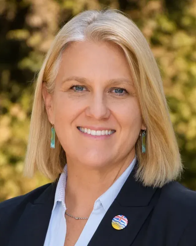
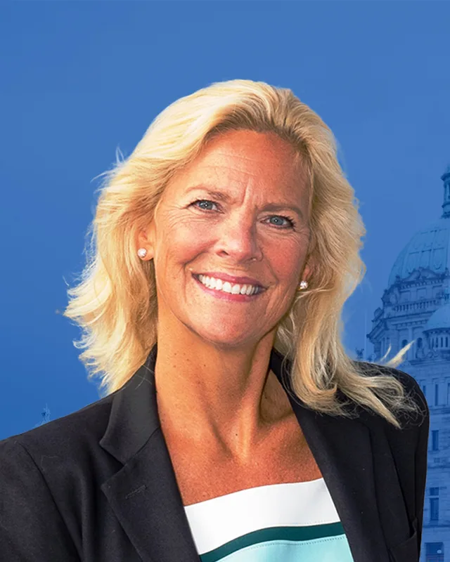
5 candidates, one seat.

This district elects one MLA. Voters mark one name on Saturday, October 24, 2026, and the candidate with the most votes wins the seat.

Surrey South is a provincial electoral district in the south of the City of Surrey, between the Delta and Langley borders and the Canada-U.S. border. The Electoral Boundaries Commission lists Panorama Ridge, Crescent, Grandview, Hazelmere and Douglas among its neighbourhoods. The 2021 census counted 56,905 people in its 122 square kilometres, and 59.3% of residents have English as their first language.

The candidates

In alphabetical order
People, 2021 census
56,905
Area
122 km²
Registered voters, 2024
39,633
Turnout, 2024
56.29%
Median age
42.0
Median household income, 2020
$110,000
THE DISTRICT

Where Surrey South is

122 km² · 56,905 people

Surrey South lies in the south of the City of Surrey. The Electoral Boundaries Commission's 2023 final report says it includes the neighbourhoods of Panorama Ridge, Crescent, Grandview, Hazelmere and Douglas. Its eastern border is the Langley municipal boundary and its western border is the Delta municipal boundary. The Canada-U.S. border is its southern boundary, and its northern boundary follows 56th Avenue, King George Boulevard and 58th Avenue. The commission counts 56,867 people in 122 square kilometres, which is 5.8% from the average district.

The City of Surrey's neighbourhood plans give the layout of the southern and eastern parts. Douglas, the City's most southern urban neighbourhood, lies east of Highway 99 and west of Highway 15, between the Peace Arch and Pacific Highway border crossings. Rosemary Heights lies south of the Nicomekl River, east of Highway 99 and north of Titman Creek. Grandview Heights runs from 16th Avenue to 28th Avenue and east to the Agricultural Land Reserve, and North Grandview Heights covers 28th to 32nd Avenue. BC Geographical Names places Hazelmere east of White Rock and Semiahmoo Bay, on the south-east side of Surrey, and the City's register puts Hazelmere Cemetery beside the Little Campbell River.

Elections BC's results file for 2024 lists 8 voting places inside the district. Five are schools: Chantrell Creek Elementary at 2575 137 Street, Colebrook Elementary at 5404 125A Street, Edgewood Elementary at 16666 23 Avenue, Morgan Elementary at 3366 156A Street and Rosemary Heights Elementary at 15516 36 Avenue. The other three are Emmanuel Covenant Church, Gracepoint Community Church and Peace Portal Alliance Church. The addresses of the schools come from the BC schools directory.

  • Panorama Ridge
  • Crescent
  • Grandview
  • Grandview Heights
  • Morgan Heights
  • North Grandview Heights
  • Rosemary Heights
  • Hazelmere
  • Hall's Prairie
  • Douglas
  • Colebrook

Sources: British Columbia Electoral Boundaries Commission (opens in a new tab), City of Surrey (opens in a new tab), City of Surrey (opens in a new tab), City of Surrey (opens in a new tab), City of Surrey (opens in a new tab), City of Surrey (opens in a new tab), BC Geographical Names Office (opens in a new tab), Elections BC (opens in a new tab), Elections BC (opens in a new tab), B.C. Education System Performance, Province of British Columbia (opens in a new tab)

HISTORY

The history of the area

Checked Thursday, October 8, 2026

The Semiahma and the river routes

Semiahmoo First Nation calls its people the Semiahma. Its website says the Semiahma have lived across Washington state, the Salish Sea and the Lower Mainland of British Columbia for thousands of years, and that they share the North Straits Salish language with the Lummi and Nooksack in the United States. The Nation writes that it became a trans-boundary nation in 1846, when the Oregon Treaty set the border at the 49th parallel. It says that after the Point Elliott Treaty some Semiahmoo and Nooksack people moved to the Little Campbell River, on the Semiahmoo Indian Reserve, and that its members in Canada live on the Semiahmoo Reserve in South Surrey.

The Nation adds that before 1850 its people spent winters at Drayton Harbour, Birch Bay, Crescent Beach and Semiahmoo Bay. The City of Surrey's history page names the Semiahmoo, Katzie and Kwantlen First Nations as peoples who have lived in the region for thousands of years. It says the Campbell, Nicomekl and Serpentine Rivers were the inland routes for trade and communication. The Surrey School District acknowledges the Kwantlen, Katzie and Semiahmoo Nations as the Nations on whose traditional and unceded territories it works.

Sources: Semiahmoo First Nation (opens in a new tab), City of Surrey (opens in a new tab), Surrey Schools (opens in a new tab)

Hall's Prairie and Hazelmere, 1860s to 1908

The Encyclopedia of British Columbia says Hall's Prairie was an early farming settlement in Surrey, 26 km southeast of New Westminster. A trapper named Sam Hall, who traded with the Hudson's Bay Company at Fort Langley, lived there in the early 1860s. Homesteaders came in the next decade, and by the 1880s the settlement had a road, a post office and a school. The City of Surrey's heritage register says the first Hall's Prairie school was built in 1884 on the site at 18035 8 Avenue. The building there now is the third Hall's Prairie school, and the register dates it to c. 1927.

The same encyclopedia says Henry Thrift, who became one of Surrey's early civic leaders, started a farm in 1884 and named it Hazelmere. Hazelmere also had a station on the New Westminster Southern Railway and a sawmill. Hazelmere United Church was built in 1903 to serve the farming community. The City registers it as a Carpenter Gothic building and protects it by a bylaw of 2000. The church annex began as the Hall's Prairie School Annex and was moved to the church site in 1949.

Hazelmere Cemetery lies beside the Little Campbell River. The register says it appears to have been officially established when the Hall's Prairie Cemetery Co. was incorporated in 1908. Local people looked after it as volunteers until 1958, when the municipality was asked to take it over. Twenty years later it was discovered that the original company still held the title, and the land had to go through a legal process before Surrey could take title.

Sources: The Encyclopedia of British Columbia (opens in a new tab), The Encyclopedia of British Columbia (opens in a new tab), City of Surrey (opens in a new tab), City of Surrey (opens in a new tab), City of Surrey (opens in a new tab), City of Surrey (opens in a new tab)

Douglas, Colebrook and the railway, 1882 to 1923

BC Geographical Names says Benjamin Douglas laid out the settlement of Douglas, on the border southeast of White Rock. He had come to the Cariboo goldfields in 1862, worked at Yale, moved to New Westminster in 1884 and subdivided the townsite in 1889. He called it Blane, B.C. The Encyclopedia of British Columbia says the New Westminster Southern Railway opened on 14 February 1891. It ran from the south side of the Fraser River to the American border east of Blaine, Washington, where it joined a line owned by James Jerome Hill, and the entry calls it the first international rail line west of Winnipeg.

The railway stop now called Colebrook began as Oliver's. BC Geographical Names records that it was named for John Oliver (1856 to 1927), who settled there in 1882 and was premier of British Columbia from 1918 to 1927. In 1909 people who objected to the name asked Great Northern Railway officials to change it to Coldbrook, and by mistake it became Colebrook.

The City's heritage register says the Pacific Highway was opened on August 3, 1923, as a concrete road built by the A.B. Palmer Co. Limited, to give better access to the American border crossing. BC Geographical Names adds that, according to April 1956 advice from Canada Customs, its facility at Douglas and its facility one mile west at the Peace Arch were administered together as the Port of Pacific Highway.

Sources: BC Geographical Names Office (opens in a new tab), The Encyclopedia of British Columbia (opens in a new tab), BC Geographical Names Office (opens in a new tab), City of Surrey (opens in a new tab)

Crescent, a schoolhouse and the King George Highway, 1922 to 1940

BC Geographical Names lists Crescent as a community above Crescent Beach and just northwest of White Rock. It records that the name was adopted on 16 August 1977, as submitted by the District of Surrey. The commission names Crescent among the neighbourhoods of Surrey South.

Grandview Heights Elementary has a one-room schoolhouse behind the main school at 17561 20 Avenue, built in 1922. The register says it is one of only two one-room schools in Surrey that stand on their original sites and are still used for teaching. The register also lists a segment of the Great Northern right of way in Grandview, between 16th Avenue and 180th Street north of 24th Avenue. It formed part of a 22-mile rail line and is now part of a City park.

The City's register says the King George Highway follows part of the old Semiahmoo Trail and was renamed the King George VI Highway when it opened in October 1940. Oak trees grown from seedlings sent from England in 1937, to mark the coronation of King George VI, survive along it. Most of them stand between the Nicomekl River and the Highway 99 junction at 8th Avenue. The register lists Douglas and Panorama Ridge among the heritage areas along the highway, which runs from the Pattullo Bridge to 8th Avenue.

Sources: BC Geographical Names Office (opens in a new tab), British Columbia Electoral Boundaries Commission (opens in a new tab), City of Surrey (opens in a new tab), City of Surrey (opens in a new tab), City of Surrey (opens in a new tab)

Rosemary Heights, Douglas and North Grandview, 1992 to 2005

The City of Surrey says its Council identified Rosemary Heights in 1992 as an area suited to development, and approved a Local Area Plan in 1994. Council approved the Central plan in November 1996, the West plan in July 1997 to finish the area to the edge of Highway 99, and the Business Park plan in February 2000. The City says Rosemary Heights Elementary and Morgan Elementary serve the area.

For Douglas, Council approved a first-stage land use plan in July 1996 and the final plan in July 1999. The plan covers 61 hectares of a neighbourhood that the City describes as mostly residential, with two small commercial areas, a park and an elementary school. North Grandview Heights followed in January 1999, as a plan for 339 hectares of large residential lots, south of 32nd Avenue and north of 28th Avenue. After a public process, Council amended parts of the plan in 2005 because of demand for smaller single family lots and townhouses.

Sources: City of Surrey (opens in a new tab), City of Surrey (opens in a new tab), City of Surrey (opens in a new tab)

Grandview Heights and Morgan Heights, 2003 to 2005

In October 2003 Surrey's Council authorized staff to prepare a general land use plan for Grandview Heights. Council approved it in June 2005 after a planning process that the City says lasted one and one-half years and involved a Citizens' Advisory Committee. The plan area covers 1,050 hectares, from 16th Avenue in the south to 28th Avenue in the north and east to the Agricultural Land Reserve. The City lists six neighbourhood plans that were started or finished inside the study area.

Morgan Heights was the first of them to be planned. Council authorized the work in January 2005, approved the first-stage plan in April 2005 and the final plan in September 2005. The plan covers 80 hectares between 24th and 28th Avenue, with 164th Street as its eastern edge, and centres on Southridge Private School. The City's pages now say the Surrey 2050 Official Community Plan update rescinded the Morgan Heights plan, and that the Official Community Plan now leads development there. The 2021 census shows how recent the housing is: 2.4% of the district's homes were built in 1960 or earlier and 23.6% were built from 2016 to 2021.

Sources: City of Surrey (opens in a new tab), City of Surrey (opens in a new tab)

THE SEAT

Who has held the seat

Legislative Assembly records, 41st Parliament onward

The Electoral Boundaries Commission's report of September 24, 2015 proposed Surrey South. It called the district the largest of its proposed Surrey districts by area, stretching from Mud Bay east to the Langley border and from the Peace Arch border crossing north to East Cloverdale and Clayton. The commission counted 57,746 people in 125 square kilometres, which is 8.7% from the average district. Bill 42 of 2015 lists Surrey South among 87 electoral districts and says it gives effect to that report. Elections BC's three history volumes, which cover 1871 to 2013, print no district called Surrey South.

Stephanie Cadieux of the BC Liberal Party won Surrey South in 2017 with 13,509 votes (50.94%), ahead of Jonathan Silveira of the BC NDP with 8,718 (32.87%). In 2020 she won with 12,970 votes (47.36%), ahead of Pauline Greaves of the BC NDP with 11,794 (43.06%). The provincial government says Cadieux resigned as MLA on April 28, 2022, and that Premier John Horgan called a by-election for September 10, 2022. Elenore Sturko of the BC Liberal Party won it with 5,568 votes (51.83%), ahead of Greaves with 3,221 (29.99%).

The commission's 2023 report counted 83,167 people in the earlier Surrey South, which is 44.7% above the average district, in 125 square kilometres. It named Surrey South and Surrey-Panorama as districts well above the usual range of population differences. It moved East Cloverdale into Surrey-Cloverdale and moved the neighbourhoods south of Highway 10, including Colebrook, from Surrey-Panorama into Surrey South. The commission heard mixed views on whether Panorama Ridge should be moved from Surrey South into Surrey-Panorama. It decided against the move, because such changes would leave adjacent districts with unequal populations. The new district has 56,867 people in 122 square kilometres.

Bill 25 of 2023 lists Surrey South among 93 districts and takes effect when the 42nd Parliament is dissolved. Elections BC's matching of voting areas lists 61 voting areas in common with the earlier Surrey South and 5 with the earlier Surrey-Panorama. In 2024 Brent Chapman of the Conservative Party won with 13,056 votes (58.83%), ahead of Haroon Ghaffar of the BC NDP with 9,136 (41.17%). Turnout was 56.29% of 39,633 registered voters.

Sources: British Columbia Electoral Boundaries Commission (opens in a new tab), Legislative Assembly of British Columbia (opens in a new tab), Elections BC (opens in a new tab), Elections BC (opens in a new tab), Elections BC (opens in a new tab), Elections BC (opens in a new tab), Province of British Columbia (opens in a new tab), British Columbia Electoral Boundaries Commission (opens in a new tab), Legislative Assembly of British Columbia (opens in a new tab), Elections BC (opens in a new tab)

Members for Surrey South
ParliamentIt satMemberElected asParty on the legislature’s record
43rd2025 to 2026Brent ChapmanConservative PartyConservative Party of BC
42nd2020 to 2024Elenore SturkoBC Liberal PartyConservative Party of BC
42nd2020 to 2024Stephanie CadieuxBC Liberal PartyBC United
41st2017 to 2020Stephanie CadieuxBC Liberal PartyBC Liberal Party

“Elected as” is the affiliation Elections BC printed with the winning result. The last column is the party the legislature’s records give for that parliament, which differs when a member changed party while in office. A row with that column empty is a winner Elections BC prints whom the legislature’s records leave out. Source: Legislative Assembly of British Columbia (opens in a new tab)

Boundaries since 2024

Surrey South has 65 voting areas. 61 of them overlap the district of the same name used from 2017 to 2024.Others overlap these districts from 2017 to 2024: Surrey-Panorama (5).

The commission that drew the boundaries counted 56,867 people in the district, 5.8% above the average for a district, over 122 km².

Sources: British Columbia Electoral Boundaries Commission, Final report, April 3, 2023 (opens in a new tab), Elections BC, Voting area conversion table, 2017 to 2024 (opens in a new tab)

PAST RESULTS

Every result since 2017

From Elections BC
2024 Provincial General ElectionBrent Chapman, Conservative Party, 58.83%
CandidateAffiliationVotesShare
Brent ChapmanElectedConservative Party13,05658.83%
Haroon GhaffarBC NDP9,13641.17%

22,192 valid votes · 119 rejected ballots · 39,633 registered voters · 56.29% voted

2022 Surrey South By-electionElenore Sturko, BC Liberal Party, 51.83%
CandidateAffiliationVotesShare
Elenore SturkoElectedBC Liberal Party5,56851.83%
Pauline GreavesBC NDP3,22129.99%
Harman BhanguConservative1,36412.70%
Simran SaraiBC Green Party3683.43%
Jason BaxLibertarian2212.06%

10,742 valid votes · 14 rejected ballots

2020 General ElectionStephanie Cadieux, BC Liberal Party, 47.36%
CandidateAffiliationVotesShare
Stephanie CadieuxElectedBC Liberal Party12,97047.36%
Pauline GreavesBC NDP11,79443.06%
Tim IbbotsonBC Green Party2,6239.58%

27,387 valid votes · 377 rejected ballots

2017 General ElectionStephanie Cadieux, BC Liberal Party, 50.94%
CandidateAffiliationVotesShare
Stephanie CadieuxElectedBC Liberal Party13,50950.94%
Jonathan SilveiraBC NDP8,71832.87%
Pascal TremblayBC Green Party3,14111.84%
Peter NjengaIndependent6342.39%
Josh BarrettLibertarian3111.17%
Gary HeeIndependent1400.53%
Fabiola Cecilia PalominoYour Political Party of BC (YPP)670.25%

26,520 valid votes · 210 rejected ballots

The boundaries changed before the 2009, 2017 and 2024 elections, so a result under the same name can cover a different area. Sources: Elections BC, Provincial Voting Results (opens in a new tab), Statement of Votes, 2024 Provincial General Election (opens in a new tab)

PEOPLE · 2021 CENSUS

Who lives in Surrey South

56,905 residents · British Columbia beside each figure

Age

Median age
42.0BC 42.8
  • Under 1517.6%BC 14.3%
  • 15 to 6464.0%BC 65.3%
  • 65 and over18.4%BC 20.3%
  • 85 and over2.2%BC 2.4%

Households

Households
20,510
People per household
2.7BC 2.4

Who lives together

  • Couples with children32.8%BC 22.7%
  • Couples without children26.5%BC 26.4%
  • One-parent families8.6%BC 7.6%
  • Multigenerational households5.2%BC 3.7%
  • People living alone19.7%BC 29.4%

Household size

  • 1 person19.7%BC 29.4%
  • 2 persons33.5%BC 35.3%
  • 3 persons18.0%BC 14.5%
  • 4 persons18.4%BC 12.6%
  • 5 or more persons10.3%BC 8.2%

Homes

Median home value
$1,150,000BC $785,000
Median monthly rent and utilities
$2,000BC $1,370
Median monthly cost for owners
$1,920BC $1,320

Own or rent

  • Own their home79.8%BC 66.8%
  • Rent their home20.2%BC 32.8%

Type of home

  • Single-detached house41.8%BC 42.4%
  • Semi-detached house5.3%BC 3.1%
  • Row house31.3%BC 8.3%
  • Apartment or flat in a duplex9.1%BC 12.2%
  • Apartment in a building that has fewer than five storeys11.3%BC 20.4%
  • Apartment in a building that has five or more storeys1.0%BC 10.9%
  • Other single-attached house0.1%BC 0.2%
  • Movable dwelling0.1%BC 2.5%

When the home was built

  • 1960 or earlier2.4%BC 12.5%
  • 1961 to 19807.6%BC 27.0%
  • 1981 to 19908.0%BC 14.2%
  • 1991 to 200013.8%BC 16.5%
  • 2001 to 200511.2%BC 6.0%
  • 2006 to 201016.0%BC 8.0%
  • 2011 to 201517.4%BC 6.6%
  • 2016 to 202123.6%BC 9.1%

Housing costs

  • Renters paying 30% or more of income on housing38.9%BC 37.8%
  • Owners paying 30% or more of income on housing26.2%BC 19.3%
  • Renters in core housing need23.7%BC 24.7%
  • Owners in core housing need9.4%BC 8.0%
  • Renters in subsidized housing11.4%BC 11.0%
  • Owners with a mortgage63.7%BC 57.5%

Income

Income is for the year 2020.

Median household income
$110,000BC $85,000
After tax
$95,000BC $76,000
Median income per person
$46,000BC $40,800

Living on a low income (after-tax measure)

  • All ages10.9%BC 10.8%
  • Under 1813.8%BC 11.3%
  • 18 to 6410.3%BC 9.7%
  • 65 and over9.3%BC 13.8%

Languages

First language learned

  • English59.3%BC 67.1%
  • Mandarin14.2%BC 4.1%
  • Punjabi (Panjabi)7.0%BC 4.9%
  • Yue (Cantonese)1.9%BC 3.9%
  • Korean1.7%BC 1.2%
  • Spanish1.2%BC 1.2%
  • German1.0%BC 1.0%
  • Hindi0.8%BC 0.7%
  • French0.8%BC 1.2%
  • Tagalog (Pilipino, Filipino)0.8%BC 1.7%

Spoken most often at home

  • English72.4%BC 78.5%
  • Mandarin12.1%BC 3.3%
  • Punjabi (Panjabi)3.9%BC 3.8%
  • Yue (Cantonese)1.3%BC 2.8%
  • Korean1.1%BC 0.9%
  • Spanish0.5%BC 0.6%
  • Hindi0.5%BC 0.3%
  • Russian0.5%BC 0.3%

English and French

  • English only89.6%BC 90.1%
  • English and French5.9%BC 6.6%
  • Neither English nor French4.5%BC 3.3%

Immigration

Born outside Canada (immigrants)
35.5%BC 29.0%
Non-permanent residents
2.2%BC 3.5%

Where immigrants were born

  • China32.8%BC 15.3%
  • India16.1%BC 13.8%
  • United Kingdom7.7%BC 8.2%
  • Taiwan5.2%BC 2.8%
  • Korea, South3.7%BC 3.3%
  • United States of America3.5%BC 4.2%
  • Philippines3.4%BC 9.2%
  • Hong Kong2.5%BC 5.5%
  • Germany1.6%BC 2.2%
  • South Africa, Republic of1.4%BC 1.1%

When immigrants arrived

  • Arrived before 198016.1%BC 19.7%
  • 1980 to 19908.5%BC 11.5%
  • 1991 to 200018.5%BC 21.0%
  • 2001 to 201026.7%BC 22.2%
  • 2011 to 202130.2%BC 25.6%

Generations in Canada

  • First generation39.4%BC 33.7%
  • Second generation25.6%BC 21.7%
  • Third generation or more35.0%BC 44.5%

Identity and origins

Indigenous identity
1.7%BC 5.9%
Visible minority
46.9%BC 34.4%

Visible minority groups

  • Chinese20.4%BC 11.2%
  • South Asian15.6%BC 9.6%
  • Filipino2.3%BC 3.5%
  • Korean2.0%BC 1.5%
  • Multiple visible minorities1.3%BC 1.2%
  • Black1.2%BC 1.3%
  • Latin American1.1%BC 1.3%
  • Japanese1.0%BC 0.9%
  • Southeast Asian0.7%BC 1.5%
  • Arab0.5%BC 0.6%
  • West Asian0.5%BC 1.4%
  • Visible minority (other)0.3%BC 0.4%

Ethnic or cultural origins reported most often

  • Chinese18.3%BC 10.5%
  • English17.4%BC 20.7%
  • Scottish12.9%BC 15.8%
  • Irish10.8%BC 12.8%
  • Indian (India)10.1%BC 5.6%
  • German10.1%BC 11.0%
  • Canadian7.7%BC 9.3%
  • French4.5%BC 6.4%
  • British Isles4.2%BC 3.9%
  • Ukrainian4.2%BC 4.3%

Religion

  • No religion48.3%BC 52.1%
  • Christian34.4%BC 34.3%
  • Sikh10.6%BC 5.9%
  • Muslim2.3%BC 2.6%
  • Hindu2.0%BC 1.7%
  • Buddhist1.5%BC 1.7%
  • Other religions0.6%BC 1.0%
  • Jewish0.4%BC 0.5%
  • Traditional Indigenous spirituality0.0%BC 0.2%

Education

Highest level completed, ages 25 to 64.

  • No certificate, diploma or degree4.1%BC 8.0%
  • High school diploma21.7%BC 25.8%
  • College, trades or other certificate below a bachelor’s degree29.3%BC 31.2%
  • Bachelor’s degree or higher44.9%BC 35.0%

Work

In the labour force
63.3%BC 63.3%
Employed
58.2%BC 57.9%
Unemployment rate at the census
8.0%BC 8.4%

Industries with the most workers

  • Professional, scientific and technical services11.7%BC 9.2%
  • Health care and social assistance11.0%BC 12.3%
  • Retail trade10.7%BC 11.6%
  • Construction8.3%BC 9.0%
  • Educational services7.9%BC 7.4%
  • Public administration5.8%BC 5.5%
  • Transportation and warehousing5.7%BC 5.5%
  • Manufacturing5.5%BC 5.9%

Kinds of work

  • Sales and service occupations24.2%BC 25.6%
  • Business, finance and administration occupations21.8%BC 17.1%
  • Trades, transport and equipment operators and related occupations14.6%BC 18.0%
  • Occupations in education, law and social, community and government services12.3%BC 11.9%
  • Health occupations8.2%BC 7.7%
  • Natural and applied sciences and related occupations7.6%BC 8.0%
  • Occupations in art, culture, recreation and sport4.2%BC 4.2%
  • Legislative and senior management occupations2.6%BC 1.2%
  • Occupations in manufacturing and utilities2.3%BC 3.4%
  • Natural resources, agriculture and related production occupations2.1%BC 2.8%

Getting to work

Where people worked

  • Worked at home29.7%BC 22.6%
  • Worked outside Canada1.3%BC 0.4%
  • No fixed workplace address12.5%BC 15.3%
  • Worked at a usual workplace56.4%BC 61.6%

How commuters travelled

  • Car, truck or van90.2%BC 79.9%
  • Public transit3.7%BC 9.3%
  • On foot3.0%BC 6.5%
  • Bicycle0.4%BC 2.0%
  • Other method2.7%BC 2.3%

Length of the trip

  • Less than 15 minutes24.1%BC 31.8%
  • 15 to 29 minutes31.1%BC 34.0%
  • 30 to 44 minutes28.2%BC 19.7%
  • 45 to 59 minutes9.3%BC 7.3%
  • 60 minutes and over7.4%BC 7.2%

Moving

Where residents lived five years before the census.

  • Lived at the same address49.0%BC 56.2%
  • Moved within the same municipality22.3%BC 16.1%
  • Moved from elsewhere in BC17.7%BC 17.0%
  • Moved from another province4.2%BC 4.6%
  • Moved from another country6.8%BC 6.1%

Counts in the census are rounded to the nearest 5, and shares are worked out from those counts. Source: BC Stats, from Statistics Canada tabulations, 2021 Census Profile for BC Provincial Electoral Districts (2023 Redistribution) (opens in a new tab)

QUESTIONS

Questions about Surrey South

10 answers

Where is Surrey South?

Surrey South is a provincial electoral district in the south of the City of Surrey, British Columbia. The Electoral Boundaries Commission's 2023 report puts its eastern border on the Langley municipal boundary, its western border on the Delta boundary and its southern boundary on the Canada-U.S. border. The northern boundary follows 56th Avenue, King George Boulevard and 58th Avenue. The commission gives its area as 122 square kilometres.

Which communities are in Surrey South?

Surrey South includes Panorama Ridge, Crescent, Grandview, Hazelmere and Douglas, according to the Electoral Boundaries Commission. The commission also says the neighbourhoods south of Highway 10, including Colebrook, belong to the district. Rosemary Heights Elementary and Morgan Elementary, which the City says serve Rosemary Heights, were 2024 voting places here, among 8 in all.

Who is the MLA for Surrey South?

Brent Chapman of the Conservative Party won Surrey South in the 2024 provincial election with 13,056 votes, which is 58.83% of the valid vote. Haroon Ghaffar of the BC NDP received 9,136 votes, or 41.17%. Turnout was 56.29% of 39,633 registered voters, according to Elections BC, which also records the results of the earlier elections in this district.

Who held the Surrey South seat before Brent Chapman?

Elenore Sturko of the BC Liberal Party held Surrey South before the 2024 election. She won the by-election of September 10, 2022 with 5,568 votes, or 51.83%. Stephanie Cadieux of the BC Liberal Party held the seat before her, after winning in 2017 and 2020. The provincial government says Cadieux resigned as MLA on April 28, 2022.

When was Surrey South created?

The Electoral Boundaries Commission proposed Surrey South in its final report of September 24, 2015. Bill 42 of 2015 lists the name among 87 districts and took effect when the 40th Parliament was dissolved. The Elections BC results file lists Surrey South from the 2017 election. Its three history volumes, which cover 1871 to 2013, print no district with this name.

How did the boundaries of Surrey South change in 2023?

The commission moved East Cloverdale from Surrey South into Surrey-Cloverdale, and moved the neighbourhoods south of Highway 10, including Colebrook, from Surrey-Panorama into Surrey South. The earlier Surrey South had 83,167 people in 125 square kilometres. The new district has 56,867 people in 122 square kilometres. Elections BC lists 61 voting areas in common with the earlier Surrey South.

How many people live in Surrey South and what languages do they speak?

The 2021 census counted 56,905 people in Surrey South, and the median age was 42. English was the first language of 59.3% of residents, Mandarin of 14.2% and Punjabi (Panjabi) of 7%. Immigrants made up 35.5% of the population, and 6,525 residents were born in China and 3,195 in India. The median household income was $110,000.

Which First Nations' territory is Surrey South in?

The City of Surrey names the Semiahmoo, Katzie and Kwantlen First Nations as peoples who have lived in the region for thousands of years. Semiahmoo First Nation, which calls its people the Semiahma, says they have lived across Washington state, the Salish Sea and the Lower Mainland for thousands of years. Its members in Canada live on the Semiahmoo Reserve in South Surrey.

What is Hazelmere in Surrey South?

Hazelmere is a farming community in the south-east of the City of Surrey, inside Surrey South. The Encyclopedia of British Columbia says Henry Thrift started a farm there in 1884 and named it Hazelmere. The City of Surrey's heritage register dates Hazelmere United Church to 1903 and says Hazelmere Cemetery appears to have been established when the Hall's Prairie Cemetery Co. was incorporated in 1908.

Where does the name Colebrook in Surrey South come from?

Colebrook, a railway stop and neighbourhood in Surrey South, began as Oliver's, named for the settler John Oliver, who came in 1882 and was later premier of British Columbia. BC Geographical Names says that in 1909 objectors asked Great Northern Railway officials to change it to Coldbrook, and by mistake it became Colebrook. Colebrook Elementary at 5404 125A Street is a voting place.
SOURCES

Where this page comes from

Figures read Thursday, October 8, 2026
  1. 2021 Census Profile for BC Provincial Electoral Districts (2023 Redistribution) (opens in a new tab)BC Stats, from Statistics Canada tabulations · read Thursday, October 8, 2026
  2. Provincial Voting Results (opens in a new tab)Elections BC · read Thursday, October 8, 2026
  3. Statement of Votes, 2024 Provincial General Election (opens in a new tab)Elections BC · read Thursday, October 8, 2026
  4. Voting area conversion table, 2017 to 2024 (opens in a new tab)Elections BC · read Thursday, October 8, 2026
  5. Final report, April 3, 2023 (opens in a new tab)British Columbia Electoral Boundaries Commission · read Thursday, October 8, 2026
  6. Members of the Legislative Assembly, 35th to 43rd Parliament (opens in a new tab)Legislative Assembly of British Columbia · read Thursday, October 8, 2026
  7. Final report, April 3, 2023 (opens in a new tab)British Columbia Electoral Boundaries Commission · read Thursday, October 8, 2026
  8. Final report, September 24, 2015 (opens in a new tab)British Columbia Electoral Boundaries Commission · read Thursday, October 8, 2026
  9. Bill 42, 2015, Electoral Districts Act (opens in a new tab)Legislative Assembly of British Columbia · read Thursday, October 8, 2026
  10. Bill 25, 2023, Electoral Districts Act (opens in a new tab)Legislative Assembly of British Columbia · read Thursday, October 8, 2026
  11. Electoral History of British Columbia, 1871 to 1986 (opens in a new tab)Elections BC · read Thursday, October 8, 2026
  12. Electoral History of British Columbia, Supplement, 1987 to 2001 (opens in a new tab)Elections BC · read Thursday, October 8, 2026
  13. Electoral History of British Columbia, Supplement, 2002 to 2013 (opens in a new tab)Elections BC · read Thursday, October 8, 2026
  14. Provincial Voting Results (opens in a new tab)Elections BC · read Thursday, October 8, 2026
  15. Statement of Votes, 2024 Provincial General Election (opens in a new tab)Elections BC · read Thursday, October 8, 2026
  16. Byelection called for Surrey South, August 13, 2022 (opens in a new tab)Province of British Columbia · read Thursday, October 8, 2026
  17. Schools in Surrey School District (opens in a new tab)B.C. Education System Performance, Province of British Columbia · read Thursday, October 8, 2026
  18. Semiahmoo First Nation (opens in a new tab)Semiahmoo First Nation · read Thursday, October 8, 2026
  19. Local Nations (opens in a new tab)Surrey Schools · read Thursday, October 8, 2026
  20. History of Surrey (opens in a new tab)City of Surrey · read Thursday, October 8, 2026
  21. Douglas (opens in a new tab)BC Geographical Names Office · read Thursday, October 8, 2026
  22. Colebrook (opens in a new tab)BC Geographical Names Office · read Thursday, October 8, 2026
  23. Hazelmere (opens in a new tab)BC Geographical Names Office · read Thursday, October 8, 2026
  24. Crescent (opens in a new tab)BC Geographical Names Office · read Thursday, October 8, 2026
  25. Halls Prairie (opens in a new tab)The Encyclopedia of British Columbia · read Thursday, October 8, 2026
  26. Hazelmere (opens in a new tab)The Encyclopedia of British Columbia · read Thursday, October 8, 2026
  27. New Westminster Southern Railway (opens in a new tab)The Encyclopedia of British Columbia · read Thursday, October 8, 2026
  28. Hall's Prairie Elementary School (South Building) (opens in a new tab)City of Surrey · read Thursday, October 8, 2026
  29. Hazelmere United Church (opens in a new tab)City of Surrey · read Thursday, October 8, 2026
  30. Hazelmere United Church Annex (opens in a new tab)City of Surrey · read Thursday, October 8, 2026
  31. Hazelmere Cemetery (opens in a new tab)City of Surrey · read Thursday, October 8, 2026
  32. Grandview Heights Elementary School Annex (opens in a new tab)City of Surrey · read Thursday, October 8, 2026
  33. Great Northern Rail Right of Way, Grandview Segment (opens in a new tab)City of Surrey · read Thursday, October 8, 2026
  34. King George Highway and Royal Oak Trees (opens in a new tab)City of Surrey · read Thursday, October 8, 2026
  35. Pacific Highway Stone Marker (opens in a new tab)City of Surrey · read Thursday, October 8, 2026
  36. Douglas NCP (opens in a new tab)City of Surrey · read Thursday, October 8, 2026
  37. Rosemary Heights Plans (opens in a new tab)City of Surrey · read Thursday, October 8, 2026
  38. North Grandview Heights NCP (opens in a new tab)City of Surrey · read Thursday, October 8, 2026
  39. Grandview Heights General Land Use Plan (opens in a new tab)City of Surrey · read Thursday, October 8, 2026
  40. Morgan Heights NCP (opens in a new tab)City of Surrey · read Thursday, October 8, 2026

Official information

From Elections BC
CORRECTIONS

Report a problem on this page.

Tell the editors what is wrong and where the correct information can be checked. The page you are on is attached automatically.