This district elects one MLA. Voters mark one name on Saturday, October 24, 2026, and the candidate with the most votes wins the seat.
Vancouver-Renfrew is a provincial electoral district in the east of the City of Vancouver. It takes in Trout Lake and the Renfrew-Collingwood neighbourhood south of the Grandview Highway, between Commercial and Victoria Drives and Boundary Road, next to Burnaby. The 2021 census counted 56,920 people in it, and the Electoral Boundaries Commission gives its area as 8 square kilometres. The commission's 2023 report renamed the earlier Vancouver-Kingsway as Vancouver-Renfrew.
Vancouver-Renfrew lies in the east of the City of Vancouver. The Electoral Boundaries Commission's 2023 final report says it includes Trout Lake and the Renfrew-Collingwood neighbourhood south of the Grandview Highway. It extends from Commercial and Victoria Drives in the west to Boundary Road in the east. Its northern boundary follows E 12th Avenue and the Grandview Highway, and its southern border runs along E 45th Avenue and Kingsway. The City of Vancouver describes Renfrew-Collingwood as running along the city's east boundary with Burnaby. The commission counted 56,922 people in the district, which covers 8 square kilometres.
Three large parks lie inside the district. John Hendry Park holds Trout Lake in the west. Renfrew Community Park, at 5 hectares, and Renfrew Ravine Park, at 6 hectares, follow Still Creek through the middle of the district, according to the Park Board. A local arts society says the creek runs through the ravine along Atlin Street between E 29th and E 22nd Avenues and later flows into Burnaby Lake. People move through the district on Kingsway, the Grandview Highway and Boundary Road, which form parts of its edge, and by SkyTrain at Joyce-Collingwood Station.
Elections BC's results file for 2024 lists nine voting places inside the district. They are Collingwood Neighbourhood House and its annex, Gladstone Secondary, Windermere Secondary, Graham Bruce, John Norquay and Renfrew elementary schools, Renfrew Park Community Centre and Trout Lake Community Centre.
Renfrew-Collingwood (south of the Grandview Highway)
Three Nations' territory and the lakes before 1890
Musqueam says its ancestors have lived throughout the Fraser River estuary for thousands of years and that portions of its territory are called Vancouver and Burnaby today. Squamish Nation lists parts of present-day Vancouver, Burnaby and New Westminster in its traditional territory. Tsleil-Waututh Nation describes its territory as centred on Burrard Inlet, which it calls səlilwət, and says it never gave up its responsibility for that territory. When the City of Vancouver announced the Rupert and Renfrew Station Area Plan in July 2025, it reported that the Musqueam, Squamish and Tsleil-Waututh Nations were involved throughout the process.
The plaque text of the Vancouver Heritage Foundation says that First Nations trails passed alongside Trout Lake before European contact. The City's neighbourhood page says that before 1890 this part of the east side had only a handful of residents. Ducks, geese, cougars and black bears lived near lakes that no longer exist. Moody Lake lay where the SkyTrain line runs today, and three smaller lakes built by beavers lay where the Grandview Highway runs now.
Trout Lake, the mill flume and John Hendry Park, 1860s to 1951
The Vancouver Heritage Foundation describes Trout Lake as a natural bog lake fed by many streams. From the 1860s until the city built its Capilano water system in the 1880s, a flume carried the lake's water to the boilers of the Hastings Mill on Burrard Inlet. Beavers kept damming the entrance of the flume. In cold winters the lake served as a skating rink, and the Cedar Cottage stop of the interurban railway stood close by.
The Park Board first showed interest in the lake in 1917 and began to gather land nearby three years later. In 1926 Aldyen Hendry Hamber and her husband Eric Hamber gave part of their land at the site to the Park Board on the condition that it be called John Hendry Park. The name honours her father, who had owned the company that ran the Hastings Mill. By 1932 a peat-mining operation worked at the site to provide the Park Board with revenue. After the Second World War the lake became the only beach on the east side, and its field house was built in 1951.
George Wales, Collingwood and the interurban, 1878 to 1954
The City of Vancouver names George Wales as the earliest non-Indigenous settler in Renfrew-Collingwood. In 1878 he bought 221 acres bounded by Wales Street, Kingsway and 45th Avenue, and the street where his house stood still carries his name. In 1891 the inter-urban, an electric railway, began to connect downtown Vancouver with New Westminster. Many early houses and stores rose near the Collingwood East Tram Station at Vanness Avenue and Joyce Street. By most accounts the name Collingwood came from tramway company principals who had lived in Collingwood, Ontario.
The first business in Collingwood was the Collingwood Inn on Kingsway just east of today's Joyce Street, which the City dates to the years near 1890. It served the stagecoaches that travelled between Gastown and New Westminster. Peter Dubois held the first Collingwood school class in his vacant store in 1895. By 1913 the community had a grocery store, a branch of the Bank of Vancouver, a butcher shop, a Methodist church and a doctor. Westminster Road was paved and renamed Kingsway, and bus service along Kingsway began in 1925. TransLink reports that the Central Park Line made its final run on July 16, 1954, after the railway company chose buses.
The City of Vancouver Archives records that the District of South Vancouver was established on 13 April 1892, with boundaries covering all areas south of 16th Avenue except two named parcels. On 1 January 1908 the larger part of the district became the Corporation of Point Grey and South Vancouver kept the east side from Cambie Street to Boundary Road. South Vancouver and Point Grey joined the City of Vancouver on 1 January 1929.
John Norquay Elementary opened officially in August 1913. The school board says it was opened to meet the demands of the growing number of people arriving in South Vancouver. Gladstone Secondary stands on what the board calls an old farm. The site was set aside for a school in the late 1920s, but the Depression and the war delayed construction until 1949. Gladstone opened as a junior high school in 1950 with 1,376 pupils, added one grade each year and graduated its first class in 1954. It is named for William Ewart Gladstone. Windermere Secondary dates from 1961 and takes its name from a lake in the Columbia Valley.
Still Moon Arts Society, a local arts group, says logging in Renfrew Ravine began in 1905 and that large cedar stumps are the only remaining sign of the old-growth trees. The Park Board calls Still Creek the longest remaining visible creek in Vancouver and Renfrew Ravine Park the only park in the city with a creek in a natural ravine. In 2002 two artists, students from Windermere Secondary, the Evergreen Foundation and local residents built the Ravine Sanctuary Garden at the south end of the ravine, according to the society.
The Park Board dates its master plan for Renfrew Ravine Park and Renfrew Community Park to September 2013. Construction of the first phase began on June 1, 2018. It added staircases to the trails, an accessible walkway from the parking lot on Renfrew Street, bridges across Still Creek, a dog off-leash area near Renfrew Street and 22nd Avenue, and a boardwalk to a historic cedar stump. The society reports that salmon returned to the Vancouver part of Still Creek in 2012 for the first time in nearly eighty years. Each September it holds the Renfrew Ravine Moon Festival, which runs from September 7 to 26 in 2026.
Collingwood Neighbourhood House and the SkyTrain stations, 1985 to 2019
Collingwood Neighbourhood House says it has served the Renfrew-Collingwood area since 1985. The plaque text of the Vancouver Heritage Foundation says it began as an idea at a kitchen table and was established in the late 1980s. The house stands at 5288 Joyce Street. It lists licensed child care, immigrant services, recreation, youth and seniors programs among its services. By its own account it became the first neighbourhood house in North America to run a community health centre in 2020.
The City dates the construction of the SkyTrain route along the old interurban route to 1986 and says it brought new low-rise and high-rise apartments near the stations. TransLink reported in October 2017 that the east stationhouse at Joyce-Collingwood Station was open, with a new elevator and escalators. In June 2019 TransLink reported the station upgrades complete, with the west stationhouse opening on Saturday, June 15. A mosaic of coloured panels by the artist Renée Van Halm covers the pavement and walls around that stationhouse and the nearby bus loop.
The community centre, the market and city plans, 2010 to 2025
Trout Lake Community Centre stands in John Hendry Park at Victoria Drive and 19th Avenue. The City says it opened in 2012 and has an ice rink, a gymnasium, a fitness centre and art and pottery studios. The Vancouver Heritage Foundation calls it a legacy of the 2010 Olympic and Paralympic Winter Games. The Foundation reports that the Park Board opened Trout Lake for ice skating in 2017 for the first time in 20 years and that National Aboriginal Day has been celebrated at the lake since 2013. Vancouver Farmers Markets lists a Saturday market named Trout Lake, from 9 am to 2 pm between April 4 and October 31 in 2026, at Lakewood Drive and E 13th Avenue.
City Council approved the Norquay Village Neighbourhood Centre Plan in 2010. It aims to renew Kingsway as a local high street, and the Kingsway streetscape works began in 2012. On July 8, 2025, Council unanimously approved the Rupert and Renfrew Station Area Plan, which will guide growth around the Rupert and Renfrew SkyTrain stations for the next 30 years. The plan includes measures to bring parts of the Still Creek corridor back to the surface and to widen it.
Elections BC's volume for 1871 to 1986 prints no district named Vancouver-Kingsway or Vancouver-Renfrew. Its volume for 1987 to 2001 prints candidate results under Vancouver-Kingsway for the 35th general election, held on 17 October 1991 after the Electoral Districts Act of 1990 came into effect. Glen Clark of the New Democratic Party won with 9,292 votes (54.79%), ahead of Elaine M. White of the Liberal Party with 4,390 (25.88%) and Christie Jung of the Social Credit Party with 3,112 (18.35%). On 28 May 1996 Clark won again with 10,525 votes (55.46%), and Francis Ho of the Liberal Party received 6,997 (36.87%). On 16 May 2001 Rob Nijjar of the Liberal Party won with 8,264 votes (49.89%), and Alicia Barsallo of the New Democratic Party received 5,429 (32.78%).
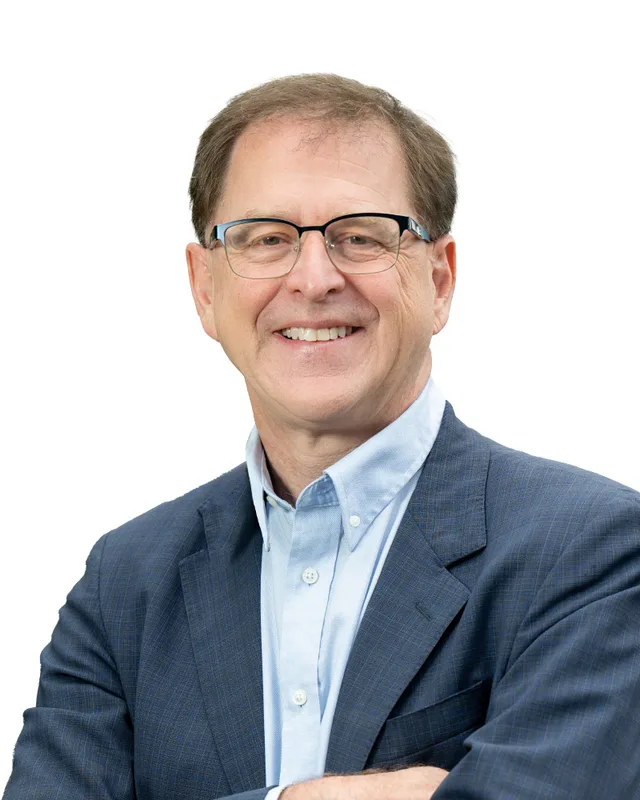
The volume for 2002 to 2013 prints Adrian Dix of the New Democratic Party as the winner on May 17, 2005 with 10,038 votes (51.44%), on May 12, 2009 with 9,229 (55.17%) and on May 14, 2013 with 10,409 (56.77%). Elections BC's results file shows Dix winning again in 2017 with 12,031 votes (60.62%) and in 2020 with 12,297 (67.81%). In 2024, under the name Vancouver-Renfrew, Dix received 10,983 votes (63.22%), Tom Ikonomou of the Conservative Party received 5,327 (30.66%) and Lawrence Taylor of the BC Green Party received 1,064 (6.12%). Turnout was 48.24% of 36,116 registered voters.
The legislature's record lists Clark for Vancouver-Kingsway in two Parliaments, Nijjar in one, and Dix in five, and then Dix for Vancouver-Renfrew in the 43rd Parliament. For every election from 1991 to 2020, the volumes and the legislature's record name the same person. This page gives years instead. The volume prints Clark as Premier from 22 February 1996 to 25 August 1999. The government's biography of Dix says he was Leader of the Official Opposition from 2011 to 2014, Minister of Health from July 2017 to November 2024, and from November 2024 Minister of Energy and Climate Solutions and Minister Responsible for Francophone Affairs. The legislature's website states that the 43rd Parliament was dissolved on September 22, 2026 and that a general election will be held on October 24, 2026.
The commission's 2023 final report renamed Vancouver-Kingsway as Vancouver-Renfrew to better reflect its geographic area and made minor adjustments to the boundaries of three neighbouring districts. Its preliminary report had used the name Vancouver-Trout Lake. Elections BC's conversion table lists 68 voting areas in the former Vancouver-Kingsway. Of these, 63 overlap Vancouver-Renfrew and 5 overlap only Vancouver-Kensington. All 61 voting areas of Vancouver-Renfrew overlap the former Vancouver-Kingsway.
Members for Vancouver-Kingsway, which covered 61 of this district’s 61 voting areas before 2024
Parliament
It sat
Member
Elected as
Party on the legislature’s record
42nd
2020 to 2024
Adrian Dix
BC NDP
BC NDP
41st
2017 to 2020
Adrian Dix
BC NDP
BC NDP
40th
2013 to 2017
Adrian Dix
BC NDP
BC NDP
39th
2009 to 2013
Adrian Dix
BC NDP
BC NDP
38th
2005 to 2009
Adrian Dix
BC NDP
BC NDP
37th
2001 to 2005
Rob Nijjar
BC Liberal Party
36th
1996 to 2001
Glen Clark
BC NDP
35th
1992 to 1996
Glen Clark
BC NDP
“Elected as” is the affiliation Elections BC printed with the winning result. The last column is the party the legislature’s records give for that parliament, which differs when a member changed party while in office. A row with that column empty is a winner Elections BC prints whom the legislature’s records leave out. Source: Legislative Assembly of British Columbia (opens in a new tab)
Boundaries since 2024
Vancouver-Renfrew has 61 voting areas. They overlap these districts from 2017 to 2024: Vancouver-Kingsway (61).
The commission that drew the boundaries counted 56,922 people in the district, 5.9% above the average for a district, over 8 km².
Where is the Vancouver-Renfrew electoral district?
Vancouver-Renfrew is in the east of the City of Vancouver. The Electoral Boundaries Commission says it includes Trout Lake and the Renfrew-Collingwood neighbourhood south of the Grandview Highway. It extends from Commercial and Victoria Drives in the west to Boundary Road in the east, next to Burnaby, and it covers 8 square kilometres.
Which communities are inside Vancouver-Renfrew?
Vancouver-Renfrew includes Renfrew, Collingwood and Trout Lake, according to the Electoral Boundaries Commission. Elections BC's results file for 2024 confirms these places with its voting places in the district, which include Collingwood Neighbourhood House, Renfrew Park Community Centre and Trout Lake Community Centre. Nine voting places stood inside Vancouver-Renfrew in 2024.
Who is the MLA for Vancouver-Renfrew and who held the seat before?
Adrian Dix of the BC NDP won Vancouver-Renfrew in 2024 and was its member when the 43rd Parliament was dissolved on September 22, 2026. Before 2024 the area belonged to Vancouver-Kingsway, which Dix held from 2005. Rob Nijjar of the Liberal Party held it from 2001 to 2005 and Glen Clark of the NDP from 1992 to 2001.
How did Vancouver-Renfrew vote in the 2024 provincial election?
In Vancouver-Renfrew in 2024, Adrian Dix of the BC NDP received 10,983 votes (63.22%). Tom Ikonomou of the Conservative Party received 5,327 votes (30.66%) and Lawrence Taylor of the BC Green Party received 1,064 (6.12%). Turnout was 48.24% of the 36,116 registered voters in the district, according to Elections BC.
How did the 2023 boundary review change Vancouver-Renfrew?
The Electoral Boundaries Commission renamed Vancouver-Kingsway as Vancouver-Renfrew in its 2023 final report, after using the name Vancouver-Trout Lake in its preliminary report. Elections BC's conversion table shows that 63 of the 68 voting areas of the former Vancouver-Kingsway overlap Vancouver-Renfrew, and the other 5 overlap only Vancouver-Kensington.
Who lives in Vancouver-Renfrew?
The 2021 census counted 56,920 people in Vancouver-Renfrew, with a median age of 40 compared with 42.8 in British Columbia. Immigrants make up 52.7% of residents, compared with 29% in the province. English is the first language of 34.6% and Yue (Cantonese) of 21.9%, followed by Tagalog at 6.4%, Mandarin at 5.4% and Vietnamese at 5.1%.
Whose territory is Vancouver-Renfrew in?
Musqueam and Squamish Nation each name Vancouver among the present-day places within their territories, and Tsleil-Waututh Nation describes its territory as centred on Burrard Inlet. In July 2025 the City of Vancouver reported that the Musqueam, Squamish and Tsleil-Waututh Nations were involved throughout the making of the Rupert and Renfrew Station Area Plan for part of the east side.
How did Trout Lake become John Hendry Park?
Aldyen Hendry Hamber and her husband Eric Hamber gave part of their land at Trout Lake to the Park Board in 1926 on the condition that it be called John Hendry Park, after her father. Before that, from the 1860s until the 1880s, a flume carried water from the lake to the Hastings Mill boilers on Burrard Inlet, in the Vancouver Heritage Foundation's account.
What are Still Creek and Renfrew Ravine in Vancouver-Renfrew?
Still Creek flows through Renfrew Ravine Park and Renfrew Community Park in Vancouver-Renfrew. The Park Board calls it the longest remaining visible creek in Vancouver, with less than 1 km of it visible through the two parks. Renfrew Ravine Park covers 6 hectares and is the only park in the city with a creek in a natural ravine.
How did the interurban railway shape Collingwood in Vancouver-Renfrew?
The City of Vancouver says the interurban railway of 1891 brought new residents to Collingwood, where many early houses and stores stood near the tram station at Vanness Avenue and Joyce Street. TransLink reports the Central Park Line made its last run on July 16, 1954, and the City says SkyTrain later followed the old route.