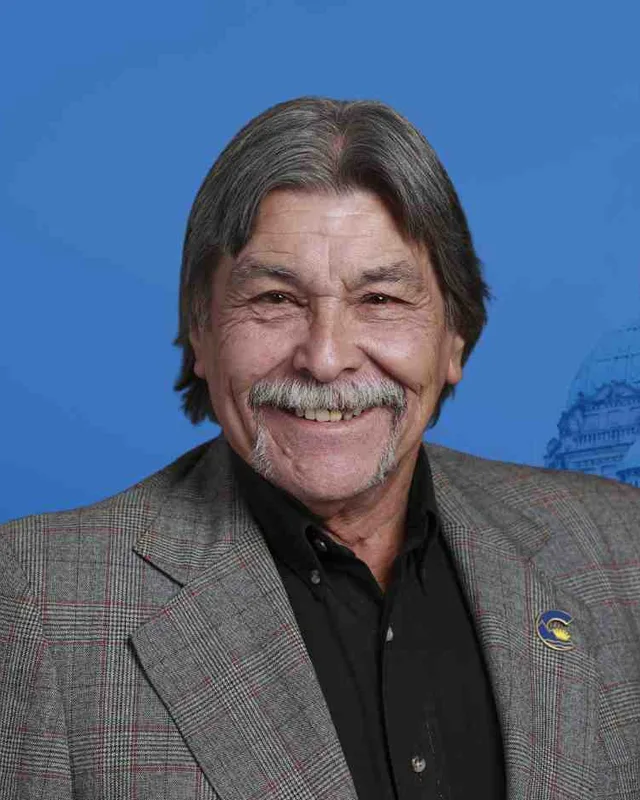
This district elects one MLA. Voters mark one name on Saturday, October 24, 2026, and the candidate with the most votes wins the seat.
Salmon Arm-Shuswap is a provincial electoral district in the Shuswap region of the British Columbia Interior. It takes in Salmon Arm, Sicamous, Enderby and Armstrong along Highways 1 and 97, the north Shuswap communities around Seymour Arm, and the Okanagan Indian Band reserve Okanagan 1 on the north shore of Okanagan Lake. The 2021 census counted 62,550 people in it, and the Electoral Boundaries Commission gives its area as 8,689 square kilometres.
Salmon Arm-Shuswap lies in the Shuswap region of the British Columbia Interior. The Electoral Boundaries Commission's 2023 final report says it includes communities along Highways 1 and 97 such as Salmon Arm, Sicamous, Enderby and Armstrong, and communities on the north shore of Okanagan Lake, such as the Okanagan Indian Band reserve (Okanagan 1). The report says the southern boundary follows the borders of Regional District of North Okanagan Electoral Area F and the Township of Spallumcheen. The commission's table gives the district a population of 62,420 and an area of 8,689 square kilometres. Elections BC's conversion table counts 93 voting areas in it and lists the 2017 to 2024 districts they overlap: Shuswap 91, Vernon-Monashee 3, Kamloops-South Thompson 2, Kamloops-North Thompson 1 and Kelowna West 1.
BC Geographical Names places Salmon Arm at the southwest end of Shuswap Lake, east of Kamloops, and Sicamous at the southeast end of the lake. It places Enderby between Armstrong and Salmon Arm, and Armstrong north of Vernon. Falkland stands at the junction of the Salmon River and Six Mile Creek, northwest of Vernon. Sorrento is on the south side of Shuswap Lake, west of Blind Bay, and Malakwa is on the Canadian Pacific Railway, on the east side of the Eagle River. The same office calls Shuswap Lake the source of the South Thompson River and gives it a shoreline of 199 miles and an area of 123 square miles.
Elections BC's results file for the 2024 election records voting places in Armstrong, Enderby, Falkland, Grindrod, Malakwa, Sorrento, Eagle Bay, Seymour Arm and the North Shuswap, among others, so those communities lie inside the district. The commission wrote that it moved the north Shuswap communities around Seymour Arm into Salmon Arm-Shuswap to unite Shuswap communities in one district and to balance populations between the districts affected. People travel by Highway 1 and Highway 97, which the commission names, and by the Canadian Pacific line that BC Geographical Names places at Salmon Arm and Malakwa.
Splatsin describes itself as the southernmost tribe of the Secwépemc Nation. It gives its territory as stretching from Mica Creek in the north to Kettle Falls, Washington in the south, and from Monte Lake in the west to Nelson in the east. Its website says Splatsin means riverbanks, where the Splatsinac, the Splatsin people, lived along both banks of the Shuswap, Eagle and Salmon Rivers. Before contact with European settlers, it says, there were Splatsin village sites at Sek’maws (Sicamous), Splatsinuwi (Enderby), Swiwaso’s (Mara Lake) and Cqlqin (Mabel Lake). The Sicamous & District Museum records that before the smallpox epidemic of 1862 there were 32 bands within Secwépemc territory, and that 17 remain.
The Adams Lake Indian Band, whose Secwépemc name is Sexqeltqín, writes that pit-house remains on the shores of its lakes and rivers are as old as nine thousand years. It says the Joint Reserve Commission allotted seven reserves to the Band in 1877, a total the Band gives as 2,785 hectares. Reserve 6, Sxwetsmèllp, lies on the western limits of the municipality of Salmon Arm, and Reserve 7 lies west of the Salmon River within the city. The Neskonlith Indian Band lists a reserve of 517 hectares, Switsemalph IR 3, on the western boundary of the city of Salmon Arm.
The Okanagan Nation Alliance, which uses the name Syilx Okanagan Nation, lists the Okanagan Indian Band as a member community at the head of Okanagan Lake. The Alliance counts six reserves for the Band, spread from Armstrong to Winfield and the west side of Okanagan Lake. The Band's own website counts seven reserves of 11,282 hectares in all. The commission's report places Okanagan 1 in this district. It records that residents of that reserve told the commission they would prefer a Vernon district, that other Band reserves lie in Salmon Arm-Shuswap, and that moving Okanagan 1 would have raised the population of Vernon-Lumby and made the boundary changes there harder. The reserve stayed.
Where the names Shuswap, Salmon Arm, Sicamous and Falkland come from
BC Geographical Names lists Shuswap Lake as a name from the Secwepemctsín language. The Geographic Board of Canada adopted the spelling on 30 June 1902, following Arrowsmith's map of 1859, and the Names Office records earlier spellings, Schewhap on a map of 1832 and Shoushwap on one of 1837. It adds that an older name for the lake is said to mean spider or insect because the arms of the lake look like the legs of an insect.
Salmon Arm takes its name from the southwest arm of the lake. The Names Office quotes a book of British Columbia place names which says salmon swarmed up the creeks and river there in such numbers that settlers pitchforked them out of the water and used them to fertilise their fields. The Sicamous post office opened on 1 November 1887, and its name is linked to the Schikmouse Narrows that Moberly's map of 1866 shows. One account the Names Office quotes, printed in the Vernon News on 18 July 1918, gives the meaning as River circling mountains.
The Falkland post office opened on 1 January 1898. From 1 July 1906 to 1 October 1912 it was named Slahaltkan, and then it took back the name Falkland. The Names Office says the place is named for Colonel Falkland George Edgeworth Warren (1834 to 1908), who retired from the Royal Horse Artillery and came to the area in 1893.
The Canadian Pacific Railway reaches the lakes, 1865 to 1900
The Sicamous & District Museum says Walter Moberly and his team found the Eagle Pass in 1865 and that it became the route of the overland railway. In 1883 the province commissioned a wagon road from Eagle Pass Landing, now Old Town Bay, to Revelstoke, and the railway of 1885 destroyed part of it. Before and during construction, the museum says, paddlewheel steamers carried most people and freight between Savona, Kamloops, Chase, Seymour Arm, Salmon Arm, Eagle Pass Landing, Sicamous and Enderby. Most of them disappeared once the railway and the roads were finished.
The Salmon Arm Museum's short history says rumours that the railway would bridge the lake from Engineer's Point to Sunnybrae led T.H. Hatherly and his son James to homestead on the north side in 1885. They became, in the museum's words, the first white settlers in the area. Track layers passed through Salmon Arm in the first week of September 1885. The museum says Salmon Arm officially began in 1890, when residents petitioned the federal government for a post office.
At Sicamous, the museum says, the railway needed timber for bridges, ties and buildings, and that gave a boost to a growing lumber industry. A large farm at Malakwa sent early potatoes, celery and lettuce to Calgary by the railway car load, and settlers from Finland came to the Cambie and Malakwa area. The railway company added junction equipment and a hotel in the late 1890s and early 1900s, supplied water and electricity to its buildings and to homes on what is now called CPR Hill, and stayed the largest employer in Sicamous until the 1950s.
The Shuswap and Okanagan Railway and the towns of 1887 to 1913
The Encyclopedia of British Columbia says the Shuswap & Okanagan Railway was incorporated in 1886 to build a line from the Canadian Pacific main line at Sicamous to Okanagan Lake near Vernon. The 82-kilometre line, leased by the Canadian Pacific, was completed in 1892. A 1976 article in Canadian Rail, the magazine of the Canadian Railroad Historical Association, gives June 1893 for the completion to Okanagan Landing and describes the line running from Sicamous down the west shore of Mara Lake, through Mara and Grindrod, Enderby and Armstrong to Vernon. BC Geographical Names says the Enderby townsite was surveyed in 1885 and first called Belvidere, that the place was known as Lambly's Landing after the brothers Thomas and Robert Lambly, who built a freight warehouse there in 1878, and that one account has the name Enderby chosen at an afternoon tea in 1887, after a poem by Jean Ingelow. The Enderby post office opened on 1 November 1887, and the City of Enderby was incorporated on 1 March 1905 with George Bell as mayor.
Salmon Arm became a municipality on 15 May 1905, according to the Salmon Arm Museum, after a majority of residents signed a petition for incorporation. Armstrong's post office opened on 1 July 1892. The City of Armstrong says the town is named for William Charles Heaton-Armstrong, who arranged the bond issue for the railway, and that in 1892 it consisted of one boxcar that served as a station and a home for the rail agent. People from Lansdowne, then the largest settlement in Spallumcheen, moved their buildings to the tracks. BC Geographical Names records a second account that names Hector Armstrong of London. The City gives its incorporation date as March 26, 1913, and BC Geographical Names gives 31 March 1913.
The Salmon Arm Museum credits A.J. Palmer with starting the custom of displaying produce and stock, and it dates the first horticultural exhibition in Salmon Arm to c. 1897. By 1915 enough dairy farmers had settled in the valley to form the Salmon Arm Co-operative Creamery Association. Butter output was 28,000 pounds in the first year and 480,000 pounds in 1944. The fruit pack topped 400,000 boxes in 1946 and held steady until the winter of 1949 to 1950, when freezing temperatures that the museum calls unprecedented damaged fruit operations across the city. In the 1950s lumber and plywood manufacturing grew in the local economy, and former fruit land became small holdings and housing subdivisions.
The Greater Vernon Museum says residents of the Village of Armstrong founded a creamery in 1902 by selling shares in land. In 1916 it joined the North Okanagan Creamery Association, and by 1923 it produced 12,000 pounds of butter a month. A fire destroyed the creamery in 1927. A cheese factory opened in 1938, the Armstrong Cheese Co-Operative was incorporated in 1939, and sales reached 820,000 pounds a year by 1943. Saputo closed the Armstrong plant in 2004, and the Village Cheese Company had opened in Armstrong in 1998. The Armstrong IPE & Stampede says on its website that its fair has been held since 1901.
The Sicamous & District Museum says that by the early 1960s, with better highways, tourism had become a larger part of the economy of Sicamous. The houseboat industry that began in the late 1960s led the way, and snowmobiling followed in the early 1990s. The museum says Sicamous incorporated in 1989 and became the District of Sicamous in December of that year. BC Geographical Names gives the date as 4 December 1989.
The Salmon Arm Museum says provincial approval for urban status came on March 12, 1912, that the city reverted to a village in 1958 for more favourable treatment under the Municipal Act, and that in 1970 village and city voted to unite as a city municipality. BC Geographical Names records the form Salmon Arm (Village) from 1 September 1958, and the form Salmon Arm (community) from 1 September 1970, following the amalgamation of the village area within the District Municipality of Salmon Arm. It records that the municipality was re-incorporated as a city by provincial Order in Council 89 of 11 February 2005, effective 14 May 2005, as the City of Salmon Arm.
The Province's summary of the 2023 wildfire season lists the Bush Creek East fire (K21633) as discovered on 12 July, naturally caused, and 45,613 hectares in size. It says Bush Creek East and the Lower East Adams Lake fire (K21620) in the Shuswap merged. The Columbia Shuswap Regional District reported that as of 4 September 2023 at 2 PM there were 176 total structure losses and 50 partially damaged structures in the North Shuswap area. It called the numbers approximate, because a full damage assessment could not be completed while the fire was still burning. Its update of 20 August 2023 describes crews at work north of Shuswap Lake, in the Celista and Magna Bay area, and a task force above Sorrento putting hand line in above homes.
The name Salmon Arm-Shuswap first appears at the 2024 provincial general election. The commission's 2023 final report named the district, and Elections BC's conversion table matches 91 of its 93 voting areas to the earlier district of Shuswap. David L. Williams of the Conservative Party won in 2024 with 16,566 votes (52.11%). Sylvia Lindgren of the BC NDP received 9,677 votes (30.44%), Greg McCune, an independent, 2,922 (9.19%), Jed Wiebe of the BC Green Party 2,250 (7.08%) and Sherry Roy, an independent, 373 (1.17%). Turnout was 61.42% of 51,806 registered voters. The legislature's records list Williams as the member for Salmon Arm-Shuswap in the 43rd Parliament, which they date from 18 February 2025.
Shuswap was represented by George Abbott of the BC Liberal Party from 1996 to 2013 and by Greg Kyllo from 2013 to 2024, as a BC Liberal until 2020 and as a member of BC United from 2020. Elections BC's volume for 1987 to 2001 lists Abbott as the winner in 1996 with 8,596 votes (34.55%) and in 2001 with 12,950 votes (56.27%). In 2020 Kyllo received 13,300 votes (51.35%), against 8,816 (34.04%) for Lindgren and 3,784 (14.61%) for Owen Madden of the BC Green Party.
Earlier results sit under other names. Elections BC's first volume prints Salmon Arm as a district from the 1924 election, when Rolf Wallgren Bruhn of the Conservative Party won with 920 votes (36.83%). Bruhn won again in 1928, 1933, 1937 and 1941 and died in 1942, and George Faulds Stirling of the CCF won the by-election that year. Arthur Brown Ritchie of the Coalition won in 1945 with 1,560 votes (60.00%) and in 1949. James Allan Reid won in 1952, 1953 and 1956, and Willis Franklin Jefcoat of Social Credit won in 1960 with 1,979 votes (41.75%) and in 1963.
The district became Shuswap in 1966, when Jefcoat won with 3,995 votes (54.07%), and he won again in 1969. Donald Emerson Lewis of the New Democratic Party won in 1972 with 5,459 votes (45.15%), and Leonard Bawtree of Social Credit won in 1975 with 7,514 votes (47.79%). The name was Shuswap-Revelstoke from 1979 to 1986: William Stewart King of the New Democratic Party won in 1979 with 10,654 votes (47.95%) and Clifford C. Michael of Social Credit won in 1983 with 14,102 votes (52.07%) and in 1986. The name returned to Shuswap in 1991, when Shannon O'Neill of the NDP won with 7,687 votes (35.50%).
Members for Shuswap, which covered 91 of this district’s 93 voting areas before 2024
Parliament
It sat
Member
Elected as
Party on the legislature’s record
42nd
2020 to 2024
Greg Kyllo
BC Liberal Party
BC United
41st
2017 to 2020
Greg Kyllo
BC Liberal Party
40th
2013 to 2017
Greg Kyllo
BC Liberal Party
BC Liberal Party
39th
2009 to 2013
George Abbott
BC Liberal Party
38th
2005 to 2009
George Abbott
BC Liberal Party
BC Liberal Party
37th
2001 to 2005
George Abbott
BC Liberal Party
36th
1996 to 2001
George Abbott
BC Liberal Party
35th
1992 to 1996
Shannon O'Neill
BC NDP
“Elected as” is the affiliation Elections BC printed with the winning result. The last column is the party the legislature’s records give for that parliament, which differs when a member changed party while in office. A row with that column empty is a winner Elections BC prints whom the legislature’s records leave out. Source: Legislative Assembly of British Columbia (opens in a new tab)
Boundaries since 2024
Salmon Arm-Shuswap has 93 voting areas. They overlap these districts from 2017 to 2024: Shuswap (91), Vernon-Monashee (3), Kamloops-South Thompson (2), Kamloops-North Thompson (1), Kelowna West (1).
The commission that drew the boundaries counted 62,420 people in the district, 16.1% above the average for a district, over 8,689 km².
Where is the Salmon Arm-Shuswap electoral district?
Salmon Arm-Shuswap is in the Shuswap region of the British Columbia Interior. The Electoral Boundaries Commission says it includes communities along Highways 1 and 97 such as Salmon Arm, Sicamous, Enderby and Armstrong, and communities on the north shore of Okanagan Lake. The commission gives the district a population of 62,420 and an area of 8,689 square kilometres.
Which communities are in Salmon Arm-Shuswap?
Salmon Arm-Shuswap includes Salmon Arm, Sicamous, Enderby and Armstrong, the four towns the Electoral Boundaries Commission names. Elections BC's 2024 results file also records voting places in Falkland, Grindrod, Malakwa, Sorrento, Eagle Bay, Seymour Arm and the North Shuswap. The commission's report places the Okanagan Indian Band reserve Okanagan 1 inside the district.
Who is the MLA for Salmon Arm-Shuswap?
David L. Williams of the Conservative Party is the member for Salmon Arm-Shuswap. He won the 2024 election with 16,566 votes (52.11%). The legislature's records list him as the member in the 43rd Parliament, dated from 18 February 2025. Sylvia Lindgren of the BC NDP came second with 9,677 votes (30.44%).
Who held the seat before Salmon Arm-Shuswap existed?
Greg Kyllo held the earlier district of Shuswap from 2013 to 2024. Elections BC's conversion table matches 91 of the 93 voting areas of Salmon Arm-Shuswap to Shuswap. George Abbott of the BC Liberal Party held Shuswap before Kyllo, from 1996 to 2013. Abbott won in 2001 with 12,950 votes (56.27%).
How did Salmon Arm-Shuswap vote in 2024?
In 2024 Salmon Arm-Shuswap elected David L. Williams of the Conservative Party with 16,566 votes (52.11%). Sylvia Lindgren of the BC NDP received 9,677 votes (30.44%), Greg McCune 2,922 (9.19%), Jed Wiebe of the BC Green Party 2,250 (7.08%) and Sherry Roy 373 (1.17%). Turnout was 61.42% of 51,806 registered voters.
How did the 2023 boundary change affect Salmon Arm-Shuswap?
The commission moved the north Shuswap communities around Seymour Arm into Salmon Arm-Shuswap, to unite Shuswap communities in one district and to balance populations. It left the Okanagan Indian Band reserve Okanagan 1 in the district, although residents had asked to join a Vernon district. Elections BC counts 93 voting areas, 91 of them from Shuswap.
Whose territory is Salmon Arm-Shuswap on?
Secwépemc and Syilx Nations have territory in Salmon Arm-Shuswap. Splatsin, based at Enderby, calls itself the southernmost tribe of the Secwépemc Nation, and the Adams Lake Indian Band lists reserves at the western limits of Salmon Arm. The Okanagan Indian Band, part of the Syilx Okanagan Nation, has its Okanagan 1 reserve in the district.
How many people live in Salmon Arm-Shuswap?
The 2021 census counted 62,550 people in Salmon Arm-Shuswap. Their median age was 54.4, against 42.8 for British Columbia as a whole. Of the district's people, 9.5% reported Indigenous identity. Owners lived in 82.1% of homes. The commission counted 62,420 people for its own work and gave the district an area of 8,689 square kilometres.
When were the towns of Salmon Arm-Shuswap founded?
Salmon Arm-Shuswap holds towns that date from the railway years. Enderby was incorporated on 1 March 1905, and Salmon Arm became a municipality on 15 May 1905. Armstrong was incorporated in 1913, and Sicamous became a district municipality in December 1989. The Shuswap and Okanagan Railway ran from Sicamous to Okanagan Lake and was completed in 1892, according to the Encyclopedia of British Columbia.
What was the Bush Creek East wildfire in Salmon Arm-Shuswap?
The Bush Creek East fire was found on 12 July 2023 in the Shuswap, according to the Province, and reached 45,613 hectares. The Columbia Shuswap Regional District counted 176 total structure losses and 50 partially damaged structures in the North Shuswap area as of 4 September 2023. Salmon Arm-Shuswap includes the north Shuswap communities around Seymour Arm, and its 2024 voting places included a North Shuswap hall.