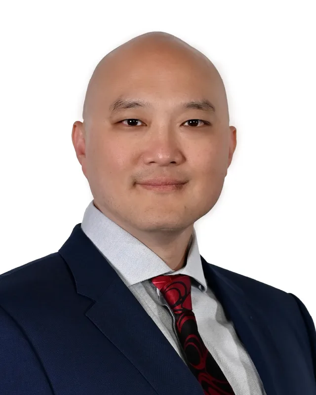
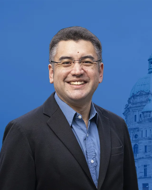
This district elects one MLA. Voters mark one name on Saturday, October 24, 2026, and the candidate with the most votes wins the seat.
Richmond Centre is a provincial electoral district in the City of Richmond. The Electoral Boundaries Commission says it contains Richmond's downtown core, between No. 2 Road and No. 4 Road, and gives its area as 7 square kilometres. The 2021 census counted 54,475 people in it. The district takes in the Brighouse area with City Hall and Minoru Park, and the Lansdowne Road area with Kwantlen Polytechnic University's Richmond campus.
Richmond Centre is one of four provincial districts in the City of Richmond. The Electoral Boundaries Commission's 2023 final report says it contains Richmond's downtown core. Its western boundary is No. 2 Road and its eastern boundary is No. 4 Road. Its northern border follows Alderbridge Way and the Westminster Highway, and its southern border follows Blundell Road. The commission gives the district 54,474 people in 7 square kilometres, the smallest area of the six districts in Richmond and Delta. No. 3 Road runs through the middle of it. The Richmond Museum's tour of the Brighouse District places City Hall at 6911 Number 3 Road and Minoru Park at 7191 Granville Avenue.
The district lies on Lulu Island, the largest of the islands that the Fraser River formed in Richmond. The City of Richmond Archives says the islands stand at an average of one metre above sea level, and that solid bedrock lies more than 200 metres below the surface. West of No. 3 Road the ground is usually a layer of clay 3 metres deep over sand. East of No. 3 Road it is usually a layer of peat up to 7 metres deep, then 3 metres of clay over sand. The Archives says most buildings of more than three storeys therefore stand on piles that carry their weight to the soil below the layer that can lose its strength in an earthquake.
Richmond's main north-south roads are numbered and run parallel, one mile apart, the Archives explains, so No. 3 Road lies between the district's two edges. In the 1930s the numbered east-west roads were renamed: Blundell Road had been No. 18 Road and Westminster Highway had been No. 19 Road. A new Brighouse Station on No. 3 Road opened in 2009 as a final stop of the Canada Line. Elections BC's results file for 2024 names nine places where people voted in the district: A.R. MacNeill Secondary School, General Currie Elementary School, Henry Anderson Elementary School, Kwantlen Polytechnic University, Richmond Pentecostal Church, Richmond Secondary School, Samuel Brighouse Elementary School, Trinity Lutheran Church and William Cook Elementary School.
Musqueam says on its website that its ancestors have lived throughout and stewarded the Fraser River estuary for thousands of years. It lists Richmond among the places that are today portions of its territory. The City of Richmond Archives describes how the ground itself came to be. The islands of Richmond formed in the Fraser delta over more than 10,000 years, as the river laid silt and sand on top of the deposits of the last Ice Age.
The Archives writes that the Coast Salish peoples of the area treated the islands as gardens, with cranberry bogs, crab apple trees and many other plants. Natural channels called sloughs drained the land, and more than 100 kilometres of them could be travelled by canoe. The Archives gives an estimate of 1,000 to 2,000 people living on the land of present-day Richmond in winter, and says as many as six permanent house sites stood on Lulu and Sea Islands. The smallpox epidemic of 1781 reduced the population and led to the abandonment of most of these sites, although First Nations people kept using many of them after settlers arrived.
Joseph and John Trutch surveyed the islands in 1859 under a contract from the colonial government. Settlers then dug ditches and canals and filled in the sloughs, and the Archives says that by the end of the First World War most of the natural sloughs were gone. Lulu Island and Sea Island are today circled by dykes, with drainage systems and pump houses that remove water from the land.
Lulu Island, the Brighouse farm and the Township, 1861 to 1883
Colonel Richard Clement Moody named Lulu Island in January 1861, according to the Archives. The actress Lulu Sweet was travelling on the steamer Otter and asked him the name of the large island they were passing. He replied that it had no name and that he would name it after her. In 1864 Samuel Brighouse acquired 697 acres on Lulu Island. The Archives says the property is bounded today by No. 3 Road on the east, No. 2 Road on the west, Granville Avenue on the south and the river on the north. He raised crops and livestock there and built the largest barn on the Fraser River.
The Township of Richmond was incorporated on 10 November 1879, the BC Geographical Names record says. Brighouse signed the petition for the incorporation. In 1880 he sold five acres at the present corner of River and Cambie Roads to the Township for $400, and the first Town Hall was built there beside the Agricultural Hall and the Methodist church that is now Minoru Chapel. He served briefly on Council in 1883 although he no longer lived in Richmond, and he leased his farmland to other farmers instead of selling it.
In 1902 the Canadian Pacific Railway built the Vancouver and Lulu Island line, which the Archives calls the Sockeye Limited, from Vancouver to Steveston. Small stations were built where the track crossed a road, and Brighouse Station went up where the track crossed No. 3 Road, near the southeast corner of the Brighouse property. Michael Wilkinson Brighouse, Samuel's nephew and heir, kept the name in public view. In 1919 he traded the five acres that the Township had bought from his uncle for four acres at the present City Hall site. The Archives says the second Town Hall opened that year, when Richmond had 3,110 people.
A Brighouse Post Office opened at the station in 1922, and the Town Hall's mailing address became The Corporation of the Township of Richmond, Brighouse, B.C. In the same year a public meeting of residents of the Brighouse and Garden City area formed a volunteer fire department, which the Richmond Museum says became a reality three days later. The Archives adds that Brighouse Grocery, first built in 1918 at No. 3 Road and General Currie Road, moved to a new building at No. 3 Road and Granville Avenue, near the new Town Hall and the station.
Minoru Park racetrack and the first flights, 1909 to 1962
Businessmen bought land from Samuel Brighouse and built Richmond's first thoroughbred racetrack in 90 days, the Archives says: a mile-long oval, a grandstand, a clubhouse and a mile of barns, at a cost of $75,000. They named it Minoru Park after the horse that won the 1909 Epsom Derby for King Edward VII. The Richmond Museum says more than 7,000 racing fans filled the stands on opening day, 21 August 1909, and many arrived on special Interurban trams. The barns stood on the west side of No. 3 Road, where Richmond Centre mall stands today.
The track also served as an airfield. On 25 March 1910 Charles K. Hamilton flew a Curtiss biplane there in front of 3,500 spectators and became the first person to fly an aeroplane in British Columbia. In April 1912 Billy Stark carried the first aircraft passengers in the province, and on 13 May 1919 two members of the Aerial League of Canada made the first flight across the Strait of Georgia. In August 1919 Ernest C. Hoy took off from the park and flew across the Rocky Mountains to Calgary with airmail.
Racing stopped in 1914, when the First World War began. The track reopened in 1920 as Brighouse Park and closed for racing in 1941. The British Columbia Turf and Country Club bought the land in 1945, and the municipality bought it in 1958. The park took back the name Minoru in 1960, and in 1962 Mayor and Council bought the Brighouse Estate, which let the park grow to its present size.
Lansdowne: a second racetrack, an airfield and a campus
The Richmond Sentinel reports that Lansdowne Park racetrack was built in 1924 as Richmond's second track, to get around the provincial limit on the length of the racing season. The same article says the track closed after the city bought the land in 1958, and that Lansdowne Centre was built in 1977.
The Archives tells how an airfield followed. In 1927 Charles Lindbergh refused to land at Vancouver during his North American tour and said there was no airport worth landing at. The City of Vancouver leased a field beside Lansdowne Park Racetrack in 1928, and Lansdowne Field became British Columbia's second licensed airport, opening officially in May 1929. It was meant to be temporary until a permanent airport could be built on Sea Island. That airport opened on 22 July 1931, and aviation on Lulu Island then stopped.
The name Lansdowne is also on Kwantlen Polytechnic University's Richmond campus on Lansdowne Road, one of the places where people in this district voted in 2024. The university's campus plan says the campus is in Richmond's City Centre, next to Lansdowne Centre and steps from Lansdowne Station. KPU says it began as Kwantlen College in 1981, became a degree-granting institution in 1995 and became Kwantlen Polytechnic University in 2008.
Schools, the end of the tram and a new town centre, 1927 to 1968
The Archives says Richmond Secondary opened in 1927 at Cambie and Sexsmith Roads, and that a new school was built in 1952 near Foster Road, now Minoru Boulevard, and Granville Avenue. William Cook Elementary opened in 1954 on Cook Road near Garden City, in what the Archives calls the area that was to become the downtown core. The Archives dates the original General Currie Elementary building to 1920, and the Museum calls it the only protected heritage school in Richmond. The Oak Street Bridge opened in 1957 and gave quick access to central Richmond, and the Archives says development and school building then increased quickly.
In 1956 the municipality's Planning Commission approved a plan to turn the Brighouse District from a rural community serving farms into a modern commercial town centre, with a new town hall, school board office, health unit, library, shops and a large park, the Museum says. A third, larger Town Hall followed in 1957 on the same site. The Interurban tram, an electric line between towns, stopped running in 1958. Samuel Brighouse Elementary School opened in 1965 to serve Brighouse Estates.
The Richmond Sentinel reports that Richmond Square shopping centre opened in 1964, and the Archives says the south part of today's mall stands on the former racetrack property. The Hudson's Bay Company opened its store on the north side two years later. On 1 June 1967 the first McDonald's outside the United States opened at 7120 Number 3 Road, the Museum says. That year Minoru Chapel, which the City's heritage inventory calls the oldest extant church in Richmond, was moved to Minoru Park from Cambie and River Roads, and it was consecrated as Minoru Chapel in 1968. The Richmond Square Twin Theatres, the first multi-screen cinema in Richmond, opened on 27 June 1968.
Towers, a new City Hall and the Canada Line, 1971 to 2010
Until the late 1950s Richmond's zoning allowed no building higher than three storeys, the Archives says. On 12 April 1971 the Review newspaper announced the municipality's first high-rise complex, to be built on Minoru Boulevard: three towers of 17 storeys with 561 dwellings. The first two were ready for rent by November 1972, and the third followed in 1973 and was sold as condominiums. The Archives counts a high-rise as seven storeys or more, and says that before these towers the tallest building in Richmond was a six-storey hospital that opened on 26 February 1966.
Richmond Square and the Hudson's Bay Company's mall were joined in 1989 under the name Richmond Centre. Famous Players opened a six-screen cinema in the mall on 23 November 1990 and it closed on 27 March 2011. BC Geographical Names records that the municipality was re-incorporated as the City of Richmond on 3 December 1990. The fourth City Hall, an eight-storey tower at No. 3 Road and Granville Avenue, opened for business on 15 May 2000. In 1981 voters had approved Sunday and holiday shopping on the municipal ballot, by 14,434 Yes votes to 8,265 No votes.
The Canada Line opened a new Brighouse Station on No. 3 Road in 2009. During the 2010 Olympic Winter Games Minoru Park held the Richmond O Zone, the Museum says, and the Archives says the civic square at City Hall had a large screen for watching events. Schools followed the growth in housing: Henry Anderson Elementary opened in 1996 for the multi-family complexes along Alberta and Garden City Roads, A.R. MacNeill Secondary opened in 2003 on No. 4 Road near Westminster Highway, and a new Richmond Secondary building opened on 5 January 2004.
The name Richmond Centre was first used for an electoral district in the 1991 general election, according to Elections BC's electoral history volume for 1987 to 2001. The Electoral Districts Act of 1990 set out 75 single-member districts and came into effect when the 35th Parliament was dissolved on 19 September 1991. Richmond Centre was one of three Richmond districts that year, with Richmond East and Richmond-Steveston.
Doug Symons of the BC Liberal Party won Richmond Centre in 1991 with 7,806 votes (42.44%) and again in 1996 with 9,925 votes (55.52%). Greg Halsey-Brandt of the BC Liberal Party won in 2001 with 12,061 votes (71.86%), after a new Electoral Districts Act took effect on 18 April 2001. Olga Ilich won in 2005 with 10,908 votes (58.56%), Rob Howard in 2009 with 10,483 votes (61.51%) and Teresa Wat in 2013 with 9,462 votes (49.83%), all for the BC Liberal Party.
The commission's 2015 report replaced the district. It calls the Richmond City Centre the most populous and fastest growing part of the city and shares it between two districts, Richmond North Centre to the north-west of City Hall and Richmond South Centre to the south-east. Richmond South Centre had 50,101 people on the commission's count, and three blocks north of Francis Road and east of No. 2 Road moved into it from Richmond-Steveston. Linda Reid of the BC Liberal Party won Richmond South Centre in 2017 with 6,914 votes (48.72%). Henry Yao of the BC NDP won it in 2020 with 6,743 votes (50.67%), ahead of Alexa Loo of the BC Liberal Party with 6,564 (49.33%).
The 2023 report renamed Richmond South Centre as Richmond Centre and says the district contains Richmond's downtown core. It moved the residential area south of Blundell Road and west of Gilbert Road into Richmond-Steveston. The district now covers 7 square kilometres, where Richmond South Centre covered 30. Elections BC's conversion table matches the 62 voting areas of 2024 to the districts used from 2017 and counts 47 overlaps with Richmond South Centre and 16 with Richmond North Centre. In the 43rd Provincial General Election on 19 October 2024, Hon Chan of the Conservative Party won with 8,426 votes (51.99%), ahead of Henry Yao of the BC NDP with 5,961 (36.78%). Wendy Yuan received 1,028, Dickens Cheung 556 and Sunny Ho 237. Turnout was 49.07% of 33,153 registered voters. The legislature lists Hon Chan as an Independent for the 43rd Parliament, which was dissolved on 22 September 2026, and a general election will be held on 24 October 2026.
Members for Richmond South Centre, which covered 47 of this district’s 62 voting areas before 2024
Parliament
It sat
Member
Elected as
Party on the legislature’s record
42nd
2020 to 2024
Henry Yao
BC NDP
BC NDP
41st
2017 to 2020
Linda Reid
BC Liberal Party
BC Liberal Party
Members for Richmond North Centre, which covered 16 of this district’s 62 voting areas before 2024
Parliament
It sat
Member
Elected as
Party on the legislature’s record
42nd
2020 to 2024
Teresa Wat
BC Liberal Party
Conservative Party of BC
41st
2017 to 2020
Teresa Wat
BC Liberal Party
BC Liberal Party
“Elected as” is the affiliation Elections BC printed with the winning result. The last column is the party the legislature’s records give for that parliament, which differs when a member changed party while in office. A row with that column empty is a winner Elections BC prints whom the legislature’s records leave out. Source: Legislative Assembly of British Columbia (opens in a new tab)
Boundaries since 2024
Richmond Centre has 62 voting areas. They overlap these districts from 2017 to 2024: Richmond South Centre (47), Richmond North Centre (16).
The commission that drew the boundaries counted 54,474 people in the district, 1.3% above the average for a district, over 7 km².
Richmond Centre is a provincial electoral district in the City of Richmond, British Columbia. The Electoral Boundaries Commission's 2023 final report says it contains Richmond's downtown core. Its western boundary is No. 2 Road and its eastern boundary is No. 4 Road. Its northern border follows Alderbridge Way and the Westminster Highway, and its southern border follows Blundell Road. The district covers 7 square kilometres.
Which neighbourhoods and places are in Richmond Centre?
Richmond Centre includes the Brighouse area, where Richmond City Hall and Minoru Park stand, and the Lansdowne Road area, where Kwantlen Polytechnic University has its Richmond campus. Elections BC's results file for 2024 names nine places where people voted in the district, among them Richmond Secondary School, Samuel Brighouse Elementary School and William Cook Elementary School. The district lies on Lulu Island.
Who won Richmond Centre in the 2024 provincial election?
Hon Chan of the Conservative Party won Richmond Centre on 19 October 2024 with 8,426 votes, 51.99% of the valid vote. Henry Yao of the BC NDP received 5,961 votes. Wendy Yuan received 1,028, Dickens Cheung as an Independent 556 and Sunny Ho as an Independent 237. Turnout was 49.07% of 33,153 registered voters.
Who represented this area before Hon Chan?
Henry Yao of the BC NDP represented Richmond South Centre from 2020 to 2024, and 47 of the 62 voting areas of Richmond Centre overlap that district. Linda Reid of the BC Liberal Party held Richmond South Centre from 2017 to 2020. An earlier district also named Richmond Centre had Teresa Wat as its member from 2013 to 2017.
How did the boundaries of Richmond Centre change in 2023?
The commission's 2023 report renamed Richmond South Centre as Richmond Centre and moved the residential area south of Blundell Road and west of Gilbert Road into Richmond-Steveston. Richmond Centre now covers 7 square kilometres, where Richmond South Centre covered 30. The commission counts 54,474 people in Richmond Centre, which is 1.3% from the average district.
How many people live in Richmond Centre?
The 2021 census counted 54,475 people in Richmond Centre, with a median age of 44 compared with 42.8 across British Columbia. Mandarin was the first language of 26.1% of residents, Yue (Cantonese) of 24.4% and English of 22.3%. Immigrants made up 68.1% of the population, and the median household income was $64,000.
Whose traditional territory is Richmond Centre on?
The Musqueam Indian Band says on its website that its ancestors have lived throughout and stewarded the Fraser River estuary for thousands of years, and it lists Richmond among the places that are today portions of its territory. Richmond Centre is in the City of Richmond. The City of Richmond Archives describes the Coast Salish peoples' use of Lulu Island's bogs, sloughs and rivers.
Why is the area around City Hall called Brighouse?
The Richmond Centre area called Brighouse takes its name from Samuel Brighouse, who acquired 697 acres on Lulu Island in 1864. The land included the site of today's City Hall and Minoru Park. Brighouse Station opened on the railway in 1902 and a Brighouse Post Office opened at the station in 1922, which fixed the name on the district's town centre.
What happened at Minoru Park in Richmond Centre?
Minoru Park in Richmond Centre was the site of Richmond's first thoroughbred racetrack, which opened on 21 August 1909. On 25 March 1910 Charles K. Hamilton made the first aeroplane flight in British Columbia there. The track closed for racing in 1941, the municipality bought the land in 1958, and the park took the name Minoru again in 1960.
When was the Richmond Centre electoral district first created?
The name Richmond Centre was first used in the 1991 general election, when Doug Symons of the BC Liberal Party won the district. Elections BC's volume for 1987 to 2001 lists it that year. The name was replaced by Richmond North Centre and Richmond South Centre for the 2017 election and returned for the 2024 election, when Hon Chan won the district.