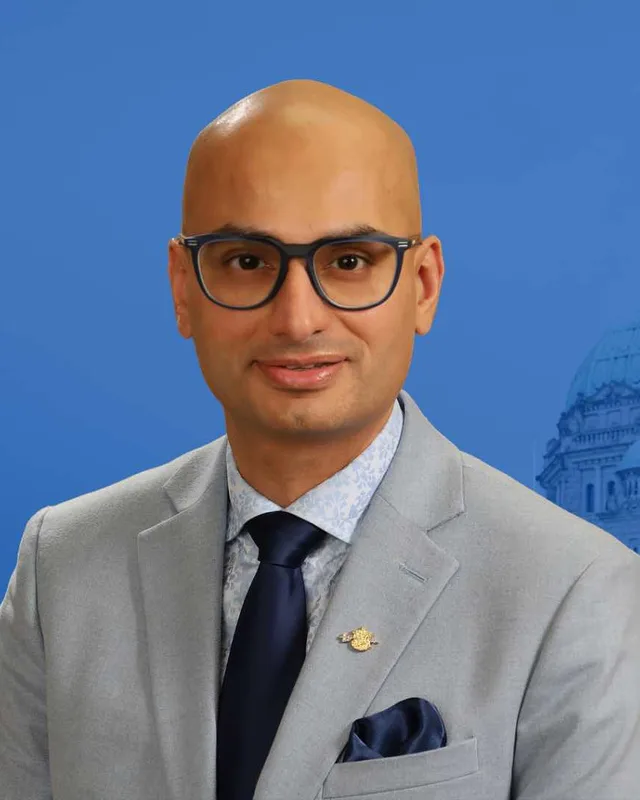
This district elects one MLA. Voters mark one name on Saturday, October 24, 2026, and the candidate with the most votes wins the seat.
Richmond-Queensborough is a provincial electoral district on the eastern part of Lulu Island, in the Fraser River delta. It takes in the Queensborough neighbourhood of New Westminster and the Richmond neighbourhoods of Hamilton and Southarm. The 2021 census counted 54,950 people in it, and the Electoral Boundaries Commission gives its area as 90 square kilometres.
Richmond-Queensborough covers the east of Lulu Island, the large island in the Fraser River delta that holds most of Richmond. The Electoral Boundaries Commission's 2023 final report says the district includes the New Westminster neighbourhood of Queensborough and the Richmond neighbourhood of Southarm. Its western boundary follows No. 3, No. 4 and No. 5 Roads and Shell Road, and its northern, southern and eastern boundaries follow the Fraser River. The commission counts 54,947 people in 90 square kilometres. That makes it the third largest of the six districts in Richmond and Delta, after Delta South at 455 square kilometres and Richmond-Bridgeport at 453.
Two cities share the district. The heritage consultants who wrote the City of New Westminster's 2012 context statement say the Fraser River separates Queensborough from the mainland part of New Westminster, and that the rest of Lulu Island belongs to Richmond. The commission's 2015 report formed the first Richmond-Queensborough by combining Queensborough with the Hamilton neighbourhood of Richmond, most of East Richmond and a small part of the South Arm community. The 2023 report gives No. 5 Road as the eastern border of Richmond-Bridgeport and No. 3 Road as the eastern border of Richmond-Steveston, so Hamilton and the South Arm shore east of No. 3 Road lie in Richmond-Queensborough.
Most people travel to work by car. The 2021 census counts 17,485 workers (82.7%) who go by car, truck or van and 2,530 (12%) who use public transit. Highway 91A crosses the North Arm of the Fraser River on the Queensborough Bridge, which carries four lanes, and a passenger ferry called the Q to Q Ferry links Queensborough with downtown New Westminster. Elections BC's statement of votes for 2024 lists 12 voting places in the district on voting day: Bethany Baptist Church, Church on Five, Daniel Woodward Elementary School, H.J. Cambie Secondary School, Hugh McRoberts Secondary School, Kingswood Elementary School, McNair Secondary School, Queensborough Community Centre, Queensborough Middle School, R.C. Palmer Secondary School, Thomas Kidd Elementary School and Walter Lee Elementary School.
The Musqueam Indian Band, xʷməθkʷəy̓əm, says its ancestors have lived throughout and stewarded the Fraser River estuary for thousands of years. Its website names both Richmond and New Westminster among the places that are today portions of Musqueam territory. The Musqueam Declaration of 10 June 1976 describes the territory it claims as including the left bank of the Fraser River and the South Arm of the river downstream to the sea, with the lands, islands and waters between.
The City of New Westminster's heritage consultants wrote in 2012 that the Kwantlen and Stó:lō First Nations first used the land of Queensborough as part of their seasonal round, collecting food from the land and fishing in the Fraser River. They say the low, fertile ground supported food crops, especially cranberries. They add that nearby Poplar Island was set aside as part of local First Nations reserve land and was later the site of a smallpox isolation hospital, and that salmon canneries in Queensborough gave jobs to fishers and canning workers once settlement began in the 1870s and 1880s.
The City of New Westminster states on its own pages that it stands on the unceded and unsurrendered land of the Halkomelem speaking peoples. The B.C. government lists the Qayqayt First Nation at New Westminster with a population of 20 and says the nation is not participating in the B.C. treaty process.
From government reserve to city lands, 1859 to 1911
The chronology in New Westminster's heritage management plan of 1993, repeated in the City's 2012 context statement, records that the 1859 Trutch survey of Richmond marked the eastern tip of Lulu Island as a Government Reserve. The statement says Colonel Moody's survey laid a grid of District Lots over Queensborough, which differs from the sections, blocks and ranges used on the rest of the island. It says the 600-acre District Lot 757 passed from the province to the City of New Westminster in 1889, when the city received a new charter, and that Alexander Ewen, a cannery owner, bought the neighbouring 140-acre District Lot 758 in the same year.
In 1890 the City sold 525 acres to Donald McGillvray, who owned a foundry on the island and was responsible for building a wagon bridge to the mainland. The statement dates the railway bridge to 1891 and says 600 acres were dyked in 1892. The auction brochure of 1892 promised an electric tramway and described the land as suited to manufacturing, shipping, market gardening, fruit growing and plant nurseries. BC Geographical Names records that the Queensborough post office opened on 1 December 1908, was named to recall an early name for New Westminster, closed on 18 May 1910 and reopened on 1 April 1911. The Queensborough Ratepayers Association formed in 1911.
When Alexander Ewen died in 1907, his large tract was divided into small, affordable lots, which the statement says led to a short period of new housing. A second period of building ran from 1925 to 1945, and the statement reports that the population reached 1,500 to 2,000. The BC Electric Railway tramline on Ewen Avenue opened in 1912, together with the first school, Queen Elizabeth School. The statement lists Japanese and Chinese berry farms, a dairy herd, orchards and market gardens, and says Chinese and Japanese market gardens developed along Ewen Avenue. Sawmills, canneries, a box factory built in 1905 and Mercer's Star Shipyards, built in 1940, gave work to Japanese, Scandinavian, Chinese, Slovak, Italian and Indo-Canadian residents.
Several of their halls remain. The statement says the Italian community founded the Italian Mutual Aid Society in 1929 and built the Roma Hall with volunteer labour in 1932. Slovak immigrants arrived after the First World War. The 1986 heritage inventory dates the Slovak Home to 1939 and Tatra Hall to c.1939. The City's Time Traveller series says the New Westminster gurdwara began in 1911 or 1912 in a home at 344 Boyne Street. On 4 March 1919 Bhai Bishan Singh paid $250 for the house next door, which served as the gurdwara until the building at 347 Wood Street opened in the winter of 1975.
The Canadian Pacific airplane plant was constructed in 1942, and industrial activity and housing both increased during the Second World War. The statement says both Japanese and Italian nationals suffered dislocation and relocation during the war. The Fraser River flood of 1948 almost breached Queensborough's old dykes.
Woodward's Landing, the railway and the ferry, 1874 to 1959
The City of Richmond Archives tells the story of the South Arm shore in Time and Tide. Nathan Woodward and his 18-year-old son Daniel arrived from Ontario in 1874 and settled around No. 5 Road, south to the Fraser River. In 1893 the municipality bought three-tenths of an acre from Nathan Woodward for $75, and a wharf there became known as Woodward's Landing. The Canadian Northern Railway built a Lulu Island branch from the British Columbia Electric Railway track in Queensborough and west along the South Arm. Its trestle ran 12,880 feet on 3,472 cedar pilings, it had stations at Queensborough, Woodward's Landing and Steveston, and it opened officially in March 1917. Peat bog fires on 30 June 1918 destroyed several small trestles and part of the long one, which was never repaired.
A ferry linked Woodward's Landing with Ladner from the fall of 1913. The book gives its traffic as more than 48,000 cars in 1932 and 378,000 in 1956, and says the last crossing was made by the Delta Princess on 23 May 1959, because the Deas Island Tunnel opened that year. A new industrial line, begun in 1931, ran along the North Arm and south beside Shell Road. Crown Zellerbach announced a plant on 26 January 1955 on 3,000 feet of South Arm shore between No. 3 and No. 4 Roads, and its official opening followed in September 1956.
The City of Richmond Archives says Trites School stood at Westminster Highway and No. 7 Road until 1933. That year it moved to No. 9 Road and Westminster Road to serve the children of the Japanese community in east Richmond and Queensborough, and it took the name of Alexander Hamilton, a berry farmer and school trustee who had agreed to the move in 1932. After the attack on Pearl Harbour on 7 December 1941 the Canadian government decided to remove all people of Japanese descent from coastal communities to a distance of at least 100 miles from the ocean. The Archives says students were forcibly removed from schools in 1942, especially in Steveston, Sea Island and east Richmond. Hamilton Elementary moved to Gilley Road and Westminster Highway in 1959 and to 5180 Smith Drive in October 1995.
Other schools followed the farms on the South Arm. Thomas Kidd Elementary opened on Shell Road in 1957 as a two-room school. Walter Lee Elementary began in 1960 as an annex to James Whiteside School, and Daniel Woodward Elementary began in 1961 as an annex to Kidd for the new Shellmont subdivision. Hugh McRoberts Junior Secondary opened in 1961 for the South Arm community. Cambie Secondary was replaced in 1995 by a new school at Jacombs Road and No. 5 Road, and the East Richmond Community Centre is part of the same facility.
The Queensborough Bridge, sewers and highways, 1960 to 1990
The Queensborough Bridge opened in 1960, according to the City's context statement, and the provincial transportation ministry says it was originally built in 1960 and carries four lanes of Highway 91A. A city study of 1965 found that more than 2,300 people lived in Queensborough, that 62% of its land was vacant, and that on nearly all roads open ditches took the place of sewers. The statement records that the lack of sewers stopped residential building in 1966 and led to a moratorium in 1969. The City adopted a Queensborough Plan in 1971, built a new community centre in 1978 and began sewer construction in 1979.
The Annacis Freeway and the Alex Fraser Bridge opened in 1984. The statement says the highway divided the neighbourhood and brought many more cars, and it also kept homes apart from industrial areas. On the Richmond side, the City adopted its first Hamilton Area Plan in 1986 and a new plan on 19 June 1995. The Richmond News reported in 2013 that, in the city's figures, Hamilton's population rose from 800 in 1991 to 4,100 in 2001.
Queensborough Landing, the ferry and the bridge renewal, 1990 to 2026
The first new subdivision in Queensborough opened in 1990, and the City approved the Port Royal waterfront housing in principle that year. Council adopted the Queensborough Community Plan in 1995, and Port Royal began construction. The statement records zoning approval for Queensborough Landing in 2001, a Wal-Mart in 2003, the closure of two sawmills and the opening of the Starlight Casino in 2007, and the purchase of the former Interfor sawmill site by Port Metro Vancouver in 2009. Work on enlarging the Queensborough Community Centre began in 2011. In Hamilton, a City report says a new community centre space and a fire hall opened in 2011, and Richmond adopted the updated Hamilton Area Plan on 25 February 2014.
The City of New Westminster began a demonstration ferry between Quayside and the Port Royal public dock on 4 August 2017 with the MV Hollyburn, which held 40 passengers and four bicycles. On 27 September 2021 Council apologized to the South Asian community for its predecessors' part in the Komagata Maru incident of 1914. It named the Queensborough River Walk and the ferry docks in commemoration of the Komagata Maru, and unveiled a plaque on 4 October 2022. In August 2025 the City signed a service agreement for the ferry that runs to 31 December 2030. On 30 January 2026 the Province announced a $20.8-million contract for the renewal of the Queensborough Bridge, with work expected from spring 2026 to fall 2027.
The name Richmond-Queensborough was first used for the 2017 provincial general election. The Electoral Boundaries Commission's final report of 24 September 2015 proposed it after hearing from many people that the Queensborough neighbourhood of New Westminster has ties to Richmond as well as to the rest of New Westminster. The report gives the proposed district 55,627 people and 92 square kilometres. On 28 October 2015 the Attorney General introduced Bill 42, the Electoral Districts Act, to adopt the report, and the Province said the new map would add ridings in Surrey and in Richmond and New Westminster.
Before 2017 Richmond had three districts: Richmond Centre, Richmond East and Richmond-Steveston. The commission's table of 2014 population estimates gives Richmond East 69,599 people, which is 28.0% from the average district. Elections BC's volumes list Linda Reid of the BC Liberal Party as the member for Richmond East after the elections of 1991, 1996, 2001, 2005, 2009 and 2013.
Jas Johal of the BC Liberal Party won Richmond-Queensborough in 2017 with 8,218 votes (41.43%), ahead of Aman Singh of the BC NDP with 8,084 (40.75%). Aman Singh won in 2020 with 9,406 votes (47.65%) against Jas Johal with 7,728 (39.15%). In the 2024 election, held on 19 October, Steve Kooner of the Conservative Party won with 10,052 votes (50.91%), ahead of Aman Singh with 8,713 (44.13%). Cindy Wu received 721 votes and Errol E. Povah 258, both as Independents. Turnout was 53.01% of 37,364 registered voters.
The 2023 report kept Queensborough in a Richmond district. It says people were divided on whether Queensborough should return to a New Westminster riding, and that because the neighbourhood has ties to both cities the commission proposed no change. It moved the Bridgeport neighbourhood out of Richmond-Queensborough and into Richmond-Bridgeport. Elections BC's conversion table lists 51 voting areas of 2024 that overlap the 2017 Richmond-Queensborough and 7 that overlap Richmond South Centre. The legislature's records list Steve Kooner as the member in the 43rd Parliament, which its members page says was dissolved on 22 September 2026 before a general election on 24 October 2026.
“Elected as” is the affiliation Elections BC printed with the winning result. The last column is the party the legislature’s records give for that parliament, which differs when a member changed party while in office. A row with that column empty is a winner Elections BC prints whom the legislature’s records leave out. Source: Legislative Assembly of British Columbia (opens in a new tab)
Boundaries since 2024
Richmond-Queensborough has 59 voting areas. 51 of them overlap the district of the same name used from 2017 to 2024.Others overlap these districts from 2017 to 2024: Richmond South Centre (7).
The commission that drew the boundaries counted 54,947 people in the district, 2.2% above the average for a district, over 90 km².
Richmond-Queensborough is a provincial electoral district on the eastern part of Lulu Island in the Fraser River delta. The Electoral Boundaries Commission's 2023 report says it includes the New Westminster neighbourhood of Queensborough and the Richmond neighbourhood of Southarm. Its western boundary follows No. 3, No. 4 and No. 5 Roads and Shell Road, and the Fraser River forms its other boundaries. The commission gives its area as 90 square kilometres.
Which communities are in Richmond-Queensborough?
Richmond-Queensborough includes Queensborough, a neighbourhood of the City of New Westminster, and the Richmond neighbourhoods of Hamilton, Southarm and East Richmond. The commission's 2015 report formed the district from Queensborough, Hamilton, most of East Richmond and part of the South Arm community. Elections BC's 2024 statement of votes lists the Queensborough Community Centre and Queensborough Middle School among its 12 voting places.
Who won Richmond-Queensborough in the 2024 provincial election?
Steve Kooner of the Conservative Party won Richmond-Queensborough on 19 October 2024 with 10,052 votes, 50.91% of the valid vote. Aman Singh of the BC NDP received 8,713 votes. Cindy Wu received 721 and Errol E. Povah 258, both as Independents. Turnout was 53.01% of 37,364 registered voters.
Who represented Richmond-Queensborough before Steve Kooner?
Aman Singh of the BC NDP represented Richmond-Queensborough in the 42nd Parliament, from 2020 to 2024. Jas Johal of the BC Liberal Party held the seat in the 41st Parliament, from 2017 to 2020. Johal won the first election for the district in 2017 with 8,218 votes, and Singh won in 2020 with 9,406 votes.
How did the boundaries of Richmond-Queensborough change in 2023?
The commission's 2023 report moved the Bridgeport neighbourhood out of Richmond-Queensborough and into Richmond-Bridgeport. It proposed no other change for Queensborough, because the neighbourhood has ties to both New Westminster and Richmond. The commission now counts 54,947 people in Richmond-Queensborough, which is 2.2% from the average district, and Elections BC counts 59 voting areas in it.
How many people live in Richmond-Queensborough?
The 2021 census counted 54,950 people in Richmond-Queensborough, with a median age of 42 compared with 42.8 across British Columbia. English was the first language of 36.1% of residents, Yue (Cantonese) of 16.7%, Mandarin of 12.6% and Punjabi of 7.4%. Immigrants made up 55.7% of the population, and the median household income was $98,000.
Whose traditional territory is Richmond-Queensborough on?
The Musqueam Indian Band, xʷməθkʷəy̓əm, names Richmond and New Westminster among the places that are today portions of its territory, and Richmond-Queensborough lies in both. The City of New Westminster says it stands on the unceded and unsurrendered land of the Halkomelem speaking peoples. The City's consultants say the Kwantlen and Stó:lō First Nations used the land of Queensborough in their seasonal round.
Why is part of New Westminster on Lulu Island in Richmond-Queensborough?
Queensborough, in Richmond-Queensborough, was a government reserve on the 1859 Trutch survey, and the City of New Westminster acquired its District Lot 757 from the province in 1889. A railway bridge followed in 1891. The Fraser River separates the neighbourhood from the rest of the city, and the commission's 2015 report joined it to Richmond neighbourhoods in one electoral district.
How do people cross to Queensborough in Richmond-Queensborough?
People reach Queensborough in Richmond-Queensborough by the Queensborough Bridge, which carries four lanes of Highway 91A over the North Arm of the Fraser River, or by the Q to Q Ferry from Quayside. The bridge was built in 1960, and the ministry expects renewal work from spring 2026 to fall 2027. The City signed a ferry service agreement that runs to 31 December 2030.
Who is Hamilton in Richmond-Queensborough named after?
Hamilton, a neighbourhood in Richmond-Queensborough, takes its name from Alexander Hamilton, who farmed berries and served on the school board in the 1930s. The City of Richmond Archives says Trites School moved to No. 9 Road and Westminster Road in 1933 to serve the Japanese community in east Richmond and Queensborough, and the school took his name. Hamilton Elementary now stands at 5180 Smith Drive.