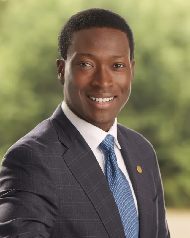
This district elects one MLA. Voters mark one name on Saturday, October 24, 2026, and the candidate with the most votes wins the seat.
Nanaimo-Lantzville is a provincial electoral district on the east coast of Vancouver Island. It takes in the northern half of the City of Nanaimo, including the neighbourhoods of Departure Bay and Wellington, and the District of Lantzville. The 2021 census counted 56,880 people, with a median age of 48, and the Electoral Boundaries Commission gives the area as 411 square kilometres.
Nanaimo-Lantzville lies on the east coast of Vancouver Island, beside the Strait of Georgia. The Electoral Boundaries Commission's 2023 final report says the district holds the rapidly expanding northern half of the City of Nanaimo and the closely integrated District of Lantzville. The commission's description of the district names the Nanaimo neighbourhoods of Departure Bay and Wellington. Its southern border follows Highway 19A from Meredith Road to Strathmore Street, its western boundary follows the administrative borders of Lantzville, and the Strait of Georgia bounds it to the north and east. The commission gives the district 56,881 people, 5.8% from the average district, and an area of 411 square kilometres.
The District of Lantzville places itself between the City of Nanaimo and the City of Parksville. It says BC Transit's Number 11 Lantzville bus starts and ends at Woodgrove Exchange. Elections BC's 2024 results show 80 voting areas in the district and 8 voting places: Beban Park Rec Centre, Costin Hall, Departure Bay Baptist Church, Destiny Worship Centre, Dover Bay Sec School, Oliver Woods Comm Centre, Pleasant Valley Elem School and Wellington Hall.
Four of those places have addresses on their owners' pages. The City of Nanaimo gives Oliver Woods Community Centre as 6000 Oliver Road. The District of Lantzville gives Costin Hall, which it owns, as 7232 Lantzville Road. Dover Bay Secondary School lists 6135 McGirr Road, and Pleasant Valley Elementary School lists 6201 Dunbar Road, on Dunbar Road just off Metral Drive.
Snuneymuxw First Nation describes itself as a Coast Salish People located in the centre of Coast Salish territory, which takes in the eastern coast of Vancouver Island, the Gulf Islands, the Fraser River, Burrard Inlet and Howe Sound. The City of Nanaimo's history says the Snuneymuxw settled in what are now Departure Bay and Nanaimo. On 23 December 1854 Snuneymuxw and the Crown, the government acting for the British monarch, entered the Snuneymuxw Sarlequun Treaty of 1854. The Nation says the treaty protects its villages, its cultivated fields and its right to hunt and fish, and that section 35 of the Constitution Act, 1982 protects the treaty. The Nation's language is Island hul'q'umi'num'.
The name Snaw-naw-as, which the Nation also writes with Nanoose in brackets, derives from the Island Halkomelem word Naus and means the way in the harbour, the Nation says. Its people are Coast Salish and speak Hul'q'umi'num'. The Nation's history page says the Joint Reserve Commission set up its reserve at Nanoose Bay in 1876, that the 63 hectare reserve lies 10 km north of Nanaimo between Lantzville and Parksville, and that the territory remains unceded, which means no treaty or agreement has given the land away. The Nation lists its mailing address as 209 Mallard Way, Lantzville.
Snaw-naw-as belongs to the Naut'sa mawt Tribal Council and the Te'mexw Treaty Association. The Province places the Nation in Stage 5 of the treaty process, final agreement negotiations, and lists an Incremental Treaty Agreement of 2013 and the Douglas Treaties of 1850 and 1854 among its agreements. On 9 April 2015 the five member Nations of the Association, Canada and British Columbia signed the Te'mexw Agreement-in-Principle, a step toward final treaties. Dover Bay Secondary School states that it stands on the traditional lands of the snaw'naw'as peoples.
Dunsmuir's Wellington coal and the Departure Bay wharves, 1869 to 1884
Robert Dunsmuir found a thick layer of coal in 1869 and named it the Wellington seam, says the Dictionary of Canadian Biography, which places the find five miles northwest of Nanaimo harbour. The Nanaimo Museum's timeline dates it to October 1869, at Diver Lake in the Wellington District north of Nanaimo. It says Dunsmuir, Diggle and Company began exporting coal from the Departure Bay wharf and that the town of Wellington developed. BC Geographical Names says the community is named for Arthur Wellesley, Duke of Wellington, and places it on the east side of Brannen Lake within the City of Nanaimo.
The Dictionary says the company needed a three-mile transport link from the pit-head to the wharves, which after 1870 meant a steam railway. By the end of 1874 the provincial minister of mines reported that the Departure Bay mines were in full operation, and that year the output was 29,818 tons. In 1881 Dunsmuir employed 547 men, more than half of them Chinese, and the yearly output was 181,048 tons. After 1882 the company sank two more main shafts, and five mines eventually worked the Wellington deposit. The Craigdarroch Castle museum holds a photograph that it dates to circa 1885 and that shows the Dunsmuir company's wharves at Departure Bay, with a steamship tied up beside them.
The Dictionary says Dunsmuir resisted the safety demands of provincial inspectors, as other owners did, and links that to accidents including the disaster of 1876 at Wellington. In 1877, when island miners threatened to strike over wages, he locked out his workers, and the Dictionary says four months were lost before the miners returned at a lower wage. The Nanaimo Museum's timeline records that in 1878 William Wall strung a telephone wire between Dunsmuir's office in Wellington and the loading docks at Departure Bay, the first telephone service in the province. It adds that James Dunsmuir's mansion at Departure Bay was built in 1884.
The explosion of 1888 and the end of Wellington's mines, 1887 to 1984
The Esquimalt and Nanaimo Railway was extended into Wellington in 1887, says the Nanaimo Museum's timeline. On 24 January 1888 an explosion in the No. 5 pit of the Wellington mine, on Diver Lake, killed 77 miners, the timeline records. On 26 January 1898 Wellington was recognized as the terminus of the railway.
The Encyclopedia of British Columbia says the Wellington townsite had 5,000 inhabitants and an opera house in the 1890s, that operations were phased out by 1900 and that many buildings were moved to Ladysmith. Other coal mines at South Wellington and East Wellington lasted until the 1950s, it adds. A tramway joined the mines to a wharf on Departure Bay, and the mines had many deadly explosions and fires and several bitter strikes.
BC Geographical Names records the name Wellington (station) as adopted on 28 July 1945 and changed to Wellington (community) on 29 November 1984. It places the community on the east side of Brannen Lake within the City of Nanaimo.
The District of Lantzville says coal was found in the area in 1916 by the Nanoose Collieries Company, run by Jack Grant, who opened Grant's Mine at the shoreline of Jacks Road. In 1920 an American firm, the Nanoose-Wellington Collieries Company, bought the mine, and its director, Fraser Lantz, renamed the area Lantzville. The mine ran until 1926, when the usable coal ran low and the mine closed. BC Geographical Names gives the source of the name as F.H. (Harry) Lantz, an American coal miner who invested in or owned the Nanoose Collieries.
BC Geographical Names records that the Lantzville post office opened on 1 May 1923, closed on 30 September 1926 and reopened on 3 July 1945. The name Lantzville (Post Office) was adopted on 2 September 1948. In 1993 the Lantzville Historical Society advised the Names Office that the community was first called Grant's Mine and that school photographs used that name until 1929. The Nanaimo Museum's timeline says Lantzville School was built in 1921.
After the mine closed, the District says, Lantzville had a limited economy and a number of local residents, and it served as a summer cottage area. Each year residents mark the mining past with Minetown Days at Huddlestone Park.
Beban Park, joining the City and the Parkway, 1953 to 1997
Frank and Hannah Beban acquired a 160 acre farm in 1930 and built a mansion, gardens and a horse racing track on it, says the City of Nanaimo. The City bought the estate in 1953, and the Nanaimo Museum's timeline gives the price as $50,000. The park first carried the name Exhibition Park and still hosts the Vancouver Island Exhibition. The Grandview Bowl and the Centennial Building were built in 1958, the Beban Pool, Frank Crane Arena and Social Centre opened in 1976, and the Agriplex was built in 1987.
The timeline records a vote on amalgamation in 1970 that failed by thirty-one votes. On 2 November 1974 a second vote, on joining Harewood, Departure Bay, Wellington, East Wellington, Northfield and Chase River to the City of Nanaimo, passed with more than 52 percent on an issue that needed more than 50 percent overall. Only Nanaimo and Harewood voted in favour, and the aldermen for the other areas accepted the change. On 1 January 1975 the city boundary grew to include those areas and Protection Island, and the population rose from 14,950 in 1971 to 40,340 in 1976.
Pleasant Valley Elementary School first opened in 1973 and was expanded in 1976, 1983 and 2000, says the school. Dover Bay Secondary School says it officially opened in 1992. The timeline records that Premier Glen Clark opened the Nanaimo Parkway on 31 May 1997, after a project that began in 1994 and employed 583 workers, and that the highway was built to provide a safer and more efficient drive through Nanaimo.
The Regional District of Nanaimo lists the Lantzville incorporation vote of its 2002 elections under Electoral Area D: 890 votes in favour (63.5%) and 511 against (36.5%), from 1,401 votes cast. BC Geographical Names records that Lantzville became a district municipality, a town with its own council, effective 25 June 2003. The District says it was the first municipality created in British Columbia in the new millennium and the 155th in the province. The 2021 census counted 3,817 people there, and its council has a mayor and four councillors.
On 18 June 2021 Lantzville Mayor Mark Swain and Snaw-naw-as Chief Gordon Edwards signed a memorandum of understanding, a written agreement on how the two governments work together, at a ceremony in Nanoose, reported CKPG Today. The agreement names land use planning, waste and water services, amenities and infrastructure as areas of shared interest. A working group from both administrations brings ideas to each council. Chief Edwards said the process lets the two governments respect each other's interests in the territory, the beaches and the water.
Elections BC's results hold one election under the name Nanaimo-Lantzville, held in 2024. George Anderson of the BC NDP won it with 15,307 votes (51.75%), ahead of Gwen O'Mahony of the Conservative Party with 11,687 (39.51%) and Lia Versaevel of the BC Green Party with 2,586 (8.74%). Turnout was 66% of 44,879 registered voters, with 29,580 valid votes and 40 rejected ballots. The Legislative Assembly's records list Anderson for Nanaimo-Lantzville in the 43rd Parliament.
The Electoral Boundaries Commission created the district in 2023. Its preliminary report called the district Nanaimo-Ladysmith, and the final report renamed it Nanaimo-Lantzville to better reflect the geographic area it represents. The commission wrote that its preliminary report split the City of Nanaimo into three districts, that it heard the boundaries in north Nanaimo were confusing, and that it therefore made two Nanaimo districts. Nanaimo-Lantzville holds the northern half of the city and Lantzville, and Nanaimo-Gabriola Island holds the downtown core and Gabriola Island. Elections BC's conversion table shows that of the 80 voting areas of the new district, 46 overlap with Nanaimo, 35 with Parksville-Qualicum and 3 with Nanaimo-North Cowichan.
The earlier district Nanaimo elected Leonard Krog of the BC NDP in 2005, 2009, 2013 and 2017, and Sheila Malcolmson of the BC NDP in the by-election of 2019 and in 2020, according to Elections BC. Krog won with 13,226 votes (51.9%) in 2005 and 12,746 (46.54%) in 2017. Malcolmson won the by-election with 12,114 votes (49.92%) and the election of 2020 with 14,344 (54.49%). In Parksville-Qualicum, which supplied 35 of the voting areas, Ron Cantelon of the BC Liberal Party won in 2009 with 13,716 votes (51.42%), and Michelle Stilwell of the BC Liberal Party won in 2013 with 14,518 (50.13%) and in 2017 with 14,468 (45.13%). Adam Walker won there in 2020 with 13,207 votes (42.00%), under the BC NDP label in Elections BC's results, and the Legislature lists him as an independent.
Members for Nanaimo, which covered 46 of this district’s 80 voting areas before 2024
Parliament
It sat
Member
Elected as
Party on the legislature’s record
42nd
2020 to 2024
Sheila Malcolmson
BC NDP
BC NDP
41st
2017 to 2020
Leonard Eugene Krog
BC NDP
41st
2017 to 2020
Sheila Malcolmson
BC NDP
BC NDP
40th
2013 to 2017
Leonard Eugene Krog
BC NDP
BC NDP
39th
2009 to 2013
Leonard Eugene Krog
BC NDP
38th
2005 to 2009
Leonard Eugene Krog
BC NDP
37th
2001 to 2005
Mike Hunter
BC Liberal Party
36th
1996 to 2001
Dale Lovick
BC NDP
35th
1992 to 1996
Dale Lovick
BC NDP
Members for Parksville-Qualicum, which covered 35 of this district’s 80 voting areas before 2024
Parliament
It sat
Member
Elected as
Party on the legislature’s record
42nd
2020 to 2024
Adam Walker
BC NDP
Independent
41st
2017 to 2020
Michelle Stilwell
BC Liberal Party
BC Liberal Party
40th
2013 to 2017
Michelle Stilwell
BC Liberal Party
BC Liberal Party
39th
2009 to 2013
Ron Cantelon
BC Liberal Party
BC Liberal Party
36th
1996 to 2001
Judith Reid
BC Liberal Party
35th
1992 to 1996
Leonard Eugene Krog
BC NDP
“Elected as” is the affiliation Elections BC printed with the winning result. The last column is the party the legislature’s records give for that parliament, which differs when a member changed party while in office. A row with that column empty is a winner Elections BC prints whom the legislature’s records leave out. Source: Legislative Assembly of British Columbia (opens in a new tab)
Boundaries since 2024
Nanaimo-Lantzville has 80 voting areas. They overlap these districts from 2017 to 2024: Nanaimo (46), Parksville-Qualicum (35), Nanaimo-North Cowichan (3).
The commission that drew the boundaries counted 56,881 people in the district, 5.8% above the average for a district, over 411 km².
Nanaimo-Lantzville is a provincial electoral district on the east coast of Vancouver Island, beside the Strait of Georgia. The Electoral Boundaries Commission says it holds the northern half of the City of Nanaimo and the District of Lantzville. The commission gives the district 56,881 people, 5.8% from the average district, and an area of 411 square kilometres. Its southern border follows Highway 19A from Meredith Road to Strathmore Street.
Which communities are in Nanaimo-Lantzville?
Nanaimo-Lantzville includes the District of Lantzville and the northern half of the City of Nanaimo, and the commission's description names the Nanaimo neighbourhoods of Departure Bay and Wellington. Elections BC's 2024 results list 8 voting places in the district, among them Costin Hall, Beban Park Rec Centre, Dover Bay Sec School, Oliver Woods Comm Centre, Pleasant Valley Elem School and Wellington Hall.
Who is the MLA for Nanaimo-Lantzville?
The Legislative Assembly's records list George Anderson of the BC NDP as the member for Nanaimo-Lantzville in the 43rd Parliament. He won the district in the 2024 provincial general election with 15,307 votes (51.75%). Gwen O'Mahony of the Conservative Party received 11,687 votes (39.51%) and Lia Versaevel of the BC Green Party received 2,586 (8.74%).
Who held the Nanaimo-Lantzville seat before George Anderson?
No member held a seat called Nanaimo-Lantzville before 2024, because the 2024 election was the first under this name. Of its 80 voting areas, 46 overlap with the earlier district Nanaimo, whose last member was Sheila Malcolmson of the BC NDP from 2020 to 2024, and 35 overlap with Parksville-Qualicum, whose last member was Adam Walker from 2020 to 2024, according to the Legislature's records and Elections BC.
How did Nanaimo-Lantzville vote in 2024?
In 2024 George Anderson of the BC NDP won Nanaimo-Lantzville with 15,307 votes (51.75%). Gwen O'Mahony of the Conservative Party received 11,687 (39.51%) and Lia Versaevel of the BC Green Party received 2,586 (8.74%). Turnout was 66% of 44,879 registered voters, and Elections BC counted 29,580 valid votes and 40 rejected ballots.
How were the boundaries of Nanaimo-Lantzville set in 2023?
The Electoral Boundaries Commission created Nanaimo-Lantzville in 2023 by dividing the City of Nanaimo between two districts, this one and Nanaimo-Gabriola Island. The commission had heard that the boundaries in north Nanaimo were confusing under the three-district plan of its preliminary report. It changed the preliminary name Nanaimo-Ladysmith to Nanaimo-Lantzville in the final report. Elections BC's conversion table shows 46 of the 80 voting areas overlapping the earlier district Nanaimo.
Whose territory is Nanaimo-Lantzville on?
The City of Nanaimo's history says the Snuneymuxw settled at Departure Bay and Nanaimo, and Snuneymuxw First Nation entered a treaty with the Crown on 23 December 1854. Snaw-naw-as (Nanoose) First Nation says its 63 hectare reserve lies between Lantzville and Parksville and that its territory remains unceded. Dover Bay Secondary School, a voting place in Nanaimo-Lantzville, states that it stands on the traditional lands of the snaw'naw'as peoples.
Who lives in Nanaimo-Lantzville?
The 2021 census counted 56,880 people in Nanaimo-Lantzville, with a median age of 48 years against 42.8 for British Columbia. People aged 65 and over were 27.1% of residents, which is 15,430 people. Immigrants made up 17.5% against 29% in the province, and 2,330 residents were born in the United Kingdom. Indigenous identity was reported by 3,645 people, or 6.5%.
When did Lantzville become a municipality?
The District of Lantzville became a district municipality effective 25 June 2003, says BC Geographical Names, after a vote in 2002 in which 890 of 1,401 votes, or 63.5%, favoured it. Lantzville, in the Nanaimo-Lantzville district, grew around Grant's Mine, a coal mine opened in 1916. The name Lantzville was adopted for the post office on 2 September 1948.
What was Wellington?
Wellington, in Nanaimo-Lantzville, was the site of the coal mines of Robert Dunsmuir, who found a thick layer of coal there in 1869. The Encyclopedia of British Columbia says the townsite had 5,000 inhabitants and an opera house in the 1890s and that operations were phased out by 1900. On 1 January 1975 Wellington was among the areas added to the City of Nanaimo.