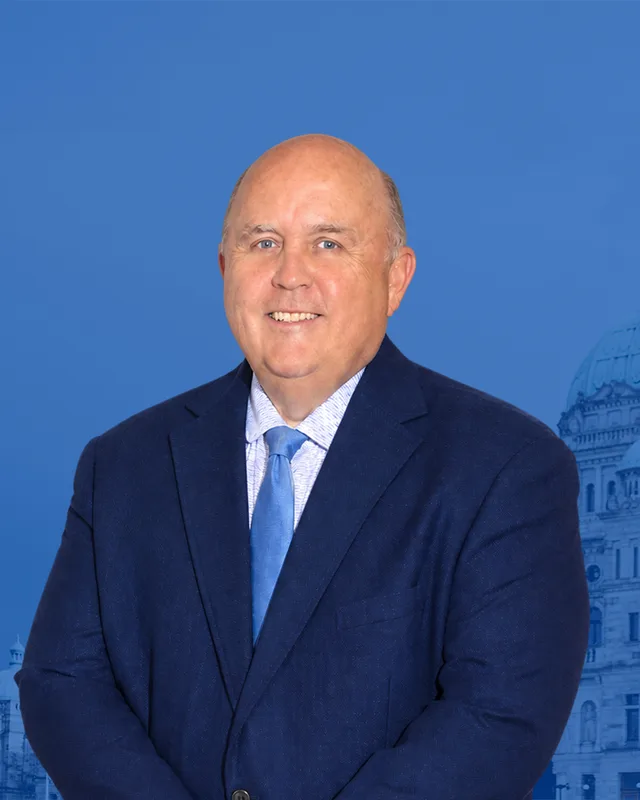
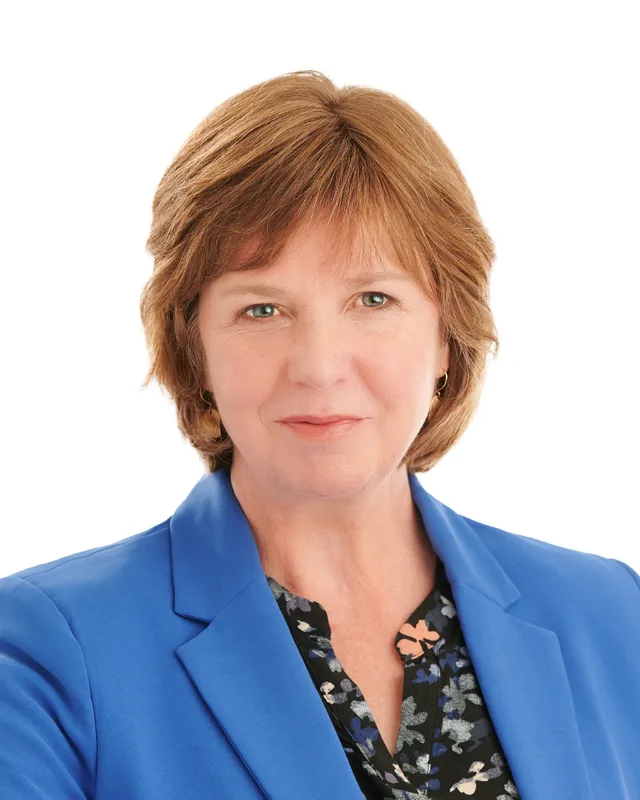
This district elects one MLA. Voters mark one name on Saturday, October 24, 2026, and the candidate with the most votes wins the seat.
Nanaimo-Gabriola Island is a provincial electoral district on the east coast of Vancouver Island. It takes in the downtown core of Nanaimo, Cedar, Gabriola Island and the community of Snuneymuxw First Nation. The 2021 census counted 59,140 people, with a median age of 44.8, and the Electoral Boundaries Commission gives the area as 504 square kilometres.
Nanaimo-Gabriola Island lies on the east coast of Vancouver Island and includes Gabriola Island, which sits just off the city. The Electoral Boundaries Commission's 2023 final report says the district contains the downtown core of Nanaimo, extending north to Departure Bay, and Gabriola Island. The commission gives it 59,172 people, 10.0% from the average district, and an area of 504 square kilometres. The 2022 preliminary report, which the final report reproduces, described a district made of Nanaimo's downtown core, Cedar, the Snuneymuxw First Nation and Gabriola Island. Its northern boundary followed Meredith Road and Northfield Road, and its southern boundary followed Regional District of Nanaimo Electoral Area A and the Nanaimo River. The final report then adjusted the Nanaimo boundaries to make two districts.
BC Geographical Names places the city of Nanaimo on the southeast side of Vancouver Island and Departure Bay on the north side of the city. It places Cedar just southeast of Nanaimo, and it lists Gabriola Island among the Gulf Islands, just off Nanaimo on the west side of the Strait of Georgia. The Islands Trust says its Gabriola local trust area, which holds Gabriola, DeCourcy and Mudge islands and 17 associated islands, covers 58 square kilometres and lies within Electoral Area B of the Regional District of Nanaimo.
The Islands Trust's fact sheet, revised in January 2015, gives the ferry route between Gabriola and Nanaimo as 3.7 nautical miles and the crossing as 20 minutes. The sheet also lists a local bus service called GERTIE and a daily floatplane service from Silva Bay to Vancouver Airport. On Vancouver Island, the City of Nanaimo says the Esquimalt and Nanaimo Railway gave the city its first land route to Victoria in 1886. Elections BC's 2024 results show 78 voting areas in the district and 15 voting places, among them Gabriola Elementary School, Cedar Elementary School, the Cranberry Fire Department community hall, the Nanaimo Yacht Club and Building 300 of Vancouver Island University.
Snuneymuxw territory, the name Nanaimo and the Gabriola villages
Snuneymuxw First Nation describes itself as a Coast Salish People in the centre of Coast Salish territory, on the eastern coast of Vancouver Island, the Gulf Islands, the Fraser River, Burrard Inlet and the Howe Sound. The Nation says its people have lived in that territory since time immemorial. Its language is Island hul'q'umi'num', one of three dialects of hul'q'umi'num', and the Nation says only a small number of Elders and members remain fluent. The Province's page for the Nation places it in the Nanaimo River watershed, including Gabriola Island and other adjacent islands, and gives its population as 1,943.
BC Geographical Names records that Nanaimo is an English form of a Halkomelem word, and that the translations offered include meeting place and people of many names. It lists five fall and winter villages of the Nanaimo Coast Salish, which the anthropologist D. Jenness named as Solachwan, Tewahlchin, Anuweenis, Kwalsiarwahl and Ishihan. It says summer villages stood at Gabriola Island and along the lower Fraser River.
The Gabriola Museum dates the first summer villages on Gabriola to 8000 BCE or earlier and says the largest stood near False Narrows, on the southwest shore. It counts more than 100 archaeological sites on the island, among them shell middens, petroglyphs and burial sites. On the Vancouver Island side, the City of Nanaimo's history says the Snuneymuxw settled at what are now Departure Bay and Nanaimo, and lived in cedar-plank longhouses that each held several families.
Gabriola Island from the Spanish charts to the Islands Trust, 1791 to 2004
BC Geographical Names quotes John Walbran's 1909 book on coast names. It says the island's name adapts the Spanish name Gaviola or Gabiola, which Jose Maria Narvaez gave to the east end of the island in 1791. The Gabriola Museum says the Spanish officers Galiano and Valdes moored for several days at Pilot Bay in 1792 and called it Cala del Descanso, which means small bay of rest. BC Geographical Names adds that a British Admiralty chart of 1863 carried the name Gabriola Island and that the Geographic Board of Canada identified it in 1906.
After the Hudson's Bay Company opened its mines at Nanaimo, coal miners and former gold miners moved to Gabriola in the mid-1850s and the 1860s, and started farms to supply the growing town, the museum says. By 1872, 18 families lived on the island. The Gabriola Millstone Quarry ran from 1887 to 1936 and supplied building stone for large buildings in Victoria and Vancouver. The first federal voters' list for Gabriola, compiled in 1887, named 47 men, 34 of them farmers.
The first government vehicle ferry, the Atrevida, began service to Gabriola in 1931 and carried 6 cars. Hydroelectric power reached the island in 1955. Between 1960 and 1969 more than 3000 lots were approved for subdivision across the Gulf Islands. In 1969 the provincial government set a minimum parcel size of 10 acres on every island in the Strait of Georgia, and in 1974 it passed the Islands Trust Act, whose mandate is to preserve and protect the Gulf Islands' amenities and environment. The museum records 4,033 people on Gabriola in 2016, and 87% of voters rejecting incorporation as a municipality in 2004.
Coal, the Bastion and the Treaty of 1854, 1852 to 1862
The Hudson's Bay Company began coal mining in what is now downtown Nanaimo in 1852, says the Nanaimo Museum. Parks Canada calls it the first commercial coal mine in British Columbia and records that the company built the Bastion in 1853 to protect the miners and settlers. BC Geographical Names says company officers named Newcastle Island in 1853 after the coal city of Newcastle upon Tyne, and that coal was mined on the island from 1853 to 1883.
The Canadian Encyclopedia says 24 families arrived from England in 1854 to settle in Colvile Town, the first name of the settlement, and that the name was little used after 1860. The City of Nanaimo's history says the town was renamed Nanaimo in 1860. In 1862 the company sold its mines, buildings and 6,193 acres of land to the Vancouver Coal Mining and Land Company.
On 23 December 1854 Snuneymuxw and the Crown, which is the government acting for the British monarch, entered the Sarlequun Snuneymuxw Treaty of 1854. The Nation says the treaty promised to protect its villages, cultivated fields and rights to hunt and fish, and that the coal could be shared while the land and water were preserved. The Gabriola Museum says the treaty gave the Crown access to land and coal. It adds that in 1862 the Crown moved the Snuneymuxw from their village by Cameron Island to their southern village site, now Reserve 1. The Nation says the treaty is protected under section 35 of the Constitution Act, 1982.
In 1864 the Vancouver Coal Mining and Land Company hired an architect in Britain to draft a town plan. The City of Nanaimo says the plan gave downtown its fan-shaped pattern of streets that run down to the harbour, and that the company then auctioned city lots. BC Geographical Names records that Nanaimo was incorporated as a city on 24 December 1874.
Other coal fields opened nearby. The City says Robert Dunsmuir opened the Wellington Mine in 1869 and built a rough railway from Wellington to Departure Bay to ship its coal, and that the Esquimalt and Nanaimo Railway, also built by Dunsmuir, gave the city its first land route to Victoria in 1886. Waste rock from the mines was used to extend the waterfront and to fill the tidal inlet that once divided downtown along Terminal Avenue.
BC Geographical Names says officers of the Hudson's Bay Company named Departure Bay in the early 1850s as a good place from which ships could leave, and that a map of 1852 labels it Departure Harbour. The City says Chinese workers came to Nanaimo as early as the 1860s, and that Japanese families settled at Brechin, near the Newcastle waterfront, where they ran herring salteries and boat works. At Cedar, BC Geographical Names records a post office that opened on 1 April 1888 and says the community was named for the profusion of cedar trees.
The No. 1 Esplanade Mine explosion and the end of mining, 1887 to 1960
On 3 May 1887, shortly before 6:00 pm, two explosions struck the No. 1 Esplanade Mine, says the City of Nanaimo. The City calls it the worst mining disaster in British Columbia and the second worst in Canada, after the Hillcrest disaster of 1914 in Alberta, which killed 189 miners. A jury blamed an unprepared and badly planted charge that ignited gas fuelled by coal dust. The City's notice of 2021 speaks of 150 lives lost, and its council resolution of 2015, which lowers City flags to half mast every 3 May, names 148 miners.
The Canadian Encyclopedia reports that coal output from the three main seams peaked in 1923, when more than 1 million tonnes were mined. Once the easily reached coal was taken, mining grew dangerous and costly, and by the early 1950s the city turned to forest products. The City's history adds that a pulp and paper mill at Harmac opened in 1950, outside the city limits.
The City says Nanaimo's last Chinatown, said to have 1,200 residents at its largest, was destroyed by fire on 30 September 1960 and was never rebuilt. The City names the Chinese Exclusion Act, the slowing of the coal industry and the move of residents into other neighbourhoods as reasons its population began to fall in the 1920s.
Newcastle Island, the waterfront and the college, 1930 to 2008
BC Geographical Names records that the Canadian Pacific Railway bought Newcastle Island in 1930 and made it a resort with a dance pavilion, wading pool, tea house, playing fields and a floating hotel. The City of Nanaimo acquired the island in 1955, and the Province's release of 2021 says the marine park was established in October 1961. The Province adds that middens on the island show at least two Salish villages that were deserted before coal was found in the area in 1849.
The City's history lists Swy-A-Lana Park, built in 1984, and the waterfront promenades, begun in 1988, among the most recent additions to the land made from mine waste along the harbour.
Vancouver Island University says it began as the Dominion-Provincial Youth Training Centre in 1936, became Malaspina College in 1969 and Malaspina University-College in 1989, and took its present name in April 2008. Its main campus in Nanaimo covers 92 acres on the territory of the Snuneymuxw First Nation, and Elections BC's 2024 results list a voting place at Building 300 of the university in this district.
Agreements and land returns with Snuneymuxw, 2005 to 2024
The Union of BC Municipalities records that the City of Nanaimo and Snuneymuxw First Nation signed a memorandum of understanding in 2005 and a protocol agreement in 2009. In 2017 the Nation removed its flag from Nanaimo city hall, which the Union describes as a sign of a breakdown in the relationship. The two governments signed a renewed protocol agreement in May 2019 and have since discussed returning the flag. They have also partnered on a ferry service to Saysutshun (Newcastle Island).
In September 2020 British Columbia and Snuneymuxw signed a Reconciliation Implementation Framework Agreement and a Land Transfer Agreement. The Province's release says the land package covers 1,003 hectares at Mount Benson and 2,097 hectares at Mount McKay, and that Snuneymuxw agreed to end a court case begun in 2001 over log booming in the Nanaimo River estuary. Both agreements build on a reconciliation agreement of 2013. On 28 July 2021 the Nation, British Columbia and Canada signed a three-party memorandum of understanding whose priorities include implementing the 1854 treaty.
On 6 December 2021 the Province renamed Newcastle Island Marine Park as Saysutshun (Newcastle Island Marine) Park. The name refers to the island's use as a place of preparation. On 27 January 2024 Snuneymuxw and Canada signed an Interim Land Reconciliation Agreement that allocates 80.09 hectares, the Camp Nanaimo Lands on Te'tuxwtun, to be set aside as a reserve. Canada's release says the lands were used by Western Forest Products, by the Department of National Defence and as the site of the Nanaimo Indian Hospital.
On 15 July 2024 the Province and Snuneymuxw announced the return of 2.67 hectares of the sxwayxum village site, also called Millstone River Village, at 1 Terminal Avenue in downtown Nanaimo. The purchase of the property and the lots next to it cost $28.5 million. The release says the site lies next to Swy-A-Lana Lagoon and Maffeo Sutton Park, and that it once held a hotel, a parking lot and other businesses.
Elections BC's results hold one election under the name Nanaimo-Gabriola Island, held in 2024. Sheila Malcolmson of the BC NDP won it with 14,663 votes (52.75%), ahead of Dale Parker of the Conservative Party with 9,633 (34.65%) and Shirley Lambrecht of the BC Green Party with 3,502 (12.6%). Turnout was 59.96% of 46,454 registered voters. The Legislative Assembly's records list Malcolmson for Nanaimo-Gabriola Island in the 43rd Parliament.
The commission's 2023 report created the district. It wrote that Nanaimo is too large for one electoral district and is projected to grow, and that it had heard of historic ties and transportation links between downtown Nanaimo and Gabriola Island. Before the change, Nanaimo residents lived in three districts: Nanaimo, Nanaimo-North Cowichan and Parksville-Qualicum. Elections BC's conversion table shows an overlap of 43 voting areas with Nanaimo, 38 with Nanaimo-North Cowichan and 1 with Parksville-Qualicum.
Elections BC's volumes show that a by-election on 15 March 1989 in Nanaimo, after David Stupich resigned on 13 October 1988, was won by Jan Pullinger of the New Democratic Party with 14,613 votes (57.12%). Dale Lovick of the New Democratic Party won in 1991 with 11,135 votes (51.25%) and in 1996 with 11,210 (48.75%). Mike Hunter of the Liberal Party won in 2001 with 9,748 (44.64%). Leonard Krog of the BC NDP won in 2005 with 13,226 votes (51.9%), in 2009 with 11,877 (53.33%), in 2013 with 10,821 (46.25%) and in 2017 with 12,746 (46.54%). Krog resigned on 30 November 2018, Elections BC says, and Sheila Malcolmson of the BC NDP won the by-election of 30 January 2019 with 12,114 votes (49.92%) and the 2020 election with 14,344 (54.49%). The overlapping district Nanaimo-North Cowichan elected Doug Routley of the BC NDP in 2009, 2013, 2017 and 2020.
The first volume lists Nanaimo at the first general election of 1871, where John Robson won with 57 votes (63.33%) against 33 (36.67%) for Joseph Carey. It prints the name Alberni-Nanaimo for 1933 and 1937, when George Sharratt Pearson of the Liberal Party won, and Nanaimo and The Islands for the elections from 1941 to 1963. David Stupich of the New Democratic Party won that district in 1963 with 4,278 votes (42.44%), against 4,259 (42.26%) for Earle Westwood of Social Credit. The name Nanaimo returned in 1966, when Stupich won with 5,625 votes (47.99%). Frank Ney of Social Credit won in 1969 with 8,252 (49.22%), and Stupich won in 1972 with 10,478 (52.6%), in 1975 with 12,177 (49.08%), in 1979 with 17,021 (58.69%) and in 1983 with 17,436 (52.17%). In 1986 Nanaimo elected two members, Dale Lovick and David Stupich.
Members for Nanaimo, which covered 43 of this district’s 78 voting areas before 2024
Parliament
It sat
Member
Elected as
Party on the legislature’s record
42nd
2020 to 2024
Sheila Malcolmson
BC NDP
BC NDP
41st
2017 to 2020
Leonard Eugene Krog
BC NDP
41st
2017 to 2020
Sheila Malcolmson
BC NDP
BC NDP
40th
2013 to 2017
Leonard Eugene Krog
BC NDP
BC NDP
39th
2009 to 2013
Leonard Eugene Krog
BC NDP
38th
2005 to 2009
Leonard Eugene Krog
BC NDP
37th
2001 to 2005
Mike Hunter
BC Liberal Party
36th
1996 to 2001
Dale Lovick
BC NDP
35th
1992 to 1996
Dale Lovick
BC NDP
Members for Nanaimo-North Cowichan, which covered 38 of this district’s 78 voting areas before 2024
Parliament
It sat
Member
Elected as
Party on the legislature’s record
42nd
2020 to 2024
Doug Routley
BC NDP
41st
2017 to 2020
Doug Routley
BC NDP
BC NDP
40th
2013 to 2017
Doug Routley
BC NDP
BC NDP
39th
2009 to 2013
Doug Routley
BC NDP
BC NDP
“Elected as” is the affiliation Elections BC printed with the winning result. The last column is the party the legislature’s records give for that parliament, which differs when a member changed party while in office. A row with that column empty is a winner Elections BC prints whom the legislature’s records leave out. Source: Legislative Assembly of British Columbia (opens in a new tab)
Boundaries since 2024
Nanaimo-Gabriola Island has 78 voting areas. They overlap these districts from 2017 to 2024: Nanaimo (43), Nanaimo-North Cowichan (38), Parksville-Qualicum (1).
The commission that drew the boundaries counted 59,172 people in the district, 10.0% above the average for a district, over 504 km².
Nanaimo-Gabriola Island is a provincial electoral district on the east coast of Vancouver Island. The Electoral Boundaries Commission's 2023 final report says it contains the downtown core of Nanaimo, extending north to Departure Bay, and Gabriola Island. The commission gives the district 59,172 people, 10.0% from the average district, and an area of 504 square kilometres.
Which communities are in Nanaimo-Gabriola Island?
Nanaimo-Gabriola Island takes in downtown Nanaimo, Gabriola Island, Cedar and the community of Snuneymuxw First Nation, according to the commission's 2022 preliminary description that its final report reproduces. Elections BC's 2024 results list 15 voting places in the district, among them Gabriola Elementary School, Cedar Elementary School, the Cranberry Fire Department community hall and Building 300 of Vancouver Island University.
Who is the MLA for Nanaimo-Gabriola Island?
The Legislative Assembly's records list Sheila Malcolmson of the BC NDP as the member for Nanaimo-Gabriola Island in the 43rd Parliament. She won the district in the 2024 provincial general election with 14,663 votes (52.75%). Dale Parker of the Conservative Party received 9,633 votes (34.65%) and Shirley Lambrecht of the BC Green Party received 3,502 (12.6%).
Who held the Nanaimo-Gabriola Island seat before Sheila Malcolmson?
No member held a seat called Nanaimo-Gabriola Island before 2024, because the 2024 election was the first under this name. The earlier district Nanaimo, which overlaps 43 of the voting areas, elected Sheila Malcolmson of the BC NDP in the 2019 by-election and in 2020, and Leonard Krog of the BC NDP in 2005, 2009, 2013 and 2017, according to Elections BC.
How did Nanaimo-Gabriola Island vote in 2024?
In 2024 Sheila Malcolmson of the BC NDP won Nanaimo-Gabriola Island with 14,663 votes (52.75%). Dale Parker of the Conservative Party received 9,633 (34.65%) and Shirley Lambrecht of the BC Green Party received 3,502 (12.6%). Turnout was 59.96% of 46,454 registered voters, and Elections BC counted 27,798 valid votes and 57 rejected ballots.
How were the boundaries of Nanaimo-Gabriola Island set in 2023?
The Electoral Boundaries Commission created Nanaimo-Gabriola Island in 2023 by dividing the City of Nanaimo between two districts, this one and Nanaimo-Lantzville. The commission said Nanaimo is too large for one district and that it heard of historic ties and transportation links between downtown Nanaimo and Gabriola Island. Elections BC's conversion table shows an overlap of 43 voting areas with Nanaimo and 38 with Nanaimo-North Cowichan.
Whose territory is Nanaimo-Gabriola Island on?
Snuneymuxw First Nation describes its territory as the eastern coast of Vancouver Island, the Gulf Islands, the Fraser River, Burrard Inlet and the Howe Sound. The Gabriola Museum says Gabriola Island is part of the unceded, ancestral territory of the Snuneymuxw. The Nation entered the Sarlequun Snuneymuxw Treaty of 1854 on 23 December 1854, and its language is Island hul'q'umi'num'.
Who lives in Nanaimo-Gabriola Island?
The 2021 census counted 59,140 people in Nanaimo-Gabriola Island, with a median age of 44.8 years against 42.8 for British Columbia. Indigenous identity was reported by 10.5% of residents, which is 6,015 people, and 13.8% were immigrants against 29% in the province. The median household income was $68,000 against $85,000 in the province.
When was Nanaimo incorporated and how did it get its name?
Nanaimo was incorporated as a city on 24 December 1874, says BC Geographical Names. The name is an English form of a Halkomelem word, and the translations offered include meeting place and people of many names. The Hudson's Bay Company's settlement was first called Colvile Town, a name little used after 1860. Downtown Nanaimo lies inside Nanaimo-Gabriola Island.
How do people reach Gabriola Island?
People reach Gabriola Island, part of Nanaimo-Gabriola Island, by ferry from Nanaimo. The Islands Trust's fact sheet, revised in January 2015, gives the route as 3.7 nautical miles and the crossing as 20 minutes. The sheet also lists a local bus service called GERTIE and a daily floatplane service from Silva Bay. The first government vehicle ferry, the Atrevida, began service in 1931.