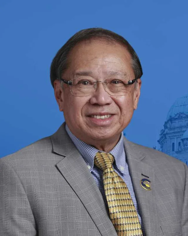
This district elects one MLA. Voters mark one name on Saturday, October 24, 2026, and the candidate with the most votes wins the seat.
Maple Ridge East is a provincial electoral district on the north bank of the Fraser River, east of 224th Street in Maple Ridge. The Electoral Boundaries Commission lists Stave Falls, Silverhill, Ruskin, Whonnock, Websters Corners, Albion and Yennadon as its communities. The 2021 census counted 57,885 people in it, and the commission gives its area as 369 square kilometres.
Maple Ridge East lies on the north bank of the Fraser River, east of 224th Street in Maple Ridge. The Electoral Boundaries Commission's 2023 final report says its boundaries follow the Fraser River in the south, 224th Street in the west, the Alouette River and Alouette Lake in the north, and Stave Lake and Silverdale Creek in the east. The commission gives the district an area of 369 square kilometres and a population of 57,888, which is 7.7% from the average district. The report names seven communities: Stave Falls, Silverhill, Ruskin, Whonnock, Websters Corners, Albion and Yennadon.
The City of Maple Ridge says on its own website that Whonnock, Webster's Corners, Ruskin, Albion and Yennadon each grew into a neighbourhood with its own post office, community centre, churches, stores and schools. BC Geographical Names places Albion and Ruskin on the north side of the Fraser River and places Whonnock west of the point where the Fraser and Stave rivers meet. The Maple Ridge Museum says Yennadon is centred on what was once called the Lillooet Road, now 232nd Street, and grew from farms and small mills near the two branches of the Alouette River.
Roads and the river decided how people travelled. Fred Braches, a local historian who writes for the Whonnock Community Association, says Dewdney Trunk Road came to the area in 1906 and that by 1930 the Lougheed Highway, Highway No. 7, ran to Mission. Before that, he writes, the Fraser River was the preferred and sometimes the only way to travel. The Albion to Fort Langley ferry crossed the river from 1957 until July 31, 2009, according to the Maple Ridge Museum.
The Katzie First Nation's website calls its territory q̓ic̓əy̓, which it translates as land of the moss, and says Katzie have lived and thrived there for thousands of years. It names the places now called Pitt Meadows, Maple Ridge, Surrey, Langley and Delta as parts of that territory, and it lists portions of Pinecone Burke, Golden Ears and Garibaldi Provincial Parks. The City of Maple Ridge acknowledges that the city stands on the traditional territories of the Katzie and Kwantlen (qʼʷa:n̓ƛʼən̓) First Nations.
The Kwantlen First Nation's primary reserve is at Fort Langley. A 2016 article in the Langley Advance Times reports that Kwantlen also has reserve lands and traditional territories well to the north of the Fraser River. At Whonnock Lake that year, Fern Gabriel of the Kwantlen First Nation described the Whonnock area as the location of the pink salmon, and she named the peaks of Golden Ears as Kwantlen's mountain. BC Hydro's page on the Powerhouse at Stave Falls says the site is on the traditional territory of the Stó:lō people and is considered the core territory of the Kwantlen First Nation.
BC Geographical Names gives Whonnock a Halkomelem origin: a word meaning place where there are always humpback salmon, the only salmon species that goes up Whonnock Creek. BC Geographical Names and Braches both say a post office took the spelling with two n's in 1885, named for the Indian village nearby.
Braches's paper on the Whonnock band of the Kwantlen First Nation says the Royal Engineers began marking out reserves in the summer of 1861, including one for the people living on the Fraser shore between the slough of York Creek and the mouth of Whonnock Creek. That reserve is today's Whonnock Indian Reserve No. 1. In 1864 the surveyor William McColl projected a much larger reserve of 2,000 acres, running from the Fraser River up to Dewdney Trunk Road between today's 280th and 272nd Streets.
The Government Gazette of December 26, 1868 listed the Whonnock reserve at 92 acres. The same notice said that land earlier supposed to lie in the reserves would be open for pre-emption on and after March 1, 1869. In 1880 the Indian Reserve Commissioner, Gilbert Malcolm Sproat, set out three new reserves on the Stave River. Braches lists the reserves now governed by the Kwantlen First Nation as Whonnock No. 1, Langley Nos. 2, 3 and 4 on the Stave River, Langley No. 5 between Whonnock and Albion, and McMillan Island No. 6. He adds that many people driving the Lougheed Highway between Whonnock and Ruskin do not know they are crossing reserve land.
Settlers, post offices and a municipality, 1861 to 1907
The Whonnock Community Association dates the first permanent white settler at Whonnock, the Shetlander Robert Robertson, to 1861. The Maple Ridge Museum gives the year as 1860. The association says few followed until the early 1880s, when the railway built a station there, and that Whonnock became the focal point for settlers across the eastern part of Maple Ridge. The museum adds that Norwegian settlers joined the mostly British community. On September 12, 1874 a group of settlers met at John McIver's farm and voted to incorporate Maple Ridge, which the City calls one of the first municipalities in British Columbia.
The Maple Ridge Museum says the first European settler at Albion was Sam Robertson, who took land east and south of Kanaka Creek. The area was first called East Haney. BC Geographical Names records that the Albion post office opened on October 1, 1907, with William Ritchie as postmaster, and that a committee of settlers chose the name Albion, the ancient Celtic name for Britain. Yennadon was once called South Lillooet. When Canada Post decided there was one Lillooet too many, the first postmaster chose the name Yennadon Manor, the grand house of the town where he was born.
Ruskin, the sawmill and the Stave River power works, 1895 to 1950
BC Geographical Names says the Canadian Co-operative Society, formed at Mission in 1895, named its sawmill and settlement at the mouth of the Stave River Ruskin Mills, after the English art critic and writer John Ruskin. The Ruskin post office opened on January 1, 1898. The Maple Ridge Museum says the co-operative failed after a few years and that E. H. Heaps took over and expanded the sawmill. The Whonnock Community Association says the mill brought in workers and their families, who needed a school, and that a railway station named Ruskin was built circa 1910.
That station was tied to the dam at Stave Falls. BC Hydro says construction of the Stave Falls Dam and Powerhouse began in 1909 and was complete by January 1, 1912. The Maple Ridge Museum says the Western Canada Power Company built one of Canada's shortest railways from Ruskin to Stave Falls between 1908 and 1912 to carry materials and workers, and that power from the dam travelled by line along Dewdney Trunk Road to Burnaby. B.C. Electric took over the company by 1920.
BC Hydro says construction of Ruskin Dam began in 1929 in a granite gorge 5.6 kilometres downstream of Stave Falls, and that a second generator was added in 1950. BC Hydro gives the address of the Powerhouse at Stave Falls as 31338 Dewdney Trunk Road in Mission. The commission lists Stave Falls as a community of this district. The powerhouse's own address is in Mission, so this profile does not place the building inside the district.
Webster's Corners and the Finnish settlers, 1888 to 1985
The City of Maple Ridge says James Murray Webster first settled in the area circa 1888 and built his homestead at Dewdney Trunk Road and 256th Street. He opened a post office in his house in 1891, and a school followed in 1896. The Maple Ridge Museum explains the final s in Corners: a place needed four corners, a full intersection, to earn the plural, and Webster was reportedly fond of standing in the middle of his intersection to hand out the mail.
The Finnish community began in 1904 and 1905 when families from Sointula on Malcolm Island came to work on a shingle bolt contract that Matti Kurikka had won. The museum says they pooled their money to buy a 159-acre farm for $2,700 and called it Sampola. The commune disbanded after seven years. In 1913 the land was divided among the families and one acre was set aside for Sampo Hall, which the museum says volunteers built in 1915.
The Finnish settlers organized a co-operative store in 1931. In 1985 a gathering at Sampo Hall marked the 80th anniversary of their arrival, and the stone monument from that day now stands in Webster's Corners Park on the former Sampola farm. The City lists Sampo Hall at 25470 Dewdney Trunk Road, built circa 1915 to 1916, among the historic buildings of Webster's Corners.
Berry farms, the 1942 expulsion and the community halls, 1912 to 1942
The Whonnock Community Association says Japanese settlers made extensive use of the soil for berry farming from the 1920s until their expulsion in 1942. The Maple Ridge Museum says that between the two World Wars, Japanese Canadian residents owned half the agricultural land in Ruskin and built fruit growing into a major industry there. The same museum page says Japanese farmers took fruit growing in Whonnock to a height it had not reached before.
Halls were where social life gathered. The Whonnock Community Association says women created and began running a community hall in Whonnock in 1912. It remained the centre of social activity for some forty years in the association's account, and it was the forerunner of the present Whonnock Lake Centre. Ruskin Community Hall opened in 1924 and, the association says, survived because of the dedication of volunteers while Ruskin lost its railway station, post office, general store and elementary school.
The Maple Ridge Museum says that for most of the settler era the communities of Hammond, Haney, Albion and Whonnock were more closely connected to Langley and Fort Langley across the river than to anywhere else. In winter the river sometimes froze, and people crossed on foot, on skates, on horseback and by wagon. The last car crossing on the ice came in the winter of 1952. In summer the first teacher of the Maple Ridge School rowed a boat across to collect children from the far bank.
Langley residents wrote to their council asking for a ferry in 1924, and the provincial government approved one later that year. The project stopped for lack of signatures and a ferry port. Residents then spent 33 years petitioning councils and the province. The Albion to Fort Langley ferry started in 1957 and made its last run on July 31, 2009. The museum says TransLink gave rising costs and the opening of the Golden Ears Bridge as its reasons for ending the service.
Maple Ridge East was first on the ballot at the 2024 provincial general election. The Electoral Boundaries Commission's 2023 final report recommended including Yennadon in Maple Ridge-Mission and renaming that district Maple Ridge East, and it says the change better balances the population with the neighbouring district of Maple Ridge-Pitt Meadows. Elections BC's table that compares old and new boundaries lists the district's overlap with the 2017 to 2024 districts as 64 voting areas with Maple Ridge-Mission, 7 with Maple Ridge-Pitt Meadows and 1 with Abbotsford-Mission.
In 2024 Lawrence Mok of the Conservative Party won Maple Ridge East with 12,058 votes (47.02%). Bob D'Eith of the BC NDP received 11,961 (46.64%) and Kylee Williams of the BC Green Party received 1,626 (6.34%). Turnout was 57.95% of 44,335 registered voters. Elections BC counted 25,645 valid votes in the district.
The largest overlap is with Maple Ridge-Mission. The name Maple Ridge-Mission first appears in Elections BC's volume for 1987 to 2001, at the 37th general election on May 16, 2001, which was the first held under the Electoral Districts Act (SBC 1999 c. 31), which raised the number of districts from 75 to 79. Randy Hawes of the Liberal Party won it in 2001 with 12,920 votes (56.67%) and in 2005 with 12,095 votes (44.30%), ahead of Jenny Stevens of the New Democratic Party with 11,896 (43.57%). The volume's results for 1991 and 1996 list Maple Ridge-Pitt Meadows and Mission-Kent.
Marc Dalton, printed in the Elections BC volume as Marc H. J. Dalton, won Maple Ridge-Mission for the Liberal Party in 2009 with 8,802 votes (45.73%), ahead of Mike Bocking of the NDP with 8,734 (45.38%). He won again in 2013 with 10,327 votes (46.61%). Bob D'Eith of the BC NDP won it in 2017 with 10,989 votes (41.94%), ahead of Dalton with 10,664 (40.70%), and again in 2020 with 13,915 votes (55.27%).
Members for Maple Ridge-Mission, which covered 64 of this district’s 67 voting areas before 2024
Parliament
It sat
Member
Elected as
Party on the legislature’s record
42nd
2020 to 2024
Bob D'Eith
BC NDP
BC NDP
41st
2017 to 2020
Bob D'Eith
BC NDP
BC NDP
40th
2013 to 2017
Marc Dalton
BC Liberal Party
39th
2009 to 2013
Marc Dalton
BC Liberal Party
38th
2005 to 2009
Randy Hawes
BC Liberal Party
BC Liberal Party
37th
2001 to 2005
Randy Hawes
BC Liberal Party
“Elected as” is the affiliation Elections BC printed with the winning result. The last column is the party the legislature’s records give for that parliament, which differs when a member changed party while in office. A row with that column empty is a winner Elections BC prints whom the legislature’s records leave out. Source: Legislative Assembly of British Columbia (opens in a new tab)
Boundaries since 2024
Maple Ridge East has 67 voting areas. They overlap these districts from 2017 to 2024: Maple Ridge-Mission (64), Maple Ridge-Pitt Meadows (7), Abbotsford-Mission (1).
The commission that drew the boundaries counted 57,888 people in the district, 7.7% above the average for a district, over 369 km².
Maple Ridge East is a provincial electoral district on the north bank of the Fraser River, east of 224th Street in Maple Ridge. The Electoral Boundaries Commission's 2023 final report says its boundaries follow the Fraser River in the south, the Alouette River and Alouette Lake in the north, and Stave Lake and Silverdale Creek in the east. The commission gives its area as 369 square kilometres.
Which communities are in Maple Ridge East?
Maple Ridge East includes Stave Falls, Silverhill, Ruskin, Whonnock, Websters Corners, Albion and Yennadon, according to the Electoral Boundaries Commission's 2023 final report. The City of Maple Ridge describes Whonnock, Webster's Corners, Ruskin, Albion and Yennadon as neighbourhoods that each grew around their own post office, community centre, churches, stores and schools.
Who won Maple Ridge East in the 2024 provincial election?
Lawrence Mok of the Conservative Party won Maple Ridge East in 2024 with 12,058 votes, 47.02% of the valid vote. Bob D'Eith of the BC NDP received 11,961 votes, 46.64%, and Kylee Williams of the BC Green Party received 1,626, 6.34%. Turnout was 57.95% of 44,335 registered voters, and Elections BC counted 25,645 valid votes.
Who represented this area before 2024?
Bob D'Eith of the BC NDP represented Maple Ridge-Mission, from which Maple Ridge East was mostly formed, before 2024. He won it in 2017 with 10,989 votes, 41.94%, and in 2020 with 13,915 votes, 55.27%. Marc Dalton of the BC Liberal Party held the district from 2009 to 2017, and Randy Hawes of the same party held it from 2001 to 2009.
How did the boundaries of Maple Ridge East change in 2023?
The Electoral Boundaries Commission's 2023 final report recommended including Yennadon in Maple Ridge-Mission and renaming the district Maple Ridge East. The report says this change better balances the population with Maple Ridge-Pitt Meadows. Elections BC lists 64 of the new district's voting areas as overlapping with Maple Ridge-Mission, 7 with Maple Ridge-Pitt Meadows and 1 with Abbotsford-Mission.
How many people live in Maple Ridge East?
The 2021 census counted 57,885 people in Maple Ridge East, with a median age of 41.2 compared with 42.8 across British Columbia. English was the first language of 79.3% of residents and Mandarin of 1.7%. Immigrants made up 22.2% of the population, and the median household income was $105,000.
Whose traditional territory is Maple Ridge East on?
The City of Maple Ridge acknowledges that Maple Ridge is on the traditional territories of the Katzie and Kwantlen First Nations. The Katzie First Nation's website names Maple Ridge as part of q̓ic̓əy̓, its territory. BC Hydro calls the area around the Powerhouse at Stave Falls the core territory of the Kwantlen First Nation, whose Whonnock Indian Reserve No. 1 lies on the Fraser River.
How did Whonnock get its name?
Whonnock is named from a Halkomelem word meaning place where there are always humpback salmon, according to BC Geographical Names. The record says humpback salmon are the only kind that goes up Whonnock Creek. Local historian Fred Braches writes that a post office took the name, spelled with two n's, in 1885, after the Indian village nearby.
Why is Ruskin called Ruskin?
Ruskin is named for John Ruskin, the English art critic and writer. BC Geographical Names says members of the Canadian Co-operative Society, formed at Mission in 1895, named their sawmill and settlement Ruskin Mills at the mouth of the Stave River. The Ruskin post office opened on January 1, 1898, and Ruskin is part of Maple Ridge East.
Who were the Finnish settlers of Webster's Corners?
The Finnish settlers of Webster's Corners came in 1904 and 1905 from Sointula on Malcolm Island to work on a shingle bolt contract, according to the Maple Ridge Museum. They bought a 159-acre farm for $2,700 and named it Sampola. After the commune ended, volunteers built Sampo Hall in 1915 on an acre set aside in 1913.