This district elects one MLA. Voters mark one name on Saturday, October 24, 2026, and the candidate with the most votes wins the seat.
Langley-Willowbrook is a provincial electoral district in the Fraser Valley. The Electoral Boundaries Commission says it contains the City of Langley and the adjacent community of Willowbrook. The 2021 census counted 57,945 people in it, and the commission gives its area as 23 square kilometres, the smallest of the three Langley districts.
Langley-Willowbrook lies in the Fraser Valley of British Columbia, on the western side of the Langleys. The Electoral Boundaries Commission's 2023 final report says it contains the City of Langley and the adjacent community of Willowbrook. Its western boundary follows 196th Street and its eastern boundary follows Murray Creek and Glover Road. In the south the boundary follows 33A, 36th and 40th Avenues, and in the north it runs along 72nd Avenue. The report describes the district as the City of Langley and the dense urban neighbourhoods immediately to the city's north.
The commission gives the district a population of 57,709, which is 7.3% from the average district, and an area of 23 square kilometres. The other two Langley districts cover 283 square kilometres (Langley-Abbotsford) and 67 square kilometres (Langley-Walnut Grove). The commission added one district to the area around Langley, citing Langley East at 34.9% above the electoral quotient. It also says new rapid transit routes are adding to the population of the area. Elections BC counts 70 voting areas in the district, and 67 of them were in the Langley district of 2017 to 2024.
The City of Langley describes itself as an urban centre of 10 square kilometres. Its parks page lists 17 parks and 10 trails, and the Nicomekl River and its floodplain run through the City. The Rotary Floodplain Trail crosses the City and joins the neighbouring City of Surrey. The business area grew along the Yale Road, now Fraser Highway. Warren Sommer, author of the City's 70th anniversary history series, names Fraser Highway, Douglas Crescent and the Langley Bypass as the roads that became the commercial centre of the Langleys. SkyTrain stations at Willowbrook and Langley City Centre will be built along Fraser Highway, and the project gives late 2029 as its current anticipated in-service date.
The City of Langley's land acknowledgement names four First Nations. It says the City respectfully acknowledges the traditional unceded territory of the Katzie, Kwantlen, Matsqui and Semiahmoo First Nations. Katzie First Nation's own website gives its name as q̓ic̓əy̓, with the words land of the moss. The site says Katzie have lived in their territory for thousands of years. It adds that the places now called Pitt Meadows, Maple Ridge, Surrey, Langley and Delta have ancient Katzie names, and that the Nation works to keep those names spoken.
KnowBC's Encyclopedia of Raincoast Place Names describes the Nicomekl River as a stream 25 kilometres long that flows southwest into Mud Bay. In 1824 a Hudson's Bay Company party led by chief trader James McMillan paddled up the river, left it at its head, followed a portage route to the Salmon River and went down the Salmon to the Fraser. The City's history of its roads says McMillan reported walking northeast from the Nicomekl River on an ancient Indigenous trail, and that the ground was so soft and miry that the journey to the Salmon River took a full day.
Warren Sommer, author of the City's 70th anniversary history series, writes that after the gold rush of 1858 the new colonial government opened First Nations traditional territories to settlement. Land grants of 160 acres were easy to acquire, and within a few years the whole of the future City of Langley had been claimed by settlers or land speculators. His history of Innes Corners adds that Indigenous people lost most of their traditional territories and were placed on reservations too small to give them a livelihood.
The Hudson's Bay farm and the Township, 1827 to 1890
James McMillan set up a Hudson's Bay Company trading post in the winter of 1827 and named it Fort Langley for Thomas Langley, a director of the London company. The City's article on the name says Thomas Langley never came to North America and died in 1829. The fort's farm lay on Langley Prairie, an area that ran southwest from today's Trinity Western University to today's City of Langley. By the 1870s its fields reached from the university to Mufford Crescent. It produced beef, pork, oats, barley, potatoes, peas and corn. John Work, the clerk of the 1824 expedition, had written that the soil looked rich and was a black mould.
By the 1870s the farm no longer made a profit, and the company arranged to subdivide it and sell the land. Retired company employees and settlers from eastern Canada and the British Isles took up farms. BC Geographical Names records that the Township of Langley was incorporated as a district municipality on 26 April 1873, under the name Corporation of the Township of Langley.
After the Yale Road was built in the 1870s and the BC Electric Railway line in 1910, dairy farms owned by families such as the Michauds, Warks and Logans did well. The City says no farm remains inside it today. Its heritage list includes two farm houses. The Michaud House was built in 1888 by Joseph and Georgiana Michaud, the first French Canadian family in Langley, and the first Roman Catholic mass was said in it. The Wark and Dumais farmhouse on Glover Road has an original part built in 1890, a kitchen added in 1900 and a verandah added in 1910. Robert James Wark was reeve from 1914 to 1918. Albert Dumais bought the 160 acre property in 1925 for $15,500 and ran a dairy farm on it until 1963.
The crossing of Fraser Highway and Glover Road was once called Innes Corners, after the early settlers Adam and William Innes. The New Westminster to Yale wagon road, today's Fraser Highway, met the roads to Fort Langley and Cloverdale there, so travellers stopped. The brothers were born in Scotland, came west in the gold rush and hauled freight on the Cariboo Road. Adam took land north and west of today's Innes Square, and William took land to the south and east. In 1874 the old trail from the Nicomekl was graded, widened and extended to join the wagon road.
Adam ran a wood and coal yard in Victoria from 1885 until his death in 1889. The City's article dates the sale of William's farm to John and Mary Logan to 1901. At that time Innes Corners had a few houses, barns and sheds, a general store, a Roman Catholic church and a one-room schoolhouse. It had no electricity or telephone, and no road was paved.
The Public Schools Act of 1872 let communities form school districts and receive provincial money. Langley Prairie built Prairie School in 1875 near what is now Innes Plaza. Florence Coulthard, the daughter of school trustee J.H. Coulthard, was its first teacher, at $150 a year. The school began with 13 students, only eight of whom attended regularly, and the province closed it in 1877. It burned four years after it closed and was rebuilt in 1881, and low attendance closed it again in the early 1890s. A one-room school opened in 1895 at today's 56th Avenue and 200th Street, and was renamed Glencoe School in 1907. A two-room school on Fraser Highway replaced it in 1915.
Warren Sommer writes that the Canadian Pacific Railway, finished in 1885, ran on the north side of the Fraser River and did little for Langley. A branch of the Vancouver, Victoria and Eastern Railway ran through Langley from 1908 to 1933 and passed both Murrayville and Langley Prairie. The railway that changed Langley Prairie was the British Columbia Electric Railway, called the Interurban, built in 1909 and 1910. The line between Langley and New Westminster carried farm produce and milk by March 1910, and passenger service began four months later. Buses replaced the Interurban in 1950.
Three Interurban stations were built in Langley Prairie. Hunter stood on 200th Street north of the Nicomekl River, Langley Prairie at the southwest corner of 204th Street and Fraser Highway, and Norris on Glover Road north of the Langley Bypass. Farmers could now ship milk, and entrepreneurs opened businesses, hotels and shops.
The City's article on Langley Prairie says the second change was the arrival of capital. George and Harriett Timms, English immigrants, arrived with their adult children and with capital. The Interurban met today's Fraser Highway, Glover Road and 56th Avenue at one place, and the family built a theatre, a cafe, a business block and a hotel on the north side of the Yale Road. On today's Douglas Crescent they built a greenhouse complex that the City calls one of the largest in the country in its day. Blacksmiths, meat markets, pharmacies, hardware stores, banks and a weekly newspaper, the Langley Advance, followed. The business area now stretches from 208th Street in the east to 196th Street in the west.
When war broke out in August 1914, Langley expanded a local militia section of the B.C. Horse. The City's article on the two wars says that by the end of the First World War more than half of the adult men in the community had served in uniform. Mayor Robert Wark, a farmer, chaired the Langley branch of the Canadian Patriotic Fund, which supported families of men overseas. Fred Roberts and John Carvolth were killed in action within nine months of each other. George and Harriet Timms's grandson George is among the fallen too, two years after them.
After the First World War several Langley Prairie streets were renamed for the fallen. Carvolth became the name of 200th Street, Berry of 208th Street, Topping of 204th Street, Roberts of 56th Avenue and Gueho of 203rd Street. Frank Glover was honoured as well. Langley replaced street names with numbers in the 1940s, and only the name Glover survives. Older roads had taken the names of farm families: 200th Street was first Griffith Road and then Hunter Road, and Blacklock Lane is today's 207th Street north of Douglas Crescent.
In the Second World War men enlisted in their hundreds, and young women served as nurses, cooks, radio operators, drivers and mechanics. The family names of the pilots Jack Sendall and Lorne McBurney are kept in City place names. The fallen of both wars are remembered each November 11 at the City's cenotaph in Douglas Park. The Langley Retired Teachers' Association says Douglas Crescent, Douglas Park and Douglas Park School are named for James Douglas, the Hudson's Bay Company chief factor who became the first governor of British Columbia after 1858.
Separation from the Township and new schools, 1955 to 1981
By the middle of the 1900s much of the Township was still rural, and farming interests dominated its council. The business area of Langley Prairie, built along the Yale Road, had become a small and successful town. In 1955 the Township declined to provide the streetlights, sidewalks and sewers that this area needed, and Langley Prairie separated from it. BC Geographical Names records the incorporation of the City of Langley on 15 March 1955, a small portion on the western side of the Township, and confirms the name on 7 July 1955. The Langley Prairie post office, opened on 16 May 1922, became the Langley post office on 1 June 1955. The City's article says the new municipality considered other names, kept Langley and dropped the word Prairie, which suggested an old rural place.
The City's history of its roads says the Yale Road became part of the Trans-Canada Highway and took the name Fraser Highway after the four-lane Highway 1 was finished in 1962. H.D. Stafford Junior Secondary School was built on the former Pleasantdale Dahlia Farm on Grade Crescent, bought by the Langley School District in 1966 for $35,000. Students moved in on 30 October 1970, classes began on 2 November 1970, and Minister of Education Donald Brothers opened it on 30 April 1971. It was named for Harold D. Stafford, who retired in 1969 after 19 years with the district.
Alice Brown Elementary opened in 1977 at 20011 44th Avenue with 425 students. It was named for a teacher who began at Belmont School in 1924 and taught until 1975. Douglas Park Community School opened on 7 September 1981 at 5409 206th Street with an estimated 240 students from kindergarten to grade seven, after two years of building that cost two million dollars. Elections BC lists all three schools as voting places inside the district in 2024.
The commission places the community of Willowbrook in this district and the communities of Willoughby, Walnut Grove and Fort Langley in Langley-Walnut Grove. The Langley Advance Times treated Willoughby and Willowbrook as one neighbourhood in 2017. It reported that Willowbrook Shopping Centre was built in 1979, that it held 150 stores and services, and that a 100,000 square foot expansion was under way. The paper described it as the only indoor mall in Langley.
The Surrey Langley SkyTrain project will extend the Expo Line 16 kilometres along Fraser Highway from King George Station in Surrey to 203 Street in Langley City. Willowbrook Station will stand at the northeast corner of 196 Street and Fraser Highway, with a transit exchange. The project says the City of Surrey, the Township of Langley and the City of Langley all meet at that station. Langley City Centre Station will stand east of 203 Street and Industrial Avenue. The project gives late 2029 as its current anticipated in-service date.
The City adopted a new Official Community Plan in 2021, which Warren Sommer describes as mainly built around transit. He writes that just as the BC Electric Railway had a profound effect on Langley Prairie, the completion of the SkyTrain extension will revitalize the City. He also writes that the line will reach what was once the Innes farm.
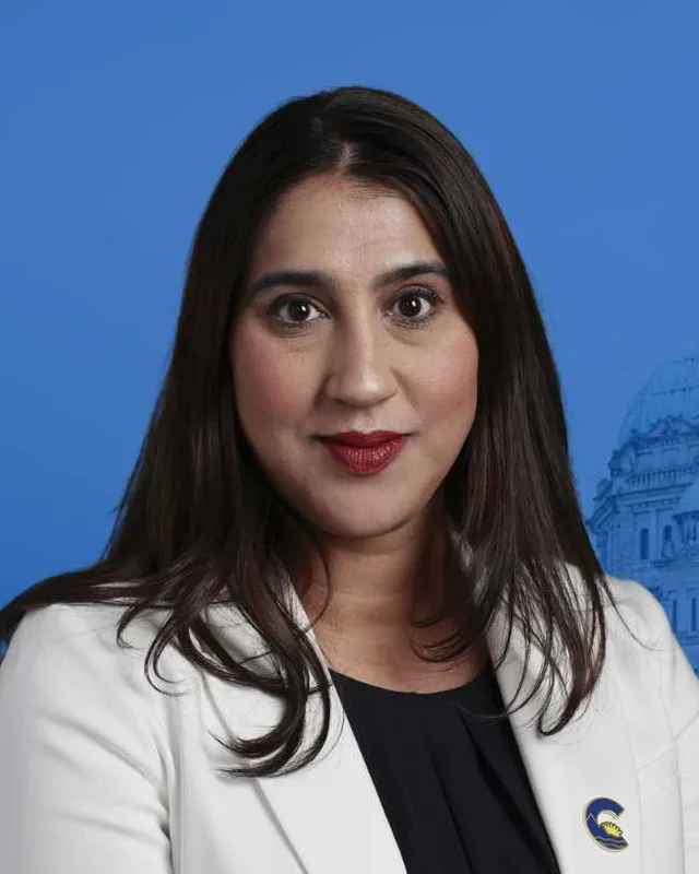
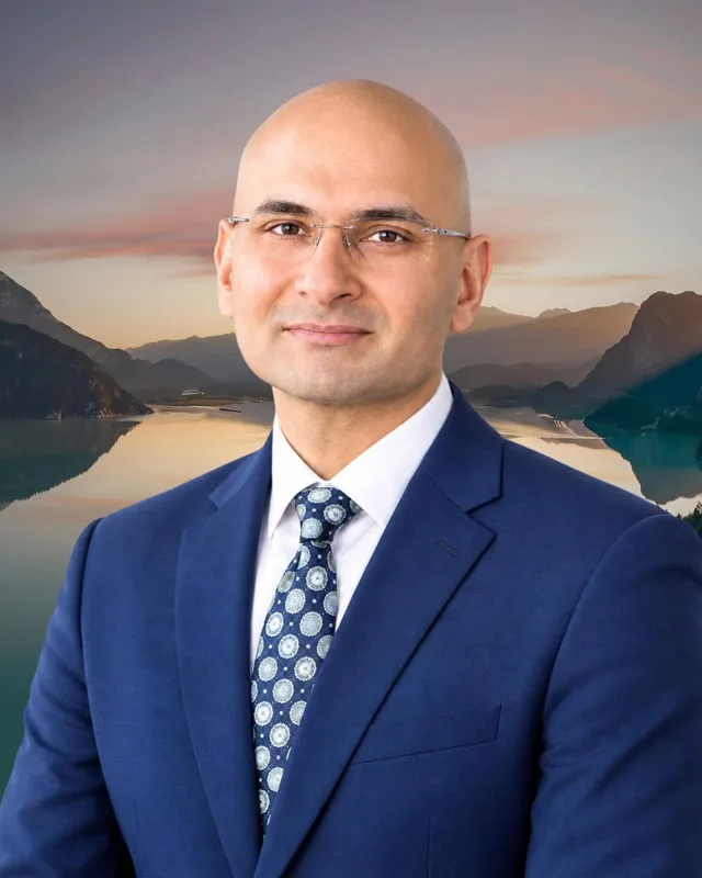
Langley-Willowbrook is a new district. The commission's 2023 final report recommends it, and the preliminary report had called it Langley-Murrayville. Elections BC's results file holds its first election, the 2024 Provincial General Election. Jody Toor of the Conservative Party won with 10,979 votes (48.24%). Andrew Mercier of the BC NDP received 10,112 votes (44.43%) and Petrina Arnason of the BC Green Party received 1,670 votes (7.34%). Turnout was 55.44% of 41,088 registered voters. The legislature's record lists Toor in the 43rd Parliament as a member of the Conservative Party of BC.
Elections BC's conversion table places 67 of the district's 70 voting areas in the Langley district of 2017 to 2024. Andrew Mercier held Langley for the BC NDP from 2020 to 2024. He won it in 2020 with 11,089 votes (47.17%), ahead of Mary Polak of the BC Liberal Party with 8,014 (34.09%). Polak held it from 2005 to 2020, and the 2002 to 2013 volume prints her wins in 2005, 2009 and 2013. Polak won it in 2017 with 10,755 votes (44.40%).
Lynn Stephens of the Liberal Party won Langley in 1991, 1996 and 2001. The 1987 to 2001 volume prints the 35th general election of 17 October 1991, when she won with 7,149 votes (38.95%) ahead of Derrill Thompson of the New Democratic Party with 5,762 (31.39%). In 1996 she won with 9,277 votes (46.62%), and in 2001 with 14,564 votes (64.85%).
A district named Langley appears in Elections BC's first volume from the 28th general election, held on 12 September 1966. Hunter Bertram Vogel of Social Credit won it that year with 7,206 votes (58.28%). The volume prints his win in 1969, and wins by Robert Howard McClelland of Social Credit in 1972, 1975, 1979 and 1983. For 1986 it prints Langley as a district with two members, Caroline Mary (Carol) Gran and Daniel George Peterson, both of Social Credit.
Members for Langley, which covered 67 of this district’s 70 voting areas before 2024
Parliament
It sat
Member
Elected as
Party on the legislature’s record
42nd
2020 to 2024
Andrew Mercier
BC NDP
BC NDP
41st
2017 to 2020
Mary Polak
BC Liberal Party
BC Liberal Party
40th
2013 to 2017
Mary Polak
BC Liberal Party
BC Liberal Party
39th
2009 to 2013
Mary Polak
BC Liberal Party
BC Liberal Party
38th
2005 to 2009
Mary Polak
BC Liberal Party
BC Liberal Party
37th
2001 to 2005
Lynn Stephens
BC Liberal Party
36th
1996 to 2001
Lynn Stephens
BC Liberal Party
35th
1992 to 1996
Lynn Stephens
BC Liberal Party
“Elected as” is the affiliation Elections BC printed with the winning result. The last column is the party the legislature’s records give for that parliament, which differs when a member changed party while in office. A row with that column empty is a winner Elections BC prints whom the legislature’s records leave out. Source: Legislative Assembly of British Columbia (opens in a new tab)
Boundaries since 2024
Langley-Willowbrook has 70 voting areas. They overlap these districts from 2017 to 2024: Langley (67).
The commission that drew the boundaries counted 57,709 people in the district, 7.3% above the average for a district, over 23 km².
Langley-Willowbrook is a provincial electoral district in the Fraser Valley of British Columbia. The Electoral Boundaries Commission's 2023 final report says it contains the City of Langley and the adjacent community of Willowbrook. The western boundary follows 196th Street, the eastern boundary follows Murray Creek and Glover Road, and the northern boundary runs along 72nd Avenue. In the south it follows 33A, 36th and 40th Avenues.
Which communities are in Langley-Willowbrook?
Langley-Willowbrook includes the City of Langley and the community of Willowbrook, according to the commission's final report. The report describes the district as the City and the dense urban neighbourhoods immediately to its north. Elections BC's 2024 results file lists 11 voting places in the district, among them Douglas Park Community School, H.D. Stafford Middle School and the Timms Community Centre.
Who won Langley-Willowbrook in the 2024 provincial election?
Jody Toor of the Conservative Party won Langley-Willowbrook in 2024 with 10,979 votes, 48.24% of the valid votes. Andrew Mercier of the BC NDP received 10,112 votes. Turnout was 55.44% of 41,088 registered voters. The legislature's record lists Toor in the 43rd Parliament as a member of the Conservative Party of BC.
Who represented this area before 2024?
Before 2024 most of the area of Langley-Willowbrook was in the Langley district. The legislature's record lists Andrew Mercier of the BC NDP as its member from 2020 to 2024, and Mary Polak of the BC Liberal Party from 2005 to 2020. Elections BC's conversion table places 67 of the 70 voting areas of Langley-Willowbrook in the Langley district.
When was Langley-Willowbrook created?
The commission's 2023 final report recommended Langley-Willowbrook, and the district first voted in the 2024 provincial election. The preliminary report had called it Langley-Murrayville. The commission added a district to the area around Langley, citing Langley East at 34.9% above the electoral quotient, and it says the new names follow the neighbourhoods in the Langley Official Community Plans.
How many people live in Langley-Willowbrook?
The 2021 census counted 57,945 people in Langley-Willowbrook, with a median age of 39.6 compared with 42.8 across British Columbia. English was the first language of 74.9% of residents, followed by Punjabi at 2.6% and Korean at 2.5%. The commission counts 57,709 people in the district, on an area of 23 square kilometres.
Which First Nations' territory is Langley-Willowbrook on?
The City of Langley acknowledges the traditional unceded territory of the Katzie, Kwantlen, Matsqui and Semiahmoo First Nations, and Langley-Willowbrook contains the City. Katzie First Nation's website says the places now called Pitt Meadows, Maple Ridge, Surrey, Langley and Delta have ancient Katzie names, and that Katzie have lived in their territory for thousands of years.
How did the City of Langley begin?
The City of Langley began as a settlement called Innes Corners, named for the settlers Adam and William Innes, and later became known as Langley Prairie. In 1955 the Township declined to provide streetlights, sidewalks and sewers, and the area separated. BC Geographical Names records the City's incorporation on 15 March 1955. Langley-Willowbrook contains the City.
When did the Interurban railway reach Langley?
The British Columbia Electric Railway, called the Interurban, reached Langley in 1910. The City of Langley's history says the line between Langley and New Westminster carried farm produce and milk by March 1910, and passenger service began four months later. Three of its stations stood in Langley Prairie, now the City of Langley, which Langley-Willowbrook contains. Buses replaced the Interurban in 1950.
When will SkyTrain reach Langley-Willowbrook?
The Surrey Langley SkyTrain project gives late 2029 as its current anticipated in-service date. The line runs 16 kilometres along Fraser Highway. Willowbrook Station will stand at the northeast corner of 196 Street and Fraser Highway, and Langley City Centre Station will stand east of 203 Street and Industrial Avenue. The western boundary of Langley-Willowbrook follows 196th Street.