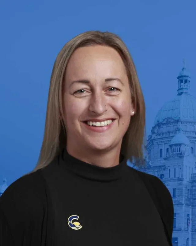
This district elects one MLA. Voters mark one name on Saturday, October 24, 2026, and the candidate with the most votes wins the seat.
Kelowna Centre is a provincial electoral district on the east shore of Okanagan Lake in the Okanagan Valley. It takes in the urban core of Kelowna and the neighbourhoods of Benvoulin and Glenmore, and it reaches north to McKinley Landing. The 2021 census counted 59,425 people in it, and the Electoral Boundaries Commission gives its area as 72 square kilometres.
Kelowna Centre lies on the east shore of Okanagan Lake. The Electoral Boundaries Commission's 2023 final report says it consists of the urban core of Kelowna and the neighbourhoods of Benvoulin and Glenmore. Okanagan Lake forms its western boundary and Highway 97 its eastern boundary. Its southern border follows KLO Road and Mission Creek, and it extends north to McKinley Landing and John Hindle Drive. The commission counts 59,446 people in the district. The report gives its area as 72 square kilometres.
The commission explains how it drew the northern line. It adjusted the boundary proposed in its preliminary report, saying that John Hindle Drive is a clearer northern boundary for Kelowna Centre. It then learned that a development is planned for McKinley Landing Ridge, so it moved the boundary north to McKinley Road, following a natural area into the lake. The commission wrote that this provides a better boundary from the lake and improves the division of Kelowna's component neighbourhoods.
The commission's map for the district labels Bernard Avenue, Harvey Avenue, Water Street, Ellis Street, Richter Street, Pandosy Street, Gordon Drive, Cadder Avenue, Guisachan Road and Glenmore Road, along with the names Benvoulin and McKinley. BC Geographical Names records that Mission Creek flows west into Okanagan Lake just south of Kelowna. The Canadian Encyclopedia says the city sits at the eastern end of the William R. Bennett Bridge, a floating bridge that replaced the Okanagan Lake Bridge in 2008, and that Kelowna was connected to the Coquihalla Highway in 1990.
The Okanagan Nation Alliance names its people the Syilx Okanagan Nation. Its website says the Syilx people are a trans-boundary tribe separated at the 49th parallel by the border between Canada and the United States, and that its members share the same land, nsyilxcən language, culture and customs. The Alliance says it was formed in 1981 as the first First Nations government in the Okanagan. It says the Syilx Nation's territory and membership were split in 1846 when the border was drawn across the territory without consent, and that the Syilx people still affirm the land is theirs because no treaty has been negotiated.
The Alliance describes the territory as a landscape of deserts and lakes, alpine forests and endangered grasslands that extends over an area it states as 69,000 square kilometres. It places the northern edge near Mica Creek, north of Revelstoke, the eastern edge between Kaslo and Kootenay Lakes, the southern edge at Wilbur, Washington, and the western edge in the Nicola Valley. Its member communities page says Westbank First Nation has five reserves totalling 2,161 hectares, and that three of them lie on the east side of Okanagan Lake in the Kelowna area, in generally unpopulated areas. That page does not say which of them fall inside this district.
The BC Geographical Names record for Kelowna lists the language of the name as n̓səl̓xcin̓, also written nsyilxcn, a Salishan language. The Canadian Encyclopedia says the name of the townsite was chosen from the Okanagan word meaning grizzly bear. For Mission Creek, which forms the district's southern edge, the same office records the creek's name as N'wha-kwi-sen, which means smoothing stones, and it cites the 12th Report of the Okanagan Historical Society, published in 1948.
BC Geographical Names says the Okanagan Mission was established by Father Pierre Richard, Father Charles Marie Pandosy and Brother Surel of the Oblates of Mary Immaculate. They founded it in 1859 at the south end of Duck Lake, now Ellison Lake, and moved it the following year to the creek that now forms the southern edge of this district. The record says the creek was then called Riviere de l'Anse au Sable, which means Sandy Cove River, and that the present name comes from the mission.
The Dictionary of Canadian Biography says Pandosy established the Immaculate Conception mission in the Okanagan valley in the summer of 1859, that his group built a house and a chapel, and that the first fruit trees in the valley were planted in that period. The Canadian Register of Historic Places describes the Pandosy Mission at 3685 Benvoulin Road as the first permanent non-native settlement in the Okanagan Valley. Four acres with seven nineteenth-century log buildings remain, among them a chapel, a root house and a barn. The register places the site in Kelowna's Mission area. The commission's report lists Okanagan Mission and Mission Creek among the communities of the neighbouring Kelowna-Mission district.
The Canadian Encyclopedia's article on Kelowna says that by 1861 the Hudson's Bay Company had established a small trading post.
The Canadian Register of Historic Places lists the Third John McDougall House at 1056 to 1060 Cameron Avenue as a log house built by John McDougall in 1886, one of the few houses in Kelowna that date from before 1890. The register says McDougall sold his ranch to G.G. MacKay after his wife Amelie died, and MacKay resold it to Lord and Lady Aberdeen. Lord Aberdeen bought the 480-acre ranch in 1890. The ranch became known as Guisachan Ranch, and the house now serves as a caretaker's residence in the City-owned Guisachan Heritage Park.
The register says George Grant MacKay, a real estate promoter, developed the Benvoulin townsite and gave the lot for the Benvoulin Church at 2279 Benvoulin Road. Howard Dell designed the church and H.W. Raymer built it in 1892. The congregation dedicated it on 11 September 1892, with three families present at first. The register calls it the first Presbyterian church between Vernon and the U.S. border and the first Protestant church in the Central Okanagan, and it ties the church to the unsuccessful Benvoulin townsite. Lord and Lady Aberdeen gave generously to the building fund.
The church served Presbyterians, Methodists and, after 1925, members of the United Church for seventy years. It closed in 1964. The Central Okanagan Heritage Society restored it, and it reopened in 1986 with the belltower rebuilt to its original form. BC Geographical Names adopted the farming settlement as Benvouline on 1 December 1955 and later changed the spelling to Benvoulin.
The townsite, the city and the packinghouses, 1892 to 1925
The Canadian Encyclopedia says the Kelowna townsite was laid out in 1892. BC Geographical Names records that the City of Kelowna was incorporated on 4 May 1905. The encyclopedia says that by 1910 Kelowna was gaining fame as the Orchard City, and that shortly after incorporation the city had 11 sawmills, three fruit-packing plants and two canneries. It adds that Canadian National Railway main-line service arrived in 1925.
The fruit trade left a building on Ellis Street. The Canadian Register of Historic Places lists the BC Growers Packing House, now called the Laurel Packinghouse, at 1304 Ellis Street. Ward and Baldock built it in 1918 for BC Growers Ltd., a company Byron McDonald established in 1913. After a sale in 1923 it served the Kelowna Growers Exchange, the Crown Fruit Company and the Laurel Cooperative Union until the 1970s. The register says it is one of the oldest fruit packing houses remaining in Kelowna. It was formally recognised on 10 January 1983 and reopened in May 1989 as the British Columbia Orchard Industry Museum.
The Kelowna Capital News reported in April 2026 that the Kelowna Regatta began in the summer of 1906 with swimming, diving, rowing and sailing and grew into a multi-day festival with hydroplane boat races, water skiing shows and parades. The paper says it ran for more than 80 years. An exhibition about it, Making Waves, was on show at the Okanagan Heritage Museum at 470 Queensway Avenue in downtown Kelowna.
Irrigation and the orchards of Glenmore, 1908 to 1971
The Canadian Register of Historic Places lists KLO House, also called Pinehurst, at 2796 KLO Road, built in 1908. The register says the house is valued for its link to the Kelowna Land and Orchard (KLO) Company, which was formed to irrigate and subdivide a large area south and east of the original Kelowna townsite.
A water study document hosted by the Okanagan Basin Water Board, which reports conditions up to July 1971, records that the Glenmore Irrigation District was formed in 1910 and supplies irrigation and domestic water to an area just north of the City of Kelowna. In 1967 an enclosed system, financed under a programme the study calls ARDA, replaced the open distribution system. It was designed to supply irrigation water to 2,009 acres within the district, 200 acres within the City of Kelowna and 80 acres at the Kelowna Golf and Country Club. By July 1971, the study says, subdivision had reduced the irrigated area within the city to 113 acres.
The register places the L.E. Taylor House at 1551 Lambert Avenue in Kelowna's Glenmore neighbourhood and dates it to 1924. Lionel E. Taylor, who lived from 1880 to 1962, established and led the Bankhead Orchard Co. Ltd., a pear grower, and served as its president or director for 51 years. The register says the surrounding orchard was sold to housing developers in 1964 and was replaced by suburban streets, leaving the house as a relic of the orcharding era.
The Canadian Encyclopedia says Kelowna's population grew after the Second World War, partly because of a veteran resettlement program, and had reached 13,000 by 1961. It records that the William R. Bennett Bridge replaced the Okanagan Lake Bridge of 1958 in 2008. The encyclopedia gives the city's 2021 census population as 144,576.
Glenmore, Benvoulin and McKinley Landing lay outside the city in 1967. The history of the Regional District of Central Okanagan lists the electoral areas of 1967. Area B took in Glenmore, Poplar Point and McKinley Landing, and Area E took in Benvoulin and South Pandosy. Each area had a director on the regional board, and the review names the interim directors for that first year.
The same review says the provincial government changed the boundaries of four municipalities in the early 1970s: Nanaimo, Prince George, Kamloops and Kelowna. The boundary extension for Kelowna took effect on 15 December 1973. The new boundary included Okanagan Mission, South Pandosy, South and East Kelowna, Rutland, Black Mountain, a portion of the Ellison District, the southern part of Electoral Area A, commonly called Winfield, and the Glenmore Valley. The review says the Rutland community was upset about being forced to become part of the city.
The Friendship Society and the Rotary Centre, 1974 to 2002
The Ki-Low-Na Friendship Society says on its website that it is a registered non-profit society founded in 1974. The website lists child and family services, daycare, elder support, English language services, housing, mental health support, outreach and youth programs. Elections BC's results file shows that the society's premises were a voting place inside this district in the 2024 provincial election. The 2021 census counted 3,425 people in the district who identify as Indigenous, of whom 1,405 identify as First Nations and 1,840 as Métis.
The Rotary Centre for the Arts at 421 Cawston Avenue grew from a 1993 decision by Kelowna City Council to authorize a feasibility study of the old Growers Supply Building. In 1995 Russell Munn gave $200,000 to name the 326-seat theatre after his wife, Mary Irwin. In 1998 the project chose Hotson Bakker Architects, and in 1999 Senator Fitzpatrick announced partial funding for restoration. In 2000 the City approved construction, with 90% of the fundraising complete, and building began in 2001. The centre opened to the public on 2 November 2002. It carries the Rotary name because the Rotary Clubs of Kelowna gave $350,000.
The Canadian Register of Historic Places adds that the restored Laurel Packinghouse became a leading part of the development of the surrounding neighbourhood as Kelowna's Cultural District.
The name Kelowna Centre first appears at the 2024 provincial general election. The Electoral Boundaries Commission recommended the district in its final report of April 2023. It wrote that the three Kelowna ridings were growing at nearly twice the provincial average, and that residents of downtown Kelowna found it confusing and inappropriate to vote in Kelowna West. The commission removed downtown from Kelowna West and added an electoral district centred on downtown Kelowna. Elections BC's conversion table matches the district's 75 voting areas to the 2017 to 2024 districts: 35 in Kelowna-Lake Country, 31 in Kelowna West and 11 in Kelowna-Mission.
Elections BC's volume for 1987 to 2001 lists John Weisbeck as the member for Okanagan East in 1996 and Sindi Hawkins as the member for Okanagan West in 1996. Each won again in 2001 under a new district name, Kelowna-Lake Country and Kelowna-Mission, after the Electoral Districts Act (SBC 1999 c. 31) came into effect on 18 April 2001 and raised the number of districts from 75 to 79. Al Horning of the BC Liberal Party won Kelowna-Lake Country in 2005 with 12,247 votes (50.37%), and Norm Letnick of the same party then won it in 2009, 2013, 2017 and 2020. Letnick received 14,679 votes (55.73%) in 2020.
Westside-Kelowna was a district in the 2009 and 2013 elections. Ben Stewart resigned that seat on 11 June 2013, and in the by-election of 10 July 2013 Christy Clark won it with 11,758 votes (62.66%). The legislature's biography says she represented Westside-Kelowna after her 2013 election and Kelowna West when she resigned in August 2017. Elections BC records that she resigned on 4 August 2017 and that a by-election was held on 14 February 2018. Ben Stewart won it with 8,406 votes (56.28%) and won again in 2020 with 12,991 votes (49.89%).
In 2024 Kristina Loewen of the Conservative Party won Kelowna Centre with 11,033 votes (42.85%). Loyal Wooldridge of the BC NDP received 10,993 votes (42.69%), Michael Humer with no affiliation received 2,613 votes (10.15%) and Bryce Tippe of the BC Green Party received 1,111 votes (4.31%). Turnout was 56.49% of 45,642 registered voters. The legislature's records list Kristina Loewen as the member for Kelowna Centre in the 43rd Parliament, for the Conservative Party of British Columbia.
Members for Kelowna-Lake Country, which covered 35 of this district’s 75 voting areas before 2024
Parliament
It sat
Member
Elected as
Party on the legislature’s record
42nd
2020 to 2024
Norm Letnick
BC Liberal Party
BC United
41st
2017 to 2020
Norm Letnick
BC Liberal Party
BC Liberal Party
40th
2013 to 2017
Norm Letnick
BC Liberal Party
BC Liberal Party
39th
2009 to 2013
Norm Letnick
BC Liberal Party
BC Liberal Party
38th
2005 to 2009
Al Horning
BC Liberal Party
BC Liberal Party
37th
2001 to 2005
John Weisbeck
BC Liberal Party
Members for Kelowna West, which covered 31 of this district’s 75 voting areas before 2024
Parliament
It sat
Member
Elected as
Party on the legislature’s record
42nd
2020 to 2024
Ben Stewart
BC Liberal Party
BC United
41st
2017 to 2020
Ben Stewart
BC Liberal Party
BC Liberal Party
41st
2017 to 2020
Christy Clark
BC Liberal Party
BC Liberal Party
“Elected as” is the affiliation Elections BC printed with the winning result. The last column is the party the legislature’s records give for that parliament, which differs when a member changed party while in office. A row with that column empty is a winner Elections BC prints whom the legislature’s records leave out. Source: Legislative Assembly of British Columbia (opens in a new tab)
Boundaries since 2024
Kelowna Centre has 75 voting areas. They overlap these districts from 2017 to 2024: Kelowna-Lake Country (35), Kelowna West (31), Kelowna-Mission (11).
The commission that drew the boundaries counted 59,446 people in the district, 10.6% above the average for a district, over 72 km².
Kelowna Centre is a provincial electoral district on the east shore of Okanagan Lake in British Columbia. The Electoral Boundaries Commission's 2023 report says Okanagan Lake forms its western boundary and Highway 97 its eastern boundary. The southern border follows KLO Road and Mission Creek, and the district extends north to McKinley Landing and John Hindle Drive.
Which neighbourhoods are in Kelowna Centre?
Kelowna Centre consists of the urban core of Kelowna and the neighbourhoods of Benvoulin and Glenmore, according to the Electoral Boundaries Commission's 2023 report. The district extends north to McKinley Landing. The Canadian Register of Historic Places places the L.E. Taylor House on Lambert Avenue in Kelowna's Glenmore neighbourhood, and the Rotary Centre for the Arts stands at 421 Cawston Avenue.
Who won Kelowna Centre in the 2024 provincial election?
Kristina Loewen of the Conservative Party won Kelowna Centre in 2024 with 11,033 votes, which is 42.85% of the valid vote. Loyal Wooldridge of the BC NDP received 10,993 votes. Michael Humer, with no affiliation, received 2,613 votes and Bryce Tippe of the BC Green Party received 1,111. Turnout was 56.49% of 45,642 registered voters.
Who is the MLA for Kelowna Centre?
Kristina Loewen of the Conservative Party of British Columbia is the member for Kelowna Centre in the legislature's records for the 43rd Parliament. Kelowna Centre was first used at the 2024 election, so no earlier member sat under this name. Norm Letnick held the Kelowna-Lake Country seat from 2009 to 2024, and Elections BC matches 35 of the new district's voting areas to that district.
Which older districts became Kelowna Centre?
Kelowna Centre drew its 75 voting areas from three districts that existed from 2017 to 2024. Elections BC's conversion table matches 35 to Kelowna-Lake Country, 31 to Kelowna West and 11 to Kelowna-Mission. The commission said the new district is centred on downtown Kelowna, which it removed from Kelowna West, where downtown residents had found voting confusing.
Why was Kelowna Centre created?
The Electoral Boundaries Commission created Kelowna Centre in its final report of April 2023 because the three Kelowna ridings were growing at nearly twice the provincial average. It said the rapidly increasing population around downtown supported a new riding. With 59,446 people, Kelowna Centre is 10.6% above the average district population, according to the commission's table.
How many people live in Kelowna Centre?
The 2021 census counted 59,425 people in Kelowna Centre, with a median age of 41.2 compared with 42.8 for British Columbia. The Electoral Boundaries Commission counts 59,446 people in its table. Of the homes, 44.9% are rented and 55% are owned. The median household income was $74,500, against $85,000 for the province.
What does the name Kelowna mean?
The Canadian Encyclopedia says the Kelowna townsite, laid out in 1892, took its name from the Okanagan word meaning grizzly bear. BC Geographical Names lists the language of the name as n̓səl̓xcin̓, also written nsyilxcn, a Salishan language. The City of Kelowna was incorporated on 4 May 1905, according to the same BC Geographical Names record.
What is the Benvoulin Church?
Benvoulin Church at 2279 Benvoulin Road is a wooden Presbyterian church built in 1892 and dedicated on 11 September 1892. The Canadian Register of Historic Places calls it the first Presbyterian church between Vernon and the U.S. border and the first Protestant church in the Central Okanagan. It closed in 1964 and reopened in 1986 after restoration by the Central Okanagan Heritage Society.
When did Glenmore become part of the City of Kelowna?
Glenmore became part of the City of Kelowna on 15 December 1973, when the provincial government extended the city boundary. The Regional District of Central Okanagan's history says the new boundary included the Glenmore Valley, South Pandosy, Okanagan Mission and Rutland. Before that, Glenmore was part of the regional district's Electoral Area B, together with Poplar Point and McKinley Landing.