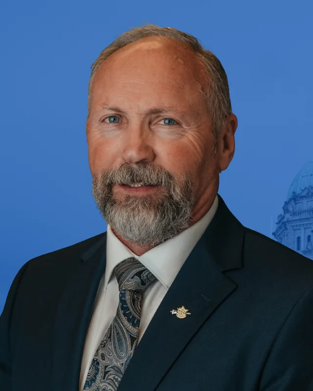
This district elects one MLA. Voters mark one name on Saturday, October 24, 2026, and the candidate with the most votes wins the seat.
Kamloops-North Thompson is a provincial electoral district of 17,024 square kilometres. It takes in the suburban and rural areas around Kamloops, including Sahali, Westsyde, Rayleigh and Heffley Creek, and the communities of the North Thompson valley and nearby: Barriere, Clearwater, Chase and Sun Peaks. The 2021 census counted 60,475 people in it. Simpcw First Nation and the Whispering Pines/Clinton Indian Band have communities here.
The Electoral Boundaries Commission's 2023 final report says Kamloops-North Thompson includes the suburban and rural areas around Kamloops, such as Bachelor Hills and Sahali. It also includes the North Thompson communities of Barriere, Clearwater, Prichard and Chase, a spelling of Pritchard that differs from the one Elections BC and BC Geographical Names print. The report says the southern and western boundaries follow Thompson Nicola Regional District Electoral Areas J and L, that Wells Grey Provincial Park bounds the district on the north, and that its eastern boundary follows the Thompson Nicola Regional District. The commission counted 60,586 people in it, which is 12.7% from the provincial average, and gives its area as 17,024 square kilometres.
Elections BC's results file for the 2024 provincial general election lists 30 voting places in the district. They include community halls at Barriere, Chase, Little Fort, Pritchard, Vavenby, Blackpool, Darfield, Squam Bay and Heffley Creek, Sun Peaks Centre, Dutch Lake Community Centre, the community hall of Simpcw First Nation and the community hall of the Whispering Pines/Clinton Indian Band. Schools used as voting places stand at Westsyde, Rayleigh, Dallas, Juniper Ridge, McGowan Park, Pinantan Lake and Westwold, and the B.C. Wildlife Park was a voting place as well.
BC Parks says the core of Wells Gray Park is reached by Highway 5 at Clearwater, and that Mahood Lake is reached by Highway 24 from Highway 5 at Little Fort. At Little Fort the Province runs a ferry across the North Thompson River, 93 kilometres north of Kamloops on Highway 5. The current of the river pushes it across in 5 minutes. It carries 2 vehicles and 12 passengers, it is free, and it runs on demand from 7 am to noon and from 1 pm to 6:20 pm. BC Geographical Names records that Wells Gray Park was created by Order in Council 1644 on 28 November 1939 and gives 540,448 hectares as its size since a boundary change on 31 March 2025.
Simpcw First Nation writes on its website that Simpcw is one of the 17 campfires (bands) of the Secwe̓pemc, or Shuswap Nation. It names its territory Simpcwúl̓ecw and says the territory covers 5,000,000 hectares, from south of McLure to Kakwa Park in the north, and from west of Goat River to east of Jasper, with the whole of the North Thompson Valley inside it. The Nation has over 900 members, many of whom live in Chu Chua, where its main village stands. Simpcw people speak the western dialect of Secwepemctsi̓n, the language of the Secwepemc or Shuswap people.
The Whispering Pines/Clinton Indian Band calls itself the home of the Pellt'iq't People on its website. The Province's page for the band places it on the North Thompson River, 18 km north of Kamloops, and lists it as a member of the Shuswap Nation Tribal Council. That page says the council's member bands are in discussions with the Province about land and resource use and take no part in the B.C. treaty process. It lists forest consultation and revenue sharing agreements signed in 2017 and 2021, an economic development agreement from 2009 and a mountain pine beetle agreement from 2007.
BC Geographical Names records the name Chu Chua as adopted on 11 August 1921, with a post office open there from 1 October 1907 to 30 December 1967. It gives two translations written down by missionaries. Father Joseph E. Guinard rendered the name as little rivers, and Father Jean-Marie Le Jeune rendered it as a creek rushing among rocks. Simpcw First Nation names Chu Chua as the place of its main village.
The Rocky Mountain Goat reported in 2016, citing Celia Nord, archives coordinator for Simpcw First Nation, that a northern Simpcw reserve mapped near Tete Jaune Cache in 1905 was abandoned after complaints from miners, settlers and others. In August 1916, as many as 60 people were forced by the government to travel to Chu Chua and live on the main reserve. The report adds that the Spanish flu epidemic of 1918 killed many of the northern people who had just arrived. Simpcw invited the public to a commemoration on 13 August 2016.
On 12 April 2022 Simpcw signed the Tcwesétmentem: Walking Together Agreement with the Province, which the Province calls B.C.'s first community agreement under section 92.1 of the Child, Family and Community Service Act. On 16 July 2026 Simpcw and the Province announced a consent-based decision-making agreement for the assessment of the Yellowhead Copper Project, proposed by Trekor Metals Limited in Simpcwúl̓ecw. Both Simpcw's consent and a provincial environmental assessment certificate are required before the proposed mine can go ahead. Ku̓kwpi7 (Chief) George Lampreau said it was the first time Simpcw had applied its consent process to a major project.
Gold seekers, place names and the railway, 1857 to 1926
The Barriere Star Journal reports, citing H.H. Bancroft, that two French Canadian gold seekers panned for gold in 1857 in the river they named the Barriere. BC Geographical Names says the name Barriere is of French origin and was adopted on 11 August 1921, the same day as the name of the Clearwater River. For the Clearwater River the record says the name appears on Trutch's 1871 map of British Columbia, and that W.B. Cheadle may have first used it on his expedition of 1862 and 1863, when he wrote that his party came to a large clear river. The North Thompson River is named for the explorer David Thompson, and the record says the Canada Gazette of 14 October 1865 called it North River.
Parks Canada says the Canadian Northern Railway used the Yellowhead Pass after 1906. In the valley, the Barriere Star Journal says the first Barriere post office opened on 1 February 1914 and that Canadian Northern passenger service started in 1915. At Clearwater the Raft River post office opened on 16 June 1910, the railway station opened between 1921 and 1923, and the post office took the name Clearwater Station on 1 February 1926. A note in BC Geographical Names says rancher Daubney Pridgeon proposed the name Navenby for the Vavenby post office, after his birthplace in Lincolnshire, and that postal officials read his N as a V. The Vavenby post office opened on 1 June 1910 and the station was built 2 1/2 miles to the east. Celia Nord says the railway cut the Simpcw reserve in half and affected its irrigation.
Westsyde, Heffley Creek, Dallas and the Wildlife Park, 1905 to 1966
Westsyde began as one of the four blocks into which the British Columbia Fruit Lands Company divided its North Shore land. The Wren News reports that the company incorporated in England in 1909 and bought 2,700 hectares, and that by 1912 its irrigation and power systems reached every block. The article places Westsyde in the second block, after Noble Creek. It says a new water system serving North Kamloops, Brocklehurst and Westsyde was not working until 1960.
Farther up the North Thompson, the Heffley Creek post office opened on 1 June 1905 and took the name of Adam P. Heffley, a rancher in the area, while the railway station was named Heffley. BC Geographical Names places Rayleigh on the Canadian National Railway, on the east side of the river and south of Heffley Creek. It places Dallas 13.5 km east of Kamloops, now inside the city boundary, and says settler veterans chose the name at a meeting in 1955. The name honours Dallas Johnson, who farmed there from 1902 until after the Second World War, when much of his land was bought for settlement under the Veterans' Land Act.
The B.C. Wildlife Park, at 9077 Dallas Drive, gives its own account of its start. John Moelaert proposed a zoo to the Kamloops Chamber of Commerce on 15 February 1965, and the Greater Kamloops Zoological Society was formed on 31 March 1965. Molson's Breweries donated 106 acres of land on 11 February 1966, and the first exhibits opened to the public on 16 August 1966.
BC Geographical Names says Chase is named for Whitfield Chase (1820 to 1896), a native of New York state who came west over the Oregon Trail in 1852. In 1865 he established a ranch where the South Thompson River runs out of Little Shuswap Lake. The Village of Chase says on its history page that he was the first non-native settler to farm and raise a family in what was then called the Shuswap Prairie.
The village's history page says the Adams River Lumber Company was formed on 2 July 1907 by J.P. McGoldrick and A.J. Lammers. The mill started in 1908, and the first lot in the Chase townsite was sold on 5 May 1908. The mill ran from 1908 to 1925, cut 30 million board feet in 1910 and employed over 300 men at that time. BC Geographical Names records that the Chase post office opened on 1 October 1908.
Chase was incorporated as a village municipality on 22 April 1969. A boundary change in February 2005 added a satellite area at Adams Lake.
BC Geographical Names says Mount Tod was adopted as a name on 3 November 1932 and honours John Tod (1794 to 1882), a Hudson's Bay Company employee who was chief trader at the company's post in Kamloops from 1842 to 1851. Sun Peaks Resort says on its website that Tod Mountain was established in 1961 and that its change into Sun Peaks Resort began in 1993. The resort calls Al Raine its first mayor and says he arrived in 1994 to help shape the master development plan.
The record for Sun Peaks says the name was created by the developers of the ski resort on the south face of Mount Tod. Their proposal to rename the mountain, made to improve promotion in Europe, was rejected. Sun Peaks was adopted as a community name on 9 April 1997 and became a recreational community on 2 March 2005. It was incorporated as a mountain resort municipality by Order in Council 159 of 25 March 2010, effective 28 June 2010, under the name Sun Peaks Mountain Resort Municipality.
The Barriere Star Journal says a carelessly dropped cigarette butt started the McLure/Barriere wildfire on 30 July 2003. The newspaper counts 72 residences and nine businesses lost, including the Tolko mill, Barriere's largest employer, and says 45 fire departments with just under 500 firefighters joined the fight. The provincial Firestorm 2003 review lists the McLure fire as starting on 31 July 2003 at McLure and Barriere, with a final size of 26,420 hectares. Its table also lists two fires that started at Chase: McGillivray on 1 August 2003, which reached 11,400 hectares, and Venables on 16 August 2003, which reached 7,635 hectares. The review team held nine days of public meetings in Barriere, Kamloops, Chase and five other towns. It says the interface fires of that summer destroyed 334 homes and forced more than 45,000 people to leave their communities.
Barriere and Clearwater both became district municipalities in December 2007. BC Geographical Names gives the Barriere date as 4 December 2007 under Order in Council 654, and the Clearwater date as 3 December 2007 under Order in Council 652. On 11 April 2025, at a community forum in Chu Chua, the two districts signed memoranda of understanding with Simpcw First Nation, according to The Rocky Mountain Goat.
The Electoral Boundaries Commission's preliminary report moved Barriere, Clearwater and neighbouring communities from a Kamloops district into a Cariboo district. The final report of 2023 says residents pointed out that the North Thompson and Wells Grey Provincial Park share major transportation and service links with Kamloops, and returned those communities to a Kamloops district. It changed the name from Kamloops-North Shuswap to Kamloops-North Thompson and moved the north Shuswap communities around Seymour Arm into Salmon Arm-Shuswap. The commission's table of current districts gives Kamloops-North Thompson 59,565 people and 21,641 square kilometres, and its table of proposed districts gives 60,586 people and 17,024 square kilometres. Elections BC's conversion table matches the district's 102 voting areas to four districts of 2017 to 2024: 61 in Kamloops-North Thompson, 42 in Kamloops-South Thompson, 3 in Fraser-Nicola and 1 in Shuswap.
Elections BC's volume for 1987 to 2001 first prints Kamloops-North Thompson at the 1991 general election, the first held under the Electoral Districts Act (SBC 1990 c. 39), which set out 75 single-member districts. Frederick H. Jackson of the New Democratic Party won it with 5,843 votes (39.43%), ahead of John E. Harwood of the Liberal Party with 4,694 (31.67%) and Paul Caissie of Social Credit with 4,283 (28.90%). Kevin Krueger of the Liberal Party won it in 1996 with 7,313 votes (43.43%), ahead of Fred Jackson with 6,945 (41.25%). He won again in 2001 with 12,676 votes (58.04%), ahead of Dwayne Hartle of the New Democratic Party with 4,181 (19.14%).
Elections BC's results for 2005 show Krueger winning with 11,648 votes (48.36%) against Mike Hanson of the BC NDP with 9,635 (40.00%). In 2009 Krueger moved to Kamloops-South Thompson, according to Elections BC's volume for 2002 to 2013, and Terry Lake of the BC Liberal Party won Kamloops-North Thompson with 9,830 votes (46.94%) against Doug Brown of the BC NDP with 9,320 (44.50%). Lake won again in 2013 with 12,183 votes (52.06%). Peter Milobar won in 2017 with 12,001 votes (48.32%) and in 2020 with 9,341 (40.99%), ahead of Sadie Hunter of the BC NDP with 9,145 (40.13%). The Legislative Assembly's records list him for this district as a BC Liberal Party member in the 41st Parliament and as a member of the Conservative Party of British Columbia in the 42nd.
In the 2024 provincial general election Ward Stamer of the Conservative Party won with 17,930 votes (59.74%), ahead of Maddi Genn of the BC NDP with 9,874 (32.90%) and Tristan Cavers of the BC Green Party with 2,209 (7.36%). Turnout was 61.86% of 48,598 registered voters. The Legislative Assembly's records list Stamer as the member for Kamloops-North Thompson in the 43rd Parliament, for the Conservative Party of British Columbia.
Members for Kamloops-South Thompson, which covered 42 of this district’s 102 voting areas before 2024
Parliament
It sat
Member
Elected as
Party on the legislature’s record
42nd
2020 to 2024
Todd Stone
BC United
41st
2017 to 2020
Todd Stone
BC Liberal Party
40th
2013 to 2017
Todd Stone
BC Liberal Party
39th
2009 to 2013
Kevin Krueger
BC Liberal Party
BC Liberal Party
“Elected as” is the affiliation Elections BC printed with the winning result. The last column is the party the legislature’s records give for that parliament, which differs when a member changed party while in office. A row with that column empty is a winner Elections BC prints whom the legislature’s records leave out. Source: Legislative Assembly of British Columbia (opens in a new tab)
Boundaries since 2024
Kamloops-North Thompson has 102 voting areas. 61 of them overlap the district of the same name used from 2017 to 2024.Others overlap these districts from 2017 to 2024: Kamloops-South Thompson (42), Fraser-Nicola (3), Shuswap (1).
The commission that drew the boundaries counted 60,586 people in the district, 12.7% above the average for a district, over 17,024 km².
Kamloops-North Thompson is a provincial electoral district that includes the suburban and rural areas around Kamloops, such as Bachelor Hills and Sahali, and the North Thompson communities of Barriere, Clearwater, Prichard and Chase, according to the Electoral Boundaries Commission's 2023 final report. The commission says Wells Grey Provincial Park bounds the district on the north and gives its area as 17,024 square kilometres.
Which communities are in Kamloops-North Thompson?
Elections BC's 2024 results list voting places in Kamloops-North Thompson at Westsyde, Rayleigh, Dallas, Heffley Creek, Pinantan Lake, Barriere, Little Fort, Vavenby, Blackpool, Darfield, Pritchard, Chase, Westwold, Squam Bay and Sun Peaks. They also list the Dutch Lake Community Centre and the community halls of Simpcw First Nation and the Whispering Pines/Clinton Indian Band. Sahali and Bachelor Hills are named in the commission's report.
Who won Kamloops-North Thompson in the 2024 provincial election?
Ward Stamer of the Conservative Party won Kamloops-North Thompson in 2024 with 17,930 votes, 59.74% of the valid vote. Maddi Genn of the BC NDP received 9,874 votes and Tristan Cavers of the BC Green Party received 2,209. Turnout was 61.86% of 48,598 registered voters. The Legislative Assembly's records list Stamer as the member in the 43rd Parliament.
Who represented Kamloops-North Thompson before Ward Stamer?
Peter Milobar held Kamloops-North Thompson from 2017 to 2024, first as a BC Liberal Party member and then as a member of the Conservative Party of British Columbia, according to the Legislative Assembly's records. Terry Lake of the BC Liberal Party held it from 2009 to 2017. Kevin Krueger of the same party held it from 1996 to 2009, and Frederick Jackson of the BC NDP held it from 1992 to 1996.
How did the boundaries of Kamloops-North Thompson change in 2023?
The Electoral Boundaries Commission's 2023 final report put Barriere, Clearwater and neighbouring communities in Kamloops-North Thompson after its preliminary report had placed them in a Cariboo district. It renamed the district from Kamloops-North Shuswap and moved the north Shuswap communities around Seymour Arm into Salmon Arm-Shuswap. The district's area is now 17,024 square kilometres, down from 21,641 in the commission's table of current districts.
How many people live in Kamloops-North Thompson?
The 2021 census counted 60,475 people in Kamloops-North Thompson, with a median age of 46.8 compared with 42.8 across British Columbia. The median household income was $91,000, 84% of households owned their home, and 8.1% of residents were immigrants. A total of 6,965 residents, 11.8% of the district, reported an Indigenous identity.
Whose territory is Kamloops-North Thompson in?
Simpcw First Nation says its territory, Simpcwúl̓ecw, covers 5,000,000 hectares and includes the whole of the North Thompson Valley, and that its main village is Chu Chua. Simpcw describes itself as one of the 17 campfires of the Secwe̓pemc, or Shuswap Nation. The Whispering Pines/Clinton Indian Band calls itself the home of the Pellt'iq't People, and the Province places it on the North Thompson River 18 km north of Kamloops.
What happened at Barriere in the 2003 wildfire?
The Barriere Star Journal says a carelessly dropped cigarette butt started the McLure/Barriere wildfire on 30 July 2003. The newspaper counts 72 residences and nine businesses lost, including the Tolko mill, Barriere's largest employer. The provincial Firestorm 2003 review lists the fire's final size as 26,420 hectares. Barriere lies in Kamloops-North Thompson.
When did Barriere, Clearwater and Chase become municipalities?
Barriere became a district municipality effective 4 December 2007 and Clearwater effective 3 December 2007, according to BC Geographical Names. Chase became a village municipality on 22 April 1969. All three lie in Kamloops-North Thompson, together with Sun Peaks, which became a mountain resort municipality effective 28 June 2010.
How did Sun Peaks get its name?
Sun Peaks is a name created by the developers of the ski resort on the south face of Mount Tod, according to BC Geographical Names. Their proposal to rename the mountain itself was rejected. Mount Tod honours John Tod, a Hudson's Bay Company chief trader at Kamloops from 1842 to 1851. Sun Peaks lies in Kamloops-North Thompson and became a municipality effective 28 June 2010.