Rainfall warning and flood watch now active for West Vancouver
Environment Canada issued a Rainfall Warning for the Metro Vancouver North Shore this morning, and the BC River Forecast Centre has upgraded to a Flood Watch for the South Coast including West Vancouver's mountain creeks and Howe Sound.
Long read. The subject the most local outlets covered that day, with the public record behind it. Every outlet and record is linked under the story. Read the original report on bcrfc.env.gov.bc.ca.

An active Rainfall Warning covers West Vancouver this morning. Environment Canada issued it at 5:00 AM Pacific time on Tuesday, and the BC River Forecast Centre has upgraded to a Flood Watch for the South Coast, including Howe Sound and the North Shore Mountains above West Vancouver.
Both agencies ask residents to stay away from waterways and to keep storm drains clear as the heaviest rain arrives today and continues through Wednesday.
What the Rainfall Warning says
Environment Canada issued the Rainfall Warning at 5:00 AM Pacific time on Tuesday, November 10, 2026. The warning covers the Metro Vancouver North Shore, including West Vancouver and North Vancouver, and is rated Yellow with high forecast confidence.
The warning says 60 to 100 mm of rain is expected through late Wednesday night. In the mountains, amounts may reach 120 mm. Winds are forecast to gust to 50 km/h near the water on Tuesday, increasing to 60 km/h near the water overnight.
The agency lists four hazards in the warning: water will pool on roads and in low-lying areas; visibility will likely be suddenly reduced at times; landslides may occur on steep slopes, in deforested areas and near recent burn scars; and washouts are possible near rivers, creeks and culverts.
What the Flood Watch means
The BC River Forecast Centre issued a Flood Watch for the South Coast on Monday, November 9 at 12:36 PM Pacific time. The watch covers Howe Sound, the North Shore Mountains and the Sea-to-Sky corridor, among other areas of the South Coast.
A Flood Watch is a step up from the High Streamflow Advisory that had been in place since November 6. The Centre defines a Flood Watch as a situation where river levels are rising and will approach or may exceed bankfull, and that flooding of areas next to affected rivers may occur.
The advisory says rivers may reach flows in the 5-to-10-year range, or higher, in areas. The Centre adds that smaller rivers and tributaries are particularly sensitive to fast-rising water and rapid deterioration of river conditions. West Vancouver has several creeks that flow from the mountains through residential neighbourhoods before reaching the ocean.
The Centre says warm temperatures forecast through Wednesday may also produce additional snowmelt from shallow snowpacks at higher elevations, adding to runoff.
What to stay away from
The BC River Forecast Centre asks residents to stay clear of the banks of fast-running rivers and streams and to never drive across flooded roads, bridges or river crossings.
The advisory also asks residents to keep storm drains clear of leaves. November leaf-fall can clog drains quickly and cause water to pool on roads or enter low-lying properties and driveway entrances.
Environment Canada asks residents to:
- Monitor weather forecasts at weather.gc.ca
- Check stream and river levels at bcrfc.env.gov.bc.ca
- Follow DriveBC at drivebc.ca for road conditions on Highway 1 and Highway 99 near West Vancouver and Horseshoe Bay
Ferries and transit
As of Tuesday morning, BC Ferries shows no weather-related cancellations or delays at Horseshoe Bay for sailings to Bowen Island, Langdale on the Sunshine Coast, or Departure Bay near Nanaimo. BC Ferries can reduce or cancel sailings during strong winds. Its current conditions page at bcferries.com/current-conditions shows sailings as they are updated.
TransLink shows no active service alerts as of Tuesday morning for the West Vancouver Blue Bus routes or the SeaBus. The SeaBus crosses Burrard Inlet and can be affected by strong winds; winds are forecast to gust to 60 km/h near the water overnight Tuesday. Residents can check updates at translink.ca/alerts.
The mountains above West Vancouver
Cypress Mountain sits in the upslope terrain both agencies identify as the area receiving the heaviest rainfall: the Rainfall Warning says up to 120 mm in the mountains, and the Flood Watch notes that higher elevations may also see snowmelt adding to runoff.
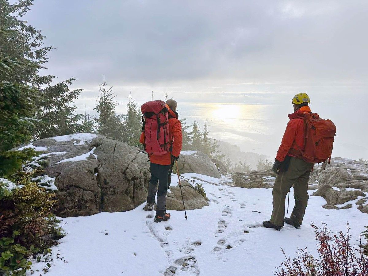
North Shore Rescue responds to calls year round in the mountains above West Vancouver, North Vancouver and the Sea-to-Sky corridor. The team asks people heading into the mountains to check conditions first, tell someone their plans, and carry appropriate gear. Its non-emergency number is 778-338-6338.
What comes next
The BC River Forecast Centre says the heaviest rain is forecast for Tuesday and Wednesday, with lingering rainfall continuing through the rest of the week. It says it will monitor conditions and issue updates as the situation changes.
Residents with questions about local drainage or road conditions can contact the District of West Vancouver through westvancouver.ca. For power outages, BC Hydro takes reports at bchydro.com. If a situation is dangerous, call 911.
The West Vancouver promise tracker on this site records the commitments made by Mayor Kirk LaPointe and the councillors during the campaign. LaPointe wrote in his campaign platform that he would strengthen the long-term plan for shoreline erosion, creek health and stormwater management. The new Council has not yet held its first regular meeting or voted on any stormwater plans.
Questions this story answers
What warning is active for West Vancouver right now?
Environment Canada issued a Rainfall Warning at 5:00 AM Pacific time on Tuesday, November 10, 2026, for the Metro Vancouver North Shore including West Vancouver and North Vancouver. The warning says 60 to 100 mm of rain is expected through late Wednesday night, with amounts possibly reaching 120 mm in the mountains. Winds are forecast to gust to 50 km/h near water, increasing to 60 km/h overnight. The warning is rated Yellow, meaning moderate impact with high forecast confidence.
What is the BC River Forecast Centre Flood Watch for the South Coast?
The BC River Forecast Centre issued a Flood Watch for the South Coast, including Howe Sound and the North Shore Mountains, on Monday November 9, 2026 at 12:36 PM Pacific time. A Flood Watch means that river levels are rising and will approach or may exceed bankfull, and that flooding of areas next to affected rivers may occur. The Centre says rivers may reach flows in the 5-to-10-year range or higher. This is a step up from the High Streamflow Advisory that was in place earlier. West Vancouver has several creeks that flow from the mountains through residential areas before reaching the ocean.
What are the hazards the warnings describe for West Vancouver?
Environment Canada's Rainfall Warning issued November 10, 2026 lists four hazards: water pooling on roads and in low-lying areas, sudden reductions in visibility, landslides in areas with steep slopes, deforested land or recent burn scars, and washouts near rivers, creeks and culverts. The BC River Forecast Centre's Flood Watch adds unstable banks, river erosion, submerged roads and swift water hazards as risks from high streamflow. Smaller rivers and tributaries are described as particularly sensitive to fast-rising water.
What is the difference between a Flood Watch and the earlier High Streamflow Advisory?
The BC River Forecast Centre defines a High Streamflow Advisory as a situation where rivers are rising or expected to rise rapidly but no major flooding is expected. A Flood Watch means river levels are rising and will approach or may exceed bankfull, and that flooding of areas next to affected rivers may occur. The Centre upgraded from an advisory to a Flood Watch for the South Coast, including Howe Sound and the North Shore Mountains, on November 9, 2026 at 12:36 PM Pacific time. This upgrade reflects a higher risk of flooding along affected waterways.
Is the Horseshoe Bay ferry terminal affected by the storms?
As of the morning of Tuesday November 10, 2026, BC Ferries shows no weather-related cancellations or delays at Horseshoe Bay for sailings to Bowen Island, Langdale or Departure Bay. Infrastructure work at Horseshoe Bay and Langdale is ongoing and unrelated to the weather. BC Ferries can adjust service during strong winds. Residents can check current conditions at bcferries.com/current-conditions for updates as the storm develops through Wednesday.
Are West Vancouver Blue Bus or SeaBus services affected by the storm?
As of the morning of Tuesday November 10, 2026, TransLink shows no active service alerts for the West Vancouver Blue Bus routes or the SeaBus. The SeaBus crosses Burrard Inlet and can be affected by strong winds; TransLink posts updates at translink.ca/alerts. Winds are forecast to gust to 60 km/h near water overnight Tuesday, so conditions could change before Wednesday morning commutes.
What should West Vancouver residents do during the Rainfall Warning and Flood Watch?
The BC River Forecast Centre's Flood Watch says to stay away from the banks of fast-running rivers and streams, and to never drive across flooded roads, bridges or river crossings. The advisory also asks residents to keep storm drains clear of leaves, which can clog drains in November and cause water to pool on roads or enter low-lying properties. Environment Canada asks residents to monitor weather.gc.ca, check stream levels at bcrfc.env.gov.bc.ca, and follow DriveBC at drivebc.ca for road conditions on Highway 1 and Highway 99.
When is the Rainfall Warning expected to end for West Vancouver?
Environment Canada's Rainfall Warning issued at 5:00 AM Pacific on November 10, 2026 says it covers the Metro Vancouver North Shore through late Wednesday night, November 11 to 12. The BC River Forecast Centre says the heaviest rain is forecast for Tuesday and Wednesday, with lingering rainfall continuing through the rest of the week. Temperatures are expected to be warm through Wednesday, which the Centre says may also cause additional snowmelt from shallow snowpacks at higher elevations in the mountains above West Vancouver.
What storm conditions are forecast in the mountains above West Vancouver?
Environment Canada's Rainfall Warning says amounts may reach 120 mm in the mountains above the North Shore. This is higher than the 60 to 100 mm forecast for lower elevations. The BC River Forecast Centre says warm temperatures through Wednesday may cause snowmelt from shallow snowpacks at higher elevations, adding to runoff into creeks and rivers. Cypress Mountain sits in the upslope terrain identified by the warnings. North Shore Rescue responds to calls in the West Vancouver mountains year round; its non-emergency line is 778-338-6338.
Sources
The pages this story draws on. Open one to check a claim yourself.
- Environment Canada, Rainfall Warning for Metro Vancouver North Shore including West Vancouver and North Vancouver, issued 5:00 AM PCT November 10, 2026weather.gc.ca
- BC River Forecast Centre, Flood Watch for South Coast including Howe Sound and North Shore Mountains, issued November 9, 2026 at 12:36 PM PCTbcrfc.env.gov.bc.ca
- TransLink service alerts, November 10, 2026translink.ca
- BC Ferries service notices for Horseshoe Bay, November 10, 2026bcferries.com
Found an error? Tell the editors with the corrections form. A correction is noted on the story it changes. Read our standards.