15 days to goBritish Columbia votes on Saturday, October 24, 2026

Get in front of undecided British Columbia voters
MLA · BC PROVINCIAL 2026

Prince George-Valemount.
4 candidates, one seat.

This district elects one MLA. Voters mark one name on Saturday, October 24, 2026, and the candidate with the most votes wins the seat.

Prince George-Valemount is a provincial electoral district in east-central British Columbia. It takes in downtown Prince George and the neighbourhoods around it, then runs east along Highway 16 through the Robson Valley to the Alberta border, and south along the upper North Thompson River valley to Blue River. The 2021 census counted 41,080 people in its 33,427 square kilometres, and 17.7% of them reported an Indigenous identity.

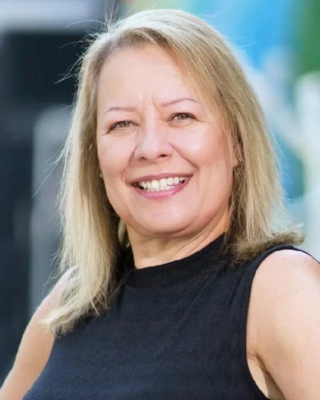
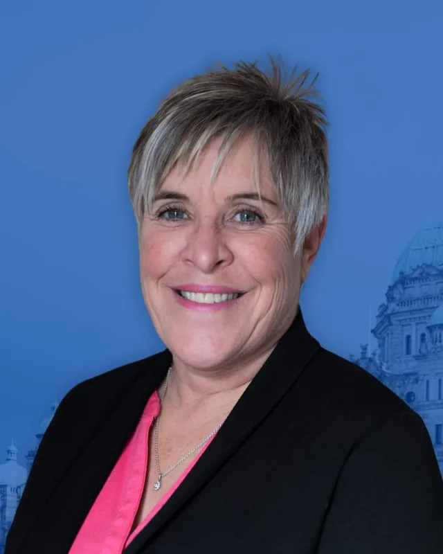
The candidates

In alphabetical order
People, 2021 census
41,080
Area
33,427 km²
Registered voters, 2024
30,564
Turnout, 2024
53.60%
Median age
40.0
Median household income, 2020
$75,000
THE DISTRICT

Where Prince George-Valemount is

33,427 km² · 41,080 people

Prince George-Valemount reaches from the middle of the city of Prince George to the Alberta border. The Electoral Boundaries Commission’s 2023 final report says it includes downtown Prince George and the neighbourhoods of Charella Garden and South Fort George, as well as the northern part of College Heights. The report adds that the district takes in communities of the Robson Valley and the uppermost part of the North Thompson River valley, such as Valemount, McBride, Tête Jaune Cache and Blue River. Its western boundary follows Wells Gray Provincial Park and Electoral Area A of the Regional District of Fraser-Fort George, and the Peace River Regional District lies to the north. The commission gives the area as 33,427 square kilometres and the population as 41,370.

The Prince George Citizen, reporting on the commission’s report of 3 April 2023, wrote that the district holds the central part of the city east of a jagged line that links Ospika Boulevard and Highway 97, together with the land along Highway 16 to the Alberta border. The same article places the part of College Heights south of Highway 16 and Domano Boulevard in Prince George-North Cariboo. Elections BC’s 2024 results list 23 voting places that stand inside the district. Around Prince George they include the Prince George Civic Centre, the John McInnis Centre and the Blackburn, Pineview, Pinewood, Van Bien and Westwood elementary schools. Farther out they include voting places at Ferndale, Willow River, Sinclair Mills, Dome Creek, Dunster, Valemount, Blue River and Avola.

The Encyclopedia of British Columbia describes the Robson Valley as a valley between the Rocky Mountains and the Cariboo Mountains, 5 km wide and 240 km long by its figures, with Valemount and McBride as its main communities. It places McBride 207 km east of Prince George, Tête Jaune Cache 266 km east on the Yellowhead Highway and Valemount 278 km east, near the north end of Kinbasket Lake. Blue River lies on the North Thompson River, 230 km north of Kamloops. On 25 September 2026 the Regional District of Fraser-Fort George began a review of the official community plans for its Electoral Area H, Robson Valley-Canoe, which includes Dunster, Dome Creek, Crescent Spur and Tête Jaune Cache. Those plans were adopted in 2001 and 2006.

  • Downtown Prince George
  • South Fort George
  • Charella Garden
  • College Heights (northern part)
  • Blackburn
  • Ferndale
  • Pineview
  • Willow River
  • Sinclair Mills
  • Dome Creek
  • Dunster
  • McBride
  • Tête Jaune Cache
  • Valemount
  • Blue River
  • Avola

Sources: British Columbia Electoral Boundaries Commission (opens in a new tab), Prince George Citizen (opens in a new tab), Elections BC (opens in a new tab), Encyclopedia of British Columbia (opens in a new tab), Encyclopedia of British Columbia (opens in a new tab), Encyclopedia of British Columbia (opens in a new tab), Encyclopedia of British Columbia (opens in a new tab), Encyclopedia of British Columbia (opens in a new tab), Regional District of Fraser-Fort George (opens in a new tab)

HISTORY

The history of the area

Checked Thursday, October 8, 2026

Lheidli T’enneh, Simpcw and the Robson Valley

The Lheidli T’enneh First Nation says that its traditional territory includes the city of Prince George. The BC Treaty Commission describes that territory as the land around Prince George, including the Nechako and Fraser River basins, stretching east to the Alberta border. The Commission lists Simpcw among nine neighbouring First Nations whose territory overlaps or is shared with that of the Lheidli T’enneh.

Simpcw First Nation says it is one of 17 bands of the Secwe̓pemc, or Shuswap Nation. It calls its territory Simpcwúl̓ecw, gives its area as 5,000,000 hectares and says it extends north to Kakwa Park and east of Jasper, including the whole of the North Thompson Valley. The Encyclopedia of British Columbia names the Secwepemc (Shuswap) and the Dakelh (Carrier) as the peoples of the Robson Valley. The Valemount Museum writes that the name Tête Jaune Cache moved downriver to a periodic settlement of Secwepemc people.

Sources: Lheidli T’enneh First Nation (opens in a new tab), BC Treaty Commission (opens in a new tab), Simpcw First Nation (opens in a new tab), Encyclopedia of British Columbia (opens in a new tab), Valemount Museum (opens in a new tab)

Yellowhead Pass and the Overlanders, 1820 to 1862

BC Geographical Names says that in 1820 Pierre Hatsinaton, a fair-haired free Iroquois nicknamed Tête Jaune (“yellow head”), guided a Hudson’s Bay Company party from St. Mary’s on the Peace River across the Rocky Mountains to the forks of the Fraser River, where he left some of the furs. The office records other names for the same man in older sources, including Pierre Bostonais and Francois Decoigne. Parks Canada writes that the company used Yellowhead Pass from the mid 1820s to the early 1850s, mainly to carry leather from the Saskatchewan District to its posts in New Caledonia. The Encyclopedia of British Columbia puts the pass 1,131 m above sea level on the British Columbia and Alberta border, 25 km west of Jasper.

In 1862 the Overlanders crossed by the same pass on their way to the Cariboo gold fields. The Canadian Encyclopedia writes that a band of Secwepemc gave the party provisions at Tête Jaune Cache, and that the party split there on 1 September 1862. A small group rafted down the North Thompson River to Kamloops, and the rest went down the Fraser River to Fort George. Parks Canada’s plaque text records that the majority went down the Fraser and others followed the North Thompson.

Sources: BC Geographical Names Office (opens in a new tab), Parks Canada (opens in a new tab), Encyclopedia of British Columbia (opens in a new tab), The Canadian Encyclopedia (opens in a new tab), Parks Canada (opens in a new tab)

Tête Jaune Cache during railway building, 1911 to 1916

The Encyclopedia of British Columbia says the modern community of Tête Jaune Cache was set up in 1911 during construction of the Grand Trunk Pacific Railway, at the place where the Fraser River leaves the mountains. The Valemount Museum says that between 1911 and 1913 it was the largest settlement west of Winnipeg, that it estimates its population at 3,000, and that most buildings were canvas tents. By 1913, the museum adds, three sternwheelers carried supplies and passengers down the Fraser River.

The same museum records that the river reached a record height in 1913 and washed away the peninsula on which the centre of the town stood. A forest fire destroyed all the houses at the mile 53 townsite, where engineers and surveyors had lived, in 1916, after the town had been deserted. BC Geographical Names gives the post office dates: Tete Jaune opened on 23 April 1912 and closed on 15 January 1917. A second office called Henningville, opened on 1 June 1913 at a site 3 miles southeast along the railway, took the name Tete Jaune Cache on 1 July 1917 and closed on 20 January 1967.

Sources: Encyclopedia of British Columbia (opens in a new tab), Valemount Museum (opens in a new tab), BC Geographical Names Office (opens in a new tab)

Stations of the Fraser and North Thompson valleys, 1913 to 1932

Railway building created most of the towns between Prince George and the Alberta border. BC Geographical Names says the Dunster station was built in 1913 and named by a Grand Trunk Pacific inspector after his home town in England, and that the post office opened in December 1915. McBride began as a station of the same railway. The village says it was founded in 1913 as Mile 90, incorporated in 1932 and named after Premier Sir Richard McBride, and BC Geographical Names records that its post office opened on 15 February 1914.

At Dome Creek the railway built its Second Crossing bridge over the Fraser River just west of the community. BC Geographical Names says the population may have reached 2,000 during that work and was recorded as 150 in 1921. On the North Thompson River a post office opened at Avola in 1913 during construction of the Canadian National line. The place had been Stillwater Flats, and the railway chose the name of a town in Sicily because another Stillwater post office already existed in the province. The Blue River post office opened on 1 March 1917.

Sources: BC Geographical Names Office (opens in a new tab), BC Geographical Names Office (opens in a new tab), Village of McBride (opens in a new tab), Encyclopedia of British Columbia (opens in a new tab), BC Geographical Names Office (opens in a new tab), BC Geographical Names Office (opens in a new tab), BC Geographical Names Office (opens in a new tab)

Swift Creek becomes Valemount, 1906 to 1962

The Valemount Museum says Fulton Alexander McKirdy staked the first homestead in the Valemount area in 1906, and that a station was built at Swift Creek when the railway came through Yellowhead Pass in 1914. Logging, a tie-cutting camp and trapping supported a small town with a store, a post office, a hotel and a school. In 1927 the Canadian National Railway moved the station farther along the line and the town took the name Valemount.

BC Geographical Names quotes a railway letter of 2 November 1927 saying that Valemount is a coined word, suggested by a station set in a valley within the mountains. The post office, opened at Cranberry Lake on 1 August 1913, became Swift Creek in 1918 and Valemount in 1928 or 1929. Valemount was incorporated as a village municipality on 13 December 1962. The old station, moved to Main Street and restored over five years, opened as the Valemount Museum in 1992.

Sources: Valemount Museum (opens in a new tab), BC Geographical Names Office (opens in a new tab), Encyclopedia of British Columbia (opens in a new tab)

Three rival townsites and the plan for downtown Prince George, 1908 to 1975

BC Geographical Names says that in 1908 George Hammond formed the Natural Resources Security Company and began Central Fort George near the Nechako River. In 1910 a rival town, South Fort George, was laid out on the Fraser River 3 miles south of the old fort. The Grand Trunk Pacific bought Indian Reserve No. 1 for its own townsite, and when the first passenger train arrived on 30 January 1914, BC Geographical Names writes, the town of Prince George was little more than a clearing. The South Fort George post office ran from 1910 to 1959, and the city boundary extended on 1 January 1975 to take in the former village. The South Fort George schoolhouse opened in 1910 with 28 students and was the first in the region, according to The Exploration Place. The City’s Heritage Register lists a house built in 1912 as one of four that remain from before the First World War in South Fort George.

The City of Prince George says the railway company hired the American firm Brett, Hall & Co. to design its town. The plan was drawn in Boston in autumn 1912 and marked out on the ground by surveyor Fred Burden in spring 1913. It used curved and diagonal streets, and it set a railway station and a hotel at the north end of George Street and City Hall in Princess Square at the south end. The present City Hall opened in January 1967 on the same site. The City lists Veterans Plaza, in front of City Hall at 1100 Patricia Boulevard, among its downtown parks.

Sources: BC Geographical Names Office (opens in a new tab), The Exploration Place (opens in a new tab), City of Prince George (opens in a new tab), City of Prince George (opens in a new tab), City of Prince George (opens in a new tab)

Park, pavilion and plaque, 2015 to 2022

Western Economic Diversification Canada wrote on 24 February 2017 that the City renamed Fort George Park in 2015 to recognize the Lheidli T’enneh village that stood on the site before the railway and the City. The department announced $377,000 toward a pavilion in the park, built with the Lheidli T’enneh First Nation. The City lists the opening of the Lheidli T’enneh Pavilion in 2018 and the signing in 2017 of a memorandum of understanding on cooperation and communication between the City, the Lheidli T’enneh First Nation and the Regional District of Fraser-Fort George.

On 21 September 2022 Chief Dolleen Logan and the Lheidli T’enneh First Nation Council presented City Council with a territorial acknowledgement plaque for City Hall. Its text is etched in English and Dakelh and reads: “We respectfully acknowledge the unceded ancestral lands of the Lheidli T'enneh, on whose land we live, work, and play.” The City said that future Council meetings would open with a land acknowledgement statement.

Sources: Western Economic Diversification Canada (opens in a new tab), City of Prince George (opens in a new tab)

The Wood Innovation and Design Centre, 2013 to 2014

On 15 November 2013 the Province reported that construction of the Wood Innovation and Design Centre in downtown Prince George was on time and on budget, with completion expected in the fall of 2014. It said the Province was investing $25.1 million and that the design-build team was working with 13 British Columbia companies. The building uses glulam columns and beams, cross-laminated timber and laminated veneer lumber, all produced in the province.

Canadian Consulting Engineer reported on 4 November 2014 that the centre had officially opened the week before, with six storeys and a mechanical penthouse reaching 29.3 metres. The magazine called it the tallest contemporary wood building in North America. The article says the University of Northern British Columbia would occupy the first three floors, and the university lists the Master of Engineering in Integrated Wood Design as based there. The City lists Wood Innovation Square, at 499 George Street, beside the centre.

Sources: Province of British Columbia (opens in a new tab), Canadian Consulting Engineer (opens in a new tab), University of Northern British Columbia (opens in a new tab), City of Prince George (opens in a new tab)

THE SEAT

Who has held the seat

Legislative Assembly records, 39th Parliament onward

Elections BC’s volume for 1987 to 2001 lists the Electoral Districts Act (SBC 1990 c. 39), assented to on 27 July 1990, as setting 75 single-member districts for the 1991 general election. The district first appears there as Prince George-Mount Robson. Lois Boone of the New Democratic Party won it in 1991 with 5,751 votes (50.99%) and in 1996 with 4,713 votes (40.67%). Shirley Bond of the Liberal Party won it in 2001 with 8,033 votes (55.72%). The 2002 to 2013 volume shows Bond winning Prince George-Mount Robson again in 2005 with 5,885 votes (41.06%).

The Electoral Districts Act of 2008 (SBC 2008 c. 14) received royal assent on 1 May 2008, raised the number of districts from 79 to 85 and applied from the 2009 general election. That is the first election in which Elections BC’s history prints the name Prince George-Valemount. Bond won it for the BC Liberal Party in 2009 with 9,072 votes (50.61%), in 2013 with 11,291 (56.95%), in 2017 with 11,209 (58.20%) and in 2020 with 9,703 (55.62%). The legislature’s record lists her for the district from the 37th Parliament, which began on 19 June 2001, to the end of the 42nd Parliament on 21 September 2024. In 2024 Rosalyn Bird of the Conservative Party won with 9,018 votes (55.19%), ahead of Clay Pountney of the BC NDP with 5,709 (34.94%) and Gwen Johansson of the BC Green Party with 1,612 (9.87%). Turnout was 53.6% of 30,564 registered voters.

The commission’s 2023 report raised the number of districts from 87 to 93. Its table of the 87 current districts gives Prince George-Valemount 50,059 people in 31,467 square kilometres, 12.9% below the average district. Its table of the proposed districts gives the new one 41,370 people in 33,427 square kilometres, 23.1% below the average. The Citizen wrote that the city had been shared between Prince George-Mackenzie and Prince George-Valemount and that the report divides it among three districts. Elections BC’s conversion table shows that of the district’s 65 voting areas, 55 come from the earlier Prince George-Valemount, 10 from Prince George-Mackenzie and 2 from Kamloops-North Thompson.

Sources: Elections BC (opens in a new tab), Elections BC (opens in a new tab), Elections BC (opens in a new tab), Legislative Assembly of British Columbia (opens in a new tab), British Columbia Electoral Boundaries Commission (opens in a new tab), Prince George Citizen (opens in a new tab), Elections BC (opens in a new tab)

Members for Prince George-Valemount
ParliamentIt satMemberElected asParty on the legislature’s record
43rd2025 to 2026Rosalyn BirdConservative PartyIndependent
42nd2020 to 2024Shirley BondBC Liberal PartyBC United
41st2017 to 2020Shirley BondBC Liberal PartyBC Liberal Party
40th2013 to 2017Shirley BondBC Liberal PartyBC Liberal Party
39th2009 to 2013Shirley BondBC Liberal PartyBC Liberal Party

“Elected as” is the affiliation Elections BC printed with the winning result. The last column is the party the legislature’s records give for that parliament, which differs when a member changed party while in office. A row with that column empty is a winner Elections BC prints whom the legislature’s records leave out. Source: Legislative Assembly of British Columbia (opens in a new tab)

Boundaries since 2024

Prince George-Valemount has 65 voting areas. 55 of them overlap the district of the same name used from 2017 to 2024.Others overlap these districts from 2017 to 2024: Prince George-Mackenzie (10), Kamloops-North Thompson (2).

The commission that drew the boundaries counted 41,370 people in the district, 23.1% below the average for a district, over 33,427 km².

Sources: British Columbia Electoral Boundaries Commission, Final report, April 3, 2023 (opens in a new tab), Elections BC, Voting area conversion table, 2017 to 2024 (opens in a new tab)

PAST RESULTS

Every result since 2009

From Elections BC
2024 Provincial General ElectionRosalyn Bird, Conservative Party, 55.19%
CandidateAffiliationVotesShare
Rosalyn BirdElectedConservative Party9,01855.19%
Clay PountneyBC NDP5,70934.94%
Gwen JohanssonBC Green Party1,6129.87%

16,339 valid votes · 43 rejected ballots · 30,564 registered voters · 53.60% voted

2020 General ElectionShirley Bond, BC Liberal Party, 55.62%
CandidateAffiliationVotesShare
Shirley BondElectedBC Liberal Party9,70355.62%
Laura ParentBC NDP4,71727.04%
MacKenzie KerrBC Green Party2,59714.89%
Sean RobsonLibertarian4282.45%

17,445 valid votes · 110 rejected ballots

2017 General ElectionShirley Bond, BC Liberal Party, 58.20%
CandidateAffiliationVotesShare
Shirley BondElectedBC Liberal Party11,20958.20%
Natalie FletcherBC NDP5,69429.57%
Nan KendyBC Green Party2,35612.23%

19,259 valid votes · 154 rejected ballots

2013 General ElectionShirley Bond, BC Liberal Party, 56.95%
CandidateAffiliationVotesShare
Shirley BondElectedBC Liberal Party11,29156.95%
Sherry OgasawaraBC NDP7,11635.89%
Nathan GiedeConservative1,1055.57%
Donald A. RobertsChristian Heritage Party of B.C.3141.58%

19,826 valid votes · 214 rejected ballots

2009 General ElectionShirley Bond, BC Liberal Party, 50.61%
CandidateAffiliationVotesShare
Shirley BondElectedBC Liberal Party9,07250.61%
Julie CarewBC NDP6,73737.58%
Andrej Joseph DeWolfBC Green Party1,2256.83%
Gordon Wilfred DickieConservative7804.35%
Don RobertsBC Refed1130.63%

17,927 valid votes · 114 rejected ballots

The boundaries changed before the 2009, 2017 and 2024 elections, so a result under the same name can cover a different area. Sources: Elections BC, Provincial Voting Results (opens in a new tab), Statement of Votes, 2024 Provincial General Election (opens in a new tab)

PEOPLE · 2021 CENSUS

Who lives in Prince George-Valemount

41,080 residents · British Columbia beside each figure

Age

Median age
40.0BC 42.8
  • Under 1514.9%BC 14.3%
  • 15 to 6467.0%BC 65.3%
  • 65 and over18.1%BC 20.3%
  • 85 and over2.0%BC 2.4%

Households

Households
18,010
People per household
2.2BC 2.4

Who lives together

  • Couples with children17.0%BC 22.7%
  • Couples without children24.0%BC 26.4%
  • One-parent families9.5%BC 7.6%
  • Multigenerational households2.1%BC 3.7%
  • People living alone34.7%BC 29.4%

Household size

  • 1 person34.7%BC 29.4%
  • 2 persons35.1%BC 35.3%
  • 3 persons13.7%BC 14.5%
  • 4 persons10.2%BC 12.6%
  • 5 or more persons6.3%BC 8.2%

Homes

Median home value
$348,000BC $785,000
Median monthly rent and utilities
$980BC $1,370
Median monthly cost for owners
$1,050BC $1,320

Own or rent

  • Own their home59.6%BC 66.8%
  • Rent their home40.4%BC 32.8%

Type of home

  • Single-detached house52.5%BC 42.4%
  • Semi-detached house4.3%BC 3.1%
  • Row house6.3%BC 8.3%
  • Apartment or flat in a duplex8.7%BC 12.2%
  • Apartment in a building that has fewer than five storeys19.7%BC 20.4%
  • Apartment in a building that has five or more storeys3.2%BC 10.9%
  • Other single-attached house0.1%BC 0.2%
  • Movable dwelling5.2%BC 2.5%

When the home was built

  • 1960 or earlier16.9%BC 12.5%
  • 1961 to 198049.0%BC 27.0%
  • 1981 to 199011.5%BC 14.2%
  • 1991 to 200011.9%BC 16.5%
  • 2001 to 20052.3%BC 6.0%
  • 2006 to 20102.5%BC 8.0%
  • 2011 to 20152.7%BC 6.6%
  • 2016 to 20213.3%BC 9.1%

Housing costs

  • Renters paying 30% or more of income on housing30.1%BC 37.8%
  • Owners paying 30% or more of income on housing9.9%BC 19.3%
  • Renters in core housing need19.4%BC 24.7%
  • Owners in core housing need3.9%BC 8.0%
  • Renters in subsidized housing14.3%BC 11.0%
  • Owners with a mortgage58.8%BC 57.5%

Income

Income is for the year 2020.

Median household income
$75,000BC $85,000
After tax
$68,000BC $76,000
Median income per person
$40,000BC $40,800

Living on a low income (after-tax measure)

  • All ages12.5%BC 10.8%
  • Under 1816.3%BC 11.3%
  • 18 to 6410.4%BC 9.7%
  • 65 and over16.1%BC 13.8%

Languages

First language learned

  • English85.5%BC 67.1%
  • Punjabi (Panjabi)3.6%BC 4.9%
  • French1.2%BC 1.2%
  • Tagalog (Pilipino, Filipino)1.0%BC 1.7%
  • German0.9%BC 1.0%
  • Spanish0.4%BC 1.2%
  • Italian0.3%BC 0.4%
  • Dutch0.3%BC 0.4%
  • Portuguese0.3%BC 0.5%
  • Yue (Cantonese)0.2%BC 3.9%

Spoken most often at home

  • English91.9%BC 78.5%
  • Punjabi (Panjabi)2.6%BC 3.8%
  • Tagalog (Pilipino, Filipino)0.5%BC 0.9%
  • Hindi0.3%BC 0.3%
  • German0.2%BC 0.1%
  • French0.2%BC 0.3%
  • Vietnamese0.2%BC 0.4%
  • Mandarin0.1%BC 3.3%

English and French

  • English only94.7%BC 90.1%
  • English and French4.8%BC 6.6%
  • Neither English nor French0.5%BC 3.3%

Immigration

Born outside Canada (immigrants)
11.1%BC 29.0%
Non-permanent residents
3.1%BC 3.5%

Where immigrants were born

  • India17.6%BC 13.8%
  • Philippines16.3%BC 9.2%
  • United Kingdom9.6%BC 8.2%
  • United States of America9.4%BC 4.2%
  • Germany6.2%BC 2.2%
  • Netherlands3.1%BC 1.1%
  • Poland2.5%BC 1.0%
  • China2.2%BC 15.3%
  • Portugal1.9%BC 0.5%
  • Italy1.8%BC 0.9%

When immigrants arrived

  • Arrived before 198035.7%BC 19.7%
  • 1980 to 19909.7%BC 11.5%
  • 1991 to 200012.3%BC 21.0%
  • 2001 to 201014.4%BC 22.2%
  • 2011 to 202128.0%BC 25.6%

Generations in Canada

  • First generation14.8%BC 33.7%
  • Second generation15.5%BC 21.7%
  • Third generation or more69.7%BC 44.5%

Identity and origins

Indigenous identity
17.7%BC 5.9%
Visible minority
12.6%BC 34.4%

Visible minority groups

  • South Asian5.9%BC 9.6%
  • Filipino2.7%BC 3.5%
  • Black1.1%BC 1.3%
  • Chinese1.0%BC 11.2%
  • Southeast Asian0.4%BC 1.5%
  • Japanese0.4%BC 0.9%
  • Latin American0.4%BC 1.3%
  • Multiple visible minorities0.3%BC 1.2%
  • Korean0.2%BC 1.5%
  • West Asian0.1%BC 1.4%
  • Visible minority (other)0.1%BC 0.4%
  • Arab0.0%BC 0.6%

Ethnic or cultural origins reported most often

  • English23.2%BC 20.7%
  • Scottish18.2%BC 15.8%
  • German16.3%BC 11.0%
  • Irish15.4%BC 12.8%
  • Canadian13.2%BC 9.3%
  • French10.8%BC 6.4%
  • Ukrainian5.5%BC 4.3%
  • First Nations (North American Indian)5.1%BC 2.1%
  • Métis5.0%BC 1.7%
  • Norwegian4.4%BC 2.8%

Religion

  • No religion59.1%BC 52.1%
  • Christian34.0%BC 34.3%
  • Sikh3.9%BC 5.9%
  • Hindu1.0%BC 1.7%
  • Other religions0.9%BC 1.0%
  • Muslim0.5%BC 2.6%
  • Buddhist0.3%BC 1.7%
  • Traditional Indigenous spirituality0.2%BC 0.2%
  • Jewish0.1%BC 0.5%

Education

Highest level completed, ages 25 to 64.

  • No certificate, diploma or degree13.5%BC 8.0%
  • High school diploma33.6%BC 25.8%
  • College, trades or other certificate below a bachelor’s degree32.5%BC 31.2%
  • Bachelor’s degree or higher20.4%BC 35.0%

Work

In the labour force
63.6%BC 63.3%
Employed
57.5%BC 57.9%
Unemployment rate at the census
9.7%BC 8.4%

Industries with the most workers

  • Health care and social assistance13.8%BC 12.3%
  • Retail trade12.4%BC 11.6%
  • Accommodation and food services9.3%BC 7.0%
  • Construction8.7%BC 9.0%
  • Transportation and warehousing7.0%BC 5.5%
  • Manufacturing6.7%BC 5.9%
  • Educational services6.6%BC 7.4%
  • Public administration6.0%BC 5.5%

Kinds of work

  • Sales and service occupations29.5%BC 25.6%
  • Trades, transport and equipment operators and related occupations22.8%BC 18.0%
  • Business, finance and administration occupations13.5%BC 17.1%
  • Occupations in education, law and social, community and government services11.7%BC 11.9%
  • Health occupations6.9%BC 7.7%
  • Natural and applied sciences and related occupations5.6%BC 8.0%
  • Occupations in manufacturing and utilities4.3%BC 3.4%
  • Natural resources, agriculture and related production occupations3.5%BC 2.8%
  • Occupations in art, culture, recreation and sport1.8%BC 4.2%
  • Legislative and senior management occupations0.7%BC 1.2%

Getting to work

Where people worked

  • Worked at home11.4%BC 22.6%
  • Worked outside Canada0.1%BC 0.4%
  • No fixed workplace address15.5%BC 15.3%
  • Worked at a usual workplace73.1%BC 61.6%

How commuters travelled

  • Car, truck or van86.0%BC 79.9%
  • Public transit3.9%BC 9.3%
  • On foot6.6%BC 6.5%
  • Bicycle1.3%BC 2.0%
  • Other method2.2%BC 2.3%

Length of the trip

  • Less than 15 minutes55.1%BC 31.8%
  • 15 to 29 minutes32.8%BC 34.0%
  • 30 to 44 minutes5.8%BC 19.7%
  • 45 to 59 minutes2.4%BC 7.3%
  • 60 minutes and over3.9%BC 7.2%

Moving

Where residents lived five years before the census.

  • Lived at the same address52.7%BC 56.2%
  • Moved within the same municipality25.1%BC 16.1%
  • Moved from elsewhere in BC13.8%BC 17.0%
  • Moved from another province4.4%BC 4.6%
  • Moved from another country4.0%BC 6.1%

Counts in the census are rounded to the nearest 5, and shares are worked out from those counts. Source: BC Stats, from Statistics Canada tabulations, 2021 Census Profile for BC Provincial Electoral Districts (2023 Redistribution) (opens in a new tab)

QUESTIONS

Questions about Prince George-Valemount

10 answers

Where is the Prince George-Valemount electoral district?

Prince George-Valemount lies in east-central British Columbia. It runs from downtown Prince George east along Highway 16 to the Alberta border and takes in the Robson Valley and the upper North Thompson River valley. The Electoral Boundaries Commission gives its area as 33,427 square kilometres. Its northern boundary is the Peace River Regional District, and its western boundary follows Wells Gray Provincial Park.

Which communities are in Prince George-Valemount?

Prince George-Valemount includes downtown Prince George, the neighbourhoods of Charella Garden and South Fort George and the northern part of College Heights. East and south of the city it includes Valemount, McBride, Tête Jaune Cache and Blue River, on the commission’s description. Elections BC’s 2024 results also place voting halls at Willow River, Sinclair Mills, Dome Creek, Dunster and Avola inside it.

Who is the MLA for Prince George-Valemount?

Rosalyn Bird is the member of the Legislative Assembly for Prince George-Valemount. She won the 2024 provincial election for the Conservative Party with 9,018 votes, which was 55.19% of the valid votes. Clay Pountney of the BC NDP received 5,709 votes and Gwen Johansson of the BC Green Party received 1,612.

Who held the Prince George-Valemount seat before Rosalyn Bird?

Shirley Bond held the seat before Rosalyn Bird. She won it in 2009, 2013, 2017 and 2020, and the legislature’s record lists her for the district until the end of the 42nd Parliament on 21 September 2024. She had also won the earlier district of Prince George-Mount Robson in 2001 and 2005.

How did Prince George-Valemount vote in 2024?

In the 2024 provincial general election, 16,339 valid votes were counted in Prince George-Valemount and 43 ballots were rejected. Turnout was 53.6% of the 30,564 registered voters. Rosalyn Bird of the Conservative Party was elected with 9,018 votes, 55.19% of the valid votes, ahead of Clay Pountney of the BC NDP with 5,709 votes.

How did the 2023 boundary change affect Prince George-Valemount?

The commission’s 2023 report reduced Prince George-Valemount from 50,059 people to 41,370 and enlarged it from 31,467 to 33,427 square kilometres. The report also divided the city of Prince George among three districts where there had been two. Of the 65 voting areas in the new district, 55 came from the earlier Prince George-Valemount, 10 from Prince George-Mackenzie and 2 from Kamloops-North Thompson.

Who lives in Prince George-Valemount?

The 2021 census counted 41,080 people in Prince George-Valemount. The median age was 40, compared with 42.8 for British Columbia, and the median household income was $75,000. Of residents, 17.7% reported an Indigenous identity, which is 7,030 people, and 11.1% were immigrants. The census counted 59.6% of households as owners of their homes.

Whose territory is Prince George-Valemount on?

The Lheidli T’enneh First Nation says its traditional territory includes the city of Prince George, and the BC Treaty Commission says it stretches east to the Alberta border. Simpcw First Nation describes its territory, Simpcwúl̓ecw, as reaching north to Kakwa Park and east of Jasper. The Encyclopedia of British Columbia names the Secwepemc and the Dakelh as the peoples of the Robson Valley.

What is the history of Tête Jaune Cache in Prince George-Valemount?

Tête Jaune Cache is a community on the Yellowhead Highway where the Fraser River leaves the mountains. The Encyclopedia of British Columbia says it was set up in 1911 during construction of the Grand Trunk Pacific Railway. The Valemount Museum says that between 1911 and 1913 it was the largest settlement west of Winnipeg, and that a flood in 1913 washed away part of the town.

When was the name Prince George-Valemount first used for a district?

The name Prince George-Valemount first appears in Elections BC’s electoral history at the 2009 general election. The Electoral Districts Act of 2008 raised the number of seats from 79 to 85 for that election. Shirley Bond of the BC Liberal Party won the district with 9,072 votes. The earlier name was Prince George-Mount Robson, used from 1991 to 2005.
SOURCES

Where this page comes from

Figures read Thursday, October 8, 2026
  1. 2021 Census Profile for BC Provincial Electoral Districts (2023 Redistribution) (opens in a new tab)BC Stats, from Statistics Canada tabulations · read Thursday, October 8, 2026
  2. Provincial Voting Results (opens in a new tab)Elections BC · read Thursday, October 8, 2026
  3. Statement of Votes, 2024 Provincial General Election (opens in a new tab)Elections BC · read Thursday, October 8, 2026
  4. Voting area conversion table, 2017 to 2024 (opens in a new tab)Elections BC · read Thursday, October 8, 2026
  5. Final report, April 3, 2023 (opens in a new tab)British Columbia Electoral Boundaries Commission · read Thursday, October 8, 2026
  6. Members of the Legislative Assembly, 35th to 43rd Parliament (opens in a new tab)Legislative Assembly of British Columbia · read Thursday, October 8, 2026
  7. Final report, April 3, 2023 (opens in a new tab)British Columbia Electoral Boundaries Commission · read Thursday, October 8, 2026
  8. Provincial general election results by voting area, 2024 (opens in a new tab)Elections BC · read Thursday, October 8, 2026
  9. Voting area conversion table, 2017 to 2024 districts to 2024 districts (opens in a new tab)Elections BC · read Thursday, October 8, 2026
  10. Electoral History of British Columbia, Supplement, 1987 to 2001 (opens in a new tab)Elections BC · read Thursday, October 8, 2026
  11. Electoral History of British Columbia, Supplement, 2002 to 2013 (opens in a new tab)Elections BC · read Thursday, October 8, 2026
  12. Members of the Legislative Assembly (opens in a new tab)Legislative Assembly of British Columbia · read Thursday, October 8, 2026
  13. About Us (opens in a new tab)Simpcw First Nation · read Thursday, October 8, 2026
  14. Our Story (opens in a new tab)Lheidli T’enneh First Nation · read Thursday, October 8, 2026
  15. Lheidli T’enneh First Nation (opens in a new tab)BC Treaty Commission · read Thursday, October 8, 2026
  16. Robson Valley (opens in a new tab)Encyclopedia of British Columbia · read Thursday, October 8, 2026
  17. Tête Jaune Cache (opens in a new tab)Encyclopedia of British Columbia · read Thursday, October 8, 2026
  18. Yellowhead Pass (opens in a new tab)Encyclopedia of British Columbia · read Thursday, October 8, 2026
  19. Valemount (opens in a new tab)Encyclopedia of British Columbia · read Thursday, October 8, 2026
  20. McBride (opens in a new tab)Encyclopedia of British Columbia · read Thursday, October 8, 2026
  21. Blue River (opens in a new tab)Encyclopedia of British Columbia · read Thursday, October 8, 2026
  22. Tête Jaune Cache, community (opens in a new tab)BC Geographical Names Office · read Thursday, October 8, 2026
  23. Valemount, village (opens in a new tab)BC Geographical Names Office · read Thursday, October 8, 2026
  24. McBride, village (opens in a new tab)BC Geographical Names Office · read Thursday, October 8, 2026
  25. Dunster, community (opens in a new tab)BC Geographical Names Office · read Thursday, October 8, 2026
  26. Dome Creek, community (opens in a new tab)BC Geographical Names Office · read Thursday, October 8, 2026
  27. Avola, community (opens in a new tab)BC Geographical Names Office · read Thursday, October 8, 2026
  28. Blue River, community (opens in a new tab)BC Geographical Names Office · read Thursday, October 8, 2026
  29. Prince George, city (opens in a new tab)BC Geographical Names Office · read Thursday, October 8, 2026
  30. Yellowhead Pass National Historic Site of Canada (opens in a new tab)Parks Canada · read Thursday, October 8, 2026
  31. Overlanders of 1862 National Historic Event (opens in a new tab)Parks Canada · read Thursday, October 8, 2026
  32. Overlanders of 1862 (opens in a new tab)The Canadian Encyclopedia · read Thursday, October 8, 2026
  33. Tête Jaune Cache History (opens in a new tab)Valemount Museum · read Thursday, October 8, 2026
  34. Valemount History (opens in a new tab)Valemount Museum · read Thursday, October 8, 2026
  35. About McBride (opens in a new tab)Village of McBride · read Thursday, October 8, 2026
  36. Official community plan review launches for Electoral Area H, September 25, 2026 (opens in a new tab)Regional District of Fraser-Fort George · read Thursday, October 8, 2026
  37. Report calls for Prince George to have three MLAs, April 3, 2023 (opens in a new tab)Prince George Citizen · read Thursday, October 8, 2026
  38. History of Prince George (opens in a new tab)City of Prince George · read Thursday, October 8, 2026
  39. Heritage Register & Properties (opens in a new tab)City of Prince George · read Thursday, October 8, 2026
  40. Downtown Parks (opens in a new tab)City of Prince George · read Thursday, October 8, 2026
  41. Lheidli T’enneh presents territorial acknowledgement plaque to City, September 22, 2022 (opens in a new tab)City of Prince George · read Thursday, October 8, 2026
  42. South Fort George Schoolhouse (opens in a new tab)The Exploration Place · read Thursday, October 8, 2026
  43. Government of Canada Invests $377,000 in Improvements to Prince George’s Premier Park, February 24, 2017 (opens in a new tab)Western Economic Diversification Canada · read Thursday, October 8, 2026
  44. Wood Innovation and Design Centre on time, on budget, November 15, 2013 (opens in a new tab)Province of British Columbia · read Thursday, October 8, 2026
  45. Canada’s tallest wood building opens as showpiece in Prince George, November 4, 2014 (opens in a new tab)Canadian Consulting Engineer · read Thursday, October 8, 2026
  46. The Wood Innovation and Design Centre (opens in a new tab)University of Northern British Columbia · read Thursday, October 8, 2026

Official information

From Elections BC
CORRECTIONS

Report a problem on this page.

Tell the editors what is wrong and where the correct information can be checked. The page you are on is attached automatically.