15 days to goBritish Columbia votes on Saturday, October 24, 2026

Get in front of undecided British Columbia voters
MLA · BC PROVINCIAL 2026

Prince George-North Cariboo.
3 candidates, one seat.

This district elects one MLA. Voters mark one name on Saturday, October 24, 2026, and the candidate with the most votes wins the seat.

Prince George-North Cariboo is a provincial electoral district in the centre of British Columbia. It takes in the southern part of the city of Prince George, the communities along Highway 97 down to Quesnel, and the old gold country around Wells, Likely and Horsefly. The Electoral Boundaries Commission counted 43,265 people in its 41,740 square kilometres, and 13.4% of residents reported an Indigenous identity in the 2021 census.

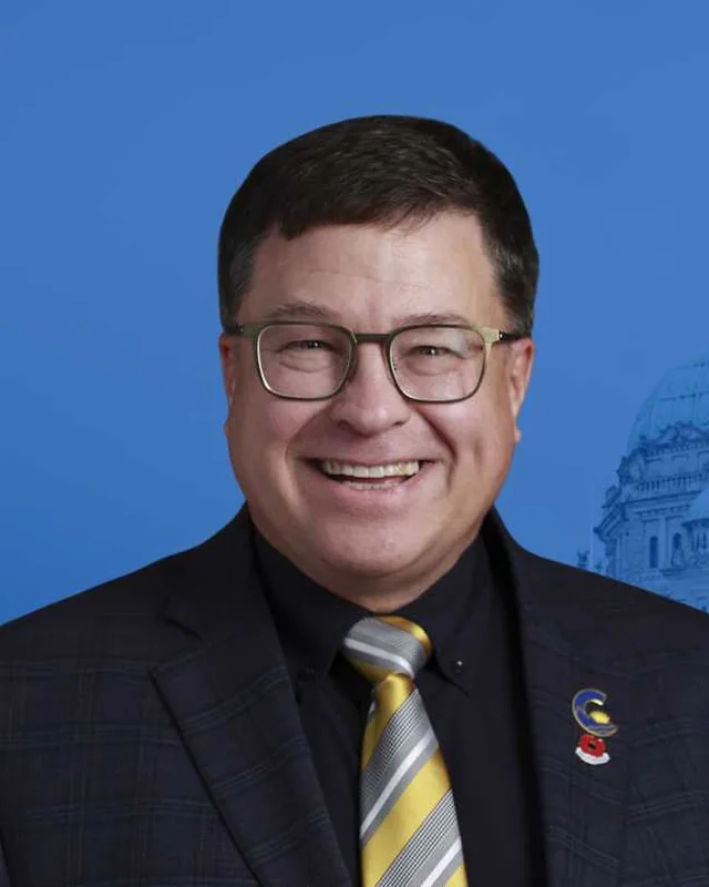
The candidates

In alphabetical order
People, 2021 census
43,530
Area
41,740 km²
Registered voters, 2024
33,572
Turnout, 2024
59.97%
Median age
44.4
Median household income, 2020
$84,000
THE DISTRICT

Where Prince George-North Cariboo is

41,740 km² · 43,530 people

Prince George-North Cariboo lies in the centre of British Columbia and covers 41,740 square kilometres. The Electoral Boundaries Commission describes it as the southern part of the city of Prince George, including most of the College Heights neighbourhood, together with communities along Highway 97 such as Quesnel, Stoner, Hixon and Marguerite. The Cariboo Regional District lies to the west. Wells, Likely and Horsefly are in the east. The northern boundary follows the Yellowhead Highway (Highway 16) and the Fraser River. The southern boundary runs to the municipal boundary of the City of Williams Lake and the boundary of Cariboo Regional District Electoral Area F.

Elections BC's results file for the 2024 election lists 24 voting places that stood inside the district. They include the Quesnel Arts and Recreation Centre, Wells Community Hall, Likely Community Hall, Horsefly Elementary-Junior Secondary School, Nazko Valley Community Centre, Hixon Elementary School and École Red Bluff Lhtako Elementary. The same list names halls and fire departments at Kersley, Bouchie Lake, Barlow Creek, Big Lake, Buckhorn, Wildwood, McLeese Lake and Miocene.

Highway 97 joins the southern end of Prince George to Quesnel, which the Encyclopedia of British Columbia places 117 km south of the city. Hixon sits halfway between the two, and Wells is 80 km east of Quesnel. The commission's report says the main highways of the Cariboo cross a high plateau with harsh weather, and that many remote communities depend on them and have no other route. The Pacific Great Eastern railway, now owned by CN, reached Quesnel in 1921 and Prince George in 1952.

  • College Heights
  • Wildwood
  • Buckhorn
  • Stoner
  • Hixon
  • Marguerite
  • Quesnel
  • Dragon Lake
  • Bouchie Lake
  • Barlow Creek
  • Big Lake
  • Kersley
  • McLeese Lake
  • Miocene
  • Wells
  • Likely
  • Horsefly
  • Nazko
  • Nazko First Nation
  • Red Bluff (Lhtako Dene Nation)

Sources: British Columbia Electoral Boundaries Commission (opens in a new tab), Elections BC (opens in a new tab), Encyclopedia of British Columbia (opens in a new tab), Encyclopedia of British Columbia (opens in a new tab), BC Geographical Names Office (opens in a new tab), BC Geographical Names Office (opens in a new tab), The Canadian Encyclopedia (opens in a new tab), Clinton and District Historical and Cultural Museum (opens in a new tab)

HISTORY

The history of the area

Checked Thursday, October 8, 2026

Dakelh and Secwepemc homelands

The City of Quesnel says it recognizes the long-standing and ongoing connection of the Southern Dakelh and Tsilhqot'in Peoples to this region, and it names the territory as that of the Lhtako Dene, Nazko, Lhoosk'uz Dené and ʔEsdilagh Nations. The Province lists the Lhtako Dene Nation (Red Bluff Indian Band) at Quesnel as a member of the Carrier Chilcotin Tribal Council, working outside the BC treaty process. The Quesnel and District Museum says it stands on the traditional territory of the Lhtako Dene. On 20 June 2017 the City and the Nation signed a memorandum of understanding, a written agreement to build a working relationship.

Nazko First Nation uses that name on its own website. A history page on the Quesnel and District Museum site gives the Carrier name of the community as Ndazkoh, meaning river flowing from the south, and places Nazko 120 km west of Quesnel. In the east, the Cariboo Regional District writes that Quesnelle Forks lies in the traditional territory of the Secwepemc people, and that the Secwepemc have valued it since time immemorial as a gathering place along a travel route. The Province's 2023 release on the Cariboo Gold mine at Wells names three Nations whose territory the project touches: Lhtako Dené Nation, Williams Lake First Nation and Xatśūll First Nation.

Sources: City of Quesnel (opens in a new tab), Province of British Columbia (opens in a new tab), Quesnel and District Museum and Archives (opens in a new tab), Quesnel and District Museum and Archives (opens in a new tab), Nazko First Nation (opens in a new tab), Cariboo Regional District (opens in a new tab), Province of British Columbia (opens in a new tab)

Quesnel from a fishing camp to a city, 1808 to 1981

BC Geographical Names quotes Simon Fraser's journal entry for 1 August 1808, “Debarked at Quesnel's River”, and says Fraser named the river for Jules Maurice Quesnel, a North West Company clerk who was 22 years old. The Canadian Encyclopedia writes that in Fraser's time the site was a summer fishing camp of the Carrier people, and that non-Indigenous settlement began in 1860 when the area became the best access to the Cariboo goldfields and Barkerville. The Encyclopedia of British Columbia adds that the town grew as a supply centre for those goldfields.

Parks Canada has set a cairn in a park on Front Street that marks Collins' Overland Telegraph, a plan of 1865 to 1866 to link America and Asia by telegraph cable across Bering Strait. The Clinton and District Historical and Cultural Museum records that Williams Lake was the end of the railway until 1921, when the line was pushed north to Quesnel, and that it reached Prince George in 1952. BC Geographical Names lists Quesnel as a village from 21 March 1928 and as a town from 1 January 1958. The form of its name changed to Quesnel (City) on 21 May 1981.

Sources: BC Geographical Names Office (opens in a new tab), The Canadian Encyclopedia (opens in a new tab), Encyclopedia of British Columbia (opens in a new tab), Clinton and District Historical and Cultural Museum (opens in a new tab)

Gold camps at Quesnelle Forks, Barkerville, Likely and Horsefly, 1859 to 1942

Gold brought the first large crowds. The Cariboo Regional District says Quesnelle Forks was established in 1859 where the Quesnel and Cariboo Rivers meet, had up to 5000 residents in its busiest years, and by 1875 had 200 Chinese merchants and miners. BC Geographical Names records that Billy Barker found gold at Williams Creek in 1862 and that between 1862 and 1870 over 100,000 people travelled the Cariboo Wagon Road. Barkerville stands 90 km east of Quesnel, southeast of Wells. Parks Canada designated it in 1924 as the centre of the Cariboo gold fields and the end of the wagon road from Yale, completed in 1865.

The Encyclopedia of British Columbia says Likely was a gold mining camp named for John Likely (1842 to 1929), a prospector who lectured fellow miners on Plato and Socrates. The nearby Bullion Pit mine, worked from 1892 to 1942, left a crater 3 km long that mining with water had washed out, and it is considered the world's largest gold mining pit. Horsefly began as Harper's Camp, named for Thaddeus Harper, a pioneer rancher and miner. Its post office opened on 1 July 1897 and took the name Horsefly on 1 July 1921, after settlers drew lots in 1920 and all but one entry favoured that name.

Sources: Cariboo Regional District (opens in a new tab), BC Geographical Names Office (opens in a new tab), Parks Canada (opens in a new tab), Encyclopedia of British Columbia (opens in a new tab), BC Geographical Names Office (opens in a new tab)

Farms and railway stops south of Prince George, 1912 to 1976

BC Geographical Names says Strathnaver, on the east side of the Fraser between Quesnel and Hixon, was settled in 1912 by Scottish immigrants in a colonization scheme of the Duke of Sutherland. He also held the title Lord Strathnaver, and the project was abandoned soon after his death in 1913. The Strathnaver post office opened on 1 July 1919 and in 1930 stood near the railway station of the Pacific Great Eastern. Hixon post office opened on 1 July 1923 and took its name from Hixon Creek, which was named for a gold prospector of the 1870s.

Nearer the city, the name College Heights was adopted by BC Geographical Names on 27 July 1976 for the west side of Prince George, as an established local name that municipal staff had recommended in 1969. The City of Prince George says its boundary grew to include College Heights, Blackburn and the land north of the Nechako River in 1975, which it calls the single largest expansion. The 2023 commission report later chose to keep Stoner and Hixon in the same district as Quesnel because Highway 97 connects them.

Sources: BC Geographical Names Office (opens in a new tab), BC Geographical Names Office (opens in a new tab), BC Geographical Names Office (opens in a new tab), City of Prince George (opens in a new tab), British Columbia Electoral Boundaries Commission (opens in a new tab)

Wells and the Cariboo Gold Quartz mine, 1933 to 2023

The Encyclopedia of British Columbia says Wells sprang up in 1933 after Fred Wells, a prospector, struck gold. His Cariboo Gold Quartz Mine led to a company town whose population reached 4,000 by the end of the decade. The mine operated until 1967. Unlike nearby Barkerville, Wells stayed a working community. BC Geographical Names records that it was made a district municipality by letters patent effective 29 June 1998, under the name District of Wells.

On 10 October 2023 the Province issued an environmental assessment certificate to Osisko Development Corp. for Cariboo Gold, a proposed underground gold mine in Wells. The Province says it was the first project assessed from start to finish under the 2018 Environmental Assessment Act. The ministers attached 22 legally binding conditions. One requires a new clean drinking water supply for the District of Wells. Another requires work with the Province on cleaning up Wells and the shore of Jack of Clubs Lake, which waste from an earlier mine contaminated with arsenic, cobalt, cadmium, lead and other substances.

Sources: Encyclopedia of British Columbia (opens in a new tab), BC Geographical Names Office (opens in a new tab), Province of British Columbia (opens in a new tab)

Nazko and the earthquakes of 2007

The community of Nazko has a voting place in the district, the Nazko Valley Community Centre. The museum history page notes a church in the valley that was built in 1892, and a school opened in 1999 or 2000 for kindergarten to grade 8. In 2007 the area drew the attention of scientists. A paper by J.F. Cassidy and 13 co-authors, published in 2011 in the Bulletin of the Seismological Society of America, describes an unusual earthquake sequence that began on 9 October 2007 in central British Columbia, 20 km west of the Nazko cone by the authors' estimate.

The Nazko cone is the most recent volcanic centre in the Anahim volcanic belt, circa 7200 years old. Within 25 hours, eight earthquakes of magnitude 2.3 to 2.9 occurred in a region where none had been recorded before. Over the next three weeks more than 800 smaller earthquakes were located, most at depths of 25 to 31 km, and after about two months almost all activity stopped. The authors interpreted the sequence as magma injected into the lower crust beneath the belt.

Sources: Elections BC (opens in a new tab), Quesnel and District Museum and Archives (opens in a new tab), USGS Publications Warehouse (opens in a new tab)

Quesnel sawmills and the pine beetle, 2014 to 2019

Global News reported on 19 March 2014 that the Canfor sawmill in Quesnel was closing after 55 years. More than 200 employees had lost their jobs, and officials said the closure was mainly due to a lack of lumber caused by the mountain pine beetle. A deal between Canfor and West Fraser Timber to swap rights to cut timber kept one mill open in Houston and one in Quesnel.

On 10 May 2019 Global News reported that Tolko Industries would close its Quest Wood sawmill in Quesnel, starting 2 August, and gave 150 as the number of employees affected. Tolko's president and chief executive officer, Brad Thorlakson, said the company did not have enough affordable wood to keep all of its British Columbia mills running. He said Tolko had known that cuts to the yearly harvest limit were coming because of the mountain pine beetle epidemic, and that costly logs, weak lumber markets and wildfires brought the closures sooner than expected.

Sources: Global News (opens in a new tab), Global News (opens in a new tab)

THE SEAT

Who has held the seat

Legislative Assembly records, 35th Parliament onward

Prince George-North Cariboo is a new name, first used at the 2024 election. Elections BC's conversion table lists the earlier districts that its voting areas come from: Cariboo North with 43, Prince George-Valemount with 18, Cariboo-Chilcotin with 2 and Nechako Lakes with 2. The commission's report gives Cariboo North 28,944 people in 38,579 square kilometres and the new district 43,265 people in 41,740 square kilometres. Its preliminary report called the district Prince George-Cariboo, and the final report changed the name to distinguish it from Cariboo-Chilcotin. The final report also moved more of College Heights into the district, though it could not place the whole neighbourhood in one district without a large gap in population between districts.

Elections BC's volume for 1987 to 2001 lists Cariboo North as a single-member district from the 1991 election. Frank Garden of the New Democratic Party won it in 1991 with 4,919 votes (39.10%). John D. Wilson of the Liberal Party won in 1996 with 5,533 votes (40.87%) and in 2001 with 10,044 votes (64.97%). The 2002 to 2013 volume shows Bob Simpson of the NDP winning in 2005 with 7,353 votes (47.28%) and in 2009 with 7,004 votes (49.51%), and notes that he sat as an Independent from 8 December 2010. Coralee Oakes of the BC Liberal Party won in 2013 with 5,867 votes (41.41%), ahead of Simpson, running as an Independent, with 5,264 (37.16%). The legislature's records list Oakes for the district in the 40th, 41st and 42nd Parliaments, to 2024.

In 2024 Sheldon Clare of the Conservative Party won Prince George-North Cariboo with 11,430 votes (56.82%). Coralee Oakes, running as an Independent, received 4,394 (21.84%), Denice Bardua of the BC NDP 3,426 (17.03%) and Randy Thompson of the BC Green Party 866 (4.31%). Turnout was 59.97% of 33,572 registered voters. The Legislative Assembly's website lists Clare for the Conservative Party of British Columbia in the 43rd Parliament, and states that the Parliament was dissolved on 22 September 2026 and that a provincial general election will be held on 24 October 2026.

Sources: British Columbia Electoral Boundaries Commission (opens in a new tab), Elections BC (opens in a new tab), Elections BC (opens in a new tab), Elections BC (opens in a new tab), Legislative Assembly of British Columbia (opens in a new tab), Elections BC (opens in a new tab)

Members for Prince George-North Cariboo
ParliamentIt satMemberElected asParty on the legislature’s record
43rd2025 to 2026Sheldon ClareConservative PartyConservative Party of BC
Members for Cariboo North, which covered 43 of this district’s 62 voting areas before 2024
ParliamentIt satMemberElected asParty on the legislature’s record
42nd2020 to 2024Coralee OakesBC Liberal PartyBC United
41st2017 to 2020Coralee OakesBC Liberal Party
40th2013 to 2017Coralee OakesBC Liberal PartyBC Liberal Party
39th2009 to 2013Bob SimpsonBC NDPIndependent
38th2005 to 2009Bob SimpsonBC NDPBC NDP
37th2001 to 2005John WilsonBC Liberal Party
36th1996 to 2001John WilsonBC Liberal Party
35th1992 to 1996Frank GardenBC NDP
Members for Prince George-Valemount, which covered 18 of this district’s 62 voting areas before 2024
ParliamentIt satMemberElected asParty on the legislature’s record
43rd2025 to 2026Rosalyn BirdConservative PartyIndependent
42nd2020 to 2024Shirley BondBC Liberal PartyBC United
41st2017 to 2020Shirley BondBC Liberal PartyBC Liberal Party
40th2013 to 2017Shirley BondBC Liberal PartyBC Liberal Party
39th2009 to 2013Shirley BondBC Liberal PartyBC Liberal Party

“Elected as” is the affiliation Elections BC printed with the winning result. The last column is the party the legislature’s records give for that parliament, which differs when a member changed party while in office. A row with that column empty is a winner Elections BC prints whom the legislature’s records leave out. Source: Legislative Assembly of British Columbia (opens in a new tab)

Boundaries since 2024

Prince George-North Cariboo has 62 voting areas. They overlap these districts from 2017 to 2024: Cariboo North (43), Prince George-Valemount (18), Cariboo-Chilcotin (2), Nechako Lakes (2).

The commission that drew the boundaries counted 43,265 people in the district, 19.5% below the average for a district, over 41,740 km².

Sources: British Columbia Electoral Boundaries Commission, Final report, April 3, 2023 (opens in a new tab), Elections BC, Voting area conversion table, 2017 to 2024 (opens in a new tab)

PAST RESULTS

Every result since 2005

From Elections BC
2024 Provincial General ElectionSheldon Clare, Conservative Party, 56.82%
CandidateAffiliationVotesShare
Sheldon ClareElectedConservative Party11,43056.82%
Coralee OakesIndependent4,39421.84%
Denice BarduaBC NDP3,42617.03%
Randy ThompsonBC Green Party8664.31%

20,116 valid votes · 18 rejected ballots · 33,572 registered voters · 59.97% voted

Cariboo North, 2005 to 2020

2020 General ElectionCoralee Oakes, BC Liberal Party, 48.42%
CandidateAffiliationVotesShare
Coralee OakesElectedBC Liberal Party5,36748.42%
Scott ElliottBC NDP3,80934.36%
Kyle TownsendConservative1,20110.84%
Douglas GookBC Green Party7076.38%

11,084 valid votes · 45 rejected ballots

2017 General ElectionCoralee Ella Oakes, BC Liberal Party, 51.06%
CandidateAffiliationVotesShare
Coralee Ella OakesElectedBC Liberal Party6,35951.06%
Scott ElliottBC NDP4,43035.57%
Richard Edward JaquesBC Green Party9197.38%
Tony GouletConservative7476.00%

12,455 valid votes · 58 rejected ballots

2013 General ElectionCoralee Oakes, BC Liberal Party, 41.41%
CandidateAffiliationVotesShare
Coralee OakesElectedBC Liberal Party5,86741.41%
Bob SimpsonIndependent5,26437.16%
Duncan BarnettBC NDP3,03621.43%

14,167 valid votes · 81 rejected ballots

2009 General ElectionBob Simpson, BC NDP, 49.51%
CandidateAffiliationVotesShare
Bob SimpsonElectedBC NDP7,00449.51%
Bruce ErnstBC Liberal Party6,50145.95%
Douglas GookBC Green Party6434.54%

14,148 valid votes · 87 rejected ballots

2005 General ElectionBob Simpson, BC NDP, 47.28%
CandidateAffiliationVotesShare
Bob SimpsonElectedBC NDP7,35347.28%
Steve WallaceBC Liberal Party7,08445.55%
Douglas GookBC Green Party8355.37%
James Michael DelbarreBC Marijuana Party2811.81%

15,553 valid votes · 126 rejected ballots

Prince George-Valemount, 2009 to 2024

2024 Provincial General ElectionRosalyn Bird, Conservative Party, 55.19%
CandidateAffiliationVotesShare
Rosalyn BirdElectedConservative Party9,01855.19%
Clay PountneyBC NDP5,70934.94%
Gwen JohanssonBC Green Party1,6129.87%

16,339 valid votes · 43 rejected ballots

2020 General ElectionShirley Bond, BC Liberal Party, 55.62%
CandidateAffiliationVotesShare
Shirley BondElectedBC Liberal Party9,70355.62%
Laura ParentBC NDP4,71727.04%
MacKenzie KerrBC Green Party2,59714.89%
Sean RobsonLibertarian4282.45%

17,445 valid votes · 110 rejected ballots

2017 General ElectionShirley Bond, BC Liberal Party, 58.20%
CandidateAffiliationVotesShare
Shirley BondElectedBC Liberal Party11,20958.20%
Natalie FletcherBC NDP5,69429.57%
Nan KendyBC Green Party2,35612.23%

19,259 valid votes · 154 rejected ballots

2013 General ElectionShirley Bond, BC Liberal Party, 56.95%
CandidateAffiliationVotesShare
Shirley BondElectedBC Liberal Party11,29156.95%
Sherry OgasawaraBC NDP7,11635.89%
Nathan GiedeConservative1,1055.57%
Donald A. RobertsChristian Heritage Party of B.C.3141.58%

19,826 valid votes · 214 rejected ballots

2009 General ElectionShirley Bond, BC Liberal Party, 50.61%
CandidateAffiliationVotesShare
Shirley BondElectedBC Liberal Party9,07250.61%
Julie CarewBC NDP6,73737.58%
Andrej Joseph DeWolfBC Green Party1,2256.83%
Gordon Wilfred DickieConservative7804.35%
Don RobertsBC Refed1130.63%

17,927 valid votes · 114 rejected ballots

The boundaries changed before the 2009, 2017 and 2024 elections, so a result under the same name can cover a different area. Sources: Elections BC, Provincial Voting Results (opens in a new tab), Statement of Votes, 2024 Provincial General Election (opens in a new tab)

PEOPLE · 2021 CENSUS

Who lives in Prince George-North Cariboo

43,530 residents · British Columbia beside each figure

Age

Median age
44.4BC 42.8
  • Under 1516.9%BC 14.3%
  • 15 to 6463.0%BC 65.3%
  • 65 and over20.1%BC 20.3%
  • 85 and over1.5%BC 2.4%

Households

Households
18,190
People per household
2.4BC 2.4

Who lives together

  • Couples with children23.1%BC 22.7%
  • Couples without children31.6%BC 26.4%
  • One-parent families8.2%BC 7.6%
  • Multigenerational households2.3%BC 3.7%
  • People living alone26.9%BC 29.4%

Household size

  • 1 person26.9%BC 29.4%
  • 2 persons39.7%BC 35.3%
  • 3 persons13.9%BC 14.5%
  • 4 persons12.0%BC 12.6%
  • 5 or more persons7.5%BC 8.2%

Homes

Median home value
$348,000BC $785,000
Median monthly rent and utilities
$900BC $1,370
Median monthly cost for owners
$890BC $1,320

Own or rent

  • Own their home79.9%BC 66.8%
  • Rent their home19.5%BC 32.8%
  • Home provided by a local government or First Nation0.7%BC 0.5%

Type of home

  • Single-detached house75.0%BC 42.4%
  • Semi-detached house2.2%BC 3.1%
  • Row house2.7%BC 8.3%
  • Apartment or flat in a duplex2.6%BC 12.2%
  • Apartment in a building that has fewer than five storeys6.7%BC 20.4%
  • Other single-attached house0.2%BC 0.2%
  • Movable dwelling10.6%BC 2.5%

When the home was built

  • 1960 or earlier9.5%BC 12.5%
  • 1961 to 198043.1%BC 27.0%
  • 1981 to 199013.9%BC 14.2%
  • 1991 to 200017.4%BC 16.5%
  • 2001 to 20053.6%BC 6.0%
  • 2006 to 20105.2%BC 8.0%
  • 2011 to 20152.9%BC 6.6%
  • 2016 to 20214.5%BC 9.1%

Housing costs

  • Renters paying 30% or more of income on housing25.0%BC 37.8%
  • Owners paying 30% or more of income on housing8.7%BC 19.3%
  • Renters in core housing need13.9%BC 24.7%
  • Owners in core housing need3.5%BC 8.0%
  • Renters in subsidized housing9.4%BC 11.0%
  • Owners with a mortgage57.4%BC 57.5%

Income

Income is for the year 2020.

Median household income
$84,000BC $85,000
After tax
$74,500BC $76,000
Median income per person
$41,200BC $40,800

Living on a low income (after-tax measure)

  • All ages10.6%BC 10.8%
  • Under 1810.2%BC 11.3%
  • 18 to 648.8%BC 9.7%
  • 65 and over16.4%BC 13.8%

Languages

First language learned

  • English90.9%BC 67.1%
  • Punjabi (Panjabi)1.2%BC 4.9%
  • German1.1%BC 1.0%
  • French1.0%BC 1.2%
  • Tagalog (Pilipino, Filipino)0.4%BC 1.7%
  • Korean0.3%BC 1.2%
  • Spanish0.2%BC 1.2%
  • Mandarin0.2%BC 4.1%
  • Dutch0.2%BC 0.4%
  • Italian0.2%BC 0.4%

Spoken most often at home

  • English96.7%BC 78.5%
  • Punjabi (Panjabi)0.6%BC 3.8%
  • German0.3%BC 0.1%
  • Russian0.2%BC 0.3%
  • Korean0.2%BC 0.9%
  • Mandarin0.1%BC 3.3%
  • French0.1%BC 0.3%
  • Tagalog (Pilipino, Filipino)0.1%BC 0.9%

English and French

  • English only96.0%BC 90.1%
  • English and French3.7%BC 6.6%
  • Neither English nor French0.3%BC 3.3%

Immigration

Born outside Canada (immigrants)
8.7%BC 29.0%
Non-permanent residents
0.7%BC 3.5%

Where immigrants were born

  • United States of America14.7%BC 4.2%
  • United Kingdom12.1%BC 8.2%
  • India8.6%BC 13.8%
  • Germany8.4%BC 2.2%
  • Philippines7.3%BC 9.2%
  • South Africa, Republic of2.9%BC 1.1%
  • China2.8%BC 15.3%
  • Netherlands2.8%BC 1.1%
  • Poland2.7%BC 1.0%
  • Oceania and other places of birth2.5%BC 2.3%

When immigrants arrived

  • Arrived before 198041.3%BC 19.7%
  • 1980 to 199010.6%BC 11.5%
  • 1991 to 200010.1%BC 21.0%
  • 2001 to 201013.8%BC 22.2%
  • 2011 to 202124.0%BC 25.6%

Generations in Canada

  • First generation10.0%BC 33.7%
  • Second generation15.3%BC 21.7%
  • Third generation or more74.6%BC 44.5%

Identity and origins

Indigenous identity
13.4%BC 5.9%
Visible minority
6.4%BC 34.4%

Visible minority groups

  • South Asian2.3%BC 9.6%
  • Filipino1.0%BC 3.5%
  • Black0.8%BC 1.3%
  • Chinese0.7%BC 11.2%
  • Korean0.3%BC 1.5%
  • Multiple visible minorities0.3%BC 1.2%
  • Latin American0.3%BC 1.3%
  • Southeast Asian0.3%BC 1.5%
  • Japanese0.2%BC 0.9%
  • Arab0.2%BC 0.6%
  • West Asian0.1%BC 1.4%
  • Visible minority (other)0.1%BC 0.4%

Ethnic or cultural origins reported most often

  • English27.5%BC 20.7%
  • Scottish20.5%BC 15.8%
  • German17.8%BC 11.0%
  • Irish17.7%BC 12.8%
  • Canadian16.1%BC 9.3%
  • French10.7%BC 6.4%
  • Dutch5.7%BC 3.9%
  • Norwegian5.4%BC 2.8%
  • Ukrainian5.4%BC 4.3%
  • Métis4.6%BC 1.7%

Religion

  • No religion62.2%BC 52.1%
  • Christian34.3%BC 34.3%
  • Sikh1.2%BC 5.9%
  • Other religions0.7%BC 1.0%
  • Muslim0.6%BC 2.6%
  • Traditional Indigenous spirituality0.5%BC 0.2%
  • Hindu0.3%BC 1.7%
  • Buddhist0.2%BC 1.7%
  • Jewish0.1%BC 0.5%

Education

Highest level completed, ages 25 to 64.

  • No certificate, diploma or degree13.2%BC 8.0%
  • High school diploma33.9%BC 25.8%
  • College, trades or other certificate below a bachelor’s degree35.5%BC 31.2%
  • Bachelor’s degree or higher17.4%BC 35.0%

Work

In the labour force
59.2%BC 63.3%
Employed
53.5%BC 57.9%
Unemployment rate at the census
9.6%BC 8.4%

Industries with the most workers

  • Health care and social assistance13.2%BC 12.3%
  • Manufacturing12.7%BC 5.9%
  • Retail trade11.8%BC 11.6%
  • Construction8.6%BC 9.0%
  • Educational services7.4%BC 7.4%
  • Agriculture, forestry, fishing and hunting7.0%BC 2.3%
  • Public administration5.4%BC 5.5%
  • Accommodation and food services5.3%BC 7.0%

Kinds of work

  • Trades, transport and equipment operators and related occupations24.5%BC 18.0%
  • Sales and service occupations22.2%BC 25.6%
  • Business, finance and administration occupations13.2%BC 17.1%
  • Occupations in education, law and social, community and government services12.4%BC 11.9%
  • Health occupations7.8%BC 7.7%
  • Natural resources, agriculture and related production occupations6.7%BC 2.8%
  • Occupations in manufacturing and utilities6.5%BC 3.4%
  • Natural and applied sciences and related occupations4.9%BC 8.0%
  • Occupations in art, culture, recreation and sport1.3%BC 4.2%
  • Legislative and senior management occupations0.6%BC 1.2%

Getting to work

Where people worked

  • Worked at home12.3%BC 22.6%
  • Worked outside Canada0.0%BC 0.4%
  • No fixed workplace address14.8%BC 15.3%
  • Worked at a usual workplace72.8%BC 61.6%

How commuters travelled

  • Car, truck or van93.8%BC 79.9%
  • Public transit1.1%BC 9.3%
  • On foot2.8%BC 6.5%
  • Bicycle0.4%BC 2.0%
  • Other method1.9%BC 2.3%

Length of the trip

  • Less than 15 minutes45.1%BC 31.8%
  • 15 to 29 minutes38.1%BC 34.0%
  • 30 to 44 minutes8.3%BC 19.7%
  • 45 to 59 minutes2.7%BC 7.3%
  • 60 minutes and over5.8%BC 7.2%

Moving

Where residents lived five years before the census.

  • Lived at the same address60.7%BC 56.2%
  • Moved within the same municipality15.3%BC 16.1%
  • Moved from elsewhere in BC19.4%BC 17.0%
  • Moved from another province3.2%BC 4.6%
  • Moved from another country1.4%BC 6.1%

Counts in the census are rounded to the nearest 5, and shares are worked out from those counts. Source: BC Stats, from Statistics Canada tabulations, 2021 Census Profile for BC Provincial Electoral Districts (2023 Redistribution) (opens in a new tab)

QUESTIONS

Questions about Prince George-North Cariboo

10 answers

Where is the Prince George-North Cariboo electoral district?

Prince George-North Cariboo is an electoral district in the centre of British Columbia. It takes in the southern part of the city of Prince George, including most of College Heights, and Highway 97 communities such as Stoner, Hixon and Quesnel. It reaches east to Wells, Likely and Horsefly. The Electoral Boundaries Commission gives its area as 41,740 square kilometres and its 2021 population count as 43,265.

Which communities are in Prince George-North Cariboo?

The Electoral Boundaries Commission names the southern part of Prince George, College Heights, Quesnel, Stoner, Hixon, Marguerite, Wells, Likely and Horsefly as parts of Prince George-North Cariboo. Elections BC's 2024 results file also lists voting places at Nazko Valley, Kersley, Bouchie Lake, Barlow Creek, Big Lake, Buckhorn, Wildwood, McLeese Lake and Miocene, so those communities stand inside the district as well.

Who is the MLA for Prince George-North Cariboo, and who held the seat before?

Sheldon Clare of the Conservative Party won Prince George-North Cariboo in the 2024 election, and the legislature lists him for the Conservative Party of British Columbia in the 43rd Parliament. The name is new, so no earlier member sat for this district. Coralee Oakes sat for Cariboo North, which supplies most of its voting areas, from 2013 to 2024.

How did Prince George-North Cariboo vote in 2024?

In the 2024 provincial election, Prince George-North Cariboo gave Sheldon Clare of the Conservative Party 11,430 votes (56.82%). Coralee Oakes, running as an Independent, received 4,394 (21.84%), Denice Bardua of the BC NDP 3,426 (17.03%) and Randy Thompson of the BC Green Party 866 (4.31%). Turnout was 59.97% of 33,572 registered voters.

How did the 2023 boundary change affect Prince George-North Cariboo?

The commission's 2023 report created Prince George-North Cariboo from four earlier districts. Elections BC's conversion table lists Cariboo North with 43 voting areas, Prince George-Valemount with 18, Cariboo-Chilcotin with 2 and Nechako Lakes with 2. Cariboo North had counted 28,944 people in 38,579 square kilometres. Prince George-North Cariboo counts 43,265 people in 41,740 square kilometres.

Who lives in Prince George-North Cariboo?

The 2021 census counted 43,530 people in Prince George-North Cariboo, and 13.4% of them, or 5,755 people, reported an Indigenous identity. The median age was 44.4 years, compared with 42.8 for British Columbia. Immigrants made up 8.7% of residents in the district, and 29% of residents across the province.

Whose traditional territory is Prince George-North Cariboo on?

The City of Quesnel names the territory of the Lhtako Dene, Nazko, Lhoosk'uz Dené and ʔEsdilagh Nations, and recognizes the Southern Dakelh and Tsilhqot'in Peoples. The Cariboo Regional District places Quesnelle Forks, near Likely in Prince George-North Cariboo, in the traditional territory of the Secwepemc people. The Province names Lhtako Dené Nation, Williams Lake First Nation and Xatśūll First Nation for the Cariboo Gold project at Wells.

What built the towns of Prince George-North Cariboo?

Gold built the eastern part of Prince George-North Cariboo. Quesnelle Forks was established in 1859, Billy Barker found gold at Williams Creek in 1862 and the Bullion Pit mine near Likely worked from 1892 to 1942. Wells began in 1933 around the Cariboo Gold Quartz Mine, which operated until 1967. The Pacific Great Eastern Railway reached Quesnel in 1921 and Prince George in 1952.

Why is the district called Prince George-North Cariboo?

The commission's preliminary report called the district Prince George-Cariboo. The final report changed the name to Prince George-North Cariboo to distinguish it from Cariboo-Chilcotin, a separate district further south. Prince George-North Cariboo takes in the north Cariboo around Quesnel, Wells, Likely and Horsefly, together with the southern part of the city of Prince George.

How far is Quesnel from Prince George?

Quesnel is 117 km south of Prince George, according to the Encyclopedia of British Columbia. Both are linked by Highway 97 through Prince George-North Cariboo, and Hixon lies halfway between them. Quesnel is named for Jules Maurice Quesnel, a North West Company clerk who travelled with Simon Fraser in 1808, and it was a village from 21 March 1928.
SOURCES

Where this page comes from

Figures read Thursday, October 8, 2026
  1. 2021 Census Profile for BC Provincial Electoral Districts (2023 Redistribution) (opens in a new tab)BC Stats, from Statistics Canada tabulations · read Thursday, October 8, 2026
  2. Provincial Voting Results (opens in a new tab)Elections BC · read Thursday, October 8, 2026
  3. Statement of Votes, 2024 Provincial General Election (opens in a new tab)Elections BC · read Thursday, October 8, 2026
  4. Voting area conversion table, 2017 to 2024 (opens in a new tab)Elections BC · read Thursday, October 8, 2026
  5. Final report, April 3, 2023 (opens in a new tab)British Columbia Electoral Boundaries Commission · read Thursday, October 8, 2026
  6. Members of the Legislative Assembly, 35th to 43rd Parliament (opens in a new tab)Legislative Assembly of British Columbia · read Thursday, October 8, 2026
  7. Final report, April 3, 2023 (opens in a new tab)British Columbia Electoral Boundaries Commission · read Thursday, October 8, 2026
  8. Provincial election results, 2005 to 2024, with voting places (opens in a new tab)Elections BC · read Thursday, October 8, 2026
  9. Electoral district conversion table, 2024 to 2017 (opens in a new tab)Elections BC · read Thursday, October 8, 2026
  10. Electoral History of British Columbia, Supplement, 1987 to 2001 (opens in a new tab)Elections BC · read Thursday, October 8, 2026
  11. Electoral History of British Columbia, Supplement, 2002 to 2013 (opens in a new tab)Elections BC · read Thursday, October 8, 2026
  12. Sheldon Clare, Member of the 43rd Parliament (opens in a new tab)Legislative Assembly of British Columbia · read Thursday, October 8, 2026
  13. First Nations (opens in a new tab)City of Quesnel · read Thursday, October 8, 2026
  14. Lhtako Dene Nation (Red Bluff Indian Band) (opens in a new tab)Province of British Columbia · read Thursday, October 8, 2026
  15. Quesnel and District Museum and Archives (opens in a new tab)Quesnel and District Museum and Archives · read Thursday, October 8, 2026
  16. Nazko, Yesterday and Today (opens in a new tab)Quesnel and District Museum and Archives · read Thursday, October 8, 2026
  17. Nazko First Nation (opens in a new tab)Nazko First Nation · read Thursday, October 8, 2026
  18. Quesnelle Forks (opens in a new tab)Cariboo Regional District · read Thursday, October 8, 2026
  19. Quesnel (City) (opens in a new tab)BC Geographical Names Office · read Thursday, October 8, 2026
  20. Quesnel (opens in a new tab)Encyclopedia of British Columbia · read Thursday, October 8, 2026
  21. Quesnel (opens in a new tab)The Canadian Encyclopedia · read Thursday, October 8, 2026
  22. Pacific Great Eastern railroad near Clinton (opens in a new tab)Clinton and District Historical and Cultural Museum · read Thursday, October 8, 2026
  23. Barkerville Historic Town (opens in a new tab)BC Geographical Names Office · read Thursday, October 8, 2026
  24. Barkerville National Historic Site of Canada (opens in a new tab)Parks Canada · read Thursday, October 8, 2026
  25. Likely (opens in a new tab)Encyclopedia of British Columbia · read Thursday, October 8, 2026
  26. Horsefly (opens in a new tab)BC Geographical Names Office · read Thursday, October 8, 2026
  27. Strathnaver (opens in a new tab)BC Geographical Names Office · read Thursday, October 8, 2026
  28. Hixon (opens in a new tab)BC Geographical Names Office · read Thursday, October 8, 2026
  29. College Heights (opens in a new tab)BC Geographical Names Office · read Thursday, October 8, 2026
  30. Our infrastructure story (opens in a new tab)City of Prince George · read Thursday, October 8, 2026
  31. Wells (opens in a new tab)Encyclopedia of British Columbia · read Thursday, October 8, 2026
  32. Wells (District Municipality) (opens in a new tab)BC Geographical Names Office · read Thursday, October 8, 2026
  33. Provincial environmental assessment certificate granted for Cariboo Gold, October 10, 2023 (opens in a new tab)Province of British Columbia · read Thursday, October 8, 2026
  34. The 2007 Nazko, British Columbia, earthquake sequence (opens in a new tab)USGS Publications Warehouse · read Thursday, October 8, 2026
  35. Sawmill in Quesnel closing after 55 years, March 19, 2014 (opens in a new tab)Global News · read Thursday, October 8, 2026
  36. Tolko to close Quesnel sawmill, May 10, 2019 (opens in a new tab)Global News · read Thursday, October 8, 2026

Official information

From Elections BC
CORRECTIONS

Report a problem on this page.

Tell the editors what is wrong and where the correct information can be checked. The page you are on is attached automatically.