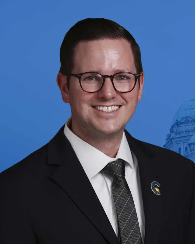
This district elects one MLA. Voters mark one name on Saturday, October 24, 2026, and the candidate with the most votes wins the seat.
Prince George-Mackenzie is a provincial electoral district in north-central British Columbia. It takes in the northwestern neighbourhoods of the city of Prince George, the Lheidli T’enneh First Nation, the District of Mackenzie and the communities around Summit, Bear and McLeod Lakes. The 2021 census counted 41,490 people in its 20,500 square kilometres, and 13.1% of them reported an Indigenous identity.
Prince George-Mackenzie takes in the northwestern neighbourhoods of the city of Prince George and a long area to the north. The Electoral Boundaries Commission’s 2023 final report names Shady Valley, Cranbrook Hill and Heritage among the neighbourhoods. North of the city, the report says, the district includes the Lheidli T’enneh First Nation, the District of Mackenzie and the communities around Summit, Bear and MacLeod Lakes. The east, west and north boundaries follow the borders of the Regional District of Fraser-Fort George. The south boundary is Upper Mud River Road. The commission counts 41,487 people in 20,500 square kilometres.
The Prince George Citizen, reporting the commission’s report on 3 April 2023, described the city part of the district as the Lakewood and Heritage areas, the North Nechako area and the Hart. BC Geographical Names places Hart Highlands in Prince George north of the Nechako River. Elections BC’s 2024 results list voting places at Beaverly, Edgewood and Heather Park elementary schools, D.P. Todd Secondary School and the Hart Pioneer Centre inside the district. Outside the city the voting places are at Miworth, Ness Lake, Nukko Lake, Salmon Valley, Summit Lake, Bear Lake, McLeod Lake and Mackenzie. BC Geographical Names puts Miworth on the Canadian National Railway beside the Nechako River northwest of Prince George, and Salmon Valley on the Salmon River north of the city.
The McLeod Lake Indian Band says its main community lies near the village of McLeod Lake on Highway 97, north of Prince George. The Mackenzie and District Museum says Highway 39 meets Highway 97 at a junction 28 kilometres south of Mackenzie. The Encyclopedia of British Columbia puts Mackenzie 190 kilometres north of Prince George, at the south end of Williston Reservoir. BC Geographical Names places the town on the southeast side of Parsnip Reach of Williston Lake, and notes that the logging and sawmill area lies beside the BCR line and the airfield.
The Lheidli T’enneh First Nation says that T’enneh means “The People” and that it is a sub-group of the Dakelh people. Its name Lheidli means “The People from the Confluence of the River” in the Carrier language, and it refers to the place where the Nechako River enters the Fraser at Prince George. The Nation gives the names of the two rivers as Nee Incha Koh, “river with strong undercurrents”, and Ltha Koh, the Big Mouth River. The BC Treaty Commission describes the Nation’s traditional territory as the land around Prince George, including the Nechako and Fraser River basins, east to the Alberta border. The City of Prince George says the Lheidli T’enneh have lived in the area for at least 9,000 years. The commission’s 2023 report places the Lheidli T’enneh First Nation inside this district.
North of the city the land belongs to the Tse’Khene of the McLeod Lake Indian Band. The band writes that Tse’Khene means “People of the Rocks” and that its people were hunters who controlled the basins of the Parsnip and Finlay Rivers and the valley of the Peace River. It gives the south limit of its territory as the high ground near Summit Lake that separates Arctic and Pacific drainage. The Mackenzie and District Museum says Summit Lake sits at low elevation on the continental divide, between waters that drain to the Pacific, such as the Fraser River, and waters that drain to the Arctic, such as the Peace River.
Alexander Mackenzie, McLeod Lake and Fort George, 1793 to 1807
BC Geographical Names says that Sir Alexander Mackenzie passed through the Mackenzie area in June 1793 on his journey overland to the Pacific Ocean. In 1805, the McLeod Lake Indian Band writes, the North West Company built the first fur trading post in British Columbia at the mouth of the Pack River on McLeod Lake. BC Geographical Names adds that James McDougall built the post in 1805 and that Simon Fraser arrived in 1806. The post was first called Trout Lake House, then La Malice Fort, and later Fort McLeod after Archibald Norman McLeod, an officer of the North West Company.
In 1807 Simon Fraser founded a post at the meeting of the Nechako and Fraser Rivers, and it was named Fort George after King George III. BC Geographical Names records the Carrier name for that place as Thle-et-leh, “the confluence”. The District of Mackenzie says that the Hudson’s Bay Company came into the area in the 1820s and set up many trading posts. The Hudson’s Bay Company closed its post at Fort George in May 1915.
The railway and the sale of the Fort George village, 1906 to 1915
BC Geographical Names says that the Grand Trunk Pacific Railway began to survey the Fort George area in 1906. The City of Prince George writes that the railway company wanted Fort George Indian Reserve No. 1, which lay where downtown Prince George is today. After years of talks, the City says, the Lheidli T’enneh reluctantly accepted the sale of 553 hectares for $125,000 in May 1912. In September 1913 the remaining members were forced off the village site against their will and the village was burned. As part of the sale, the City says, contractors built new houses and St. Pius X Church at Khas T’an Lhe Ghulgh Reserve No. 2 and four houses at Hlez Ba Nee Chek Reserve No. 3. The Exploration Place museum says the Lheidli T’enneh were moved in 1913 to a place upstream on the Fraser River near Shelley.
The first passenger train reached Prince George on 30 January 1914. The city was incorporated on 6 March 1915. At the first civic election that year the name Prince George won over Fort George with 153 votes. The City’s own account puts the 1915 boundaries at 5.1 square kilometres, covering downtown and parts of the Crescents and Millar Addition.
The Hart Highway and the city’s growth north, 1945 to 1975
The Hart Highway, now Highway 97, goes 406 kilometres from Prince George across the Rocky Mountains to Dawson Creek. The Encyclopedia of British Columbia says construction began in 1945 and was finished on 1 July 1952, and that the road is named for John Hart, who was premier from 1941 to 1947. The City’s biography of former mayor Harry Perry says he persuaded Hart to build a highway north through the Pine Pass.
The City of Prince George reports that its population went from 4,000 people in 1947 to 60,000 less than 30 years later. Its boundaries stayed unchanged from 1915 until 1953 and then grew in 14 steps. The largest step came in 1975, when the city took in Blackburn, College Heights and the area north of the Nechako River. By 1995 the city covered just under 327 square kilometres. The city’s peak population was just over 75,000 in 1996. BC Geographical Names places Hart Highlands in Prince George north of the Nechako River, the area the City says it took in during 1975.
Mackenzie was built as a new town for the forest industry. The Mackenzie and District Museum says that in 1964 BC Forest Products announced a $60 million forestry complex in the area. The BC Forest Service built a road from the junction of Highways 39 and 97 to Finlay Forks in the early 1960s, and in 1965 the clearing of the townsite began. BC Geographical Names records that Mackenzie was incorporated as a district municipality on 19 May 1966 and named for Sir Alexander Mackenzie. The museum says that the population was just over 7,000 by the early 1970s and that Mackenzie’s first high school graduating class, of 11 students, finished in 1972.
The town grew beside a new lake. The Encyclopedia of British Columbia says BC Hydro built the W.A.C. Bennett Dam on the Peace River from 1962 to 1967 and that its power station began to run in 1968. Williston Reservoir, 1,773 square kilometres in area, flooded the valleys of the Parsnip and Finlay Rivers. The District of Mackenzie says the water covered many settlements along those rivers. BC Hydro states that the reservoir lies on the traditional territories of Tsay Keh Dene, Kwadacha and the Treaty 8 First Nations.
Treaty 8 at McLeod Lake and the Lheidli T’enneh treaty votes, 1987 to 2018
Treaty 8 was proposed in 1898, and the McLeod Lake Indian Band writes that Canada did not sign the band to it then. In 1987 the band told Canada that it wished to join. Canada agreed, the band says, but British Columbia refused to transfer land. In 1988 the band won an injunction that stopped timber harvesting on its lands. Negotiations with Canada and British Columbia began in 1992, and in 2000 the band ratified an agreement that brought it into Treaty 8. The band says the settlement gave it a trust fund and 20,000 hectares of forest, reserve and other land. The Province lists the Act that carries the agreement as the McLeod Lake Indian Band Treaty No. 8 Adhesion and Settlement Agreement Act, 2000.
The Lheidli T’enneh followed the BC treaty process. The BC Treaty Commission records that the Nation filed its statement of intent in December 1993, signed a framework agreement on 26 August 1996 and signed an agreement in principle on 26 July 2003. The Province states that the Lheidli T’enneh voted in 2007 not to accept the original treaty agreement. The commission records that a treaty was initialled on 5 May 2018, and the Province states that members voted again not to accept the treaty in June 2018.
The Globe and Mail reported on 16 April 2010 that the Pope & Talbot pulp mill at Mackenzie had been shut in 2008 by the bankruptcy of its owner, and that the town had seen all of its lumber, pulp and paper mills close. That day a unit of Sinar Mas called Paper Excellence BV agreed to pay $20 million for the pulp mill. The Globe reported that the mill’s union had signed a contract for more than 240 workers and that the McLeod Lake Indian Band, which holds resource rights in the area, said it would ensure the mill had enough wood fibre.
PaperAge reported that Paper Excellence bought the mill in 2010 and invested more than $360 million in it. The company reduced production in June 2020 and announced the permanent closure of the mill in April 2021. The company said the mill’s small production capacity and the lack of local wood fibre at an economic price meant it could not compete with mills elsewhere in the world. The Encyclopedia of British Columbia gives Mackenzie’s population as 3,281 in the 2021 census.
Elections BC’s volume for 1871 to 1986 records that the Constitution (Amendment) Act, SBC 1978 c.14, assented to on 29 June 1978, created the districts of Prince George North and Prince George South. John Herbert (Jack) Heinrich of the Social Credit Party won Prince George North in 1979 with 7,477 votes (52.73%) and in 1983 with 8,616 (53.26%). Lois Ruth Boone of the New Democratic Party won in 1986 with 7,573 votes (48.03%). The 1987 to 2001 volume lists Paul Ramsey of the New Democratic Party as the winner in 1991 with 5,468 votes (38.74%) and in 1996 with 5,837 (39.58%). Pat Bell of the Liberal Party won in 2001 with 9,215 votes (61.02%). The 2002 to 2013 volume shows Bell winning Prince George North in 2005 with 7,697 votes (49.93%).
The Electoral Districts Act of 2008 (SBC 2008 c.14) received royal assent on 1 May 2008, raised the number of districts from 79 to 85 and took effect on 14 April 2009. The 2002 to 2013 volume lists Pat Bell under Prince George North in 2005 and under Prince George-Mackenzie in 2009. Bell won the new district for the BC Liberal Party with 9,816 votes (56.05%), ahead of Tobias Lawrence of the BC NDP with 6,452 (36.84%). Mike Morris of the BC Liberal Party won in 2013 with 10,524 votes (55.58%), in 2017 with 10,725 (57.12%) and in 2020 with 8,543 (50.80%). Kiel Giddens of the Conservative Party won in 2024 with 11,307 votes (60.92%), ahead of Shar McCrory of the BC NDP with 5,242 (28.24%).
The commission’s 2023 final report raised the number of districts from 87 to 93. Its table of the 87 current districts gives the earlier Prince George-Mackenzie 46,920 people and 20,511 square kilometres, 18.4% below the average district. Its table of the proposed districts gives the new one 41,487 people and 20,500 square kilometres, 22.9% below the average. The Prince George Citizen wrote that before the change the city was shared between Prince George-Mackenzie and Prince George-Valemount, and that the report divides it among three districts. Elections BC’s conversion table lists the 2017 to 2024 districts that the new one draws on: Prince George-Mackenzie with 52 voting areas, Prince George-Valemount with 2 and Peace River North with 1.
“Elected as” is the affiliation Elections BC printed with the winning result. The last column is the party the legislature’s records give for that parliament, which differs when a member changed party while in office. A row with that column empty is a winner Elections BC prints whom the legislature’s records leave out. Source: Legislative Assembly of British Columbia (opens in a new tab)
Boundaries since 2024
Prince George-Mackenzie has 52 voting areas. 52 of them overlap the district of the same name used from 2017 to 2024.Others overlap these districts from 2017 to 2024: Prince George-Valemount (2), Peace River North (1).
The commission that drew the boundaries counted 41,487 people in the district, 22.9% below the average for a district, over 20,500 km².
Where is the Prince George-Mackenzie electoral district?
Prince George-Mackenzie lies in north-central British Columbia. It covers the northwestern neighbourhoods of the city of Prince George and the land north of the city as far as Mackenzie, on the Electoral Boundaries Commission’s description. The commission gives its area as 20,500 square kilometres. Its east, west and north boundaries follow the borders of the Regional District of Fraser-Fort George.
Which communities are in Prince George-Mackenzie?
Prince George-Mackenzie includes the Prince George neighbourhoods of Shady Valley, Cranbrook Hill and Heritage, the Lheidli T’enneh First Nation, the District of Mackenzie, and the communities around Summit, Bear and McLeod Lakes. Elections BC’s 2024 results also list voting places at Miworth, Ness Lake, Nukko Lake and Salmon Valley, which places those communities inside the district.
Who is the MLA for Prince George-Mackenzie?
Kiel Giddens is the member of the Legislative Assembly for Prince George-Mackenzie. He won the 2024 provincial election for the Conservative Party with 11,307 votes, which was 60.92% of the valid votes. Shar McCrory of the BC NDP received 5,242 votes and James Steidle of the BC Green Party received 1,576.
Who held the Prince George-Mackenzie seat before Kiel Giddens?
Mike Morris held the Prince George-Mackenzie seat before Kiel Giddens. He won it in 2013, 2017 and 2020, and the legislature’s record shows him as a member from 2013 to 2024. Pat Bell held the seat from the 2009 election to 2013, the first election in which the district name Prince George-Mackenzie was used.
How many people voted in Prince George-Mackenzie in 2024?
In the 2024 provincial general election, 18,560 valid votes were counted in Prince George-Mackenzie, and 28 ballots were rejected. Turnout was 59.5% of the 31,239 registered voters. Kiel Giddens of the Conservative Party was elected with 11,307 votes. Rachael Weber, who ran with no party affiliation, received 435 votes.
How did the 2023 boundary change affect Prince George-Mackenzie?
The commission’s 2023 report shrank Prince George-Mackenzie from 46,920 people to 41,487, and from 20,511 to 20,500 square kilometres. It also divided the city of Prince George among three districts instead of two. Of the voting areas in the new district, 52 came from the earlier Prince George-Mackenzie, 2 from Prince George-Valemount and 1 from Peace River North.
Whose territory is Prince George-Mackenzie on?
Prince George-Mackenzie includes the Lheidli T’enneh First Nation, a Dakelh people whose name means “The People from the Confluence of the River.” It also takes in the area around McLeod Lake, where the McLeod Lake Indian Band, a Tse’Khene nation, has its main community. The band joined Treaty 8 in 2000. The Lheidli T’enneh are in the BC treaty process.
Who lives in Prince George-Mackenzie?
The 2021 census counted 41,490 people in Prince George-Mackenzie. The median age was 40.4, compared with 42.8 for British Columbia. Of residents, 13.1% reported an Indigenous identity, which is 5,410 people, and 8.1% were immigrants. The median household income was $98,000. The census counted 80.6% of households as owners of their homes.
When was the town of Mackenzie founded?
The town of Mackenzie was incorporated as a district municipality on 19 May 1966, according to BC Geographical Names. Clearing of the townsite began in 1965 after BC Forest Products announced a forestry complex in the area in 1964. It sits at the south end of Williston Reservoir, in Prince George-Mackenzie, and is named for Sir Alexander Mackenzie.
When was the name Prince George-Mackenzie first used for a district?
The name Prince George-Mackenzie first appears in Elections BC’s electoral history at the 2009 general election. The Electoral Districts Act of 2008 created the district, raised the number of seats from 79 to 85 and took effect on 14 April 2009. Pat Bell of the BC Liberal Party won the first election there with 9,816 votes.