This district elects one MLA. Voters mark one name on Saturday, October 24, 2026, and the candidate with the most votes wins the seat.
Burnaby East is a provincial electoral district in the north-east of the City of Burnaby, British Columbia. It takes in Simon Fraser University and the UniverCity community on Burnaby Mountain, the neighbourhoods of Westridge, Sullivan Heights, Lochdale and Lake City, and the Burrard Inlet shore at Barnet Marine Park. The 2021 census counted 54,495 people in it, and the Electoral Boundaries Commission gives its area as 36 square kilometres.
The Electoral Boundaries Commission's final report of 3 April 2023 says Burnaby East includes Sullivan Heights, Westridge and Simon Fraser University. Burrard Inlet forms its northern boundary and Kensington Avenue its western boundary. The municipal borders of the City of Burnaby form its southern and eastern boundaries. The commission counts 54,748 people in an area of 36 square kilometres, which is 1.8% from the average district.
The land rises from Burrard Inlet to the top of Burnaby Mountain, where the university stands. The City of Burnaby describes the Burnaby Mountain Conservation Area as 576 hectares overlooking Burrard Inlet next to the university. Heritage Burnaby, the City's archive, describes Westridge as a neighbourhood that Inlet Drive divides into two parts, and places the Sullivan Heights houses east of Stoney Creek Park. Elections BC's 2024 results file lists 14 voting places in the district. They include Simon Fraser University's Halpern Centre, Westridge Elementary, Lochdale Community Elementary, Forest Grove Elementary, University Highlands Elementary and Cariboo Hill Secondary.
Heritage Burnaby describes the Lake City area as an industrial park with single-family neighbourhoods south of the Lougheed Highway. TransLink's Millennium Line SkyTrain opened on 31 August 2002. TransLink's own page on a proposed gondola names Production Way-University Station as the starting point of a link to the university, and says the project has no approval and no funding. TransLink gives the gondola trip as 7 minutes, against 15 to 45 minutes by bus.
The City of Burnaby says it is located on the unceded territories of the xʷməθkʷəy̓əm (Musqueam), Sḵwx̱wú7mesh (Squamish), səlilwətaɬ (Tsleil-Waututh) and kʷikʷəƛ̓əm (Kwikwetlem) Peoples. It adds that each Nation has distinct histories and distinct traditional territories that fully or partly cover the city.
The northern boundary of this district is Burrard Inlet, which the Tsleil-Waututh Nation calls səlilwət. The Nation's website says: "We are səlilwətaɬ (Tsleil-Waututh Nation), People of the Inlet." It describes a traditional territory of 1,865 square kilometres, reaching north to Mount Garibaldi, east to Coquitlam Lake and west to Howe Sound, and says its people have lived there for thousands of years.
The City of Burnaby says Burnaby Mountain was long a harvesting site for Coast Salish peoples. It describes the shore at Barnet Marine Park as an important harvesting, gathering and processing site for Coast Salish peoples, before it became the site of a logging mill camp.
The Barnet mill and its company town, 1889 to the 1930s
The City says Burnaby Mountain was first logged in 1903. On the shore below it, Heritage Burnaby records that the North Pacific Lumber Company at Barnet was one of Burnaby's first industrial developments and one of the largest in the British Empire. Its partners, James MacLaren and Frank Ross, built the mill in 1889 and it began operating in 1899. They built it to obtain timber rights to 84,000 acres in northern British Columbia.
The mill was far from other settlements, so the company built houses for workers with families and bunkhouses for single men. Heritage Burnaby says the bunkhouses separated Caucasian workers from Chinese and Sikh workers. Barnet became a company town with its own general store, school, post office, community hall and telephone exchange.
In 1925 the Barnet Lumber Company took over the mill. Heritage Burnaby says it was one of the most successful local employers until the 1930s, when the Great Depression brought a strike at the mill. The company then failed to pay its taxes, and the municipality took over the site with all its homes. Burnaby dismantled the mill and sold the land in two parts. The eastern part became Kapoor Sawmills and the western part went to the McColl-Frontenac Oil Company.
Lochdale, the Pole Line Road and the community hall, 1914 to 1931
Heritage Burnaby says the Sperling Avenue School opened in 1914 to serve the growing community around the B.C. Electric Company's Pole Line Road, which is now Sperling Avenue. It replaced the one-room Duthie schoolhouse. The archive places the school in the Lochdale historic neighbourhood.
The Lochdale Community Hall at 490 Sperling Avenue was built in 1925 by the Lochdale Social Club, with volunteer labour and donated materials. Heritage Burnaby calls it Burnaby's last remaining early community hall building. It was used for public political meetings, theatre, dinners and dances, and it housed services of the St. Margaret of Scotland Anglican parish until that parish's church opened in 1929. The City placed it on its heritage register by Bylaw No. 9807 on 23 November 1992.
The archive quotes the 1931 Burnaby Year Book on the crossing of Hastings-Barnet Road and Sperling Avenue. It describes a service station and a general store that held the Lochdale Post Office, gardens kept by householders, and chicken farms. The Year Book also reports that the Shell Oil Co. was to build a refinery north of the crossing, and it lists the Barnet mill, two miles to the east, as a place of work.
Burnaby Mountain park and the pipeline, 1942 to 1957
Heritage Burnaby records that Burnaby Mountain was dedicated as a park in 1942. The Parliament of Canada gave the Trans Mountain Oil Pipe Line Company its charter on 21 March 1951. In May 1952 Burnaby's council gave final reading to Bylaw No. 3203, which conveyed land to the company, and the park boundaries were changed that year. Heritage Burnaby says significant conservation and park land was left untouched.
The company's Burnaby Terminal is at 8099 Shellmont Street, in the Lake City area on the mountain. Heritage Burnaby says construction of the storage tanks finished in October 1953, when the first shipment of oil reached the terminal.
The City of Burnaby gives 1957 as the year the mountain became an official park and recreation area. Heritage Burnaby adds that in 1957 the site on the mountain was chosen for Burnaby's pavilion marking the centennial of British Columbia, and says the grounds gave the public a formal viewpoint and access to the trails for the first time.
Heritage Burnaby says the Westridge neighbourhood was created as a subdivision during the housing boom after the Second World War, laid out by the C.B. Riley Company to follow the shape of the land. West of Inlet Drive it holds a 1950s subdivision of single-family homes. East of Inlet Drive the subdivision dates from the 1970s and has larger lots and some low-rise buildings. The archive also dates the Sullivan Heights houses east of Stoney Creek Park to the 1950s, and the multi-family buildings west of the park to after 1974.
Heritage Burnaby says the Lake City Industrial Park opened in the 1950s as an industrial area with road and rail links. Heritage Burnaby gives sixteen as the count of developed industrial properties in the park when the university opened in 1965, and calls the figure an estimate. Early firms included Nabob Foods, Volkswagen Canada, British Columbia Television Broadcasting, Simpson Sears and H.Y. Louie Company Limited. Streets there are named Production, Enterprise and Venture. By 1979 the houses south of the Lougheed Highway and west of Eagle Creek were largely built.
Cariboo Hill Secondary School opened in 1961 with 410 students. Heritage Burnaby says it was built because students in the north-east of Burnaby had to travel to Edmonds Junior High School, and it held over 1,100 students in 1974. The Forest Grove subdivision followed in the early 1980s. Forest Grove Elementary opened in 1986 with 374 pupils, and was then the second largest elementary school in Burnaby.
Simon Fraser University's own history says a report in January 1963 recommended a new university in the Lower Mainland. Two months later the British Columbia Legislature gave formal assent to create it, and Dr. Gordon M. Shrum was appointed the first chancellor. The chancellor recommended the top of Burnaby Mountain for its views of Burrard Inlet, the Coast Mountains, the Fraser River and Vancouver harbour.
The Vancouver firm of Erickson/Massey won the design competition. Construction began in the spring of 1964, and on 9 September 1965 the university opened to 2,500 charter students. Heritage Burnaby records that it was nicknamed the "instant university". The archive lists Zoltan S. Kiss, Duncan McNab and Associates, Rhone and Iredale and Robert F. Harrison among the architects of individual buildings, under the Erickson/Massey plan. It says the campus was designed as terraced structures that follow the mountain ridge.
Ainu poles, conservation land and UniverCity, 1989 to the 2000s
Simon Fraser University's page on its Indigenous art walk says the sculpture Kamui Mintara, Playground of the Gods, was made in 1989 by the Ainu sculptors Nuburi Toko and Shusei Toko. It was a gift to Burnaby from its Japanese twin city of Kushiro, and it stands in Burnaby Mountain Park. The City's conservation area page says the poles represent goodwill between Burnaby and Kushiro.
UniverCity's history page says the architects Arthur Erickson and Geoff Massey proposed a residential community on the mountain in their 1963 plan. In 1995 the university's president John Stubbs and Burnaby's mayor William Copeland signed a Memorandum of Understanding. The City says the university transferred 820 acres to Burnaby, which became a conservation area in 1995. In 1996 the City approved the Official Community Plan and zoning changes for the housing, and in 1997 the Burnaby Mountain Community Corporation was set up to plan it.
The plan covers 65 hectares and allows 4,536 homes in two neighbourhoods, built on parcels leased for 99 years. At full build-out it expects 10,000 residents. Heritage Burnaby says the new housing known as UniverCity took shape beside the university by the early 2000s. The UniverCity website now gives 5,000 residents and describes University Highlands Elementary School in the community.
Rapid transit, a pipeline dispute and a shared park, 2002 to 2025
TransLink's Millennium Line SkyTrain opened on 31 August 2002. TransLink's page on the Burnaby Mountain Gondola names Production Way-University Station as the SkyTrain end of a proposed link to the university. The page says the project is not approved or funded.
In November 2014 the company then called Kinder Morgan did survey drilling on Burnaby Mountain for the Trans Mountain expansion. CTV News reported that RCMP officers took more than two dozen protesters into custody on 20 November 2014. The news outlet World Pipelines reported that Kinder Morgan left early, after drilling to 150 metres on one of two planned sites. It also reported that the company had given wrong GPS coordinates in its court filing, that a judge refused to extend the injunction and that the judge dismissed the contempt charges.
On 30 April 2024 the Canada Energy Regulator gave final authorization for the expanded pipeline to operate. It carries crude oil from Edmonton to the Westridge Marine Terminal in Burnaby, and raises capacity from 300,000 to 890,000 barrels a day. In June 2025 the City of Burnaby and the səlilwətaɬ (Tsleil-Waututh Nation) signed an agreement to co-manage Barnet Marine Park, which the City says has been significant to the Nation since time immemorial.
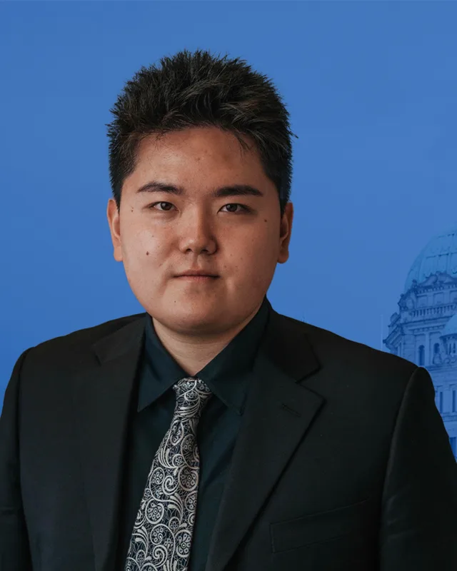
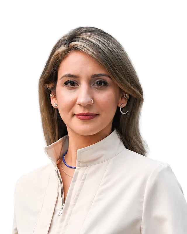
Burnaby East is a new district name. The Electoral Boundaries Commission's final report of 3 April 2023 maps five districts inside Burnaby: Burnaby Centre, Burnaby East, Burnaby-New Westminster, Burnaby North and Burnaby South-Metrotown. The three electoral history volumes that Elections BC published for 1871 to 2013 list no district called Burnaby East. The name first appears in the results of the 43rd provincial general election, held on 19 October 2024. Reah Arora of the BC NDP won with 10,490 votes (51.85%), ahead of Simon Chandler of the Conservative Party with 8,198 votes (40.52%) and Tara Shushtarian of the BC Green Party with 1,544 votes (7.63%). Turnout was 54.95% of 36,896 registered voters.
Elections BC's statement of votes prints the winner as Reah Arora. The Legislative Assembly lists the member for Burnaby East, in the 43rd Parliament, as Rohini Arora of the BC NDP.
Elections BC's conversion table matches all 58 voting areas of Burnaby East to the district of Burnaby-Lougheed, which was used from 2009 until the 2024 election. It first appears in Elections BC's volume for 2002 to 2013, at the general election of 12 May 2009. Harry Bloy of the BC Liberal Party won it with 9,207 votes (48.45%). Jane Shin of the BC NDP won it in 2013 with 8,952 votes (44.26%). Katrina Chen of the BC NDP won it in 2017 with 10,911 votes (48.06%) and in 2020 with 12,574 votes (60.25%). Before 2009 the volume lists Bloy as the member for Burquitlam, elected in 2005.
The commission's report also says that, between its preliminary and final reports, it moved the neighbourhood of Victory Heights out of Burnaby East and into Burnaby-New Westminster.
Members for Burnaby-Lougheed, which covered 58 of this district’s 58 voting areas before 2024
Parliament
It sat
Member
Elected as
Party on the legislature’s record
42nd
2020 to 2024
Katrina Chen
BC NDP
BC NDP
41st
2017 to 2020
Katrina Chen
BC NDP
BC NDP
40th
2013 to 2017
Jane Jae Kyung Shin
BC NDP
39th
2009 to 2013
Harry Bloy
BC Liberal Party
BC Liberal Party
“Elected as” is the affiliation Elections BC printed with the winning result. The last column is the party the legislature’s records give for that parliament, which differs when a member changed party while in office. A row with that column empty is a winner Elections BC prints whom the legislature’s records leave out. Source: Legislative Assembly of British Columbia (opens in a new tab)
Boundaries since 2024
Burnaby East has 58 voting areas. They overlap these districts from 2017 to 2024: Burnaby-Lougheed (58).
The commission that drew the boundaries counted 54,748 people in the district, 1.8% above the average for a district, over 36 km².
Burnaby East is a provincial electoral district in the north-east of the City of Burnaby, British Columbia. The Electoral Boundaries Commission's 2023 final report says Burrard Inlet forms its northern boundary and Kensington Avenue its western boundary, while the municipal borders of Burnaby form its southern and eastern boundaries. The commission gives its area as 36 square kilometres.
Which neighbourhoods are in Burnaby East?
Burnaby East includes Sullivan Heights, Westridge and Simon Fraser University, according to the Electoral Boundaries Commission's 2023 final report. Elections BC's 2024 results file also lists voting places at Lochdale, Forest Grove, University Highlands and Cariboo Hill, and Heritage Burnaby describes the Lake City and Lyndhurst neighbourhoods and the UniverCity housing beside the university.
Who won Burnaby East in the 2024 provincial election?
Reah Arora of the BC NDP won Burnaby East in the 2024 provincial general election with 10,490 votes, 51.85% of the valid vote. Simon Chandler of the Conservative Party received 8,198 votes, 40.52%, and Tara Shushtarian of the BC Green Party received 1,544 votes, 7.63%. Turnout was 54.95% of 36,896 registered voters. The Legislative Assembly lists the member as Rohini Arora.
Who represented this part of Burnaby before 2024?
All 58 voting areas of Burnaby East came from Burnaby-Lougheed. Katrina Chen of the BC NDP won Burnaby-Lougheed in 2017 and 2020. Jane Shin of the BC NDP won it in 2013, and Harry Bloy of the BC Liberal Party won it in 2009, the first election in which Elections BC's histories show the district.
When was the Burnaby East district created?
The Electoral Boundaries Commission's final report of 3 April 2023 maps Burnaby East as one of five districts inside Burnaby. The name first appears in the results of the 43rd provincial general election, held on 19 October 2024. Elections BC's histories for 1871 to 2013 contain no district of that name.
How did the 2023 boundary change affect Burnaby East?
Elections BC's conversion table matches all 58 voting areas of Burnaby East to the former district of Burnaby-Lougheed. The commission counts 54,748 people in the new district, which is 1.8% from the average district. Its final report says it moved the neighbourhood of Victory Heights out of Burnaby East and into Burnaby-New Westminster.
How many people live in Burnaby East?
The 2021 census counted 54,495 people in Burnaby East, with a median age of 40.8 compared with 42.8 across British Columbia. English was the first language of 47.3% of residents, Mandarin of 9.8% and Yue (Cantonese) of 9.2%. Immigrants made up 43.3% of the population, against 29% in British Columbia, and the median household income was $89,000.
Whose traditional territory is Burnaby East on?
The City of Burnaby names four Nations whose unceded territories it is on: Musqueam, Squamish, Tsleil-Waututh and Kwikwetlem. Burnaby East lies on the south shore of Burrard Inlet, which the Tsleil-Waututh Nation calls səlilwət. In June 2025 the City and the Nation signed an agreement to co-manage Barnet Marine Park in the district.
When did Simon Fraser University open on Burnaby Mountain?
Simon Fraser University opened on Burnaby Mountain on 9 September 1965 to 2,500 charter students, according to the university's own history. The Vancouver firm of Erickson/Massey won the design competition, and construction began in the spring of 1964. The campus lies inside the Burnaby East electoral district, which the Electoral Boundaries Commission says includes the university.
What was Barnet in Burnaby East?
Barnet was a company town on the shore of Burrard Inlet in Burnaby East. Heritage Burnaby says MacLaren and Ross built the North Pacific Lumber Company mill there in 1889 and it began operating in 1899. Barnet had its own store, school, post office, community hall and telephone exchange. Barnet Marine Park now occupies the site of the old mill camp.