15 days to goBritish Columbia votes on Saturday, October 24, 2026

Get in front of undecided British Columbia voters
MLA · BC PROVINCIAL 2026

Burnaby-New Westminster.
3 candidates, one seat.

This district elects one MLA. Voters mark one name on Saturday, October 24, 2026, and the candidate with the most votes wins the seat.

Burnaby-New Westminster is a provincial electoral district that spans the border of two cities. It takes in the Edmonds and Middlegate neighbourhoods of south-east Burnaby and the Kelvin, Eastburn, Connaught Heights and Victory Heights neighbourhoods of New Westminster, together with Moody Park and the Byrne Creek area. The 2021 census counted 52,865 people in it, and the Electoral Boundaries Commission gives its area as 9 square kilometres.

The candidates

In alphabetical order
People, 2021 census
52,865
Area
9 km²
Registered voters, 2024
34,794
Turnout, 2024
51.26%
Median age
41.6
Median household income, 2020
$81,000
THE DISTRICT

Where Burnaby-New Westminster is

9 km² · 52,865 people

The Electoral Boundaries Commission's final report of 3 April 2023 says Burnaby-New Westminster includes the New Westminster neighbourhoods of Kelvin, Eastburn and Connaught Heights and the adjacent Burnaby neighbourhoods of Middlegate and Edmonds. It gives the boundaries as Imperial Street in the north, Griffiths Drive in the west, Sixth Avenue in the south, and McBride Boulevard, Cumberland Street and Newcombe Street in the east. The commission counts 53,035 people in an area of 9 square kilometres. It also says the commission moved Connaught Heights and Victory Heights into this district between its preliminary and final reports, which cut the number of districts that divide New Westminster from five to three.

Elections BC's 2024 results file lists ten voting places inside the district. Five are in New Westminster: Lord Kelvin Elementary at 1010 Hamilton Street, École Herbert Spencer Elementary at 605 Second Street, École Lord Tweedsmuir Elementary at 1714 Eighth Avenue, F.W. Howay Elementary at 91 Courtney Crescent, and the New Westminster Lawn Bowling Club in Moody Park. Five are in Burnaby: Edmonds Community Centre at 7433 Edmonds Street, Byrne Creek Community School at 7777 18th Street, Edmonds Community Elementary at 7651 18th Avenue, Second Street Community Elementary at 7502 2nd Street and Twelfth Avenue Elementary at 7622 12th Avenue. The school addresses come from the B.C. Ministry of Education's school pages.

Kingsway crosses the Burnaby part of the district. Heritage Burnaby, the City's archive, says it was built as the highway between New Westminster and Vancouver, with Burnaby paying 25% of the cost and the province 75%. TransLink says the SkyTrain Expo Line opened on 11 December 1985 and connected downtown Vancouver, Burnaby and New Westminster, and the Burnaby Village Museum says the line largely follows the route of the earlier interurban tram. Canada's Historic Places places a house on Marine Way in Connaught Heights between a regional road and the SkyTrain corridor. McBride Boulevard, on the eastern boundary, gives access to the stal̕əw̓asəm Bridge, whose four lanes the provincial project office scheduled to open on the morning of Saturday, 14 February 2026.

  • Edmonds
  • Middlegate
  • Kelvin
  • Eastburn
  • Connaught Heights
  • Victory Heights

Sources: British Columbia Electoral Boundaries Commission (opens in a new tab), Elections BC (opens in a new tab), B.C. Ministry of Education (Education System Performance) (opens in a new tab), B.C. Ministry of Education (Education System Performance) (opens in a new tab), B.C. Ministry of Education (Education System Performance) (opens in a new tab), B.C. Ministry of Education (Education System Performance) (opens in a new tab), City of New Westminster (opens in a new tab), City of Burnaby (opens in a new tab), Heritage Burnaby (City of Burnaby) (opens in a new tab), B.C. Ministry of Education (Education System Performance) (opens in a new tab), B.C. Ministry of Education (Education System Performance) (opens in a new tab), B.C. Ministry of Education (Education System Performance) (opens in a new tab), Heritage Burnaby (City of Burnaby) (opens in a new tab), TransLink (opens in a new tab), Burnaby Village Museum (opens in a new tab), Canada's Historic Places (opens in a new tab), Pattullo Bridge Replacement Project (Government of British Columbia) (opens in a new tab)

HISTORY

The history of the area

Checked Thursday, October 8, 2026

Qayqayt, Sxwaymelh and the Nations of the Fraser River

The City of Burnaby says it is on the unceded territories of the xʷməθkʷəy̓əm (Musqueam), Sḵwx̱wú7mesh (Squamish), səlilwətaɬ (Tsleil-Waututh) and kʷikʷəƛ̓əm (Kwikwetlem) Peoples, and that each Nation has its own history and its own traditional territory covering the city fully or in part. The Burnaby Village Museum adds that several Indigenous communities surround Burnaby today, and it names the Qayqayt among them.

New Westminster has its own record. BC Geographical Names says the place held the Coast Salish village of Sxwaymelh, and it repeats a 1925 account from Tsawwassen Chief Harry Joe, who linked the name to salmon that disappear and reappear in the water near this seasonal camp. New Westminster Schools writes that in the 19th century a village called Qayqayt, pronounced Ka-kite, stood along what is now Front Street. The same page says a smallpox epidemic killed many First Peoples in 1904, that the McKenna McBride Commission closed the New Westminster Indian Reserve in 1916, and that Chief Larrabee applied for Indian status in 1994 and revived the Qayqayt band. New Westminster Schools' territorial acknowledgement names the Qayqayt First Nation and all Coast Salish peoples as the peoples on whose traditional and unceded territories the school district works. The B.C. government lists the Qayqayt First Nation in New Westminster with 20 members and says it takes no part in the B.C. treaty process.

Sources: City of Burnaby (opens in a new tab), Burnaby Village Museum (opens in a new tab), BC Geographical Names Office (opens in a new tab), New Westminster Schools (School District 40) (opens in a new tab), New Westminster Schools (School District 40) (opens in a new tab), Government of British Columbia (opens in a new tab)

The tram line, the first municipal hall and Edmonds, 1891 to 1913

The Burnaby Village Museum's guide says that in 1891 businessmen from Vancouver and New Westminster began building an electric tram between their cities. They owned land along the route and encouraged local landowners to form a government, and the City of Burnaby gives 22 September 1892 as the date of its charter. Heritage Burnaby holds a photograph of the first council in 1892 on the steps of Sample's Boarding House at 6850 Beresford Street, near Griffiths Avenue and Kingsway, with Charles R. Shaw as reeve.

The Dictionary of Canadian Biography records that Henry Valentine Edmonds, born in Dublin in 1837, reached British Columbia in April 1862, held land in Port Moody, Vancouver, Burnaby and on Lulu Island, and was mayor of New Westminster for part of 1883. It calls Edmonds Street and the Edmonds transit station reminders of his work as a suburban land promoter. Heritage Burnaby says the neighbourhood grew because it sat on the early interurban line, and that Burnaby's first municipal hall was built in 1899 at Kingsway and Edmonds, near the tram line and the population centre of South Burnaby. A brick hall replaced it in 1911. A photograph that the archive dates to 1910 shows a tram passing the triangular Edmonds Block at Edmonds Street and Kingsway, and one dated 1912 shows that the block held a store, a doctor's office and a post office. The archive's record for Kingsway carries the date 1913 and says the highway between New Westminster and Vancouver was among the public works of 1911 and 1912.

Sources: Burnaby Village Museum (opens in a new tab), City of Burnaby (opens in a new tab), Heritage Burnaby (City of Burnaby) (opens in a new tab), Dictionary of Canadian Biography (opens in a new tab), Heritage Burnaby (City of Burnaby) (opens in a new tab), Heritage Burnaby (City of Burnaby) (opens in a new tab), Heritage Burnaby (City of Burnaby) (opens in a new tab), Heritage Burnaby (City of Burnaby) (opens in a new tab), Heritage Burnaby (City of Burnaby) (opens in a new tab), Heritage Burnaby (City of Burnaby) (opens in a new tab)

Moody Park and the Royal City's first park, 1859 to 1958

BC Geographical Names records that Colonel R.C. Moody chose the site of New Westminster in February 1859, that a royal proclamation of 5 May 1859 gave it the name New Westminster, and that it was the capital of the Colony of British Columbia from 1859 to 1868. The city was incorporated on 16 July 1860.

The City's park history says Moody Park was the first park created after incorporation. On 20 April 1863 the council moved that a space of not less than 20 acres be reserved and called Moody Square, in honour of the founder of the city. Voters passed a $10,000 bylaw in 1889 to improve it, and it served as a golf course and a shooting range before the province conveyed it to the City in 1908. The Kiwanis Club gave the park a community hall, dedicated on 23 August 1938, and raised $45,000 for the outdoor pool that opened on 30 June 1949. The New Westminster Lawn Bowling Club opened its clubhouse and lawns next to Eighth Street on 20 May 1950, paid for by the sale of its old lawn at Dublin Street and Tenth Street. Century House, a seniors' centre built for British Columbia's centennial, was opened by Princess Margaret on 23 July 1958. The park now covers 23.78 acres at Sixth Avenue and Eighth Street, and a new outdoor pool replaced the Kiwanis Pool on 18 July 2009.

Sources: BC Geographical Names Office (opens in a new tab), City of New Westminster (opens in a new tab)

Veterans' lots and a late addition: Victory Heights and Connaught Heights, 1918 to 1976

Heritage New West, a heritage society, says New Westminster faced a housing crisis when the Second World War ended in May 1945. The City owned a large parcel bounded by Tenth Avenue on the north, Eighth Avenue on the south, Richmond Street on the east and First Street on the west, and the council turned it into a subdivision named Victory Heights. Sales opened on 1 October 1945 for 30 days and were limited to returning veterans, at 40 per cent of the assessed land value. All 53 original lots sold, and the City released another 92 the next year on the same terms. Buyers had to use the land at once to build homes.

Connaught Heights has a different past. Canada's Historic Places says the neighbourhood was District Lot 172 until it joined New Westminster in 1965, and that most of its houses date from the 1930s. The house at 2033 Marine Way, built in 1918, is recorded as the fourth-oldest in the neighbourhood. The City opened Connaught Heights Park in 1976 on a former power line corridor, between London Street and Ninth Avenue at 22nd Street. The register calls it the only formal park in the neighbourhood.

Sources: Heritage New West (New Westminster Heritage Preservation Society) (opens in a new tab), Canada's Historic Places (opens in a new tab), Canada's Historic Places (opens in a new tab)

The trams end, Kingsway changes and the Edmonds plan, 1950 to 1994

The Burnaby Village Museum's guide says passenger service on the interurban trams stopped during the 1950s, and that residents who had commuted by tram began to travel by bus and car. It lists the bowling alley called the Westminster Rollerway on Edmonds Street and the Gai Paree nightclub on Kingsway among the amusements of those years. Heritage Burnaby says Burnaby's municipal hall moved from Kingsway and Edmonds in the early 1950s. The 1911 hall was renovated as a police building in 1956 and demolished in 1970, and the site later became Edmonds House, a seniors' residence. A plot plan for the Middlegate Shopping Centre went before a Burnaby council committee on 7 March 1960.

Heritage Burnaby records that the Stride Avenue area filled in during the early 1950s, that building had slowed by 1970, that duplexes became common between 1970 and 1980, and that by the late 1980s the area was part of the Edmonds Town Centre South plan. A 1980 survey found that 25% of the homes in the Edmonds neighbourhood were built before 1930. TransLink says SkyTrain opened on 11 December 1985 with eight days of free rides and began charging fares on 3 January 1986. The City of Burnaby says it adopted the Edmonds Town Centre Community Plan in 1994.

Sources: Burnaby Village Museum (opens in a new tab), Heritage Burnaby (City of Burnaby) (opens in a new tab), Heritage Burnaby (City of Burnaby) (opens in a new tab), Heritage Burnaby (City of Burnaby) (opens in a new tab), Heritage Burnaby (City of Burnaby) (opens in a new tab), TransLink (opens in a new tab), City of Burnaby (opens in a new tab)

Byrne Creek and the school beside it, 1998 to 2005

Byrne Creek runs through a ravine park in south-east Burnaby before it reaches the Fraser River. A spill in 1998 killed more than 5,000 fish, along with beavers and other creatures, according to a Discover Salmon feature on the creek. Freshet News reports that the Byrne Creek Streamkeepers formed in 1999, and the feature says the group counts insects and fish, measures the water, and releases chum fry and coho smolts into the creek each year. A mural project called Fish on Fences produced 1,300 wooden fish made by school children and residents.

Heritage Burnaby records that Byrne Creek Secondary School opened in 2005 at 7777 18th Street for grades 8 through 12. It was built for as many as 1,200 students, and by 2009 plans were ready to raise that to 1,500. Elections BC lists it as Byrne Creek Community School, one of the district's voting places in 2024.

Sources: Discover Salmon (Uninterrupted) (opens in a new tab), Freshet News (opens in a new tab), Heritage Burnaby (City of Burnaby) (opens in a new tab), Elections BC (opens in a new tab)

Highgate Village, the Edmonds centre and a new bridge, 2002 to 2026

Heritage Burnaby holds photographs from November 2002 showing the Middlegate Mall parking lot on Kingsway, taken for a newspaper story about plans to redevelop the mall. Between 2003 and 2004 an excavator was working at the north end of the Middlegate Shopping Centre property, the future site of the Highgate Village development. The Edmonds Community Centre and Fred Randall Pool at 7433 Edmonds Street held its grand opening in the summer of 2013. Construction Canada reported on 27 September 2013 that CEI Architecture designed the $32-million centre, which has 8,825 square metres of floor space, a six-lane 25-metre pool and a leisure pool with a lazy river.

On 15 June 2023 the City of Burnaby invited residents to give opinions on new community plans for Edmonds, Royal Oak and Cascade Heights, with online surveys open until 31 July 2023. The City says it is revising the 1994 Edmonds Town Centre plan because priorities have shifted on transport, land use, housing needs, population growth and climate action. On the New Westminster side, the provincial Pattullo Bridge Replacement project said that all four lanes of the stal̕əw̓asəm Bridge would open on the morning of Saturday, 14 February 2026, and that the Pattullo Bridge would then close to traffic for removal. Access to the new bridge runs along McBride Boulevard and the new Royal Avenue on-ramp.

Sources: Heritage Burnaby (City of Burnaby) (opens in a new tab), Heritage Burnaby (City of Burnaby) (opens in a new tab), Construction Canada (opens in a new tab), City of Burnaby (opens in a new tab), City of Burnaby (opens in a new tab), City of Burnaby (opens in a new tab), Pattullo Bridge Replacement Project (Government of British Columbia) (opens in a new tab)

THE SEAT

Who has held the seat

Legislative Assembly records, 35th Parliament onward

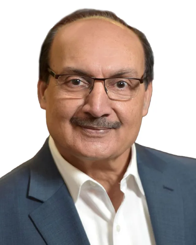
Burnaby-New Westminster is a new district name. The Electoral Boundaries Commission's final report of 3 April 2023 maps it as one of five districts in Burnaby and one of three that share the City of New Westminster. The three electoral history volumes that Elections BC published for 1871 to 2013 list no district with this name. Its only result so far comes from the 43rd provincial general election on 19 October 2024. Raj Chouhan of the BC NDP won with 10,647 votes (59.99%), ahead of Deepak Suri of the Conservative Party with 6,161 votes (34.71%) and Daniel Kofi Ampong, an independent, with 940 votes (5.3%). Turnout was 51.26% of 34,794 registered voters. On 18 February 2025 the Legislative Assembly declared Chouhan, the member for Burnaby-New Westminster, elected Speaker for the 43rd Parliament.

Elections BC's conversion table matches the district's 59 voting areas to the districts of 2017 to 2024: 32 in Burnaby-Edmonds, 19 in New Westminster and 4 in Burnaby-Lougheed. Chouhan won Burnaby-Edmonds in 2005 with 10,337 votes (46.71%), in 2009 with 8,647 votes (51.94%), in 2013 with 9,253 votes (51.43%), in 2017 with 10,827 votes (54.25%) and in 2020 with 11,063 votes (62.01%). Elections BC's volume for 1987 to 2001 prints Fred Randall of the NDP as the winner there in 1991 with 9,947 votes (47.15%) and in 1996 with 9,912 votes (46.45%), and Patty Sahota of the Liberal Party in 2001 with 9,607 votes (51.09%).

The volume for 1871 to 1986 first lists Burnaby-Edmonds at the 28th general election of 1966, when Gordon Hudson Dowding of the NDP won with 5,748 votes (48.71%). He won again in 1969 and 1972. Raymond L. Loewen of Social Credit won in 1975, Rosemary Brown of the NDP in 1979 and 1983, and David Maurice Mercier of Social Credit in 1986.

The 19 voting areas from New Westminster belonged to a district with a longer record. Joyce Murray of the Liberal Party won it in 2001 with 11,059 votes (49.20%). Chuck Puchmayr of the BC NDP won it in 2005 with 13,226 votes (51.32%), Dawn Black of the BC NDP in 2009 with 13,418 votes (56.36%), Judy Darcy of the BC NDP in 2013 with 13,170 votes (48.84%) and in 2017 with 14,377 votes (51.93%), and Jennifer Whiteside of the BC NDP in 2020 with 15,903 votes (60.25%).

Sources: British Columbia Electoral Boundaries Commission (opens in a new tab), Elections BC (opens in a new tab), Elections BC (opens in a new tab), Elections BC (opens in a new tab), Elections BC (opens in a new tab), Elections BC (opens in a new tab), Legislative Assembly of British Columbia (opens in a new tab)

Members for Burnaby-New Westminster
ParliamentIt satMemberElected asParty on the legislature’s record
43rd2025 to 2026Raj ChouhanBC NDPBC NDP
Members for Burnaby-Edmonds, which covered 32 of this district’s 59 voting areas before 2024
ParliamentIt satMemberElected asParty on the legislature’s record
42nd2020 to 2024Raj ChouhanBC NDPBC NDP
41st2017 to 2020Raj ChouhanBC NDPBC NDP
40th2013 to 2017Raj ChouhanBC NDPBC NDP
39th2009 to 2013Raj ChouhanBC NDPBC NDP
38th2005 to 2009Raj ChouhanBC NDPBC NDP
37th2001 to 2005Patty SahotaBC Liberal Party
36th1996 to 2001Fred RandallBC NDP
35th1992 to 1996Fred RandallBC NDP
Members for New Westminster, which covered 19 of this district’s 59 voting areas before 2024
ParliamentIt satMemberElected asParty on the legislature’s record
42nd2020 to 2024Jennifer WhitesideBC NDPBC NDP
41st2017 to 2020Judy DarcyBC NDPBC NDP
40th2013 to 2017Judy DarcyBC NDPBC NDP
39th2009 to 2013Dawn BlackBC NDPBC NDP
38th2005 to 2009Chuck PuchmayrBC NDPBC NDP
37th2001 to 2005Joyce MurrayBC Liberal Party
35th1992 to 1996Anita Mae Joan HagenBC NDP

“Elected as” is the affiliation Elections BC printed with the winning result. The last column is the party the legislature’s records give for that parliament, which differs when a member changed party while in office. A row with that column empty is a winner Elections BC prints whom the legislature’s records leave out. Source: Legislative Assembly of British Columbia (opens in a new tab)

Boundaries since 2024

Burnaby-New Westminster has 59 voting areas. They overlap these districts from 2017 to 2024: Burnaby-Edmonds (32), New Westminster (19), Burnaby-Lougheed (4).

The commission that drew the boundaries counted 53,035 people in the district, 1.4% below the average for a district, over 9 km².

Sources: British Columbia Electoral Boundaries Commission, Final report, April 3, 2023 (opens in a new tab), Elections BC, Voting area conversion table, 2017 to 2024 (opens in a new tab)

PAST RESULTS

Every result since 2005

From Elections BC
2024 Provincial General ElectionRaj Chouhan, BC NDP, 59.99%
CandidateAffiliationVotesShare
Raj ChouhanElectedBC NDP10,64759.99%
Deepak SuriConservative Party6,16134.71%
Daniel Kofi AmpongIndependent9405.30%

17,748 valid votes · 89 rejected ballots · 34,794 registered voters · 51.26% voted

Burnaby-Edmonds, 2005 to 2020

2020 General ElectionRaj Chouhan, BC NDP, 62.01%
CandidateAffiliationVotesShare
Raj ChouhanElectedBC NDP11,06362.01%
Tripat AtwalBC Liberal Party4,75426.65%
Iqbal ParekhBC Green Party2,02311.34%

17,840 valid votes · 196 rejected ballots

2017 General ElectionRaj Chouhan, BC NDP, 54.25%
CandidateAffiliationVotesShare
Raj ChouhanElectedBC NDP10,82754.25%
Garrison DukeBC Liberal Party6,40432.09%
Valentine WuBC Green Party2,72813.67%

19,959 valid votes · 156 rejected ballots

2013 General ElectionRaj Chouhan, BC NDP, 51.43%
CandidateAffiliationVotesShare
Raj ChouhanElectedBC NDP9,25351.43%
Jeff KuahBC Liberal Party6,95038.63%
Wyatt TessariBC Green Party1,5738.74%
Nicholas Edward D'AmicoBC Excalibur Party2151.20%

17,991 valid votes · 203 rejected ballots

2009 General ElectionRaj Chouhan, BC NDP, 51.94%
CandidateAffiliationVotesShare
Raj ChouhanElectedBC NDP8,64751.94%
Lee Alexander RankinBC Liberal Party6,38538.36%
Carrie McLarenBC Green Party1,1226.74%
Dan CancadeLibertarian4932.96%

16,647 valid votes · 178 rejected ballots

2005 General ElectionRaj Chouhan, BC NDP, 46.71%
CandidateAffiliationVotesShare
Raj ChouhanElectedBC NDP10,33746.71%
Patty SahotaBC Liberal Party9,59943.38%
Suzanne DeveauBC Green Party2,1929.91%

22,128 valid votes · 155 rejected ballots

New Westminster, 2005 to 2020

2020 General ElectionJennifer Whiteside, BC NDP, 60.25%
CandidateAffiliationVotesShare
Jennifer WhitesideElectedBC NDP15,90360.25%
Cyrus SyBC Green Party5,02019.02%
Lorraine BrettBC Liberal Party4,29116.26%
Benny OgdenConservative9123.46%
Donald WilsonLibertarian2691.02%

26,395 valid votes · 146 rejected ballots

2017 General ElectionJudy Darcy, BC NDP, 51.93%
CandidateAffiliationVotesShare
Judy DarcyElectedBC NDP14,37751.93%
Jonina CampbellBC Green Party6,93925.07%
Lorraine BrettBC Liberal Party5,87021.20%
James CrostyBC Social Credit Party2981.08%
Rex BrockiLibertarian1990.72%

27,683 valid votes · 108 rejected ballots

2013 General ElectionJudy Darcy, BC NDP, 48.84%
CandidateAffiliationVotesShare
Judy DarcyElectedBC NDP13,17048.84%
Hector BremnerBC Liberal Party8,99733.37%
Terry Douglas TeatherBC Green Party2,2528.35%
Paul ForsethConservative1,3184.89%
James CrostyIndependent1,0383.85%
Lewis Clarke DahlbyLibertarian1900.70%

26,965 valid votes · 132 rejected ballots

2009 General ElectionDawn Black, BC NDP, 56.36%
CandidateAffiliationVotesShare
Dawn BlackElectedBC NDP13,41856.36%
Carole Dorothy MillarBC Liberal Party8,24034.61%
Matthew LairdBC Green Party2,1519.03%

23,809 valid votes · 137 rejected ballots

2005 General ElectionChuck Puchmayr, BC NDP, 51.32%
CandidateAffiliationVotesShare
Chuck PuchmayrElectedBC NDP13,22651.32%
Joyce MurrayBC Liberal Party9,64537.42%
Robert BroughtonBC Green Party2,4169.37%
Christina RackiBC Marijuana Party2931.14%
John Robinson WarrenDR BC1520.59%
Greg CalcuttaThe Platinum Party420.16%

25,774 valid votes · 166 rejected ballots

The boundaries changed before the 2009, 2017 and 2024 elections, so a result under the same name can cover a different area. Sources: Elections BC, Provincial Voting Results (opens in a new tab), Statement of Votes, 2024 Provincial General Election (opens in a new tab)

PEOPLE · 2021 CENSUS

Who lives in Burnaby-New Westminster

52,865 residents · British Columbia beside each figure

Age

Median age
41.6BC 42.8
  • Under 1513.5%BC 14.3%
  • 15 to 6468.0%BC 65.3%
  • 65 and over18.5%BC 20.3%
  • 85 and over3.4%BC 2.4%

Households

Households
20,890
People per household
2.5BC 2.4

Who lives together

  • Couples with children24.9%BC 22.7%
  • Couples without children19.9%BC 26.4%
  • One-parent families7.8%BC 7.6%
  • Multigenerational households4.7%BC 3.7%
  • People living alone31.6%BC 29.4%

Household size

  • 1 person31.6%BC 29.4%
  • 2 persons29.5%BC 35.3%
  • 3 persons16.1%BC 14.5%
  • 4 persons13.2%BC 12.6%
  • 5 or more persons9.7%BC 8.2%

Homes

Median home value
$1,000,000BC $785,000
Median monthly rent and utilities
$1,250BC $1,370
Median monthly cost for owners
$1,530BC $1,320

Own or rent

  • Own their home55.2%BC 66.8%
  • Rent their home44.8%BC 32.8%

Type of home

  • Single-detached house17.2%BC 42.4%
  • Semi-detached house2.2%BC 3.1%
  • Row house4.9%BC 8.3%
  • Apartment or flat in a duplex19.9%BC 12.2%
  • Apartment in a building that has fewer than five storeys28.8%BC 20.4%
  • Apartment in a building that has five or more storeys26.7%BC 10.9%
  • Other single-attached house0.2%BC 0.2%

When the home was built

  • 1960 or earlier18.9%BC 12.5%
  • 1961 to 198023.6%BC 27.0%
  • 1981 to 199010.0%BC 14.2%
  • 1991 to 200013.9%BC 16.5%
  • 2001 to 20057.8%BC 6.0%
  • 2006 to 201010.3%BC 8.0%
  • 2011 to 20157.4%BC 6.6%
  • 2016 to 20218.1%BC 9.1%

Housing costs

  • Renters paying 30% or more of income on housing33.0%BC 37.8%
  • Owners paying 30% or more of income on housing24.2%BC 19.3%
  • Renters in core housing need29.7%BC 24.7%
  • Owners in core housing need11.9%BC 8.0%
  • Renters in subsidized housing20.4%BC 11.0%
  • Owners with a mortgage61.1%BC 57.5%

Income

Income is for the year 2020.

Median household income
$81,000BC $85,000
After tax
$73,000BC $76,000
Median income per person
$38,000BC $40,800

Living on a low income (after-tax measure)

  • All ages12.9%BC 10.8%
  • Under 1813.9%BC 11.3%
  • 18 to 6410.3%BC 9.7%
  • 65 and over22.3%BC 13.8%

Languages

First language learned

  • English40.9%BC 67.1%
  • Mandarin9.2%BC 4.1%
  • Yue (Cantonese)7.2%BC 3.9%
  • Tagalog (Pilipino, Filipino)5.2%BC 1.7%
  • Punjabi (Panjabi)4.2%BC 4.9%
  • Korean2.1%BC 1.2%
  • Spanish2.0%BC 1.2%
  • Arabic1.4%BC 0.5%
  • Hindi1.3%BC 0.7%
  • Serbian1.2%BC 0.2%

Spoken most often at home

  • English58.4%BC 78.5%
  • Mandarin7.0%BC 3.3%
  • Yue (Cantonese)5.4%BC 2.8%
  • Punjabi (Panjabi)2.8%BC 3.8%
  • Tagalog (Pilipino, Filipino)2.6%BC 0.9%
  • Korean1.7%BC 0.9%
  • Arabic1.3%BC 0.3%
  • Spanish1.1%BC 0.6%

English and French

  • English only88.6%BC 90.1%
  • English and French5.1%BC 6.6%
  • Neither English nor French6.3%BC 3.3%

Immigration

Born outside Canada (immigrants)
50.5%BC 29.0%
Non-permanent residents
5.1%BC 3.5%

Where immigrants were born

  • China18.2%BC 15.3%
  • Philippines16.5%BC 9.2%
  • India8.9%BC 13.8%
  • Hong Kong5.0%BC 5.5%
  • Taiwan4.2%BC 2.8%
  • Korea, South3.9%BC 3.3%
  • Eritrea2.5%BC 0.2%
  • Afghanistan2.4%BC 0.4%
  • Viet Nam2.3%BC 2.3%
  • Iran2.1%BC 3.2%

When immigrants arrived

  • Arrived before 198011.9%BC 19.7%
  • 1980 to 19909.6%BC 11.5%
  • 1991 to 200023.7%BC 21.0%
  • 2001 to 201025.0%BC 22.2%
  • 2011 to 202129.8%BC 25.6%

Generations in Canada

  • First generation56.6%BC 33.7%
  • Second generation23.9%BC 21.7%
  • Third generation or more19.5%BC 44.5%

Identity and origins

Indigenous identity
2.0%BC 5.9%
Visible minority
65.7%BC 34.4%

Visible minority groups

  • Chinese21.9%BC 11.2%
  • South Asian11.8%BC 9.6%
  • Filipino10.5%BC 3.5%
  • Black3.9%BC 1.3%
  • West Asian3.2%BC 1.4%
  • Korean2.9%BC 1.5%
  • Multiple visible minorities2.6%BC 1.2%
  • Southeast Asian2.5%BC 1.5%
  • Latin American2.2%BC 1.3%
  • Arab1.8%BC 0.6%
  • Japanese1.2%BC 0.9%
  • Visible minority (other)1.2%BC 0.4%

Ethnic or cultural origins reported most often

  • Chinese20.6%BC 10.5%
  • Filipino10.0%BC 3.5%
  • English9.5%BC 20.7%
  • Scottish7.7%BC 15.8%
  • Indian (India)7.0%BC 5.6%
  • Irish5.8%BC 12.8%
  • Canadian5.6%BC 9.3%
  • German4.4%BC 11.0%
  • French2.9%BC 6.4%
  • Korean2.9%BC 1.5%

Religion

  • No religion41.0%BC 52.1%
  • Christian39.1%BC 34.3%
  • Muslim6.8%BC 2.6%
  • Sikh5.4%BC 5.9%
  • Buddhist3.1%BC 1.7%
  • Hindu3.1%BC 1.7%
  • Other religions1.1%BC 1.0%
  • Jewish0.2%BC 0.5%
  • Traditional Indigenous spirituality0.0%BC 0.2%

Education

Highest level completed, ages 25 to 64.

  • No certificate, diploma or degree8.4%BC 8.0%
  • High school diploma23.2%BC 25.8%
  • College, trades or other certificate below a bachelor’s degree28.2%BC 31.2%
  • Bachelor’s degree or higher40.3%BC 35.0%

Work

In the labour force
64.5%BC 63.3%
Employed
58.2%BC 57.9%
Unemployment rate at the census
9.6%BC 8.4%

Industries with the most workers

  • Health care and social assistance12.6%BC 12.3%
  • Retail trade10.8%BC 11.6%
  • Professional, scientific and technical services10.2%BC 9.2%
  • Construction8.3%BC 9.0%
  • Accommodation and food services7.4%BC 7.0%
  • Educational services7.0%BC 7.4%
  • Manufacturing6.5%BC 5.9%
  • Transportation and warehousing6.0%BC 5.5%

Kinds of work

  • Sales and service occupations27.0%BC 25.6%
  • Business, finance and administration occupations18.6%BC 17.1%
  • Trades, transport and equipment operators and related occupations16.4%BC 18.0%
  • Natural and applied sciences and related occupations11.2%BC 8.0%
  • Occupations in education, law and social, community and government services9.8%BC 11.9%
  • Health occupations8.0%BC 7.7%
  • Occupations in manufacturing and utilities3.8%BC 3.4%
  • Occupations in art, culture, recreation and sport3.7%BC 4.2%
  • Natural resources, agriculture and related production occupations0.8%BC 2.8%
  • Legislative and senior management occupations0.6%BC 1.2%

Getting to work

Where people worked

  • Worked at home23.3%BC 22.6%
  • Worked outside Canada0.4%BC 0.4%
  • No fixed workplace address13.6%BC 15.3%
  • Worked at a usual workplace62.6%BC 61.6%

How commuters travelled

  • Car, truck or van68.8%BC 79.9%
  • Public transit23.9%BC 9.3%
  • On foot4.7%BC 6.5%
  • Bicycle0.8%BC 2.0%
  • Other method1.7%BC 2.3%

Length of the trip

  • Less than 15 minutes16.2%BC 31.8%
  • 15 to 29 minutes33.0%BC 34.0%
  • 30 to 44 minutes30.5%BC 19.7%
  • 45 to 59 minutes11.3%BC 7.3%
  • 60 minutes and over9.0%BC 7.2%

Moving

Where residents lived five years before the census.

  • Lived at the same address59.2%BC 56.2%
  • Moved within the same municipality13.0%BC 16.1%
  • Moved from elsewhere in BC15.0%BC 17.0%
  • Moved from another province2.6%BC 4.6%
  • Moved from another country10.2%BC 6.1%

Counts in the census are rounded to the nearest 5, and shares are worked out from those counts. Source: BC Stats, from Statistics Canada tabulations, 2021 Census Profile for BC Provincial Electoral Districts (2023 Redistribution) (opens in a new tab)

QUESTIONS

Questions about Burnaby-New Westminster

10 answers

Where is Burnaby-New Westminster?

Burnaby-New Westminster is a provincial electoral district on the border of the cities of Burnaby and New Westminster in British Columbia. The Electoral Boundaries Commission's 2023 final report gives its boundaries as Imperial Street in the north, Griffiths Drive in the west, Sixth Avenue in the south, and McBride Boulevard, Cumberland Street and Newcombe Street in the east. The commission gives its area as 9 square kilometres.

Which neighbourhoods are in Burnaby-New Westminster?

Burnaby-New Westminster includes the New Westminster neighbourhoods of Kelvin, Eastburn and Connaught Heights and the Burnaby neighbourhoods of Middlegate and Edmonds, according to the Electoral Boundaries Commission's 2023 final report. The same report says the commission moved Victory Heights and Connaught Heights into the district before it published its final version. The New Westminster Lawn Bowling Club in Moody Park was a voting place there in 2024.

Who won Burnaby-New Westminster in the 2024 provincial election?

Raj Chouhan of the BC NDP won Burnaby-New Westminster in the 2024 provincial general election with 10,647 votes, 59.99% of the valid vote. Deepak Suri of the Conservative Party received 6,161 votes, 34.71%, and Daniel Kofi Ampong, an independent, received 940 votes, 5.3%. Turnout was 51.26% of 34,794 registered voters.

Who is the Speaker of the legislature and which district does the Speaker represent?

Raj Chouhan, the member for Burnaby-New Westminster, was declared elected Speaker of the Legislative Assembly for the 43rd Parliament on 18 February 2025, according to Hansard, the legislature's official record. He is a member of the BC NDP and won Burnaby-New Westminster in the 2024 provincial general election with 10,647 votes.

Who represented this area before 2024?

Most of Burnaby-New Westminster came from two earlier districts. Raj Chouhan of the BC NDP held Burnaby-Edmonds, source of 32 voting areas, from 2005 to 2024. Jennifer Whiteside of the BC NDP held New Westminster from 2020 to 2024, and that district supplied 19 voting areas. A further 4 voting areas came from Burnaby-Lougheed.

When was the Burnaby-New Westminster district created?

The Electoral Boundaries Commission's final report of 3 April 2023 created Burnaby-New Westminster as one of five districts inside Burnaby. Elections BC prints its first result under the name for the general election of 19 October 2024, and its histories for 1871 to 2013 contain no district with this name.

How many people live in Burnaby-New Westminster?

The 2021 census counted 52,865 people in Burnaby-New Westminster, with a median age of 41.6 compared with 42.8 across British Columbia. English was the first language of 40.9% of residents, Mandarin of 9.2% and Yue (Cantonese) of 7.2%. Immigrants made up 50.5% of the population, against 29% in British Columbia, and the median household income was $81,000.

Whose traditional territory is Burnaby-New Westminster on?

Burnaby's own statement lists four host Nations: Musqueam, Squamish, Tsleil-Waututh and Kwikwetlem. New Westminster Schools acknowledges the Qayqayt First Nation and all Coast Salish peoples, and BC Geographical Names records a Coast Salish village called Sxwaymelh at the site of New Westminster, which holds the district's eastern part.

Where did the name Edmonds come from?

The Edmonds neighbourhood of Burnaby, which lies in Burnaby-New Westminster, is named for Henry Valentine Edmonds, according to the Dictionary of Canadian Biography. He reached British Columbia in April 1862, held land in Burnaby and was mayor of New Westminster for part of 1883. The biography calls Edmonds Street a reminder of his work as a suburban land promoter.

What is Victory Heights in New Westminster?

Victory Heights is a New Westminster subdivision in Burnaby-New Westminster that the City created for returning soldiers after the Second World War. Heritage New West says lot sales opened on 1 October 1945 for veterans only, at 40 per cent of the assessed land value, and that all 53 original lots sold. The City released another 92 lots the next year.
SOURCES

Where this page comes from

Figures read Thursday, October 8, 2026
  1. 2021 Census Profile for BC Provincial Electoral Districts (2023 Redistribution) (opens in a new tab)BC Stats, from Statistics Canada tabulations · read Thursday, October 8, 2026
  2. Provincial Voting Results (opens in a new tab)Elections BC · read Thursday, October 8, 2026
  3. Statement of Votes, 2024 Provincial General Election (opens in a new tab)Elections BC · read Thursday, October 8, 2026
  4. Voting area conversion table, 2017 to 2024 (opens in a new tab)Elections BC · read Thursday, October 8, 2026
  5. Final report, April 3, 2023 (opens in a new tab)British Columbia Electoral Boundaries Commission · read Thursday, October 8, 2026
  6. Members of the Legislative Assembly, 35th to 43rd Parliament (opens in a new tab)Legislative Assembly of British Columbia · read Thursday, October 8, 2026
  7. Final report, April 3, 2023 (opens in a new tab)British Columbia Electoral Boundaries Commission · read Thursday, October 8, 2026
  8. Electoral History of British Columbia, 1871 to 1986 (opens in a new tab)Elections BC · read Thursday, October 8, 2026
  9. Electoral History of British Columbia, Supplement, 1987 to 2001 (opens in a new tab)Elections BC · read Thursday, October 8, 2026
  10. Electoral History of British Columbia, Supplement, 2002 to 2013 (opens in a new tab)Elections BC · read Thursday, October 8, 2026
  11. Provincial Voting Results (opens in a new tab)Elections BC · read Thursday, October 8, 2026
  12. Statement of Votes, 2024 Provincial General Election (opens in a new tab)Elections BC · read Thursday, October 8, 2026
  13. Debates, 43rd Parliament, first session, morning sitting of 18 February 2025 (opens in a new tab)Legislative Assembly of British Columbia · read Thursday, October 8, 2026
  14. Indigenous Peoples and Reconciliation (opens in a new tab)City of Burnaby · read Thursday, October 8, 2026
  15. History of Burnaby Resource Guide (opens in a new tab)Burnaby Village Museum · read Thursday, October 8, 2026
  16. About Burnaby (opens in a new tab)City of Burnaby · read Thursday, October 8, 2026
  17. New Westminster, BC Geographical Names record (opens in a new tab)BC Geographical Names Office · read Thursday, October 8, 2026
  18. Qayqayt First Nation (New Westminster) (opens in a new tab)Government of British Columbia · read Thursday, October 8, 2026
  19. About the Qayqayt First Nation (opens in a new tab)New Westminster Schools (School District 40) · read Thursday, October 8, 2026
  20. Acknowledging traditional territory as a sign of respect (opens in a new tab)New Westminster Schools (School District 40) · read Thursday, October 8, 2026
  21. Edmonds, Henry Valentine (opens in a new tab)Dictionary of Canadian Biography · read Thursday, October 8, 2026
  22. Edmonds Neighbourhood (opens in a new tab)Heritage Burnaby (City of Burnaby) · read Thursday, October 8, 2026
  23. Kingsway (opens in a new tab)Heritage Burnaby (City of Burnaby) · read Thursday, October 8, 2026
  24. Burnaby Municipal Hall (1899) (opens in a new tab)Heritage Burnaby (City of Burnaby) · read Thursday, October 8, 2026
  25. Burnaby Municipal Hall (1911) (opens in a new tab)Heritage Burnaby (City of Burnaby) · read Thursday, October 8, 2026
  26. Burnaby Council (opens in a new tab)Heritage Burnaby (City of Burnaby) · read Thursday, October 8, 2026
  27. Edmonds Area in Burnaby (opens in a new tab)Heritage Burnaby (City of Burnaby) · read Thursday, October 8, 2026
  28. Edmonds Block, Edmonds and Kingsway (opens in a new tab)Heritage Burnaby (City of Burnaby) · read Thursday, October 8, 2026
  29. Stride Avenue Neighbourhood (opens in a new tab)Heritage Burnaby (City of Burnaby) · read Thursday, October 8, 2026
  30. Plot Plan - Middlegate Shopping Centre Development (opens in a new tab)Heritage Burnaby (City of Burnaby) · read Thursday, October 8, 2026
  31. Middlegate Mall (opens in a new tab)Heritage Burnaby (City of Burnaby) · read Thursday, October 8, 2026
  32. Excavator at north end of Middlegate Shopping Centre property (opens in a new tab)Heritage Burnaby (City of Burnaby) · read Thursday, October 8, 2026
  33. Byrne Creek Secondary School (opens in a new tab)Heritage Burnaby (City of Burnaby) · read Thursday, October 8, 2026
  34. Moody Park, in Parks and Recreation History of Park Sites and Facilities (opens in a new tab)City of New Westminster · read Thursday, October 8, 2026
  35. On the Homefront: Victory Heights (opens in a new tab)Heritage New West (New Westminster Heritage Preservation Society) · read Thursday, October 8, 2026
  36. 2033 Marine Way (opens in a new tab)Canada's Historic Places · read Thursday, October 8, 2026
  37. Connaught Heights Park (opens in a new tab)Canada's Historic Places · read Thursday, October 8, 2026
  38. SkyTrain turns 30 today! (opens in a new tab)TransLink · read Thursday, October 8, 2026
  39. Four lanes opening on the stal̕əw̓asəm Bridge and permanent closure of the Pattullo Bridge, 13 February 2026 (opens in a new tab)Pattullo Bridge Replacement Project (Government of British Columbia) · read Thursday, October 8, 2026
  40. Edmonds Community Centre (opens in a new tab)City of Burnaby · read Thursday, October 8, 2026
  41. Community centre welcomed by Burnaby residents (opens in a new tab)Construction Canada · read Thursday, October 8, 2026
  42. Edmonds Town Centre Community Plan, questions and answers (opens in a new tab)City of Burnaby · read Thursday, October 8, 2026
  43. City seeking public input on community plans for Edmonds, Royal Oak and Cascade Heights neighbourhoods (opens in a new tab)City of Burnaby · read Thursday, October 8, 2026
  44. Guardians of Byrne Creek, 20 years later (opens in a new tab)Discover Salmon (Uninterrupted) · read Thursday, October 8, 2026
  45. Burnaby group welcomes volunteers for bug counting, releasing salmon and much more (opens in a new tab)Freshet News · read Thursday, October 8, 2026
  46. Lord Kelvin Elementary School (opens in a new tab)B.C. Ministry of Education (Education System Performance) · read Thursday, October 8, 2026
  47. Herbert Spencer Elementary School (opens in a new tab)B.C. Ministry of Education (Education System Performance) · read Thursday, October 8, 2026
  48. Lord Tweedsmuir Elementary School (opens in a new tab)B.C. Ministry of Education (Education System Performance) · read Thursday, October 8, 2026
  49. F W Howay Elementary School (opens in a new tab)B.C. Ministry of Education (Education System Performance) · read Thursday, October 8, 2026
  50. Edmonds Community Elementary School (opens in a new tab)B.C. Ministry of Education (Education System Performance) · read Thursday, October 8, 2026
  51. Second Street Community Elementary School (opens in a new tab)B.C. Ministry of Education (Education System Performance) · read Thursday, October 8, 2026
  52. Twelfth Avenue Elementary School (opens in a new tab)B.C. Ministry of Education (Education System Performance) · read Thursday, October 8, 2026

Official information

From Elections BC
CORRECTIONS

Report a problem on this page.

Tell the editors what is wrong and where the correct information can be checked. The page you are on is attached automatically.