15 days to goBritish Columbia votes on Saturday, October 24, 2026

Get in front of undecided British Columbia voters
MLA · BC PROVINCIAL 2026

Burnaby Centre.
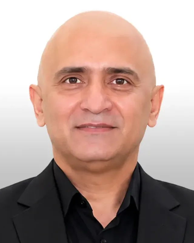
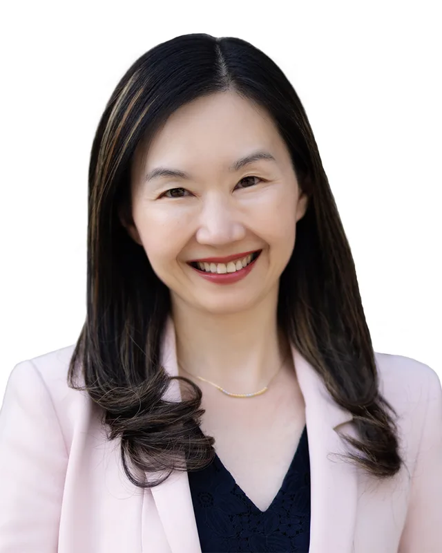
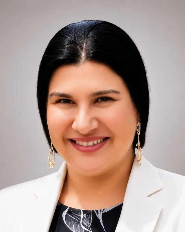
4 candidates, one seat.

This district elects one MLA. Voters mark one name on Saturday, October 24, 2026, and the candidate with the most votes wins the seat.

Burnaby Centre is a provincial electoral district in the City of Burnaby. It takes in the neighbourhoods of Cascade Heights, Garden Village, Deer Lake and Buckingham Heights, along with Deer Lake Park and the Burnaby campus of the British Columbia Institute of Technology. The 2021 census counted 53,625 people in it, and the Electoral Boundaries Commission gives its area as 18 square kilometres.

The candidates

In alphabetical order
People, 2021 census
53,625
Area
18 km²
Registered voters, 2024
34,290
Turnout, 2024
50.11%
Median age
42.4
Median household income, 2020
$84,000
THE DISTRICT

Where Burnaby Centre is

18 km² · 53,625 people

Burnaby Centre is one of five districts that the Electoral Boundaries Commission's 2023 final report draws inside the City of Burnaby. The report says it includes the neighbourhoods of Cascade Heights, Garden Village, Deer Lake and Buckingham Heights. Its western boundary runs along Boundary Road. Its northern boundary follows Highway 1 and the Lougheed Highway. Its eastern boundary follows Sperling Avenue, Lakefield Drive and Imperial Street, and its southern boundary follows Kingsway. The commission counts 53,458 people in an area of 18 square kilometres.

The commission's map labels Deer Lake Park inside the boundary, and BC Geographical Names places Deer Lake southwest of Burnaby Lake. Heritage Burnaby, the City's archive, describes Garden Village as the area bounded by Moscrop Street on the north, Kingsway and Grange on the south, Willingdon on the east and Boundary Road on the west. It describes the Cascade-Schou area, which it also calls Cascade Heights, as the area that holds the Burnaby Hospital site and has BCIT on its eastern edge. Elections BC's 2024 results file lists 13 voting places in the district, among them BCIT's Burnaby campus, Burnaby Central Secondary School, Moscrop Secondary School, Deer Lake United Church and Wesburn Community Centre.

Three roads run along or through the district. Kingsway, its southern boundary, began as the road between New Westminster and Vancouver. Canada Way, originally called Douglas Road, runs through it, and Burnaby City Hall stands at 4949 Canada Way. Highway 1 on the north is a freeway that opened in 1964 and runs 11 kilometres across Burnaby from North Road to Boundary Road.

  • Cascade Heights
  • Cascade-Schou
  • Garden Village
  • Deer Lake
  • Buckingham Heights
  • Douglas-Gilpin

Sources: British Columbia Electoral Boundaries Commission (opens in a new tab), BC Geographical Names Office (opens in a new tab), Heritage Burnaby (City of Burnaby) (opens in a new tab), Heritage Burnaby (City of Burnaby) (opens in a new tab), Elections BC (opens in a new tab), Burnaby Village Museum (opens in a new tab), Heritage Burnaby (City of Burnaby) (opens in a new tab), Freshet News (opens in a new tab)

HISTORY

The history of the area

Checked Thursday, October 8, 2026

Coast Salish Nations and the Deer Lake area

The City of Burnaby says it is on the unceded territories of the xʷməθkʷəy̓əm (Musqueam), Sḵwx̱wú7mesh (Squamish), səlilwətaɬ (Tsleil-Waututh) and kʷikʷəƛ̓əm (Kwikwetlem) Peoples. The Squamish Nation's website says its traditional territory includes parts of present-day cities such as Vancouver, Burnaby and New Westminster, and that some of its village sites date back 3,000 years. Musqueam's website says its people are traditional hən̓q̓əmin̓əm̓-speaking people and that its ancestors have lived in the Fraser River estuary, including much of Metro Vancouver, for thousands of years.

The Burnaby Village Museum's resource guide records what is known about the lake in this district. A caption in the guide says a stone knife found near the museum's present site is thousands of years old, and that the Deer Lake area was once an important village site for hən̓q̓əmin̓əm̓ and Sḵwx̱wú7mesh people. The guide says archaeological sites called middens have been found near Deer Lake. It says Indigenous families returned each year to campsites in Burnaby's Central Valley to gather cranberries, hunt game birds and fish for trout and salmon in local creeks and lakes. The guide states that the hən̓q̓əmin̓əm̓ and Sḵwx̱wú7mesh speaking people of Burnaby never ceded title to their ancestral lands.

Sources: City of Burnaby (opens in a new tab), Squamish Nation (Sḵwx̱wú7mesh Úxwumixw) (opens in a new tab), Musqueam Indian Band (xʷməθkʷəy̓əm) (opens in a new tab), Burnaby Village Museum (opens in a new tab)

The tram, the charter and Fairacres, 1891 to 1911

The Burnaby Village Museum's guide says that before 1892 settlers saw the land as the ground between New Westminster and the rapidly growing City of Vancouver. In 1891 businessmen from the two cities began building an interurban tram line between them. They owned property along the route, and the guide says building the tram encouraged property sales, especially near Deer Lake. The provincial government recognized Burnaby in September 1892, and the City of Burnaby gives 22 September 1892 as the date of its charter. The guide says Burnaby and Deer Lake residents built their homes near Canada Way, originally Douglas Road.

BC Geographical Names records that the name Deer Lake was adopted on 21 April 1936 on map 92G/2, as labelled on BC map 2B of 1914, and that the name appeared in the 1930 BC Gazetteer. The record lists Little Lake as an old name for it.

The Burnaby Art Gallery says that in 1909 Henry and Grace Ceperley bought a strawberry farm on the north shore of Deer Lake, and that their house Fairacres was finished in 1911. Canada's Historic Places says the building of Fairacres changed the Deer Lake area from a farming community into a favoured place for wealthy suburban homes. The museum guide's account of 1914 to 1929 says Deer Lake stayed a mostly British neighbourhood whose residents had cars, radios, telephones, central heating and hobby farms.

Sources: Burnaby Village Museum (opens in a new tab), City of Burnaby (opens in a new tab), BC Geographical Names Office (opens in a new tab), City of Burnaby (opens in a new tab), Canada's Historic Places (opens in a new tab)

Oakalla Prison Farm, 1912 to 1991

The Burnaby Village Museum's guide says the provincial government opened a prison on Crown land next to Deer Lake in 1912, and that the people held there worked on a farm. Heritage Burnaby says the Oakalla Prison Farm stood on 185 acres, was designed to hold 150 men and 50 women, and by the 1950s held well over 1,000 people. It had its own dairy, vegetable gardens and livestock. The guide says executions took place at the prison until 1959, and that the people who served time there included labour activists, members of religious minorities and Indigenous people who refused to obey discriminatory laws.

Heritage Burnaby says that by 1979 the decision had been made to close the farm, and that 64 acres were transferred to Burnaby for Deer Lake Park. Oakalla closed in 1991. Its buildings were demolished to make way for a new housing development and an expansion of the park.

Sources: Burnaby Village Museum (opens in a new tab), Heritage Burnaby (City of Burnaby) (opens in a new tab)

The civic centre at Deer Lake, 1949 to 1967

Heritage Burnaby says Deer Lake Park was established in 1949 on the lake's eastern shore. It says the move of the Municipal Hall to the Deer Lake area in the mid-1950s began the plan for an administrative and cultural centre for Burnaby. The City's archive records that the official opening of the hall at 4949 Canada Way was held on 22 June 1956, and that the building cost $625,000.00. Council chose a site in what the archive calls the exact geographic centre of Burnaby. That ended a disagreement between North Burnaby and South Burnaby residents, and the new hall replaced the municipal buildings at Edmonds and Kingsway.

The Burnaby Art Gallery says Benedictine monks bought the Ceperley property in 1939 and added a gymnasium, which later became the James Cowan Theatre. The City acquired the property in 1966, and Heritage Burnaby says Fairacres was dedicated in 1967 to mark Canada's Centennial. The gallery says it began as an association in 1967. Heritage Burnaby lists the Arts Centre, Century Gardens and the Burnaby Art Gallery among the cultural facilities that opened that year. The gallery says the City took over its management in 1998 and restored the outside of Ceperley House, and that the work was finished in 2000.

Sources: Heritage Burnaby (City of Burnaby) (opens in a new tab), Heritage Burnaby (City of Burnaby) (opens in a new tab), City of Burnaby (opens in a new tab), Heritage Burnaby (City of Burnaby) (opens in a new tab)

A hospital, schools, BCIT and a freeway, 1952 to 1964

The museum's guide says Burnaby's population rose from 30,328 in 1941 to 100,157 in 1961, and that new families demanded schools, parks, playgrounds and Burnaby's first hospital. Fraser Health says Burnaby Hospital opened in 1952. Heritage Burnaby records its address as 3935 Kincaid Street, in the Cascade-Schou area. Cascade Heights School, at 4343 Smith Avenue, opened in 1953 and was among the first new elementary schools built in Burnaby during the postwar housing boom. Moscrop Secondary School opened in 1956 with 636 students, and Burnaby Central opened in 1958 with 719 students as the third high school in Burnaby. Heritage Burnaby describes the north-east corner of Garden Village as a typical 1950s subdivision of single family homes.

BCIT's history page lists the BC Vocational School opening in Burnaby in 1960 and the Burnaby Campus being established in 1964 for programs in engineering, health and business. It lists the first graduating class in 1966. Freshet News reports that the Highway 1 freeway through Burnaby opened in 1964. A Heritage Burnaby photograph of the new freeway, dated c. 1964, shows the Willingdon exit.

Sources: Burnaby Village Museum (opens in a new tab), Fraser Health (opens in a new tab), Heritage Burnaby (City of Burnaby) (opens in a new tab), Heritage Burnaby (City of Burnaby) (opens in a new tab), Heritage Burnaby (City of Burnaby) (opens in a new tab), Heritage Burnaby (City of Burnaby) (opens in a new tab), Heritage Burnaby (City of Burnaby) (opens in a new tab), British Columbia Institute of Technology (opens in a new tab), Freshet News (opens in a new tab), Heritage Burnaby (City of Burnaby) (opens in a new tab)

Heritage Village, the carousel and the Shadbolt Centre, 1971 to 1995

Heritage Burnaby says the museum, first called Heritage Village, opened from 19 to 21 November 1971 for one weekend and then resumed fuller operation in 1972. It was a project of the Centennial '71 Committee, and the Century Park Museum Association ran it until 1990. The first site covered 4.3 acres. The museum's 50th anniversary page says hən̓q̓əmin̓əm̓ and Sḵwx̱wú7mesh speaking peoples lived in long-term settlements near Deer Lake, at the present site of the museum.

The museum's history page says the Municipality of Burnaby took over the museum in 1990, and that a new entrance opened that year across Deer Lake Brook. The museum now occupies ten acres at 6501 Deer Lake Avenue. The C.W. Parker Carousel officially opened in 1993 in the new Don Wrigley Pavilion. The City's page on the Shadbolt Centre for the Arts says Hotson Bakker Architects designed it in 1995, that it stands in Deer Lake Park, and that it is named for the painter Jack Shadbolt and his wife Doris Shadbolt, a curator and author. The centre received the Canadian Wood Council Award of Merit in 1996.

Sources: Heritage Burnaby (City of Burnaby) (opens in a new tab), Burnaby Village Museum (opens in a new tab), Burnaby Village Museum (opens in a new tab), City of Burnaby (opens in a new tab)

BCIT and Burnaby Hospital, 2011 to 2026

BCIT's history page lists an Indigenous Gathering Place established at its Burnaby campus in 2011. The campus is one of the 13 voting places that Elections BC lists in the district for the 2024 provincial election.

Fraser Health reported on 12 March 2026 that a new six-storey health-care pavilion and an expanded support services building at Burnaby Hospital opened to patients on Tuesday, 10 March 2026. The pavilion has 83 beds, mostly in single-patient rooms. It holds a mental-health inpatient unit, maternity and neonatal intensive care units, a medicine unit and outpatient clinics. On 21 September 2026 Fraser Health said the Province is providing $210 million for the next phase, which improves and expands the emergency department and the surgical unit.

Sources: British Columbia Institute of Technology (opens in a new tab), Elections BC (opens in a new tab), Fraser Health (opens in a new tab), Fraser Health (opens in a new tab)

THE SEAT

Who has held the seat

Legislative Assembly records, 35th Parliament onward

Burnaby Centre is a new district. The Electoral Boundaries Commission's final report of 3 April 2023 proposes five districts for Burnaby to address the rapid population growth in the City and surrounding areas. Elections BC's three electoral history volumes, which cover 1871 to 2013, print no district called Burnaby Centre. Elections BC's Statement of Votes reports the first result for the name at the 43rd provincial general election on 19 October 2024. Anne Kang of the BC NDP won with 9,780 votes (57.28%), ahead of Dharam Kajal of the Conservative Party with 7,294 votes (42.72%). Turnout was 50.11% of 34,290 registered voters.

Elections BC's conversion table matches the district's 60 voting areas to the districts of 2017 to 2024: 41 in Burnaby-Deer Lake, 17 in Burnaby North, 2 in Burnaby-Edmonds and 1 in Burnaby-Lougheed. Burnaby-Deer Lake first appears in Elections BC's volume for 2002 to 2013, at the 39th general election on 12 May 2009. Kathy Corrigan of the BC NDP won it with 8,103 votes (48.75%), and won again in 2013 with 8,189 votes (48.48%). Anne Kang of the BC NDP won it in 2017 with 8,747 votes (47.89%) and in 2020 with 9,190 votes (56.62%).

Burnaby North, the source of the other 17 voting areas, was held by Richard T. Lee of the BC Liberal Party from 2001 to 2017. Janet Routledge of the BC NDP won it in 2017, 2020 and 2024. The commission's report says it placed the area around Metrotown south of Kingsway in Burnaby South-Metrotown to keep the SkyTrain corridor in one district. Kingsway is the southern boundary of Burnaby Centre.

Sources: British Columbia Electoral Boundaries Commission (opens in a new tab), Elections BC (opens in a new tab), Elections BC (opens in a new tab), Elections BC (opens in a new tab), Elections BC (opens in a new tab), Elections BC (opens in a new tab)

Members for Burnaby Centre
ParliamentIt satMemberElected asParty on the legislature’s record
43rd2025 to 2026Anne KangBC NDPBC NDP
Members for Burnaby-Deer Lake, which covered 41 of this district’s 60 voting areas before 2024
ParliamentIt satMemberElected asParty on the legislature’s record
42nd2020 to 2024Anne KangBC NDPBC NDP
41st2017 to 2020Anne KangBC NDPBC NDP
40th2013 to 2017Kathy CorriganBC NDPBC NDP
39th2009 to 2013Kathy CorriganBC NDPBC NDP
Members for Burnaby North, which covered 17 of this district’s 60 voting areas before 2024
ParliamentIt satMemberElected asParty on the legislature’s record
43rd2025 to 2026Janet RoutledgeBC NDPBC NDP
42nd2020 to 2024Janet RoutledgeBC NDPBC NDP
41st2017 to 2020Janet RoutledgeBC NDPBC NDP
40th2013 to 2017Richard T. LeeBC Liberal PartyBC Liberal Party
39th2009 to 2013Richard T. LeeBC Liberal PartyBC Liberal Party
38th2005 to 2009Richard T. LeeBC Liberal PartyBC Liberal Party
37th2001 to 2005Richard T. LeeBC Liberal Party
36th1996 to 2001Pietro CalendinoBC NDP
35th1992 to 1996Barry JonesBC NDP

“Elected as” is the affiliation Elections BC printed with the winning result. The last column is the party the legislature’s records give for that parliament, which differs when a member changed party while in office. A row with that column empty is a winner Elections BC prints whom the legislature’s records leave out. Source: Legislative Assembly of British Columbia (opens in a new tab)

Boundaries since 2024

Burnaby Centre has 60 voting areas. They overlap these districts from 2017 to 2024: Burnaby-Deer Lake (41), Burnaby North (17), Burnaby-Edmonds (2), Burnaby-Lougheed (1).

The commission that drew the boundaries counted 53,458 people in the district, 0.6% below the average for a district, over 18 km².

Sources: British Columbia Electoral Boundaries Commission, Final report, April 3, 2023 (opens in a new tab), Elections BC, Voting area conversion table, 2017 to 2024 (opens in a new tab)

PAST RESULTS

Every result since 2005

From Elections BC
2024 Provincial General ElectionAnne Kang, BC NDP, 57.28%
CandidateAffiliationVotesShare
Anne KangElectedBC NDP9,78057.28%
Dharam KajalConservative Party7,29442.72%

17,074 valid votes · 108 rejected ballots · 34,290 registered voters · 50.11% voted

Burnaby-Deer Lake, 2009 to 2020

2020 General ElectionAnne Kang, BC NDP, 56.62%
CandidateAffiliationVotesShare
Anne KangElectedBC NDP9,19056.62%
Glynnis Hoi Sum ChanBC Liberal Party5,16331.81%
Mehreen ChaudryBC Green Party1,87811.57%

16,231 valid votes · 138 rejected ballots

2017 General ElectionAnne Kang, BC NDP, 47.89%
CandidateAffiliationVotesShare
Anne KangElectedBC NDP8,74747.89%
Karen Xiao Bao WangBC Liberal Party6,49135.54%
Rick McGowanBC Green Party2,20912.09%
Graham BowersConservative5893.22%
Elias IshakIndependent2291.25%

18,265 valid votes · 136 rejected ballots

2013 General ElectionKathy Corrigan, BC NDP, 48.48%
CandidateAffiliationVotesShare
Kathy CorriganElectedBC NDP8,18948.48%
Shian GuBC Liberal Party7,28643.13%
Richard (Rick) McGowanBC Green Party1,4178.39%

16,892 valid votes · 168 rejected ballots

2009 General ElectionKathy Corrigan, BC NDP, 48.75%
CandidateAffiliationVotesShare
Kathy CorriganElectedBC NDP8,10348.75%
John NuraneyBC Liberal Party7,59145.67%
G. Bruce FriesenBC Green Party9285.58%

16,622 valid votes · 156 rejected ballots

Burnaby North, 2005 to 2024

2024 Provincial General ElectionJanet Routledge, BC NDP, 53.26%
CandidateAffiliationVotesShare
Janet RoutledgeElectedBC NDP10,72453.26%
Michael WuConservative Party8,65843.00%
Martin KendellIndependent7543.74%

20,136 valid votes · 47 rejected ballots

2020 General ElectionJanet Routledge, BC NDP, 57.80%
CandidateAffiliationVotesShare
Janet RoutledgeElectedBC NDP12,89457.80%
Raymond DongBC Liberal Party6,84630.69%
Norine ShimBC Green Party2,56811.51%

22,308 valid votes · 176 rejected ballots

2017 General ElectionJanet Routledge, BC NDP, 48.57%
CandidateAffiliationVotesShare
Janet RoutledgeElectedBC NDP11,44848.57%
Richard T. LeeBC Liberal Party9,29039.42%
Peter HallschmidBC Green Party2,83112.01%

23,569 valid votes · 171 rejected ballots

2013 General ElectionRichard T. Lee, BC Liberal Party, 46.82%
CandidateAffiliationVotesShare
Richard T. LeeElectedBC Liberal Party10,54346.82%
Janet RoutledgeBC NDP9,87543.85%
Carrie McLarenBC Green Party1,5777.00%
Wayne Michael MarklundNo affiliation5232.32%

22,518 valid votes · 170 rejected ballots

2009 General ElectionRichard T. Lee, BC Liberal Party, 48.19%
CandidateAffiliationVotesShare
Richard T. LeeElectedBC Liberal Party9,88048.19%
Mondee RedmanBC NDP9,33245.51%
Doug PerryBC Green Party1,2926.30%

20,504 valid votes · 178 rejected ballots

2005 General ElectionRichard T. Lee, BC Liberal Party, 45.59%
CandidateAffiliationVotesShare
Richard T. LeeElectedBC Liberal Party10,42145.59%
Pietro CalendinoBC NDP10,35645.31%
Richard BrandBC Green Party1,7637.71%
Matthew R. LairdDR BC3161.38%

22,856 valid votes · 155 rejected ballots

The boundaries changed before the 2009, 2017 and 2024 elections, so a result under the same name can cover a different area. Sources: Elections BC, Provincial Voting Results (opens in a new tab), Statement of Votes, 2024 Provincial General Election (opens in a new tab)

PEOPLE · 2021 CENSUS

Who lives in Burnaby Centre

53,625 residents · British Columbia beside each figure

Age

Median age
42.4BC 42.8
  • Under 1512.8%BC 14.3%
  • 15 to 6467.4%BC 65.3%
  • 65 and over19.8%BC 20.3%
  • 85 and over3.0%BC 2.4%

Households

Households
20,655
People per household
2.6BC 2.4

Who lives together

  • Couples with children25.6%BC 22.7%
  • Couples without children21.6%BC 26.4%
  • One-parent families7.9%BC 7.6%
  • Multigenerational households5.2%BC 3.7%
  • People living alone27.1%BC 29.4%

Household size

  • 1 person27.1%BC 29.4%
  • 2 persons30.9%BC 35.3%
  • 3 persons17.1%BC 14.5%
  • 4 persons14.9%BC 12.6%
  • 5 or more persons9.9%BC 8.2%

Homes

Median home value
$1,200,000BC $785,000
Median monthly rent and utilities
$1,410BC $1,370
Median monthly cost for owners
$1,140BC $1,320

Own or rent

  • Own their home62.5%BC 66.8%
  • Rent their home37.5%BC 32.8%

Type of home

  • Single-detached house22.4%BC 42.4%
  • Semi-detached house6.2%BC 3.1%
  • Row house7.4%BC 8.3%
  • Apartment or flat in a duplex21.6%BC 12.2%
  • Apartment in a building that has fewer than five storeys22.5%BC 20.4%
  • Apartment in a building that has five or more storeys19.5%BC 10.9%
  • Other single-attached house0.5%BC 0.2%

When the home was built

  • 1960 or earlier12.2%BC 12.5%
  • 1961 to 198029.0%BC 27.0%
  • 1981 to 199015.0%BC 14.2%
  • 1991 to 200018.0%BC 16.5%
  • 2001 to 20056.5%BC 6.0%
  • 2006 to 20107.2%BC 8.0%
  • 2011 to 20156.6%BC 6.6%
  • 2016 to 20215.6%BC 9.1%

Housing costs

  • Renters paying 30% or more of income on housing35.3%BC 37.8%
  • Owners paying 30% or more of income on housing25.8%BC 19.3%
  • Renters in core housing need27.4%BC 24.7%
  • Owners in core housing need13.6%BC 8.0%
  • Renters in subsidized housing13.0%BC 11.0%
  • Owners with a mortgage49.7%BC 57.5%

Income

Income is for the year 2020.

Median household income
$84,000BC $85,000
After tax
$75,500BC $76,000
Median income per person
$36,400BC $40,800

Living on a low income (after-tax measure)

  • All ages13.2%BC 10.8%
  • Under 1812.4%BC 11.3%
  • 18 to 6411.8%BC 9.7%
  • 65 and over18.4%BC 13.8%

Languages

First language learned

  • English36.4%BC 67.1%
  • Mandarin15.0%BC 4.1%
  • Yue (Cantonese)11.6%BC 3.9%
  • Tagalog (Pilipino, Filipino)3.3%BC 1.7%
  • Punjabi (Panjabi)2.5%BC 4.9%
  • Spanish2.0%BC 1.2%
  • Korean1.9%BC 1.2%
  • Vietnamese1.6%BC 0.7%
  • Hindi1.4%BC 0.7%
  • Gujarati1.2%BC 0.2%

Spoken most often at home

  • English53.6%BC 78.5%
  • Mandarin12.8%BC 3.3%
  • Yue (Cantonese)7.9%BC 2.8%
  • Tagalog (Pilipino, Filipino)2.0%BC 0.9%
  • Korean1.6%BC 0.9%
  • Punjabi (Panjabi)1.3%BC 3.8%
  • Spanish1.1%BC 0.6%
  • Vietnamese1.0%BC 0.4%

English and French

  • English only87.9%BC 90.1%
  • English and French4.6%BC 6.6%
  • Neither English nor French7.4%BC 3.3%

Immigration

Born outside Canada (immigrants)
53.4%BC 29.0%
Non-permanent residents
6.3%BC 3.5%

Where immigrants were born

  • China26.8%BC 15.3%
  • Philippines10.1%BC 9.2%
  • Taiwan8.3%BC 2.8%
  • Hong Kong8.0%BC 5.5%
  • India6.7%BC 13.8%
  • Viet Nam3.4%BC 2.3%
  • Korea, South3.3%BC 3.3%
  • Oceania and other places of birth1.8%BC 2.3%
  • Iran1.8%BC 3.2%
  • United Kingdom1.7%BC 8.2%

When immigrants arrived

  • Arrived before 198015.1%BC 19.7%
  • 1980 to 199011.4%BC 11.5%
  • 1991 to 200025.0%BC 21.0%
  • 2001 to 201024.2%BC 22.2%
  • 2011 to 202124.3%BC 25.6%

Generations in Canada

  • First generation60.9%BC 33.7%
  • Second generation23.5%BC 21.7%
  • Third generation or more15.6%BC 44.5%

Identity and origins

Indigenous identity
1.6%BC 5.9%
Visible minority
72.8%BC 34.4%

Visible minority groups

  • Chinese37.0%BC 11.2%
  • South Asian12.3%BC 9.6%
  • Filipino7.0%BC 3.5%
  • Southeast Asian2.9%BC 1.5%
  • Korean2.6%BC 1.5%
  • Latin American2.4%BC 1.3%
  • Multiple visible minorities2.3%BC 1.2%
  • West Asian1.9%BC 1.4%
  • Black1.7%BC 1.3%
  • Japanese1.3%BC 0.9%
  • Arab0.7%BC 0.6%
  • Visible minority (other)0.6%BC 0.4%

Ethnic or cultural origins reported most often

  • Chinese32.6%BC 10.5%
  • Indian (India)8.2%BC 5.6%
  • Filipino6.9%BC 3.5%
  • English6.6%BC 20.7%
  • Scottish5.2%BC 15.8%
  • Canadian4.3%BC 9.3%
  • Irish4.3%BC 12.8%
  • Taiwanese4.2%BC 0.8%
  • German3.4%BC 11.0%
  • Italian3.1%BC 3.3%

Religion

  • No religion46.2%BC 52.1%
  • Christian35.1%BC 34.3%
  • Muslim6.0%BC 2.6%
  • Buddhist4.4%BC 1.7%
  • Hindu4.0%BC 1.7%
  • Sikh3.2%BC 5.9%
  • Other religions1.0%BC 1.0%
  • Jewish0.1%BC 0.5%
  • Traditional Indigenous spirituality0.1%BC 0.2%

Education

Highest level completed, ages 25 to 64.

  • No certificate, diploma or degree5.9%BC 8.0%
  • High school diploma20.6%BC 25.8%
  • College, trades or other certificate below a bachelor’s degree27.0%BC 31.2%
  • Bachelor’s degree or higher46.6%BC 35.0%

Work

In the labour force
61.3%BC 63.3%
Employed
55.5%BC 57.9%
Unemployment rate at the census
9.6%BC 8.4%

Industries with the most workers

  • Professional, scientific and technical services12.4%BC 9.2%
  • Retail trade12.2%BC 11.6%
  • Health care and social assistance11.7%BC 12.3%
  • Construction7.3%BC 9.0%
  • Accommodation and food services6.7%BC 7.0%
  • Educational services6.6%BC 7.4%
  • Manufacturing5.4%BC 5.9%
  • Finance and insurance5.2%BC 3.7%

Kinds of work

  • Sales and service occupations27.0%BC 25.6%
  • Business, finance and administration occupations20.3%BC 17.1%
  • Trades, transport and equipment operators and related occupations14.0%BC 18.0%
  • Natural and applied sciences and related occupations13.0%BC 8.0%
  • Occupations in education, law and social, community and government services9.7%BC 11.9%
  • Health occupations7.3%BC 7.7%
  • Occupations in art, culture, recreation and sport4.4%BC 4.2%
  • Occupations in manufacturing and utilities2.7%BC 3.4%
  • Natural resources, agriculture and related production occupations0.8%BC 2.8%
  • Legislative and senior management occupations0.6%BC 1.2%

Getting to work

Where people worked

  • Worked at home27.8%BC 22.6%
  • Worked outside Canada0.9%BC 0.4%
  • No fixed workplace address13.7%BC 15.3%
  • Worked at a usual workplace57.6%BC 61.6%

How commuters travelled

  • Car, truck or van71.4%BC 79.9%
  • Public transit20.5%BC 9.3%
  • On foot4.7%BC 6.5%
  • Bicycle1.0%BC 2.0%
  • Other method2.3%BC 2.3%

Length of the trip

  • Less than 15 minutes17.7%BC 31.8%
  • 15 to 29 minutes34.5%BC 34.0%
  • 30 to 44 minutes31.3%BC 19.7%
  • 45 to 59 minutes9.5%BC 7.3%
  • 60 minutes and over7.1%BC 7.2%

Moving

Where residents lived five years before the census.

  • Lived at the same address62.2%BC 56.2%
  • Moved within the same municipality12.3%BC 16.1%
  • Moved from elsewhere in BC12.3%BC 17.0%
  • Moved from another province2.7%BC 4.6%
  • Moved from another country10.5%BC 6.1%

Counts in the census are rounded to the nearest 5, and shares are worked out from those counts. Source: BC Stats, from Statistics Canada tabulations, 2021 Census Profile for BC Provincial Electoral Districts (2023 Redistribution) (opens in a new tab)

QUESTIONS

Questions about Burnaby Centre

10 answers

Where is Burnaby Centre?

Burnaby Centre is a provincial electoral district in the City of Burnaby, British Columbia. The Electoral Boundaries Commission's 2023 final report says it runs along Boundary Road in the west, follows Highway 1 and the Lougheed Highway in the north, Sperling Avenue, Lakefield Drive and Imperial Street in the east, and Kingsway in the south. The commission gives its area as 18 square kilometres.

Which neighbourhoods are in Burnaby Centre?

Burnaby Centre includes the neighbourhoods of Cascade Heights, Garden Village, Deer Lake and Buckingham Heights, according to the Electoral Boundaries Commission's 2023 final report. Heritage Burnaby also places Burnaby Central Secondary School in the Douglas-Gilpin area and Moscrop Secondary School in the Cascade-Schou area, and both schools were voting places in the district in 2024.

Who won Burnaby Centre in the 2024 provincial election?

Anne Kang of the BC NDP won Burnaby Centre in the 2024 provincial general election with 9,780 votes, 57.28% of the valid vote. Dharam Kajal of the Conservative Party received 7,294 votes, 42.72%. Turnout was 50.11% of 34,290 registered voters. Kang had won the earlier district of Burnaby-Deer Lake in 2017 and 2020.

Who represented this part of Burnaby before 2024?

Most of Burnaby Centre's voting areas came from Burnaby-Deer Lake, which Anne Kang of the BC NDP won in 2017 and 2020. Kathy Corrigan of the BC NDP won Burnaby-Deer Lake in 2009 and 2013. A further 17 voting areas came from Burnaby North, where Janet Routledge of the BC NDP won in 2017, 2020 and 2024.

When was the Burnaby Centre district created?

The Electoral Boundaries Commission's final report of 3 April 2023 proposed Burnaby Centre as one of five districts for Burnaby, because of rapid population growth in the City and surrounding areas. Elections BC reports the first result under the name at the 43rd provincial general election on 19 October 2024. Elections BC's histories for 1871 to 2013 print no district called Burnaby Centre.

How did the 2023 boundary change affect Burnaby Centre?

Elections BC's conversion table matches Burnaby Centre's 60 voting areas to the districts of 2017 to 2024: 41 in Burnaby-Deer Lake, 17 in Burnaby North, 2 in Burnaby-Edmonds and 1 in Burnaby-Lougheed. The commission counts 53,458 people in the district, which is 0.6% below the average district. Kingsway forms its southern boundary.

How many people live in Burnaby Centre?

The 2021 census counted 53,625 people in Burnaby Centre, with a median age of 42.4 compared with 42.8 across British Columbia. English was the first language of 36.4% of residents, Mandarin of 15% and Yue (Cantonese) of 11.6%. Immigrants made up 53.4% of the population, against 29% in British Columbia, and the median household income was $84,000.

Whose traditional territory is Burnaby Centre on?

The City of Burnaby says it is on the unceded territories of the Musqueam, Squamish, Tsleil-Waututh and Kwikwetlem Peoples. The Squamish Nation's website says its traditional territory includes parts of Burnaby. Musqueam's website says its ancestors have lived in the Fraser River estuary, including much of Metro Vancouver, for thousands of years. Burnaby Centre lies inside the City of Burnaby.

What stands beside Deer Lake in Burnaby Centre?

Deer Lake Park was established in 1949 on the lake's eastern shore, according to Heritage Burnaby, and the City says the Shadbolt Centre for the Arts stands in the park. The Burnaby Art Gallery occupies Ceperley House at 6344 Deer Lake Avenue, and the Burnaby Village Museum is at 6501 Deer Lake Avenue. Heritage Burnaby says 64 acres of former Oakalla Prison Farm land were transferred to Burnaby for the park.

What was Oakalla in Burnaby Centre?

Oakalla was a provincial prison farm that opened in 1912 on 185 acres next to Deer Lake, according to Heritage Burnaby. The farm was closed by 1979 and 64 acres went to Deer Lake Park. Oakalla closed in 1991, and its buildings were demolished to make way for housing and an expansion of the park.
SOURCES

Where this page comes from

Figures read Thursday, October 8, 2026
  1. 2021 Census Profile for BC Provincial Electoral Districts (2023 Redistribution) (opens in a new tab)BC Stats, from Statistics Canada tabulations · read Thursday, October 8, 2026
  2. Provincial Voting Results (opens in a new tab)Elections BC · read Thursday, October 8, 2026
  3. Statement of Votes, 2024 Provincial General Election (opens in a new tab)Elections BC · read Thursday, October 8, 2026
  4. Voting area conversion table, 2017 to 2024 (opens in a new tab)Elections BC · read Thursday, October 8, 2026
  5. Final report, April 3, 2023 (opens in a new tab)British Columbia Electoral Boundaries Commission · read Thursday, October 8, 2026
  6. Members of the Legislative Assembly, 35th to 43rd Parliament (opens in a new tab)Legislative Assembly of British Columbia · read Thursday, October 8, 2026
  7. Final report, April 3, 2023 (opens in a new tab)British Columbia Electoral Boundaries Commission · read Thursday, October 8, 2026
  8. Electoral History of British Columbia, 1871 to 1986 (opens in a new tab)Elections BC · read Thursday, October 8, 2026
  9. Electoral History of British Columbia, Supplement, 1987 to 2001 (opens in a new tab)Elections BC · read Thursday, October 8, 2026
  10. Electoral History of British Columbia, Supplement, 2002 to 2013 (opens in a new tab)Elections BC · read Thursday, October 8, 2026
  11. Provincial Voting Results (opens in a new tab)Elections BC · read Thursday, October 8, 2026
  12. Statement of Votes, 2024 Provincial General Election (opens in a new tab)Elections BC · read Thursday, October 8, 2026
  13. Indigenous Peoples and Reconciliation (opens in a new tab)City of Burnaby · read Thursday, October 8, 2026
  14. Our Land (opens in a new tab)Squamish Nation (Sḵwx̱wú7mesh Úxwumixw) · read Thursday, October 8, 2026
  15. Our Story (opens in a new tab)Musqueam Indian Band (xʷməθkʷəy̓əm) · read Thursday, October 8, 2026
  16. History of Burnaby Resource Guide (opens in a new tab)Burnaby Village Museum · read Thursday, October 8, 2026
  17. About Burnaby (opens in a new tab)City of Burnaby · read Thursday, October 8, 2026
  18. Deer Lake, BC Geographical Names record (opens in a new tab)BC Geographical Names Office · read Thursday, October 8, 2026
  19. Fairacres Mansion (opens in a new tab)Canada's Historic Places · read Thursday, October 8, 2026
  20. About the Gallery (opens in a new tab)City of Burnaby · read Thursday, October 8, 2026
  21. H.T. Ceperley Estate 'Fairacres' Mansion (opens in a new tab)Heritage Burnaby (City of Burnaby) · read Thursday, October 8, 2026
  22. Oakalla Prison (opens in a new tab)Heritage Burnaby (City of Burnaby) · read Thursday, October 8, 2026
  23. Deer Lake Park (opens in a new tab)Heritage Burnaby (City of Burnaby) · read Thursday, October 8, 2026
  24. Burnaby Municipal Hall (opens in a new tab)Heritage Burnaby (City of Burnaby) · read Thursday, October 8, 2026
  25. Cascade-Schou Neighbourhood (opens in a new tab)Heritage Burnaby (City of Burnaby) · read Thursday, October 8, 2026
  26. Garden Village Neighbourhood (opens in a new tab)Heritage Burnaby (City of Burnaby) · read Thursday, October 8, 2026
  27. Cascade Heights School (opens in a new tab)Heritage Burnaby (City of Burnaby) · read Thursday, October 8, 2026
  28. Moscrop Secondary School (opens in a new tab)Heritage Burnaby (City of Burnaby) · read Thursday, October 8, 2026
  29. Burnaby Central School (opens in a new tab)Heritage Burnaby (City of Burnaby) · read Thursday, October 8, 2026
  30. Burnaby General Hospital (opens in a new tab)Heritage Burnaby (City of Burnaby) · read Thursday, October 8, 2026
  31. New Freeway in Burnaby (opens in a new tab)Heritage Burnaby (City of Burnaby) · read Thursday, October 8, 2026
  32. Burnaby Hospital redevelopment will deliver better health care in a growing region (opens in a new tab)Fraser Health · read Thursday, October 8, 2026
  33. Opening doors to enhanced, modernized patient care in new facilities (opens in a new tab)Fraser Health · read Thursday, October 8, 2026
  34. Moving forward on renewed plan to redevelop Burnaby Hospital (opens in a new tab)Fraser Health · read Thursday, October 8, 2026
  35. BCIT history (opens in a new tab)British Columbia Institute of Technology · read Thursday, October 8, 2026
  36. A highway runs through it: Burnaby's Great Divide, Part 1 (opens in a new tab)Freshet News · read Thursday, October 8, 2026
  37. Burnaby Village Museum turns 50 (opens in a new tab)Heritage Burnaby (City of Burnaby) · read Thursday, October 8, 2026
  38. History of Burnaby Village Museum (opens in a new tab)Burnaby Village Museum · read Thursday, October 8, 2026
  39. 1990 to 2005: Focus (opens in a new tab)Burnaby Village Museum · read Thursday, October 8, 2026
  40. About the Shadbolt (opens in a new tab)City of Burnaby · read Thursday, October 8, 2026

Official information

From Elections BC
CORRECTIONS

Report a problem on this page.

Tell the editors what is wrong and where the correct information can be checked. The page you are on is attached automatically.