What to know before hiking at Cypress Mountain this winter
BC Parks requires backcountry hikers at Cypress to pick up a free access tag from Black Mountain Lodge before heading out from November 1 to May 31. Overnight parking outside three designated areas will get a vehicle towed.
Long read. The subject the most local outlets covered that day, with the public record behind it. Every outlet and record is linked under the story. Read the original report on bcparks.ca.

Winter arrives early at Cypress Mountain, and the rules for hiking and backcountry travel in Cypress Provincial Park change as soon as it does. BC Parks' winter access system began on November 1, 2026, and runs until May 31. Anyone planning to hike to the Black Mountain Plateau, Bowen Lookout or the backcountry beyond the ski area needs to know what it requires before they leave the trailhead.
The backcountry access tag
From November 1 to May 31, all backcountry hikers at Cypress must pick up a free backcountry access tag from the Brown Bag Room in Black Mountain Lodge before heading out. BC Parks introduced the system to guide hikers safely through the ski resort's terrain during the ski season. The tags are free and available at the lodge.
The corridor itself is marked by green circular signs. It runs through the ski resort area and leads hikers to the backcountry trails on the other side of the alpine ski area. Once past the resort, the trails are marked by red poles.
Two trails specifically require using the access corridor: the Black Mountain Plateau trail and the Bowen Lookout trail. Both pass through or alongside the ski resort, and both must be reached via the marked corridor from November through the end of May.
Where winter travel stops
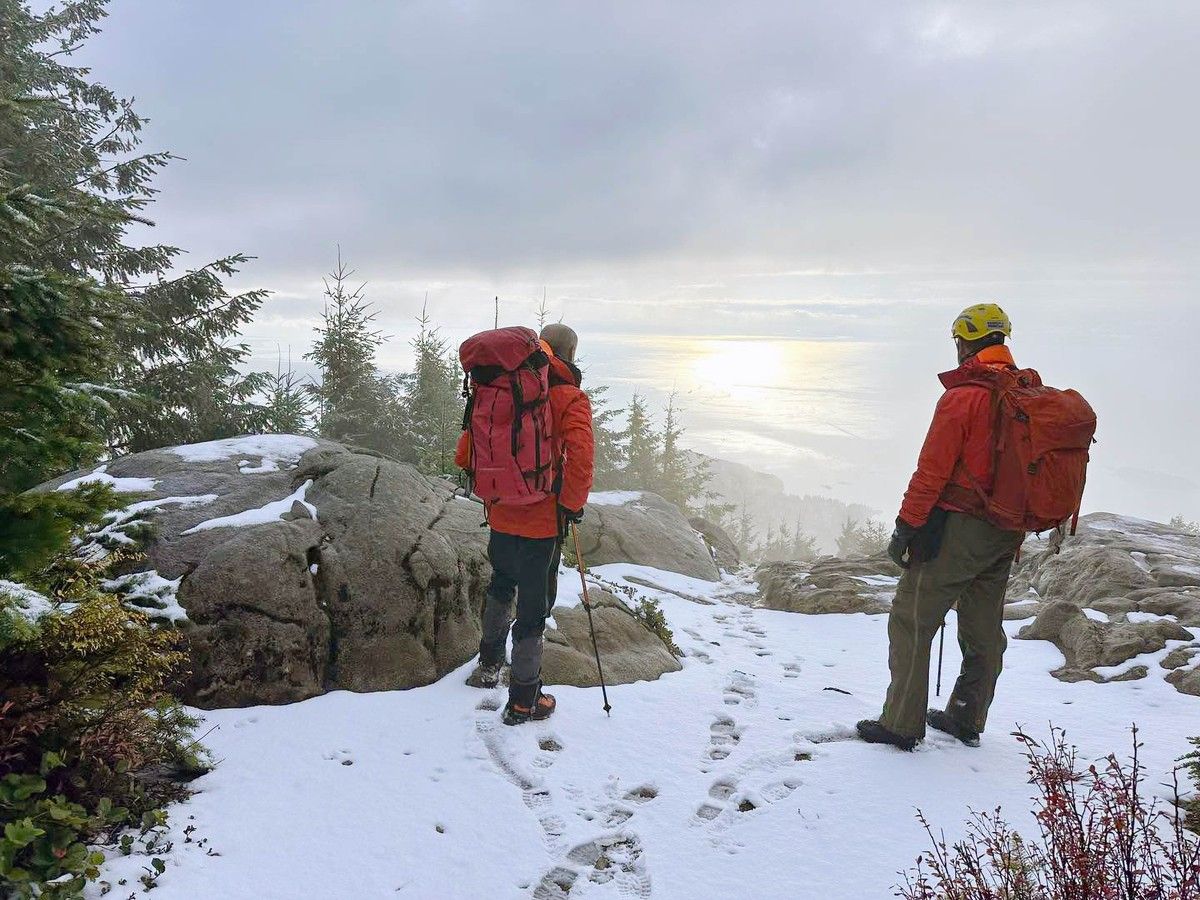
BC Parks discourages winter travel past Bowen Lookout. The route toward Eagle Bluffs and along the Howe Sound Crest Trail beyond that point crosses avalanche terrain. These areas carry serious risk in winter, and BC Parks asks hikers to turn back at Bowen Lookout.
The Howe Sound Crest Trail, which runs along the ridge above West Vancouver and connects Cypress Mountain to Deeks Lake and beyond, can be accessed from the Yew Lake area during summer. In winter, the section past Bowen Lookout is not safe for travel.
November 2026 brought a series of heavy rain storms to the North Shore mountains above West Vancouver, with high temperatures for the season. That moisture raises another concern below the treeline: creek crossings.
Creek crossings after heavy rain
Several Cypress Provincial Park trails require hikers to cross creeks that have no bridges. BC Parks warns that these crossings can become difficult or impossible to pass after heavy rain. Before any hike, check the trail conditions report on BC Parks' Cypress park page at bcparks.ca/cypress-park/ for the current state of key crossings.
After heavy fall rain, waiting a day or two for water levels to drop is better than attempting a crossing that has become dangerous.
Parking: know the rules before you go
Winter parking at Cypress is tightly restricted, and the rules are enforced.
BC Parks allows overnight parking in three places only:
- Parking lot 3B
- Designated road shoulder areas south of lot 3B
- The road shoulder between Cypress Bowl Road and the nordic area information kiosk
Vehicles left overnight in any other location will be towed. For daytime parking, the lots fill on weekends and holidays. BC Parks recommends carpooling whenever possible.
For people coming without a car, Cypress Coach Lines operates a shuttle service to Cypress Mountain during the ski season. The company's website at cypresscoachlines.com has booking details and contact information. Cypress Mountain Resort also runs a free shuttle from a central Vancouver pickup point during the ski season, though its schedule depends on the resort being open.
Avalanche conditions
The mountains above Cypress Provincial Park carry avalanche terrain in winter, and the danger changes with each storm cycle. Avalanche Canada publishes a daily danger forecast for the Sea to Sky region, which includes the slopes above the Cypress ski area and the ridgeline running toward Eagle Bluffs and the Howe Sound Crest Trail.
The forecast covers the backcountry terrain above the ski resort, the ridge toward Eagle Bluffs, and the Howe Sound Crest Trail corridor. It identifies specific terrain features and aspects to avoid each day. Checking the forecast at avalanche.ca before any backcountry trip above Cypress is a standard step for anyone planning to go beyond the marked ski runs.
No campfires, any time of year
Cypress Provincial Park has a permanent campfire ban. Open fires are not permitted anywhere in the park, year-round, including in picnic areas. The ban applies in all seasons.
Before you go
Three resources to check before any winter trip to Cypress:
- Trail conditions: BC Parks' Cypress park page at bcparks.ca/cypress-park/ is updated when conditions change. The page also shows the current advisory language for each zone.
- Avalanche conditions: Avalanche Canada publishes a daily danger forecast for the Sea to Sky region, which covers the mountains above Cypress, at avalanche.ca. The forecast rates danger by elevation band and identifies which terrain to avoid.
- Road conditions: BC's DriveBC service at drivebc.ca shows current alerts for Cypress Bowl Road, including any closures or road conditions after snow or ice.
For people planning to stay overnight, pick up the backcountry access tag at Black Mountain Lodge when you arrive. For day hikers reaching the Bowen Lookout or Black Mountain trails, the same applies: get the tag first, then head out.
Questions this story answers
Do I need a permit or tag to hike at Cypress Mountain in winter?
Yes. BC Parks requires all backcountry hikers at Cypress Provincial Park to pick up a free backcountry access tag from the Brown Bag Room in Black Mountain Lodge before heading into the backcountry. This requirement runs from November 1 to May 31 each year. There is no charge for the tag. The access corridor through the ski resort is marked by green circular signs, and the trails themselves are marked by red poles.
Which trails at Cypress require using the backcountry access corridor?
BC Parks says the Black Mountain Plateau trail and the Bowen Lookout trail must both be accessed via the backcountry access corridor, which runs through the ski resort area and is marked by green circular signs. Hikers must pick up a free access tag from Black Mountain Lodge before using this corridor. The corridor operates from November 1 to May 31.
Is the Howe Sound Crest Trail safe to hike in winter at Cypress Mountain?
BC Parks strongly discourages winter travel along the Howe Sound Crest Trail past Bowen Lookout. The trail beyond that point and the route toward Eagle Bluffs cross avalanche terrain and involve hazardous conditions in winter. Travel to those areas is not recommended from November through spring. The Howe Sound Crest Trail can be accessed from the Yew Lake area during summer months.
Where can I park at Cypress Mountain for a backcountry hike in winter?
BC Parks allows overnight parking in three places only: Parking lot 3B, designated road shoulder areas south of lot 3B, and the road shoulder between Cypress Bowl Road and the nordic area information kiosk. Vehicles left overnight anywhere else will be towed. Daytime parking on weekends and holidays fills quickly, and BC Parks recommends carpooling or taking the Cypress Coach Lines shuttle bus.
Is there a campfire ban at Cypress Provincial Park?
Yes. BC Parks has a permanent campfire ban throughout Cypress Provincial Park, all year round. Open fires are not allowed in any part of the park, including picnic areas. This ban does not change in summer.
How do I get to Cypress Mountain without a car in winter?
Cypress Coach Lines operates a shuttle service from Vancouver to Cypress Mountain during the ski season. The company lists a phone number and booking system on its website at cypresscoachlines.com. Cypress Mountain Resort also operates a free shuttle during the ski season. BC Parks recommends carpooling or using a shuttle service, particularly on weekends when parking fills up.
What should I do about creek crossings on Cypress Mountain trails in winter?
Several trails at Cypress Provincial Park cross creeks that have no bridges. BC Parks warns that these crossings can be difficult or impossible after heavy rainfall. Before heading out, check the current trail conditions report on BC Parks' Cypress park page at bcparks.ca/cypress-park/. After a series of November rain storms on the North Shore mountains, water levels on some crossings may be elevated.
What is the best way to find out about trail conditions at Cypress Mountain before I go?
BC Parks publishes a trail conditions report on the Cypress Provincial Park page at bcparks.ca/cypress-park/ that is updated when conditions change. For avalanche conditions in the mountains above Cypress Mountain, check the Avalanche Canada forecast for the Sea to Sky region at avalanche.ca. For road conditions on Cypress Bowl Road, BC's 511 service at drivebc.ca shows current alerts.
Sources
The pages this story draws on. Open one to check a claim yourself.
Found an error? Tell the editors with the corrections form. A correction is noted on the story it changes. Read our standards.