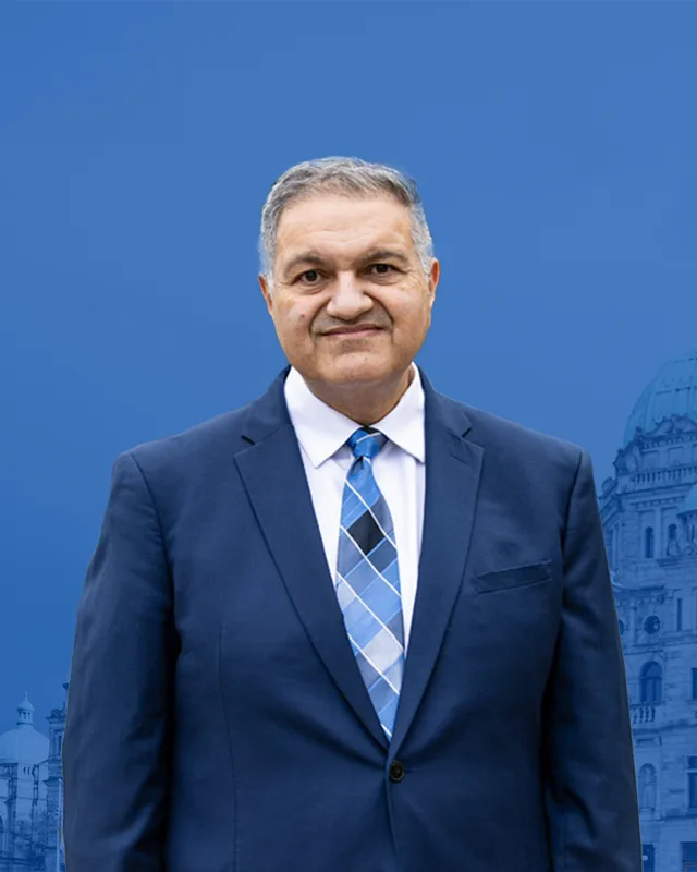
This district elects one MLA. Voters mark one name on Saturday, October 24, 2026, and the candidate with the most votes wins the seat.
Surrey-Newton is a provincial electoral district in the west of the City of Surrey, between 120th and 144th Streets. The Electoral Boundaries Commission says it includes Newton town centre, Strawberry Hill, Highland Creek and the main campus of Kwantlen Polytechnic University. The 2021 census counted 61,520 people in its 14 square kilometres, and 49.3% of them are immigrants.
Surrey-Newton lies in the west of the City of Surrey. The Electoral Boundaries Commission's 2023 final report says it includes Newton town centre, Strawberry Hill, Highland Creek, the main campus of Kwantlen Polytechnic University and the area around King George Boulevard north of 64th Avenue. Its boundaries follow 80th Avenue in the north and 64th and 68th Avenues in the south. In the east it runs along 144th Street and in the west along 120th Street. The commission gives the area as 14 square kilometres and the population as 61,398, which is 14.2% from the average district.
Newton reaches beyond this district. The same report says Surrey North includes the northern part of Newton, and that its changes to Surrey-Newton and Surrey-Fleetwood keep the centre of Newton in one district. The City of Surrey's Newton Town Centre Plan covers 61 hectares, bounded by 72 Avenue in the north, 138 Street in the east, 68 Avenue in the south and 135 Street, 70B Avenue and 134 Street in the west. The City says that in 2016 the wider Newton community had over 149,000 residents, the largest population of any community in Surrey.
King George Boulevard is the main road the commission names in its description. The City says the crossing of King George Boulevard and 72 Avenue became the main commercial area of Newton after the boulevard was completed in 1940. In March 2013 TransLink announced work at Newton Exchange, a bus station in Newton, to make room for a new B-Line service to Guildford along King George Boulevard and 104th Avenue. At the 2024 election people voted at 14 places in the district. Twelve carry a school's name, and the other two are Kwantlen Polytechnic University and the Newton Recreation Centre.
The Surrey School District acknowledges the Kwantlen, Katzie and Semiahmoo Nations as the peoples on whose traditional and unceded territories its schools stand. It also names the many other Coast Salish peoples who continue to use and care for this land. The City of Surrey makes the same acknowledgement on its page for Newton and says these Nations have ancient and ongoing ties to the place.
The Katzie First Nation says on its website that its people have lived in their territory for thousands of years. It lists Pitt Meadows, Maple Ridge, Surrey, Langley and Delta as places that each have ancient Katzie names, and it says it works to keep those names in use by coming generations. Kwantlen Polytechnic University, which has its main campus in this district, says the Kwantlen First Nation gave the university its name. The university gives the meaning of the word Kwantlen as Tireless Runner.
Elias Newton and the interurban station, 1880s to 1914
BC Geographical Names says Newton is named after Elias John Newton. A second account in the same record, taken from a book of British Columbia place names, says the name comes from E.J. Villeneuf, a pioneer settler, saddler and harness maker. According to that account his neighbours found his name hard to say, so he changed it to Newton. The Encyclopedia of British Columbia says Newton settled in the area in the mid-1880s.
The Encyclopedia says the community grew up around an interurban station of the BC Electric Railway, built in 1910 at a crossroads. It adds that King and Farris Lumber Company built one of western Canada's first electric-powered sawmills at Newton in 1910. The City of Surrey says the Newton name was recognized more firmly after Newton Station opened on the BC Electric line, and that Newton Elementary opened in 1914 at the northwest corner of today's King George Boulevard and 72 Avenue. BC Geographical Names records that the Newton Station Post Office opened on 1 April 1914 and was renamed the Newton Post Office on 6 June 1960.
Strawberry Hill and the Japanese Canadian berry farms, 1900 to 1942
The Canadian Register of Historic Places places Strawberry Hill east of 120 Street, west of 128 Street, north of 72 Avenue and south of 96 Avenue. The part between 72 and 80 Avenue is in Surrey-Newton. The Encyclopedia of British Columbia says Japanese berry farmers settled the area in the early 1900s and that, by the late twentieth century, it had become mostly residential.
The register's statement of significance, written by the Province of British Columbia, says Japanese Canadian families bought land at Strawberry Hill and began berry and poultry farming among the stumps of freshly logged old growth timber. It says strawberry, raspberry and gooseberry growing was a successful industry before 1940. After the First World War, growers faced too much supply, too few markets and no price control. The farmers formed the Surrey Berry Growers' Co-operative Association and the Strawberry Hill Farmers' Institute to set quality and price controls.
The statement also describes the forced internment of the farmers during the Second World War and the seizure and sale of their homes and farms. It records that one tract, owned by the farmer Zennosuke Inouye, was returned to him afterwards. The Province recognized Strawberry Hill as a heritage site in 2017.
The Canadian Register of Historic Places says the Strawberry Hill Farmers Institute was founded on September 3, 1909. Donations, grants and volunteer labour paid for the hall, which stood on land given by the institute's first president, George Henry Flux. The register says the institute held lectures on farming practices, hosted social activities and helped new settlers, and that the hall stood at the corner of 75A Avenue and 122 Street.
The City of Surrey's heritage register dates the building to circa 1909 and lists it as a utilitarian homestead hall. The City says a fire destroyed the original building in 2021 and that a replica was completed in 2024. The replica stands at 12152 75 Avenue and is now a childcare centre for children aged 3 to 5.
Farms, a boulevard and the first high school, 1920 to 1973
Two houses on the City of Surrey's heritage register show the farms of the district before the suburbs. Burkart House at 13483 72 Avenue was built circa 1920 as a Craftsman bungalow, and the City registered it in 1998. At 6571 King George Boulevard, Adolph and Ruth Swanson bought a property in 1927, cleared it and started building a house in 1932. In 1943 they built a barn, which the City says later served as a community hall for a trailer park.
The City's entry says new owners bought the property circa 1960 and turned the farm into a trailer park, and that the wife of one of them, Rita Johnson (the City's spelling), later served on Surrey Council, as an MLA and as the first woman premier of British Columbia. King George Boulevard was completed in 1940. Princess Margaret Secondary School, which opened in 1951, was the first high school in the area. Frank Hurt Secondary School and Newton Arena both opened in 1973.
Kwantlen College split from Douglas College in 1981. It became a university college with power to grant degrees by 1995, and in 2008 Premier Gordon Campbell announced its new name, Kwantlen Polytechnic University. The university's address is 12666 72 Avenue. The Newton Wave Pool opened in 1987, and the City of Surrey approved the first Newton Town Centre Plan in 1990.
The City says some civic and recreation buildings and some shops followed north of 72 Avenue, and that key parts of the plan area, particularly south of 72 Avenue, were never developed. In 2008 Council endorsed a report that sought an agreement between the City and TransLink to prepare an updated land use and transit plan. In November 2018 Council suspended the Surrey-Newton-Guildford light rail project, and on July 13, 2020 it adopted an updated plan. The Newton branch of Surrey Libraries, a 14,700 square foot building designed by Patkau Architects, stands a short distance from Newton Exchange at 13795 70 Avenue.
The Surrey Now-Leader reported in April 2012 that Surrey's annual Vaisakhi event was then in its 12th year and was coordinated by the Gurdwara Sahib Dasmesh Darbar in Newton. The temple stands at 12885 85 Avenue, north of this district. Vaisakhi marks the founding of the Khalsa in 1699, according to the same article.
The article gave the 2012 route. The parade went south on 128 Street, west along 82 Avenue, south on 124 Street, along 75 Avenue and 76 Avenue, and north on 128 Street back to the temple. The parts of the route south of 80th Avenue are inside Surrey-Newton. The article said attendance had usually been between 80,000 and 100,000. The City of Surrey now says Newton hosts one of the largest Vaisakhi parades outside India, with more than 400,000 people. In the 2021 census 45% of residents of the district gave Punjabi as their first language.
Elections BC's volume for 1987 to 2001 says the Constitution Amendment Act (S.B.C. 1985, chapter 3), assented to on 21 February 1985, changed the boundaries of Surrey and created Surrey-Guildford-Whalley, Surrey-Newton and Surrey-White Rock-Cloverdale. The first election for Surrey-Newton was held on 22 October 1986. Rita Johnston of Social Credit won it with 13,436 votes (48.81%), ahead of Bob Bose with 12,460 (45.26%), according to the volume for 1871 to 1986.
The volume for 1987 to 2001 shows Penny Priddy of the NDP winning in 1991 with 10,193 votes (42.28%), ahead of Johnston with 7,796 (32.33%). The Legislative Assembly says Johnston, the member for Surrey-Newton, became Premier on April 2, 1991, and lost her seat in the election of October 17, 1991. Priddy won again in 1996 with 13,969 votes (49.54%), ahead of Indra Thind of the Liberals with 9,788 (34.71%). Tony Bhullar of the BC Liberal Party won in 2001 with 6,750 votes (49.45%), ahead of Param Grewal of the NDP with 3,949 (28.93%).
Harry Bains of the BC NDP won the district in 2005 with 10,741 votes (57.89%) and was the member until 2024, according to the legislature's record. His later results were 10,709 votes in 2009, 9,788 (56.42%) in 2013, 9,744 (57.31%) in 2017 and 8,893 (62.64%) in 2020. The Electoral Districts Act of 2023 (Bill 25) lists Surrey-Newton among 93 districts. The Legislative Assembly's copy is certified as passed at third reading on April 25, 2023, and the Act comes into force on the day the 42nd Parliament is dissolved.
The commission's final report gives the earlier Surrey-Newton 56,327 people, which is 2.0% below the average, and the new district 61,398. The final report also adjusted the boundary between Surrey Central, now Surrey-Serpentine River, and Surrey-Newton to follow Bear Creek. Elections BC's matching of voting areas lists 42 areas in common with the earlier Surrey-Newton, nine with Surrey-Green Timbers and eight with Surrey-Panorama. In 2024 Jessie Sunner of the BC NDP won with 7,924 votes (51.17%), ahead of Tegjot Bal of the Conservative Party with 6,658 (42.99%). Turnout was 50.81% of 30,549 registered voters.
“Elected as” is the affiliation Elections BC printed with the winning result. The last column is the party the legislature’s records give for that parliament, which differs when a member changed party while in office. A row with that column empty is a winner Elections BC prints whom the legislature’s records leave out. Source: Legislative Assembly of British Columbia (opens in a new tab)
Boundaries since 2024
Surrey-Newton has 56 voting areas. 42 of them overlap the district of the same name used from 2017 to 2024.Others overlap these districts from 2017 to 2024: Surrey-Green Timbers (9), Surrey-Panorama (8).
The commission that drew the boundaries counted 61,398 people in the district, 14.2% above the average for a district, over 14 km².
Surrey-Newton is a provincial electoral district in the west of the City of Surrey, British Columbia. The Electoral Boundaries Commission's 2023 final report says its boundaries follow 80th Avenue in the north, 64th and 68th Avenues in the south, 144th Street in the east and 120th Street in the west. The commission gives its area as 14 square kilometres.
Which communities are in Surrey-Newton?
Surrey-Newton includes Newton town centre, Strawberry Hill and Highland Creek, according to the Electoral Boundaries Commission's 2023 final report. The report also places the main campus of Kwantlen Polytechnic University and the area around King George Boulevard north of 64th Avenue in the district. The northern part of Newton is in the neighbouring district, Surrey North.
Who won Surrey-Newton in the 2024 provincial election?
Jessie Sunner of the BC NDP won Surrey-Newton in 2024 with 7,924 votes, which is 51.17% of the valid vote. Tegjot Bal of the Conservative Party received 6,658 votes. Amrit Birring of the Freedom Party of BC received 371. Turnout was 50.81% of 30,549 registered voters, according to Elections BC.
Who has been the MLA for Surrey-Newton?
Jessie Sunner of the BC NDP won Surrey-Newton in 2024. Harry Bains of the BC NDP held the seat in five parliaments from 2005 to 2024, according to the legislature's record. Tony Bhullar of the BC Liberal Party held it from 2001 to 2005, and Penny Priddy of the BC NDP held it from 1992 to 2001.
Which premier was the MLA for Surrey-Newton?
Rita Johnston was the member for Surrey-Newton when she became Premier of British Columbia on April 2, 1991, according to the Legislative Assembly. She is described there as the first woman Premier in Canadian history. She lost her seat in the election of October 17, 1991, when Penny Priddy of the NDP won Surrey-Newton with 10,193 votes.
When was the Surrey-Newton electoral district created?
Surrey-Newton was created by the Constitution Amendment Act (S.B.C. 1985, chapter 3), assented to on 21 February 1985, which altered the boundaries of Surrey. Elections BC's volume for 1871 to 1986 prints its first result, from the general election held on 22 October 1986, when Rita Johnston of Social Credit won with 13,436 votes.
How did the boundaries of Surrey-Newton change in 2023?
The Electoral Boundaries Commission changed Surrey-Newton in 2023 to reduce population differences with neighbouring districts and to keep the centre of Newton in one district. It counts 61,398 people in the new district, compared with 56,327 in the earlier one. Elections BC matches 42 of the district's 56 voting areas to the earlier Surrey-Newton.
How many people live in Surrey-Newton and what languages do they speak?
The 2021 census counted 61,520 people in Surrey-Newton, with a median age of 35.6 compared with 42.8 across British Columbia. Punjabi was the first language of 45% of residents and English of 27.8%, followed by Hindi at 3.7%, Urdu at 2.3% and Tagalog at 2%. Immigrants made up 49.3% of the population.
Who is Newton in Surrey-Newton named after?
Newton is named after Elias John Newton, according to BC Geographical Names, which also records a second account that the name comes from E.J. Villeneuf, a settler who changed his surname to Newton. The Encyclopedia of British Columbia says Newton grew up around a BC Electric Railway interurban station built in 1910.
Whose traditional territory is Surrey-Newton on?
The Surrey School District acknowledges the Kwantlen, Katzie and Semiahmoo Nations on whose traditional and unceded territories its schools stand, including those in Surrey-Newton. The City of Surrey's Newton page says the same of the Newton area. Kwantlen Polytechnic University, whose main campus is in the district, was named by the Kwantlen First Nation.