This district elects one MLA. Voters mark one name on Saturday, October 24, 2026, and the candidate with the most votes wins the seat.
North Island is a provincial electoral district that takes in the northern part of Vancouver Island, the islands around it and the mainland part of the Mount Waddington Regional District. It includes Campbell River, Sayward, Port McNeill, Port Hardy and Alert Bay. The 2021 census counted 58,935 people in it, and the Electoral Boundaries Commission gives its area as 39,933 square kilometres.
North Island covers the northern part of Vancouver Island, the islands around it and the Mount Waddington Regional District on the mainland. The Electoral Boundaries Commission's 2023 final report says the district includes Campbell River, Sayward, Port McNeill, Port Hardy and Alert Bay, and that its southern boundary follows the border of the Strathcona Regional District. The report's table of proposed districts gives North Island 58,940 people and 39,933 square kilometres. Its table of the 87 districts then in use lists the same population and 45,034 square kilometres.
The Strathcona Regional District names five member municipalities: Campbell River, Gold River, Sayward, Tahsis and Zeballos. Its Electoral Area A takes in Gold River, Tahsis and Zeballos and runs west to Kyuquot Sound and Nootka Sound. Electoral Area B is Cortes Island and the islands around it. Electoral Area C includes Quadra Island, Read Island, Redonda Island, the Thurlow Islands and the mainland inlets. In the north, the Regional District of Mount Waddington has its office in Port McNeill and states that it lies within the territory of the Kwakwaka’wakw.
Port Hardy says the logging road that joins it to Campbell River was paved in December of 1979. BC Geographical Names says Tahsis, on Nootka Sound, had no road to the rest of Vancouver Island until 1972. Elections BC's 2024 results file records voting places on Cortes Island and Quadra Island, in Campbell River, Port McNeill and Port Hardy, at Kyuquot and Zeballos on the west coast, on Cormorant Island and Malcolm Island, and at Winter Harbour, Holberg and Quatsino.
Kwakwaka’wakw Nations of the north and east coasts
The U'mista Cultural Society in Alert Bay says its people are the Kwakwa̱ka̱ʼwakw, people who speak Kwakʼwala and live in different places under different names for their separate groups. The ʼNa̱mǥ̱is First Nation says its territory takes in the whole Nimpkish and Kokish river valleys on northern Vancouver Island, with the waters and several islands near Johnstone Strait and Queen Charlotte Strait. It says the members who live in the territory are concentrated at ʼYa̱lis, which is Alert Bay on Cormorant Island, and that its lands were never ceded. The Kwakiutl First Nation describes itself as part of the Kwakwaka’wakw and as living on the north-eastern tip of Vancouver Island, with its office on Tsakis Way at Fort Rupert.
Further south, the Wei Wai Kum First Nation, also called the Campbell River Indian Band, says it belongs to the Ligʷiłdaxʷ, the southernmost group of the Kwakwaka’wakw. Its page names Loughborough Inlet and the Tyee Spit at Campbell River, called Glamatoo, among its primary territories. It says the Ligʷiłdaxʷ moved south over time and displaced Salish peoples at Kelsey Bay, on Quadra Island and at Campbell River. The We Wai Kai Nation has reserves at Cape Mudge on Quadra Island and at Quinsam inside the city limits of Campbell River. The K’ómoks First Nation, covered in the profile of Courtenay-Comox, gives a different account in which its first ancestors settled at Quinsam and its people came to occupy Quadra Island. This page gives each Nation's own statement.
The Homalco First Nation, Xwémalhkwu, calls itself a Northern Coast Salish Nation. It says its territory includes all of Bute Inlet and reaches west to Campbell River, south to Comox and north to Sayward, taking in the Discovery Islands and Discovery Passage. In the early 1990s it set up a new reserve in Campbell River through a land exchange with the Province, and its village is there today. The Klahoose First Nation says its traditional territories span from Cortes Island to Toba Inlet and that Squirrel Cove is its primary village site. The Museum at Campbell River names Xwemalhkwu, Klahoose and K’ómoks as the Coast Salish First Nations that are its closest neighbours. The museum works on the land of the Ligʷiłdaxʷ.
On the west coast, the Mowachaht/Muchalaht First Nation, which is a member of the Nuu-chah-nulth nation, names Yuquot in Nootka Sound as the centre of its hahoothlee, its territory. The Village of Gold River states that its area is the traditional territory of the Mowachaht and Muchalaht people. BC Geographical Names says the head of Tahsis Inlet was an important Mowachaht winter village in the late 18th century. The Ka:’yu:’k’t’h’/Che:k’tles7et’h’ First Nations say their territory runs from Porritt Creek, north of Nootka Sound, to Solander Island at the tip of Brooks Peninsula. They describe themselves as the northernmost of 14 Nuu-chah-nulth Nations and cite archaeological evidence of at least 5,000 years of continuous occupation.
The Kwakiutl First Nation records that its people told the Hudson's Bay Company about coal at Suquash in 1835, and that the company's steamer Beaver came to look at it in 1836. According to the Nation, the Kwagu’l would not let the company work the coal and offered to mine it themselves and sell it. In May of 1849 the company began to build Fort Rupert in Beaver Harbour as a base for developing the coalfields. BC Geographical Names records that the village beside the fort, T'saxis, was used by the Kwakiutl, Kweeha, Komkiutis and Walas Kwakiutl, and that Fort Rupert Indian Reserve 1 was allotted in 1886.
At Alert Bay, BC Geographical Names says two settlers leased Cormorant Island in 1870 and set up a fish saltery. The U'mista Cultural Society adds that they induced the ʼNa̱mǥ̱is First Nation to move from the Nimpkish River village of Xwa̱lkw to Alert Bay to supply labour, and that a missionary, a school, a sawmill and an Indian agent followed. The mission of the Reverend Alfred James Hall moved from Fort Rupert to Alert Bay in 1878. The post office opened on October 1, 1885, and the Union Steam Ship Company added Alert Bay to its route in 1889.
The potlatch law, the return of the masks and St. Michael's, 1878 to 1980
U'mista records that a law passed on April 19, 1884 made the potlatch a crime punishable by two to six months in jail. The potlatch is the ceremony the Kwakwa̱ka̱ʼwakw hold to mark births, marriages, names, new chiefs and deaths. In 1921 Dan Cranmer held a large potlatch at Village Island. Forty-five people were arrested and twenty men and women were sent to Oakalla Prison near Vancouver. The Indian agent stored the masks and regalia handed over in the Anglican Parish Hall at Alert Bay, and most of the collection was later shipped to museums in Ottawa and Toronto. Section 149 of the Indian Act was deleted when the Act was revised in 1951.
Efforts to bring the collection home began in the late 1950s and early 1960s. The U'mista Cultural Society was incorporated on March 22, 1974, and its centre in Alert Bay opened in November of 1980. The Royal Ontario Museum returned its part in 1988, and the Smithsonian's National Museum of the American Indian returned sixteen more pieces in 2002. The We Wai Kai Nation shows part of the potlatch collection at its Nuyumbalees Cultural Centre at Cape Mudge.
The ʼNa̱mǥ̱is First Nation's Going Home project describes the St. Michael's school at Alert Bay. The Anglican Church began a mission there in 1878, a boarding school by 1882 and an industrial school for boys in 1894. A new building opened in 1929 with space for 200 children, and the student residence closed in 1974. The Homalco First Nation and the Ka:’yu:’k’t’h’/Che:k’tles7et’h’ First Nations each state on their own sites that their children were taken to residential schools.
Sointula, Port Alice, Zeballos and Tahsis, 1901 to 1945
The Dictionary of Canadian Biography says the Finnish journalist Matti Kurikka reached Nanaimo towards the end of August 1900 and became president of a colonization company called Kalevan Kansa. The company chose Malcolm Island for a colony named Sointula, which means harmony. The first settlers arrived late in 1901 and brought a printing press for a newspaper. The biography says the colony broke up in 1904, in part over a debate about marriage, and that a Finnish tone still survives on Malcolm Island.
BC Geographical Names says the Whalen Pulp and Paper Company built a pulp mill at Port Alice in 1917, and that the post office opened on October 1, 1917. The Village of Zeballos says gold was found in the hills around it in the early 1930s, that the Privateer mine produced 30 to 40 ounces of gold to the ton of ore, and that a town stood there by 1938. The mines had shut by 1942. Zeballos became a village on June 27, 1952, according to BC Geographical Names. The same source says Tahsis was founded in 1945 when the Gibson brothers built a sawmill.
Campbell River: power, a pulp mill and Ripple Rock, 1907 to 1958
BC Geographical Names records that the Campbell River post office opened on June 1, 1907. The place became a village municipality on June 24, 1947, a district municipality on December 17, 1964 and a city effective April 4, 2005. The Museum at Campbell River, writing in the Campbell River Mirror, says the BC Power Commission started its Campbell River power project in 1945 and that Premier John Hart switched on power from the new John Hart Dam on December 15, 1947. Up to 450 men worked on the dam and power plant, and a pulp mill was built at Duncan Bay in 1952.
The museum's own page on Ripple Rock says the underwater rock in Seymour Narrows was destroyed by a planned explosion at 9:31 a.m. on April 5, 1958. It says Ripple Rock damaged or sank at least 20 large and 100 smaller vessels between 1875 and 1958, that at least 110 people drowned in those accidents, and that CBC Television showed the blast live across Canada. The museum records the explosion as a National Historic Event.
U'mista describes the 1964 move of the Gwa'sala and the 'Nakwaxda'xw. It says the Canadian government relocated the two peoples from Smith Inlet, Seymour Inlet and Blunden Harbour to the Tsulquate reserve near Port Hardy, and that the Indian agent burned their houses. The Village of Gold River says it was built in 1965 and incorporated on August 26, 1965, and that its mill closed on February 16, 1999. BC Geographical Names gives incorporation dates of February 18, 1966 for Port McNeill and April 5, 1966 for Port Hardy.
Port Hardy says its population grew to more than 5,000 during the years of the Island Copper Mine, 1971 to 1995, when the mine employed more than 900 people. It says the Quatsino First Nation now manages the former mine site. In treaty matters, the Kwakiutl First Nation says it has stepped away from the British Columbia treaty process to pursue claims under the Douglas Treaty. The Government of British Columbia states that the Maa-nulth First Nations Final Agreement, which includes Ka:’yu:’k’t’h’/Che:k’tles7et’h’, came into effect on April 1, 2011.
Elections BC's volume for 1871 to 1986 lists the Constitution (Amendment) Act, SBC 1978 c.14, dated June 29, 1978, as the Act that created North Island, with ten other new districts, in time for the 1979 election. At the 32nd general election in 1979, Colin Stuart Gabelmann of the New Democratic Party won with 8,831 votes (52.17%), ahead of Gerry Furney of the Social Credit Party with 6,649 (39.28%). Gabelmann won again in 1983 with 11,572 votes (55.19%) and in 1986 with 11,724 (54.58%).
The volume for 1987 to 2001 prints Gabelmann's win in 1991 with 8,427 votes (50.39%), ahead of Dan Reynen of the Liberal Party with 5,670 (33.91%). Glenn Robertson of the New Democratic Party won in 1996 with 8,385 votes (45.80%), ahead of Gerry Furney, now a Liberal, with 6,781 (37.04%). In 2001 Rod Sanderson Visser of the Liberal Party won with 13,781 votes (57.12%). The legislature's record lists him as Rod Visser.
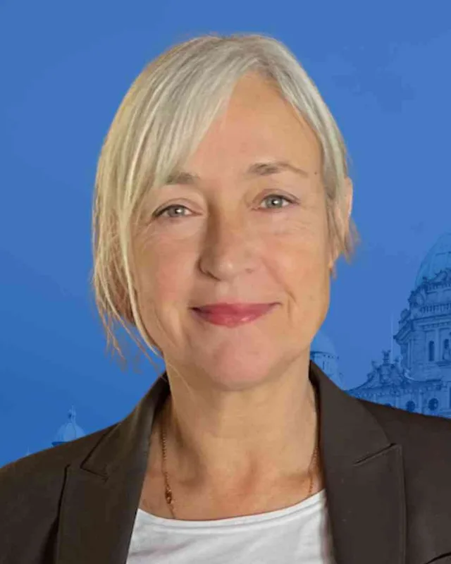
Claire Trevena of the BC NDP won North Island in 2005, 2009, 2013 and 2017. Michele Babchuk of the BC NDP won in 2020 with 12,467 votes (50.75%). In 2024 Anna Kindy of the Conservative Party won with 14,100 votes (47.07%), ahead of Michele Babchuk with 13,461 (44.93%) and Nic Dedeluk of the BC Green Party with 2,397. Turnout was 62.15% of 48,249 registered voters. The legislature's page for Anna Kindy states that the 43rd Parliament was dissolved on September 22, 2026 and that a provincial general election will be held on October 24, 2026.
A page of the commission's report headed Preliminary Report 2022 says it proposed no changes to the Courtenay-Comox and North Island districts. Elections BC's conversion table matches the district's 91 voting areas to the 2017 districts: 91 in North Island, 3 in Courtenay-Comox, 2 in Powell River-Sunshine Coast and 1 in North Coast.
“Elected as” is the affiliation Elections BC printed with the winning result. The last column is the party the legislature’s records give for that parliament, which differs when a member changed party while in office. A row with that column empty is a winner Elections BC prints whom the legislature’s records leave out. Source: Legislative Assembly of British Columbia (opens in a new tab)
Boundaries since 2024
North Island has 91 voting areas. 91 of them overlap the district of the same name used from 2017 to 2024.Others overlap these districts from 2017 to 2024: Courtenay-Comox (3), Powell River-Sunshine Coast (2), North Coast (1).
The commission that drew the boundaries counted 58,940 people in the district, 9.6% above the average for a district, over 39,933 km².
North Island is a provincial electoral district covering the northern part of Vancouver Island, the islands around it and the Mount Waddington Regional District on the mainland. The Electoral Boundaries Commission's 2023 final report gives it 58,940 people and 39,933 square kilometres. The report says its southern boundary follows the border of the Strathcona Regional District.
Which communities are in North Island?
North Island includes Campbell River, Sayward, Port McNeill, Port Hardy and Alert Bay, according to the commission's 2023 final report. Elections BC's 2024 results file also records voting places on Quadra Island and Cortes Island, at Tahsis, Zeballos, Kyuquot, Port Alice, Holberg and Winter Harbour, and at Sointula on Malcolm Island.
Who is the MLA for North Island?
Anna Kindy of the Conservative Party won North Island in 2024 with 14,100 votes (47.07%). The legislature's page for her states that the 43rd Parliament was dissolved on September 22, 2026 and that a provincial general election will be held on October 24, 2026. Michele Babchuk of the BC NDP held the seat before her.
Who represented North Island before Anna Kindy?
Michele Babchuk of the BC NDP won North Island in 2020 with 12,467 votes (50.75%). Before her, Claire Trevena of the BC NDP won the district in 2005, 2009, 2013 and 2017. The legislature's record lists Trevena in the 38th, 39th, 40th and 41st Parliaments, and Babchuk in the 42nd.
How did North Island vote in 2024?
North Island elected Anna Kindy of the Conservative Party in 2024 with 14,100 votes (47.07%). Michele Babchuk of the BC NDP received 13,461 votes (44.93%) and Nic Dedeluk of the BC Green Party received 2,397 votes. Turnout was 62.15% of the 48,249 registered voters, according to the figures Elections BC published for the district.
When was North Island created?
North Island was created by the Constitution (Amendment) Act, SBC 1978 c.14, dated June 29, 1978, according to Elections BC's volume for 1871 to 1986. The district was first contested in the 1979 general election. Colin Stuart Gabelmann of the New Democratic Party won it that year with 8,831 votes (52.17%) and won it again in 1983 and 1986.
Which First Nations have territory in North Island?
Several Nations describe territory in North Island, each in its own words. They include the Kwakwaka’wakw Nations (the Kwakiutl, Wei Wai Kum, We Wai Kai and the ʼNa̱mǥ̱is), the Homalco and Klahoose, who are Coast Salish, and the Mowachaht/Muchalaht and Ka:’yu:’k’t’h’/Che:k’tles7et’h’, who are Nuu-chah-nulth. Their sites give the boundaries each Nation claims.
Who lives in North Island?
The 2021 census counted 58,935 people in North Island, with a median age of 48.8 years against 42.8 for British Columbia. Indigenous identity was reported by 16% of residents, which is 9,275 people, of whom 6,970 are First Nations and 1,895 are Métis. English was the first language of 91.1% of residents, and immigrants made up 10.5%.
What do people in North Island do for work?
Health care and social assistance employs the largest share of workers in North Island, at 15.1%, according to the 2021 census figures on this page. Retail trade follows at 12.5%, agriculture, forestry, fishing and hunting at 10.2%, and construction at 8.8%. The district's history includes pulp mills, a copper mine, gold mines and sawmills.
What is the Potlatch Collection in Alert Bay?
The Potlatch Collection is the set of masks and regalia taken from the Kwakwa̱ka̱ʼwakw after the 1921 potlatch at Village Island, now shown at the U'mista Cultural Centre in Alert Bay, in North Island. The centre opened in November of 1980. The Royal Ontario Museum returned its part in 1988, and the Smithsonian returned sixteen more pieces in 2002.