15 days to goBritish Columbia votes on Saturday, October 24, 2026

Get in front of undecided British Columbia voters
MLA · BC PROVINCIAL 2026

Coquitlam-Maillardville.
3 candidates, one seat.

This district elects one MLA. Voters mark one name on Saturday, October 24, 2026, and the candidate with the most votes wins the seat.

Coquitlam-Maillardville is a provincial electoral district in the southwest of the City of Coquitlam, in Metro Vancouver. It takes in Maillardville, Austin Heights, Fraser Mills, Ranch Park and Mayfair, and runs from Guildford Way south to the Fraser River. The 2021 census counted 57,045 people in it, and the Electoral Boundaries Commission gives its area as 33 square kilometres.

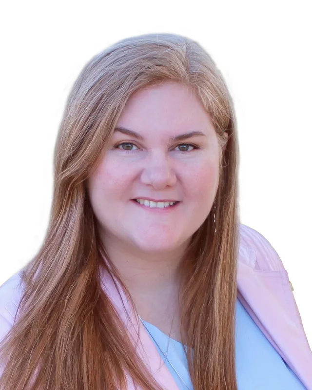
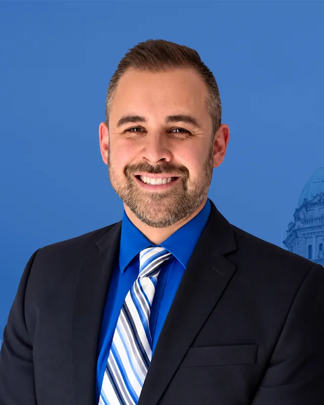
The candidates

In alphabetical order
People, 2021 census
57,045
Area
33 km²
Registered voters, 2024
40,666
Turnout, 2024
56.90%
Median age
44.0
Median household income, 2020
$101,000
THE DISTRICT

Where Coquitlam-Maillardville is

33 km² · 57,045 people

Coquitlam-Maillardville lies in the southwest of the City of Coquitlam. The Electoral Boundaries Commission's 2023 final report says it includes Maillardville, Austin Heights, Fraser Mills, Ranch Park and Mayfair. Its boundaries follow Blue Mountain Street in the west, the Fraser River in the south and Guildford Way in the north. In the east it follows the Coquitlam municipal boundary, except where it jogs into Port Coquitlam so that both kʷikʷəƛ̓əm (Kwikwetlem) reserves are in one district. The commission counted 57,047 people in 33 square kilometres.

The commission's map labels Como Lake, Mundy Park and Ranch Park inside the district. The City of Coquitlam gives Mundy Park as 178 hectares at 641 Hillcrest Street, with a 5.5 kilometre multi-use pathway around it. The City's 2019 community profile says Austin Heights covers 66 hectares, that 85% of its housing is multi-family apartments, and that Blue Mountain Park there has a playground, a wading pool and spray park in summer, tennis courts and sculpture gardens.

Most people travel by road. The 2021 census shows that among people counted by main way of getting to work, 83.1% used a car, truck or van, 10.1% took public transit, 4% walked and 0.5% cycled. The City's profile says the Lougheed Highway opened in 1953 and the Trans-Canada Highway in 1964, and that the Lougheed SkyTrain station is ten minutes away from Austin Heights by public bus.

  • Maillardville
  • Laval Square
  • Millside
  • Austin Heights
  • Fraser Mills
  • Ranch Park
  • Mayfair
  • Como Lake
  • Mundy Park
  • slakəyánc (Coquitlam Indian Reserve 1)
  • setɬamékmən (Coquitlam Indian Reserve 2)

Sources: British Columbia Electoral Boundaries Commission (opens in a new tab), Province of British Columbia (BC Data Catalogue) (opens in a new tab), City of Coquitlam (opens in a new tab), City of Coquitlam (opens in a new tab)

HISTORY

The history of the area

Checked Thursday, October 8, 2026

kʷikʷəƛ̓əm territory and the village of slakəyánc

The kʷikʷəƛ̓əm (Kwikwetlem) First Nation says on its website that its name in the hən̓q̓əmin̓əm̓ language means "Red Fish up the River", and that its people have lived in their territory around the Coquitlam River Watershed since before remembered time. The City of Coquitlam says the Nation is located on traditional and ancestral lands in the Coquitlam area, lands historically shared with the Katzie and other Coast Salish Peoples.

The Nation's two reserves are slakəyánc (Coquitlam Indian Reserve 1) and setɬamékmən (Coquitlam Indian Reserve 2). The Electoral Boundaries Commission moved Coquitlam 2 into this district in 2023 so that both lie together. The Province says slakəyánc is the Nation's ancient village site and that its name means "young sockeye". The federal government managed the reserve lands from 1876. The City says the Nation's Land Code became operational on 1 July 2020 and returns that authority to the Nation.

On 12 December 2023 the Province announced 14 new rental homes for Nation members at Lot 16, 65 Colony Farm Road, on slakəyánc. It was the first project the Nation completed under its Land Code. Monthly rents run from $500 for a one-bedroom home to $1,200 for a four-bedroom home. Chief Ron Giesbrecht gave the Nation's population growth as 6.8% a year from 2011 to 2023.

Sources: kʷikʷəƛ̓əm (Kwikwetlem) First Nation (opens in a new tab), City of Coquitlam (opens in a new tab), Province of British Columbia (BC Gov News) (opens in a new tab), British Columbia Electoral Boundaries Commission (opens in a new tab)

Mundy Lake and Como Lake, 1869 to 1957

The City's page on Mundy Park says George and Constance Munday emigrated from England in 1869 and eventually settled in the area. George claimed 150 acres in 1888, hoping that railway development would raise land values. The City says much of the old growth forest was logged in the 1920s. The Raymond L. Spani Memorial Pool opened in the park on 29 May 1970.

BC Geographical Names records G.A. Munday as a former owner of the property. A municipal map of 1920 spelled both the lake and the street Munday. The Post Office later changed the street to Mundy, to avoid a duplicate name in the New Westminster postal district, and local use of the lake name followed. The Office adopted Munday Lake on 4 July 1957 and kept that spelling to preserve the link to the first owner, while Mundy became the municipality's spelling.

Como Lake has a separate record. BC Geographical Names lists an earlier name, Welcome Lake, taken from a Geological Survey sheet of 1908 and a BC map of 1914. It records that on 4 July 1957 the name changed to Como Lake, the established local name.

Sources: City of Coquitlam (opens in a new tab), BC Geographical Names Office (opens in a new tab), BC Geographical Names Office (opens in a new tab)

The mill on the Fraser River, 1905 to 1913

The City's heritage statements say the Fraser Mills sawmill was established in 1889 to sell lumber abroad, which needed large ships. The Fraser River channel was too shallow for them and the mill shut down. The river was dredged in 1905 and the mill resumed production in 1906. Orders came faster than the mill could fill them, and the next year an investment syndicate based in the United States bought it and paid for new equipment. The City describes the mill as at one time the largest lumber mill in the British Empire.

A major expansion in 1907 and 1908 brought a company town. The Fraser Mills Manager's Residence was completed by 1908 at the entry to Millside, the town north of the mill. Millside Elementary School opened in 1907 as a two-room school for children up to Grade 7, and doubled to four rooms in 1925. The Coquitlam Public Library says the first stores stood along Pitt River Road, which later became Brunette Avenue.

In 1913 the Corporation of the District of Fraser Mills was incorporated by Letters Patent, separate from the District of Coquitlam. The City says the company town covered 390 acres along the Fraser River. The Coquitlam Archives says the Canadian Western Lumber Company operated the mill through much of the twentieth century.

Sources: City of Coquitlam (opens in a new tab), City of Coquitlam (opens in a new tab), City of Coquitlam (opens in a new tab), Coquitlam Public Library (opens in a new tab), City of Coquitlam Archives (opens in a new tab), City of Coquitlam Archives (opens in a new tab)

French Canadians arrive and Maillardville is founded, 1909 to 1912

The City's heritage statements give one account of how Maillardville began. An economic downturn in 1907 led to riots against Asian workers and left the mill short of labour. Fraser Mills hired a Roman Catholic priest to recruit workers in the lumbering regions of Quebec and Ontario. On 28 September 1909, 110 French Canadians arrived at the Millside Station, from villages in the Hull and Sherbrooke regions of Quebec and from Rockland, Ontario. The City counts the group as 40 families. A second group came the next year. The settlers founded Maillardville beside the mill, on lots supplied by the company that they paid for month by month.

They planned the town around a church in a central square. Funds were raised to build the first church in 1910, and the Société francophone de Maillardville says the parishioners of Our Lady of Lourdes celebrated Christmas mass that year. The City says the rectory was built in 1911 for the priest, and names Father Edmond Maillard, born in Lyon, France, who had been an Oblate missionary in New Westminster. The Société says the community was named in his honour in 1912. The City calls Maillardville one of the only distinct French-Canadian settlements west of Manitoba.

Sources: City of Coquitlam (opens in a new tab), City of Coquitlam (opens in a new tab), Société francophone de Maillardville (opens in a new tab)

The mill strike of 1931 and the school strike of 1951

Fraser Mills workers went on strike on 17 September 1931. The Coquitlam Heritage Society says wages were cut five times between January 1930 and September 1931, by almost one-third in total. The Lumber Workers' Industrial Union led the strike, and the society says the close community of Maillardville let it last two and a half months. A soup kitchen opened on Cartier Avenue and Chinese farmers gave vegetables. The society says the strike ended the wage cuts, with no significant pay rise and no recognition of the union. It says management, including Henry Mackin, blamed Communist agitators, although most strikers came from Maillardville itself.

A second dispute came over schools. The Société francophone de Maillardville says Catholic schools went on strike on 2 April 1951 because they felt they were the victims of injustice. The Festival du Bois website says the strike involved 840 students and drew international attention.

Sources: Coquitlam Heritage Society (opens in a new tab), Société francophone de Maillardville (opens in a new tab), Festival du Bois (opens in a new tab)

The Lougheed Highway, Austin Heights and the merger with Coquitlam, 1953 to 1971

The Lougheed Highway opened in 1953. A City report to Council dated 4 March 2014 says residential growth in Maillardville surged after World War II, with small businesses locating along Brunette Avenue. The City's profile of Austin Heights says that neighbourhood began to develop rapidly as a residential community after the war, and that the Trans-Canada Highway opened in 1964.

The mill's houses changed use. The last manager left the Manager's Residence in 1956, and in 1961 it became an RCMP headquarters. The last manager left the Mackin Residence in 1971. That year the Province forced the merger of Fraser Mills with Coquitlam. Talks had begun in 1969 and stalled over the mill's tax rate. The merger was finalized on 7 October 1971, when new Letters Patent were signed, and the City says it gave Coquitlam an industrial tax base and brought municipal services to Fraser Mills.

Sources: City of Coquitlam (opens in a new tab), City of Coquitlam (opens in a new tab), City of Coquitlam (opens in a new tab), City of Coquitlam (opens in a new tab), City of Coquitlam Archives (opens in a new tab)

Place des Arts, the festival and the neighbourhood plans, 1972 to 2014

Place des Arts began in 1972 as a not-for-profit society in Ryan House, the former mill manager's home at 1120 Brunette Avenue, and expanded into 18,000 square feet in 1996. The Société francophone de Maillardville was founded in 1983. The Coquitlam Public Library's Poirier Branch was formed in 1989 when the Ridgeway and Cottonwood branches merged, and it stands at 575 Poirier Street. The Société produces Festival du Bois, which takes place in Mackin Park each spring. The festival's own site welcomes visitors to its 38th annual festival and lists 5 to 7 March 2027.

The City's first Maillardville Neighbourhood Plan was adopted by Council in 1990. It created a mixed-use Neighbourhood Centre, set out improvements to Brunette Avenue and guided the development of the Clock Tower area and Heritage Square. The Neighbourhood Centre rules were updated in July 2008. The City's report of 4 March 2014 proposed a new plan to take 6,000 new residents over 20 to 25 years, with two Heritage Character Areas, Laval Square and Allard-LeBleu, named for the early townsites around that square and those avenues.

Sources: Place des Arts (opens in a new tab), City of Coquitlam (opens in a new tab), Société francophone de Maillardville (opens in a new tab), Coquitlam Public Library (opens in a new tab), Festival du Bois (opens in a new tab), City of Coquitlam (opens in a new tab)

The sawmill closes and the Fraser Mills neighbourhood, 2005 to 2031

The Coquitlam Public Library's exhibit says the Fraser Mills sawmill closed in 2005 after 115 years and was Coquitlam's largest private employer. The site is now a 96-acre master-planned neighbourhood developed with Beedie Living. Council approved the Waterfront Village Centre Neighbourhood Plan and a Development Agreement on 3 October 2022. The plan provides 5,500 residential units, 462 of them rental, with 16.6 acres of park and 5.1 acres of restored natural area.

The City says Council's approval of the public amenities was announced on 16 April 2025, with the first phase of park work targeted for completion in 2027. That phase includes a Riverfront Park with a renewed wharf, a playground, water play areas and two tennis courts, and a Historic Como Creek Greenway trail. The City says the area was once the largest sawmill in the British Empire, and that this history shaped the park's design themes. A community centre with a pool is planned for 2031, and on 13 July 2026 Council received the completed schematic design.

Sources: Coquitlam Public Library (opens in a new tab), City of Coquitlam (Let's Talk Coquitlam) (opens in a new tab), City of Coquitlam (opens in a new tab), City of Coquitlam (opens in a new tab)

THE SEAT

Who has held the seat

Legislative Assembly records, 35th Parliament onward

The 1871 to 1986 volume of Elections BC's electoral history prints no district named Coquitlam-Maillardville. The 1987 to 2001 volume first prints the name at the 1991 general election, the 35th, and lists the Electoral Districts Act (SBC 1990 c. 39), which replaced multi-member districts with 75 single-member districts. John Cashore of the New Democratic Party won in 1991 with 11,136 votes (47.18%), ahead of Bill F. McGuire of the Liberal Party with 8,930 (37.84%). Cashore won again in 1996 with 10,812 votes (45.91%), ahead of Maxine Wilson of the Liberal Party with 9,440 (40.08%). Richard Stewart of the Liberal Party won in 2001 with 11,549 votes (56.97%), ahead of Ken Landgraff of the New Democratic Party with 4,442 (21.90%).

Diane Thorne of the BC NDP won in 2005 with 10,532 votes (46.96%), ahead of Stewart with 10,001 (44.60%). She won again in 2009 with 9,818 votes (47.93%), ahead of Dennis John Marsden of the BC Liberal Party with 9,145 (44.64%). Selina Mae Robinson of the BC NDP won in 2013 with 9,930 votes (45.74%), 41 votes ahead of Steve Kim of the BC Liberal Party with 9,889 (45.55%). Robinson won in 2017 with 11,438 votes (50.61%) and in 2020 with 12,278 (59.70%). The legislature lists her party in the 42nd Parliament as Independent. In 2024 Jennifer Blatherwick of the BC NDP won with 11,972 votes, ahead of Hamed Najafi of the Conservative Party with 9,146 (39.57%). Turnout was 56.9% of 40,666 registered voters.

The commission's 2023 report lists the existing Coquitlam-Maillardville with 55,876 people in 30 square kilometres and the new district with 57,047 people in 33 square kilometres. The preliminary report had proposed the ridings New Westminster-Maillardville and Coquitlam-Mundy Park. After feedback about Maillardville's historic ties to Coquitlam, the final report moved Maillardville back into a Coquitlam riding, reunited it with Austin Heights and named that riding Coquitlam-Maillardville. Of the new district's 72 voting areas, Elections BC's conversion table matches 56 to the Coquitlam-Maillardville of 2017 to 2024, 11 to Port Moody-Coquitlam, 6 to Coquitlam-Burke Mountain and 1 to Port Coquitlam.

Sources: Elections BC (opens in a new tab), Elections BC (opens in a new tab), Elections BC (opens in a new tab), Elections BC (opens in a new tab), Legislative Assembly of British Columbia (opens in a new tab), British Columbia Electoral Boundaries Commission (opens in a new tab), Elections BC (opens in a new tab)

Members for Coquitlam-Maillardville
ParliamentIt satMemberElected asParty on the legislature’s record
43rd2025 to 2026Jennifer BlatherwickBC NDPBC NDP
42nd2020 to 2024Selina RobinsonBC NDPIndependent
41st2017 to 2020Selina RobinsonBC NDP
40th2013 to 2017Selina RobinsonBC NDP
39th2009 to 2013Diane ThorneBC NDPBC NDP
38th2005 to 2009Diane ThorneBC NDPBC NDP
37th2001 to 2005Richard StewartBC Liberal Party
36th1996 to 2001John CashoreBC NDP
35th1992 to 1996John CashoreBC NDP

“Elected as” is the affiliation Elections BC printed with the winning result. The last column is the party the legislature’s records give for that parliament, which differs when a member changed party while in office. A row with that column empty is a winner Elections BC prints whom the legislature’s records leave out. Source: Legislative Assembly of British Columbia (opens in a new tab)

Boundaries since 2024

Coquitlam-Maillardville has 72 voting areas. 56 of them overlap the district of the same name used from 2017 to 2024.Others overlap these districts from 2017 to 2024: Port Moody-Coquitlam (11), Coquitlam-Burke Mountain (6), Port Coquitlam (1).

The commission that drew the boundaries counted 57,047 people in the district, 6.1% above the average for a district, over 33 km².

Sources: British Columbia Electoral Boundaries Commission, Final report, April 3, 2023 (opens in a new tab), Elections BC, Voting area conversion table, 2017 to 2024 (opens in a new tab)

PAST RESULTS

Every result since 2005

From Elections BC
2024 Provincial General ElectionJennifer Blatherwick, BC NDP, 51.80%
CandidateAffiliationVotesShare
Jennifer BlatherwickElectedBC NDP11,97251.80%
Hamed NajafiConservative Party9,14639.57%
Nicola SpurlingBC Green Party1,4616.32%
Ken HolowankyIndependent5352.31%

23,114 valid votes · 26 rejected ballots · 40,666 registered voters · 56.90% voted

2020 General ElectionSelina Robinson, BC NDP, 59.70%
CandidateAffiliationVotesShare
Selina RobinsonElectedBC NDP12,27859.70%
Will DavisBC Liberal Party5,88228.60%
Nicola SpurlingBC Green Party2,40511.69%

20,565 valid votes · 187 rejected ballots

2017 General ElectionSelina Mae Robinson, BC NDP, 50.61%
CandidateAffiliationVotesShare
Selina Mae RobinsonElectedBC NDP11,43850.61%
Steve KimBC Liberal Party8,51937.70%
Nicola Eyton SpurlingBC Green Party2,46710.92%
Jesse Velay-VitowLibertarian1750.77%

22,599 valid votes · 99 rejected ballots

2013 General ElectionSelina Mae Robinson, BC NDP, 45.74%
CandidateAffiliationVotesShare
Selina Mae RobinsonElectedBC NDP9,93045.74%
Steve KimBC Liberal Party9,88945.55%
Edward Andreas StanbroughBC Green Party1,8918.71%

21,710 valid votes · 186 rejected ballots

2009 General ElectionDiane Thorne, BC NDP, 47.93%
CandidateAffiliationVotesShare
Diane ThorneElectedBC NDP9,81847.93%
Dennis John MarsdenBC Liberal Party9,14544.64%
Stephen ReidBC Green Party1,0405.08%
Doug SteadIndependent4812.35%

20,484 valid votes · 137 rejected ballots

2005 General ElectionDiane Thorne, BC NDP, 46.96%
CandidateAffiliationVotesShare
Diane ThorneElectedBC NDP10,53246.96%
Richard StewartBC Liberal Party10,00144.60%
Michael HejaziBC Green Party1,4156.31%
Brandon SteeleBC Marijuana Party2361.05%
Paul GeddesLibertarian1730.77%
Nattanya AndersenThe Platinum Party690.31%

22,426 valid votes · 156 rejected ballots

The boundaries changed before the 2009, 2017 and 2024 elections, so a result under the same name can cover a different area. Sources: Elections BC, Provincial Voting Results (opens in a new tab), Statement of Votes, 2024 Provincial General Election (opens in a new tab)

PEOPLE · 2021 CENSUS

Who lives in Coquitlam-Maillardville

57,045 residents · British Columbia beside each figure

Age

Median age
44.0BC 42.8
  • Under 1514.8%BC 14.3%
  • 15 to 6467.0%BC 65.3%
  • 65 and over18.1%BC 20.3%
  • 85 and over2.2%BC 2.4%

Households

Households
20,610
People per household
2.7BC 2.4

Who lives together

  • Couples with children32.1%BC 22.7%
  • Couples without children22.5%BC 26.4%
  • One-parent families8.4%BC 7.6%
  • Multigenerational households5.2%BC 3.7%
  • People living alone22.2%BC 29.4%

Household size

  • 1 person22.2%BC 29.4%
  • 2 persons30.1%BC 35.3%
  • 3 persons18.3%BC 14.5%
  • 4 persons18.5%BC 12.6%
  • 5 or more persons10.9%BC 8.2%

Homes

Median home value
$1,200,000BC $785,000
Median monthly rent and utilities
$1,300BC $1,370
Median monthly cost for owners
$1,460BC $1,320

Own or rent

  • Own their home70.4%BC 66.8%
  • Rent their home29.4%BC 32.8%
  • Home provided by a local government or First Nation0.1%BC 0.5%

Type of home

  • Single-detached house47.1%BC 42.4%
  • Semi-detached house3.3%BC 3.1%
  • Row house8.5%BC 8.3%
  • Apartment or flat in a duplex20.3%BC 12.2%
  • Apartment in a building that has fewer than five storeys18.9%BC 20.4%
  • Apartment in a building that has five or more storeys0.7%BC 10.9%
  • Movable dwelling1.2%BC 2.5%

When the home was built

  • 1960 or earlier10.7%BC 12.5%
  • 1961 to 198041.7%BC 27.0%
  • 1981 to 199021.1%BC 14.2%
  • 1991 to 200011.9%BC 16.5%
  • 2001 to 20052.4%BC 6.0%
  • 2006 to 20102.7%BC 8.0%
  • 2011 to 20154.5%BC 6.6%
  • 2016 to 20215.0%BC 9.1%

Housing costs

  • Renters paying 30% or more of income on housing33.1%BC 37.8%
  • Owners paying 30% or more of income on housing18.7%BC 19.3%
  • Renters in core housing need27.8%BC 24.7%
  • Owners in core housing need8.0%BC 8.0%
  • Renters in subsidized housing11.4%BC 11.0%
  • Owners with a mortgage57.6%BC 57.5%

Income

Income is for the year 2020.

Median household income
$101,000BC $85,000
After tax
$90,000BC $76,000
Median income per person
$42,400BC $40,800

Living on a low income (after-tax measure)

  • All ages8.6%BC 10.8%
  • Under 1810.4%BC 11.3%
  • 18 to 647.5%BC 9.7%
  • 65 and over11.1%BC 13.8%

Languages

First language learned

  • English57.4%BC 67.1%
  • Mandarin6.2%BC 4.1%
  • Yue (Cantonese)4.7%BC 3.9%
  • Korean4.7%BC 1.2%
  • Iranian Persian2.3%BC 0.9%
  • Tagalog (Pilipino, Filipino)2.2%BC 1.7%
  • Spanish1.8%BC 1.2%
  • Punjabi (Panjabi)1.3%BC 4.9%
  • Italian1.1%BC 0.4%
  • Russian1.0%BC 0.6%

Spoken most often at home

  • English73.0%BC 78.5%
  • Mandarin4.9%BC 3.3%
  • Korean3.9%BC 0.9%
  • Yue (Cantonese)3.0%BC 2.8%
  • Iranian Persian1.7%BC 0.7%
  • Tagalog (Pilipino, Filipino)1.1%BC 0.9%
  • Spanish1.0%BC 0.6%
  • Russian0.6%BC 0.3%

English and French

  • English only89.8%BC 90.1%
  • English and French6.6%BC 6.6%
  • Neither English nor French3.5%BC 3.3%

Immigration

Born outside Canada (immigrants)
38.0%BC 29.0%
Non-permanent residents
2.4%BC 3.5%

Where immigrants were born

  • China16.1%BC 15.3%
  • Korea, South10.9%BC 3.3%
  • Philippines9.0%BC 9.2%
  • Iran6.8%BC 3.2%
  • Hong Kong5.1%BC 5.5%
  • United Kingdom4.9%BC 8.2%
  • India4.4%BC 13.8%
  • Taiwan3.7%BC 2.8%
  • United States of America2.1%BC 4.2%
  • Romania1.9%BC 0.7%

When immigrants arrived

  • Arrived before 198016.8%BC 19.7%
  • 1980 to 199012.2%BC 11.5%
  • 1991 to 200025.2%BC 21.0%
  • 2001 to 201025.2%BC 22.2%
  • 2011 to 202120.6%BC 25.6%

Generations in Canada

  • First generation41.6%BC 33.7%
  • Second generation25.7%BC 21.7%
  • Third generation or more32.7%BC 44.5%

Identity and origins

Indigenous identity
2.6%BC 5.9%
Visible minority
46.6%BC 34.4%

Visible minority groups

  • Chinese15.7%BC 11.2%
  • South Asian6.3%BC 9.6%
  • Korean5.7%BC 1.5%
  • Filipino4.7%BC 3.5%
  • West Asian3.8%BC 1.4%
  • Multiple visible minorities2.3%BC 1.2%
  • Latin American2.3%BC 1.3%
  • Southeast Asian1.6%BC 1.5%
  • Black1.5%BC 1.3%
  • Japanese1.3%BC 0.9%
  • Arab0.9%BC 0.6%
  • Visible minority (other)0.6%BC 0.4%

Ethnic or cultural origins reported most often

  • English16.2%BC 20.7%
  • Chinese15.0%BC 10.5%
  • Scottish12.3%BC 15.8%
  • Irish9.0%BC 12.8%
  • Canadian8.2%BC 9.3%
  • German7.0%BC 11.0%
  • Italian5.9%BC 3.3%
  • Korean5.5%BC 1.5%
  • Filipino4.6%BC 3.5%
  • French4.6%BC 6.4%

Religion

  • No religion48.6%BC 52.1%
  • Christian40.5%BC 34.3%
  • Muslim4.5%BC 2.6%
  • Sikh1.8%BC 5.9%
  • Hindu1.7%BC 1.7%
  • Buddhist1.5%BC 1.7%
  • Other religions1.0%BC 1.0%
  • Jewish0.3%BC 0.5%
  • Traditional Indigenous spirituality0.0%BC 0.2%

Education

Highest level completed, ages 25 to 64.

  • No certificate, diploma or degree6.7%BC 8.0%
  • High school diploma24.8%BC 25.8%
  • College, trades or other certificate below a bachelor’s degree31.5%BC 31.2%
  • Bachelor’s degree or higher37.0%BC 35.0%

Work

In the labour force
65.1%BC 63.3%
Employed
59.0%BC 57.9%
Unemployment rate at the census
9.4%BC 8.4%

Industries with the most workers

  • Retail trade11.4%BC 11.6%
  • Health care and social assistance11.3%BC 12.3%
  • Professional, scientific and technical services10.2%BC 9.2%
  • Construction9.6%BC 9.0%
  • Educational services8.2%BC 7.4%
  • Manufacturing6.4%BC 5.9%
  • Accommodation and food services5.9%BC 7.0%
  • Public administration5.0%BC 5.5%

Kinds of work

  • Sales and service occupations24.9%BC 25.6%
  • Business, finance and administration occupations19.7%BC 17.1%
  • Trades, transport and equipment operators and related occupations17.6%BC 18.0%
  • Occupations in education, law and social, community and government services11.5%BC 11.9%
  • Natural and applied sciences and related occupations10.3%BC 8.0%
  • Health occupations7.1%BC 7.7%
  • Occupations in art, culture, recreation and sport3.9%BC 4.2%
  • Occupations in manufacturing and utilities2.9%BC 3.4%
  • Legislative and senior management occupations1.2%BC 1.2%
  • Natural resources, agriculture and related production occupations0.8%BC 2.8%

Getting to work

Where people worked

  • Worked at home24.6%BC 22.6%
  • Worked outside Canada0.5%BC 0.4%
  • No fixed workplace address14.6%BC 15.3%
  • Worked at a usual workplace60.3%BC 61.6%

How commuters travelled

  • Car, truck or van83.1%BC 79.9%
  • Public transit10.1%BC 9.3%
  • On foot4.0%BC 6.5%
  • Bicycle0.5%BC 2.0%
  • Other method2.3%BC 2.3%

Length of the trip

  • Less than 15 minutes21.0%BC 31.8%
  • 15 to 29 minutes32.1%BC 34.0%
  • 30 to 44 minutes26.5%BC 19.7%
  • 45 to 59 minutes11.2%BC 7.3%
  • 60 minutes and over9.2%BC 7.2%

Moving

Where residents lived five years before the census.

  • Lived at the same address65.4%BC 56.2%
  • Moved within the same municipality11.7%BC 16.1%
  • Moved from elsewhere in BC16.1%BC 17.0%
  • Moved from another province2.3%BC 4.6%
  • Moved from another country4.6%BC 6.1%

Counts in the census are rounded to the nearest 5, and shares are worked out from those counts. Source: BC Stats, from Statistics Canada tabulations, 2021 Census Profile for BC Provincial Electoral Districts (2023 Redistribution) (opens in a new tab)

QUESTIONS

Questions about Coquitlam-Maillardville

10 answers

Where is Coquitlam-Maillardville?

Coquitlam-Maillardville is a provincial electoral district in the southwest of the City of Coquitlam, in Metro Vancouver. The Electoral Boundaries Commission's 2023 final report says its boundaries follow Blue Mountain Street in the west, the Fraser River in the south and Guildford Way in the north. The commission counted 57,047 people in 33 square kilometres.

Which communities are in Coquitlam-Maillardville?

Coquitlam-Maillardville includes Maillardville, Austin Heights, Fraser Mills, Ranch Park and Mayfair, according to the commission's 2023 final report. The commission's map also labels Como Lake and Mundy Park inside it. The district holds both Kwikwetlem reserves, slakəyánc and setɬamékmən, and the new Fraser Mills neighbourhood on the old sawmill site beside the Fraser River.

Who is the member for Coquitlam-Maillardville?

Jennifer Blatherwick of the BC NDP is the member the legislature records for Coquitlam-Maillardville in the 43rd Parliament, after winning the district in 2024. Selina Robinson held it before her, and the legislature lists her as an Independent in the 42nd Parliament. Robinson held it for the BC NDP in the 40th and 41st Parliaments, and Diane Thorne of the BC NDP held it in the 38th and 39th.

How did Coquitlam-Maillardville vote in 2024?

Jennifer Blatherwick of the BC NDP won Coquitlam-Maillardville in the 2024 provincial general election with 11,972 votes, 51.8% of the valid vote. Hamed Najafi of the Conservative Party received 9,146 votes, 39.57%. Nicola Spurling of the BC Green Party received 1,461 votes and Ken Holowanky, an Independent, 535. Turnout was 56.9% of the 40,666 registered voters.

How have the boundaries of Coquitlam-Maillardville changed?

The commission's 2023 report lists the existing Coquitlam-Maillardville with 55,876 people in 30 square kilometres, and the new district with 57,047 people in 33 square kilometres. Elections BC's conversion table matches 56 of the new district's 72 voting areas to the old Coquitlam-Maillardville, 11 to Port Moody-Coquitlam, 6 to Coquitlam-Burke Mountain and 1 to Port Coquitlam. The commission reunited Maillardville with Austin Heights.

Who lives in Coquitlam-Maillardville?

The 2021 census counted 57,045 people in Coquitlam-Maillardville, with a median age of 44 years against 42.8 for British Columbia. Immigrants are 38% of residents, against 29% for the province. The first language is English for 57.4% of residents, Mandarin for 6.2%, Yue (Cantonese) for 4.7% and Korean for 4.7%.

Whose traditional territory is Coquitlam-Maillardville on?

The kʷikʷəƛ̓əm (Kwikwetlem) First Nation says it has lived in its territory around the Coquitlam River Watershed since before remembered time. The City of Coquitlam says the Nation is on traditional and ancestral lands in the Coquitlam area, historically shared with the Katzie and other Coast Salish Peoples. Both of the Nation's reserves lie in Coquitlam-Maillardville, according to the commission's 2023 report.

What is Maillardville named after?

Maillardville is named after Father Edmond Maillard, an Oblate missionary born in Lyon, France, who served the new settlement as a priest. The City of Coquitlam's heritage statement says the community was named in his honour, and the Société francophone de Maillardville dates the naming to 1912. French Canadians began arriving in Coquitlam-Maillardville on 28 September 1909 to work at Fraser Mills.

When was the name Coquitlam-Maillardville first used for a provincial district?

Elections BC's electoral history volume for 1987 to 2001 first prints Coquitlam-Maillardville at the 1991 general election. John Cashore of the New Democratic Party won it with 11,136 votes, 47.18% of the valid vote. The volume lists the Electoral Districts Act (SBC 1990 c. 39), which replaced multi-member districts with 75 single-member districts. The 1871 to 1986 volume prints no district with this name.

What was Fraser Mills?

Fraser Mills was a sawmill and company town on the north bank of the Fraser River, in what is now Coquitlam-Maillardville. The City's heritage statements say the mill was at one time the largest lumber mill in the British Empire. Fraser Mills was a separate municipality from 1913 until its merger with Coquitlam was finalized on 7 October 1971. The sawmill closed in 2005.
SOURCES

Where this page comes from

Figures read Thursday, October 8, 2026
  1. 2021 Census Profile for BC Provincial Electoral Districts (2023 Redistribution) (opens in a new tab)BC Stats, from Statistics Canada tabulations · read Thursday, October 8, 2026
  2. Provincial Voting Results (opens in a new tab)Elections BC · read Thursday, October 8, 2026
  3. Statement of Votes, 2024 Provincial General Election (opens in a new tab)Elections BC · read Thursday, October 8, 2026
  4. Voting area conversion table, 2017 to 2024 (opens in a new tab)Elections BC · read Thursday, October 8, 2026
  5. Final report, April 3, 2023 (opens in a new tab)British Columbia Electoral Boundaries Commission · read Thursday, October 8, 2026
  6. Members of the Legislative Assembly, 35th to 43rd Parliament (opens in a new tab)Legislative Assembly of British Columbia · read Thursday, October 8, 2026
  7. Final report, April 3, 2023 (opens in a new tab)British Columbia Electoral Boundaries Commission · read Thursday, October 8, 2026
  8. Electoral History of British Columbia, 1871 to 1986 (opens in a new tab)Elections BC · read Thursday, October 8, 2026
  9. Electoral History of British Columbia, Supplement, 1987 to 2001 (opens in a new tab)Elections BC · read Thursday, October 8, 2026
  10. Electoral History of British Columbia, Supplement, 2002 to 2013 (opens in a new tab)Elections BC · read Thursday, October 8, 2026
  11. Provincial general election and by-election results by voting area (opens in a new tab)Elections BC · read Thursday, October 8, 2026
  12. Voting area conversion table, 2024 districts to 2017 districts (opens in a new tab)Elections BC · read Thursday, October 8, 2026
  13. Members of the Legislative Assembly (opens in a new tab)Legislative Assembly of British Columbia · read Thursday, October 8, 2026
  14. 2021 census profile by electoral district (opens in a new tab)Province of British Columbia (BC Data Catalogue) · read Thursday, October 8, 2026
  15. kʷikʷəƛ̓əm First Nation home page (opens in a new tab)kʷikʷəƛ̓əm (Kwikwetlem) First Nation · read Thursday, October 8, 2026
  16. kʷikʷəƛ̓əm Land Code news item (opens in a new tab)City of Coquitlam · read Thursday, October 8, 2026
  17. New affordable homes open for kʷikʷəƛ̓əm First Nation members (opens in a new tab)Province of British Columbia (BC Gov News) · read Thursday, October 8, 2026
  18. Mundy Park (opens in a new tab)City of Coquitlam · read Thursday, October 8, 2026
  19. Munday Lake (opens in a new tab)BC Geographical Names Office · read Thursday, October 8, 2026
  20. Welcome Lake (Como Lake) (opens in a new tab)BC Geographical Names Office · read Thursday, October 8, 2026
  21. Fraser Mills Manager's Residence, 1120 Brunette Avenue (Statements of Significance, 2007) (opens in a new tab)City of Coquitlam · read Thursday, October 8, 2026
  22. Mackin Residence, 169 King Edward Street (Statements of Significance, 2007) (opens in a new tab)City of Coquitlam · read Thursday, October 8, 2026
  23. Notre Dame de Lourdes Rectory, 828 Laval Street (Statements of Significance, 2007) (opens in a new tab)City of Coquitlam · read Thursday, October 8, 2026
  24. Millside Elementary School, 1432 Brunette Avenue (Statements of Significance, 2007) (opens in a new tab)City of Coquitlam · read Thursday, October 8, 2026
  25. Coquitlam's Changing Boundaries (opens in a new tab)City of Coquitlam Archives · read Thursday, October 8, 2026
  26. Fraser Mills, archival records (opens in a new tab)City of Coquitlam Archives · read Thursday, October 8, 2026
  27. Fraser Mills (history exhibit) (opens in a new tab)Coquitlam Public Library · read Thursday, October 8, 2026
  28. Life in Maillardville: landmarks (opens in a new tab)Coquitlam Public Library · read Thursday, October 8, 2026
  29. Our history (opens in a new tab)Coquitlam Public Library · read Thursday, October 8, 2026
  30. Société francophone de Maillardville (opens in a new tab)Société francophone de Maillardville · read Thursday, October 8, 2026
  31. Maillardville history (opens in a new tab)Festival du Bois · read Thursday, October 8, 2026
  32. Festival du Bois home page (opens in a new tab)Festival du Bois · read Thursday, October 8, 2026
  33. Labour Demonstrations: Fraser Mills Strike (opens in a new tab)Coquitlam Heritage Society · read Thursday, October 8, 2026
  34. About Place des Arts (opens in a new tab)Place des Arts · read Thursday, October 8, 2026
  35. Austin Heights Community Profile 2019 (opens in a new tab)City of Coquitlam · read Thursday, October 8, 2026
  36. Report to Council, March 4, 2014: Proposed Maillardville Neighbourhood Plan (opens in a new tab)City of Coquitlam · read Thursday, October 8, 2026
  37. Fraser Mills Amenities (opens in a new tab)City of Coquitlam (Let's Talk Coquitlam) · read Thursday, October 8, 2026
  38. Coquitlam Moves Forward with Public Amenities for Fraser Mills Neighbourhood (opens in a new tab)City of Coquitlam · read Thursday, October 8, 2026
  39. City of Coquitlam and Beedie Living unveil first look at new Fraser Mills Community Centre (opens in a new tab)City of Coquitlam · read Thursday, October 8, 2026

Official information

From Elections BC
CORRECTIONS

Report a problem on this page.

Tell the editors what is wrong and where the correct information can be checked. The page you are on is attached automatically.