15 days to goBritish Columbia votes on Saturday, October 24, 2026

Get in front of undecided British Columbia voters
MLA · BC PROVINCIAL 2026

Abbotsford West.
3 candidates, one seat.

This district elects one MLA. Voters mark one name on Saturday, October 24, 2026, and the candidate with the most votes wins the seat.

Abbotsford West is a provincial electoral district in the Fraser Valley. It takes in the northwest part of the City of Abbotsford and the communities of Matsqui, Riverside, Gifford and Mount Lehman, with the Fraser River as its northern edge. The 2021 census counted 61,910 people in it, and the Electoral Boundaries Commission gives its area as 91 square kilometres.

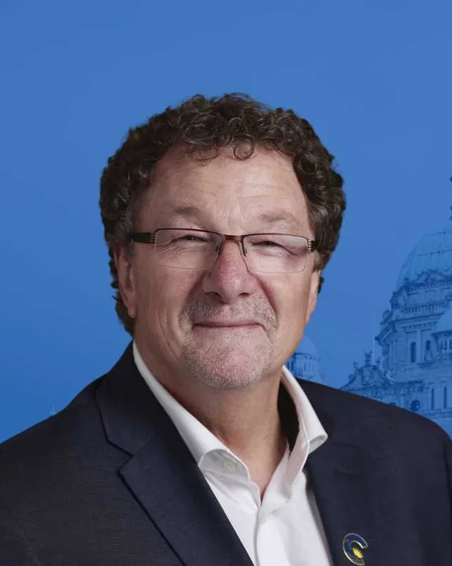
The candidates

In alphabetical order
People, 2021 census
61,910
Area
91 km²
Registered voters, 2024
37,833
Turnout, 2024
52.14%
Median age
39.2
Median household income, 2020
$85,000
THE DISTRICT

Where Abbotsford West is

91 km² · 61,910 people

Abbotsford West lies in the northwest of the City of Abbotsford, in the Fraser Valley of British Columbia. The Electoral Boundaries Commission's 2023 final report says it includes the northwest part of Abbotsford and the communities of Matsqui, Riverside, Gifford and Mount Lehman. Bradner Road is its western boundary and the Fraser River is its northern boundary. The southern boundary follows Highway 1, South Fraser Way and Old Yale Road. The eastern boundary follows McMillan Road and Highway 11, then turns east to take in the Sahhacum 1 Reserve.

The commission gives the district an area of 91 square kilometres and a population of 61,904, which is 15.1% from the average district. In the same report, the table of the districts then in place counts the earlier Abbotsford West at 65,094 people and 135 square kilometres. The City of Abbotsford says Matsqui Trail Regional Park in Abbotsford has a railway crossing on the dike, and that the park became a regional park of the Fraser Valley Regional District in 2017. The City has maintained it since then.

Highway 1 forms the southern boundary. The Province lists the 13-kilometre stretch between 264 Street and Mt. Lehman Road as under construction, with $2.34 billion in provincial funding, and the work includes replacing the Bradner Road overpass. It lists the 8-kilometre stretch from Mt. Lehman Road to Highway 11 as a separate phase with $2.65 billion in provincial funding.

  • Northwest Abbotsford
  • Matsqui
  • Riverside
  • Gifford
  • Mount Lehman
  • Sahhacum 1 Reserve (Matsqui First Nation)

Sources: British Columbia Electoral Boundaries Commission (opens in a new tab), City of Abbotsford (opens in a new tab), Province of British Columbia (opens in a new tab), Province of British Columbia (opens in a new tab)

HISTORY

The history of the area

Checked Wednesday, October 7, 2026

The Matsqui name and the Máthxwi people

BC Geographical Names records that the name Matsqui comes from the Halq'eméylem language and belongs to a Salish people who lived on the lower Fraser River and near Sumas Lake. The record names two villages, Ma'mak'ume on the south side of the Fraser and Kokoae'uk near Sumas Lake, and gives the population in 1911 as 40. The Canadian Encyclopedia says the word means "easy portage" or "easy travelling". It explains this as the ease with which people could go up creeks from the Fraser and drag canoes over the height of land to the former Sumas Lake.

The Stó:lō Service Agency Society lists Matsqui (Màthxwi) among its eleven communities and names S'ólh Téméxw as its territory, with a reach from Yale to Langley. In 2021 Abbotsford's Máthxwi Elementary School took its present name at 5730 Riverside Road. The school district's page says Mathxwí comes from Halq'eméylem and gives several readings, among them a root plant that grew in marshes and the words easy travelling and easy portage.

Canada's 2024 release on a Matsqui claim names two reserves of the Matsqui First Nation: Sahhacum Indian Reserve 1 and Matsqui Main Indian Reserve 2. The commission's report draws the eastern boundary of this district so that it includes the Sahhacum 1 Reserve.

Sources: BC Geographical Names Office (opens in a new tab), The Canadian Encyclopedia (opens in a new tab), Stó:lō Service Agency Society (opens in a new tab), Abbotsford School District (opens in a new tab), Crown-Indigenous Relations and Northern Affairs Canada (opens in a new tab), British Columbia Electoral Boundaries Commission (opens in a new tab)

Mount Lehman Landing and the first farms, 1860s to 1912

Heritage Abbotsford Society says settlement at Mount Lehman began in the 1860s with land clearing for farming and grazing. People came by a landing on the Fraser River, and a trail led south toward Peardonville and the United States border. The society records that Samuel and Isaac Lehman occupied the bluff above the river in 1875, and that a general store was running at the landing by 1883. BC Geographical Names says the place takes its name from Isaac Lehman, who pre-empted land there in 1875, and that the post office opened on 1 May 1884.

The society says a one-room school was built in 1884 on land donated by James Bangs and served as church and community centre as well. Mount Lehman United Church opened on 15 March 1894 as a union church of Methodists, Presbyterians, Baptists and Anglicans. It became Presbyterian in 1904 and joined the United Church of Canada in 1925. The Mount Lehman Community Hall dates from 1904 and stands at 6418 Mount Lehman Road. The present school building went up in 1912.

Sources: Heritage Abbotsford Society (opens in a new tab), BC Geographical Names Office (opens in a new tab)

The District of Matsqui, 1892 to 1995

BC Geographical Names records that the District of Matsqui was incorporated on 26 November 1892 as The Corporation of the District of Matsqui, with 54,145 acres. The record gives 6418 Mt Lehman Rd as the address of the original municipal hall. The hall moved to 32383 South Fraser Way in 1951 and to 32315 South Fraser Way in 1982.

The same office records that the Village of Abbotsford was incorporated on 22 February 1924 and joined the Sumas district to form the District of Abbotsford on 17 November 1972. On 1 January 1995 the district of Abbotsford and the District of Matsqui were joined as the City of Abbotsford under Letters Patent. The record says the Matsqui municipal name was rescinded at that point, and the building on South Fraser Way became the city's municipal hall.

Sources: BC Geographical Names Office (opens in a new tab), BC Geographical Names Office (opens in a new tab)

Matsqui Village and the railways, 1903 to 1960

The Abbotsford School District says many early immigrants to Matsqui Village came from Scandinavia, and that St. Olaf Street is named for the patron saint of Norway. Matsqui Evangelical Lutheran Church says it was founded in 1903 by Scandinavian settler families, who met in farm homes with a travelling pastor. In 1904 the Halvorson family gave land for a church building. Heritage Abbotsford Society calls it the first of three churches built in Matsqui Village. It stands at 5781 Riverside Street.

The Fraser Valley Heritage Railway Society says the British Columbia Electric Railway's Fraser Valley line was completed in 1910 and began passenger service on 3 October 1910, running from downtown Vancouver to Chilliwack. Heritage Abbotsford Society says the commercial centre of Mount Lehman moved to the railway crossing after the line opened. It adds that the Canadian Northern Railway opened its south-bank line in 1915, and that a freight and passenger shelter opened at the landing in 1916 and was removed in 1960. KnowBC records that Gifford was a station on the interurban line 7 kilometres northwest of Abbotsford, probably named for Thomas Gifford, the New Westminster member of the Legislative Assembly in 1910. The place was earlier called Glenmore, and its post office ran from 1912 to 1948.

Sources: Abbotsford School District (opens in a new tab), Matsqui Evangelical Lutheran Church (opens in a new tab), Heritage Abbotsford Society (opens in a new tab), Fraser Valley Heritage Railway Society (opens in a new tab), KnowBC (opens in a new tab)

Reserve land and a railway right of way, 1908 to 2024

Canada's release of 21 February 2024 says Canada granted the Vancouver Power Company rights of way for a tramway across Sahhacum Indian Reserve 1 and Matsqui Main Indian Reserve 2 in 1908. The release says reserve land was taken without adequate compensation, and that Canada did not build and maintain crossings, which cut the Matsqui First Nation off from parts of its reserve lands. Canada agreed to pay more than $59 million to settle the claim.

The Province's page on the Matsqui First Nation says it is one of five of eleven Stó:lō Nation bands negotiating land and resource issues outside the British Columbia treaty process. The page lists the Í:xel Sq'eq'ó (Together We Paddle) Agreement of 2021 and the Leq'á:mel-Matsqui Strategic Engagement Agreement of 2022. It also lists forest consultation and revenue sharing agreements dating from 2008, the latest signed in 2025.

Sources: Crown-Indigenous Relations and Northern Affairs Canada (opens in a new tab), Province of British Columbia (opens in a new tab)

The Matsqui dike and the flood of 1948

The Chilliwack Museum says the Fraser River reached 24.08 feet at the Mission gauge at the end of May 1948, and the Matsqui dike collapsed. The river peaked in early June at 24.73 feet, which the museum describes as one foot below the 1894 flood. The Abbotsford News reported in 2018 that at 7:40 a.m. on 31 May 1948 the dike failed near the north end of Gladwin Road, leaving a gap 50 feet wide with water moving at 12 miles an hour.

The same article says the water in Matsqui Village stood as deep as 8 feet and took 6 weeks to go down. The people who left their homes were sheltered at the Abbotsford Airport. Matsqui Evangelical Lutheran Church records that the flood damaged its building, which was repaired and moved to its present site. The Chilliwack Museum says the dikes were widened and raised with gravel, silt and dirt after 1948.

Sources: Chilliwack Museum and Archives (opens in a new tab), Abbotsford News (opens in a new tab), Matsqui Evangelical Lutheran Church (opens in a new tab)

Farmland and the Agricultural Land Reserve, 1973 to 2015

The Agricultural Land Commission says the Legislative Assembly gave royal assent to the Land Commission Act on 18 April 1973, the first law of its kind in Canada for protecting farmland. It gives the Agricultural Land Reserve as 4,612,526 hectares, which is 4.9% of British Columbia's land.

The City of Abbotsford gives these figures for the whole city, not for this district alone. Of 27,413 hectares of reserve land in the city, 17,213 hectares (63%) were farmed in 2012. The city reported more than 1,300 farms in 2015 and total farm receipts of $853,000,000. Berries made up 28% of crop acreage, and the city's page says 55% of the table eggs and 45% of the chicken produced in British Columbia come from Abbotsford.

Sources: Agricultural Land Commission (opens in a new tab), City of Abbotsford (opens in a new tab)

Punjabi families in Abbotsford, 1905 to 2021

The Abbotsford News reported in 2011 that the first Sikhs arrived in the Fraser Valley from Punjab in 1905 and worked on farms and in the forest industry. The Abbotsford Lumber Company, owned by the Trethewey family, employed many of them. The Gur Sikh Temple was established in 1911, and Parks Canada says the Abbotsford Sikh Temple at 33089 South Fraser Way was designated a national historic site in 2002. South Fraser Way is part of the southern boundary of this district.

The 2021 census counted Punjabi as the first language of 34.8% of people in Abbotsford West, and English for 48.1%. It counted 14,855 residents born in India and found that 35.7% of residents are immigrants, against 29% for British Columbia.

Sources: Abbotsford News (opens in a new tab), Parks Canada (opens in a new tab)

THE SEAT

Who has held the seat

Legislative Assembly records, 39th Parliament onward

Elections BC's volume for 2002 to 2013 first prints Abbotsford West at the 39th general election, held on May 12, 2009. The Electoral Districts Act (SBC 2008 c. 14) received Royal Assent on May 1, 2008 and established 85 districts, which came into effect on April 14, 2009. Michael G. de Jong of the Liberal Party won with 8,992 votes (55.81%). Taranjit Purewal of the New Democratic Party received 5,106 (31.69%).

Before 2009 Michael de Jong held two other districts, Matsqui and Abbotsford-Mount Lehman. Elections BC's volume for 1987 to 2001 prints Matsqui at the 35th general election on 17 October 1991, won by Peter A. Dueck of the Social Credit Party with 8,236 votes (43.74%). Dueck resigned on 30 November 1993. At the by-election on 17 February 1994, Michael G. de Jong of the Liberal Party won with 5,464 votes (41.77%) and Grace Mary McCarthy of Social Credit received 5,422 (41.45%). De Jong won Matsqui on 28 May 1996 with 10,903 votes (50.81%).

The name Abbotsford-Mount Lehman first appears in the 1987 to 2001 volume at the general election of 16 May 2001, the first held under the Electoral Districts Act (SBC 1999 c. 31). That Act raised the number of districts from 75 to 79 and came into effect on 18 April 2001. De Jong won with 12,660 votes (68.48%). In the 2002 to 2013 volume he won again on May 17, 2005 with 11,325 votes (57.55%), ahead of Taranjit Purewal with 6,132 (31.16%).

As Abbotsford West, de Jong won with 9,473 votes (50.65%) in 2013, 11,618 (55.23%) in 2017 and 8,880 (45.51%) in 2020, when Preet Rai of the BC NDP received 7,119 (36.49%). The legislature's record lists him as the member in every Parliament from the 35th to the 42nd. In 2024 Korky Neufeld of the Conservative Party won with 11,483 votes (58.35%). Graeme Hutchison of the BC NDP received 7,255 (36.87%) and James Davison, an Independent, 940 (4.78%). Turnout was 52.14% of 37,833 registered voters.

The commission's 2023 report adjusted the southeastern boundary with Abbotsford-Mission and moved the northwestern parts of Abbotsford South into Abbotsford West and Langley-Willowbrook. Elections BC's conversion table places the 65 voting areas of the new district in the earlier districts as 62 in Abbotsford West, 4 in Abbotsford-Mission and 1 in Maple Ridge-Mission.

Sources: Elections BC (opens in a new tab), Elections BC (opens in a new tab), Elections BC (opens in a new tab), Elections BC (opens in a new tab), Legislative Assembly of British Columbia (opens in a new tab), British Columbia Electoral Boundaries Commission (opens in a new tab)

Members for Abbotsford West
ParliamentIt satMemberElected asParty on the legislature’s record
43rd2025 to 2026Korky NeufeldConservative PartyConservative Party of BC
42nd2020 to 2024Michael de JongBC Liberal PartyBC United
41st2017 to 2020Michael de JongBC Liberal PartyBC Liberal Party
40th2013 to 2017Michael de JongBC Liberal PartyBC Liberal Party
39th2009 to 2013Michael de JongBC Liberal Party

“Elected as” is the affiliation Elections BC printed with the winning result. The last column is the party the legislature’s records give for that parliament, which differs when a member changed party while in office. A row with that column empty is a winner Elections BC prints whom the legislature’s records leave out. Source: Legislative Assembly of British Columbia (opens in a new tab)

Boundaries since 2024

Abbotsford West has 65 voting areas. 62 of them overlap the district of the same name used from 2017 to 2024.Others overlap these districts from 2017 to 2024: Abbotsford-Mission (4), Maple Ridge-Mission (1).

The commission that drew the boundaries counted 61,904 people in the district, 15.1% above the average for a district, over 91 km².

Sources: British Columbia Electoral Boundaries Commission, Final report, April 3, 2023 (opens in a new tab), Elections BC, Voting area conversion table, 2017 to 2024 (opens in a new tab)

PAST RESULTS

Every result since 2009

From Elections BC
2024 Provincial General ElectionKorky Neufeld, Conservative Party, 58.35%
CandidateAffiliationVotesShare
Korky NeufeldElectedConservative Party11,48358.35%
Graeme HutchisonBC NDP7,25536.87%
James DavisonIndependent9404.78%

19,678 valid votes · 47 rejected ballots · 37,833 registered voters · 52.14% voted

2020 General ElectionMichael de Jong, BC Liberal Party, 45.51%
CandidateAffiliationVotesShare
Michael de JongElectedBC Liberal Party8,88045.51%
Preet RaiBC NDP7,11936.49%
Michael HenshallConservative1,7669.05%
Kevin EastwoodBC Green Party1,6718.56%
Sukhi GillB.C. Vision750.38%

19,511 valid votes · 170 rejected ballots

2017 General ElectionMichael de Jong, BC Liberal Party, 55.23%
CandidateAffiliationVotesShare
Michael de JongElectedBC Liberal Party11,61855.23%
Preet RaiBC NDP6,47430.77%
Kevin Allan EastwoodBC Green Party2,28010.84%
Lynn SimcoxChristian Heritage Party of B.C.5162.45%
Dave SharkeyLibertarian1490.71%

21,037 valid votes · 148 rejected ballots

2013 General ElectionMichael de Jong, BC Liberal Party, 50.65%
CandidateAffiliationVotesShare
Michael de JongElectedBC Liberal Party9,47350.65%
Sukhi DhamiBC NDP5,43029.03%
Paul Brian RedekoppConservative1,7919.58%
Moe GillIndependent1,0825.79%
Stephen Carl O'SheaBC Green Party8774.69%
Kerry-Lynn OsbourneBC Excalibur Party490.26%

18,702 valid votes · 245 rejected ballots

2009 General ElectionMichael G. de Jong, BC Liberal Party, 55.81%
CandidateAffiliationVotesShare
Michael G. de JongElectedBC Liberal Party8,99255.81%
Taranjit PurewalBC NDP5,10631.69%
Dalbir BenipalConservative1,0436.47%
Karen Marie DurantBC Green Party9706.02%

16,111 valid votes · 183 rejected ballots

The boundaries changed before the 2009, 2017 and 2024 elections, so a result under the same name can cover a different area. Sources: Elections BC, Provincial Voting Results (opens in a new tab), Statement of Votes, 2024 Provincial General Election (opens in a new tab)

PEOPLE · 2021 CENSUS

Who lives in Abbotsford West

61,910 residents · British Columbia beside each figure

Age

Median age
39.2BC 42.8
  • Under 1517.0%BC 14.3%
  • 15 to 6463.6%BC 65.3%
  • 65 and over19.5%BC 20.3%
  • 85 and over2.3%BC 2.4%

Households

Households
21,535
People per household
2.9BC 2.4

Who lives together

  • Couples with children23.0%BC 22.7%
  • Couples without children22.1%BC 26.4%
  • One-parent families7.4%BC 7.6%
  • Multigenerational households10.7%BC 3.7%
  • People living alone25.8%BC 29.4%

Household size

  • 1 person25.8%BC 29.4%
  • 2 persons30.2%BC 35.3%
  • 3 persons12.9%BC 14.5%
  • 4 persons13.3%BC 12.6%
  • 5 or more persons17.8%BC 8.2%

Homes

Median home value
$740,000BC $785,000
Median monthly rent and utilities
$1,100BC $1,370
Median monthly cost for owners
$1,410BC $1,320

Own or rent

  • Own their home69.0%BC 66.8%
  • Rent their home30.9%BC 32.8%
  • Home provided by a local government or First Nation0.1%BC 0.5%

Type of home

  • Single-detached house27.6%BC 42.4%
  • Semi-detached house3.1%BC 3.1%
  • Row house10.7%BC 8.3%
  • Apartment or flat in a duplex23.5%BC 12.2%
  • Apartment in a building that has fewer than five storeys30.8%BC 20.4%
  • Apartment in a building that has five or more storeys3.5%BC 10.9%
  • Other single-attached house0.1%BC 0.2%
  • Movable dwelling0.7%BC 2.5%

When the home was built

  • 1960 or earlier3.9%BC 12.5%
  • 1961 to 198020.4%BC 27.0%
  • 1981 to 199026.3%BC 14.2%
  • 1991 to 200025.5%BC 16.5%
  • 2001 to 20055.7%BC 6.0%
  • 2006 to 20105.6%BC 8.0%
  • 2011 to 20154.4%BC 6.6%
  • 2016 to 20218.2%BC 9.1%

Housing costs

  • Renters paying 30% or more of income on housing32.1%BC 37.8%
  • Owners paying 30% or more of income on housing19.8%BC 19.3%
  • Renters in core housing need22.4%BC 24.7%
  • Owners in core housing need6.0%BC 8.0%
  • Renters in subsidized housing8.1%BC 11.0%
  • Owners with a mortgage64.2%BC 57.5%

Income

Income is for the year 2020.

Median household income
$85,000BC $85,000
After tax
$76,500BC $76,000
Median income per person
$35,200BC $40,800

Living on a low income (after-tax measure)

  • All ages8.8%BC 10.8%
  • Under 188.7%BC 11.3%
  • 18 to 647.5%BC 9.7%
  • 65 and over13.0%BC 13.8%

Languages

First language learned

  • English48.1%BC 67.1%
  • Punjabi (Panjabi)34.8%BC 4.9%
  • German2.2%BC 1.0%
  • Tagalog (Pilipino, Filipino)0.8%BC 1.7%
  • Spanish0.8%BC 1.2%
  • Korean0.7%BC 1.2%
  • Hindi0.7%BC 0.7%
  • Vietnamese0.7%BC 0.7%
  • French0.6%BC 1.2%
  • Dutch0.6%BC 0.4%

Spoken most often at home

  • English57.9%BC 78.5%
  • Punjabi (Panjabi)30.0%BC 3.8%
  • Korean0.6%BC 0.9%
  • Hindi0.5%BC 0.3%
  • Vietnamese0.5%BC 0.4%
  • Spanish0.4%BC 0.6%
  • Mandarin0.4%BC 3.3%
  • Arabic0.3%BC 0.3%

English and French

  • English only86.0%BC 90.1%
  • English and French3.8%BC 6.6%
  • Neither English nor French10.1%BC 3.3%

Immigration

Born outside Canada (immigrants)
35.7%BC 29.0%
Non-permanent residents
5.4%BC 3.5%

Where immigrants were born

  • India67.0%BC 13.8%
  • United Kingdom3.3%BC 8.2%
  • Philippines3.0%BC 9.2%
  • United States of America2.5%BC 4.2%
  • Viet Nam2.0%BC 2.3%
  • China1.4%BC 15.3%
  • Korea, South1.4%BC 3.3%
  • Netherlands1.4%BC 1.1%
  • Germany1.4%BC 2.2%
  • Pakistan1.0%BC 0.9%

When immigrants arrived

  • Arrived before 198012.8%BC 19.7%
  • 1980 to 19908.8%BC 11.5%
  • 1991 to 200020.7%BC 21.0%
  • 2001 to 201028.8%BC 22.2%
  • 2011 to 202128.9%BC 25.6%

Generations in Canada

  • First generation42.1%BC 33.7%
  • Second generation26.6%BC 21.7%
  • Third generation or more31.4%BC 44.5%

Identity and origins

Indigenous identity
3.5%BC 5.9%
Visible minority
53.1%BC 34.4%

Visible minority groups

  • South Asian43.7%BC 9.6%
  • Southeast Asian1.6%BC 1.5%
  • Chinese1.5%BC 11.2%
  • Filipino1.4%BC 3.5%
  • Black1.2%BC 1.3%
  • Latin American0.9%BC 1.3%
  • Korean0.9%BC 1.5%
  • Multiple visible minorities0.8%BC 1.2%
  • Arab0.4%BC 0.6%
  • Japanese0.3%BC 0.9%
  • West Asian0.3%BC 1.4%
  • Visible minority (other)0.1%BC 0.4%

Ethnic or cultural origins reported most often

  • Indian (India)23.3%BC 5.6%
  • Punjabi12.9%BC 1.9%
  • English12.9%BC 20.7%
  • German10.2%BC 11.0%
  • Scottish9.6%BC 15.8%
  • Sikh9.4%BC 1.4%
  • Canadian7.6%BC 9.3%
  • Irish7.3%BC 12.8%
  • Dutch5.0%BC 3.9%
  • French4.7%BC 6.4%

Religion

  • Sikh38.0%BC 5.9%
  • Christian31.5%BC 34.3%
  • No religion24.4%BC 52.1%
  • Hindu3.3%BC 1.7%
  • Muslim1.2%BC 2.6%
  • Buddhist0.7%BC 1.7%
  • Other religions0.7%BC 1.0%
  • Traditional Indigenous spirituality0.1%BC 0.2%
  • Jewish0.0%BC 0.5%

Education

Highest level completed, ages 25 to 64.

  • No certificate, diploma or degree16.5%BC 8.0%
  • High school diploma34.6%BC 25.8%
  • College, trades or other certificate below a bachelor’s degree26.2%BC 31.2%
  • Bachelor’s degree or higher22.6%BC 35.0%

Work

In the labour force
63.3%BC 63.3%
Employed
57.8%BC 57.9%
Unemployment rate at the census
8.6%BC 8.4%

Industries with the most workers

  • Retail trade11.6%BC 11.6%
  • Health care and social assistance11.0%BC 12.3%
  • Transportation and warehousing10.9%BC 5.5%
  • Manufacturing10.2%BC 5.9%
  • Construction9.9%BC 9.0%
  • Agriculture, forestry, fishing and hunting7.1%BC 2.3%
  • Accommodation and food services7.1%BC 7.0%
  • Educational services5.5%BC 7.4%

Kinds of work

  • Sales and service occupations25.7%BC 25.6%
  • Trades, transport and equipment operators and related occupations24.8%BC 18.0%
  • Business, finance and administration occupations12.7%BC 17.1%
  • Occupations in education, law and social, community and government services10.3%BC 11.9%
  • Occupations in manufacturing and utilities7.7%BC 3.4%
  • Natural resources, agriculture and related production occupations6.6%BC 2.8%
  • Health occupations6.3%BC 7.7%
  • Natural and applied sciences and related occupations3.4%BC 8.0%
  • Occupations in art, culture, recreation and sport1.9%BC 4.2%
  • Legislative and senior management occupations0.4%BC 1.2%

Getting to work

Where people worked

  • Worked at home11.5%BC 22.6%
  • Worked outside Canada0.3%BC 0.4%
  • No fixed workplace address22.1%BC 15.3%
  • Worked at a usual workplace66.1%BC 61.6%

How commuters travelled

  • Car, truck or van91.5%BC 79.9%
  • Public transit3.0%BC 9.3%
  • On foot3.4%BC 6.5%
  • Bicycle0.4%BC 2.0%
  • Other method1.8%BC 2.3%

Length of the trip

  • Less than 15 minutes36.0%BC 31.8%
  • 15 to 29 minutes31.9%BC 34.0%
  • 30 to 44 minutes17.4%BC 19.7%
  • 45 to 59 minutes6.6%BC 7.3%
  • 60 minutes and over8.1%BC 7.2%

Moving

Where residents lived five years before the census.

  • Lived at the same address53.5%BC 56.2%
  • Moved within the same municipality23.4%BC 16.1%
  • Moved from elsewhere in BC12.4%BC 17.0%
  • Moved from another province2.8%BC 4.6%
  • Moved from another country7.9%BC 6.1%

Counts in the census are rounded to the nearest 5, and shares are worked out from those counts. Source: BC Stats, from Statistics Canada tabulations, 2021 Census Profile for BC Provincial Electoral Districts (2023 Redistribution) (opens in a new tab)

QUESTIONS

Questions about Abbotsford West

10 answers

Where is Abbotsford West?

Abbotsford West is a provincial electoral district in the northwest of the City of Abbotsford, in the Fraser Valley of British Columbia. The Electoral Boundaries Commission's 2023 final report gives its area as 91 square kilometres. The Fraser River is its northern boundary and Bradner Road is its western boundary, and the commission counts 61,904 people in it.

Which communities are in Abbotsford West?

Abbotsford West includes the northwest part of Abbotsford and the communities of Matsqui, Riverside, Gifford and Mount Lehman, according to the Electoral Boundaries Commission's 2023 final report. The report also draws the eastern boundary so that the district includes the Sahhacum 1 Reserve, one of the reserves of the Matsqui First Nation.

Who won Abbotsford West in the 2024 provincial election?

Korky Neufeld of the Conservative Party won Abbotsford West in 2024 with 11,483 votes, 58.35% of the valid vote. Graeme Hutchison of the BC NDP received 7,255 votes, and James Davison, an Independent, received 940. Turnout was 52.14% of 37,833 registered voters, and 19,678 valid votes were counted in the district.

Who represented Abbotsford West before 2024?

Michael de Jong represented Abbotsford West before 2024. The legislature's record lists him as the member in the 39th to 42nd Parliaments, and his party as BC United in the 42nd. He won in 2020 with 8,880 votes, 45.51%, running for the BC Liberal Party. Preet Rai of the BC NDP received 7,119 votes.

When was Abbotsford West first created?

The name Abbotsford West was first used at the 39th general election on May 12, 2009, under the Electoral Districts Act (SBC 2008 c. 14), which established 85 districts. Michael G. de Jong of the Liberal Party won it that year with 8,992 votes, 55.81%. Elections BC's volume for 2002 to 2013 prints the result.

What districts did Michael de Jong hold before Abbotsford West?

Michael de Jong held Matsqui and then Abbotsford-Mount Lehman before Abbotsford West. He won Matsqui at a by-election on 17 February 1994 and again in 1996. Elections BC's volume for 1987 to 2001 first prints Abbotsford-Mount Lehman at the general election of 16 May 2001, and he won it that year and in 2005.

How did the boundaries of Abbotsford West change in 2023?

The Electoral Boundaries Commission's 2023 final report adjusted the southeastern boundary with Abbotsford-Mission and moved northwestern parts of Abbotsford South into Abbotsford West. Of the new district's 65 voting areas, 62 were in the earlier Abbotsford West. The commission counts 61,904 people in the district, which is 15.1% from the average district.

How many people live in Abbotsford West?

The 2021 census counted 61,910 people in Abbotsford West, with a median age of 39.2 compared with 42.8 across British Columbia. English was the first language of 48.1% of residents and Punjabi of 34.8%. Immigrants made up 35.7% of the population, and 69% of households owned their home.

Which First Nation has land in Abbotsford West?

The Matsqui First Nation (Máthxwi) has Sahhacum Indian Reserve 1, which the Electoral Boundaries Commission's 2023 report includes in Abbotsford West. Canada's 2024 release names Matsqui Main Indian Reserve 2 as its other reserve. The Stó:lō Service Agency Society, which lists Matsqui among its eleven communities, names S'ólh Téméxw as its territory.

How did Matsqui get its name?

Matsqui comes from the Halq'eméylem language, and BC Geographical Names says it belongs to a Salish people of the lower Fraser River and Sumas Lake. The Canadian Encyclopedia says the word means easy portage or easy travelling. Abbotsford West takes in Matsqui, where the District of Matsqui was incorporated on 26 November 1892.
SOURCES

Where this page comes from

Figures read Thursday, October 8, 2026
  1. 2021 Census Profile for BC Provincial Electoral Districts (2023 Redistribution) (opens in a new tab)BC Stats, from Statistics Canada tabulations · read Thursday, October 8, 2026
  2. Provincial Voting Results (opens in a new tab)Elections BC · read Thursday, October 8, 2026
  3. Statement of Votes, 2024 Provincial General Election (opens in a new tab)Elections BC · read Thursday, October 8, 2026
  4. Voting area conversion table, 2017 to 2024 (opens in a new tab)Elections BC · read Thursday, October 8, 2026
  5. Final report, April 3, 2023 (opens in a new tab)British Columbia Electoral Boundaries Commission · read Thursday, October 8, 2026
  6. Members of the Legislative Assembly, 35th to 43rd Parliament (opens in a new tab)Legislative Assembly of British Columbia · read Thursday, October 8, 2026
  7. Final report, April 3, 2023 (opens in a new tab)British Columbia Electoral Boundaries Commission · read Wednesday, October 7, 2026
  8. Electoral History of British Columbia, Supplement, 1987 to 2001 (opens in a new tab)Elections BC · read Wednesday, October 7, 2026
  9. Electoral History of British Columbia, Supplement, 2002 to 2013 (opens in a new tab)Elections BC · read Wednesday, October 7, 2026
  10. Provincial Voting Results (opens in a new tab)Elections BC · read Wednesday, October 7, 2026
  11. Statement of Votes, 2024 Provincial General Election (opens in a new tab)Elections BC · read Wednesday, October 7, 2026
  12. Members of the Legislative Assembly (opens in a new tab)Legislative Assembly of British Columbia · read Wednesday, October 7, 2026
  13. Matsqui, BC Geographical Names record (district municipality) (opens in a new tab)BC Geographical Names Office · read Wednesday, October 7, 2026
  14. Matsqui, BC Geographical Names record (urban community) (opens in a new tab)BC Geographical Names Office · read Wednesday, October 7, 2026
  15. Mount Lehman, BC Geographical Names record (opens in a new tab)BC Geographical Names Office · read Wednesday, October 7, 2026
  16. Abbotsford, BC Geographical Names record (opens in a new tab)BC Geographical Names Office · read Wednesday, October 7, 2026
  17. About (opens in a new tab)Stó:lō Service Agency Society · read Wednesday, October 7, 2026
  18. Matsqui First Nation to receive more than $59 million in effort to address past wrong, release of February 21, 2024 (opens in a new tab)Crown-Indigenous Relations and Northern Affairs Canada · read Wednesday, October 7, 2026
  19. Matsqui First Nation (opens in a new tab)Province of British Columbia · read Wednesday, October 7, 2026
  20. School Name History, Máthxwi Elementary (opens in a new tab)Abbotsford School District · read Wednesday, October 7, 2026
  21. Matsqui (opens in a new tab)The Canadian Encyclopedia · read Wednesday, October 7, 2026
  22. Built Heritage (opens in a new tab)Heritage Abbotsford Society · read Wednesday, October 7, 2026
  23. History (opens in a new tab)Matsqui Evangelical Lutheran Church · read Wednesday, October 7, 2026
  24. Gifford, Encyclopedia of British Columbia (opens in a new tab)KnowBC · read Wednesday, October 7, 2026
  25. History (opens in a new tab)Fraser Valley Heritage Railway Society · read Wednesday, October 7, 2026
  26. Lead up to the Flood of 1948 (opens in a new tab)Chilliwack Museum and Archives · read Wednesday, October 7, 2026
  27. Matsqui flood remembered, 70 years later (opens in a new tab)Abbotsford News · read Wednesday, October 7, 2026
  28. Matsqui Trail Regional Park At-Grade Railway Crossing Closure (opens in a new tab)City of Abbotsford · read Wednesday, October 7, 2026
  29. 50 Years of the Provincial Agricultural Land Commission (opens in a new tab)Agricultural Land Commission · read Wednesday, October 7, 2026
  30. Agriculture (opens in a new tab)City of Abbotsford · read Wednesday, October 7, 2026
  31. First Sikhs in Abbotsford met with hospitality (opens in a new tab)Abbotsford News · read Wednesday, October 7, 2026
  32. Abbotsford Sikh Temple National Historic Site of Canada (opens in a new tab)Parks Canada · read Wednesday, October 7, 2026
  33. 264th Street to Mt. Lehman Road (Phase 3A) (opens in a new tab)Province of British Columbia · read Wednesday, October 7, 2026
  34. Mt. Lehman Road to Highway 11 (Phase 3B) (opens in a new tab)Province of British Columbia · read Wednesday, October 7, 2026

Official information

From Elections BC
CORRECTIONS

Report a problem on this page.

Tell the editors what is wrong and where the correct information can be checked. The page you are on is attached automatically.