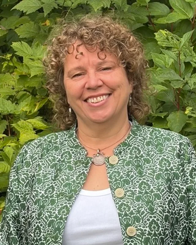
This district elects one MLA. Voters mark one name on Saturday, October 24, 2026, and the candidate with the most votes wins the seat.
Victoria-Swan Lake is a provincial electoral district in Greater Victoria, on the south end of Vancouver Island. The Electoral Boundaries Commission says it includes the neighbourhoods of Swan Lake, Tillicum, Burnside and Oaklands. They lie in the north of the City of Victoria and in the part of the District of Saanich around Swan Lake. The 2021 census counted 54,785 people, and the commission gives the area as 18 square kilometres.
Victoria-Swan Lake lies north of Bay Street in Greater Victoria. The Electoral Boundaries Commission's 2023 final report says the district includes the neighbourhoods of Swan Lake, Tillicum, Burnside and Oaklands. It gives Bay Street as the southern border, Richmond Avenue, Shelbourne Street and Cedar Hill Road as the eastern border, the Gorge Waterway as the western boundary and McKenzie Avenue as the northern border. The commission counts 54,780 people in the district, which is 1.9% from the average, and gives its area as 18 square kilometres. It recommended no change to the boundaries. The Victoria Heritage Foundation places Burnside in the north-west of the City of Victoria and Oaklands in the north-east. The Saanich Archives places Tillicum in the District of Saanich, and the Swan Lake nature sanctuary is on land that Saanich owns.
The Gorge Waterway is a narrow tidal channel that joins Victoria Harbour to Portage Inlet. The Saanich Archives describes Tillicum as surrounded by Portage Inlet to the west, the Gorge Waterway to the south, the Trans-Canada Highway to the north and the City of Victoria to the east. Swan Lake and the wetland around it lie inside a nature sanctuary that Saanich owns, apart from two small parcels held by Nature Trust BC. Until the Trans-Canada Highway was finished, the Archives says, Gorge Road was the main route to other parts of Vancouver Island. The Victoria Heritage Foundation says the old Canadian Northern Railway line through Cecelia Ravine is now parkland and part of the Galloping Goose Regional Trail. BC Transit's rider's guide effective April 15, 2024 lists routes 8, 11, 24 and 25 with Tillicum Centre in their names, and route 22 to Hillside Centre. Elections BC's results file places voting places named Tillicum, Oaklands, Quadra, Reynolds and Cedar Hill inside the district in 2024.
Lək̓ʷəŋən territory around the Gorge and Swan Lake
The Songhees Nation's page on its traditional territory says the land is that of the lək̓ʷəŋən People, known today as the Esquimalt and Songhees Nations, and that the lək̓ʷəŋən People have hunted and gathered on this land for thousands of years. The Esquimalt Nation's website says its members belong to the Lekwungen peoples, that its traditional name is Xʷsepsəm and that its territory is centred around what is now the City of Victoria. It names Cəliʔɬčə, which it places from Mount Douglas to Elk and Beaver Lakes, among its sister nations, many of which it says are now collectively known as Songhees.
The Swan Lake Christmas Hill Nature Sanctuary Society says Swan Lake lies on the traditional territory of the lək̓ʷəŋən (Songhees and Kosapsum) Peoples and was an important hunting and gathering area. It reports arrowheads and spear tips found in the fields and hillsides around the lake. It also says over a hundred species of plants are known and still used by the lək̓ʷəŋən People for food, medicines, shelter and ceremony. The Saanich Archives says the Tillicum neighbourhood gave First Nations people both shelter and food before European contact, and that evidence of First Nations settlement in the area now called Saanich goes back over 4,000 years.
The Saanich Archives also retells a story that the Songhees elder Jimmy Fraser told the anthropologist Wilson Duff in the 1950s about the narrows of the Gorge. In it the Transformer, Haals, saw a girl named Camossung crying beside her grandfather because she was hungry. Haals filled the inlet with her favourite foods and turned the two into large boulders, which made the rapids and the reversing falls. Young people dived into the rapids to touch the rocks and take in some of the Transformer's power. The Archives says the stones kept pleasure craft and commercial fishing boats from passing the narrows until June 1960, when the owner of the Gorge Boathouse dynamited the rocks.
The 1850 Kosampsom treaty and the first farms, 1845 to 1889
Crown-Indigenous Relations and Northern Affairs Canada publishes the texts of the Douglas treaties. The treaty of the Kosampsom tribe is dated April 30, 1850. It describes land on the east side of the arm of the inlet "enclosing Christmas Hill and Lake and the lands west of those objects." The text keeps the people's village sites and enclosed fields for their own use and leaves them free to hunt over unoccupied lands and carry on their fisheries. It records a payment of fifty-two pounds ten shillings sterling. The Esquimalt Nation says its ancestors signed the Douglas "treaties" in 1850. The Saanich Archives says First Nations argue that their ancestors understood these agreements as peace treaties or agreements of cohabitation of the land, while the British read them as purchase agreements.
The Saanich Archives dates North Dairy Farm to 1845, as an estimate, and calls it one of three original Hudson's Bay Company farms that supplied Fort Victoria with produce. It says the farm was subdivided in 1889 and that its land was divided several more times between 1891 and 1946. An Archives photograph caption places an old Hudson's Bay Company barn on the Borden property, where Reynolds School stands today. The Archives names John Work as an early landowner in the Quadra area. His land lay east of William Fraser Tolmie's Cloverdale Farm, where Cedar Hill Park is now, and he called it Hillside Farm. The Swan Lake sanctuary society says the first Hudson's Bay settler farmed around the lake in 1857, raising sheep, livestock and vegetables, and that farming continued there through the 1930s with a dairy farm and two wineries.
Swan Lake: a hotel, a railway and a nature sanctuary, 1864 to 1988
The Swan Lake Hotel stood on the south side of the lake. The sanctuary society dates it to 1864, says it was known for fishing in spring and summer and for skating in winter, and says it burned in 1894, was rebuilt, and burned again in 1897 and was never rebuilt. The Saanich Archives places the hotel on Saanich Road near Falmouth Road, says it first opened in the late 1860s and says fire destroyed it in 1897. The two sources differ on the opening date and agree on 1897. They also differ on the origin of the lake's name. BC Geographical Names adopted the name on 1 May 1934, says the origin is not recorded and reports that the lake was named after James Gilchrist Swan of Port Townsend, Washington, who studied British Columbia's First Nations. The sanctuary society says the origin is unclear, notes that the name appears on an 1885 map of Victoria and gives the Trumpeter swans that visited the lake as the more popular belief.
George Godfrey Girling and Elizabeth Mills Girling settled with their children on the shores of Swan Lake in 1912. The Saanich Archives says their daughter Annie photographed the farm and the area around the lake from 1912 to 1928, and that over 900 of her photographs were donated to the Archives in 2008. The Archives also says the Canadian Northern Pacific Railway ran from Victoria to Sidney from 1917 until 1935 on a route that followed the present Lochside Regional Trail past Swan Lake. Canada's Historic Places dates that service from 1915 to 1935 and says the 140 metre Swan Lake and Brett trestles were built between 1915 and 1917 and now stand within a nature sanctuary.
The Archives says Swan Lake was a popular place for swimming in summer and skating in winter from the 1920s through the 1940s. By the 1950s it received waste from local farms and industries. The sanctuary society says two wineries together discharged more than 2,000 kilograms of sludge a year into the stream that feeds the lake. In 1965 Saanich voters approved spending $100,000 to buy land around the lake, and the society says much of the property had been bought by 1973, a purchase it puts at $230,000. The Archives says the society that runs the sanctuary was incorporated on June 16, 1975, with its first office in the Girling family's former house at 781 Ralph Street. The society says the Nature House was completed in 1988.
The Gorge: bridges, regattas and a park, 1848 to 2012
The Saanich Archives gives 1848 as the first record of a bridge over the Gorge, when logs were laid across the narrows. A new bridge replaced the logs in 1867 and opened a few hours before the first Queen's Birthday Regatta, held on May 21, 1867, and spectators used it at once to watch the races. Later bridges followed in 1872, 1882 and 1899, a steel-framed bridge in 1933 and the present, seventh bridge in 1967, which was widened to 38 feet and given a sidewalk. The Archives calls it one of only two connectors from Saanich into Esquimalt. First Nations canoe races at the regatta, in which local bands raced for prize money, began in 1870, and the first illuminated boat parade was held in 1886.
The Archives says the Gorge was a popular summer destination from the 1890s to the 1940s, with swimming races from 1908. In the 1940s it gained a reputation as an unpleasant place to swim because of mud and sewage from leaking septic tanks. In 1923 Portage Inlet and the Gorge Waterway were designated part of the Victoria Harbour Migratory Bird Sanctuary. In 1966 Saanich bought 9.9 acres of waterfront for $14,850, and the land along the Gorge was dedicated as parkland in perpetuity. A beautification project begun in 1967 and finished in 1973 produced Gorge Waterway Park. After work on water quality in the 1970s and 1980s, the first annual Gorge Swim Fest was held in 2012.
Tillicum: farms, a school, a bowling club and a drive-in, 1906 to 1982
The Saanich Archives' list of place names says the Tillicum community took its name from the post office, which took it from the street. The list records a story told for generations, with no written or printed proof, that the two original settlers would meet at their fence, where Tillicum Avenue runs, and greet each other with "Kla how ya, tillicum" in Chinook, meaning "Hello, friend". In 1906 Martha Rudd used her savings to buy land on Burnside Road, where, according to the Archives, she kept dairy cattle and built Victoria's first grain silo with help from the Department of Agriculture. Her son George donated five acres to Saanich for Rudd Park, and the Archives dates the gift to 1943 as an estimate.
Tillicum School on Albina Street was planned in 1914, finished in 1916 and designed by C. Elwood Watkins, who also designed Victoria High School. Additions followed in 1921 and 1929, and the building is still a school. The Burnside Lawn Bowling Club was organized in 1922 and incorporated in 1923, the year George Vallance gave land on Hampton Road for a green and clubhouse. The Archives says the Hampton Hall clubhouse was completed in 1927. Canada's Historic Places says club members and community volunteers built it, dates its construction to 1924 and says the club has called it home since 1927.
From the 1920s until 1942, Rinzo Ono ran the Tillicum Dairy with his wife and two daughters on leased land near Tillicum and Burnside Roads. In 1942 the federal government ordered the removal of Japanese Canadians from BC coastal areas, and the Archives says the Ono family was among the 22,000 sent to camps in the interior. The family moved to Montreal after the war and never returned to Saanich. The Tillicum Outdoor Theatre opened on June 1, 1951, with 620 car speakers, and closed in 1979. Tillicum Shopping Centre opened in 1982. The George R. Pearkes Arena opened on October 6, 1968, and the Les Passmore Centre for seniors opened the same year. Cuthbert Holmes Park, which covers 67.7 acres along the Colquitz River, opened in 1990.
Burnside: a streetcar, a railway and Gorge Road motels, 1894 to the 1960s
The Victoria Heritage Foundation's walking tour says Burnside Gorge is a residential area in the north-west of the City of Victoria. In the late 19th century, properties along the Gorge waterway were fashionable. In 1894 the architect W. Ridgway-Wilson designed a Queen Anne style house for the industrialist Charles Spratt. Premier Richard McBride acquired it in 1908 and called it Glenelg. Many of the Edwardian-era houses were built after the Lohbrunner Estate was subdivided in 1908, when Irma, Balfour, Albany and Carroll streets were laid out.
Roads and rails followed. The Foundation says Gorge Road East was paved in 1912, a new bridge crossed Cecelia Ravine, and a streetcar line, route 10, opened that year along Burnside Road East to Carroll Street. Many streetcar operators lived in the neighbourhood. Burnside Elementary School, dated 1912 and designed by C. Elwood Watkins, closed in 2006. In 1916 the Canadian Northern Railway finished its line through the ravine, which is now parkland and part of the Galloping Goose Regional Trail. In the 1950s motels were built along Gorge Road, which was the main route to the Western Communities and the Malahat until the Trans-Canada Highway was completed in the late 1960s. A motel at 279 Gorge Road East stands on the site of McBride's house.
Oaklands and Hillside: lots, a school and a mall, 1850s to 1962
The Victoria Heritage Foundation says Oaklands was named after the area's native Garry Oak trees. It describes the area as heavily forested land and the traditional territory of the Lekwungen peoples, today's Songhees and Esquimalt First Nations, for thousands of years. The area was surveyed in the 1850s and divided into large lots. Roderick Finlayson, chief trader of the Hudson's Bay Company, bought several, including the land south of Ryan and west of Scott Streets. The Foundation says the Finlaysons' 103-acre Rock Bay estate stayed largely undeveloped until after Sarah Finlayson's death in 1906.
The Foundation says most of the building in Oaklands came between the First and Second World Wars, and that the first large building boom ran from 1909 to 1913. In 1908 an investment company proposed building houses on 350 lots covering 80 acres on either side of Cedar Hill Road between Hillside and Bay, to be called Rockland Park. In 1911 the Daily Colonist advertised lots for $500, and the streetcar line was extended along Hillside Avenue. Oaklands School, designed by C. Elwood Watkins, was built in 1913. The boom ended in 1913 and 1914, and the neighbourhood took many years to fill with houses. The Foundation dates Hillside Mall to 1962 and says the Cridge Centre building at Cook Street and Hillside Avenue was built in 1893 as the BC Protestant Orphanage.
Quadra, Cedar Hill and Cloverdale: farms, schools and roads, 1886 to 1971
The Saanich Archives says George and Elizabeth McRae bought 200 acres in 1886 that had been part of John Work's 1858 farm, and that their first buildings stood where the Cedar Hill Community Centre stands today. The Archives dates to 1920, as an estimate, the family's first rental of land to Harry Eve, a golf professional who started the Cedar Hill Golf Course. In 1967 Saanich bought the land from the McRae family for $1,200,000, renamed it Cedar Hill Park in 1968 and built the community centre in 1972. Reynolds Secondary School opened on October 23, 1967, as a junior secondary school, with senior grades added in 1969 and 1970. The first three classrooms of Braefoot School were built in 1965, and the finished building opened in 1971, when Cedar Hill students moved there from the 1912 school on Cedar Hill Cross Road.
The Archives says Saanich needed a high-volume east-west road by 1960. Council approved plans for the McKenzie Avenue extension in February 1963, and the Archives calls it the largest single road construction project Saanich had undertaken to that point. In 1968 the Province approved funds and paid half the cost, because McKenzie Avenue had been reclassified as a secondary highway. The road was widened from two lanes to four and extended from Carey Road west to the Trans-Canada Highway. The commission names McKenzie Avenue as the northern border of the district. Canada's Historic Places says much of the south part of Quadra was originally W.F. Tolmie's Cloverdale Farm. The Saanich Archives says his son Simon Fraser Tolmie was born at the farm in 1867, was elected Premier of British Columbia in 1928 and died in 1937 at the family home there.
Victoria-Swan Lake first appears on the ballot at the 2009 general election in Elections BC's volume for 2002 to 2013. The Electoral Districts Act (S.B.C. 2008, c.14) received royal assent on May 1, 2008, increased the number of districts and members from 79 to 85, and came into effect on April 14, 2009, the day the 38th Parliament was dissolved. Rob Fleming of the NDP won the district in 2009 with 13,119 votes (60.53%), ahead of Jesse McClinton of the Liberal Party with 5,754 votes. The volume prints McClinton's share as 26.54% and Elections BC's later results file prints 26.55%. Fleming won in 2013 with 12,350 votes (54.49%), ahead of Spencer Alexander Malthouse of the Green Party with 5,260 (23.21%) and Christina Bates of the Liberal Party with 5,055 (22.30%). The volume's list of elected members prints Fleming under Victoria-Hillside for 2005, where it records 13,926 votes (57.00%), and under Victoria-Swan Lake for 2009 and 2013. The legislature lists Fleming for Victoria-Hillside in the 38th Parliament and for Victoria-Swan Lake in the 39th to 42nd Parliaments, so the two records name the same member for the elections of 2005, 2009 and 2013.
Fleming won again in 2017 with 13,374 votes (53.60%), ahead of Christopher Alan Maxwell of the BC Green Party with 7,413 (29.71%), and in 2020 with 14,186 votes (59.35%), ahead of Annemieke Holthuis of the BC Green Party with 6,638 (27.77%). The legislature lists him for the 40th Parliament, which it dates from 23 June 2013 to 16 April 2017, the 41st, from 22 June 2017 to 21 September 2020, and the 42nd, from 7 December 2020 to 21 September 2024. In 2024 Nina Krieger of the BC NDP won with 14,273 votes (56.03%), ahead of Christina Winter of the BC Green Party with 5,899 (23.16%) and Tim Taylor of the Conservative Party with 5,146 (20.20%). Turnout was 62.63% of 40,752 registered voters. Elections BC's results file records Krieger's election in the 2024 general election. The legislature lists her for the 43rd Parliament, which it dates from 18 February 2025 to 22 September 2026. The Government of British Columbia's biography says she was first elected as MLA for Victoria-Swan Lake in 2024 and was appointed Minister of Public Safety and Solicitor General in July 2025.
The 2023 boundary review left the district as it was. The commission's final report recommended no change to the boundaries of Victoria-Swan Lake. Its Appendix C, which lists the districts as drawn in 2023, gives the district 54,780 people, 1.9% from the average, in 18 square kilometres. Its Appendix D, which lists the 87 districts then current, gives the same population and area, with a deviation of 4.7% below the average. Elections BC's conversion table links each of the district's 81 voting areas to voting areas of the Victoria-Swan Lake of 2017 to 2024.
“Elected as” is the affiliation Elections BC printed with the winning result. The last column is the party the legislature’s records give for that parliament, which differs when a member changed party while in office. A row with that column empty is a winner Elections BC prints whom the legislature’s records leave out. Source: Legislative Assembly of British Columbia (opens in a new tab)
Boundaries since 2024
Victoria-Swan Lake has 81 voting areas. 77 of them overlap the district of the same name used from 2017 to 2024.
The commission that drew the boundaries counted 54,780 people in the district, 1.9% above the average for a district, over 18 km².
Where is the Victoria-Swan Lake electoral district?
Victoria-Swan Lake is a provincial electoral district in Greater Victoria on southern Vancouver Island. The Electoral Boundaries Commission gives Bay Street as its southern border, Richmond Avenue, Shelbourne Street and Cedar Hill Road as its eastern border, the Gorge Waterway as its western boundary and McKenzie Avenue as its northern border. The commission counts 54,780 people and an area of 18 square kilometres.
Which neighbourhoods are in Victoria-Swan Lake?
Victoria-Swan Lake includes the neighbourhoods of Swan Lake, Tillicum, Burnside and Oaklands, according to the Electoral Boundaries Commission. Burnside and Oaklands belong to the City of Victoria, and Tillicum belongs to the District of Saanich. Elections BC's 2024 results file also places voting places named for Quadra, Cedar Hill and Cloverdale inside the district.
Who is the MLA for Victoria-Swan Lake?
Nina Krieger of the BC NDP was elected for Victoria-Swan Lake in the 2024 provincial general election, with 14,273 votes or 56.03% of the valid votes. The legislature lists her for the 43rd Parliament, which it records as ending on 22 September 2026. The Government of British Columbia says she was appointed Minister of Public Safety and Solicitor General in July 2025.
Who held Victoria-Swan Lake before Nina Krieger?
Rob Fleming of the BC NDP held Victoria-Swan Lake before Nina Krieger. Elections BC's results show him winning the district in 2009, 2013, 2017 and 2020, and the legislature lists him for the 39th to 42nd Parliaments, the last ending on 21 September 2024. Elections BC's volume for 2002 to 2013 also prints him winning Victoria-Hillside in 2005.
How did Victoria-Swan Lake vote in 2024?
In 2024 Victoria-Swan Lake elected Nina Krieger of the BC NDP with 14,273 votes (56.03%). Christina Winter of the BC Green Party received 5,899 votes (23.16%), Tim Taylor of the Conservative Party 5,146 (20.20%) and Robert Crooks of the Communist Party of BC 156 (0.61%). Turnout was 62.63% of 40,752 registered voters.
Did the boundaries of Victoria-Swan Lake change in 2023?
The Electoral Boundaries Commission recommended no change to the boundaries of Victoria-Swan Lake in its 2023 final report. It lists the district at 54,780 people and 18 square kilometres both before and after the review. Elections BC's conversion table links each of the district's 81 voting areas to voting areas of the Victoria-Swan Lake of 2017 to 2024.
How many people live in Victoria-Swan Lake?
The 2021 census counted 54,785 people in Victoria-Swan Lake, with a median age of 40.8 compared with 42.8 for British Columbia. Of the district's homes, 54.3% are owned and 45.7% are rented, and 37.6% of households are one person living alone. The census counts 1,750 residents born in the Philippines and 1,385 born in the United Kingdom.
Whose traditional territory is Victoria-Swan Lake on?
The Songhees Nation says the land is that of the lək̓ʷəŋən People, known today as the Esquimalt and Songhees Nations. The Esquimalt Nation says its territory is centred around the City of Victoria. The Swan Lake sanctuary society places Swan Lake on the territory of the lək̓ʷəŋən (Songhees and Kosapsum) Peoples. A treaty of the Kosampsom tribe dated April 30, 1850 names Christmas Hill and Lake.
What is the history of Swan Lake in Victoria-Swan Lake?
Swan Lake in Victoria-Swan Lake was farmed from 1857, when the sanctuary society says the first Hudson's Bay settler raised sheep, livestock and vegetables there. A hotel on the lake burned in 1897. Saanich voters approved $100,000 in 1965 to buy land around the lake, and the society that runs the nature sanctuary was incorporated in June 1975.
Where does the name Tillicum come from in Victoria-Swan Lake?
The Saanich Archives says the Tillicum community took its name from its post office, which took it from the street. It records a story, told for generations without written proof, that the name comes from the Chinook greeting "Kla how ya, tillicum", meaning "Hello, friend". Tillicum is one of the four neighbourhoods the commission names in Victoria-Swan Lake.
When was the Victoria-Swan Lake district created?
Victoria-Swan Lake first appears on the ballot at the 2009 general election in Elections BC's volume for 2002 to 2013. The Electoral Districts Act (S.B.C. 2008, c.14), which received royal assent on May 1, 2008, raised the number of districts from 79 to 85 and came into effect on April 14, 2009. Rob Fleming won the district in 2009 with 13,119 votes.