This district elects one MLA. Voters mark one name on Saturday, October 24, 2026, and the candidate with the most votes wins the seat.
Vernon-Lumby is a provincial electoral district in the North Okanagan of British Columbia. It takes in the City of Vernon, Silver Star Provincial Park and the communities east of the city, among them Lumby, Blue Springs, Trinity Valley and Mabel Lake. The 2021 census counted 57,375 people, and the Electoral Boundaries Commission gives its area as 1,265 square kilometres.
Vernon-Lumby lies in the North Okanagan. The Canadian Encyclopedia places the City of Vernon in the North Okanagan Valley between Okanagan, Kalamalka and Swan lakes. The Electoral Boundaries Commission's 2023 final report says the district includes Vernon and Silver Star Provincial Park, as well as communities east of the city such as Lumby, Blue Springs, Trinity Valley and Mabel Lake. The report says the riding follows the municipal boundary of the City of Vernon on the west and Electoral Area D of the Regional District of North Okanagan to the north and east. The Regional District's own list names that area as Area D (Rural Lumby). The commission counts 57,423 people in the district, a deviation of 6.8% from the average district population, and gives its area as 1,265 square kilometres.
The land rises from the valley floor toward the mountains. BC Parks places Silver Star Park 22 kilometres northeast of Vernon, reached by turning off Highway 97 onto 48th Avenue and following Silver Star Road. The Encyclopedia of British Columbia places Lumby 25 kilometres east of Vernon on Highway 6, in the foothills of the Monashee Mountains, and the Village of Lumby gives its elevation as 495 metres. BC Geographical Names records Blue Springs just east of Lumby, Trinity Valley between Vernon and the south end of Mabel Lake, and Mabel Lake northeast of Vernon.
Elections BC divides the district into 85 voting areas. In 2024 people voted at 13 places inside it, among them the Vernon Rec Centre, Vernon Sec School and the Mabel Lake Comm Hall. The commission moved the Monashee area, including Cherryville, out of the district, and it moved Coldstream into Kelowna-Lake Country-Coldstream.
The Okanagan Nation Alliance uses the name Syilx Okanagan Nation for the people it represents. Its website says the traditional Syilx territory includes the Okanagan Indian Band, that the Syilx people share one language, nsyilxcən, and that the land is theirs because no treaty has been negotiated. It adds that reserves were set up in the early 1900s over the opposition of the Syilx people, who wanted a treaty first. The Okanagan Indian Band describes itself as part of the Okanagan Nation, located at the head of Okanagan Lake in Vernon, with reserves that total 11,282 hectares. Its Territorial Stewardship Division says it works under Syilx laws to protect the lands, waters and cultural heritage of Band territory. The Vernon Museum writes the Syilx name for the head of the lake as Nk’maplqs.
On its about page Splatsin calls itself the southernmost tribe of the Secwépemc Nation. Its story page lists Cqlqin (Mabel Lake) among its village sites from before European settlers arrived. It also names Swa7will (Shuswap Falls) near Lumby as a shared fishing place, where Splatsin controlled the fishing to the north and allowed the Okanagan people to fish above the falls. Splatsin writes that it still holds the title to that area. The Electoral Boundaries Commission heard that people of the Okanagan Indian Band's Okanagan 1 reserve would prefer a Vernon riding. Its report keeps that reserve in Salmon Arm-Shuswap, because other Band reserves lie there and a move would have added to the population of Vernon-Lumby.
BC Geographical Names records that the Priest Valley post office opened on 1 November 1884 and was renamed Vernon on 1 November 1887. The place had been called Priest's Valley because the priests of the Okanagan Mission, set up in 1860, had a station there. A blacksmith's shop on Price Ellison's farm also gave it the name Forge Valley. The Canadian Encyclopedia says a townsite called Centreville was laid out in 1885 and renamed Vernon in 1887 for Forbes George Vernon, who became chief commissioner of Lands and Works for British Columbia. BC Geographical Names gives 30 December 1892 as the date Vernon was incorporated as a city. The Encyclopedia says the Shuswap and Okanagan Railway reached Vernon from Sicamous in 1891, and that an extension to Okanagan Landing allowed the launch of the first Canadian Pacific sternwheeler on Okanagan Lake, the Aberdeen, in 1893. It dates the start of fruit growing to the early 1890s and gives the city's 2021 census population as 44,519.
The Lumby Historical Society dates the first settlement to 1862, when Louis Christien called the area Bull Meadows. The Society says the area was later renamed for Peter Bessette, with 1877 as its estimate, and in 1889 it became White Valley. BC Geographical Names says the White Valley post office opened on 1 August 1889 and was renamed Lumby on 1 February 1894, for Moses Lumby, who settled in the district in 1870 and was government agent at Vernon from 1891 to 1893. Sources differ on the townsite. The Encyclopedia of British Columbia says Louis Morand and Quinn Faulkner laid it out in 1888 and that it was renamed in 1892. The Historical Society gives 1892 on its governance page and 1893 on its economic development page. BC Geographical Names gives 20 December 1955 for incorporation as a village, and the Historical Society gives December 22, 1955. The Village of Lumby gives its 2021 census population as 2,063, up from 1,833 in 2016.
Blue Springs, Trinity Valley and Mabel Lake, 1892 to 1942
BC Geographical Names records that the Blue Springs post office opened on 1 October 1892 and closed on 1 February 1896. The name comes from a nearby spring whose water looks blue in the small basin it has worn in the ground. Trinity Valley was named in the early 1890s by James H. Christie, who settled at the foot of Mabel Lake in 1892. Its post office was open from 1 December 1909 to 3 December 1942. The Names Office records that Charles E. Perry, a Canadian Pacific Railway survey engineer, named Mabel Lake in the 1870s for Mabel Hope Charles, the eldest child of the Hudson's Bay Company manager William Charles, and that the Geographic Board of Canada adopted the lake's name on 31 March 1924. The Mabel Lake post office opened on 1 January 1904 and closed on 31 January 1956. The Encyclopedia of British Columbia says Lumby became the trading centre for the surrounding forest industry and ranching districts, among them Mabel Lake and Trinity Valley.
Silver Star: mining claims, skis and a park, 1896 to 1984
The Vernon Museum says the Syilx people used the mountain for generations, with foot trails to its hunting and foraging grounds. BC Parks also records hunting and berry picking by the Indigenous people of the region, with evidence of overnight camps from berry season when the park was classified. Settlers called the peak Aberdeen Mountain for Lord Aberdeen, governor general from 1893 to 1898. The museum says the Silver Star Mining Company marked out the earliest claim in 1896, with the rancher Cornelius O’Keefe as president, that shares sold for $1.00 each, and that the ore was too low in grade to work at a profit. It says mining ended in the 1920s, with 1926 as its estimate. BC Parks writes that claims were registered in the early 1900s and that there has been no activity since the late 1940s. BC Geographical Names says the mountain became Silver Star Mountain on 6 June 1952, the name in local use.
The museum says two skiers made the first ascent in 1921, the Silver Star Ski Club formed in 1938, and the first downhill race was held that December. It says the park was designated a Provincial Recreation Area in 1978, and that in 1984 the 5 km Aberdeen Trail joined Sovereign Lake to the summit.
The military camp and the internment camp, 1911 to 1920
The Vernon Museum says the Okanagan militia unit called the 30th BC Horse formed in 1908, with squadrons from Vernon, Lumby, Coldstream, Armstrong, Enderby and Kelowna. In 1911 the City of Vernon leased land to the Department of National Defence at no cost for a summer training camp, and the museum dates the camp to 1912, on Mission Hill. In June 1913 it drew 800 soldiers from across British Columbia, and the museum counts 3500 men there by 1915.
On Sept. 18, 1914, the Vernon Internment Camp opened on the site of what is now MacDonald Park. The museum gives 1100, a rounded figure, as the number of men, women and children who passed through its gates, most of them of Austro-Hungarian and German descent. The camp closed in February 1920, and the museum says some people stayed imprisoned for several months after the Armistice. In 2015 the Vernon and District Family History Society completed a headstones and monument project that uncovered information about the 11 men who died in the camp.
The Vernon Museum says the federal government ordered Japanese Canadian men aged 18 to 45 out of a protected zone on the British Columbia coast in 1942, and a few months later extended the order to every Japanese man, woman and child in that zone. Vernon had no internment camp in the Second World War. Even so, hundreds of Japanese Canadians were forced to move there, in part because the Okanagan Security Committee asked for interned Japanese men to work in orchards against their will.
In 1967 the local Japanese community gave the City of Vernon the Japanese Gardens in Polson Park, a Canada Centennial project. The museum says a committee raised $5,257, work began in September 1966 and the gardens were unveiled on June 24, 1967. The Chinese community gave the Chinese Pagoda as part of the same project. The Canadian Encyclopedia says Okanagan College was created in 1968.
The railway to Lumby, 1925, and the Monashee Community Forest
The Lumby Historical Society cites a 1909 report that a trip from Lumby to Vernon, a distance of 24 kilometres, could take five hours. A railway line from Vernon was laid out in 1919 and the roadbed was built in 1925, when trains began regular trips to Lumby with lumber, hay and farm produce. The Society writes that by the 1950s Lumby's sawmills made and shipped more product than the mills of Kamloops and Kelowna combined.
The Monashee Community Forest LLP was registered in October 2012 as an equal partnership between the Village of Lumby and Splatsin, which takes part through its organization Yucwmenlucwu (Caretakers of the Land). The Province issued its Community Forest Licence on April 10, 2013, and the first harvest followed that year. The Village gives its gross area as 7,411 hectares and its annual allowable cut as 21,595 cubic metres.
The name Vernon-Lumby first appears at the 2024 provincial general election. The Electoral Boundaries Commission's final report of April 2023 renamed Vernon-Monashee after it moved the Monashee area, including Cherryville, out of the district, and wrote that the new name reflects the geographic area the riding will represent. The commission also wrote that it heard concerns that its preliminary report split the City of Vernon between three districts, and that its final report places the city in one. Elections BC's conversion table matches the district's 85 voting areas to the 2017 to 2024 districts: 84 in Vernon-Monashee and 1 in Shuswap.
Elections BC's volume for 1987 to 2001 prints a district called Okanagan-Vernon at the 1991 election, where Lyall Hanson of Social Credit won with 8,615 votes (37.99%). The same volume notes that he sat as a member of the Reform Party as of 11 May 1994, while the legislature's records list him under the Social Credit Party. April Sanders of the BC Liberal Party won Okanagan-Vernon in 1996 with 9,776 votes (39.06%), and Tom Christensen of the same party won it in 2001 with 13,868 votes (56.51%). The 2002 to 2013 volume prints Christensen's win in 2005 with 11,566 votes (43.20%), and Eric Foster of the BC Liberal Party winning Vernon-Monashee in 2009 with 9,015 votes (37.27%). Foster won again in 2013 and 2017. In 2020 Harwinder Sandhu of the BC NDP won Vernon-Monashee with 10,222 votes (36.56%), against 9,798 (35.05%) for Foster.
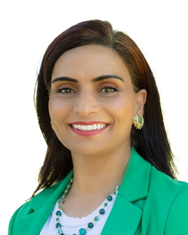
In 2024 Harwinder Sandhu of the BC NDP won Vernon-Lumby with 11,837 votes (42.69%). Dennis Giesbrecht of the Conservative Party received 11,361 votes (40.97%), Kevin Acton, with no party affiliation, 4,266 (15.38%) and Robert Johnson of the Libertarian Party 265 (0.96%). Turnout was 60.65% of 45,810 registered voters. The legislature's member records list Sandhu as the BC NDP member for Vernon-Lumby in the 43rd Parliament, dated from 18 February 2025 to 22 September 2026. The legislature's website says the 43rd Parliament was dissolved on September 22, 2026, and that a provincial general election will be held on October 24, 2026.
Members for Vernon-Monashee, which covered 84 of this district’s 85 voting areas before 2024
Parliament
It sat
Member
Elected as
Party on the legislature’s record
42nd
2020 to 2024
Harwinder Sandhu
BC NDP
BC NDP
41st
2017 to 2020
Eric Foster
BC Liberal Party
40th
2013 to 2017
Eric Foster
BC Liberal Party
39th
2009 to 2013
Eric Foster
BC Liberal Party
“Elected as” is the affiliation Elections BC printed with the winning result. The last column is the party the legislature’s records give for that parliament, which differs when a member changed party while in office. A row with that column empty is a winner Elections BC prints whom the legislature’s records leave out. Source: Legislative Assembly of British Columbia (opens in a new tab)
Boundaries since 2024
Vernon-Lumby has 85 voting areas. They overlap these districts from 2017 to 2024: Vernon-Monashee (84), Shuswap (1).
The commission that drew the boundaries counted 57,423 people in the district, 6.8% above the average for a district, over 1,265 km².
Vernon-Lumby is a provincial electoral district in the North Okanagan of British Columbia. The Electoral Boundaries Commission's 2023 final report says it includes the City of Vernon and Silver Star Provincial Park, with communities east of the city such as Lumby, Blue Springs, Trinity Valley and Mabel Lake. The commission gives its area as 1,265 square kilometres and counts 57,423 people in it.
Which communities are in Vernon-Lumby?
Vernon-Lumby includes the City of Vernon and the Village of Lumby, with Blue Springs, Trinity Valley and Mabel Lake, according to the commission's 2023 final report. It also takes in Silver Star Provincial Park. Elections BC's 2024 results file lists a voting place called the Mabel Lake Comm Hall inside the district. The Monashee area, including Cherryville, was moved out of it in 2023.
Who is the MLA for Vernon-Lumby?
Harwinder Sandhu of the BC NDP won Vernon-Lumby in 2024, and the legislature lists him as its member in the 43rd Parliament, dated from 18 February 2025. That Parliament was dissolved on September 22, 2026. Before 2024 Sandhu held Vernon-Monashee from 2020, and Eric Foster of the BC Liberal Party held that district from 2009 to 2020, according to the legislature's records.
How did Vernon-Lumby vote in 2024?
Harwinder Sandhu of the BC NDP won Vernon-Lumby in 2024 with 11,837 votes (42.69%). Dennis Giesbrecht of the Conservative Party received 11,361 votes (40.97%), Kevin Acton, with no party affiliation, 4,266 (15.38%) and Robert Johnson of the Libertarian Party 265 (0.96%). Turnout was 60.65% of 45,810 registered voters, according to Elections BC.
How did the boundaries of Vernon-Lumby change in 2023?
The Electoral Boundaries Commission moved the Monashee area, including Cherryville, out of Vernon-Monashee and renamed the district Vernon-Lumby. It moved Coldstream into Kelowna-Lake Country-Coldstream and placed the City of Vernon in one district. Elections BC's conversion table matches 84 of the 85 voting areas of Vernon-Lumby to Vernon-Monashee and 1 to Shuswap.
Who lives in Vernon-Lumby?
The 2021 census counted 57,375 people in Vernon-Lumby, with a median age of 49.2 against 42.8 for British Columbia. People aged 65 and over make up 27.2% of residents, against 20.3% in the province. English is the first language of 88% and German of 2.3%, and 7.3% of residents identified as Indigenous.
Whose traditional territory is Vernon-Lumby on?
The Okanagan Nation Alliance says the traditional Syilx territory includes the Okanagan Indian Band, which places itself at the head of Okanagan Lake in Vernon. Splatsin, the southernmost tribe of the Secwépemc Nation by its own description, names Cqlqin (Mabel Lake) as a village site and Swa7will (Shuswap Falls) near Lumby as a fishing place. The commission kept the Band's Okanagan 1 reserve in Salmon Arm-Shuswap.
How did Lumby get its name?
Lumby, in Vernon-Lumby, is named for Moses Lumby, who settled in the district in 1870 and was government agent at Vernon from 1891 to 1893, according to BC Geographical Names. The White Valley post office opened on 1 August 1889 and was renamed Lumby on 1 February 1894. Lumby became a village municipality in December 1955.
What happened at Vernon during the First World War?
Vernon, the largest community in Vernon-Lumby, hosted a military training camp on Mission Hill, which the Vernon Museum dates to 1912. The Vernon Internment Camp opened on Sept. 18, 1914, on the site of what is now MacDonald Park, and closed in February 1920. The museum says 11 men died in the camp.
What is the history of Silver Star in Vernon-Lumby?
Silver Star Provincial Park in Vernon-Lumby lies 22 kilometres northeast of Vernon, according to BC Parks. The Vernon Museum says the Silver Star Mining Company marked out the mountain's earliest claim in 1896 and that the Silver Star Ski Club formed in 1938. BC Geographical Names records that the mountain became Silver Star Mountain on 6 June 1952.