This district elects one MLA. Voters mark one name on Saturday, October 24, 2026, and the candidate with the most votes wins the seat.
Langley-Abbotsford is a provincial electoral district in the Fraser Valley. The Electoral Boundaries Commission says it takes in most of the Township of Langley, including Murrayville, Fern Ridge, Glen Valley and Aldergrove, and the western edge of the City of Abbotsford, with the Canada-U.S. border as its southern boundary. The 2021 census counted 56,225 people in it, and the commission gives its area as 283 square kilometres.
Langley-Abbotsford lies in the Fraser Valley of British Columbia, across the Township of Langley and the western edge of the City of Abbotsford. The Electoral Boundaries Commission's 2023 final report says the district takes in most of the Township, including Murrayville, Fern Ridge, Glen Valley and Aldergrove. Its boundaries follow the Canada-U.S. border in the south and the Fraser River in the north. In the west the boundary runs along 196th Street in the Township, and in the east it runs along Bradner Road in the City of Abbotsford.
The commission gives the district a population of 56,458, which is 5.0% from the average district, and an area of 283 square kilometres. The earlier Langley East district had 77,530 people, 34.9% above the average, and the commission proposed one more district in the Langley area after residents asked for more representation. The preliminary report named this district Langley-Aldergrove. The final report renamed it Langley-Abbotsford and describes it as the more rural parts of Langley Township, with the western most part of Abbotsford.
Elections BC's results file for the 2024 election lists 19 places where people voted inside the district. They include Aldergrove Community Secondary School, Bradner Community Hall, Brookswood Secondary School, Aberdeen Elementary School and the United Churches of Langley in Murrayville. Metro Vancouver describes Aldergrove Regional Park as 280 hectares of second growth forest, wetlands, meadows and fields on the boundary between the Township and Abbotsford. The Aldergrove Star reports that Aldergrove keeps an international border crossing, and that Old Yale Road, which once linked New Westminster to Yale, runs through Murrayville.
The Stó:lō Service Agency Society says its core administrative area extends from Yale to Langley, and it lists Matsqui, with the traditional name Màthxwi, among its member communities. Metro Vancouver's 2013 management plan for Aldergrove Regional Park places the park in Stó:lō territory. The plan says that only the Matsqui First Nation, a member band of the Stó:lō Nation, includes the park area in its traditional territory. It records Leqetsel as the name of Pepin Brook and Meqsel, a word it translates as nose, as the name of a Transformer stone in the east of the park.
The plan says that the land around Matsqui Indian Reserve 4, including the Gordon's Brook area of the park, was the site of large gatherings before European settlement. It dates the reserve to 1868 and places it beside the south-west boundary of the park. The Province's page on the Matsqui First Nation gives a population of 299 and says the Nation is one of five of eleven Stó:lō Nation bands negotiating land and resource issues outside the British Columbia treaty process.
The Province lists the Kwantlen First Nation at Fort Langley, with a population of 564. The Nation's own website says it is located between two Halkomelem dialects, the upriver Halq'eméylem and the downriver hən̓q̓əmin̓əm̓, and that it honours both. The Langley School District's page for Aldergrove Community Secondary School acknowledges the traditional, ancestral and unceded territories of the Máthxwi, q̓ʷɑ:n̓ƛ̓ən̓, q̓ic̓əy̓ and SEMYOME First Nations.
BC Geographical Names records that the Corporation of the Township of Langley was incorporated as a district municipality on 26 April 1873. Metro Vancouver's park plan describes it as a ten-mile square with its northern border on the Fraser River, and says a strip of land 2.5 miles wide, which it calls orphaned territory, lay between the township and the international border. The same record says a small portion on the western side was re-incorporated as the City of Langley on 15 March 1955.
KnowBC says Paul Murray settled at Murray's Corners in 1874 and built a hotel on the old Yale Road, and that a sawmill and a store followed in the 1880s. The Canadian Register of Historic Places says the Murray family received Crown grants of 160 acres on each corner of the crossing of the New Westminster-Yale Road and the Fort Langley Trail. It places the change of name to Murrayville in 1911 or close to it, made purportedly at the wish of the newly arrived post office. KnowBC says Murrayville was the commercial centre of Langley in the early 1900s and the site of the municipal hall and high school, until economic power shifted to Langley Prairie.
The Register says the pumphouse at Five Corners has supplied water to Murrayville continuously since 1911, when a resident pumped water from an artesian well to Belmont School and the Municipal Hall with a hydraulic ram. The present pumphouse was built in 1928 to shelter an electric pump. The Aldergrove Star reports that Old Yale Road began as a dirt path for wagons in the 1870s and was covered with gravel in 1897, and that the concrete surface west of Five Corners was poured in 1923. The Star gives 1928 as the year Murrayville Community Hall opened.
The border survey and the farms beside it, 1858 to 1942
The park plan records that the Oregon Boundary Treaty of 1846 set the 49th parallel as the international boundary, and that little was done to mark it on the ground until gold was discovered. By mid-July 1858 the British and American Boundary Commissions were both at work. Royal Engineers made a camp on Semiahmoo Bay and began to work eastward, creating the Boundary Commission Trail along the 49th parallel to Sumas. The plan says the largest push to settle the area came in 1899, when families from Norway and Sweden arrived, followed by settlers from the United Kingdom, Japan and India.
The plan names farm families whose land became part of the park. The Loucks family settled in 1908 on a mixed farm and sold produce in New Westminster and Vancouver, and in 1912 William Marley Loucks built an Edwardian house that still stands in the park. In 1929 the Pepin family moved from the Campbell Valley area to a farm, and its dairy later operated as Pepindale Dairy. The plan adds that the people of Matsqui took part in the new farm economy, with the Fraser River as their link for trade and communication.
The plan says the Tanaka family bought a property in 1938 to expand its soft fruit and vegetable farm. In 1942 Japanese families in British Columbia were declared enemy aliens and forcibly moved from coastal areas. The Tanaka family was sent to Tachme, an internment camp near Hope, and the government seized its farm and assets.
Shortreed's Corners, Alder Grove and the railway, 1883 to 1934
The Canadian Register of Historic Places says the first name of the Aldergrove area was Shortreed, after Robert Shortreed Jr., who arrived in 1883 and ran a general store with the telegraph, the post office and a blacksmith shop. The Aldergrove Star reports that the crossroads where the Yale Road met a trail to the United States became known as Shortreed's Corners, after the brothers Robert Jr. and Duncan Shortreed from Ontario. The settlement later took the name Alder Grove, suggested by George Bruskey because of the many alder trees, and the Alder Grove Post Office opened on 1 October 1885. The Register says the name later became one word, possibly at the insistence of the post office. The Star adds that the settlement had the Township's first customs office, in the home of the settler William Vanetta.
The Register says Frederick John Hart, a Newfoundlander who worked as a life insurance salesman and realtor, promoted settlement of the Aldergrove area through building construction and a planned townsite, and donated land for a church. The building put up for him in 1910 first held a bank, a home improvement store and a realty office. Four years later the BC Telephone Company bought it and ran the local telephone exchange there until 1952. Since 1993 it has been a telephone museum and community archives for Aldergrove.
The Aldergrove Star reports that the Vancouver, Victoria and Eastern, a subsidiary of the Great Northern Railway, built its line to Aldergrove from the west in 1908 and opened it in 1909. By March 1910 trains ran daily except Sundays, and by 1924 service had fallen to three times a week. The railway applied to close the Aldergrove station in 1925, and the federal government refused after protests from residents. The last train ran in 1929 and the tracks stayed in place until 1934. The Register says Aldergrove was one of only two Great Northern stops in Langley.
Glen Valley and the Fraser River landing, 1877 to 1968
KnowBC describes Glen Valley as a former steamship landing on the south shore of the Fraser River and a dairy farming district on soil left by a turn of the river. It says Gilbert McKay first settled it in 1877. BC Geographical Names places Glen Valley in the northeast corner of Langley and quotes a 1927 letter saying that two or three of the first settlers chose the name, with 1890 given as the probable year. Earlier names were Beaver Valley and Cromarty's Prairie. The post office opened on 1 November 1904 and closed on 30 April 1968, and a railway station stood near Nathan Creek.
The Canadian Register of Historic Places says the Glen Valley community grew around McKay's wharf at the foot of Jackman Road, now 272nd Street. The original McKay house, which held the first post office and the first store in 1904, was moved back from the river, and the Hassall house was built on that site in 1917. The Register calls it one of a few houses in the area built on land acquired from the Soldiers' Settlement Board, which encouraged men returning from the First World War to take up small farms. Jack Hassall and his wife Christina ran a dairy farm, and the family lived in the house from 1918 until the late 1970s. The house stands between the railway and the Fraser River in a regional park.
Bradner, the interurban line and the daffodils, 1910 to 1928
The Fraser Valley Heritage Railway Society says the British Columbia Electric Railway completed its Fraser Valley line in 1910 and began passenger service on October 3, 1910. The line ran from downtown Vancouver to Chilliwack, with up to four round trips each day, and it last carried passengers in 1955. KnowBC says Bradner was a stop on this interurban line and describes it as a community 15 km west of downtown Abbotsford that is now part of that city.
KnowBC adds that since the 1920s Bradner has been the centre of the largest bulb-growing area in British Columbia and is known as the Daffodil Capital of Canada, and that an annual spring flower show has been held there since 1928. The Aldergrove Star reports that Fenwick Fatkin started the Bradner Flower Show in 1928, after arriving from Newcastle on Tyne, England, in 1912. He had seen that conditions in Bradner were ideal for daffodils and started the area's first bulb business on his homestead. In 2015 a daffodil memorial stood on Bradner Road near the Bradner community hall.
Fraser Health says Langley Memorial Hospital, first known as the cottage hospital, opened in 1948 with 35 beds. The Aldergrove Star's 2017 profile of Murrayville says the hospital has stood on the hill in Murrayville since 1948 and that Murrayville is also home to the Langley RCMP headquarters, the Langley School District office and Langley Regional Airport, which houses the Canadian Museum of Flight. BC Geographical Names records that the name Brookswood was adopted for a settlement on 3 May 1951, and that a Brookswood post office was open from 16 February 1925 to 15 October 1926.
The Langley School District says Aldergrove Community Secondary School opened in 1958 as Aldergrove Junior-Senior High School, the second oldest school in the district. It welcomed First Nations students and their families from Haida Gwaii, Bella Bella and Bella Coola, who lived in the homes of local Aldergrove families. A teacher asked Ellen Neel, a hereditary totem carver of the Kwakwaka'wakw First Nation, to carve a pole for the school, which became known as the Totems.
The park plan says the Keillor family bought a parcel of land in 1959 and planned a lake with a camping area. The base of the lake was built in 1962 and the beach fully opened in 1963 as Aldergrove Beach. In 1967 the Greater Vancouver Regional District, now Metro Vancouver, began to assemble land for a park, and it has operated the park since 1969. The lake closed in early 2011 because of its lifespan, and the plan counts 342,000 visitors to the park in 2012.
Statistics Canada's 2016 Census of Agriculture, as compiled by Metro Vancouver, counts 1,103 farms in Langley, down from 1,584 in 1996. Total farm area was 10,807 hectares in 2016. Gross farm receipts were $340,111,011 in 2015, against $203,399,307 in 2000. The bulletin's figures cover all of Langley, which is larger than this district.
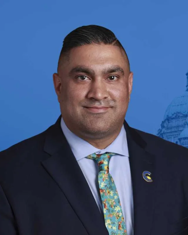
Langley-Abbotsford is a new district. The commission's 2023 final report proposes it, and Elections BC's results file holds its first election, the 2024 Provincial General Election. Harman Bhangu of the Conservative Party won with 14,341 votes (55.65%). John Aldag of the BC NDP received 8,691 (33.73%), Melissa Snazell of the BC Green Party 1,434 (5.56%), Karen Long, an Independent, 1,104 (4.28%) and Alex Joehl of the Libertarian Party 200 (0.78%). Turnout was 59.46% of 43,448 registered voters. The legislature's record lists Bhangu in the 43rd Parliament as a member of the Conservative Party of BC.
The place had other district names before. Elections BC's volume for 1987 to 2001 first prints Fort Langley-Aldergrove at the 35th general election, held on 17 October 1991. The volume lists the Electoral Districts Act (SBC 1990 c. 39), assented to on 27 July 1990, as setting out 75 single-member districts. Gary Farrell-Collins of the Liberal Party won with 8,663 votes (43.57%), ahead of Charles Bradford of the New Democratic Party with 6,027 (30.31%). Rich Coleman of the Liberal Party won it in 1996 with 12,005 votes (47.30%) and in 2001 with 16,527 (68.30%). The 2002 to 2013 volume prints his wins of 15,454 votes (59.13%) in 2005, 15,139 (61.09%) in 2009 and 15,989 (55.10%) in 2013.
Bill 42 of 2015, the Electoral Districts Act, set 87 districts. Its list of names includes Langley and Langley East and no Fort Langley-Aldergrove, and it took effect on the day the 40th Parliament was dissolved. Coleman won Langley East in 2017 with 16,348 votes (53.45%), ahead of Inder Johal of the BC NDP with 8,820 (28.84%). Megan Dykeman of the BC NDP won it in 2020 with 13,169 votes (42.56%), ahead of Margaret Kunst of the BC Liberal Party with 10,385 (33.56%). The legislature's record lists Dykeman as the member from 2020 to 2024.
The 2023 commission report drew Langley-Abbotsford from parts of four districts. Elections BC's conversion table places its 75 voting areas in the 2017 to 2024 districts as 37 in Langley East, 28 in Abbotsford South, 12 in Langley and 3 in Abbotsford West. The legislature's record lists Bruce Banman of the Conservative Party of BC as the member for Abbotsford South from 2020 to 2024.
Members for Langley East, which covered 37 of this district’s 75 voting areas before 2024
Parliament
It sat
Member
Elected as
Party on the legislature’s record
42nd
2020 to 2024
Megan Dykeman
BC NDP
BC NDP
41st
2017 to 2020
Rich Coleman
BC Liberal Party
BC Liberal Party
Members for Abbotsford South, which covered 28 of this district’s 75 voting areas before 2024
Parliament
It sat
Member
Elected as
Party on the legislature’s record
43rd
2025 to 2026
Bruce Banman
Conservative Party
Independent
42nd
2020 to 2024
Bruce Banman
BC Liberal Party
Conservative Party of BC
41st
2017 to 2020
Darryl Plecas
BC Liberal Party
Independent
40th
2013 to 2017
Darryl Plecas
BC Liberal Party
BC Liberal Party
39th
2009 to 2013
John van Dongen
BC Liberal Party
Independent
“Elected as” is the affiliation Elections BC printed with the winning result. The last column is the party the legislature’s records give for that parliament, which differs when a member changed party while in office. A row with that column empty is a winner Elections BC prints whom the legislature’s records leave out. Source: Legislative Assembly of British Columbia (opens in a new tab)
Boundaries since 2024
Langley-Abbotsford has 75 voting areas. They overlap these districts from 2017 to 2024: Langley East (37), Abbotsford South (28), Langley (12), Abbotsford West (3).
The commission that drew the boundaries counted 56,458 people in the district, 5.0% above the average for a district, over 283 km².
Langley-Abbotsford is a provincial electoral district in the Fraser Valley of British Columbia. The Electoral Boundaries Commission's 2023 final report says its boundaries follow the Canada-U.S. border in the south and the Fraser River in the north. In the west it follows 196th Street in the Township of Langley, and in the east Bradner Road in the City of Abbotsford.
Which communities are in Langley-Abbotsford?
Langley-Abbotsford includes Murrayville, Fern Ridge, Glen Valley and Aldergrove, according to the Electoral Boundaries Commission's 2023 final report. The commission says the district takes in most of the Township of Langley and the western most part of Abbotsford. Elections BC's 2024 results file also lists voting places in Brookswood, Bradner and Aberdeen inside the district.
Who won Langley-Abbotsford in the 2024 provincial election?
Harman Bhangu of the Conservative Party won Langley-Abbotsford in 2024 with 14,341 votes, 55.65% of the valid votes. John Aldag of the BC NDP received 8,691 votes. Turnout was 59.46% of 43,448 registered voters, and 25,770 valid votes were counted in the district. The legislature's record lists Bhangu as a member of the Conservative Party of BC.
Who represented this area before 2024?
Before 2024 the area of Langley-Abbotsford was mostly in the Langley East and Abbotsford South districts. Megan Dykeman of the BC NDP held Langley East from 2020 to 2024, and Rich Coleman held it from 2017 to 2020. Bruce Banman of the Conservative Party of BC held Abbotsford South from 2020 to 2024, according to the legislature's record.
When was Langley-Abbotsford created?
The Electoral Boundaries Commission's 2023 final report proposed Langley-Abbotsford, and the district first voted in the 2024 provincial election. The commission's preliminary report had named it Langley-Aldergrove. Elections BC's conversion table places its 75 voting areas in four earlier districts, with 37 in Langley East, 28 in Abbotsford South, 12 in Langley and 3 in Abbotsford West.
How many people live in Langley-Abbotsford?
The 2021 census counted 56,225 people in Langley-Abbotsford, with a median age of 44 compared with 42.8 across British Columbia. English was the first language of 78.9% of residents and Punjabi of 7.3%. Immigrants made up 18.8% of the population, and 79% of households owned their home. The commission counts 56,458 people in the district.
Which First Nations have territory in Langley-Abbotsford?
The Matsqui First Nation (Máthxwi) is the Nation that Metro Vancouver's Aldergrove Regional Park plan says includes the park area in its traditional territory. The plan places Matsqui Indian Reserve 4 beside the park, and dates the reserve to 1868. The Langley School District's Aldergrove school page names four Nations in its acknowledgement, among them the Máthxwi.
How did Aldergrove get its name?
Aldergrove in Langley-Abbotsford was first called Shortreed's Corners after the Shortreed brothers, who ran a general store at the crossroads. The settlement became Alder Grove, a name suggested by George Bruskey because of the many alder trees, and the Alder Grove Post Office opened on 1 October 1885. The Aldergrove Star and the Canadian Register of Historic Places report this.
What is Bradner known for?
Bradner, in the Abbotsford part of Langley-Abbotsford, is known as the Daffodil Capital of Canada. KnowBC says that since the 1920s it has been the centre of the largest bulb-growing area in British Columbia. The Bradner Flower Show has been held every spring since 1928, and the Aldergrove Star credits Fenwick Fatkin with starting it that year.
When did the Township of Langley begin?
The Township of Langley, which holds most of Langley-Abbotsford, was incorporated as a district municipality on 26 April 1873, according to BC Geographical Names. It was first called the Corporation of the Township of Langley. The City of Langley, on the western side, was re-incorporated from a small portion of the Township on 15 March 1955.