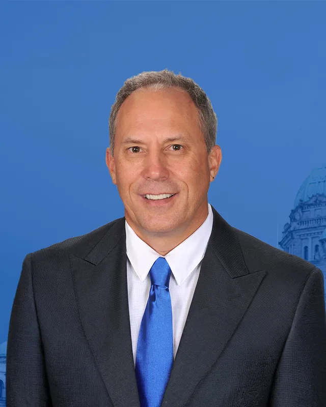
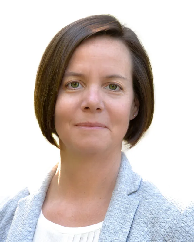
This district elects one MLA. Voters mark one name on Saturday, October 24, 2026, and the candidate with the most votes wins the seat.
Ladysmith-Oceanside is a provincial electoral district on the east coast of Vancouver Island, facing the Strait of Georgia. It takes in the Town of Ladysmith, Saltair, Cassidy, Nanoose Bay, the City of Parksville, the Town of Qualicum Beach and Lasqueti Island, with the communities of Stz'uminus First Nation and Snaw-naw-as (Nanoose) First Nation. The 2021 census counted 56,340 people, with a median age of 60.4, and the Electoral Boundaries Commission gives the area as 2,127 square kilometres.
Ladysmith-Oceanside lies on the east coast of Vancouver Island. The Electoral Boundaries Commission's report says the district includes Saltair, Ladysmith, Cassidy, Nanoose Bay, Parksville, Qualicum Beach and Lasqueti Island. Its northern boundaries follow the Island Highway and Regional District of Nanaimo Electoral Area G, and it extends south along the borders of Ladysmith and Cowichan Valley Regional District Electoral Area H. The commission gives the district 56,308 people, 4.7 per cent from the average district, and an area of 2,127 square kilometres.
Much of the land borders salt water. BC Geographical Names places Nanoose Harbour northwest of Nanaimo and southeast of Parksville, and Qualicum Beach on the east side of Vancouver Island north of Parksville. Stz'uminus First Nation says much of its territory borders the Strait of Georgia and Ladysmith Harbour. Canada's Historic Places register describes Rathtrevor Beach Provincial Park in Parksville as a 347-hectare park with a two-kilometre stretch of beach. Lasqueti Island, in the Strait of Georgia, is 8 kilometres wide and 22 kilometres long, with an area of 73.56 square kilometres, and the Lasqueti Internet Access Society says BC Hydro does not serve it.
People travel by road, rail, air and water. The Qualicum Beach Museum says trains ran on the railway to Qualicum Beach from 1913 to 2011. Nanaimo Airport gives its address as 3350 Spitfire Road in Cassidy. A passenger-only ferry crosses from French Creek Harbour on Vancouver Island to False Bay on Lasqueti Island in 50 minutes to over an hour. Elections BC's 2024 results show 84 voting areas in the district and 11 voting places, among them Frank Jameson Community Centre, Nanoose Place, Saltair Community Centre, Lasqueti Community Hall and the Stz'uminus Health Centre.
Stz'uminus, Snaw-naw-as and the Pentl'ach language
Stz'uminus First Nation calls itself a Coast Salish People who have lived around the Salish Sea for thousands of years. The Nation says its traditional territory on east Vancouver Island includes four reserves of more than 1,200 hectares, much of it bordering the Strait of Georgia and Ladysmith Harbour. It reports 1,300 members, with about half living on its reserves. The Province's 2022 news release describes the Nation's territory as a collective assertion with the member Nations of the Quw'utsun Nation, extending along eastern Vancouver Island, the southern Gulf Islands and the lower Fraser River.
Snaw-naw-as (Nanoose) First Nation says its name means the way in the harbour and comes from the Island Halkomelem word Naus. Its people speak Hul'q'umi'num' and live at Nanoose Bay. The Nation says the Joint Reserve Commission established its reserve at Nanoose Bay in 1876, that the reserve measures 63 hectares and that the territory remains unceded. BC Geographical Names records that Captain Richards of H.M.S. Plumper applied the name Nanoose to the harbour in 1859 to 1860, taking it from the Snaw Naw As.
The Qualicum First Nation says the pentl'ach language was traditionally spoken within and beyond its territories. It says the language has been declared extinct since the 1940s, calls that description inaccurate and began a formal language project in 2017. The Qualicum Beach Museum devotes an exhibit to the Pentlatch peoples, whom it describes as the people of the local area. BC Geographical Names records that the name Qualicum comes from a Nanaimo term for the place of the dog salmon, and that Dr. Robert Brown documented the area in 1864.
BC Geographical Names records that the Spanish naval officer Jose Maria Narvaez named Lasqueti Island in July 1791 for Juan Maria Lasqueti. Spanish charts of 1792 print it as Isla de Lasqueti, and maps of the middle of the 19th century call it Sangster Island. The official name Lasqueti Island was adopted on 18 December 1906. The island's community society gives the Coast Salish name of the island as Xwe'etay.
The same society reports that archaeological surveys found large settlement sites in almost every bay on the island. It dates the longhouse villages to within the last 2,000 to 3,000 years, says artifacts suggest people camped in the interior 6,000 to 8,000 years ago, and dates inland refuge sites to the last 1,000 years.
Three bodies govern the island, the society says: the Islands Trust for land use, the qathet Regional District for services and bylaws, and School District 69, which runs False Bay School. The Islands Trust says its Lasqueti local trust area includes more than 23 associated islands and three provincial parks, Jedediah Island, Sabine Channel and Squitty Bay.
Settlers, post offices and the railway, 1859 to 1914
European farming began in the 1880s at Nanoose Harbour, according to BC Geographical Names, and the Arlington Hotel post office opened there in 1906. The same office records that the four Parks brothers claimed land at the place that became Parksville on 5 October 1885, and that the post office opened on 1 February 1887 with Nelson Parks as postmaster. The City of Parksville says a wagon road from Nanaimo to Englishman's River, reaching on to Comox, was finished in 1886, and that the Esquimalt and Nanaimo Railway extension of 1901 sped the town's growth.
Canada's Historic Places register records that William Rath, a gold prospector, founded a homestead in 1886 on the land that is now Rathtrevor Beach Provincial Park, and that his family later allowed recreational use of the land, which became a campground. At Qualicum Beach, the museum says a Canadian Pacific Railway employee, H.E. Beasley, took charge in 1905 of extending the island's railway north from Nanaimo. The train station was built in 1913 and the railway reached the town one year later. The Qualicum Beach Hotel was built in 1913, and BC Geographical Names records that the town's post office opened on 1 November 1913.
Cassidy takes its name from Thomas Cassidy, who settled in the Oyster District in the 1870s and supplied milk and vegetables to the crews building the railway. BC Geographical Names records that the Cassidy post office opened on 1 June 1919 and that the community lies between Nanaimo and Ladysmith.
The Ladysmith and District Historical Society tells how the town began. Robert Dunsmuir found a coal seam near Diver Lake in 1869 and the Wellington seam in 1871. Later Ephraim Hodgson found a continuation of that seam, which became the Extension mine. After a dispute with the Western Fuel Company over land for the railway, access to the existing wharves was denied, and James Dunsmuir chose Oyster Harbour as the shipping port. In 1898 work began on a railway extension, a coal washer, bunkers and wharves. Most miners moved from Wellington and brought their homes, shops, hotels and churches, which were loaded on rail flat cars and reassembled at the harbour. BC Geographical Names records that the Oyster Harbour post office opened on 1 October 1899.
James Dunsmuir named the town Ladysmith on 1 March 1900, after the South African town whose siege had just been lifted, says BC Geographical Names. The society adds that ten streets carry the names of generals of that war. The City of Ladysmith was incorporated on 3 June 1904. A copper smelter, supplied with ore by rail from Mount Sicker, ran from 1902 to 1912. The society says a strike of more than a year caused much animosity between strikers and non-strikers, and that the Extension mine closed in 1931 as the seam ran out and demand for coal fell.
In 1933 a windstorm blew down trees in the hills behind the town, and the Rockefeller Foundation, which then owned the forest, agreed to sell it. The Comox Logging and Railway Company began logging and shipping logs through the harbour in 1936. The society says this was the town's main industry until 1986 and that two sawmills still work there. BC Geographical Names records that Ladysmith became a village municipality on 1 January 1958 and a town municipality on 1 January 1965.
Airfield, hotel and new municipalities, 1942 to 1986
Nanaimo Airport says the Department of National Defence bought 522 acres in 1942 for $20,000 and built an airstrip for a Royal Canadian Air Force glider pilot training facility. After the Second World War the City of Nanaimo leased the field from the federal government for $1 a year. The Nanaimo Airport Commission took over operations under a 30-year lease in April 1992, and in 1999 the air terminal was named for the First World War flying ace Raymond Collishaw.
BC Geographical Names records that Qualicum Beach became a village municipality on 5 May 1942 and a town municipality on 7 January 1983. Parksville became a village municipality on 19 June 1945, a town municipality on 30 March 1978 and a city municipality on 1 May 1986. The Qualicum Beach Museum says the Qualicum Beach Hotel, managed with its golf course by Noel Money until his death in 1941, was torn down in 1969. Canada's Historic Places register records that Rathtrevor Beach became a provincial park on 20 April 1967.
The Department of National Defence's Maritime Engineering Journal says torpedo testing at Nanoose Bay began after December 1953, when a senior officer of the Royal Canadian Navy confirmed that the deep, quiet waters of Area WG suited faster torpedoes. Two new torpedoes were being tested there in January 1954. Canada and the United States signed a formal agreement on 18 May 1965 that made Nanoose a jointly operated underwater range, now called the Canadian Forces Maritime Experimental and Test Ranges. The journal says the tracking range doubled in size in 1970 and grew to 44 square nautical miles in 1992. BC Geographical Names records that in 1999 the federal government expropriated 217 square kilometres of ocean floor for the testing.
Accords, treaty talks and Ladysmith Harbour, 2007 to 2025
The Union of BC Municipalities records that the Town of Ladysmith and Stz'uminus First Nation signed a Community Accord in 2007, after a debate over expanding the town boundary and a proposal for waterfront development. The two governments renewed it in 2012 as the Naut'sa mawt Accord, a Hul'qumi'num phrase meaning working together, and signed a Co-operation Protocol that October. In early 2018 they completed a joint Waterfront Area Plan covering over 50 hectares of land and water lots, which received a provincial planning award in 2018.
On 19 July 2022 the Province and Stz'uminus signed a reconciliation agreement. The Province's release says it commits the parties to land transfer agreements worth as much as $28.5 million, gives the Nation $3 million in immediate financial benefits and provides $10 million over five years for Stz'uminus-led remediation of Crown land in Ladysmith Harbour. The Province's page for the Nation says Stz'uminus withdrew from the Hul'qumi'num Treaty Group in 2019 and negotiates land and resource agreements outside the BC treaty process. Stz'uminus First Nation is one of four Nations that sued as plaintiffs in Cowichan Tribes v. Canada, decided by the Supreme Court of British Columbia on 7 August 2025.
Snaw-naw-as belongs to the Te'mexw Treaty Association with four other Nations. The BC Treaty Commission records a Statement of Intent filed on 15 July 1994, a Framework Agreement signed on 5 December 1996 and an Agreement in Principle signed in April 2015, and says the association is in Stage 5 negotiations to finalize a treaty.
Elections BC's volumes show that the name Parksville-Qualicum first appears at the 1991 election, when Leonard Krog of the New Democratic Party won with 10,408 votes (40.24%). In 1996 Paul Reitsma of the Liberal Party won with 13,459 votes (41.19%), ahead of Krog with 12,976 (39.72%). Reitsma resigned on 23 June 1998, and Judith Reid of the Liberal Party won the by-election of 14 December 1998 with 13,862 votes (52.61%) against 5,978 (22.69%) for Krog. The district was named Nanaimo-Parksville in 2001, when Reid won with 17,356 votes (62.60%), and again in 2005, when Ron Cantelon of the Liberal Party won with 16,542 (51.42%).
The name Parksville-Qualicum returned in 2009, when Cantelon won with 13,716 votes (51.42%). Michelle Stilwell of the BC Liberal Party won in 2013 with 14,518 votes (50.13%) and in 2017 with 14,468 (45.13%). In 2020 Adam Walker won with 13,207 votes (42.00%), listed as BC NDP in Elections BC's results and as an independent in the Legislature's member records. Elections BC's conversion table also shows an overlap of 26 with Nanaimo-North Cowichan, which elected Doug Routley of the BC NDP in 2009, 2013, 2017 and 2020.
The commission's 2023 report gave the district the name Ladysmith-Oceanside. Its preliminary report had used Nanaimo-Oceanside, and the final report changed the name after Nanaimo was divided into two districts, Nanaimo-Gabriola Island and Nanaimo-Lantzville. The commission considered moving Coombs and Errington from Mid Island-Pacific Rim into the district because of their ties to Parksville and Qualicum, and left them out to avoid too large a population gap between the two districts.
In 2024 Stephanie Higginson of the BC NDP won with 14,144 votes (41.49%), ahead of Brett Fee of the Conservative Party with 12,097 (35.48%). Adam Walker stood as an independent and received 5,559 (16.31%). Turnout was 69.08% of 49,387 registered voters. The Legislative Assembly's member records list Higginson for Ladysmith-Oceanside in the 43rd Parliament.
Members for Parksville-Qualicum, which covered 60 of this district’s 84 voting areas before 2024
Parliament
It sat
Member
Elected as
Party on the legislature’s record
42nd
2020 to 2024
Adam Walker
BC NDP
Independent
41st
2017 to 2020
Michelle Stilwell
BC Liberal Party
BC Liberal Party
40th
2013 to 2017
Michelle Stilwell
BC Liberal Party
BC Liberal Party
39th
2009 to 2013
Ron Cantelon
BC Liberal Party
BC Liberal Party
36th
1996 to 2001
Judith Reid
BC Liberal Party
35th
1992 to 1996
Leonard Eugene Krog
BC NDP
Members for Nanaimo-North Cowichan, which covered 26 of this district’s 84 voting areas before 2024
Parliament
It sat
Member
Elected as
Party on the legislature’s record
42nd
2020 to 2024
Doug Routley
BC NDP
41st
2017 to 2020
Doug Routley
BC NDP
BC NDP
40th
2013 to 2017
Doug Routley
BC NDP
BC NDP
39th
2009 to 2013
Doug Routley
BC NDP
BC NDP
“Elected as” is the affiliation Elections BC printed with the winning result. The last column is the party the legislature’s records give for that parliament, which differs when a member changed party while in office. A row with that column empty is a winner Elections BC prints whom the legislature’s records leave out. Source: Legislative Assembly of British Columbia (opens in a new tab)
Boundaries since 2024
Ladysmith-Oceanside has 84 voting areas. They overlap these districts from 2017 to 2024: Parksville-Qualicum (60), Nanaimo-North Cowichan (26), Mid Island-Pacific Rim (4), Nanaimo (1), Powell River-Sunshine Coast (1).
The commission that drew the boundaries counted 56,308 people in the district, 4.7% above the average for a district, over 2,127 km².
Ladysmith-Oceanside is a provincial electoral district on the east coast of Vancouver Island. The Electoral Boundaries Commission's report says it includes Saltair, Ladysmith, Cassidy, Nanoose Bay, Parksville, Qualicum Beach and Lasqueti Island. The commission gives the district 56,308 people and an area of 2,127 square kilometres. Its northern boundaries follow the Island Highway and Regional District of Nanaimo Electoral Area G.
Which communities are in Ladysmith-Oceanside?
Ladysmith-Oceanside includes the Town of Ladysmith, the City of Parksville, the Town of Qualicum Beach, Saltair, Cassidy, Nanoose Bay and Lasqueti Island. Elections BC's 2024 results list 11 voting places in the district, among them the Stz'uminus Health Centre, Nanoose Place, Saltair Community Centre and Lasqueti Community Hall, which places the Stz'uminus First Nation community inside the district as well.
Who is the MLA for Ladysmith-Oceanside?
The Legislative Assembly's records list Stephanie Higginson of the BC NDP as the member for Ladysmith-Oceanside in the 43rd Parliament. She won the seat in the 2024 provincial general election with 14,144 votes (41.49%). Brett Fee of the Conservative Party came second with 12,097 votes (35.48%). Elections BC counted 34,092 valid votes in the district.
Who held the Ladysmith-Oceanside seat before Stephanie Higginson?
Elections BC's results file holds one election under the name Ladysmith-Oceanside, held in 2024, so no earlier member held the seat by that name. The earlier district with the most overlap, Parksville-Qualicum, was held by Adam Walker from 2020 to 2024, Michelle Stilwell of the BC Liberal Party from 2013 to 2020 and Ron Cantelon of the BC Liberal Party from 2009 to 2013, according to the Legislature's records.
How did Ladysmith-Oceanside vote in 2024?
In 2024 Stephanie Higginson of the BC NDP won Ladysmith-Oceanside with 14,144 votes (41.49%). Brett Fee of the Conservative Party received 12,097 (35.48%), Adam Walker, an independent, received 5,559 (16.31%) and Laura Ferreira of the BC Green Party received 2,292 (6.72%). Turnout was 69.08% of 49,387 registered voters, and 24 ballots were rejected.
How did the boundaries of Ladysmith-Oceanside change in 2023?
In 2023 the Electoral Boundaries Commission divided Nanaimo between two districts and joined Oceanside, Ladysmith and Saltair in Ladysmith-Oceanside, a name that replaced Nanaimo-Oceanside from its preliminary report. The commission considered adding Coombs and Errington from Mid Island-Pacific Rim, but that would have made the population gap between the two districts too large. Elections BC's conversion table shows an overlap of 60 with Parksville-Qualicum.
Which First Nations are in Ladysmith-Oceanside?
Stz'uminus First Nation and Snaw-naw-as (Nanoose) First Nation both have communities in Ladysmith-Oceanside. Stz'uminus says its territory borders the Strait of Georgia and Ladysmith Harbour. Snaw-naw-as says its reserve at Nanoose Bay was established in 1876 and that its territory remains unceded. The Qualicum Beach Museum also tells the story of the Pentlatch peoples, whom it describes as the people of the Qualicum Beach area.
Who lives in Ladysmith-Oceanside?
The 2021 census counted 56,340 people in Ladysmith-Oceanside. The median age was 60.4 years against 42.8 for British Columbia, and 22,890 people, or 40.6 per cent, were 65 or older. Immigrants made up 15.7 per cent of residents against 29 per cent in the province, and 3,730 residents were born in the United Kingdom. Indigenous identity was reported by 3,445 people, or 6.3 per cent.
When was Ladysmith named?
Ladysmith, in the Ladysmith-Oceanside district, was named on 1 March 1900 by James Dunsmuir, after the South African town whose siege had just been lifted, according to BC Geographical Names. It was incorporated as the City of Ladysmith on 3 June 1904 and became a town municipality on 1 January 1965. Before that the settlement was Oyster Harbour, whose post office opened on 1 October 1899.
How do people reach Lasqueti Island?
Lasqueti Island, part of Ladysmith-Oceanside, is reached by a passenger-only ferry from French Creek Harbour on Vancouver Island to False Bay. The Lasqueti Internet Access Society says the trip takes from 50 minutes to over an hour, carries no cars and is run by Western Pacific Marine under contract from BC Ferries. The island is 8 kilometres wide and 22 kilometres long, and BC Hydro does not serve it.