This district elects one MLA. Voters mark one name on Saturday, October 24, 2026, and the candidate with the most votes wins the seat.
Kootenay-Monashee is a provincial electoral district in the southeast of British Columbia. It takes in Trail, Rossland, Castlegar, Fruitvale, Montrose and Warfield, the communities along the Slocan River, the Arrow Lakes shore at Burton and Fauquier, and Cherryville in the Monashee Mountains. The 2021 census counted 41,485 people in it, and the Electoral Boundaries Commission gives its area as 11,551 square kilometres.
The Electoral Boundaries Commission's 2023 final report says Kootenay-Monashee includes Montrose, Fruitvale, Castlegar, Rossland, Trail and communities along the Slocan River delta, together with the Monashee Mountains and Cherryville. Its western boundary follows Regional District of Kootenay Boundary Electoral Area B and Regional District of North Okanagan Electoral Area E. Elsewhere it follows the borders of Regional District of Central Kootenay Electoral Areas J, H and K, Kokanee Glacier Provincial Park, Silverton and Upper Arrow Lake. The commission counts 41,446 people in the district, which is 22.9% below the average district, and gives the area as 11,551 square kilometres.
BC Geographical Names places Castlegar on the south and west sides of the Columbia River at its junction with the Kootenay River, and Trail along the Columbia between Castlegar and the BC-Washington boundary. Rossland is south-west of Trail, Warfield lies between Rossland and Trail, and Fruitvale is east of Trail. Montrose stands on the east side of the Columbia at Beaver Creek, south-east of Trail, and Genelle on the west side between Trail and Castlegar. Slocan lies at the south end of Slocan Lake and Winlaw on the east side of the Slocan River. Burton sits on The Narrows of the Columbia River just north of Lower Arrow Lake, Fauquier on the east side of The Needles on Lower Arrow Lake, and Cherryville south-east of the place where Cherry Creek meets the Shuswap River.
The commission wrote that Cherryville shares a transportation corridor with Upper Arrow Lakes communities. BC Parks directs visitors east on Highway 6 from Vernon, through Lumby, to reach Cherryville. School District 8 gives Highway 6 as the address of Brent Kennedy Elementary in Crescent Valley. A Doukhobor Heritage page gives directions from Highway 3A at the north end of Castlegar. BC Hydro's Hugh Keenleyside Dam stands 8 km upstream from Castlegar, and BC Hydro says its navigation lock for boats is closed for the 2026 season because of a mechanical issue.
Several Nations describe this land, each in its own words. The Ktunaxa Nation calls its territory ʔamakʔis Ktunaxa and says Ktunaxa people have occupied the lands beside the Kootenay and Columbia Rivers and the Arrow Lakes for more than 10,000 years. Its place names page gives Kik̓siⱡuk as the Ktunaxa name for Castlegar. The Syilx Okanagan Nation says that Syilx Okanagan and Sinixt people from the eastern parts of Syilx Territory were dispersed by colonization, and that its people have continued to return to those parts, including the Arrow Lakes, to hunt, fish, harvest and hold ceremonies.
The Autonomous Sinixt are Sinixt people who say they reject the authority of the governments of Canada, British Columbia and the United States, and of the Okanagan Nation Alliance and the Colville Confederated Tribes. They call the Sinixt homeland təmxʷúlaʔxʷ and describe it as reaching from north of the Grand Bend on the Columbia River to the height of the Monashee Range in the west and the height of the Purcell Range in the east. Their history page says Canada established a small reserve for the Arrow Lakes Band in 1902. After the band's last registered member, Annie Joseph, died in 1953, an Order in Council declared the band extinct for purposes of the Indian Act. The page says the declaration applied to the Arrow Lakes Band, the only Sinixt group that Canada recognized.
Gold on Cherry Creek and Monashee Creek, 1863 to 1919
A 1982 assessment report by K.L. Daughtry and W.R. Gilmour for Brican Resources Ltd., held in the BC government's assessment report files, says the area around Monashee Mountain was one of the earliest productive mining districts in Western Canada. A small silver lode, later called the Hidden Treasure, was found on Monashee Creek in 1863, and a small amount of its ore was sent to the coast in 1864. The report calls placer gold from Cherry Creek and Monashee Creek the most important mineral output of the Monashee. It dates the first mention of the Cherry Creek discovery to the 1876 Annual Report of the Minister of Mines. It also says no reliable figures exist for placer production, that published estimates reach as much as 150,000 ounces for the 1880s, and that the Ministry of Mines records more than 5,000 ounces.
BC Geographical Names records that the place now called Cherryville was first named Camagna, after E. Camagna, who pre-empted land there in 1909 and was postmaster until 1919. The Camagna post office opened on 1 November 1909 and closed on 15 April 1919. It reopened as the Cherryville Post Office on 1 October 1919. The same record says the name Cherryville is descriptive.
Red Mountain gold and the city of Rossland, 1890 to 1929
The Rossland Museum says the first claim near present-day Rossland was staked in 1887. In July 1890 the prospectors Joe Moris and Joe Bourgeois, together with their assayer Eugene Topping of Nelson, staked five claims on Red Mountain. Topping paid $12.50 for the five claims and renamed the Le Wise claim the Le Roi. A tent camp grew around the first mines and became the City of Rossland, which BC Geographical Names records as incorporated on 18 March 1897. The museum gives the population as 3,000 by 1895 and 7,000 by 1898.
The Province lists the Rossland Miners Union Hall, built in 1898, as a historic site. Its listing says the hall honours Rossland Miners Union No. 38 of the Western Federation of Miners, the first metalliferous mines union local in British Columbia. The museum says the high-production mines closed in 1929 after the price of copper fell following the First World War. It adds that the present museum building, at the Black Bear Mine, opened in 1967.
BC Geographical Names says the history of Trail began in 1891, when the first ore from the Le Roi mine was taken to the landing for shipment on the Columbia River to the smelters at Butte, Montana. The City of Trail was incorporated on 14 June 1901. The Rossland Museum says Fritz Augustus Heinze built a smelter at Trail that was complete and in production by 1 February 1896, and that the first load of ore from Rossland reached it on 11 June 1896. The Canadian Pacific Railway bought the smelter and Heinze's railways on 11 February 1898. The Consolidated Mining and Smelting Company of Canada was incorporated in 1906. It changed its name to Cominco Ltd. on 16 May 1966, and it agreed to merge with Teck Corporation on 29 April 2001. BC Geographical Names says Warfield was named after an official of the smelter.
The Convention of Ottawa, signed on 15 April 1935, set up a tribunal to settle a complaint by the United States. The convention says the complaint was that fumes from the smelter at Trail were causing damage in the State of Washington. In its decision of 16 April 1938 the tribunal awarded $78,000 for damage from 1 January 1932 to 1 October 1937. In its decision of 11 March 1941 it found that "no State has the right to use or permit the use of its territory in such a manner as to cause injury by fumes in or to the territory of another or the properties or persons therein, when the case is of serious consequence and the injury is established by clear and convincing evidence". The United Nations publishes both decisions.
The Canadian Encyclopedia says more than 7,500 Doukhobors sailed to Canada in 1899 and settled in what became Saskatchewan. In 1908 their leader Peter Verigin led most of his followers to southern British Columbia, where he bought land and set up a community of 6,000 members. The encyclopedia's article on Castlegar says Doukhobors took up land in that area in 1908. BC Geographical Names records that Verigin named Brilliant in 1908 because of the brilliance of the water, and that the Brilliant Post Office opened on 1 November 1908. Brilliant lies on the north side of the meeting of the Kootenay and Columbia Rivers, opposite Castlegar.
Doukhobor Heritage records that Peter Vasilevitch Verigin died on 29 October 1924 and that Verigin's Tomb was established that year at Brilliant. The page says the tomb was bombed in 1931 for the first of many times, and that the original marble structure was replaced that year with a plain concrete one. In 2005 it was renamed Verigin's Memorial Park, and the Union of Spiritual Communities of Christ owns and runs it. The Canadian Encyclopedia says the Depression of the 1930s and internal disenchantment ruined the communal system, and that by 1939 the land had been foreclosed on and the British Columbia government had acquired it.
Heritage BC says Slocan City was one of the internment camps for the 22,000 Japanese Canadians who were forced from their homes during the Second World War. Its page on the Slocan Extension also lists Lemon Creek, Popoff Farm and Bay Farm. In Slocan City, 595 Japanese Canadians lived in old hotels, other old buildings and mine houses at the end of 1942. The Japanese cemetery monument in Slocan is the only remaining sign of that camp. Lemon Creek was the largest of the nine West Kootenay camps, with more than 1,851 people. Forced-work crews built 268 two-family cabins there, and the camp was completed in 1942 and 1943 and dismantled in 1946. Popoff Farm held more than 1,000 people on a farm the government leased and was the last camp built, completed in 1943. Bay Farm held 1,376 Japanese Canadians by the end of 1942. Heritage BC adds that Slocan was a departure point in 1946 for people sent to Japan. School District 8 places W.E. Graham Community School at 915 Harold Street in Slocan, and Elections BC lists the school as a voting place in Kootenay-Monashee in 2024.
Castlegar, the Columbia dam and Selkirk College, 1946 to 2015
BC Geographical Names records that Castlegar was incorporated as a village municipality on 30 October 1946 and that Kinnaird became a separate village municipality on 6 August 1948. The two joined to form the City of Castlegar on 1 January 1974. BC Hydro says the Hugh Keenleyside Dam, 8 km upstream from Castlegar, was the second of three Columbia River Treaty dams it built. The dam was declared operational on 10 October 1968, ahead of schedule. Columbia Power completed a 185 MW power plant beside it in 2002.
Selkirk College says residents of six communities, among them Trail, Nelson, Castlegar and Slocan, voted in a referendum on 25 February 1965 to pay half the cost of building and equipping a college, and that 72% voted in favour. It opened in September 1966 with 458 charter students in the old bunkhouses at the Celgar pulp mill, and moved into the Castlegar Campus in January 1967. Columbia Power's Waneta Expansion, a 335 MW station on the Pend d'Oreille River south of Trail, was built from 2010 to 2015.
The name Kootenay-Monashee first appears in the 2024 provincial general election of 19 October 2024, and Elections BC's results file holds that one election under it. The commission's final report of April 3, 2023 renamed Kootenay West as Kootenay-Monashee and moved Nakusp, New Denver and Silverton to Kootenay Central. That left the district below the commission's usual range for population. The commission considered adding Christina Lake, then decided against it after hearing about the ties between Christina Lake and other Boundary communities and the transport problems for its residents in reaching their MLA. It added the Monashee area, including Cherryville, which it said shares a transportation corridor with Upper Arrow Lakes communities. Elections BC's conversion table matches 60 of the district's 62 voting areas to Kootenay West, 4 to Nelson-Creston, 2 to Vernon-Monashee, and 1 each to Boundary-Similkameen, Columbia River-Revelstoke and Shuswap.
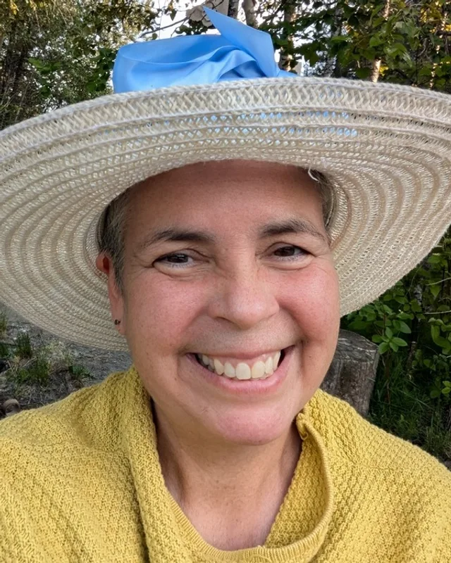
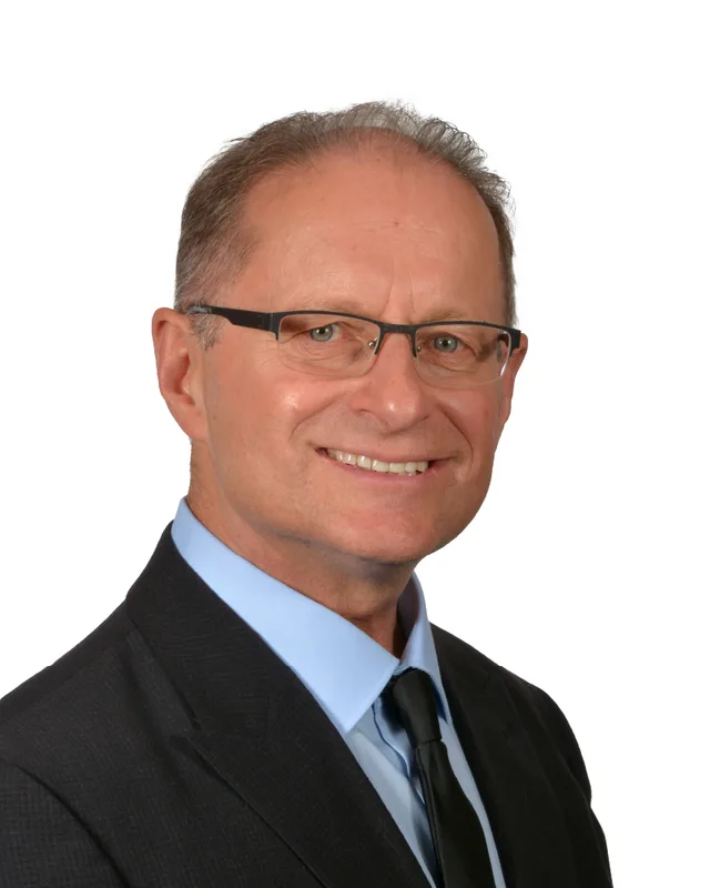
In 2024 Steve Morissette of the BC NDP won with 10,202 votes (52.04%). Glen Byle of the Conservative Party received 7,616 votes (38.85%) and Donovan Cavers of the BC Green Party 1,785 (9.11%). Turnout was 60.02% of 32,732 registered voters. Katrine Conroy of the BC NDP held Kootenay West from 2009 to 2024. She won it with 12,126 votes (66.65%) in 2009, 11,349 (63.01%) in 2013, 11,297 (59.64%) in 2017 and 10,822 (61.15%) in 2020. In 2005 she won the earlier district of West Kootenay-Boundary with 13,318 votes (60.26%).
Elections BC's volume for 1871 to 1986 prints a district named Rossland City at the 1903 election, which James Alexander Macdonald, printed as LIB., won with 436 votes (55.97%). It prints Trail in 1920, won by James Hargrave Schofield, printed as CONS., with 1,315 votes (60.80%). Rossland-Trail first appears in 1924, when Schofield won it with 938 votes (48.88%), and he won again in 1928 with 1,686 (58.12%). Christopher Anthony Conyers D'Arcy of the New Democratic Party won Rossland-Trail at each election from 1972 to 1986, receiving 8,195 votes (50.84%) in 1986. Ed Conroy of the NDP won it in 1991 with 8,340 votes (51.73%) and in 1996 with 8,635 (50.74%). In 2001, under the name West Kootenay-Boundary, Sandy Santori of the Liberal Party won with 10,784 votes (49.74%), ahead of Ed Conroy with 6,915 (31.89%).
Members for Kootenay West, which covered 60 of this district’s 62 voting areas before 2024
Parliament
It sat
Member
Elected as
Party on the legislature’s record
42nd
2020 to 2024
Katrine Conroy
BC NDP
BC NDP
41st
2017 to 2020
Katrine Conroy
BC NDP
BC NDP
40th
2013 to 2017
Katrine Conroy
BC NDP
BC NDP
39th
2009 to 2013
Katrine Conroy
BC NDP
BC NDP
“Elected as” is the affiliation Elections BC printed with the winning result. The last column is the party the legislature’s records give for that parliament, which differs when a member changed party while in office. A row with that column empty is a winner Elections BC prints whom the legislature’s records leave out. Source: Legislative Assembly of British Columbia (opens in a new tab)
Boundaries since 2024
Kootenay-Monashee has 62 voting areas. They overlap these districts from 2017 to 2024: Kootenay West (60), Nelson-Creston (4), Vernon-Monashee (2), Boundary-Similkameen (1), Columbia River-Revelstoke (1), Shuswap (1).
The commission that drew the boundaries counted 41,446 people in the district, 22.9% below the average for a district, over 11,551 km².
Kootenay-Monashee is a provincial electoral district in the southeast of British Columbia. The Electoral Boundaries Commission's 2023 final report says it includes Montrose, Fruitvale, Castlegar, Rossland, Trail, communities along the Slocan River delta, the Monashee Mountains and Cherryville. The commission counts 41,446 people in the district and gives its area as 11,551 square kilometres.
Which communities are in Kootenay-Monashee?
Kootenay-Monashee includes Trail, Rossland, Castlegar, Fruitvale and Montrose, according to the commission's 2023 final report. Elections BC's statement of votes for 2024 also lists voting places in Warfield, Genelle, Oasis, Robson, Crescent Valley, Winlaw, Slocan, Burton, Fauquier and Cherryville, so those communities are in the district too.
Who won Kootenay-Monashee in the 2024 provincial election?
Steve Morissette of the BC NDP won Kootenay-Monashee on 19 October 2024 with 10,202 votes, which was 52.04% of the valid vote. Glen Byle of the Conservative Party received 7,616 votes and Donovan Cavers of the BC Green Party received 1,785. Turnout was 60.02% of 32,732 registered voters, according to Elections BC.
Who represented this area before 2024?
Katrine Conroy of the BC NDP represented Kootenay West, the district the commission renamed Kootenay-Monashee, from 2009 to 2024. She won it with 12,126 votes in 2009 and 10,822 votes in 2020. In 2005 she had won the earlier district of West Kootenay-Boundary with 13,318 votes, according to Elections BC.
How did the boundaries of Kootenay-Monashee change in 2023?
The commission's final report of April 3, 2023 renamed Kootenay West as Kootenay-Monashee. It moved Nakusp, New Denver and Silverton to Kootenay Central and added the Monashee area, including Cherryville. Elections BC's conversion table matches 60 of the 62 voting areas of Kootenay-Monashee to Kootenay West. The name first appears in the 2024 election.
How many people live in Kootenay-Monashee?
The 2021 census counted 41,485 people in Kootenay-Monashee, with a median age of 47.2 years compared with 42.8 for British Columbia. In the district, 79.3% of households own their home and 20.7% rent. The median household income was $76,500, compared with $85,000 for the province.
Whose traditional territory is Kootenay-Monashee on?
Three Nations describe the land of Kootenay-Monashee in their own words. The Ktunaxa Nation calls its territory ʔamakʔis Ktunaxa and names Castlegar Kik̓siⱡuk. The Syilx Okanagan Nation says its people return to the Arrow Lakes to hunt, fish and harvest. The Autonomous Sinixt call the Sinixt homeland təmxʷúlaʔxʷ and say it reaches the height of the Monashee Range.
What built the towns of Kootenay-Monashee?
Mining at Rossland and the smelter at Trail shaped the south of Kootenay-Monashee. The Rossland Museum says prospectors staked five claims on Red Mountain in July 1890 and that the Trail smelter was in production by 1 February 1896. The Consolidated Mining and Smelting Company was incorporated in 1906 and renamed Cominco in 1966.
Who were the Doukhobors of the Castlegar area?
The Canadian Encyclopedia says Doukhobors took up land in the Castlegar area of Kootenay-Monashee in 1908. Their leader Peter Verigin led most of his followers to southern British Columbia that year and set up a community of 6,000 members. Verigin died on 29 October 1924, and his tomb at Brilliant, opposite Castlegar, is now Verigin's Memorial Park.
When did Selkirk College open in Castlegar?
Selkirk College opened in September 1966 with 458 charter students, who studied in old bunkhouses at the Celgar pulp mill. Its Castlegar Campus welcomed students in January 1967. Voters in six West Kootenay and Boundary communities, including Castlegar, Trail and Slocan, approved the college in a referendum on 25 February 1965. Castlegar is in Kootenay-Monashee.