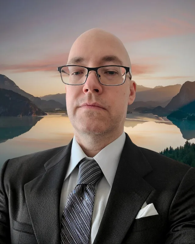
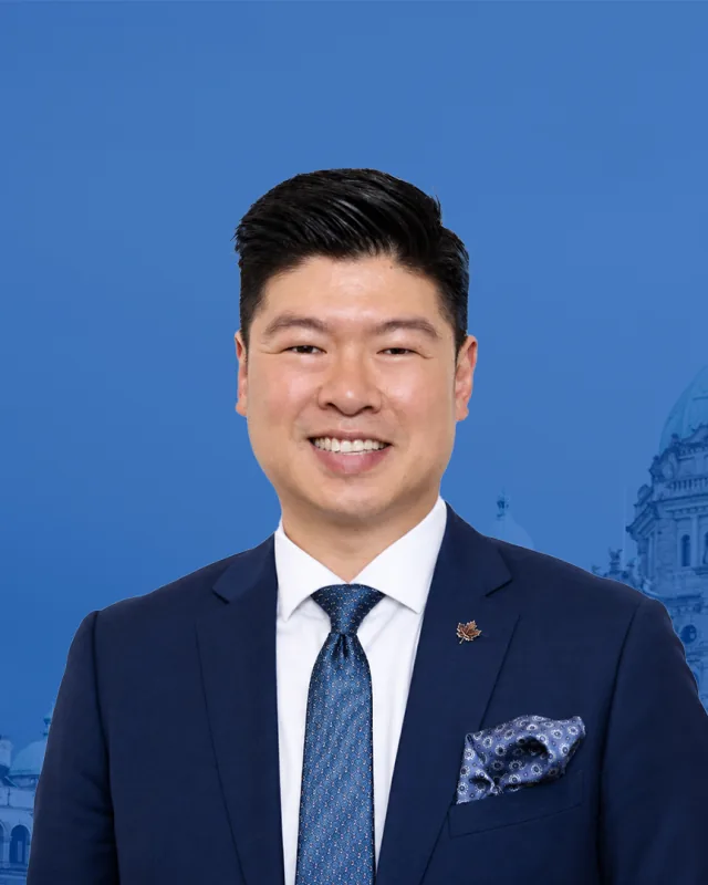
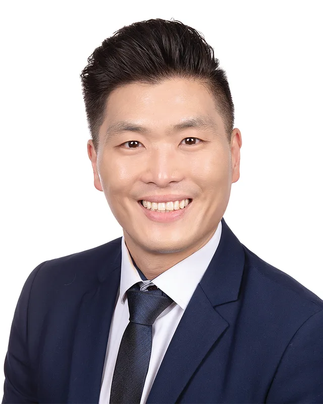
This district elects one MLA. Voters mark one name on Saturday, October 24, 2026, and the candidate with the most votes wins the seat.
Burnaby South-Metrotown is a provincial electoral district in the south-west of the City of Burnaby. It takes in the Metrotown, Suncrest and South Slope neighbourhoods and the SkyTrain corridor south of Kingsway, between Boundary Road in the west, Tenth Avenue and Griffiths Drive in the east, and the Fraser River in the south. The 2021 census counted 52,280 people in it, and the Electoral Boundaries Commission gives its area as 20 square kilometres.
Burnaby South-Metrotown lies in the south-west of the City of Burnaby. The Electoral Boundaries Commission's 2023 final report says it includes the Metrotown, Suncrest and South Slope neighbourhoods, together with the SkyTrain corridor south of Kingsway. Kingsway forms its northern boundary and the Fraser River its southern boundary. Boundary Road marks the west side, and Tenth Avenue and Griffiths Drive mark the east side. The commission counts 52,278 people in an area of 20 square kilometres.
Elections BC's 2024 results file lists 13 places where people voted inside the district. They are the Alan Emmott Centre, the Bob Prittie Metrotown Library, the Bonsor Recreation Complex, Burnaby South Secondary School, the Poppy Residences at Legion Branch 83, the South Burnaby Lawn Bowls Club, and the elementary schools Clinton, Glenwood, Maywood, Nelson, South Slope, Suncrest and Taylor Park.
The City of Burnaby calls Metrotown its regional city centre and its downtown, and says it serves the south-west part of the city. Central Park lies just off Boundary Road and Kingsway at 3883 Imperial Street, covers 86 hectares and can be reached from Patterson SkyTrain station, according to the City's park page. The commission's map labels the park inside the district.
Musqueam and Squamish territory along the Fraser River
Burnaby's page on Nations and territories names four Nations for the city: xʷməθkʷəy̓əm (Musqueam), Sḵwx̱wú7mesh (Squamish), səlilwətaɬ (Tsleil-Waututh) and kʷikʷəƛ̓əm (Kwikwetlem). It says each has its own history and its own traditional territory, and that those territories cover the city fully or in part. The district's southern boundary is the Fraser River.
Musqueam's territory page says its ancestors have lived throughout the Fraser River estuary, and have cared for it, for thousands of years. The same page says the Musqueam Declaration of 10 June 1976 describes a territory that includes Burnaby, Vancouver, Richmond, New Westminster and other cities.
The Squamish Nation's page gives its traditional territory as 6,732 square kilometres. It lists parts of Vancouver, Burnaby and New Westminster inside that territory and says some village sites in it date back 3,000 years.
A military reserve becomes Central Park, 1860 to 1899
Heritage Burnaby records that in 1860 the Royal Engineers were building the road from New Westminster to Vancouver, which is now Kingsway. They set aside a military reserve at the highest point of the trail along the ridge. A fire had burned the original forest before 1860, and the stumps left an open view over the land below. By the 1880s the councils of New Westminster and Vancouver both saw the reserve as a possible place for recreation. While the tram line was under construction, the province moved to turn the whole reserve into a park, and on 14 January 1891 the Lieutenant Governor of British Columbia proclaimed it a public recreation ground.
The Central Park neighbourhood grew around the park. Heritage Burnaby calls it one of the first and fastest-growing communities in Burnaby, set along the electric tram line and Vancouver Road, which is Kingsway. The province used the area for a settlement project called the Central Park Small Holdings. The record places the subdivision and sale of the land in 1894, a date it gives as an estimate, and by 1899 the settlement had grown enough to build an Anglican church.
Farms, a post office and factories on the Fraser shore, 1862 to 1972
Heritage Burnaby's records for the Fraser River side of south Burnaby begin in 1862. That year Hugh MacRoberts, a farmer on Sea Island in Richmond, built a trail to New Westminster to bring his produce to market, and the trail later became Marine Drive. The riverside land had been used as cranberry bogs, and its soil suited hay and root crops. A settlement grew around River Road, the Dundonald School opened there in 1905, and the Fraser Arm Post Office followed three years later. The records say the Fraser Arm area took its name from the place where the tram crossed Gilley Avenue on its way down to the North Arm of the Fraser River.
By the late 1920s the Fraser Arm area was turning into an industrial and manufacturing district. The Canadian National Railway built a bridge from Burnaby to Lulu Island in 1931. Chinese market gardens also grew there, and in 1926 the Vancouver Sun estimated that Chinese farms in the Lower Fraser Valley supplied 90 per cent of the green vegetables sold in the Vancouver market area.
In 1972 Council adopted the Big Bend Development Plan, and soon afterwards 620 acres, a figure the record gives as an estimate, were added to the Agricultural Land Reserve, the province's protected farmland. Heritage Burnaby says that by the 2000s the Big Bend held 160 acres of productive farmland and over 400 acres of parkland, together with business and industrial areas. It lists the area at Marine Way and Boundary among them. Boundary Road is the western boundary of this district.
Nelson Avenue School, Ocean View and the first high school, 1912 to 1927
Heritage Burnaby says Nelson Avenue School was established in 1912 to serve the Alta Vista district. The same archive gives Alta Vista as the historic neighbourhood of South Slope Elementary. The building on Irmin Street that stands today is an annex that the architects Bowman & Cullerne designed in the Classical Revival style and finished in 1927. It was built to match the original Windsor Street School building. Elections BC lists Nelson Elementary School as a voting place in the district.
Ocean View Burial Park, at 4000 Imperial Street, dates to 1919. Heritage Burnaby calls it the first non-sectarian cemetery in British Columbia that was created as a business for profit, which means a burial ground tied to no single church. Local investors led by Lieut. Col. G.H. Dorrell organized it as the Ocean View Cemetery Company, and Albert F. Arnold of the Canadian Financiers Trust Company designed its landscape.
The oldest surviving public school building in Burnaby stands at 6650 Southoaks Crescent. Joseph Henry Bowman designed the Kingsway East School, and it was completed in 1913 as the planned auditorium and gymnasium of Burnaby's first high school. Economic limits and the First World War led the municipality to use it as Kingsway East Elementary School until 1921. Burnaby South High School opened there in 1922. The school stands in Burnaby South Memorial Park with a cenotaph and memorial tennis courts. The City rehabilitated it for community use in 2002 and 2003 and renamed it the Alan Emmott Centre. The Canadian Register of Historic Places records its formal recognition on 23 November 1992.
Postwar homes, Maywood School, Bonsor and Swangard Stadium, 1945 to 1969
Heritage Burnaby says the years after the Second World War brought fast growth in homebuilding in the Alta Vista area, with the Sussex and Suncrest subdivisions and new schools and amenities for the larger population. In the Sussex-Nelson area just south of Metrotown, the homes next to Metrotown date to the 1950s, and the single-family homes south of Rumble Street date to the 1960s and 1970s. As of 1980 it had more people than any other area the City studied for planning. In Suncrest, a small residential area south of Central Park, most of the housing dates to 1930 to 1960.
Maywood Elementary School, at 4567 Imperial Street, was built in 1962 between Nelson and Suncrest schools to relieve crowded classrooms at both. It was built on one level with no basement and no high stairs, in a line of classrooms that could be extended. Additions followed in 1964, 1966, 1967, 1971 and 1972, and fires in 1979 and 1989 caused damage that needed partial reconstruction.
A photograph caption in the City archive says the South Burnaby Men's Club began buying properties in 1965 with an initial investment of $7,500. The Bonsor Recreation Complex at 6550 Bonsor Avenue grew from that effort, and the South Burnaby Metro Club is based there. Swangard Stadium opened in Central Park on 26 April 1969. It is named after Erwin Swangard, a former managing editor of the Vancouver Sun, and was paid for entirely by private donations and civic and provincial grants.
The 1977 plan, SkyTrain, Metropolis and a new library, 1977 to 1992
In 1977 Burnaby's Planning Department and Norman Hotson Architects produced an 83-page report called Burnaby Metrotown: a development plan. The Real Estate News Exchange reported in 2017 that this was the last full plan for Metrotown before the 2017 one. Heritage Burnaby says the idea for Metrotown was first expressed in the 1970s, that the building now called Metropolis at Metrotown opened in 1986, and that the Expo Line of the new SkyTrain system soon served it.
TransLink's account says SkyTrain opened on 11 December 1985 with eight days of free rides, and that fares began on 3 January 1986. The new train line joined downtown Vancouver, Burnaby and New Westminster. Heritage Burnaby says the Metrotown complex later grew into three adjoining malls: Metropolis at Metrotown, Metrotown Centre and Station Square. Its address is 4700 Kingsway.
The City archive records that the Central Park library branch was replaced by the Bob Prittie Metrotown branch in 1991. A council report from 4 March 1991 is titled as a plaque to commemorate the opening of the branch. The library stands at 6100 Willingdon Avenue, at the corner of Central Boulevard. In 1992 South Slope Elementary School, at 4446 Watling Street, opened as the school for the B.C. Provincial School for the Deaf, which replaced the Jericho Hill School for the Deaf in Vancouver.
Crystal Mall, Nikkei Place and the downtown plan, 2000 to 2025
Two buildings opened in 2000. Nikkei Place says its museum and cultural centre has offered programs, exhibits and events since 22 September 2000, and the centre's address is 6688 Southoaks Crescent, on the street where the Alan Emmott Centre stands. The Crystal Mall opened the same year at Kingsway and Willingdon Avenue. The Tyee reported on 2 July 2019 that the developer Stanley Kwok led the project, that building began in 1996 on a 750,000-square-foot mall costing $200 million, and that the Asian financial crisis of 1997 struck during the work. The mall replaced the Dragon Inn restaurant.
Heritage Burnaby says two office towers at the Metrotown complex were occupied in 2001 by Shaw Cable and TransLink. In late July 2017 Burnaby's council approved the Metrotown Downtown Plan unanimously, the Real Estate News Exchange reported on 5 September 2017. The plan replaced the 1977 plan and allows mixed-use towers along Kingsway between Wilson and Nelson Avenues. The City's table of town centres lists 25,800 residents in Metrotown in 2011 and 66,800 projected for 2041.
On 5 May 2023 the City announced a process to build a new City Hall in Metrotown, where Civic Square was one proposed site. After public input in summer 2023, the City says residents supported the Civic Square site and also wanted City Hall to stay centrally located. Council then directed staff to study a phased replacement of City Hall at its present site, 4949 Canada Way.
Burnaby South-Metrotown is a new name. None of the three Elections BC electoral history volumes, which cover 1871 to 2013, prints a district with this name. The first result under it comes from the 43rd provincial general election of 19 October 2024. Paul Choi of the BC NDP won with 7,560 votes (49.33%). Han Lee of the Conservative Party received 6,373 votes (41.59%), Carrie McLaren of the BC Green Party 960 (6.26%), Meiling Chia, who listed no affiliation, 290 (1.89%), and MichaelAngelo Abc RobinHood, an independent, 142 (0.93%). Turnout was 48.85% of 31,434 registered voters.
The Electoral Boundaries Commission's final report of 3 April 2023 gave Burnaby five districts. For this district it added the area around Metrotown south of Kingsway, so that the SkyTrain corridor stays in one district and the district has room for the growth the commission expected there. The report counts 52,278 people, which is 2.8% below the average district, in 20 square kilometres.
Elections BC's conversion table matches the district's 51 voting areas to the districts of 2017 to 2024: 34 in Burnaby-Edmonds and 17 in Burnaby-Deer Lake. Burnaby-Edmonds first appears in the 1871 to 1986 volume at the general election of 1966, when Gordon Hudson Dowding of the NDP won with 5,748 votes (48.71%). Raj Chouhan of the BC NDP won it at the five general elections from 2005 to 2020, and Patty Sahota of the BC Liberal Party won it in 2001.
Burnaby-Deer Lake, the source of the other 17 voting areas, first appears in the 2002 to 2013 volume at the general election of 2009. The Electoral Districts Act (S.B.C. 2008, c.14), assented to on 1 May 2008, raised the number of districts from 79 to 85. Kathy Corrigan of the BC NDP won Burnaby-Deer Lake in 2009 and 2013, and Anne Kang of the BC NDP won it in 2017 and 2020.
Members for Burnaby-Edmonds, which covered 34 of this district’s 51 voting areas before 2024
Parliament
It sat
Member
Elected as
Party on the legislature’s record
42nd
2020 to 2024
Raj Chouhan
BC NDP
BC NDP
41st
2017 to 2020
Raj Chouhan
BC NDP
BC NDP
40th
2013 to 2017
Raj Chouhan
BC NDP
BC NDP
39th
2009 to 2013
Raj Chouhan
BC NDP
BC NDP
38th
2005 to 2009
Raj Chouhan
BC NDP
BC NDP
37th
2001 to 2005
Patty Sahota
BC Liberal Party
36th
1996 to 2001
Fred Randall
BC NDP
35th
1992 to 1996
Fred Randall
BC NDP
Members for Burnaby-Deer Lake, which covered 17 of this district’s 51 voting areas before 2024
Parliament
It sat
Member
Elected as
Party on the legislature’s record
42nd
2020 to 2024
Anne Kang
BC NDP
BC NDP
41st
2017 to 2020
Anne Kang
BC NDP
BC NDP
40th
2013 to 2017
Kathy Corrigan
BC NDP
BC NDP
39th
2009 to 2013
Kathy Corrigan
BC NDP
BC NDP
“Elected as” is the affiliation Elections BC printed with the winning result. The last column is the party the legislature’s records give for that parliament, which differs when a member changed party while in office. A row with that column empty is a winner Elections BC prints whom the legislature’s records leave out. Source: Legislative Assembly of British Columbia (opens in a new tab)
Boundaries since 2024
Burnaby South-Metrotown has 51 voting areas. They overlap these districts from 2017 to 2024: Burnaby-Edmonds (34), Burnaby-Deer Lake (17).
The commission that drew the boundaries counted 52,278 people in the district, 2.8% below the average for a district, over 20 km².
Burnaby South-Metrotown is a provincial electoral district in the south-west of the City of Burnaby, British Columbia. The Electoral Boundaries Commission's 2023 final report places its northern boundary at Kingsway, its western boundary at Boundary Road and its southern boundary at the Fraser River. Tenth Avenue and Griffiths Drive form its eastern boundary. The commission gives its area as 20 square kilometres.
Which neighbourhoods are in Burnaby South-Metrotown?
The commission's 2023 final report says Burnaby South-Metrotown includes the Metrotown, Suncrest and South Slope neighbourhoods and the SkyTrain corridor south of Kingsway. Elections BC's 2024 results file lists voting places at the Maywood, Nelson, Suncrest, South Slope, Clinton, Glenwood and Taylor Park elementary schools and at the Bonsor Recreation Complex, all inside the district.
Who won Burnaby South-Metrotown in the 2024 provincial election?
Paul Choi of the BC NDP won Burnaby South-Metrotown in the provincial general election of 19 October 2024 with 7,560 votes, 49.33% of the valid vote. Han Lee of the Conservative Party received 6,373 votes, Carrie McLaren of the BC Green Party 960, Meiling Chia 290 and MichaelAngelo Abc RobinHood, an independent, 142. Turnout was 48.85% of 31,434 registered voters.
Who represented this part of Burnaby before 2024?
Burnaby South-Metrotown was first used in 2024, so its voters belonged to two earlier districts. Of its 51 voting areas, 34 were in Burnaby-Edmonds, where Raj Chouhan of the BC NDP won from 2005 to 2020, and 17 were in Burnaby-Deer Lake, where Kathy Corrigan won in 2009 and 2013 and Anne Kang won in 2017 and 2020, both for the BC NDP.
Is Burnaby South-Metrotown a new electoral district?
Yes. Burnaby South-Metrotown is a new district name. Elections BC's electoral history volumes for 1871 to 2013 print no district called Burnaby South-Metrotown, and its first result is from the provincial general election of 19 October 2024. The Electoral Boundaries Commission's final report of 3 April 2023 gave the City of Burnaby five districts, and this is one of them.
How did the 2023 boundary changes affect Burnaby South-Metrotown?
The Electoral Boundaries Commission's 2023 final report added the area around Metrotown south of Kingsway to Burnaby South-Metrotown, so that the SkyTrain corridor stays in one district and the district has room for expected growth. The report counts 52,278 people in the district, which is 2.8% below the average district, in 20 square kilometres.
How many people live in Burnaby South-Metrotown?
The 2021 census counted 52,280 people in Burnaby South-Metrotown, with a median age of 39.2 compared with 42.8 across British Columbia. Immigrants make up 57% of residents and 76% belong to a visible minority group. English was the first language of 30.4%, Mandarin of 19.9% and Yue (Cantonese) of 12.1%. The median household income was $74,500.
Whose traditional territory is Burnaby South-Metrotown on?
Burnaby's page on Nations and territories names the Musqueam, Squamish, Tsleil-Waututh and Kwikwetlem peoples as Nations whose territories cover the city fully or in part. Musqueam's territory page lists Burnaby among the places in its territory, and the Squamish Nation's page lists parts of Burnaby in its own. Burnaby South-Metrotown lies inside the City of Burnaby.
What is Metrotown?
Metrotown is a neighbourhood in Burnaby South-Metrotown that the City of Burnaby calls its regional city centre and downtown. Heritage Burnaby records that the building now called Metropolis at Metrotown opened in 1986 at 4700 Kingsway, a year after SkyTrain opened on 11 December 1985. A Metrotown Downtown Plan approved in late July 2017 replaced the plan of 1977.
How old is Central Park in Burnaby?
The Lieutenant Governor of British Columbia proclaimed Central Park a public recreation ground on 14 January 1891, according to Heritage Burnaby. The park, at 3883 Imperial Street, is shown inside Burnaby South-Metrotown on the commission's map. The City gives its size as 86 hectares, and Swangard Stadium opened in it on 26 April 1969.