---
title: "Vancouver-Fraserview: candidates, history and census, BC provincial 2026 | voche.me"
canonical_url: "https://voche.me/bc/provincial-2026/races/mla/vancouver-fraserview"
last_updated: "2026-10-10T04:05:30.652Z"
meta:
description: "3 candidates in Vancouver-Fraserview, BC provincial 2026. Area history, results since 2005, past MLAs and the 2021 census."
"og:description": "3 candidates in Vancouver-Fraserview, BC provincial 2026. Area history, results since 2005, past MLAs and the 2021 census."
"og:title": "Vancouver-Fraserview: candidates, history and census, BC provincial 2026"
"twitter:description": "3 candidates in Vancouver-Fraserview, BC provincial 2026. Area history, results since 2005, past MLAs and the 2021 census."
"twitter:title": "Vancouver-Fraserview: candidates, history and census, BC provincial 2026"
---
**
MLA · BC PROVINCIAL 2026
# Vancouver-Fraserview.
3 candidates, one seat.
This district elects one MLA. Voters mark one name on Saturday, October 24, 2026, and the candidate with the most votes wins the seat.
Vancouver-Fraserview is a provincial electoral district in the southeast corner of the City of Vancouver. It takes in the Victoria-Fraserview and Killarney neighbourhoods, from the Fraser River in the south to E 49th, E 45th and E 41st Avenues in the north. The 2021 census counted 58,685 people in it, and the Electoral Boundaries Commission gives its area as 12 square kilometres.
## The candidates
In alphabetical order
[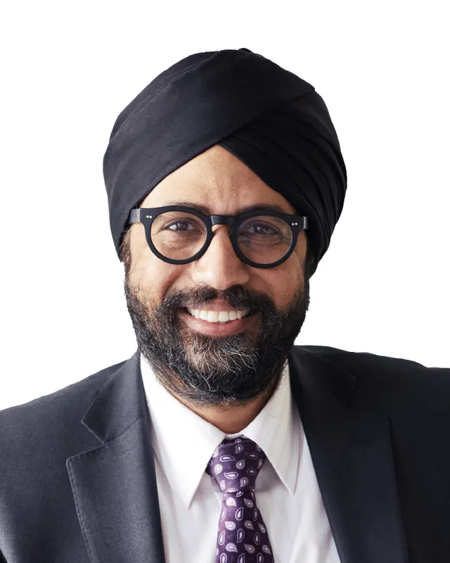MLA · Vancouver-Fraserview**BC NDP**Aman Singh
Researched by voche.meExplore the profile ](https://voche.me/bc/provincial-2026/candidates/aman-singh) [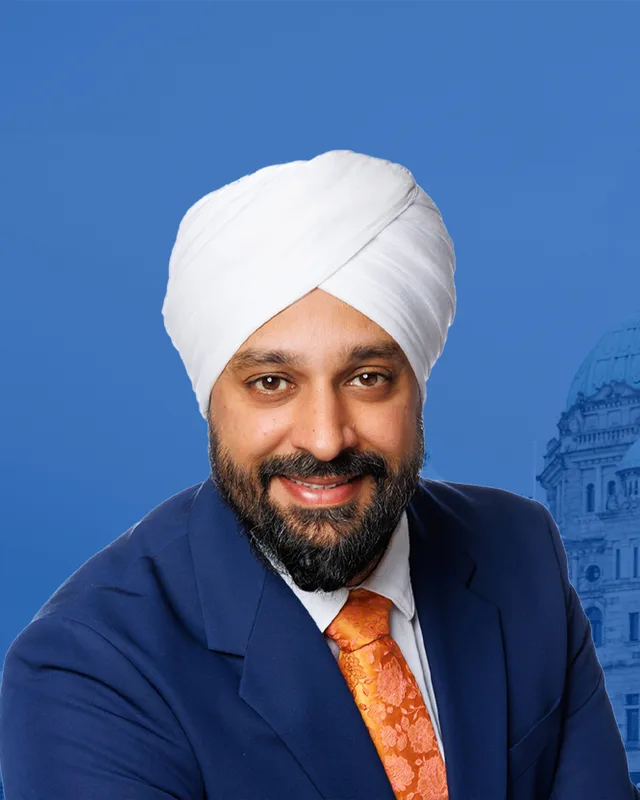MLA · Vancouver-Fraserview**Conservative Party of BC**Deep Sandhu
Researched by voche.meExplore the profile ](https://voche.me/bc/provincial-2026/candidates/deep-sandhu) [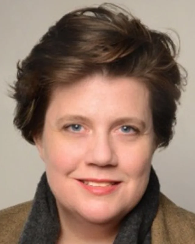MLA · Vancouver-Fraserview**BC Green Party**Francoise Raunet
Researched by voche.meExplore the profile ](https://voche.me/bc/provincial-2026/candidates/francoise-raunet)
- People, 2021 census
- 58,685
- Area
- 12 km²
- Registered voters, 2024
- 39,801
- Turnout, 2024
- 52.42%
- Median age
- 42.4
- Median household income, 2020
- $90,000
THE DISTRICT
## Where Vancouver-Fraserview is
12 km² · 58,685 people
Vancouver-Fraserview lies in the southeast of the City of Vancouver. The Electoral Boundaries Commission's 2023 final report says it includes the Victoria-Fraserview and Killarney neighbourhoods. Its southern boundary is the Fraser River, and its northern boundary follows E 49th, E 45th and E 41st Avenues. In the west, the report lists Crompton Street and Ross Street among its boundaries. The commission counted 58,686 people in the district, which covers 12 square kilometres.
The commission's map of the district names Killarney, Fraserview Golf Course, Everett Crowley Park and Captain Cook Park. It shows Southeast Marine Drive along the river side, Boundary Road on the eastern side next to Burnaby, and the streets Knight, Victoria, Fraser and Kerr. The City of Vancouver describes Victoria-Fraserview as lying on the south slope toward the Fraser River, between the Knight Street Bridge and Killarney. Killarney, in the City's words, is in the southeastern corner of the city, bordering Burnaby and the Fraser River.
Elections BC's results file for the 2024 election lists 13 places where people voted in the district: Killarney Community Centre, Champlain Heights Community Centre, Killarney Secondary School, David Thompson Secondary School, five elementary schools, two school annexes, Harvest City Church and the Harbour Master Club at Tugboat Landing. The City's Killarney page names Champlain Heights and Everett Crowley Park, which has 40 hectares of walking trails, as part of the Killarney area.
- Victoria-Fraserview
- Fraserview
- Killarney
- Champlain Heights
- West Fraserlands
- East Fraser Lands (River District)
Sources: [British Columbia Electoral Boundaries Commission (opens in a new tab)](https://elections.bc.ca/docs/rpt/BCEBC-Final-Report-April-3-2023.pdf), [Elections BC (opens in a new tab)](https://catalogue.data.gov.bc.ca/dataset/44914a35-de9a-4830-ac48-870001ef8935), [City of Vancouver (opens in a new tab)](https://vancouver.ca/news-calendar/victoria-fraserview.aspx), [City of Vancouver (opens in a new tab)](https://vancouver.ca/news-calendar/killarney.aspx)
HISTORY
## The history of the area
Checked Thursday, October 8, 2026
### Musqueam, Squamish and Tsleil-Waututh territory
Three Nations describe the land around the Fraser River and Burrard Inlet as their territory, each in its own words. The Musqueam Indian Band calls itself xʷməθkʷəy̓əm and says its people speak hən̓q̓əmin̓əm̓. Its website says its ancestors have lived throughout the Fraser River estuary for thousands of years, and says that portions of its territory are now called Vancouver, Burnaby, Richmond and other names. Musqueam leaders and members signed the Musqueam Declaration on 10 June 1976, stating their claim to aboriginal title and rights.
On its website the Squamish Nation, Sḵwx̱wú7mesh Úxwumixw, states that its traditional territory covers 6,732 square kilometres. The territory takes in parts of present-day cities such as Vancouver, Burnaby and New Westminster, and all of Burrard Inlet and English Bay. Village sites in it date back 3,000 years, the Nation says. The Tsleil-Waututh Nation, səlilwətaɬ, calls itself the People of the Inlet and says its people have lived in its traditional territory for thousands of years. The City of Vancouver names all three Nations in its land acknowledgement.
The City's plan for the East Fraser Lands, on the river in this district, says local First Nations people used the area around it for travel, spiritual and ceremonial purposes, and for harvesting food, and still do. The plan says permanent and seasonal settlements stood along the shoreline, particularly near fresh water.
Sources: [Musqueam Indian Band (xʷməθkʷəy̓əm) (opens in a new tab)](https://www.musqueam.bc.ca/our-story/our-territory/), [Musqueam Indian Band (xʷməθkʷəy̓əm) (opens in a new tab)](https://www.musqueam.bc.ca/our-story/), [Squamish Nation (Sḵwx̱wú7mesh Úxwumixw) (opens in a new tab)](https://www.squamish.net/about-us/our-land/), [Tsleil-Waututh Nation (səlilwətaɬ) (opens in a new tab)](https://twnation.ca/about/), [City of Vancouver (opens in a new tab)](https://vancouver.ca/news-calendar/victoria-fraserview.aspx), [City of Vancouver (opens in a new tab)](https://bylaws.vancouver.ca/odp/odp-east-fraser-lands.pdf)
### Settlers and the District of South Vancouver, 1860s to 1892
The City of Vancouver says the first non-Indigenous families settled in Victoria-Fraserview in the 1860s, drawn by the forests on the north bank of the Fraser River. In Killarney, the City names William Rowling as the first non-native settler, in 1868. It says he received a military land grant and that his family came to own 3.5 kilometres of the Fraser River shoreline. George Wales bought 221 acres in northern Killarney in 1878 for one dollar an acre, and Wales Street still carries his family's name.
The remaining land was auctioned in 160-acre parcels in 1888. By 1890 the City says No. 1 Road, now 45th Avenue, and No. 2 Road, now 54th Avenue, had been built along the northern edges of those properties. The City of Vancouver itself was incorporated on 6 April 1886, according to BC Geographical Names. The City of Vancouver Archives records that the District of South Vancouver was established on 13 April 1892 by a provincial charter called letters patent, with boundaries covering the areas south of 16th Avenue. This district lay inside it.
Sources: [City of Vancouver (opens in a new tab)](https://vancouver.ca/news-calendar/victoria-fraserview.aspx), [City of Vancouver (opens in a new tab)](https://vancouver.ca/news-calendar/killarney.aspx), [BC Geographical Names Office (opens in a new tab)](https://apps.gov.bc.ca/pub/bcgnws/names/24320.html), [City of Vancouver Archives (opens in a new tab)](https://searcharchives.vancouver.ca/south-vancouver-b-c)
### Farms, a dairy and the Fraser River mills, 1900s to 1950s
The south of the district had farms and mills. The Encyclopedia of British Columbia says Avalon Dairy began in 1906, when Jeremiah Crowley and his wife Maud arrived from Newfoundland and bought a farm in South Vancouver. The Vancouver Heritage Foundation records that Crowley built the Craftsman-style farmhouse in 1908, that his family owned the site until it was sold in 2011, and that the address changed in 2018 from 5805 Wales Street to 2661 East 43rd Avenue. It lists the dairy, now based in Burnaby, as the oldest continuously operating dairy in British Columbia.
The City of Vancouver also names the Cooper House at 5872 Wales Street, a Craftsman house built in 1919 on an acre of land. In Killarney, the City says a Stewart family fruit farm of eight hectares, established in the 1890s, supplied fruit to the Vancouver market.
On the river, a University of British Columbia report on Everett Crowley Park says that in the 1920s two mills stood side by side near the bottom of Boundary Road: the Old Dominion Mill, bought by H. R. MacMillan, and the Canadian White Pine Mill. The report says the mills employed thousands of workers and that the Old Dominion Mill closed in 1952. The City's plan for the East Fraser Lands says the White Pines Mill occupied that site for much of the twentieth century.
Sources: [Harbour Publishing (KnowBC) (opens in a new tab)](https://www.knowbc.com/limited/Books/Encyclopedia-of-BC/A/Avalon-Dairy-Ltd), [Vancouver Heritage Foundation (opens in a new tab)](https://www.heritagesitefinder.ca/location/2661-e-43rd-ave-vancouver-bc), [City of Vancouver (opens in a new tab)](https://vancouver.ca/news-calendar/victoria-fraserview.aspx), [City of Vancouver (opens in a new tab)](https://vancouver.ca/news-calendar/killarney.aspx), [University of British Columbia, Greenest City Scholar program (opens in a new tab)](https://www.sustain.ubc.ca/sites/default/files/2017-28_Everett%20Crowley%20Park%20Restoration%20Assessment_Campbell.pdf), [City of Vancouver (opens in a new tab)](https://bylaws.vancouver.ca/odp/odp-east-fraser-lands.pdf)
### Amalgamation with Vancouver in 1929 and the golf course, 1934
In 1908 the larger part of South Vancouver became the separate Corporation of Point Grey, which left South Vancouver as the area south of 16th Avenue on the east side, from Cambie Street to Boundary Road. The City of Vancouver Archives records that Point Grey and the rest of South Vancouver joined the City of Vancouver on 1 January 1929. From then on the streets of Victoria-Fraserview and Killarney were part of the City.
The Vancouver Park Board's golf presentation says Fraserview Golf Course opened in 1934 and was redesigned in 1998. It gives the course an area of 95 hectares. The City of Vancouver says that during the depression of the 1930s relief workers were put to work clearing the land for the course, and that residents were given permits to cut firewood and use the land for vegetable gardens before it opened. The City also says the streets of the later Fraserview subdivision were named after golf courses from around the world.
Sources: [City of Vancouver Archives (opens in a new tab)](https://searcharchives.vancouver.ca/south-vancouver-b-c), [City of Vancouver Archives (opens in a new tab)](https://searcharchives.vancouver.ca/point-grey-b-c), [Vancouver Board of Parks and Recreation (opens in a new tab)](https://parkboardmeetings.vancouver.ca/2019/20191022/PRESENTATION-GolfVancouverParks-Overview-20191022.pdf), [City of Vancouver (opens in a new tab)](https://vancouver.ca/news-calendar/killarney.aspx), [City of Vancouver (opens in a new tab)](https://vancouver.ca/news-calendar/victoria-fraserview.aspx)
### Veterans housing and the Kerr Road landfill, 1944 to 1967
The City of Vancouver says Victoria-Fraserview was mostly undeveloped until the end of the Second World War. In the late 1940s there was a shortage of housing for returning war veterans, and Victoria-Fraserview and the neighbouring area of Sunset received 1,100 new homes. The housing was begun in the 1940s and finished in the 1950s. The City says many residents did not welcome it, and that the Canadian Mortgage and Housing Corporation took over 182 hectares by law to carry it out. Homes went to veterans according to the number of children, the length of overseas service and the urgency of need. In the early 1950s the subdivision became known as "diaper town" because so many children lived there.
The University of British Columbia report says the Kerr Road landfill officially opened in 1944 and closed in 1967. The report's timeline records that all of the City of Vancouver's waste was being deposited there, and that the landfill covered an area almost as large as today's Everett Crowley Park. The report says the waste reached 49 metres in the central area, and that the site was capped with 1.5 metres of fill.
Sources: [City of Vancouver (opens in a new tab)](https://vancouver.ca/news-calendar/victoria-fraserview.aspx), [University of British Columbia, Greenest City Scholar program (opens in a new tab)](https://www.sustain.ubc.ca/sites/default/files/2017-28_Everett%20Crowley%20Park%20Restoration%20Assessment_Campbell.pdf)
### Killarney, Champlain Heights and Everett Crowley Park, 1957 to the 1990s
The City says Killarney remained second-growth forest and farms until after the Second World War, and that the area became known as Killarney after the bog south of 45th Avenue was drained and developed at Killarney Street, and a high school and community centre were built. The Vancouver School Board's history says construction of Killarney Secondary on 49th Avenue near Kerr Street began in 1956, when vacant lots surrounded the site. The school opened in the fall of 1957 with 1,260 students and 52 teachers in grades 7 to 10, and took its name from Killarney, Ireland.
The City says Vancouver's first cooperative housing development, DeCosmos Village, was built in Killarney in 1970, and that the southern part of the area became Champlain Heights in the 1970s. The School Board's history says Champlain Mall opened in 1973 with 32 stores. The City's plan for the East Fraser Lands says Champlain Heights was developed in the 1970s and 1980s, and that West Fraserlands, the residential area beside the river west of Kerr Street, was built in the 1980s and 1990s.
The old landfill became a park. The University of British Columbia report says the area was designated as Everett Crowley Park in 1987, and the School Board's history gives the same year for the park's opening.
Sources: [City of Vancouver (opens in a new tab)](https://vancouver.ca/news-calendar/killarney.aspx), [Vancouver School Board (opens in a new tab)](https://www.vsb.bc.ca/killarney/school-history), [City of Vancouver (opens in a new tab)](https://bylaws.vancouver.ca/odp/odp-east-fraser-lands.pdf), [University of British Columbia, Greenest City Scholar program (opens in a new tab)](https://www.sustain.ubc.ca/sites/default/files/2017-28_Everett%20Crowley%20Park%20Restoration%20Assessment_Campbell.pdf)
### The sawmill site becomes the River District, 2002 to 2024
The East Fraser Lands lie in the southeast corner of Vancouver on the Fraser River, between Kerr Street and Boundary Road, south of Marine Way. The City's Official Development Plan, the document that sets the rules for the site, says the City's Industrial Lands Strategy of 1995 stated that, if the sawmill ceased operations, the City should reconsider the future of the land. In May 2002, after the mill closed, Council told staff to talk with the land owners and the local community about the options. The plan says the mill was dismantled in 2004. In December 2004 Council adopted the East Fraserlands Policy Statement.
Council adopted the Official Development Plan by By-law No. 9393 on 12 December 2006. The City says the land-use rules for Area 1, Area 2 and Kerr Street were changed in 2008 and 2010, and that the site holds 126 acres of former industrial land. Over 25 years the City expects the community to include parks, a community centre, schools, childcare facilities and a riverfront walk. Wesgroup Properties owns most of the land, and the City calls the area the River District. On 8 October 2024 Council enacted amendments that allow more social housing, rental housing and housing that people buy as individual units.
Sources: [City of Vancouver (opens in a new tab)](https://bylaws.vancouver.ca/odp/odp-east-fraser-lands.pdf), [City of Vancouver (opens in a new tab)](https://vancouver.ca/home-property-development/east-fraser-lands-river-district.aspx)
THE SEAT
## Who has held the seat
Legislative Assembly records, 36th Parliament onward
Elections BC's volume for 1871 to 1986 prints no district named Vancouver-Fraserview. Its volume for 1987 to 2001 prints candidate results under the name for the 36th general election, held on 28 May 1996. Ian Waddell of the New Democratic Party won with 8,774 votes (45.97%), ahead of Gulzar Cheema of the Liberal Party with 8,394 (43.98%).
At the 37th general election, held on 16 May 2001, Ken Johnston of the Liberal Party won with 10,361 votes (56.84%) and Waddell received 5,815 (31.91%). Later winners were Wally Oppal of the BC Liberal Party in 2005 with 9,895 votes (47.8%), Kash Heed of the BC Liberal Party in 2009 with 9,549 (49.29%), and Suzanne Anton of the BC Liberal Party in 2013 with 10,118 (46.74%). George Chow of the BC NDP won in 2017 with 11,487 votes (48.57%), in 2020 with 12,247 (56.37%) and in 2024 with 11,896 (57.18%). Jag S Sanghera of the Conservative Party received 7,618 votes (36.62%) in 2024, and turnout was 52.42% of 39,801 registered voters.
The commission's 2023 final report proposed minor adjustments to the boundaries of Vancouver-Langara, Vancouver-Fraserview, Vancouver-Kensington and Vancouver-Kingsway, to balance their populations and leave room for future growth. It counted 65,070 people in the former Vancouver-Fraserview, 13.2% from the average district, over 13 square kilometres. The district now counts 58,686 people, 9.1% from the average, over 12 square kilometres. Elections BC's conversion table matches 71 of the district's 72 voting areas to the former Vancouver-Fraserview. The commission also proposed a twelfth electoral district in Vancouver.
Sources: [Elections BC (opens in a new tab)](https://elections.bc.ca/docs/rpt/1871-1986_ElectoralHistoryofBC.pdf), [Elections BC (opens in a new tab)](https://elections.bc.ca/docs/rpt/1987-2001-ElectionHistory.pdf), [Elections BC (opens in a new tab)](https://elections.bc.ca/docs/rpt/2002-2013-ElectionHistory.pdf), [Elections BC (opens in a new tab)](https://catalogue.data.gov.bc.ca/dataset/44914a35-de9a-4830-ac48-870001ef8935), [British Columbia Electoral Boundaries Commission (opens in a new tab)](https://elections.bc.ca/docs/rpt/BCEBC-Final-Report-April-3-2023.pdf)
Members for Vancouver-Fraserview
| Parliament | It sat | Member | Elected as | Party on the legislature’s record |
| --- | --- | --- | --- | --- |
| 43rd | 2025 to 2026 | George Chow | BC NDP | BC NDP |
| 42nd | 2020 to 2024 | George Chow | BC NDP | BC NDP |
| 41st | 2017 to 2020 | George Chow | BC NDP | BC NDP |
| 40th | 2013 to 2017 | Suzanne Anton | BC Liberal Party | BC Liberal Party |
| 39th | 2009 to 2013 | Kash Heed | | BC Liberal Party |
| 38th | 2005 to 2009 | Wally Oppal | BC Liberal Party | BC Liberal Party |
| 37th | 2001 to 2005 | Ken Johnston | | BC Liberal Party |
| 36th | 1996 to 2001 | Ian Waddell | | BC NDP |
“Elected as” is the affiliation Elections BC printed with the winning result. The last column is the party the legislature’s records give for that parliament, which differs when a member changed party while in office. A row with that column empty is a winner Elections BC prints whom the legislature’s records leave out. Source: [Legislative Assembly of British Columbia (opens in a new tab)](https://www.leg.bc.ca/members)
### Boundaries since 2024
Vancouver-Fraserview has 72 voting areas. 71 of them overlap the district of the same name used from 2017 to 2024.
The commission that drew the boundaries counted 58,686 people in the district, 9.1% above the average for a district, over 12 km².
Sources: [British Columbia Electoral Boundaries Commission, Final report, April 3, 2023 (opens in a new tab)](https://elections.bc.ca/docs/rpt/BCEBC-Final-Report-April-3-2023.pdf), [Elections BC, Voting area conversion table, 2017 to 2024 (opens in a new tab)](https://catalogue.data.gov.bc.ca/dataset/fb26db04-780c-4229-a147-da4fd5311d36)
PAST RESULTS
## Every result since 2005
From Elections BC
**2024 Provincial General Election**George Chow, BC NDP, 57.18%
| Candidate | Affiliation | Votes | Share |
| --- | --- | --- | --- |
| George ChowElected | BC NDP | 11,896 | 57.18% |
| Jag S Sanghera | Conservative Party | 7,618 | 36.62% |
| Francoise Raunet | BC Green Party | 1,290 | 6.20% |
20,804 valid votes · 61 rejected ballots · 39,801 registered voters · 52.42% voted
**2020 General Election**George Chow, BC NDP, 56.37%
| Candidate | Affiliation | Votes | Share |
| --- | --- | --- | --- |
| George ChowElected | BC NDP | 12,247 | 56.37% |
| David Grewal | BC Liberal Party | 7,511 | 34.57% |
| Françoise Raunet | BC Green Party | 1,969 | 9.06% |
21,727 valid votes · 170 rejected ballots
**2017 General Election**George Chow, BC NDP, 48.57%
| Candidate | Affiliation | Votes | Share |
| --- | --- | --- | --- |
| George ChowElected | BC NDP | 11,487 | 48.57% |
| Suzanne Anton | BC Liberal Party | 9,985 | 42.22% |
| Eric Kolotyluk | BC Green Party | 1,826 | 7.72% |
| Hiroshi Hyde | Libertarian | 179 | 0.76% |
| Harpreet S. Bajwa | Your Political Party of BC (YPP) | 174 | 0.74% |
23,651 valid votes · 252 rejected ballots
**2013 General Election**Suzanne Anton, BC Liberal Party, 46.74%
| Candidate | Affiliation | Votes | Share |
| --- | --- | --- | --- |
| Suzanne AntonElected | BC Liberal Party | 10,118 | 46.74% |
| Gabriel Yiu | BC NDP | 9,648 | 44.57% |
| Stuart Mackinnon | BC Green Party | 1,230 | 5.68% |
| Rajiv Pandey | Conservative | 653 | 3.02% |
21,649 valid votes · 251 rejected ballots
**2009 General Election**Kash P. Heed, BC Liberal Party, 49.29%
| Candidate | Affiliation | Votes | Share |
| --- | --- | --- | --- |
| Kash P. HeedElected | BC Liberal Party | 9,549 | 49.29% |
| Gabriel Yiu | BC NDP | 8,801 | 45.43% |
| Jodie Joanna Emery | BC Green Party | 904 | 4.67% |
| Andrew Stevano | BC Refed | 118 | 0.61% |
19,372 valid votes · 175 rejected ballots
**2005 General Election**Wally Oppal, BC Liberal Party, 47.80%
| Candidate | Affiliation | Votes | Share |
| --- | --- | --- | --- |
| Wally OppalElected | BC Liberal Party | 9,895 | 47.80% |
| Ravinder Gill | BC NDP | 8,783 | 42.43% |
| Doug Perry | BC Green Party | 1,374 | 6.64% |
| Shea Campbell | BC Marijuana Party | 650 | 3.14% |
20,702 valid votes · 286 rejected ballots
The boundaries changed before the 2009, 2017 and 2024 elections, so a result under the same name can cover a different area. Sources: [Elections BC, Provincial Voting Results (opens in a new tab)](https://catalogue.data.gov.bc.ca/dataset/44914a35-de9a-4830-ac48-870001ef8935), [Statement of Votes, 2024 Provincial General Election (opens in a new tab)](https://elections.bc.ca/docs/rpt/statement-of-votes-2024-provincial-election.pdf)
PEOPLE · 2021 CENSUS
## Who lives in Vancouver-Fraserview
58,685 residents · British Columbia beside each figure
### Age
- Median age
- 42.4BC 42.8
- Under 1512.9%BC 14.3%
- 15 to 6467.2%BC 65.3%
- 65 and over20.0%BC 20.3%
- 85 and over3.2%BC 2.4%
### Households
- Households
- 21,515
- People per household
- 2.7BC 2.4
#### Who lives together
- Couples with children27.5%BC 22.7%
- Couples without children20.3%BC 26.4%
- One-parent families9.9%BC 7.6%
- Multigenerational households6.5%BC 3.7%
- People living alone24.1%BC 29.4%
#### Household size
- 1 person24.2%BC 29.4%
- 2 persons30.5%BC 35.3%
- 3 persons18.0%BC 14.5%
- 4 persons15.8%BC 12.6%
- 5 or more persons11.5%BC 8.2%
### Homes
- Median home value
- $1,500,000BC $785,000
- Median monthly rent and utilities
- $1,370BC $1,370
- Median monthly cost for owners
- $1,160BC $1,320
#### Own or rent
- Own their home57.6%BC 66.8%
- Rent their home42.4%BC 32.8%
#### Type of home
- Single-detached house19.4%BC 42.4%
- Semi-detached house0.5%BC 3.1%
- Row house18.5%BC 8.3%
- Apartment or flat in a duplex31.7%BC 12.2%
- Apartment in a building that has fewer than five storeys25.7%BC 20.4%
- Apartment in a building that has five or more storeys4.0%BC 10.9%
- Other single-attached house0.2%BC 0.2%
#### When the home was built
- 1960 or earlier10.1%BC 12.5%
- 1961 to 198024.7%BC 27.0%
- 1981 to 199014.8%BC 14.2%
- 1991 to 200017.8%BC 16.5%
- 2001 to 20056.3%BC 6.0%
- 2006 to 20104.5%BC 8.0%
- 2011 to 20156.4%BC 6.6%
- 2016 to 202115.4%BC 9.1%
### Housing costs
- Renters paying 30% or more of income on housing29.9%BC 37.8%
- Owners paying 30% or more of income on housing22.5%BC 19.3%
- Renters in core housing need24.4%BC 24.7%
- Owners in core housing need9.9%BC 8.0%
- Renters in subsidized housing18.2%BC 11.0%
- Owners with a mortgage49.4%BC 57.5%
### Income
Income is for the year 2020.
- Median household income
- $90,000BC $85,000
- After tax
- $79,500BC $76,000
- Median income per person
- $37,600BC $40,800
#### Living on a low income (after-tax measure)
- All ages9.9%BC 10.8%
- Under 1810.6%BC 11.3%
- 18 to 648.2%BC 9.7%
- 65 and over15.2%BC 13.8%
### Languages
#### First language learned
- English35.9%BC 67.1%
- Yue (Cantonese)22.8%BC 3.9%
- Punjabi (Panjabi)5.9%BC 4.9%
- Tagalog (Pilipino, Filipino)5.1%BC 1.7%
- Mandarin4.5%BC 4.1%
- Vietnamese2.8%BC 0.7%
- Spanish2.2%BC 1.2%
- Korean1.2%BC 1.2%
- Hindi0.9%BC 0.7%
- Japanese0.8%BC 0.4%
#### Spoken most often at home
- English54.1%BC 78.5%
- Yue (Cantonese)15.9%BC 2.8%
- Punjabi (Panjabi)4.4%BC 3.8%
- Mandarin4.1%BC 3.3%
- Tagalog (Pilipino, Filipino)3.3%BC 0.9%
- Vietnamese2.1%BC 0.4%
- Spanish1.2%BC 0.6%
- Korean0.8%BC 0.9%
#### English and French
- English only86.3%BC 90.1%
- English and French4.5%BC 6.6%
- Neither English nor French9.1%BC 3.3%
### Immigration
- Born outside Canada (immigrants)
- 52.0%BC 29.0%
- Non-permanent residents
- 4.4%BC 3.5%
#### Where immigrants were born
- China24.7%BC 15.3%
- Philippines16.4%BC 9.2%
- Hong Kong15.1%BC 5.5%
- India10.1%BC 13.8%
- Viet Nam5.3%BC 2.3%
- Taiwan2.7%BC 2.8%
- United Kingdom2.1%BC 8.2%
- Oceania and other places of birth2.0%BC 2.3%
- Korea, South1.7%BC 3.3%
- United States of America1.2%BC 4.2%
#### When immigrants arrived
- Arrived before 198016.6%BC 19.7%
- 1980 to 199017.6%BC 11.5%
- 1991 to 200029.0%BC 21.0%
- 2001 to 201017.2%BC 22.2%
- 2011 to 202119.6%BC 25.6%
#### Generations in Canada
- First generation57.6%BC 33.7%
- Second generation28.0%BC 21.7%
- Third generation or more14.4%BC 44.5%
### Identity and origins
- Indigenous identity
- 1.4%BC 5.9%
- Visible minority
- 77.0%BC 34.4%
#### Visible minority groups
- Chinese37.0%BC 11.2%
- South Asian13.8%BC 9.6%
- Filipino10.7%BC 3.5%
- Southeast Asian4.8%BC 1.5%
- Multiple visible minorities2.9%BC 1.2%
- Latin American2.2%BC 1.3%
- Korean1.5%BC 1.5%
- Black1.4%BC 1.3%
- Japanese1.2%BC 0.9%
- West Asian0.6%BC 1.4%
- Visible minority (other)0.5%BC 0.4%
- Arab0.4%BC 0.6%
#### Ethnic or cultural origins reported most often
- Chinese34.9%BC 10.5%
- Filipino10.3%BC 3.5%
- Indian (India)7.9%BC 5.6%
- English6.5%BC 20.7%
- Scottish5.7%BC 15.8%
- Vietnamese4.8%BC 1.1%
- Irish4.8%BC 12.8%
- Canadian4.1%BC 9.3%
- German3.6%BC 11.0%
- Hong Konger2.8%BC 0.6%
### Religion
- No religion45.4%BC 52.1%
- Christian33.8%BC 34.3%
- Sikh8.1%BC 5.9%
- Buddhist5.8%BC 1.7%
- Hindu2.9%BC 1.7%
- Muslim2.8%BC 2.6%
- Other religions0.7%BC 1.0%
- Jewish0.5%BC 0.5%
- Traditional Indigenous spirituality0.1%BC 0.2%
### Education
Highest level completed, ages 25 to 64.
- No certificate, diploma or degree8.8%BC 8.0%
- High school diploma24.9%BC 25.8%
- College, trades or other certificate below a bachelor’s degree26.9%BC 31.2%
- Bachelor’s degree or higher39.4%BC 35.0%
### Work
- In the labour force
- 63.5%BC 63.3%
- Employed
- 57.5%BC 57.9%
- Unemployment rate at the census
- 9.5%BC 8.4%
#### Industries with the most workers
- Health care and social assistance12.7%BC 12.3%
- Retail trade11.9%BC 11.6%
- Professional, scientific and technical services9.6%BC 9.2%
- Accommodation and food services8.7%BC 7.0%
- Educational services7.3%BC 7.4%
- Construction6.5%BC 9.0%
- Transportation and warehousing6.2%BC 5.5%
- Manufacturing6.1%BC 5.9%
#### Kinds of work
- Sales and service occupations29.8%BC 25.6%
- Business, finance and administration occupations18.5%BC 17.1%
- Trades, transport and equipment operators and related occupations14.9%BC 18.0%
- Occupations in education, law and social, community and government services10.4%BC 11.9%
- Natural and applied sciences and related occupations9.0%BC 8.0%
- Health occupations8.1%BC 7.7%
- Occupations in art, culture, recreation and sport4.0%BC 4.2%
- Occupations in manufacturing and utilities3.8%BC 3.4%
- Natural resources, agriculture and related production occupations0.9%BC 2.8%
- Legislative and senior management occupations0.8%BC 1.2%
### Getting to work
#### Where people worked
- Worked at home22.9%BC 22.6%
- Worked outside Canada0.3%BC 0.4%
- No fixed workplace address14.2%BC 15.3%
- Worked at a usual workplace62.6%BC 61.6%
#### How commuters travelled
- Car, truck or van73.3%BC 79.9%
- Public transit21.1%BC 9.3%
- On foot2.5%BC 6.5%
- Bicycle1.5%BC 2.0%
- Other method1.5%BC 2.3%
#### Length of the trip
- Less than 15 minutes12.7%BC 31.8%
- 15 to 29 minutes41.2%BC 34.0%
- 30 to 44 minutes29.7%BC 19.7%
- 45 to 59 minutes9.2%BC 7.3%
- 60 minutes and over7.2%BC 7.2%
### Moving
Where residents lived five years before the census.
- Lived at the same address62.8%BC 56.2%
- Moved within the same municipality18.8%BC 16.1%
- Moved from elsewhere in BC8.5%BC 17.0%
- Moved from another province2.1%BC 4.6%
- Moved from another country7.8%BC 6.1%
Counts in the census are rounded to the nearest 5, and shares are worked out from those counts. Source: [BC Stats, from Statistics Canada tabulations, 2021 Census Profile for BC Provincial Electoral Districts (2023 Redistribution) (opens in a new tab)](https://catalogue.data.gov.bc.ca/dataset/census-profiles-for-bc-provincial-electoral-districts)
QUESTIONS
## Questions about Vancouver-Fraserview
10 answers
### Where is Vancouver-Fraserview?
Vancouver-Fraserview is a provincial electoral district in the southeast corner of the City of Vancouver. The Electoral Boundaries Commission's 2023 final report says its southern boundary is the Fraser River and its northern boundary follows E 49th, E 45th and E 41st Avenues. The commission gives its area as 12 square kilometres and counts 58,686 people in it.
### Which neighbourhoods are in Vancouver-Fraserview?
Vancouver-Fraserview includes the Victoria-Fraserview and Killarney neighbourhoods, according to the commission's 2023 final report. Champlain Heights, West Fraserlands and the East Fraser Lands, called the River District, lie in the Killarney area along the Fraser River. Elections BC's 2024 results file lists voting places at the Killarney and Champlain Heights community centres.
### Who is the MLA for Vancouver-Fraserview?
George Chow of the BC NDP won Vancouver-Fraserview in the 2024 provincial election with 11,896 votes, 57.18% of the valid vote. He also won the district in 2017 and 2020. Jag S Sanghera of the Conservative Party received 7,618 votes and Francoise Raunet of the BC Green Party received 1,290. Turnout was 52.42% of 39,801 registered voters.
### Who represented Vancouver-Fraserview before George Chow?
Suzanne Anton of the BC Liberal Party represented Vancouver-Fraserview before George Chow. She won in 2013 with 10,118 votes, 46.74% of the valid vote. Kash Heed of the BC Liberal Party won the district in 2009 and Wally Oppal of the BC Liberal Party won it in 2005. Ken Johnston of the Liberal Party won it in 2001.
### How did Vancouver-Fraserview vote in 2024?
In 2024 Vancouver-Fraserview elected George Chow of the BC NDP with 11,896 of 20,804 valid votes, which is 57.18%. Jag S Sanghera of the Conservative Party received 7,618 votes, 36.62%, and Francoise Raunet of the BC Green Party received 1,290, 6.2%. Turnout was 52.42% of 39,801 registered voters, according to Elections BC's results file.
### How did the boundaries of Vancouver-Fraserview change in 2023?
The commission's 2023 final report proposed minor adjustments to Vancouver-Fraserview and its neighbours Langara, Kensington and Kingsway, to balance their populations. The former Vancouver-Fraserview had 65,070 people, 13.2% from the average district. The district now has 58,686 people, 9.1% from the average, and 71 of its 72 voting areas were in the former district.
### Who lives in Vancouver-Fraserview?
The 2021 census counted 58,685 people in Vancouver-Fraserview, with a median age of 42.4 compared with 42.8 across British Columbia. English was the first language of 35.9% of residents and Yue (Cantonese) of 22.8%. Immigrants made up 52% of the population, and the median household income was $90,000. Of households, 57.6% owned their home.
### Whose traditional territory is Vancouver-Fraserview on?
The Musqueam, Squamish and Tsleil-Waututh Nations each describe territory around the Fraser River and Burrard Inlet, and the City of Vancouver names all three in its land acknowledgement. Musqueam says its ancestors lived throughout the Fraser River estuary for thousands of years. The pages of the three Nations are listed under sources.
### When did Vancouver-Fraserview become part of the City of Vancouver?
The area of Vancouver-Fraserview joined the City of Vancouver on 1 January 1929, when South Vancouver and Point Grey amalgamated with the city, according to the City of Vancouver Archives. The archives record that the District of South Vancouver had been established on 13 April 1892. Before 1929 the district's land lay in South Vancouver.
### What are the East Fraser Lands in Vancouver-Fraserview?
The East Fraser Lands, also called the River District, are 126 acres of former industrial land on the Fraser River in Vancouver-Fraserview, between Kerr Street and Boundary Road. A sawmill occupied the site for much of the twentieth century. Council adopted the Official Development Plan on 12 December 2006, and the City says the community will take 25 years to build.
SOURCES
## Where this page comes from
Figures read Thursday, October 8, 2026
1. [2021 Census Profile for BC Provincial Electoral Districts (2023 Redistribution) (opens in a new tab)](https://catalogue.data.gov.bc.ca/dataset/census-profiles-for-bc-provincial-electoral-districts)BC Stats, from Statistics Canada tabulations · read Thursday, October 8, 2026
2. [Provincial Voting Results (opens in a new tab)](https://catalogue.data.gov.bc.ca/dataset/44914a35-de9a-4830-ac48-870001ef8935)Elections BC · read Thursday, October 8, 2026
3. [Statement of Votes, 2024 Provincial General Election (opens in a new tab)](https://elections.bc.ca/docs/rpt/statement-of-votes-2024-provincial-election.pdf)Elections BC · read Thursday, October 8, 2026
4. [Voting area conversion table, 2017 to 2024 (opens in a new tab)](https://catalogue.data.gov.bc.ca/dataset/fb26db04-780c-4229-a147-da4fd5311d36)Elections BC · read Thursday, October 8, 2026
5. [Final report, April 3, 2023 (opens in a new tab)](https://elections.bc.ca/docs/rpt/BCEBC-Final-Report-April-3-2023.pdf)British Columbia Electoral Boundaries Commission · read Thursday, October 8, 2026
6. [Members of the Legislative Assembly, 35th to 43rd Parliament (opens in a new tab)](https://www.leg.bc.ca/members)Legislative Assembly of British Columbia · read Thursday, October 8, 2026
7. [Final report, April 3, 2023 (opens in a new tab)](https://elections.bc.ca/docs/rpt/BCEBC-Final-Report-April-3-2023.pdf)British Columbia Electoral Boundaries Commission · read Thursday, October 8, 2026
8. [Electoral History of British Columbia, 1871 to 1986 (opens in a new tab)](https://elections.bc.ca/docs/rpt/1871-1986_ElectoralHistoryofBC.pdf)Elections BC · read Thursday, October 8, 2026
9. [Electoral History of British Columbia, Supplement, 1987 to 2001 (opens in a new tab)](https://elections.bc.ca/docs/rpt/1987-2001-ElectionHistory.pdf)Elections BC · read Thursday, October 8, 2026
10. [Electoral History of British Columbia, Supplement, 2002 to 2013 (opens in a new tab)](https://elections.bc.ca/docs/rpt/2002-2013-ElectionHistory.pdf)Elections BC · read Thursday, October 8, 2026
11. [Provincial Voting Results (opens in a new tab)](https://catalogue.data.gov.bc.ca/dataset/44914a35-de9a-4830-ac48-870001ef8935)Elections BC · read Thursday, October 8, 2026
12. [Musqueam Territory (opens in a new tab)](https://www.musqueam.bc.ca/our-story/our-territory/)Musqueam Indian Band (xʷməθkʷəy̓əm) · read Thursday, October 8, 2026
13. [Musqueam's Story (opens in a new tab)](https://www.musqueam.bc.ca/our-story/)Musqueam Indian Band (xʷməθkʷəy̓əm) · read Thursday, October 8, 2026
14. [Our Land (opens in a new tab)](https://www.squamish.net/about-us/our-land/)Squamish Nation (Sḵwx̱wú7mesh Úxwumixw) · read Thursday, October 8, 2026
15. [About Tsleil-Waututh Nation (opens in a new tab)](https://twnation.ca/about/)Tsleil-Waututh Nation (səlilwətaɬ) · read Thursday, October 8, 2026
16. [Victoria-Fraserview (opens in a new tab)](https://vancouver.ca/news-calendar/victoria-fraserview.aspx)City of Vancouver · read Thursday, October 8, 2026
17. [Killarney (opens in a new tab)](https://vancouver.ca/news-calendar/killarney.aspx)City of Vancouver · read Thursday, October 8, 2026
18. [South Vancouver (B.C.) (opens in a new tab)](https://searcharchives.vancouver.ca/south-vancouver-b-c)City of Vancouver Archives · read Thursday, October 8, 2026
19. [Point Grey (B.C.) (opens in a new tab)](https://searcharchives.vancouver.ca/point-grey-b-c)City of Vancouver Archives · read Thursday, October 8, 2026
20. [Vancouver, BC Geographical Names record (opens in a new tab)](https://apps.gov.bc.ca/pub/bcgnws/names/24320.html)BC Geographical Names Office · read Thursday, October 8, 2026
21. [Avalon Dairy, 2661 E 43rd Ave (opens in a new tab)](https://www.heritagesitefinder.ca/location/2661-e-43rd-ave-vancouver-bc)Vancouver Heritage Foundation · read Thursday, October 8, 2026
22. [Avalon Dairy Ltd, Encyclopedia of British Columbia (opens in a new tab)](https://www.knowbc.com/limited/Books/Encyclopedia-of-BC/A/Avalon-Dairy-Ltd)Harbour Publishing (KnowBC) · read Thursday, October 8, 2026
23. [Golf in Vancouver parks, overview, October 22, 2019 (opens in a new tab)](https://parkboardmeetings.vancouver.ca/2019/20191022/PRESENTATION-GolfVancouverParks-Overview-20191022.pdf)Vancouver Board of Parks and Recreation · read Thursday, October 8, 2026
24. [Everett Crowley Park: an assessment of current and future restoration efforts (opens in a new tab)](https://www.sustain.ubc.ca/sites/default/files/2017-28_Everett%20Crowley%20Park%20Restoration%20Assessment_Campbell.pdf)University of British Columbia, Greenest City Scholar program · read Thursday, October 8, 2026
25. [Killarney Secondary School history (opens in a new tab)](https://www.vsb.bc.ca/killarney/school-history)Vancouver School Board · read Thursday, October 8, 2026
26. [East Fraser Lands Official Development Plan (opens in a new tab)](https://bylaws.vancouver.ca/odp/odp-east-fraser-lands.pdf)City of Vancouver · read Thursday, October 8, 2026
27. [East Fraser Lands (River District) (opens in a new tab)](https://vancouver.ca/home-property-development/east-fraser-lands-river-district.aspx)City of Vancouver · read Thursday, October 8, 2026
## Official information
From Elections BC
Your district
### [Check which district an address is in](https://elections.bc.ca/resources/maps/find-your-district/)
Look up your address to be sure this district is yours.
[Look it up (opens in a new tab)](https://elections.bc.ca/resources/maps/find-your-district/)
Candidates
### [The official candidate list](https://www.elections.bc.ca/docs/fin/GE-2026-10-24-Candidate-Website-Report.PDF)
The list this page is built from, published by Elections BC.
[Open the list (opens in a new tab)](https://www.elections.bc.ca/docs/fin/GE-2026-10-24-Candidate-Website-Report.PDF)
Voting
### [Where and when to vote](https://elections.bc.ca/2026-provincial-election/where-to-vote/)
Voting places and hours for general voting day and advance voting.
[Find your voting place (opens in a new tab)](https://elections.bc.ca/2026-provincial-election/where-to-vote/)
## Sitemap
See the full [sitemap](/bc/provincial-2026/sitemap.md) for all pages.