---
title: "Port Coquitlam: candidates, history and census, BC provincial 2026 | voche.me"
canonical_url: "https://voche.me/bc/provincial-2026/races/mla/port-coquitlam"
last_updated: "2026-10-10T04:05:24.951Z"
meta:
description: "5 candidates in Port Coquitlam for the BC provincial 2026 election. The history of the area, every result since 2009, past MLAs and the 2021 census profile."
"og:description": "5 candidates in Port Coquitlam for the BC provincial 2026 election. The history of the area, every result since 2009, past MLAs and the 2021 census profile."
"og:title": "Port Coquitlam: candidates, history and census, BC provincial 2026"
"twitter:description": "5 candidates in Port Coquitlam for the BC provincial 2026 election. The history of the area, every result since 2009, past MLAs and the 2021 census profile."
"twitter:title": "Port Coquitlam: candidates, history and census, BC provincial 2026"
---
**
MLA · BC PROVINCIAL 2026
# Port Coquitlam.
5 candidates, one seat.
This district elects one MLA. Voters mark one name on Saturday, October 24, 2026, and the candidate with the most votes wins the seat.
Port Coquitlam is a provincial electoral district in Metro Vancouver that follows the borders of the City of Port Coquitlam, on the north side of the Fraser River between the Coquitlam and Pitt rivers. It takes in the Downtown, Mary Hill, Lincoln Park, Riverwood, Citadel Heights and the Dominion Triangle. The 2021 census counted 61,500 people in it, and the Electoral Boundaries Commission gives its area as 34 square kilometres.
## The candidates
In alphabetical order
[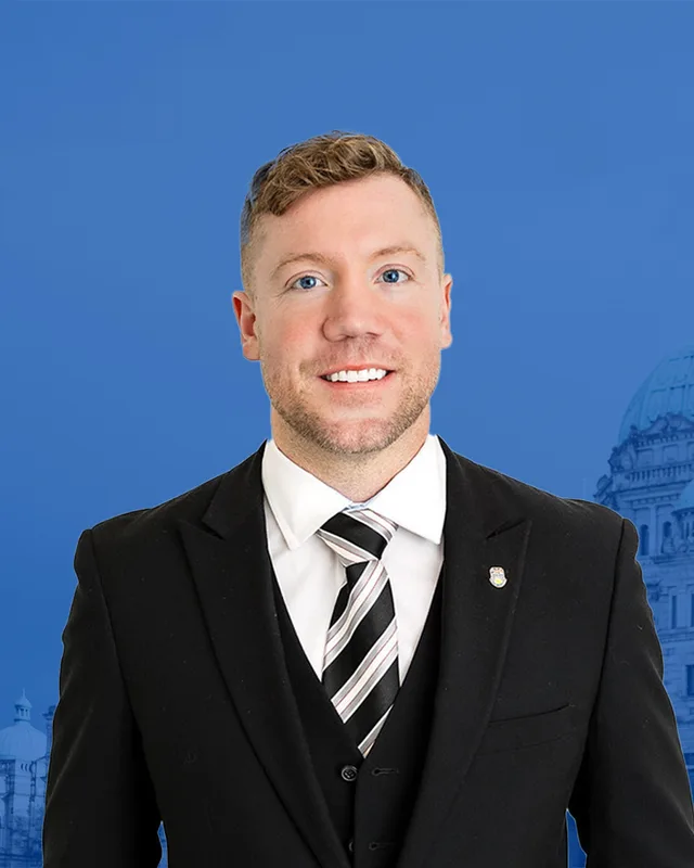MLA · Port Coquitlam**Conservative Party of BC**Keenan Adams
Researched by voche.meExplore the profile ](https://voche.me/bc/provincial-2026/candidates/keenan-adams) [MLA · Port Coquitlam**No party affiliation**Lee-Ann Bates
On the official list. Research to come.Explore the profile ](https://voche.me/bc/provincial-2026/candidates/lee-ann-bates) [MLA · Port Coquitlam**BC Libertarian Party**Lewis C. Dahlby
On the official list. Research to come.Explore the profile ](https://voche.me/bc/provincial-2026/candidates/lewis-c-dahlby) [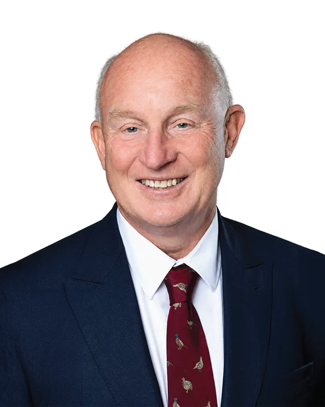MLA · Port Coquitlam**BC NDP**Mike Farnworth
Researched by voche.meExplore the profile ](https://voche.me/bc/provincial-2026/candidates/mike-farnworth) [MLA · Port Coquitlam**BC Green Party**Stephanie Hendy
On the official list. Research to come.Explore the profile ](https://voche.me/bc/provincial-2026/candidates/stephanie-hendy)
- People, 2021 census
- 61,500
- Area
- 34 km²
- Registered voters, 2024
- 44,601
- Turnout, 2024
- 57.70%
- Median age
- 41.6
- Median household income, 2020
- $101,000
THE DISTRICT
## Where Port Coquitlam is
34 km² · 61,500 people
Port Coquitlam is an electoral district that matches one city. The Electoral Boundaries Commission's 2023 final report says the riding is centred on the City of Port Coquitlam. Its southern boundary follows the Fraser River south of Douglas Island, and its eastern boundary follows the Pitt River. Its northern and western boundaries follow the city's borders and leave out the kʷikʷəƛ̓əm (Kwikwetlem) reserve in the City. The commission gives the area as 34 square kilometres and the population as 61,483.
The City's Official Community Plan says the city is bounded by the Fraser, Pitt and Coquitlam rivers. It says the Lougheed Highway and the CP Rail tracks have long divided the city into a north side and a south side, and that the rail yards limited movement between the two until the Coast Meridian Overpass opened in March 2010. The plan says the low land and silty soil of the lowlands drain poorly, and that a system of dikes and pump stations protects the city from flooding. It names Lincoln Park and Mary Hill as neighbourhoods that grew from the 1950s, Riverwood and Citadel Heights as neighbourhoods of the 1980s and 1990s, and the Dominion Avenue and Fremont neighbourhoods as areas then being built.
The City describes the Traboulay PoCo Trail as a 25-kilometre route that encircles the community, with a stretch past Gates Park and Lions Park and another along the Pitt River. TransLink lists a West Coast Express commuter rail station and park and ride at 2125 Kingsway Avenue. The 2021 census shows that among people counted by main way of getting to work, 85.9% used a car, truck or van, 8% took public transit, 3.2% walked and 1% cycled.
- Downtown Port Coquitlam
- Northside
- Mary Hill
- Lincoln Park
- Riverwood
- Citadel Heights
- Dominion Triangle
- Dominion Avenue
- Fremont
- Douglas Island
Sources: [British Columbia Electoral Boundaries Commission (opens in a new tab)](https://elections.bc.ca/docs/rpt/BCEBC-Final-Report-April-3-2023.pdf), [City of Port Coquitlam (opens in a new tab)](https://www.portcoquitlam.ca/sites/default/files/2024-10/3838%20-%20Official%20Community%20Plan.pdf), [City of Port Coquitlam (opens in a new tab)](https://www.portcoquitlam.ca/recreation-parks/parks-trails/traboulay-poco-trail), [TransLink (opens in a new tab)](https://www.translink.ca/rider-guide/driving/park-and-ride), [Province of British Columbia (BC Data Catalogue) (opens in a new tab)](https://catalogue.data.gov.bc.ca/dataset/da0326f2-2191-4345-84d3-d14cd6ee76eb)
HISTORY
## The history of the area
Checked Thursday, October 8, 2026
### kʷikʷəƛ̓əm territory and the meaning of the name
The kʷikʷəƛ̓əm (Kwikwetlem) First Nation says on its website that it has lived in its territory around the Coquitlam River Watershed since before remembered time. The Nation says its name in the hən̓q̓əmin̓əm̓ language means "Red Fish up the River", after a unique run of sockeye salmon that once thrived in its waters. The site names two reserve lands, slakəyánc (I.R. #1) and setɬamékmən (I.R. #2). The commission's 2023 report leaves the reserve called Coquitlam 2 out of the Port Coquitlam district and places it in Coquitlam-Maillardville, so that both Kwikwetlem reserves lie in one district.
BC Geographical Names lists Halqʼeméylem as the language of origin of the name Port Coquitlam. It records a 1927 manuscript by Denys Nelson that gives the meaning of Coquitlam as "small red salmon", and The Canadian Encyclopedia says the fish were abundant in the Coquitlam River. The City's heritage statement for City Hall, which spells the name Kwayhquitlum, says the Nation lived in the area for at least part of the year to fish, hunt and gather food and supplies. It adds that archaeological digs at the foot of Pitt River Road found fishing weights, basketry pieces and tools.
Sources: [kʷikʷəƛ̓əm (Kwikwetlem) First Nation (opens in a new tab)](https://www.kwikwetlem.com/), [British Columbia Electoral Boundaries Commission (opens in a new tab)](https://elections.bc.ca/docs/rpt/BCEBC-Final-Report-April-3-2023.pdf), [BC Geographical Names Office (opens in a new tab)](https://apps.gov.bc.ca/pub/bcgnws/names/17769.html), [The Canadian Encyclopedia (opens in a new tab)](https://thecanadianencyclopedia.ca/en/article/port-coquitlam), [City of Port Coquitlam (opens in a new tab)](https://www.portcoquitlam.ca/media/file/city-hall-statement-significance-draft)
### Settlers, a road and names on the map, 1827 to 1936
BC Geographical Names says the first mention of the Pitt River by name is "Pitts River" in the 1827 journal of James McMillan of the Hudson's Bay Company. The Provincial Archives place names file says it honours William Pitt, the British prime minister. The Canadian Encyclopedia says the McLean family settled along the Pitt River near the present bridge in 1853, and that in 1862 the Royal Engineers under Colonel Richard Clement Moody had the Pitt River Road built to connect the area with New Westminster. The City's heritage statement also names the McLean family as the first European settlers, in 1853.
Moody's wife gave her name to Mary Hill. BC Geographical Names says the Royal Engineers thought a citadel built there would defend New Westminster against an American invasion. The City today has a neighbourhood called Citadel Heights and a boardwalk called Citadel Landing. Douglas Island, at the meeting of the Pitt and Fraser rivers, was adopted as an official name on 11 February 1936. The entry presumes the island is named after James Douglas and says he bought all the lots on it from the Crown at auction on 6 October 1859. It also records that Donald McLean obtained a Crown grant at De Boville Slough in 1903, a name that was on a map in 1913.
Sources: [BC Geographical Names Office (opens in a new tab)](https://apps.gov.bc.ca/pub/bcgnws/names/80.html), [The Canadian Encyclopedia (opens in a new tab)](https://thecanadianencyclopedia.ca/en/article/port-coquitlam), [City of Port Coquitlam (opens in a new tab)](https://www.portcoquitlam.ca/media/file/city-hall-statement-significance-draft), [BC Geographical Names Office (opens in a new tab)](https://apps.gov.bc.ca/pub/bcgnws/names/6427.html), [City of Port Coquitlam (opens in a new tab)](https://www.portcoquitlam.ca/recreation-parks/parks-trails/traboulay-poco-trail), [City of Port Coquitlam (opens in a new tab)](https://www.portcoquitlam.ca/sites/default/files/2024-10/3838%20-%20Official%20Community%20Plan.pdf), [BC Geographical Names Office (opens in a new tab)](https://apps.gov.bc.ca/pub/bcgnws/names/14785.html), [BC Geographical Names Office (opens in a new tab)](https://apps.gov.bc.ca/pub/bcgnws/names/8563.html)
### Westminster Junction becomes a city, 1881 to 1914
BC Geographical Names records that the Coquitlam Post Office opened on 1 March 1881 and became the Port Coquitlam Post Office on 1 July 1913. The same entry says a map sheet of 1913 labels the railway station here Westminster Junction. The City's Official Community Plan says CP Rail moved its freight yard and operations to the area in 1911, and the PoCo Heritage exhibit on the city's early years describes the railway moving its freight yards from Vancouver to Westminster Junction as an expansion that began in 1912. The Canadian Centre for Architecture holds a photograph of the freight yards at Coquitlam, now Port Coquitlam, dated 1912 to 1914.
The Port Coquitlam Heritage and Cultural Society says the city was planned as an industrial centre with a port on the Fraser River and a Canadian Pacific station. The port could not be built. The station and the farming and logging community around it made the city possible. Residents voted to separate from the District of Coquitlam, and the City of Port Coquitlam was incorporated on 7 March 1913. The incorporation celebration was held on 18 April, when a parade ended at Agricultural Hall, known as Aggie Hall, and four maple trees were planted in Aggie Park. A new city hall opened in October 1914. The City's heritage statement names Parr, MacKenzie & Day of Vancouver as its architects.
Sources: [BC Geographical Names Office (opens in a new tab)](https://apps.gov.bc.ca/pub/bcgnws/names/17769.html), [City of Port Coquitlam (opens in a new tab)](https://www.portcoquitlam.ca/sites/default/files/2024-10/3838%20-%20Official%20Community%20Plan.pdf), [PoCo Heritage Museum and Archives (Digital Museums Canada) (opens in a new tab)](https://www.communitystories.ca/v2/port-coquitlam-flu-fire-flood_grippe-incendie-inondations/story/founding-the-city/), [Canadian Centre for Architecture (opens in a new tab)](https://www.cca.qc.ca/en/search/details/collection/object/11489), [Port Coquitlam Heritage and Cultural Society (opens in a new tab)](https://pocoheritage.org/poco-history/), [PoCo Heritage Museum and Archives (Digital Museums Canada) (opens in a new tab)](https://www.communitystories.ca/v2/port-coquitlam-flu-fire-flood_grippe-incendie-inondations/story/first-world-war/), [City of Port Coquitlam (opens in a new tab)](https://www.portcoquitlam.ca/media/file/city-hall-statement-significance-draft)
### Influenza, fire and flood, 1918 to 1923
The PoCo Heritage Museum and Archives groups these years under four headings: flu, fire, flood and financial fears. In October 1918 the railway carried the Siberian Expeditionary Force through Port Coquitlam, and the first cases of Spanish flu came with it. Military authorities took over Agricultural Hall as an emergency hospital and set up tents around it. After the first death on 12 October 1918, the city's medical officer ordered a quarantine that closed public gathering places and schools. In 1920 a fire that began on the roof of the fire hall, around the flue of a cook stove, spread to the Coquitlam Hotel and other downtown businesses. Firefighters from Essondale and New Westminster came to help, and after two hours the fire was under control, with three houses lost.
In October 1921 heavy rain raised the rivers. A log jam formed at the Coquitlam River Bridge, the road and rail bridges gave way, and a surge of water swept through the downtown business district. Residents were evacuated from the Myrtle Hotel on Dewdney Trunk Road, and a barbershop and a jeweller's shop were swept away. Mayor Arthur Mars was the first to cross the river in a bosun's chair, a seat hung from a rope. The fire investigator blamed council for having no volunteer fire brigade and for ignoring the stove flue bylaws. The city settled with business owners for $79,000 plus costs and sold its $8,000 fire engine. City Clerk Roy Leigh went through the tax ledgers to find properties that could be seized for unpaid taxes and resold, and the exhibit says this helped the city avoid bankruptcy. The first May Day celebration followed in 1923.
Sources: [PoCo Heritage Museum and Archives (Digital Museums Canada) (opens in a new tab)](https://www.communitystories.ca/v2/port-coquitlam-flu-fire-flood_grippe-incendie-inondations/story/flu/), [PoCo Heritage Museum and Archives (Digital Museums Canada) (opens in a new tab)](https://www.communitystories.ca/v2/port-coquitlam-flu-fire-flood_grippe-incendie-inondations/story/fire/), [PoCo Heritage Museum and Archives (Digital Museums Canada) (opens in a new tab)](https://www.communitystories.ca/v2/port-coquitlam-flu-fire-flood_grippe-incendie-inondations/story/fighting-the-flames/), [PoCo Heritage Museum and Archives (Digital Museums Canada) (opens in a new tab)](https://www.communitystories.ca/v2/port-coquitlam-flu-fire-flood_grippe-incendie-inondations/story/flood/), [PoCo Heritage Museum and Archives (Digital Museums Canada) (opens in a new tab)](https://www.communitystories.ca/v2/port-coquitlam-flu-fire-flood_grippe-incendie-inondations/story/fleeing-the-flood/), [PoCo Heritage Museum and Archives (Digital Museums Canada) (opens in a new tab)](https://www.communitystories.ca/v2/port-coquitlam-flu-fire-flood_grippe-incendie-inondations/story/financial-fears/), [PoCo Heritage Museum and Archives (Digital Museums Canada) (opens in a new tab)](https://www.communitystories.ca/v2/port-coquitlam-flu-fire-flood_grippe-incendie-inondations/story/saving-the-city/), [PoCo Heritage Museum and Archives (Digital Museums Canada) (opens in a new tab)](https://www.communitystories.ca/v2/port-coquitlam-flu-fire-flood_grippe-incendie-inondations/story/new-normal/)
### Industry, new neighbourhoods and the PoCo Trail, 1945 to 2001
The Canadian Encyclopedia says that before and during the Second World War most of the city's work force was employed in railways. It says metal, rubber and iron-casting industries, tungsten refining, boat building and nearby gravel operations were established after the war. Its figures are 3,200 people in 1951 and 36,800 in 1991. The City's Official Community Plan says the Davies area and the Meridian industrial parks are developed to capacity and that industrial uses are now being developed in the Dominion Triangle.
City Hall, built in 1914, received an addition in 1988 that doubled the size of the building, according to the City's heritage statement. The idea for the Traboulay PoCo Trail began in 1967 as a centennial project. A volunteer group called the PoCo Trail Blazers helped shape it in the early 1970s, Council adopted a plan to upgrade it in 1997, and in 2001 it was renamed for Len Traboulay, the city's 13th mayor, who served 19 years. TransLink says the West Coast Express commuter rail service has run since 1995, and the City's plan places its Port Coquitlam station on the eastern edge of the Downtown.
Sources: [The Canadian Encyclopedia (opens in a new tab)](https://thecanadianencyclopedia.ca/en/article/port-coquitlam), [City of Port Coquitlam (opens in a new tab)](https://www.portcoquitlam.ca/sites/default/files/2024-10/3838%20-%20Official%20Community%20Plan.pdf), [City of Port Coquitlam (opens in a new tab)](https://www.portcoquitlam.ca/media/file/city-hall-statement-significance-draft), [City of Port Coquitlam (opens in a new tab)](https://www.portcoquitlam.ca/recreation-parks/parks-trails/traboulay-poco-trail), [TransLink (opens in a new tab)](https://www.translink.ca/about-us/about-translink/operating-companies/west-coast-express)
### Terry Fox and Port Coquitlam, 1968 to 2025
The Terry Fox Foundation says Terry Fox was born in Winnipeg in 1958. His parents moved the family west to Surrey in 1966 and then settled in Port Coquitlam, which was the Fox family home from 1968 to 1990. The Foundation's account of his early years says he played basketball for the Port Coquitlam High School Ravens in grade eleven and graduated from the school. The Foundation says he dipped his artificial leg in the Atlantic Ocean on 12 April 1980 and was forced to stop on 1 September 1980, outside Thunder Bay, after 5,373 kilometres. He died on 28 June 1981.
The City of Port Coquitlam holds a Terry Fox Hometown Run, and its page calls him "our hometown hero". The Terry Fox Library is inside the Port Coquitlam Community Centre, according to the City. CTV News reported that an exhibit titled "Terry Fox: Inspiring Local Champions" was unveiled at the community centre on Saturday 12 April 2025.
Sources: [Terry Fox Foundation (opens in a new tab)](https://terryfox.org/terrys-story/), [Terry Fox Foundation (opens in a new tab)](https://terryfox.org/wp-content/uploads/2025/08/Terrys-Parents.pdf), [Terry Fox Foundation (opens in a new tab)](https://terryfox.org/wp-content/uploads/2025/08/Terrys-Early-Years.pdf), [City of Port Coquitlam (opens in a new tab)](https://www.portcoquitlam.ca/explore-poco/events/terry-fox-hometown-run), [City of Port Coquitlam (opens in a new tab)](https://www.portcoquitlam.ca/node/5844), [CTV News (opens in a new tab)](https://ctvnews.ca/vancouver/article/we-have-to-tell-terrys-story-port-coquitlam-marks-anniversary-of-marathon-of-hope-with-new-exhibit)
### New crossings and a rebuilt downtown, 2009 to 2025
A government release dated 27 October 2009 says Premier Gordon Campbell and Member of Parliament Randy Kamp officially opened the new seven-lane Pitt River Bridge that day. It replaced two swing bridges, and traffic over them had grown from 27,000 vehicles a day in 1985 to 88,000 in 2007. The project cost $198 million, with $108 million from the Province and up to $90 million from Canada, and includes an interchange with ramps to replace the intersection of the Lougheed Highway and the Mary Hill Bypass. In April 2009 the Province announced $2 million from Bike BC for cycling lanes on the new Coast Meridian Overpass. The City's plan says the overpass opened in March 2010 and gave the city a third north-south link across the rail yards.
Downtown, the Port Coquitlam Heritage Museum and Archives opened on 7 March 2013, the centenary of incorporation. The City completed a year-long Downtown Action Plan in fall 2017, the year construction of the Port Coquitlam Community Centre began. The City says the 205,000-square-foot building at 2150 Wilson Avenue cost $132 million and replaced the aging recreation facilities and library, and it scheduled the grand opening celebration for Saturday 2 October 2021. McAllister Avenue reopened to traffic in February 2022. Veterans Park was completed in June 2023 with a new central place for the cenotaph, chosen in consultation with Royal Canadian Legion Branch 133. The City invited residents to the grand reopening of the rebuilt Leigh Square on Friday 4 April 2025.
Sources: [Government of Canada and Province of British Columbia (opens in a new tab)](https://www.canada.ca/en/news/archive/2009/10/premier-kamp-open-new-pitt-river-bridge.html), [Province of British Columbia (BC Gov News archive) (opens in a new tab)](https://archive.news.gov.bc.ca/releases/news_releases_2005-2009/2009tran0037-000659.htm), [City of Port Coquitlam (opens in a new tab)](https://www.portcoquitlam.ca/sites/default/files/2024-10/3838%20-%20Official%20Community%20Plan.pdf), [Port Coquitlam Heritage and Cultural Society (opens in a new tab)](https://pocoheritage.org/about-3/), [City of Port Coquitlam (opens in a new tab)](https://www.portcoquitlam.ca/our-government/capital-projects/revitalizing-our-downtown), [City of Port Coquitlam (opens in a new tab)](https://www.portcoquitlam.ca/node/4076), [City of Port Coquitlam (opens in a new tab)](https://www.portcoquitlam.ca/node/4089), [City of Port Coquitlam (opens in a new tab)](https://www.portcoquitlam.ca/our-government/media-centre/city-port-coquitlam-invites-community-grand-reopening-leigh-square)
THE SEAT
## Who has held the seat
Legislative Assembly records, 35th Parliament onward
The 1871 to 1986 volume of Elections BC's electoral history prints no district named Port Coquitlam. The 1987 to 2001 volume first prints the name at the 35th general election of 1991. That volume also lists the Electoral Districts Act (SBC 1990 c. 39), which set out 75 single-member districts in place of the earlier multi-member ones. Mike Farnworth of the New Democratic Party won in 1991 with 11,435 votes (45.47%), ahead of Ernest R. Jilg of the Liberal Party with 9,929 (39.49%) and Jim Allard of Social Credit with 3,781 (15.04%). Farnworth won again in 1996 with 14,767 votes (46.37%), ahead of Irene Barr of the Liberal Party with 13,310 (41.80%).
The Electoral Districts Act (SBC 1999 c. 31) raised the number of districts from 75 to 79 and took effect when the 36th Parliament was dissolved on 18 April 2001. The volume prints the district as Port Coquitlam-Burke Mountain at the 2001 general election, when Karn Manhas of the Liberal Party won with 9,963 votes (45.19%), ahead of Farnworth with 7,198 (32.65%). In 2005 Farnworth took Port Coquitlam-Burke Mountain with 11,844 votes (48.14%), with Greg Moore of the Liberal Party second on 10,752 (43.70%). The Electoral Districts Act (S.B.C. 2008, c.14) raised the number of districts to 85 for the 2009 election, and the 2002 to 2013 volume lists Farnworth under Port Coquitlam from then on. He won in 2009 with 11,121 votes (54.71%) and in 2013 with 11,755 (52.94%).
Farnworth won in 2017 with 14,079 votes (55.79%), ahead of Susan Chambers of the BC Liberal Party with 7,582 (30.05%). In 2020 he won with 15,370 votes (64.14%), ahead of Mehran Zargham of the BC Liberal Party with 5,009 (20.90%). In 2024 he won with 13,843 votes (53.87%), ahead of Keenan Adams of the Conservative Party with 9,967 (38.79%). Turnout was 57.7% of 44,601 registered voters. The legislature's record lists Farnworth as the member in the 43rd Parliament.
The commission's 2023 report lists the existing Port Coquitlam with 61,483 people in 35 square kilometres and the new district with 61,483 people in 34 square kilometres. The change it proposed was to move the Kwikwetlem reserve Coquitlam 2 into Coquitlam-Maillardville. Elections BC's conversion table matches all 75 voting areas of the new district to the Port Coquitlam used from 2017 to 2024.
Sources: [Elections BC (opens in a new tab)](https://elections.bc.ca/docs/rpt/1871-1986_ElectoralHistoryofBC.pdf), [Elections BC (opens in a new tab)](https://elections.bc.ca/docs/rpt/1987-2001-ElectionHistory.pdf), [Elections BC (opens in a new tab)](https://elections.bc.ca/docs/rpt/2002-2013-ElectionHistory.pdf), [Elections BC (opens in a new tab)](https://catalogue.data.gov.bc.ca/dataset/44914a35-de9a-4830-ac48-870001ef8935), [Elections BC (opens in a new tab)](https://catalogue.data.gov.bc.ca/dataset/fb26db04-780c-4229-a147-da4fd5311d36), [British Columbia Electoral Boundaries Commission (opens in a new tab)](https://elections.bc.ca/docs/rpt/BCEBC-Final-Report-April-3-2023.pdf), [Legislative Assembly of British Columbia (opens in a new tab)](https://www.leg.bc.ca/members)
Members for Port Coquitlam
| Parliament | It sat | Member | Elected as | Party on the legislature’s record |
| --- | --- | --- | --- | --- |
| 43rd | 2025 to 2026 | Mike Farnworth | BC NDP | BC NDP |
| 42nd | 2020 to 2024 | Mike Farnworth | BC NDP | BC NDP |
| 41st | 2017 to 2020 | Mike Farnworth | BC NDP | BC NDP |
| 40th | 2013 to 2017 | Mike Farnworth | BC NDP | BC NDP |
| 39th | 2009 to 2013 | Mike Farnworth | BC NDP | BC NDP |
| 36th | 1996 to 2001 | Mike Farnworth | | BC NDP |
| 35th | 1992 to 1996 | Mike Farnworth | | BC NDP |
“Elected as” is the affiliation Elections BC printed with the winning result. The last column is the party the legislature’s records give for that parliament, which differs when a member changed party while in office. A row with that column empty is a winner Elections BC prints whom the legislature’s records leave out. Source: [Legislative Assembly of British Columbia (opens in a new tab)](https://www.leg.bc.ca/members)
### Boundaries since 2024
Port Coquitlam has 75 voting areas. 75 of them overlap the district of the same name used from 2017 to 2024.
The commission that drew the boundaries counted 61,483 people in the district, 14.3% above the average for a district, over 34 km².
Sources: [British Columbia Electoral Boundaries Commission, Final report, April 3, 2023 (opens in a new tab)](https://elections.bc.ca/docs/rpt/BCEBC-Final-Report-April-3-2023.pdf), [Elections BC, Voting area conversion table, 2017 to 2024 (opens in a new tab)](https://catalogue.data.gov.bc.ca/dataset/fb26db04-780c-4229-a147-da4fd5311d36)
PAST RESULTS
## Every result since 2009
From Elections BC
**2024 Provincial General Election**Mike Farnworth, BC NDP, 53.87%
| Candidate | Affiliation | Votes | Share |
| --- | --- | --- | --- |
| Mike FarnworthElected | BC NDP | 13,843 | 53.87% |
| Keenan Adams | Conservative Party | 9,967 | 38.79% |
| Adam Bremner-Akins | BC Green Party | 1,644 | 6.40% |
| Lewis Dahlby | Libertarian | 244 | 0.95% |
25,698 valid votes · 38 rejected ballots · 44,601 registered voters · 57.70% voted
**2020 General Election**Mike Farnworth, BC NDP, 64.14%
| Candidate | Affiliation | Votes | Share |
| --- | --- | --- | --- |
| Mike FarnworthElected | BC NDP | 15,370 | 64.14% |
| Mehran Zargham | BC Liberal Party | 5,009 | 20.90% |
| Erik Minty | BC Green Party | 3,023 | 12.61% |
| Lewis Clarke Dahlby | Libertarian | 563 | 2.35% |
23,965 valid votes · 146 rejected ballots
**2017 General Election**Mike Farnworth, BC NDP, 55.79%
| Candidate | Affiliation | Votes | Share |
| --- | --- | --- | --- |
| Mike FarnworthElected | BC NDP | 14,079 | 55.79% |
| Susan Chambers | BC Liberal Party | 7,582 | 30.05% |
| Jason Hanley | BC Green Party | 3,237 | 12.83% |
| Lewis Clarke Dahlby | Libertarian | 248 | 0.98% |
| Billy Gibbons | BC Cascadia Party | 88 | 0.35% |
25,234 valid votes · 131 rejected ballots
**2013 General Election**Mike Farnworth, BC NDP, 52.94%
| Candidate | Affiliation | Votes | Share |
| --- | --- | --- | --- |
| Mike FarnworthElected | BC NDP | 11,755 | 52.94% |
| Barbara Lu | BC Liberal Party | 8,120 | 36.57% |
| Ryan Hague | Conservative | 1,525 | 6.87% |
| Brent Williams | Your Political Party of BC (YPP) | 447 | 2.01% |
| Jogender Dahiya (JD) | Libertarian | 358 | 1.61% |
22,205 valid votes · 160 rejected ballots
**2009 General Election**Mike Farnworth, BC NDP, 54.71%
| Candidate | Affiliation | Votes | Share |
| --- | --- | --- | --- |
| Mike FarnworthElected | BC NDP | 11,121 | 54.71% |
| Bernie Christoph Hiller | BC Liberal Party | 7,896 | 38.85% |
| Cole Bertsch | BC Green Party | 994 | 4.89% |
| Lewis Clarke Dahlby | Libertarian | 178 | 0.88% |
| Brent Williams | Your Political Party of BC (YPP) | 137 | 0.67% |
20,326 valid votes · 106 rejected ballots
The boundaries changed before the 2009, 2017 and 2024 elections, so a result under the same name can cover a different area. Sources: [Elections BC, Provincial Voting Results (opens in a new tab)](https://catalogue.data.gov.bc.ca/dataset/44914a35-de9a-4830-ac48-870001ef8935), [Statement of Votes, 2024 Provincial General Election (opens in a new tab)](https://elections.bc.ca/docs/rpt/statement-of-votes-2024-provincial-election.pdf)
PEOPLE · 2021 CENSUS
## Who lives in Port Coquitlam
61,500 residents · British Columbia beside each figure
### Age
- Median age
- 41.6BC 42.8
- Under 1515.7%BC 14.3%
- 15 to 6468.6%BC 65.3%
- 65 and over15.7%BC 20.3%
- 85 and over1.8%BC 2.4%
### Households
- Households
- 22,885
- People per household
- 2.6BC 2.4
#### Who lives together
- Couples with children32.1%BC 22.7%
- Couples without children23.5%BC 26.4%
- One-parent families9.1%BC 7.6%
- Multigenerational households4.2%BC 3.7%
- People living alone22.7%BC 29.4%
#### Household size
- 1 person22.7%BC 29.4%
- 2 persons31.7%BC 35.3%
- 3 persons18.8%BC 14.5%
- 4 persons17.7%BC 12.6%
- 5 or more persons9.0%BC 8.2%
### Homes
- Median home value
- $900,000BC $785,000
- Median monthly rent and utilities
- $1,450BC $1,370
- Median monthly cost for owners
- $1,660BC $1,320
#### Own or rent
- Own their home77.1%BC 66.8%
- Rent their home22.9%BC 32.8%
#### Type of home
- Single-detached house36.7%BC 42.4%
- Semi-detached house3.7%BC 3.1%
- Row house16.1%BC 8.3%
- Apartment or flat in a duplex15.2%BC 12.2%
- Apartment in a building that has fewer than five storeys26.5%BC 20.4%
- Apartment in a building that has five or more storeys1.8%BC 10.9%
#### When the home was built
- 1960 or earlier5.0%BC 12.5%
- 1961 to 198027.8%BC 27.0%
- 1981 to 199016.4%BC 14.2%
- 1991 to 200024.3%BC 16.5%
- 2001 to 20055.5%BC 6.0%
- 2006 to 20107.3%BC 8.0%
- 2011 to 20156.5%BC 6.6%
- 2016 to 20217.1%BC 9.1%
### Housing costs
- Renters paying 30% or more of income on housing35.1%BC 37.8%
- Owners paying 30% or more of income on housing18.1%BC 19.3%
- Renters in core housing need28.7%BC 24.7%
- Owners in core housing need8.6%BC 8.0%
- Renters in subsidized housing14.7%BC 11.0%
- Owners with a mortgage66.5%BC 57.5%
### Income
Income is for the year 2020.
- Median household income
- $101,000BC $85,000
- After tax
- $89,000BC $76,000
- Median income per person
- $44,800BC $40,800
#### Living on a low income (after-tax measure)
- All ages7.7%BC 10.8%
- Under 189.4%BC 11.3%
- 18 to 646.3%BC 9.7%
- 65 and over11.7%BC 13.8%
### Languages
#### First language learned
- English62.4%BC 67.1%
- Yue (Cantonese)4.5%BC 3.9%
- Mandarin3.4%BC 4.1%
- Korean2.6%BC 1.2%
- Tagalog (Pilipino, Filipino)2.4%BC 1.7%
- Iranian Persian2.2%BC 0.9%
- Spanish1.8%BC 1.2%
- Punjabi (Panjabi)1.6%BC 4.9%
- Russian1.5%BC 0.6%
- Polish1.0%BC 0.3%
#### Spoken most often at home
- English76.5%BC 78.5%
- Yue (Cantonese)2.8%BC 2.8%
- Mandarin2.5%BC 3.3%
- Korean2.1%BC 0.9%
- Iranian Persian1.6%BC 0.7%
- Russian1.3%BC 0.3%
- Tagalog (Pilipino, Filipino)1.2%BC 0.9%
- Punjabi (Panjabi)1.1%BC 3.8%
#### English and French
- English only90.6%BC 90.1%
- French only0.1%BC 0.0%
- English and French6.6%BC 6.6%
- Neither English nor French2.8%BC 3.3%
### Immigration
- Born outside Canada (immigrants)
- 34.4%BC 29.0%
- Non-permanent residents
- 1.6%BC 3.5%
#### Where immigrants were born
- Philippines10.5%BC 9.2%
- China9.9%BC 15.3%
- Iran7.2%BC 3.2%
- India6.2%BC 13.8%
- Korea, South6.2%BC 3.3%
- United Kingdom6.0%BC 8.2%
- Hong Kong5.9%BC 5.5%
- Poland2.7%BC 1.0%
- Romania2.3%BC 0.7%
- Taiwan2.2%BC 2.8%
#### When immigrants arrived
- Arrived before 198014.9%BC 19.7%
- 1980 to 199011.9%BC 11.5%
- 1991 to 200025.5%BC 21.0%
- 2001 to 201024.5%BC 22.2%
- 2011 to 202123.3%BC 25.6%
#### Generations in Canada
- First generation37.0%BC 33.7%
- Second generation24.4%BC 21.7%
- Third generation or more38.6%BC 44.5%
### Identity and origins
- Indigenous identity
- 3.0%BC 5.9%
- Visible minority
- 39.7%BC 34.4%
#### Visible minority groups
- Chinese11.7%BC 11.2%
- South Asian5.8%BC 9.6%
- Filipino5.1%BC 3.5%
- West Asian3.9%BC 1.4%
- Korean3.2%BC 1.5%
- Black2.0%BC 1.3%
- Latin American1.9%BC 1.3%
- Multiple visible minorities1.8%BC 1.2%
- Southeast Asian1.5%BC 1.5%
- Japanese1.3%BC 0.9%
- Arab1.0%BC 0.6%
- Visible minority (other)0.5%BC 0.4%
#### Ethnic or cultural origins reported most often
- English18.6%BC 20.7%
- Scottish15.0%BC 15.8%
- Irish11.6%BC 12.8%
- Chinese11.3%BC 10.5%
- Canadian10.1%BC 9.3%
- German8.7%BC 11.0%
- French5.2%BC 6.4%
- Filipino5.0%BC 3.5%
- Italian4.8%BC 3.3%
- Ukrainian4.1%BC 4.3%
### Religion
- No religion49.4%BC 52.1%
- Christian39.7%BC 34.3%
- Muslim4.3%BC 2.6%
- Sikh2.2%BC 5.9%
- Buddhist1.4%BC 1.7%
- Hindu1.3%BC 1.7%
- Other religions1.2%BC 1.0%
- Jewish0.5%BC 0.5%
- Traditional Indigenous spirituality0.1%BC 0.2%
### Education
Highest level completed, ages 25 to 64.
- No certificate, diploma or degree6.5%BC 8.0%
- High school diploma25.4%BC 25.8%
- College, trades or other certificate below a bachelor’s degree34.6%BC 31.2%
- Bachelor’s degree or higher33.4%BC 35.0%
### Work
- In the labour force
- 68.3%BC 63.3%
- Employed
- 62.8%BC 57.9%
- Unemployment rate at the census
- 8.1%BC 8.4%
#### Industries with the most workers
- Health care and social assistance12.4%BC 12.3%
- Retail trade10.8%BC 11.6%
- Construction10.7%BC 9.0%
- Professional, scientific and technical services8.3%BC 9.2%
- Educational services7.3%BC 7.4%
- Manufacturing7.1%BC 5.9%
- Accommodation and food services6.0%BC 7.0%
- Public administration5.5%BC 5.5%
#### Kinds of work
- Sales and service occupations24.0%BC 25.6%
- Trades, transport and equipment operators and related occupations19.4%BC 18.0%
- Business, finance and administration occupations18.4%BC 17.1%
- Occupations in education, law and social, community and government services12.1%BC 11.9%
- Natural and applied sciences and related occupations9.0%BC 8.0%
- Health occupations7.1%BC 7.7%
- Occupations in art, culture, recreation and sport4.0%BC 4.2%
- Occupations in manufacturing and utilities3.7%BC 3.4%
- Natural resources, agriculture and related production occupations1.3%BC 2.8%
- Legislative and senior management occupations1.0%BC 1.2%
### Getting to work
#### Where people worked
- Worked at home21.0%BC 22.6%
- Worked outside Canada0.3%BC 0.4%
- No fixed workplace address15.9%BC 15.3%
- Worked at a usual workplace62.8%BC 61.6%
#### How commuters travelled
- Car, truck or van85.9%BC 79.9%
- Public transit8.0%BC 9.3%
- On foot3.2%BC 6.5%
- Bicycle1.0%BC 2.0%
- Other method2.0%BC 2.3%
#### Length of the trip
- Less than 15 minutes24.5%BC 31.8%
- 15 to 29 minutes28.9%BC 34.0%
- 30 to 44 minutes23.4%BC 19.7%
- 45 to 59 minutes13.1%BC 7.3%
- 60 minutes and over10.1%BC 7.2%
### Moving
Where residents lived five years before the census.
- Lived at the same address63.5%BC 56.2%
- Moved within the same municipality9.3%BC 16.1%
- Moved from elsewhere in BC20.6%BC 17.0%
- Moved from another province2.6%BC 4.6%
- Moved from another country4.0%BC 6.1%
Counts in the census are rounded to the nearest 5, and shares are worked out from those counts. Source: [BC Stats, from Statistics Canada tabulations, 2021 Census Profile for BC Provincial Electoral Districts (2023 Redistribution) (opens in a new tab)](https://catalogue.data.gov.bc.ca/dataset/census-profiles-for-bc-provincial-electoral-districts)
QUESTIONS
## Questions about Port Coquitlam
10 answers
### Where is the Port Coquitlam electoral district?
Port Coquitlam is a provincial electoral district in Metro Vancouver that follows the municipal boundaries of the City of Port Coquitlam. The Electoral Boundaries Commission's 2023 final report says its southern boundary follows the Fraser River south of Douglas Island and its eastern boundary follows the Pitt River. The commission gives the district's area as 34 square kilometres and its population as 61,483.
### Which neighbourhoods are in the Port Coquitlam district?
The Port Coquitlam district covers the City of Port Coquitlam except one Kwikwetlem reserve. The City's Official Community Plan names the neighbourhoods Lincoln Park and Mary Hill, which grew from the 1950s, and Riverwood and Citadel Heights, which grew in the 1980s and 1990s. It also names the Downtown, Northside, Dominion Avenue and Fremont areas, and the Dominion Triangle.
### Who is the member for Port Coquitlam?
Mike Farnworth of the BC NDP is the member the legislature records for Port Coquitlam in the 43rd Parliament, after winning the district in 2024. The legislature also records him for Port Coquitlam in the 39th to 42nd Parliaments, and in the 35th and 36th. It records him for Port Coquitlam-Burke Mountain in the 38th Parliament.
### How did Port Coquitlam vote in 2024?
Mike Farnworth of the BC NDP won Port Coquitlam in the 2024 provincial general election with 13,843 votes, 53.87% of the valid vote. Keenan Adams of the Conservative Party received 9,967 votes, 38.79%. Adam Bremner-Akins of the BC Green Party received 1,644 votes and Lewis Dahlby of the Libertarian Party received 244 votes. Turnout was 57.7% of the 44,601 registered voters.
### How did the boundaries of Port Coquitlam change in 2023?
The commission's 2023 report proposed one change to Port Coquitlam: it moved the kʷikʷəƛ̓əm (Kwikwetlem) reserve Coquitlam 2 into Coquitlam-Maillardville, so that both Kwikwetlem reserves lie in one district. It lists the existing district with 61,483 people in 35 square kilometres and the new one with 61,483 people in 34. Elections BC's conversion table matches all 75 voting areas to the Port Coquitlam of 2017 to 2024.
### Who lives in Port Coquitlam?
The 2021 census counted 61,500 people in Port Coquitlam, with a median age of 41.6 years against 42.8 for British Columbia. Immigrants are 34.4% of residents, against 29% for the province. English is the first language of 62.4% of residents, Yue (Cantonese) of 4.5%, Mandarin of 3.4%, Korean of 2.6% and Tagalog of 2.4%. The median household income is $101,000.
### Whose traditional territory is the Port Coquitlam district on?
The Port Coquitlam district lies in the territory of the kʷikʷəƛ̓əm (Kwikwetlem) First Nation, according to the Port Coquitlam Heritage and Cultural Society, whose history page is titled "The Traditional, Ancestral and Unceded Territory of the kʷikʷəƛ̓əm". The Nation says it has lived in its territory around the Coquitlam River Watershed since before remembered time. Its reserves are slakəyánc and setɬamékmən.
### When was Port Coquitlam incorporated, and what did the railway have to do with it?
The City of Port Coquitlam was incorporated on 7 March 1913, according to BC Geographical Names. The City's Official Community Plan says CP Rail moved its freight yard and operations to the area in 1911. BC Geographical Names says a map sheet of 1913 labels the railway station Westminster Junction, and that the Port Coquitlam Post Office took its name on 1 July 1913.
### What happened in Port Coquitlam in 1920 and 1921?
A fire in 1920 burned much of downtown Port Coquitlam, according to the PoCo Heritage Museum and Archives. It began on the roof of the fire hall, took two hours to bring under control and destroyed many businesses and three houses. In October 1921 a log jam formed at the Coquitlam River Bridge, the road and rail bridges gave way, and a surge of water swept through the downtown.
### What is the Traboulay PoCo Trail?
The Traboulay PoCo Trail is a 25-kilometre route of gravel and paved paths that the City says encircles Port Coquitlam. The idea began in 1967 as a project for Canada's centennial, and in 2001 the trail was renamed for Len Traboulay, the city's 13th mayor, who served 19 years. It passes Gates Park, Lions Park, the Coquitlam River and the Pitt River.
SOURCES
## Where this page comes from
Figures read Thursday, October 8, 2026
1. [2021 Census Profile for BC Provincial Electoral Districts (2023 Redistribution) (opens in a new tab)](https://catalogue.data.gov.bc.ca/dataset/census-profiles-for-bc-provincial-electoral-districts)BC Stats, from Statistics Canada tabulations · read Thursday, October 8, 2026
2. [Provincial Voting Results (opens in a new tab)](https://catalogue.data.gov.bc.ca/dataset/44914a35-de9a-4830-ac48-870001ef8935)Elections BC · read Thursday, October 8, 2026
3. [Statement of Votes, 2024 Provincial General Election (opens in a new tab)](https://elections.bc.ca/docs/rpt/statement-of-votes-2024-provincial-election.pdf)Elections BC · read Thursday, October 8, 2026
4. [Voting area conversion table, 2017 to 2024 (opens in a new tab)](https://catalogue.data.gov.bc.ca/dataset/fb26db04-780c-4229-a147-da4fd5311d36)Elections BC · read Thursday, October 8, 2026
5. [Final report, April 3, 2023 (opens in a new tab)](https://elections.bc.ca/docs/rpt/BCEBC-Final-Report-April-3-2023.pdf)British Columbia Electoral Boundaries Commission · read Thursday, October 8, 2026
6. [Members of the Legislative Assembly, 35th to 43rd Parliament (opens in a new tab)](https://www.leg.bc.ca/members)Legislative Assembly of British Columbia · read Thursday, October 8, 2026
7. [Final report, April 3, 2023 (opens in a new tab)](https://elections.bc.ca/docs/rpt/BCEBC-Final-Report-April-3-2023.pdf)British Columbia Electoral Boundaries Commission · read Thursday, October 8, 2026
8. [Electoral History of British Columbia, 1871 to 1986 (opens in a new tab)](https://elections.bc.ca/docs/rpt/1871-1986_ElectoralHistoryofBC.pdf)Elections BC · read Thursday, October 8, 2026
9. [Electoral History of British Columbia, Supplement, 1987 to 2001 (opens in a new tab)](https://elections.bc.ca/docs/rpt/1987-2001-ElectionHistory.pdf)Elections BC · read Thursday, October 8, 2026
10. [Electoral History of British Columbia, Supplement, 2002 to 2013 (opens in a new tab)](https://elections.bc.ca/docs/rpt/2002-2013-ElectionHistory.pdf)Elections BC · read Thursday, October 8, 2026
11. [Provincial general election and by-election results by voting area (opens in a new tab)](https://catalogue.data.gov.bc.ca/dataset/44914a35-de9a-4830-ac48-870001ef8935)Elections BC · read Thursday, October 8, 2026
12. [Voting area conversion table, 2024 districts to 2017 districts (opens in a new tab)](https://catalogue.data.gov.bc.ca/dataset/fb26db04-780c-4229-a147-da4fd5311d36)Elections BC · read Thursday, October 8, 2026
13. [Members of the Legislative Assembly (opens in a new tab)](https://www.leg.bc.ca/members)Legislative Assembly of British Columbia · read Thursday, October 8, 2026
14. [2021 census profile by electoral district (opens in a new tab)](https://catalogue.data.gov.bc.ca/dataset/da0326f2-2191-4345-84d3-d14cd6ee76eb)Province of British Columbia (BC Data Catalogue) · read Thursday, October 8, 2026
15. [kʷikʷəƛ̓əm First Nation home page (opens in a new tab)](https://www.kwikwetlem.com/)kʷikʷəƛ̓əm (Kwikwetlem) First Nation · read Thursday, October 8, 2026
16. [Port Coquitlam (opens in a new tab)](https://apps.gov.bc.ca/pub/bcgnws/names/17769.html)BC Geographical Names Office · read Thursday, October 8, 2026
17. [Mary Hill (hill) (opens in a new tab)](https://apps.gov.bc.ca/pub/bcgnws/names/6427.html)BC Geographical Names Office · read Thursday, October 8, 2026
18. [Pitt River (opens in a new tab)](https://apps.gov.bc.ca/pub/bcgnws/names/80.html)BC Geographical Names Office · read Thursday, October 8, 2026
19. [Douglas Island (opens in a new tab)](https://apps.gov.bc.ca/pub/bcgnws/names/14785.html)BC Geographical Names Office · read Thursday, October 8, 2026
20. [De Boville Slough (opens in a new tab)](https://apps.gov.bc.ca/pub/bcgnws/names/8563.html)BC Geographical Names Office · read Thursday, October 8, 2026
21. [Port Coquitlam (opens in a new tab)](https://thecanadianencyclopedia.ca/en/article/port-coquitlam)The Canadian Encyclopedia · read Thursday, October 8, 2026
22. [Port Coquitlam City Hall, statement of significance (draft) (opens in a new tab)](https://www.portcoquitlam.ca/media/file/city-hall-statement-significance-draft)City of Port Coquitlam · read Thursday, October 8, 2026
23. [Official Community Plan Bylaw, 2013, No. 3838 (opens in a new tab)](https://www.portcoquitlam.ca/sites/default/files/2024-10/3838%20-%20Official%20Community%20Plan.pdf)City of Port Coquitlam · read Thursday, October 8, 2026
24. [Traboulay PoCo Trail (opens in a new tab)](https://www.portcoquitlam.ca/recreation-parks/parks-trails/traboulay-poco-trail)City of Port Coquitlam · read Thursday, October 8, 2026
25. [The Traditional, Ancestral and Unceded Territory of the kʷikʷəƛ̓əm (PoCo history) (opens in a new tab)](https://pocoheritage.org/poco-history/)Port Coquitlam Heritage and Cultural Society · read Thursday, October 8, 2026
26. [About PoCo Heritage (opens in a new tab)](https://pocoheritage.org/about-3/)Port Coquitlam Heritage and Cultural Society · read Thursday, October 8, 2026
27. [Founding the City (opens in a new tab)](https://www.communitystories.ca/v2/port-coquitlam-flu-fire-flood_grippe-incendie-inondations/story/founding-the-city/)PoCo Heritage Museum and Archives (Digital Museums Canada) · read Thursday, October 8, 2026
28. [First World War (opens in a new tab)](https://www.communitystories.ca/v2/port-coquitlam-flu-fire-flood_grippe-incendie-inondations/story/first-world-war/)PoCo Heritage Museum and Archives (Digital Museums Canada) · read Thursday, October 8, 2026
29. [Flu in 1918 (opens in a new tab)](https://www.communitystories.ca/v2/port-coquitlam-flu-fire-flood_grippe-incendie-inondations/story/flu/)PoCo Heritage Museum and Archives (Digital Museums Canada) · read Thursday, October 8, 2026
30. [Fire (opens in a new tab)](https://www.communitystories.ca/v2/port-coquitlam-flu-fire-flood_grippe-incendie-inondations/story/fire/)PoCo Heritage Museum and Archives (Digital Museums Canada) · read Thursday, October 8, 2026
31. [Fighting the Flames (opens in a new tab)](https://www.communitystories.ca/v2/port-coquitlam-flu-fire-flood_grippe-incendie-inondations/story/fighting-the-flames/)PoCo Heritage Museum and Archives (Digital Museums Canada) · read Thursday, October 8, 2026
32. [Flood (opens in a new tab)](https://www.communitystories.ca/v2/port-coquitlam-flu-fire-flood_grippe-incendie-inondations/story/flood/)PoCo Heritage Museum and Archives (Digital Museums Canada) · read Thursday, October 8, 2026
33. [Fleeing the Flood (opens in a new tab)](https://www.communitystories.ca/v2/port-coquitlam-flu-fire-flood_grippe-incendie-inondations/story/fleeing-the-flood/)PoCo Heritage Museum and Archives (Digital Museums Canada) · read Thursday, October 8, 2026
34. [Financial Fears (opens in a new tab)](https://www.communitystories.ca/v2/port-coquitlam-flu-fire-flood_grippe-incendie-inondations/story/financial-fears/)PoCo Heritage Museum and Archives (Digital Museums Canada) · read Thursday, October 8, 2026
35. [Saving the City (opens in a new tab)](https://www.communitystories.ca/v2/port-coquitlam-flu-fire-flood_grippe-incendie-inondations/story/saving-the-city/)PoCo Heritage Museum and Archives (Digital Museums Canada) · read Thursday, October 8, 2026
36. [A New Normal (opens in a new tab)](https://www.communitystories.ca/v2/port-coquitlam-flu-fire-flood_grippe-incendie-inondations/story/new-normal/)PoCo Heritage Museum and Archives (Digital Museums Canada) · read Thursday, October 8, 2026
37. [View of the Canadian Pacific Railroad Company freight yards, Coquitlam (now Port Coquitlam) (opens in a new tab)](https://www.cca.qc.ca/en/search/details/collection/object/11489)Canadian Centre for Architecture · read Thursday, October 8, 2026
38. [Park and Ride (opens in a new tab)](https://www.translink.ca/rider-guide/driving/park-and-ride)TransLink · read Thursday, October 8, 2026
39. [West Coast Express (opens in a new tab)](https://www.translink.ca/about-us/about-translink/operating-companies/west-coast-express)TransLink · read Thursday, October 8, 2026
40. [Premier and MP Kamp open new Pitt River Bridge (release GC019/09, 27 October 2009) (opens in a new tab)](https://www.canada.ca/en/news/archive/2009/10/premier-kamp-open-new-pitt-river-bridge.html)Government of Canada and Province of British Columbia · read Thursday, October 8, 2026
41. [Bike BC adds Port Coquitlam bike lanes (opens in a new tab)](https://archive.news.gov.bc.ca/releases/news_releases_2005-2009/2009tran0037-000659.htm)Province of British Columbia (BC Gov News archive) · read Thursday, October 8, 2026
42. [Terry's Story (opens in a new tab)](https://terryfox.org/terrys-story/)Terry Fox Foundation · read Thursday, October 8, 2026
43. [Terry's Parents (opens in a new tab)](https://terryfox.org/wp-content/uploads/2025/08/Terrys-Parents.pdf)Terry Fox Foundation · read Thursday, October 8, 2026
44. [The Early Years (opens in a new tab)](https://terryfox.org/wp-content/uploads/2025/08/Terrys-Early-Years.pdf)Terry Fox Foundation · read Thursday, October 8, 2026
45. [Terry Fox Hometown Run (opens in a new tab)](https://www.portcoquitlam.ca/explore-poco/events/terry-fox-hometown-run)City of Port Coquitlam · read Thursday, October 8, 2026
46. [Terry Fox Library notice (opens in a new tab)](https://www.portcoquitlam.ca/node/5844)City of Port Coquitlam · read Thursday, October 8, 2026
47. ['We have to tell Terry's story': Port Coquitlam marks anniversary of Marathon of Hope with new exhibit (opens in a new tab)](https://ctvnews.ca/vancouver/article/we-have-to-tell-terrys-story-port-coquitlam-marks-anniversary-of-marathon-of-hope-with-new-exhibit)CTV News · read Thursday, October 8, 2026
48. [Revitalizing Our Downtown (opens in a new tab)](https://www.portcoquitlam.ca/our-government/capital-projects/revitalizing-our-downtown)City of Port Coquitlam · read Thursday, October 8, 2026
49. [Port Coquitlam Community Centre on time and within budget (29 July 2021) (opens in a new tab)](https://www.portcoquitlam.ca/node/4076)City of Port Coquitlam · read Thursday, October 8, 2026
50. [Port Coquitlam Community Centre grand opening celebration Oct. 2 (25 September 2021) (opens in a new tab)](https://www.portcoquitlam.ca/node/4089)City of Port Coquitlam · read Thursday, October 8, 2026
51. [Grand reopening of Leigh Square (2 April 2025) (opens in a new tab)](https://www.portcoquitlam.ca/our-government/media-centre/city-port-coquitlam-invites-community-grand-reopening-leigh-square)City of Port Coquitlam · read Thursday, October 8, 2026
## Official information
From Elections BC
Your district
### [Check which district an address is in](https://elections.bc.ca/resources/maps/find-your-district/)
Look up your address to be sure this district is yours.
[Look it up (opens in a new tab)](https://elections.bc.ca/resources/maps/find-your-district/)
Candidates
### [The official candidate list](https://www.elections.bc.ca/docs/fin/GE-2026-10-24-Candidate-Website-Report.PDF)
The list this page is built from, published by Elections BC.
[Open the list (opens in a new tab)](https://www.elections.bc.ca/docs/fin/GE-2026-10-24-Candidate-Website-Report.PDF)
Voting
### [Where and when to vote](https://elections.bc.ca/2026-provincial-election/where-to-vote/)
Voting places and hours for general voting day and advance voting.
[Find your voting place (opens in a new tab)](https://elections.bc.ca/2026-provincial-election/where-to-vote/)
## Sitemap
See the full [sitemap](/bc/provincial-2026/sitemap.md) for all pages.