---
title: "Peace River North: candidates, history and census, BC provincial 2026 | voche.me"
canonical_url: "https://voche.me/bc/provincial-2026/races/mla/peace-river-north"
last_updated: "2026-10-10T04:05:24.450Z"
meta:
description: "2 candidates in Peace River North, BC provincial 2026. Area history, results since 2005, past MLAs and the 2021 census."
"og:description": "2 candidates in Peace River North, BC provincial 2026. Area history, results since 2005, past MLAs and the 2021 census."
"og:title": "Peace River North: candidates, history and census, BC provincial 2026"
"twitter:description": "2 candidates in Peace River North, BC provincial 2026. Area history, results since 2005, past MLAs and the 2021 census."
"twitter:title": "Peace River North: candidates, history and census, BC provincial 2026"
---
**
MLA · BC PROVINCIAL 2026
# Peace River North.
2 candidates, one seat.
This district elects one MLA. Voters mark one name on Saturday, October 24, 2026, and the candidate with the most votes wins the seat.
Peace River North is a provincial electoral district in the north-east corner of British Columbia, north of the Peace River. It takes in Fort St. John, Taylor, Hudson's Hope and Fort Nelson, reaches the Yukon and Northwest Territories borders, and covers 175,795 square kilometres. The 2021 census counted 40,380 people, and 15.8% of them reported an Indigenous identity.
## The candidates
In alphabetical order
[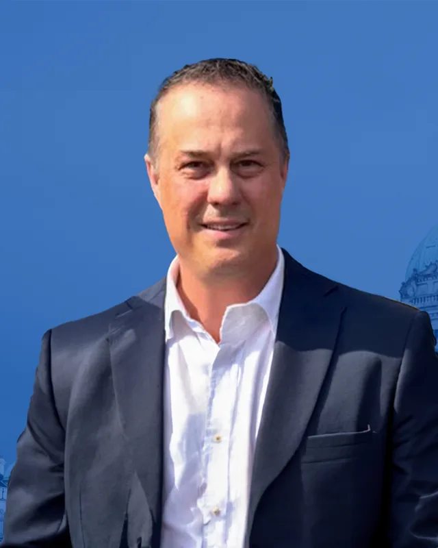MLA · Peace River North**Conservative Party of BC**Curtis Whitford
Researched by voche.meExplore the profile ](https://voche.me/bc/provincial-2026/candidates/curtis-whitford) [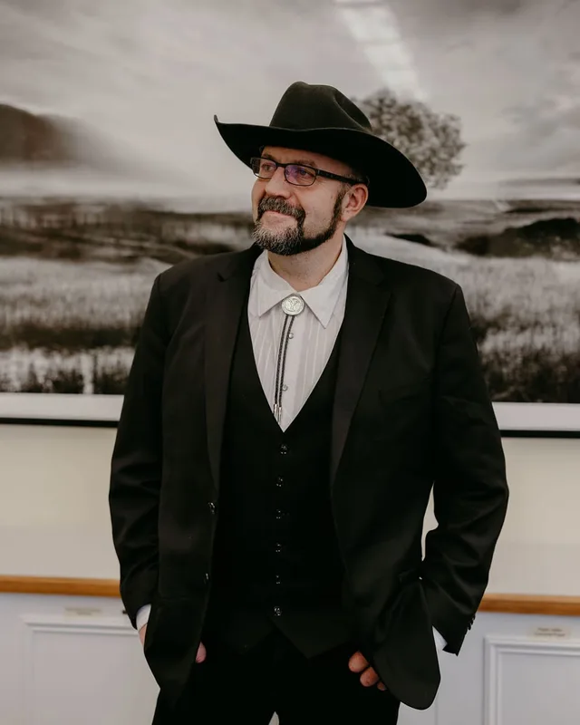MLA · Peace River North**No party affiliation**Jordan Kealy
Researched by voche.meExplore the profile ](https://voche.me/bc/provincial-2026/candidates/jordan-kealy)
- People, 2021 census
- 40,380
- Area
- 175,795 km²
- Registered voters, 2024
- 26,413
- Turnout, 2024
- 57.16%
- Median age
- 34.4
- Median household income, 2020
- $100,000
THE DISTRICT
## Where Peace River North is
175,795 km² · 40,380 people
Peace River North fills the north-east corner of British Columbia. The Electoral Boundaries Commission's 2023 final report says it extends to the borders of the Yukon and the Northwest Territories in the north and to the Alberta border in the east. It consists of communities north of the Peace River, including Hudson's Hope, Fort St. John, Taylor and Fort Nelson. Its western boundary follows the borders of the Northern Rockies Regional Municipality and the Peace River Regional District, and its southern boundary follows the Peace River. The commission's table gives the area as 175,795 square kilometres and the population count as 40,375, which is 24.9% below the average district.
The commission says the six northern districts have challenging terrain and weather, limited transportation options and poor internet connections. It looked at reducing those six districts to five and decided that this would deprive residents of effective representation. Elections BC's 2024 results file lists voting places at Baldonnel, Buick Creek, Charlie Lake, Montney, Pink Mountain, Prespatou, Prophet River, Taylor, Toad River, Upper Pine and Wonowon, and at Northern Rockies Lodge.
The District of Taylor places Taylor 18 km south of Fort St. John, along the Peace River. Halfway River First Nation says it is based in Wonowon, 75 km northwest of Fort St. John. Prophet River First Nation says its community is 100 km south of Fort Nelson, on the Alaska Highway at Mile 233, and Fort Nelson First Nation says most of its members were moved to Mile 295 of the same highway in the early 1960s. The Peace River Regional District lists Blueberry River First Nations, Doig River First Nation and Halfway River First Nation among the First Nations communities in its area.
- Fort St. John
- Charlie Lake
- Baldonnel
- Taylor
- Hudson's Hope
- Montney
- Buick Creek
- Prespatou
- Upper Pine
- Wonowon
- Halfway River First Nation
- Pink Mountain
- Prophet River
- Prophet River First Nation
- Toad River
- Fort Nelson
Sources: [British Columbia Electoral Boundaries Commission (opens in a new tab)](https://elections.bc.ca/docs/rpt/BCEBC-Final-Report-April-3-2023.pdf), [Elections BC (opens in a new tab)](https://catalogue.data.gov.bc.ca/dataset/44914a35-de9a-4830-ac48-870001ef8935), [District of Taylor (opens in a new tab)](https://districtoftaylor.com/?p=38), [Halfway River First Nation (opens in a new tab)](https://hrfn.ca/), [Prophet River First Nation (opens in a new tab)](https://prophetriverfirstnation.com/), [Fort Nelson First Nation (opens in a new tab)](https://fortnelsonfirstnation.org/about-fnfn/), [Peace River Regional District (opens in a new tab)](https://www.prrd.bc.ca/our-government/who-we-are/communities/)
HISTORY
## The history of the area
Checked Thursday, October 8, 2026
### Dane-zaa and Dene peoples of the north-east
Doig River First Nation calls its people Tsááʔ çhé ne dane and says they are descendants of the Dane-zaa peoples, who have occupied the Peace River region of British Columbia and Alberta for thousands of years. Its history page says archaeological evidence from the Charlie Lake cave site shows that the area was occupied from at least 10,500 years ago by people who hunted bison and other game. The Canadian Encyclopedia describes Charlie Lake Cave as one of the oldest archaeological sites in Canada. Doig River First Nation says its people followed the teachings of the Nááchę, or Dreamers, who gained knowledge of the future through dreaming.
Blueberry River First Nations describes itself as a Treaty 8 Nation whose traditional territory extends over 3.8 million hectares of the Peace River region. Its 2025 backgrounder says the Nation has both Dane-zaa (Beaver) and Cree (Nêhiyawêwin) cultural groups, who exist together as one community, and that its main reserve is 80 km northwest of Fort St. John. Halfway River First Nation calls itself a Dane-Zaa Nation. Doig River First Nation gives the distance from Fort St. John to its community as 70 km northeast.
Farther north, Prophet River First Nation describes itself as a Dene Tsaa Nation and says its traditional territory is mainly in the boreal forest of north-eastern British Columbia. Fort Nelson First Nation says its people are the People of the Land, that they have occupied north-east British Columbia for tens of thousands of years, and that they speak the Dené and Cree languages. It lists places its families came from, among them Nelson Forks, Fontas, Kahntah and Moose Lake. The Northern Rockies Regional Municipality says the Métis community of Fort Nelson has been in the region since the North West Company arrived. The 2021 census counted 6,265 people with an Indigenous identity in the district, including 3,750 First Nations people and 2,240 Métis.
Sources: [Doig River First Nation (opens in a new tab)](https://doigriverfn.com/about/history/), [Doig River First Nation (opens in a new tab)](https://doigriverfn.com/about/about-doig-river/), [The Canadian Encyclopedia (opens in a new tab)](https://thecanadianencyclopedia.ca/en/article/fort-st-john), [Blueberry River First Nations (opens in a new tab)](https://blueberryfn.com/wp-content/uploads/2025/07/Blueberry-River-First-Nations-Background-Information-for-Media-July-2025.pdf), [Halfway River First Nation (opens in a new tab)](https://hrfn.ca/), [Prophet River First Nation (opens in a new tab)](https://prophetriverfirstnation.com/), [Fort Nelson First Nation (opens in a new tab)](https://fortnelsonfirstnation.org/about-fnfn/), [Northern Rockies Regional Municipality (opens in a new tab)](https://www.northernrockies.ca/community-recreation/arts-culture/indigenous-culture-history)
### Forts and trading posts, 1794 to 1867
Doig River First Nation says Rocky Mountain Fort was established in its traditional territories in 1794, and that its people then began to take part in the fur trade. The Canadian Encyclopedia says the North West Company built that fort and replaced it with Fort d'Epinette in 1806 near the mouth of the Beatton River, and that the Hudson's Bay Company renamed the post Fort St John in 1821. BC Geographical Names says the origin of the Fort St. John name is unknown, and names the Beatton River after Francis Work Beatton, the company's factor at Fort St. John from 1883 to 1928.
Upstream, the Hudson's Hope Museum's timeline says that in 1805 Simon Fraser, James MacDougall and John Stuart established Rocky Mountain Portage House for the North West Company. It says a new log post was built in 1899 on the museum's present site, on the north side of the river. BC Geographical Names says the post was known as Hudson's Hope or the Hope of Hudson as early as 1873, and that writers disagree about where the name came from. The same source quotes Alexander Mackenzie's 1793 journal, which calls the river Unjigah or Peace River and says its name comes from Peace Point, the spot where the Cree and the Beaver settled their dispute.
In the north, BC Geographical Names says Fort Nelson was founded in 1805 and was apparently named after Horatio, Lord Nelson. The Fort Nelson Heritage Museum also dates the fur post to 1805. At Toad River the Hudson's Bay Company set up a trading post in 1867, which a Geological Survey of Canada report of 1890 noted as abandoned. Fort Nelson First Nation says its members came to the Old Fort on the Fort Nelson River to trade furs and buy goods at the Hudson Bay Post.
Sources: [Doig River First Nation (opens in a new tab)](https://doigriverfn.com/about/history/), [The Canadian Encyclopedia (opens in a new tab)](https://thecanadianencyclopedia.ca/en/article/fort-st-john), [BC Geographical Names (opens in a new tab)](https://apps.gov.bc.ca/pub/bcgnws/names/3602.html), [BC Geographical Names (opens in a new tab)](https://apps.gov.bc.ca/pub/bcgnws/names/2769.html), [Hudson's Hope Museum (opens in a new tab)](https://www.hudsonshopemuseum.com/?p=277), [BC Geographical Names (opens in a new tab)](https://apps.gov.bc.ca/pub/bcgnws/names/40230.html), [BC Geographical Names (opens in a new tab)](https://apps.gov.bc.ca/pub/bcgnws/names/6874.html), [BC Geographical Names (opens in a new tab)](https://apps.gov.bc.ca/pub/bcgnws/names/60101.html), [Fort Nelson Heritage Museum (opens in a new tab)](https://www.fortnelsonmuseum.ca/history), [BC Geographical Names (opens in a new tab)](https://apps.gov.bc.ca/pub/bcgnws/names/19996.html), [Fort Nelson First Nation (opens in a new tab)](https://fortnelsonfirstnation.org/about-fnfn/)
### Treaty 8 and the signatures of 1900, 1910 and 1914
Treaty No. 8 was made on 21 June 1899 at Lesser Slave Lake. The government's published text lists later signatures as adhesions, which are signatures from groups that joined after the first meeting. The commissioners' report says the people at Fort St. John had left for their hunting grounds on 1 June 1899, weeks before the meeting date, and that the commissioners turned back. On 30 May 1900 the Beaver Indians of the Upper Peace River met Commissioner James Ansdell Macrae at Fort St. John and signed an adhesion. The treaty text promises the right to pursue their usual vocations of hunting, trapping and fishing throughout the tract, subject to government regulations.
Doig River First Nation says that in 1898 its people opposed gold miners heading north through their territory to the Klondike, until the Crown agreed to a Peace Treaty. It says its ancestors, the Fort St. John Beaver Band, signed Treaty 8 in 1900 to protect their lands and natural resources from outside interests. Blueberry River First Nations also gives 1900 as the year its ancestors signed.
Fort Nelson First Nation says Chief Jimmie Badine and Headman Tommy Whitehead signed its adhesion on 15 August 1910 at the Old Fort. The BC Assembly of First Nations lists Prophet River First Nation as joining Treaty 8 in 1910 and splitting from Fort Nelson in 1974. It lists Halfway River First Nation as joining in 1914 as part of the Hudson Hope band. The Treaty 8 Tribal Association says it has supported Treaty 8 First Nations in north-eastern British Columbia since 1982, and names Doig River, Fort Nelson, Halfway River, Prophet River, Saulteau and West Moberly among its six member Nations.
Sources: [Crown-Indigenous Relations and Northern Affairs Canada (opens in a new tab)](https://www.rcaanc-cirnac.gc.ca/eng/1100100028813/1581293624572), [Doig River First Nation (opens in a new tab)](https://doigriverfn.com/about/history/), [Blueberry River First Nations (opens in a new tab)](https://blueberryfn.com/wp-content/uploads/2025/07/Blueberry-River-First-Nations-Background-Information-for-Media-July-2025.pdf), [Fort Nelson First Nation (opens in a new tab)](https://fortnelsonfirstnation.org/about-fnfn/), [BC Assembly of First Nations (opens in a new tab)](https://www.bcafn.ca/node/3208), [BC Assembly of First Nations (opens in a new tab)](https://www.bcafn.ca/first-nations-bc/northeast/halfway-river-first-nation), [Treaty 8 Tribal Association (opens in a new tab)](https://www.treaty8.bc.ca/)
### Homesteaders and reserves, 1905 to 1947
Doig River First Nation says the province passed the Game Amendment Act in 1905 and brought in a trapline registration system in 1911. Many members could not pay the fees, and settlers took over their traplines. It says the Fort St. John Beaver Band chose a gathering place now known as Montney for its reserve in 1914. After the Second World War the Department of Indian Affairs wanted the Montney land for returning soldiers, and the band surrendered it. In return it received three smaller reserves at the Doig, Blueberry and Beatton rivers. Elections BC lists a voting place at Montney Rec Hall. By 1977 the band had split into the Doig River and Blueberry River First Nations.
Homesteaders arrived in the same years. The Hudson's Hope Museum says many homesteaders came in 1912, and that nine people filed for their quarter sections. BC Geographical Names says the Fort St. John post office opened on 1 April 1912 and that Fort St. John was incorporated as a village municipality on 31 December 1947. It says J. Abbot, a Justice of the Peace, began homesteading at Baldonnel in 1923 and is said to have named it after his home in Ireland.
The District of Taylor says Donald Herbert Taylor's family moved back down the river in 1912 and was the first to settle on Taylor Flats, that a post office opened at the Taylor farm in 1923, and that a log schoolhouse built in 1919 was the first school north of the Peace River in British Columbia. BC Geographical Names says Charlie Lake was first called Old Charlie's Lake, after an old Indigenous man who lived at the south end of the lake all year while others camped there in season. It gives Tahkahje Dat'ona Manè' as the Sekani name for the lake.
Sources: [Doig River First Nation (opens in a new tab)](https://doigriverfn.com/about/history/), [Elections BC (opens in a new tab)](https://catalogue.data.gov.bc.ca/dataset/44914a35-de9a-4830-ac48-870001ef8935), [Hudson's Hope Museum (opens in a new tab)](https://www.hudsonshopemuseum.com/?p=277), [BC Geographical Names (opens in a new tab)](https://apps.gov.bc.ca/pub/bcgnws/names/3602.html), [BC Geographical Names (opens in a new tab)](https://apps.gov.bc.ca/pub/bcgnws/names/11039.html), [District of Taylor (opens in a new tab)](https://districtoftaylor.com/about-taylor/), [BC Geographical Names (opens in a new tab)](https://apps.gov.bc.ca/pub/bcgnws/names/4945.html)
### The Alaska Highway and the Peace River bridge, 1941 to 1960s
The Fort Nelson Heritage Museum says the Northwest Air Staging Route established an airport at Fort Nelson in 1941, and that the population rose in 1942 when United States Army troops arrived to build the highway. Parks Canada, which recognises the Alaska Highway as a national historic event, records that construction began in March 1942 as a joint American and Canadian defence project. By the end of 1943 Dawson Creek and Fairbanks were joined by 1523 miles of all-weather road. Parks Canada says the builders relied on local guides and generally followed existing trails.
Doig River First Nation says the army engineers built the highway across its traditional territory, and that after the war the road brought settlers and developers who changed its way of life. The City of Fort St. John says that in May 1942 a United States Army Corps of Engineers pontoon barge carrying seventeen soldiers and equipment sank on Charlie Lake, and twelve of the soldiers died. The city says the trapper Gus Hedin rescued five of the men in three trips in his rowboat, and that a monument now honours the twelve.
At Taylor the highway crossed the Peace River on a suspension bridge. The District of Taylor says the bridge opened in 1943, nine months after construction began. The Canadian Encyclopedia says it was closed to traffic at 11 p.m. on 15 October 1957 after the shale on the north bank began to move, and that its cables then ruptured. A ferry restored traffic after a week and ran until the river froze three weeks later. Detours served for two years until a steel truss bridge that reused the old piers replaced the suspension bridge. The District of Taylor adds that the first rail crossing of the Peace River there took place in May 1958.
Sources: [Fort Nelson Heritage Museum (opens in a new tab)](https://www.fortnelsonmuseum.ca/history), [Parks Canada (opens in a new tab)](https://pc.gc.ca/apps/DFHD/page_nhs_eng.aspx?id=1677), [Doig River First Nation (opens in a new tab)](https://doigriverfn.com/about/history/), [City of Fort St. John (opens in a new tab)](https://fortstjohn.ca/EN/main/parks-rec/parks-trails/charlie-lake-boat-launch.html), [District of Taylor (opens in a new tab)](https://districtoftaylor.com/about-taylor/), [The Canadian Encyclopedia (opens in a new tab)](https://thecanadianencyclopedia.ca/en/article/collapse-of-the-peace-river-bridge)
### Gas, the railway and the dams, 1951 to 2009
The Canadian Encyclopedia says the discovery of oil and natural gas south of Fort St. John in 1951 attracted more people. The Encyclopedia of BC says Westcoast Transmission was founded in 1949 to carry gas from Peace River properties to southern British Columbia and the United States, and that its pipeline, completed in 1957, was the first major natural gas pipeline in Canada. The District of Taylor says industry first moved into Taylor with the construction of that pipeline and the Taylor Refinery, on a site that is now a gas plant.
Dorthea Calverley of the South Peace Historical Society wrote that the first three official trains of the Pacific Great Eastern Railway reached Fort St. John at 1:30 p.m. on 3 October 1958. She wrote that Premier W.A.C. Bennett and representatives of nine railways were greeted by the Dawson Creek Pipe Band, that Foley, Welch and Stewart had started the line in 1912, and that Fort St. John had waited a long time for direct rail service to the coast.
BC Hydro says the W.A.C. Bennett Dam, completed in 1968, was the largest earth-filled structure ever built, and that Peace Canyon Dam was completed in 1980 downstream, closer to Hudson's Hope. The Hudson's Hope Museum says Hudson's Hope was incorporated in 1965, that 2000 men were working on the dam in 1966 while the population rose to 6,000, and that dinosaur tracks were excavated from the Peace River Canyon from 1976 to 1979 before the canyon was flooded. It links a school change in 1986 to the population decrease after the dam was finished.
Regional government changed over the same years. BC Geographical Names records that the Peace River-Liard Regional District took effect on 31 October 1967 and was split on 31 October 1987 into the Peace River Regional District and the Fort Nelson-Liard Regional District. Fort Nelson became a village municipality on 8 April 1971 and a town municipality on 31 October 1987. The Northern Rockies Regional Municipality was incorporated on 6 February 2009 and took over the former town.
Sources: [The Canadian Encyclopedia (opens in a new tab)](https://thecanadianencyclopedia.ca/en/article/fort-st-john), [Encyclopedia of British Columbia (opens in a new tab)](https://www.knowbc.com/limited/Books/Encyclopedia-of-BC/W/Westcoast-Energy-Inc), [District of Taylor (opens in a new tab)](https://districtoftaylor.com/about-taylor/), [South Peace Historical Society (opens in a new tab)](https://calverley.ca/article/03-011-the-arrival-of-the-first-p-g-e-at-fort-st-john-oct-3-1958/), [BC Hydro (opens in a new tab)](https://www.bchydro.com/toolbar/about/who_we_are/history.html), [Hudson's Hope Museum (opens in a new tab)](https://www.hudsonshopemuseum.com/?p=277), [BC Geographical Names (opens in a new tab)](https://apps.gov.bc.ca/pub/bcgnws/names/39945.html), [BC Geographical Names (opens in a new tab)](https://apps.gov.bc.ca/pub/bcgnws/names/60101.html), [BC Geographical Names (opens in a new tab)](https://apps.gov.bc.ca/pub/bcgnws/names/60100.html)
### Treaty rights in court and Site C, 2015 to 2025
On 3 March 2015 Blueberry River First Nations filed a civil claim in the BC Supreme Court. It argued that the Province had failed to manage the combined effect of industrial development in its claim area, and had so breached the Nation's Treaty 8 rights. After a trial of 160 days, the court ruled on 29 June 2021 that the Province had infringed those rights. The Nation's backgrounder says the court directed the Province to stop issuing authorizations for new industrial activities until the two sides could manage that combined effect in a way that respected the treaty.
On 18 January 2023 the Nation and the Province announced the Blueberry River First Nations Implementation Agreement. According to the Nation, it protects areas from new oil and gas disturbance and forestry in high-value areas, sets limits on new surface land disturbance from oil and gas development, and creates a $200-million restoration fund that was to be fully funded by June 2025. The BC government's declaration page describes the agreement as a partnership approach to land, water and resource stewardship.
A BC Hydro news release of 9 August 2025, datelined Fort St. John, says construction on the Site C project began in 2015 and the first generating unit came online in October 2024. The release reports that the sixth and final unit was commissioned, giving Site C a capacity of more than 1,100 megawatts.
Sources: [Blueberry River First Nations (opens in a new tab)](https://blueberryfn.com/wp-content/uploads/2025/07/Blueberry-River-First-Nations-Background-Information-for-Media-July-2025.pdf), [Government of British Columbia (opens in a new tab)](https://declaration.gov.bc.ca/featured-stories/helping-to-right-past-wrongs-and-uphold-legally-protected-treaty-rights), [BC Hydro (opens in a new tab)](https://www.bchydro.com/news/press_centre/news_releases/2025/site-c-full-operation.html)
THE SEAT
## Who has held the seat
Legislative Assembly records, 35th Parliament onward
Elections BC's volume for 1871 to 1986 prints a district named North Peace River, with results from the 1956 general election to the 1986 one. Harold Earl Roche of Social Credit won it that year with 1,087 votes (53.23%). Jacob Francis Huhn of Social Credit won it in 1960 with 1,651 votes (46.21%) and in 1963 with 2,310 votes (69.43%). Dean Edward Smith of Social Credit won in 1966, 1969, 1972 and 1975, and his totals included 3,877 votes (73.23%) in 1969. Anthony Julius (Tony) Brummet of Social Credit won in 1979 with 6,598 votes (76.02%), in 1983 with 8,528 votes (76.71%) and in 1986 with 6,359 votes (67.21%).
The volume for 1987 to 2001 says the Royal Commission on Electoral Boundaries recommended 75 single-member districts, and that its recommendations took effect on 19 September 1991. Peace River North first appears in the volume at the 1991 general election, where its results table prints the name as Peace North River. Richard Neufeld of Social Credit won it with 5,758 votes (54.79%). The volume says he sat as a Reform Party member from 14 March 1994 and as a Liberal from 7 October 1997. He won as a Reform candidate in 1996 with 5,299 votes (48.41%) and as a Liberal in 2001 with 6,629 votes (73.22%). The volume for 2002 to 2013 prints his 2005 win, with 5,498 votes (59.37%). Pat Pimm of the BC Liberal Party won in 2009 with 3,992 votes (43.15%) and in 2013 with 7,905 votes (58.94%). The same volume notes that Pimm sat as an Independent from 27 June 2011 and returned to the Liberals on 13 July 2011.
Dan Davies won as a BC Liberal in 2017 with 9,707 votes (66.28%) and in 2020 with 6,746 votes (55.76%). The legislature's record lists him under BC United in the 42nd Parliament. In 2024 he received 3,038 votes (20.15%) as an Independent, and Jordan Kealy of the Conservative Party won with 11,213 votes (74.36%). The legislature's record for the 43rd Parliament lists Kealy as Independent. The commission's 2023 final report says the northern districts should keep their current boundaries, and lists this district at 175,813 square kilometres in the set used until 2024 and 175,795 in the new set, with 40,375 people in both. Elections BC's conversion table links all 59 of its voting areas to the former Peace River North, with one of them also overlapping Peace River South. The Legislative Assembly's website says the 43rd Parliament was dissolved on 22 September 2026 and a general election will be held on 24 October 2026.
Sources: [Elections BC (opens in a new tab)](https://elections.bc.ca/docs/rpt/1871-1986_ElectoralHistoryofBC.pdf), [Elections BC (opens in a new tab)](https://elections.bc.ca/docs/rpt/1987-2001-ElectionHistory.pdf), [Elections BC (opens in a new tab)](https://elections.bc.ca/docs/rpt/2002-2013-ElectionHistory.pdf), [Elections BC (opens in a new tab)](https://catalogue.data.gov.bc.ca/dataset/44914a35-de9a-4830-ac48-870001ef8935), [Legislative Assembly of British Columbia (opens in a new tab)](https://www.leg.bc.ca/members), [Legislative Assembly of British Columbia (opens in a new tab)](https://www.leg.bc.ca/members/43rd-Parliament/Kealy-Jordan), [British Columbia Electoral Boundaries Commission (opens in a new tab)](https://elections.bc.ca/docs/rpt/BCEBC-Final-Report-April-3-2023.pdf)
Members for Peace River North
| Parliament | It sat | Member | Elected as | Party on the legislature’s record |
| --- | --- | --- | --- | --- |
| 43rd | 2025 to 2026 | Jordan Kealy | Conservative Party | Independent |
| 42nd | 2020 to 2024 | Dan Davies | BC Liberal Party | BC United |
| 41st | 2017 to 2020 | Dan Davies | BC Liberal Party | BC Liberal Party |
| 40th | 2013 to 2017 | Pat Pimm | BC Liberal Party | Independent |
| 39th | 2009 to 2013 | Pat Pimm | BC Liberal Party | BC Liberal Party |
| 38th | 2005 to 2009 | Richard Neufeld | BC Liberal Party | |
| 37th | 2001 to 2005 | Richard Neufeld | | BC Liberal Party |
| 36th | 1996 to 2001 | Richard Neufeld | | BC Liberal Party |
| 35th | 1992 to 1996 | Richard Neufeld | | Social Credit Party |
“Elected as” is the affiliation Elections BC printed with the winning result. The last column is the party the legislature’s records give for that parliament, which differs when a member changed party while in office. A row with that column empty is a winner Elections BC prints whom the legislature’s records leave out. Source: [Legislative Assembly of British Columbia (opens in a new tab)](https://www.leg.bc.ca/members)
### Boundaries since 2024
Peace River North has 59 voting areas. 59 of them overlap the district of the same name used from 2017 to 2024. Others overlap these districts from 2017 to 2024: Peace River South (1).
The commission that drew the boundaries counted 40,375 people in the district, 24.9% below the average for a district, over 175,795 km².
Sources: [British Columbia Electoral Boundaries Commission, Final report, April 3, 2023 (opens in a new tab)](https://elections.bc.ca/docs/rpt/BCEBC-Final-Report-April-3-2023.pdf), [Elections BC, Voting area conversion table, 2017 to 2024 (opens in a new tab)](https://catalogue.data.gov.bc.ca/dataset/fb26db04-780c-4229-a147-da4fd5311d36)
PAST RESULTS
## Every result since 2005
From Elections BC
**2024 Provincial General Election**Jordan Kealy, Conservative Party, 74.36%
| Candidate | Affiliation | Votes | Share |
| --- | --- | --- | --- |
| Jordan KealyElected | Conservative Party | 11,213 | 74.36% |
| Dan Davies | Independent | 3,038 | 20.15% |
| Ian McMahon | BC NDP | 828 | 5.49% |
15,079 valid votes · 18 rejected ballots · 26,413 registered voters · 57.16% voted
**2020 General Election**Dan Davies, BC Liberal Party, 55.76%
| Candidate | Affiliation | Votes | Share |
| --- | --- | --- | --- |
| Dan DaviesElected | BC Liberal Party | 6,746 | 55.76% |
| Trevor Bolin | Conservative | 4,150 | 34.30% |
| Danielle Monroe | BC NDP | 1,202 | 9.94% |
12,098 valid votes · 86 rejected ballots
**2017 General Election**Dan Davies, BC Liberal Party, 66.28%
| Candidate | Affiliation | Votes | Share |
| --- | --- | --- | --- |
| Dan DaviesElected | BC Liberal Party | 9,707 | 66.28% |
| Bob Fedderly | Independent | 2,785 | 19.02% |
| Rob Dempsey | BC NDP | 962 | 6.57% |
| Rob Fraser | Independent | 917 | 6.26% |
| Jeff Richert | Independent | 275 | 1.88% |
14,646 valid votes · 65 rejected ballots
**2013 General Election**Pat Pimm, BC Liberal Party, 58.94%
| Candidate | Affiliation | Votes | Share |
| --- | --- | --- | --- |
| Pat PimmElected | BC Liberal Party | 7,905 | 58.94% |
| Arthur Austin Hadland | Independent | 3,287 | 24.51% |
| Judy Ann Fox-McGuire | BC NDP | 1,319 | 9.84% |
| Wyeth Sigurdson | Conservative | 900 | 6.71% |
13,411 valid votes · 44 rejected ballots
**2009 General Election**Pat Pimm, BC Liberal Party, 43.15%
| Candidate | Affiliation | Votes | Share |
| --- | --- | --- | --- |
| Pat PimmElected | BC Liberal Party | 3,992 | 43.15% |
| Arthur A. Hadland | Independent | 2,899 | 31.33% |
| Jackie Allen | BC NDP | 1,293 | 13.98% |
| Liz Logan | BC Green Party | 1,010 | 10.92% |
| Suzanne Arntson | BC Refed | 58 | 0.63% |
9,252 valid votes · 52 rejected ballots
**2005 General Election**Richard Neufeld, BC Liberal Party, 59.37%
| Candidate | Affiliation | Votes | Share |
| --- | --- | --- | --- |
| Richard NeufeldElected | BC Liberal Party | 5,498 | 59.37% |
| Brian Churchill | BC NDP | 2,511 | 27.12% |
| Clarence G. Apsassin | BC Green Party | 638 | 6.89% |
| Leonard Joseph Seigo | Independent | 613 | 6.62% |
9,260 valid votes · 61 rejected ballots
The boundaries changed before the 2009, 2017 and 2024 elections, so a result under the same name can cover a different area. Sources: [Elections BC, Provincial Voting Results (opens in a new tab)](https://catalogue.data.gov.bc.ca/dataset/44914a35-de9a-4830-ac48-870001ef8935), [Statement of Votes, 2024 Provincial General Election (opens in a new tab)](https://elections.bc.ca/docs/rpt/statement-of-votes-2024-provincial-election.pdf)
PEOPLE · 2021 CENSUS
## Who lives in Peace River North
40,380 residents · British Columbia beside each figure
### Age
- Median age
- 34.4BC 42.8
- Under 1522.1%BC 14.3%
- 15 to 6467.4%BC 65.3%
- 65 and over10.5%BC 20.3%
- 85 and over0.8%BC 2.4%
### Households
- Households
- 15,930
- People per household
- 2.5BC 2.4
#### Who lives together
- Couples with children27.9%BC 22.7%
- Couples without children24.7%BC 26.4%
- One-parent families8.1%BC 7.6%
- Multigenerational households1.5%BC 3.7%
- People living alone28.5%BC 29.4%
#### Household size
- 1 person28.5%BC 29.4%
- 2 persons33.5%BC 35.3%
- 3 persons15.3%BC 14.5%
- 4 persons13.1%BC 12.6%
- 5 or more persons9.6%BC 8.2%
### Homes
- Median home value
- $348,000BC $785,000
- Median monthly rent and utilities
- $1,120BC $1,370
- Median monthly cost for owners
- $1,510BC $1,320
#### Own or rent
- Own their home65.3%BC 66.8%
- Rent their home31.8%BC 32.8%
- Home provided by a local government or First Nation3.0%BC 0.5%
#### Type of home
- Single-detached house59.0%BC 42.4%
- Semi-detached house6.7%BC 3.1%
- Row house6.8%BC 8.3%
- Apartment or flat in a duplex1.8%BC 12.2%
- Apartment in a building that has fewer than five storeys11.9%BC 20.4%
- Apartment in a building that has five or more storeys0.9%BC 10.9%
- Other single-attached house0.2%BC 0.2%
- Movable dwelling12.5%BC 2.5%
#### When the home was built
- 1960 or earlier5.8%BC 12.5%
- 1961 to 198034.4%BC 27.0%
- 1981 to 199011.0%BC 14.2%
- 1991 to 200015.4%BC 16.5%
- 2001 to 20058.1%BC 6.0%
- 2006 to 20109.1%BC 8.0%
- 2011 to 20159.8%BC 6.6%
- 2016 to 20216.4%BC 9.1%
### Housing costs
- Renters paying 30% or more of income on housing23.2%BC 37.8%
- Owners paying 30% or more of income on housing11.1%BC 19.3%
- Renters in core housing need10.1%BC 24.7%
- Owners in core housing need2.8%BC 8.0%
- Renters in subsidized housing8.1%BC 11.0%
- Owners with a mortgage67.8%BC 57.5%
### Income
Income is for the year 2020.
- Median household income
- $100,000BC $85,000
- After tax
- $86,000BC $76,000
- Median income per person
- $49,200BC $40,800
#### Living on a low income (after-tax measure)
- All ages9.6%BC 10.8%
- Under 1811.6%BC 11.3%
- 18 to 648.0%BC 9.7%
- 65 and over15.0%BC 13.8%
### Languages
#### First language learned
- English83.3%BC 67.1%
- German2.4%BC 1.0%
- Russian2.3%BC 0.6%
- Tagalog (Pilipino, Filipino)1.6%BC 1.7%
- Plautdietsch1.2%BC 0.0%
- Punjabi (Panjabi)1.1%BC 4.9%
- French0.8%BC 1.2%
- Spanish0.3%BC 1.2%
- Korean0.2%BC 1.2%
- Malayalam0.2%BC 0.1%
#### Spoken most often at home
- English90.9%BC 78.5%
- Plautdietsch1.1%BC 0.0%
- Punjabi (Panjabi)0.9%BC 3.8%
- German0.9%BC 0.1%
- Tagalog (Pilipino, Filipino)0.9%BC 0.9%
- Russian0.3%BC 0.3%
- Korean0.2%BC 0.9%
- Portuguese0.2%BC 0.3%
#### English and French
- English only95.2%BC 90.1%
- English and French3.9%BC 6.6%
- Neither English nor French0.9%BC 3.3%
### Immigration
- Born outside Canada (immigrants)
- 9.9%BC 29.0%
- Non-permanent residents
- 1.9%BC 3.5%
#### Where immigrants were born
- Philippines24.0%BC 9.2%
- United States of America13.4%BC 4.2%
- India11.2%BC 13.8%
- Germany8.6%BC 2.2%
- United Kingdom6.4%BC 8.2%
- Russian Federation3.2%BC 0.9%
- Nigeria2.9%BC 0.3%
- Jamaica2.0%BC 0.3%
- Oceania and other places of birth1.9%BC 2.3%
- Pakistan1.9%BC 0.9%
#### When immigrants arrived
- Arrived before 198016.2%BC 19.7%
- 1980 to 19905.2%BC 11.5%
- 1991 to 200011.9%BC 21.0%
- 2001 to 201018.6%BC 22.2%
- 2011 to 202148.1%BC 25.6%
#### Generations in Canada
- First generation12.4%BC 33.7%
- Second generation13.4%BC 21.7%
- Third generation or more74.3%BC 44.5%
### Identity and origins
- Indigenous identity
- 15.8%BC 5.9%
- Visible minority
- 10.2%BC 34.4%
#### Visible minority groups
- Filipino3.4%BC 3.5%
- South Asian3.0%BC 9.6%
- Black1.3%BC 1.3%
- Chinese0.5%BC 11.2%
- Multiple visible minorities0.4%BC 1.2%
- Korean0.3%BC 1.5%
- Latin American0.3%BC 1.3%
- Southeast Asian0.3%BC 1.5%
- Japanese0.3%BC 0.9%
- Visible minority (other)0.2%BC 0.4%
- Arab0.2%BC 0.6%
- West Asian0.0%BC 1.4%
#### Ethnic or cultural origins reported most often
- English20.0%BC 20.7%
- German18.6%BC 11.0%
- Scottish17.8%BC 15.8%
- Canadian16.9%BC 9.3%
- Irish15.4%BC 12.8%
- French9.1%BC 6.4%
- Ukrainian5.7%BC 4.3%
- Métis4.6%BC 1.7%
- Norwegian4.5%BC 2.8%
- First Nations (North American Indian)4.5%BC 2.1%
### Religion
- No religion55.0%BC 52.1%
- Christian40.7%BC 34.3%
- Sikh1.3%BC 5.9%
- Hindu0.8%BC 1.7%
- Muslim0.7%BC 2.6%
- Other religions0.7%BC 1.0%
- Traditional Indigenous spirituality0.5%BC 0.2%
- Buddhist0.2%BC 1.7%
- Jewish0.1%BC 0.5%
### Education
Highest level completed, ages 25 to 64.
- No certificate, diploma or degree16.6%BC 8.0%
- High school diploma32.4%BC 25.8%
- College, trades or other certificate below a bachelor’s degree34.0%BC 31.2%
- Bachelor’s degree or higher17.0%BC 35.0%
### Work
- In the labour force
- 72.0%BC 63.3%
- Employed
- 65.6%BC 57.9%
- Unemployment rate at the census
- 8.9%BC 8.4%
#### Industries with the most workers
- Construction12.8%BC 9.0%
- Mining, quarrying, and oil and gas extraction10.7%BC 1.0%
- Retail trade10.6%BC 11.6%
- Health care and social assistance7.1%BC 12.3%
- Educational services6.9%BC 7.4%
- Accommodation and food services6.9%BC 7.0%
- Transportation and warehousing6.0%BC 5.5%
- Public administration5.8%BC 5.5%
#### Kinds of work
- Trades, transport and equipment operators and related occupations25.9%BC 18.0%
- Sales and service occupations23.7%BC 25.6%
- Business, finance and administration occupations14.5%BC 17.1%
- Occupations in education, law and social, community and government services10.3%BC 11.9%
- Natural resources, agriculture and related production occupations8.1%BC 2.8%
- Natural and applied sciences and related occupations6.4%BC 8.0%
- Occupations in manufacturing and utilities4.7%BC 3.4%
- Health occupations4.2%BC 7.7%
- Occupations in art, culture, recreation and sport1.7%BC 4.2%
- Legislative and senior management occupations0.7%BC 1.2%
### Getting to work
#### Where people worked
- Worked at home12.0%BC 22.6%
- Worked outside Canada0.0%BC 0.4%
- No fixed workplace address21.8%BC 15.3%
- Worked at a usual workplace66.2%BC 61.6%
#### How commuters travelled
- Car, truck or van92.3%BC 79.9%
- Public transit0.5%BC 9.3%
- On foot5.4%BC 6.5%
- Bicycle0.3%BC 2.0%
- Other method1.4%BC 2.3%
#### Length of the trip
- Less than 15 minutes58.9%BC 31.8%
- 15 to 29 minutes23.2%BC 34.0%
- 30 to 44 minutes6.8%BC 19.7%
- 45 to 59 minutes2.5%BC 7.3%
- 60 minutes and over8.6%BC 7.2%
### Moving
Where residents lived five years before the census.
- Lived at the same address57.6%BC 56.2%
- Moved within the same municipality18.0%BC 16.1%
- Moved from elsewhere in BC15.0%BC 17.0%
- Moved from another province6.2%BC 4.6%
- Moved from another country3.2%BC 6.1%
Counts in the census are rounded to the nearest 5, and shares are worked out from those counts. Source: [BC Stats, from Statistics Canada tabulations, 2021 Census Profile for BC Provincial Electoral Districts (2023 Redistribution) (opens in a new tab)](https://catalogue.data.gov.bc.ca/dataset/census-profiles-for-bc-provincial-electoral-districts)
QUESTIONS
## Questions about Peace River North
10 answers
### Where is Peace River North?
Peace River North is a provincial electoral district in the north-east corner of British Columbia, north of the Peace River. The Electoral Boundaries Commission's 2023 report says it reaches the Yukon and Northwest Territories borders in the north and the Alberta border in the east. It covers 175,795 square kilometres and includes Fort St. John, Taylor, Hudson's Hope and Fort Nelson.
### Which communities are in Peace River North?
Peace River North includes Fort St. John, Taylor, Hudson's Hope and Fort Nelson, which the Electoral Boundaries Commission names in its 2023 report. Elections BC's 2024 results file also lists voting places at Baldonnel, Buick Creek, Charlie Lake, Montney, Pink Mountain, Prespatou, Prophet River, Toad River, Upper Pine and Wonowon, and at Northern Rockies Lodge.
### Who is the MLA for Peace River North?
Jordan Kealy won Peace River North in the 2024 provincial general election as the Conservative Party candidate, with 11,213 votes (74.36%), according to Elections BC. The legislature's record for the 43rd Parliament lists him as Independent. The member before him was Dan Davies, who held the district in the 41st and 42nd Parliaments, from 2017 to 2024.
### How did Peace River North vote in 2024?
In 2024, Jordan Kealy of the Conservative Party received 11,213 votes (74.36%) in Peace River North. Dan Davies, running as an Independent, received 3,038 votes (20.15%), and Ian McMahon of the BC NDP received 828 votes (5.49%). Elections BC reports that 57.16% of the district's 26,413 registered voters took part.
### How did the boundaries of Peace River North change in 2023?
The Electoral Boundaries Commission's 2023 final report says the six northern districts should keep their current boundaries. It lists Peace River North at 175,813 square kilometres before the change and 175,795 after, with 40,375 people in both. Elections BC's conversion table links the district's 59 voting areas to the former Peace River North, and one of them also overlaps Peace River South.
### Who lives in Peace River North?
The 2021 census counted 40,380 people in Peace River North, with a median age of 34.4 compared with 42.8 for British Columbia. Of them, 15.8% reported an Indigenous identity (6,265 people), including 3,750 First Nations people and 2,240 Métis. The median household income was $100,000, compared with $85,000 for the province.
### Which First Nations have ties to the Peace River North area?
Treaty 8 covers the Peace River North area, and its Nations there include Doig River First Nation, Blueberry River First Nations, Halfway River First Nation, Prophet River First Nation and Fort Nelson First Nation, each named as it names itself on its own website. Treaty 8 was made on 21 June 1899, and the Fort St. John Beaver adhesion was signed on 30 May 1900.
### When was the name Peace River North first used?
The name Peace River North was first contested in the 1991 provincial general election, when the 75 single-member districts recommended by the Royal Commission on Electoral Boundaries took effect. Richard Neufeld of Social Credit won it with 5,758 votes (54.79%). Elections BC's earlier volume prints a separate district named North Peace River, with results from 1956 to 1986.
### What happened at Charlie Lake in May 1942?
A United States Army Corps of Engineers pontoon barge carrying seventeen soldiers and equipment sank on Charlie Lake in May 1942, during construction of the Alaska Highway, and twelve soldiers died, according to the City of Fort St. John. The trapper Gus Hedin rescued five men. Charlie Lake is a community in Peace River North, and a monument honours the twelve.
### When is the next election in Peace River North?
The Legislative Assembly's website says the 43rd Parliament was dissolved on 22 September 2026 and that a provincial general election will be held on 24 October 2026. Voters in Peace River North will elect one member. At the 2024 election, Elections BC counted 26,413 registered voters in the district.
SOURCES
## Where this page comes from
Figures read Thursday, October 8, 2026
1. [2021 Census Profile for BC Provincial Electoral Districts (2023 Redistribution) (opens in a new tab)](https://catalogue.data.gov.bc.ca/dataset/census-profiles-for-bc-provincial-electoral-districts)BC Stats, from Statistics Canada tabulations · read Thursday, October 8, 2026
2. [Provincial Voting Results (opens in a new tab)](https://catalogue.data.gov.bc.ca/dataset/44914a35-de9a-4830-ac48-870001ef8935)Elections BC · read Thursday, October 8, 2026
3. [Statement of Votes, 2024 Provincial General Election (opens in a new tab)](https://elections.bc.ca/docs/rpt/statement-of-votes-2024-provincial-election.pdf)Elections BC · read Thursday, October 8, 2026
4. [Voting area conversion table, 2017 to 2024 (opens in a new tab)](https://catalogue.data.gov.bc.ca/dataset/fb26db04-780c-4229-a147-da4fd5311d36)Elections BC · read Thursday, October 8, 2026
5. [Final report, April 3, 2023 (opens in a new tab)](https://elections.bc.ca/docs/rpt/BCEBC-Final-Report-April-3-2023.pdf)British Columbia Electoral Boundaries Commission · read Thursday, October 8, 2026
6. [Members of the Legislative Assembly, 35th to 43rd Parliament (opens in a new tab)](https://www.leg.bc.ca/members)Legislative Assembly of British Columbia · read Thursday, October 8, 2026
7. [Final report, April 3, 2023 (opens in a new tab)](https://elections.bc.ca/docs/rpt/BCEBC-Final-Report-April-3-2023.pdf)British Columbia Electoral Boundaries Commission · read Thursday, October 8, 2026
8. [Provincial Voting Results (opens in a new tab)](https://catalogue.data.gov.bc.ca/dataset/44914a35-de9a-4830-ac48-870001ef8935)Elections BC · read Thursday, October 8, 2026
9. [Electoral History of British Columbia, 1871 to 1986 (opens in a new tab)](https://elections.bc.ca/docs/rpt/1871-1986_ElectoralHistoryofBC.pdf)Elections BC · read Thursday, October 8, 2026
10. [Electoral History of British Columbia, Supplement, 1987 to 2001 (opens in a new tab)](https://elections.bc.ca/docs/rpt/1987-2001-ElectionHistory.pdf)Elections BC · read Thursday, October 8, 2026
11. [Electoral History of British Columbia, Supplement, 2002 to 2013 (opens in a new tab)](https://elections.bc.ca/docs/rpt/2002-2013-ElectionHistory.pdf)Elections BC · read Thursday, October 8, 2026
12. [Members of the Legislative Assembly, 35th to 43rd Parliament (opens in a new tab)](https://www.leg.bc.ca/members)Legislative Assembly of British Columbia · read Thursday, October 8, 2026
13. [MLA: Jordan Kealy (opens in a new tab)](https://www.leg.bc.ca/members/43rd-Parliament/Kealy-Jordan)Legislative Assembly of British Columbia · read Thursday, October 8, 2026
14. [Treaty Texts: Treaty No. 8 (opens in a new tab)](https://www.rcaanc-cirnac.gc.ca/eng/1100100028813/1581293624572)Crown-Indigenous Relations and Northern Affairs Canada · read Thursday, October 8, 2026
15. [Doig River First Nation History (opens in a new tab)](https://doigriverfn.com/about/history/)Doig River First Nation · read Thursday, October 8, 2026
16. [About Doig River (opens in a new tab)](https://doigriverfn.com/about/about-doig-river/)Doig River First Nation · read Thursday, October 8, 2026
17. [Backgrounder for Media, 2025 (opens in a new tab)](https://blueberryfn.com/wp-content/uploads/2025/07/Blueberry-River-First-Nations-Background-Information-for-Media-July-2025.pdf)Blueberry River First Nations · read Thursday, October 8, 2026
18. [Halfway River First Nation (opens in a new tab)](https://hrfn.ca/)Halfway River First Nation · read Thursday, October 8, 2026
19. [Prophet River First Nation (opens in a new tab)](https://prophetriverfirstnation.com/)Prophet River First Nation · read Thursday, October 8, 2026
20. [About FNFN (opens in a new tab)](https://fortnelsonfirstnation.org/about-fnfn/)Fort Nelson First Nation · read Thursday, October 8, 2026
21. [Treaty 8 Tribal Association (opens in a new tab)](https://www.treaty8.bc.ca/)Treaty 8 Tribal Association · read Thursday, October 8, 2026
22. [Halfway River First Nation (opens in a new tab)](https://www.bcafn.ca/first-nations-bc/northeast/halfway-river-first-nation)BC Assembly of First Nations · read Thursday, October 8, 2026
23. [Prophet River Band, Dene Tsaa Tse K'Nai First Nation (opens in a new tab)](https://www.bcafn.ca/node/3208)BC Assembly of First Nations · read Thursday, October 8, 2026
24. [Helping to right past wrongs and uphold legally protected treaty rights (opens in a new tab)](https://declaration.gov.bc.ca/featured-stories/helping-to-right-past-wrongs-and-uphold-legally-protected-treaty-rights)Government of British Columbia · read Thursday, October 8, 2026
25. [Indigenous Culture and History (opens in a new tab)](https://www.northernrockies.ca/community-recreation/arts-culture/indigenous-culture-history)Northern Rockies Regional Municipality · read Thursday, October 8, 2026
26. [Communities (opens in a new tab)](https://www.prrd.bc.ca/our-government/who-we-are/communities/)Peace River Regional District · read Thursday, October 8, 2026
27. [Taylor Visitor Centre (opens in a new tab)](https://districtoftaylor.com/?p=38)District of Taylor · read Thursday, October 8, 2026
28. [About Taylor (opens in a new tab)](https://districtoftaylor.com/about-taylor/)District of Taylor · read Thursday, October 8, 2026
29. [Charlie Lake Boat Launch (opens in a new tab)](https://fortstjohn.ca/EN/main/parks-rec/parks-trails/charlie-lake-boat-launch.html)City of Fort St. John · read Thursday, October 8, 2026
30. [Timeline of Hudson's Hope (opens in a new tab)](https://www.hudsonshopemuseum.com/?p=277)Hudson's Hope Museum · read Thursday, October 8, 2026
31. [History (opens in a new tab)](https://www.fortnelsonmuseum.ca/history)Fort Nelson Heritage Museum · read Thursday, October 8, 2026
32. [The Arrival of the First P.G.E. at Fort St. John (opens in a new tab)](https://calverley.ca/article/03-011-the-arrival-of-the-first-p-g-e-at-fort-st-john-oct-3-1958/)South Peace Historical Society · read Thursday, October 8, 2026
33. [Fort St. John (opens in a new tab)](https://apps.gov.bc.ca/pub/bcgnws/names/3602.html)BC Geographical Names · read Thursday, October 8, 2026
34. [Beatton River (opens in a new tab)](https://apps.gov.bc.ca/pub/bcgnws/names/2769.html)BC Geographical Names · read Thursday, October 8, 2026
35. [Hudson's Hope (opens in a new tab)](https://apps.gov.bc.ca/pub/bcgnws/names/40230.html)BC Geographical Names · read Thursday, October 8, 2026
36. [Peace River (opens in a new tab)](https://apps.gov.bc.ca/pub/bcgnws/names/6874.html)BC Geographical Names · read Thursday, October 8, 2026
37. [Fort Nelson (opens in a new tab)](https://apps.gov.bc.ca/pub/bcgnws/names/60101.html)BC Geographical Names · read Thursday, October 8, 2026
38. [Toad River (opens in a new tab)](https://apps.gov.bc.ca/pub/bcgnws/names/19996.html)BC Geographical Names · read Thursday, October 8, 2026
39. [Baldonnel (opens in a new tab)](https://apps.gov.bc.ca/pub/bcgnws/names/11039.html)BC Geographical Names · read Thursday, October 8, 2026
40. [Charlie Lake (opens in a new tab)](https://apps.gov.bc.ca/pub/bcgnws/names/4945.html)BC Geographical Names · read Thursday, October 8, 2026
41. [Peace River Regional District (opens in a new tab)](https://apps.gov.bc.ca/pub/bcgnws/names/39945.html)BC Geographical Names · read Thursday, October 8, 2026
42. [Northern Rockies Regional Municipality (opens in a new tab)](https://apps.gov.bc.ca/pub/bcgnws/names/60100.html)BC Geographical Names · read Thursday, October 8, 2026
43. [Fort St John (opens in a new tab)](https://thecanadianencyclopedia.ca/en/article/fort-st-john)The Canadian Encyclopedia · read Thursday, October 8, 2026
44. [Collapse of the Peace River Bridge (opens in a new tab)](https://thecanadianencyclopedia.ca/en/article/collapse-of-the-peace-river-bridge)The Canadian Encyclopedia · read Thursday, October 8, 2026
45. [Westcoast Energy Inc (opens in a new tab)](https://www.knowbc.com/limited/Books/Encyclopedia-of-BC/W/Westcoast-Energy-Inc)Encyclopedia of British Columbia · read Thursday, October 8, 2026
46. [Alaska Highway National Historic Event (opens in a new tab)](https://pc.gc.ca/apps/DFHD/page_nhs_eng.aspx?id=1677)Parks Canada · read Thursday, October 8, 2026
47. [Our history (opens in a new tab)](https://www.bchydro.com/toolbar/about/who_we_are/history.html)BC Hydro · read Thursday, October 8, 2026
48. [Site C project comes into full operation (opens in a new tab)](https://www.bchydro.com/news/press_centre/news_releases/2025/site-c-full-operation.html)BC Hydro · read Thursday, October 8, 2026
## Official information
From Elections BC
Your district
### [Check which district an address is in](https://elections.bc.ca/resources/maps/find-your-district/)
Look up your address to be sure this district is yours.
[Look it up (opens in a new tab)](https://elections.bc.ca/resources/maps/find-your-district/)
Candidates
### [The official candidate list](https://www.elections.bc.ca/docs/fin/GE-2026-10-24-Candidate-Website-Report.PDF)
The list this page is built from, published by Elections BC.
[Open the list (opens in a new tab)](https://www.elections.bc.ca/docs/fin/GE-2026-10-24-Candidate-Website-Report.PDF)
Voting
### [Where and when to vote](https://elections.bc.ca/2026-provincial-election/where-to-vote/)
Voting places and hours for general voting day and advance voting.
[Find your voting place (opens in a new tab)](https://elections.bc.ca/2026-provincial-election/where-to-vote/)
## Sitemap
See the full [sitemap](/bc/provincial-2026/sitemap.md) for all pages.