---
title: "North Vancouver-Seymour: candidates, history and census, BC provincial 2026 | voche.me"
canonical_url: "https://voche.me/bc/provincial-2026/races/mla/north-vancouver-seymour"
last_updated: "2026-10-10T04:05:24.083Z"
meta:
description: "5 candidates in North Vancouver-Seymour, BC provincial 2026. Area history, results since 2005, past MLAs and the 2021 census."
"og:description": "5 candidates in North Vancouver-Seymour, BC provincial 2026. Area history, results since 2005, past MLAs and the 2021 census."
"og:title": "North Vancouver-Seymour: candidates, history and census, BC provincial 2026"
"twitter:description": "5 candidates in North Vancouver-Seymour, BC provincial 2026. Area history, results since 2005, past MLAs and the 2021 census."
"twitter:title": "North Vancouver-Seymour: candidates, history and census, BC provincial 2026"
---
**
MLA · BC PROVINCIAL 2026
# North Vancouver-Seymour.
5 candidates, one seat.
This district elects one MLA. Voters mark one name on Saturday, October 24, 2026, and the candidate with the most votes wins the seat.
North Vancouver-Seymour is a provincial electoral district on the north shore of Burrard Inlet. It takes in Lynn Valley, Dollarton, Deep Cove, North Lonsdale, the area east of Lynn Creek and the Tsleil-Waututh Nation, and it reaches north to the Metro Vancouver boundary. The 2021 census counted 61,845 people in it, and the Electoral Boundaries Commission gives its area as 391 square kilometres.
## The candidates
In alphabetical order
[MLA · North Vancouver-Seymour**BC Green Party**Ben Holt
Researched by voche.meExplore the profile ](https://voche.me/bc/provincial-2026/candidates/ben-holt) [MLA · North Vancouver-Seymour**OneBC**Frederick Thiele
On the official list. Research to come.Explore the profile ](https://voche.me/bc/provincial-2026/candidates/frederick-thiele) [MLA · North Vancouver-Seymour**Centre BC**Lori Climenhaga
On the official list. Research to come.Explore the profile ](https://voche.me/bc/provincial-2026/candidates/lori-climenhaga) [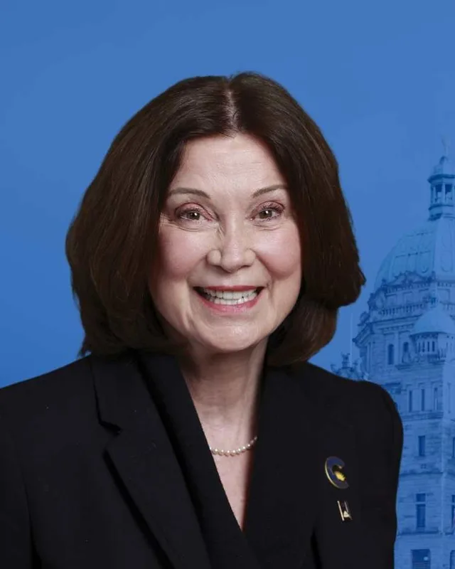MLA · North Vancouver-Seymour**Conservative Party of BC**Lynne Block
Researched by voche.meExplore the profile ](https://voche.me/bc/provincial-2026/candidates/lynne-block) [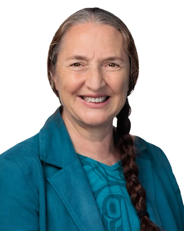MLA · North Vancouver-Seymour**BC NDP**Susie Chant
Researched by voche.meExplore the profile ](https://voche.me/bc/provincial-2026/candidates/susie-chant)
- People, 2021 census
- 61,845
- Area
- 391 km²
- Registered voters, 2024
- 46,159
- Turnout, 2024
- 66.64%
- Median age
- 44.0
- Median household income, 2020
- $124,000
THE DISTRICT
## Where North Vancouver-Seymour is
391 km² · 61,845 people
North Vancouver-Seymour lies on the north shore of Burrard Inlet, east of the Capilano River. The Electoral Boundaries Commission's 2023 final report says it includes the communities of Lynn Valley, Dollarton and Deep Cove and the Tsleil-Waututh First Nation. It also includes North Lonsdale and the area east of Lynn Creek. Burrard Inlet is its southern boundary and the Metro Vancouver Regional District is its northern boundary. The eastern border follows Indian Arm and Indian River. The western border follows the Trans-Canada Highway, Montroyal Boulevard, Mosquito Creek and the Capilano River. The report gives the area as 391 square kilometres and the population as 61,855.
The commission's map of the district labels Lynn Canyon Park, Lynn Headwaters Regional Park and Mount Seymour Provincial Park. It labels the Seymour River and Seymour Lake, and Palisade Lake and Burwell Lake. It marks Burrard Inlet 3, the Tsleil-Waututh Nation's reserve, and a second reserve named Inlailawatash 4A inside the boundary. It draws Dollarton Highway, Mount Seymour Parkway, Mountain Highway, Lynn Valley Road and Berkley Road. In the 2024 election, Elections BC's results file shows 14 voting places inside the district. They include the Lynn Valley Community Recreation Centre, Parkgate Community Centre, Karen Magnussen Community Recreation Centre, the Tsleil-Waututh Nation Gathering Place, North Lonsdale United Church and schools named Blueridge, Eastview, Upper Lynn, Ross Road and Boundary.
The 2021 census counted 43.7% of the district's homes as single-detached houses, and 77% of households owned their home. Among people who travelled to work, 82.1% used a car, truck or van and 8% used public transit. English was the first language of 72.4% of residents and Iranian Persian of 4.6%, and 2,820 residents were born in Iran.
- Lynn Valley
- Dollarton
- Deep Cove
- North Lonsdale
- The area east of Lynn Creek
- Tsleil-Waututh Nation (səlilwətaɬ)
- Burrard Inlet 3 Reserve (Tsleil-Waututh Nation)
Sources: [British Columbia Electoral Boundaries Commission (opens in a new tab)](https://elections.bc.ca/docs/rpt/BCEBC-Final-Report-April-3-2023.pdf), [Elections BC (opens in a new tab)](https://catalogue.data.gov.bc.ca/dataset/44914a35-de9a-4830-ac48-870001ef8935)
HISTORY
## The history of the area
Checked Thursday, October 8, 2026
### Tsleil-Waututh villages on Burrard Inlet and Indian Arm
The Tsleil-Waututh Nation's own name for itself is səlilwətaɬ, which it translates as the People of the Inlet. Its website gives the area its Ancestors occupied as 1,865 square kilometres, reaching north to Mount Garibaldi, east to Coquitlam Lake and west to Howe Sound. The Nation says its community is now centred on Burrard Inlet between Maplewood Flats and Deep Cove. It says that in autumn families camped on the Indian, Capilano and Seymour rivers to fish for pink and chum salmon. The commission's map shows the Indian River on the district's eastern edge, the Capilano River on its western edge and the Seymour River inside it.
The Nation names three villages beside one another on this shore: Squaw-uck, the Tsleil-Waututh Nation Indian Reserve No. 3, and Jol-gul-hook at Seymour Creek. BC Geographical Names places the reserve Burrard Inlet 3 on the north shore of Burrard Inlet, north of Berry Point. The North Shore Heritage Preservation Society writes that the ancestral village at what is now Cates Park was Whey-ah-wichen, which it translates as facing both directions or facing the wind.
The Nation says it continues to negotiate a treaty with Canada and British Columbia, a process that started in 1994, and that it has more than 600 members. It built an administration and health building in 2019. On October 25, 2019, it filed an Addition to Reserve with the federal government for 45 acres in Squaw-uck, to expand its reserve lands. In late September 2024 the Nation became the full owner of this land, named the stáʔtləw̓ District, at 2420 and 2452 Dollarton Highway across from Maplewood Flats.
Sources: [Tsleil-Waututh Nation (səlilwətaɬ) (opens in a new tab)](https://twnation.ca/about/), [Tsleil-Waututh Nation (səlilwətaɬ) (opens in a new tab)](https://twnation.ca/our-story/), [Tsleil-Waututh Nation (səlilwətaɬ) (opens in a new tab)](https://twnation.ca/additiontoreserve/), [BC Geographical Names Office (opens in a new tab)](https://apps.gov.bc.ca/pub/bcgnws/names/65003.html), [North Shore Heritage Preservation Society (opens in a new tab)](https://northshoreheritage.org/blog/2021/9/2/malcolm-lowry-a-dollarton-legacy), [British Columbia Electoral Boundaries Commission (opens in a new tab)](https://elections.bc.ca/docs/rpt/BCEBC-Final-Report-April-3-2023.pdf)
### John Linn and Lynn Creek, 1859 to 1891
BC Geographical Names records that Lynn Creek is named after Sapper John Linn of the Royal Engineers, who came to British Columbia in 1859 with the detachment sent after the Fraser River gold rush. Linn was born at Corstorphine, Edinburgh, on July 12, 1821. In 1869, the record says, he moved his family from New Westminster to a cottage on the north shore of Burrard Inlet just east of what is now Lynn Creek. He received Lot 204 as a free grant under the government's plan to reward soldier settlers. A survey made in 1869 labelled the creek Freds Creek. The record calls the spelling Lynn probably an error by the person who drew the map.
The North Shore Heritage Preservation Society says Linn died on 11 April 1876. His widow Mary Linn stayed on the land, raising cattle and oxen that hauled logs, until she sold it to Edward Mahon in 1891 for $22,000. The Society gives X̱á7elcha as the Squamish name for Lynn Creek. The Geographic Board of Canada adopted the name Lynn Creek in its 18th Report, dated 31 March 1924. MONOVA, the museum and archives of North Vancouver, says the District of North Vancouver was incorporated in 1891 and stretched from Horseshoe Bay in the west to Indian Arm in the east, leaving out Moodyville.
Sources: [BC Geographical Names Office (opens in a new tab)](https://apps.gov.bc.ca/pub/bcgnws/names/12170.html), [North Shore Heritage Preservation Society (opens in a new tab)](https://www.northshoreheritage.org/blog/2023/9/19/john-linn-and-his-promised-land), [MONOVA: Museum & Archives of North Vancouver (opens in a new tab)](https://monova.ca/education/history/)
### Shingle mills, the streetcar and Lynn Canyon Park, 1899 to 1920
A 1992 North Shore Heritage column in the North Shore News, written by Dorothy Foster, describes the first house in the Lynn Valley area. Julius M. Fromme began building it in 1899 on District Lot 2023, facing a road used by loggers. In 1907, the column says, Fromme bought the Hastings Shingle Company, renamed it the Lynn Valley Lumber Company and built a second mill at Lynn Valley Road and Mountain Highway. That company logged the west bank of Lynn Creek. The column adds that Fromme served as reeve from 1924 to 1930.
MONOVA says the streetcar line to Lynn Valley was completed in 1912 and that Lynn Canyon opened as a municipal park the same year. The first Lynn Valley Day was held on September 14, 1912. The McTavish brothers gave five hectares beside Lynn Creek, and the District of North Vancouver added four. A suspension bridge opened that year as well and cost 10 cents to cross. The Lynn Canyon Ecology Centre, which the District operates, says the bridge hangs 50 metres above Lynn Creek and is free to cross today.
MONOVA records that a building at 3203 Institute Road, designed by Henry Blackadder, opened in 1920 as Lynn Valley Elementary School. In 2006 it opened as the archives of North Vancouver, and MONOVA places those archives in Lynn Valley.
Sources: [North Shore News (opens in a new tab)](https://nsdl.arcabc.ca/_flysystem/repo-service/2025-03/39283-Extracted%20Text.txt), [MONOVA: Museum & Archives of North Vancouver (opens in a new tab)](https://monova.ca/wilderness-doorstep-vancouvers-mountain-playground-lynn-valley-suspension-bridge/), [MONOVA: Museum & Archives of North Vancouver (opens in a new tab)](https://monova.ca/education/history/), [Lynn Canyon Ecology Centre (District of North Vancouver) (opens in a new tab)](https://ecologycentre.ca/suspension-bridge/)
### The Dollar mill and Dollarton, 1916 to 1942
The North Shore Heritage Preservation Society writes that the Canadian Robert Dollar Company bought 100 acres on Indian Arm at Roche Point on November 9, 1916. The land could be reached only by boat. The society cites a report in the North Shore Press of April 6, 1917, that a wharf able to load two ships at once was under construction and that the mill was being fitted with machinery. MONOVA dates the opening of the mill to 1917 and says it closed in 1942.
Dollar built a town for the workers. The Society lists homes, bunkhouses, a post office, a store, a church and a school, and says the mill workers included Indigenous, Chinese, Japanese and Sikh men. It says the company paid for a $40,000 water system running from the Seymour River to the mill, and that 24 children were ready to start at the school in the fall of 1917. The place became known as Dollarton instead of Roche Point. BC Geographical Names records that the Dollarton post office opened on 17 July 1918.
Robert Dollar died in 1932, a decade before the mill shut down, according to the Society. It cites a North Shore Press report of June 2, 1933, that gave the mill 130 employees and a capacity of 150,000 feet of lumber a day. The names Dollar Road and Dollarton Highway remain.
Sources: [North Shore Heritage Preservation Society (opens in a new tab)](https://www.northshoreheritage.org/blog/2025/4/25/the-dollar-in-dollarton), [MONOVA: Museum & Archives of North Vancouver (opens in a new tab)](https://monova.ca/education/history/), [BC Geographical Names Office (opens in a new tab)](https://apps.gov.bc.ca/pub/bcgnws/names/18230.html)
### Malcolm Lowry, the shacks and Cates Park, 1939 to 1958
The North Shore Heritage Preservation Society says the British writer Malcolm Lowry arrived in Vancouver in 1939 with his wife. In 1940 they rented a small cabin built on piles at Lazy Bay, in an area of Dollarton that later became part of Cates Park. Lowry lived there until 1954. He finished the novel Under the Volcano at the cabin, and it was published in 1947. A fire destroyed the first cabin in 1944, and the Society says Lowry died in England in 1957.
Other squatters lived along this shore. The Society says the District of North Vancouver removed most of their shacks in 1958 to make way for Cates Park. MONOVA dates the dedication of Cates Park, also called Whey-ah-Wichen Park, to 1950 and says it was dedicated in memory of Charles H. Cates, founder of the Cates Towing Company. The Society adds that the park's entrance sign carries both names.
Sources: [North Shore Heritage Preservation Society (opens in a new tab)](https://northshoreheritage.org/blog/2021/9/2/malcolm-lowry-a-dollarton-legacy), [MONOVA: Museum & Archives of North Vancouver (opens in a new tab)](https://monova.ca/education/history/)
### Deep Cove and Mount Seymour, 1859 to 1936
BC Geographical Names says Captain G.H. Richards of the British Admiralty named Deep Cove in 1859 or 1860, during his survey of the inlet. A British Admiralty chart published in 1860 from his surveys labelled the long inlet it opens onto as North Arm. The name Indian Arm was approved in 1921 after the Vancouver Harbour Commissioners proposed it. The record adds that Spanish explorers in 1792 were told the name Sasamat, which was applied either to Indian Arm or to all of Burrard Inlet. A summer post office named Deep Water opened on 16 May 1927 and was renamed Deep Cove on 22 March 1940. MONOVA says Deep Cove was developing as a summer resort by 1930, with Corfield's Dance Hall, and that the Deep Cove Yacht Club formed in 1936.
Mount Seymour and the Seymour River carry the name of Frederick Seymour, who succeeded James Douglas as Governor of the Colony of British Columbia and held the office from 1864 to 1869. BC Geographical Names records the first recorded climb of the mountain on 16 August 1908, by a party of the BC Mountaineering Club. The Geographic Board of Canada adopted the name Seymour Creek in 1917, and the form Seymour River was adopted on 6 May 1947. BC Parks says most settlers around Vancouver knew little of the mountain until the late 1920s, that members of the Alpine Club of Canada explored it as a place to ski in 1929, and that the park was established in 1936. BC Geographical Names gives 31 January 1936 as the date of the order that created it.
Sources: [BC Geographical Names Office (opens in a new tab)](https://apps.gov.bc.ca/pub/bcgnws/names/13230.html), [BC Geographical Names Office (opens in a new tab)](https://apps.gov.bc.ca/pub/bcgnws/names/13228.html), [BC Geographical Names Office (opens in a new tab)](https://apps.gov.bc.ca/pub/bcgnws/names/1284.html), [MONOVA: Museum & Archives of North Vancouver (opens in a new tab)](https://monova.ca/education/history/), [BC Geographical Names Office (opens in a new tab)](https://apps.gov.bc.ca/pub/bcgnws/names/15303.html), [BC Geographical Names Office (opens in a new tab)](https://apps.gov.bc.ca/pub/bcgnws/names/15310.html), [BC Geographical Names Office (opens in a new tab)](https://apps.gov.bc.ca/pub/bcgnws/names/8179.html), [BC Parks (opens in a new tab)](https://bcparks.ca/mount-seymour-park/)
### The Seymour watershed and the water supply, 1926 to 2009
MONOVA records that the Greater Vancouver Water District was created in 1926 and drew water from the Capilano and Seymour River watersheds. Metro Vancouver's fact sheet says Seymour Falls Dam, on the Seymour River 18 kilometres north of Burrard Inlet, was built between 1959 and 1961 at a cost of $9.5 million. Its concrete section is 235 metres long and 30 metres high, and it stands upstream of the Lower Seymour Conservation Reserve. A seismic upgrade of the dam cost $44 million and ran from 2004 to 2007.
MONOVA says the Seymour-Capilano Filtration Plant began sending water to residents of Metro Vancouver in 2009 and treats water from the Capilano and Seymour watersheds. The commission's map of the district draws the Seymour River and Seymour Lake inside its boundary, and the district's northern boundary follows the Metro Vancouver Regional District.
Sources: [MONOVA: Museum & Archives of North Vancouver (opens in a new tab)](https://monova.ca/education/history/), [Metro Vancouver (opens in a new tab)](https://metrovancouver.org/services/water/Documents/seymour-falls-dam-fact-sheet.pdf), [British Columbia Electoral Boundaries Commission (opens in a new tab)](https://elections.bc.ca/docs/rpt/BCEBC-Final-Report-April-3-2023.pdf)
THE SEAT
## Who has held the seat
Legislative Assembly records, 35th Parliament onward
Elections BC's volume for 1871 to 1986 lists the Constitution Amendment Act (SBC 1966 c. 11), which increased the number of districts to 48 and the number of members to 55. The volume says the Act created new districts that included North Vancouver-Capilano and North Vancouver-Seymour. Before 1966 the volume prints a two-member district named North Vancouver, where James Gordon Gibson and Raymond Joseph Perrault, both of the Liberal Party, won in 1963. The first election in North Vancouver-Seymour had its polling day on 12 September 1966. Barrie Aird Clark of the Liberal Party won with 5,301 votes (39.61%), ahead of Murdo Frazer of the Social Credit Party with 4,607 (34.43%) and Harry Greene of the New Democratic Party with 3,137 (23.44%).
Clark won again in 1969 with 7,219 votes (39.06%). Colin Stuart Gabelmann of the New Democratic Party won in 1972 with 7,609 votes (32.89%), ahead of Derril Thomas Warren of the Progressive Conservative Party with 6,124 (26.47%) and Clark with 5,100 (22.05%). John (Jack) Davis of the Social Credit Party won in 1975 with 14,550 votes (53.49%), in 1979 with 11,049 (48.61%), in 1983 with 15,268 (59.16%) and in 1986 with 14,339 (55.92%). Daniel Jarvis of the Liberal Party won in 1991 with 12,120 votes (50.84%), ahead of Dominique Roelants of the New Democratic Party with 7,126 (29.89%). He won again in 1996 with 14,165 (56.35%), in 2001 with 15,568 (65.12%) and in 2005 with 14,518 (56.92%).
Jane Thornthwaite of the BC Liberal Party won in 2009 with 13,426 votes (59.18%), in 2013 with 13,186 (50.92%) and in 2017 with 13,194 (46.36%). Susie Chant of the BC NDP won in 2020 with 12,891 votes (46.84%) and in 2024 with 16,210 (52.77%), ahead of Sam Chandola of the Conservative Party with 10,995 (35.79%).
In 2023 the commission's final report placed North Lonsdale and the area east of Lynn Creek in North Vancouver-Seymour instead of North Vancouver-Lonsdale. The report gives the reason as space for expected growth around the urban core of North Vancouver. Appendix D of the report counts 57,100 people and 388 square kilometres in the district as it stood before, and the new district counts 61,855 people and 391 square kilometres. Elections BC's conversion table lists 70 voting areas that overlap the earlier North Vancouver-Seymour and 8 that overlap North Vancouver-Lonsdale.
Sources: [Elections BC (opens in a new tab)](https://elections.bc.ca/docs/rpt/1871-1986_ElectoralHistoryofBC.pdf), [Elections BC (opens in a new tab)](https://elections.bc.ca/docs/rpt/1987-2001-ElectionHistory.pdf), [Elections BC (opens in a new tab)](https://elections.bc.ca/docs/rpt/2002-2013-ElectionHistory.pdf), [Elections BC (opens in a new tab)](https://catalogue.data.gov.bc.ca/dataset/44914a35-de9a-4830-ac48-870001ef8935), [Elections BC (opens in a new tab)](https://elections.bc.ca/docs/rpt/statement-of-votes-2024-provincial-election.pdf), [British Columbia Electoral Boundaries Commission (opens in a new tab)](https://elections.bc.ca/docs/rpt/BCEBC-Final-Report-April-3-2023.pdf)
Members for North Vancouver-Seymour
| Parliament | It sat | Member | Elected as | Party on the legislature’s record |
| --- | --- | --- | --- | --- |
| 43rd | 2025 to 2026 | Susie Chant | BC NDP | BC NDP |
| 42nd | 2020 to 2024 | Susie Chant | BC NDP | BC NDP |
| 41st | 2017 to 2020 | Jane Thornthwaite | | BC Liberal Party |
| 40th | 2013 to 2017 | Jane Thornthwaite | BC Liberal Party | BC Liberal Party |
| 39th | 2009 to 2013 | Jane Thornthwaite | | BC Liberal Party |
| 38th | 2005 to 2009 | Daniel Jarvis | | BC Liberal Party |
| 37th | 2001 to 2005 | Daniel Jarvis | | BC Liberal Party |
| 36th | 1996 to 2001 | Daniel Jarvis | | BC Liberal Party |
| 35th | 1992 to 1996 | Daniel Jarvis | | BC Liberal Party |
“Elected as” is the affiliation Elections BC printed with the winning result. The last column is the party the legislature’s records give for that parliament, which differs when a member changed party while in office. A row with that column empty is a winner Elections BC prints whom the legislature’s records leave out. Source: [Legislative Assembly of British Columbia (opens in a new tab)](https://www.leg.bc.ca/members)
### Boundaries since 2024
North Vancouver-Seymour has 76 voting areas. 70 of them overlap the district of the same name used from 2017 to 2024. Others overlap these districts from 2017 to 2024: North Vancouver-Lonsdale (8).
The commission that drew the boundaries counted 61,855 people in the district, 15.0% above the average for a district, over 391 km².
Sources: [British Columbia Electoral Boundaries Commission, Final report, April 3, 2023 (opens in a new tab)](https://elections.bc.ca/docs/rpt/BCEBC-Final-Report-April-3-2023.pdf), [Elections BC, Voting area conversion table, 2017 to 2024 (opens in a new tab)](https://catalogue.data.gov.bc.ca/dataset/fb26db04-780c-4229-a147-da4fd5311d36)
PAST RESULTS
## Every result since 2005
From Elections BC
**2024 Provincial General Election**Susie Chant, BC NDP, 52.77%
| Candidate | Affiliation | Votes | Share |
| --- | --- | --- | --- |
| Susie ChantElected | BC NDP | 16,210 | 52.77% |
| Sam Chandola | Conservative Party | 10,995 | 35.79% |
| Mitchell Baker | Independent | 1,794 | 5.84% |
| Subhadarshi Tripathy | BC Green Party | 1,722 | 5.61% |
30,721 valid votes · 39 rejected ballots · 46,159 registered voters · 66.64% voted
**2020 General Election**Susie Chant, BC NDP, 46.84%
| Candidate | Affiliation | Votes | Share |
| --- | --- | --- | --- |
| Susie ChantElected | BC NDP | 12,891 | 46.84% |
| Jane Thornthwaite | BC Liberal Party | 9,827 | 35.70% |
| Harrison Johnston | BC Green Party | 4,514 | 16.40% |
| Clayton Welwood | Libertarian | 291 | 1.06% |
27,523 valid votes · 189 rejected ballots
**2017 General Election**Jane Ann Thornthwaite, BC Liberal Party, 46.36%
| Candidate | Affiliation | Votes | Share |
| --- | --- | --- | --- |
| Jane Ann ThornthwaiteElected | BC Liberal Party | 13,194 | 46.36% |
| Michael Rene Charrois | BC NDP | 9,808 | 34.47% |
| Joshua Johnson | BC Green Party | 5,208 | 18.30% |
| Clayton Welwood | Libertarian | 247 | 0.87% |
28,457 valid votes · 134 rejected ballots
**2013 General Election**Jane Thornthwaite, BC Liberal Party, 50.92%
| Candidate | Affiliation | Votes | Share |
| --- | --- | --- | --- |
| Jane ThornthwaiteElected | BC Liberal Party | 13,186 | 50.92% |
| Jim Hanson | BC NDP | 8,524 | 32.92% |
| Daniel Scott Smith | BC Green Party | 1,897 | 7.33% |
| Brian R. Wilson | Conservative | 1,206 | 4.66% |
| Jaime Alexandra Webbe | Independent | 1,081 | 4.17% |
25,894 valid votes · 89 rejected ballots
**2009 General Election**Jane Ann Thornthwaite, BC Liberal Party, 59.18%
| Candidate | Affiliation | Votes | Share |
| --- | --- | --- | --- |
| Jane Ann ThornthwaiteElected | BC Liberal Party | 13,426 | 59.18% |
| Mo Norton | BC NDP | 6,212 | 27.38% |
| Daniel Quinn | BC Green Party | 2,116 | 9.33% |
| Gary Bickling Hee | Conservative | 931 | 4.10% |
22,685 valid votes · 100 rejected ballots
**2005 General Election**Daniel Morrison Jarvis, BC Liberal Party, 56.92%
| Candidate | Affiliation | Votes | Share |
| --- | --- | --- | --- |
| Daniel Morrison JarvisElected | BC Liberal Party | 14,518 | 56.92% |
| Cathy Pinsent | BC NDP | 7,595 | 29.78% |
| John Sharpe | BC Green Party | 3,013 | 11.81% |
| Darin Keith Neal | BC Marijuana Party | 212 | 0.83% |
| Christine E. Ellis | Work Less Party | 169 | 0.66% |
25,507 valid votes · 110 rejected ballots
The boundaries changed before the 2009, 2017 and 2024 elections, so a result under the same name can cover a different area. Sources: [Elections BC, Provincial Voting Results (opens in a new tab)](https://catalogue.data.gov.bc.ca/dataset/44914a35-de9a-4830-ac48-870001ef8935), [Statement of Votes, 2024 Provincial General Election (opens in a new tab)](https://elections.bc.ca/docs/rpt/statement-of-votes-2024-provincial-election.pdf)
PEOPLE · 2021 CENSUS
## Who lives in North Vancouver-Seymour
61,845 residents · British Columbia beside each figure
### Age
- Median age
- 44.0BC 42.8
- Under 1516.8%BC 14.3%
- 15 to 6464.6%BC 65.3%
- 65 and over18.6%BC 20.3%
- 85 and over2.2%BC 2.4%
### Households
- Households
- 23,075
- People per household
- 2.7BC 2.4
#### Who lives together
- Couples with children34.8%BC 22.7%
- Couples without children25.3%BC 26.4%
- One-parent families8.2%BC 7.6%
- Multigenerational households2.8%BC 3.7%
- People living alone21.2%BC 29.4%
#### Household size
- 1 person21.2%BC 29.4%
- 2 persons32.5%BC 35.3%
- 3 persons18.3%BC 14.5%
- 4 persons19.7%BC 12.6%
- 5 or more persons8.3%BC 8.2%
### Homes
- Median home value
- $1,510,000BC $785,000
- Median monthly rent and utilities
- $1,800BC $1,370
- Median monthly cost for owners
- $1,900BC $1,320
#### Own or rent
- Own their home77.0%BC 66.8%
- Rent their home22.9%BC 32.8%
- Home provided by a local government or First Nation0.1%BC 0.5%
#### Type of home
- Single-detached house43.7%BC 42.4%
- Semi-detached house2.1%BC 3.1%
- Row house12.2%BC 8.3%
- Apartment or flat in a duplex17.0%BC 12.2%
- Apartment in a building that has fewer than five storeys14.4%BC 20.4%
- Apartment in a building that has five or more storeys10.6%BC 10.9%
#### When the home was built
- 1960 or earlier14.7%BC 12.5%
- 1961 to 198037.8%BC 27.0%
- 1981 to 199016.3%BC 14.2%
- 1991 to 200011.3%BC 16.5%
- 2001 to 20053.6%BC 6.0%
- 2006 to 20103.5%BC 8.0%
- 2011 to 20154.1%BC 6.6%
- 2016 to 20218.7%BC 9.1%
### Housing costs
- Renters paying 30% or more of income on housing39.9%BC 37.8%
- Owners paying 30% or more of income on housing19.7%BC 19.3%
- Renters in core housing need23.4%BC 24.7%
- Owners in core housing need7.0%BC 8.0%
- Renters in subsidized housing13.9%BC 11.0%
- Owners with a mortgage57.7%BC 57.5%
### Income
Income is for the year 2020.
- Median household income
- $124,000BC $85,000
- After tax
- $106,000BC $76,000
- Median income per person
- $51,600BC $40,800
#### Living on a low income (after-tax measure)
- All ages6.7%BC 10.8%
- Under 188.1%BC 11.3%
- 18 to 645.9%BC 9.7%
- 65 and over7.8%BC 13.8%
### Languages
#### First language learned
- English72.4%BC 67.1%
- Iranian Persian4.6%BC 0.9%
- Mandarin2.2%BC 4.1%
- Spanish1.8%BC 1.2%
- Yue (Cantonese)1.8%BC 3.9%
- Korean1.7%BC 1.2%
- French1.5%BC 1.2%
- German1.3%BC 1.0%
- Tagalog (Pilipino, Filipino)1.1%BC 1.7%
- Russian0.7%BC 0.6%
#### Spoken most often at home
- English84.4%BC 78.5%
- Iranian Persian3.0%BC 0.7%
- Mandarin1.6%BC 3.3%
- Korean1.2%BC 0.9%
- Spanish0.9%BC 0.6%
- Yue (Cantonese)0.8%BC 2.8%
- French0.7%BC 0.3%
- Tagalog (Pilipino, Filipino)0.6%BC 0.9%
#### English and French
- English only87.9%BC 90.1%
- English and French10.9%BC 6.6%
- Neither English nor French1.1%BC 3.3%
### Immigration
- Born outside Canada (immigrants)
- 29.7%BC 29.0%
- Non-permanent residents
- 2.1%BC 3.5%
#### Where immigrants were born
- Iran15.5%BC 3.2%
- United Kingdom14.2%BC 8.2%
- China6.8%BC 15.3%
- Philippines6.2%BC 9.2%
- United States of America5.6%BC 4.2%
- Korea, South4.5%BC 3.3%
- South Africa, Republic of4.0%BC 1.1%
- Germany3.3%BC 2.2%
- Hong Kong3.2%BC 5.5%
- India2.5%BC 13.8%
#### When immigrants arrived
- Arrived before 198023.6%BC 19.7%
- 1980 to 199011.4%BC 11.5%
- 1991 to 200020.1%BC 21.0%
- 2001 to 201021.5%BC 22.2%
- 2011 to 202123.5%BC 25.6%
#### Generations in Canada
- First generation33.6%BC 33.7%
- Second generation24.8%BC 21.7%
- Third generation or more41.6%BC 44.5%
### Identity and origins
- Indigenous identity
- 2.7%BC 5.9%
- Visible minority
- 25.9%BC 34.4%
#### Visible minority groups
- Chinese6.9%BC 11.2%
- West Asian5.4%BC 1.4%
- South Asian3.1%BC 9.6%
- Filipino2.6%BC 3.5%
- Korean2.0%BC 1.5%
- Latin American1.5%BC 1.3%
- Japanese1.4%BC 0.9%
- Multiple visible minorities1.3%BC 1.2%
- Black0.6%BC 1.3%
- Southeast Asian0.5%BC 1.5%
- Visible minority (other)0.4%BC 0.4%
- Arab0.2%BC 0.6%
#### Ethnic or cultural origins reported most often
- English25.7%BC 20.7%
- Scottish19.4%BC 15.8%
- Irish15.5%BC 12.8%
- German11.2%BC 11.0%
- Canadian9.8%BC 9.3%
- Chinese6.9%BC 10.5%
- French6.7%BC 6.4%
- British Isles6.6%BC 3.9%
- Italian4.9%BC 3.3%
- Iranian4.5%BC 1.0%
### Religion
- No religion56.5%BC 52.1%
- Christian35.0%BC 34.3%
- Muslim4.1%BC 2.6%
- Other religions1.2%BC 1.0%
- Jewish1.1%BC 0.5%
- Buddhist1.0%BC 1.7%
- Sikh0.7%BC 5.9%
- Hindu0.4%BC 1.7%
- Traditional Indigenous spirituality0.1%BC 0.2%
### Education
Highest level completed, ages 25 to 64.
- No certificate, diploma or degree2.2%BC 8.0%
- High school diploma17.9%BC 25.8%
- College, trades or other certificate below a bachelor’s degree29.0%BC 31.2%
- Bachelor’s degree or higher50.8%BC 35.0%
### Work
- In the labour force
- 67.5%BC 63.3%
- Employed
- 62.8%BC 57.9%
- Unemployment rate at the census
- 7.0%BC 8.4%
#### Industries with the most workers
- Professional, scientific and technical services15.6%BC 9.2%
- Health care and social assistance11.6%BC 12.3%
- Educational services9.4%BC 7.4%
- Retail trade9.1%BC 11.6%
- Construction7.2%BC 9.0%
- Finance and insurance5.5%BC 3.7%
- Public administration5.0%BC 5.5%
- Information and cultural industries5.0%BC 2.7%
#### Kinds of work
- Sales and service occupations21.1%BC 25.6%
- Business, finance and administration occupations21.0%BC 17.1%
- Occupations in education, law and social, community and government services14.8%BC 11.9%
- Trades, transport and equipment operators and related occupations11.8%BC 18.0%
- Natural and applied sciences and related occupations10.3%BC 8.0%
- Health occupations7.6%BC 7.7%
- Occupations in art, culture, recreation and sport7.3%BC 4.2%
- Legislative and senior management occupations3.1%BC 1.2%
- Occupations in manufacturing and utilities1.5%BC 3.4%
- Natural resources, agriculture and related production occupations1.5%BC 2.8%
### Getting to work
#### Where people worked
- Worked at home33.8%BC 22.6%
- Worked outside Canada0.4%BC 0.4%
- No fixed workplace address11.1%BC 15.3%
- Worked at a usual workplace54.7%BC 61.6%
#### How commuters travelled
- Car, truck or van82.1%BC 79.9%
- Public transit8.0%BC 9.3%
- On foot5.4%BC 6.5%
- Bicycle2.3%BC 2.0%
- Other method2.3%BC 2.3%
#### Length of the trip
- Less than 15 minutes26.3%BC 31.8%
- 15 to 29 minutes40.8%BC 34.0%
- 30 to 44 minutes21.9%BC 19.7%
- 45 to 59 minutes6.7%BC 7.3%
- 60 minutes and over4.4%BC 7.2%
### Moving
Where residents lived five years before the census.
- Lived at the same address63.8%BC 56.2%
- Moved within the same municipality11.6%BC 16.1%
- Moved from elsewhere in BC16.7%BC 17.0%
- Moved from another province2.5%BC 4.6%
- Moved from another country5.3%BC 6.1%
Counts in the census are rounded to the nearest 5, and shares are worked out from those counts. Source: [BC Stats, from Statistics Canada tabulations, 2021 Census Profile for BC Provincial Electoral Districts (2023 Redistribution) (opens in a new tab)](https://catalogue.data.gov.bc.ca/dataset/census-profiles-for-bc-provincial-electoral-districts)
QUESTIONS
## Questions about North Vancouver-Seymour
10 answers
### Where is North Vancouver-Seymour?
North Vancouver-Seymour is a provincial electoral district on the north shore of Burrard Inlet in British Columbia. The Electoral Boundaries Commission's 2023 final report gives its area as 391 square kilometres. Burrard Inlet is its southern boundary, the Metro Vancouver Regional District is its northern boundary, and its eastern border follows Indian Arm and Indian River. Its western border follows the Trans-Canada Highway, Montroyal Boulevard, Mosquito Creek and the Capilano River.
### Which communities are in North Vancouver-Seymour?
North Vancouver-Seymour includes the communities of Lynn Valley, Dollarton and Deep Cove and the Tsleil-Waututh First Nation, according to the commission's 2023 final report. It also includes North Lonsdale and the area east of Lynn Creek. Elections BC's 2024 results file lists 14 voting places in the district, among them the Lynn Valley Community Recreation Centre and the Tsleil-Waututh Nation Gathering Place.
### Who is the member of the legislature for North Vancouver-Seymour?
Susie Chant of the BC NDP won North Vancouver-Seymour in 2020 and again in 2024. Jane Thornthwaite of the BC Liberal Party held the seat before her, from 2009 to 2020. Daniel Jarvis of the BC Liberal Party sat for North Vancouver-Seymour from 1992 to 2009, according to the legislature's records of its members.
### How did North Vancouver-Seymour vote in 2024?
Susie Chant of the BC NDP won North Vancouver-Seymour in 2024 with 16,210 votes, 52.77% of the valid vote. Sam Chandola of the Conservative Party received 10,995 votes, 35.79%. Mitchell Baker, an Independent, received 1,794 votes, and Subhadarshi Tripathy of the BC Green Party received 1,722 votes. Turnout was 66.64% of 46,159 registered voters.
### How did the 2023 boundary change affect North Vancouver-Seymour?
The Electoral Boundaries Commission's 2023 final report added North Lonsdale and the area east of Lynn Creek to North Vancouver-Seymour, taking them from North Vancouver-Lonsdale. The district as it stood before counted 57,100 people in 388 square kilometres. The new North Vancouver-Seymour counts 61,855 people in 391 square kilometres, and its 76 voting areas include 8 that overlap the earlier North Vancouver-Lonsdale.
### When was the name North Vancouver-Seymour first used?
The name North Vancouver-Seymour was first used at the 28th general election, with polling day on 12 September 1966, after the Constitution Amendment Act of 1966 created the district. Barrie Aird Clark of the Liberal Party won it with 5,301 votes, 39.61%, ahead of Murdo Frazer of the Social Credit Party with 4,607 votes, 34.43%. Elections BC's volume for 1871 to 1986 prints the result.
### How many people live in North Vancouver-Seymour?
The 2021 census counted 61,845 people in North Vancouver-Seymour, with a median age of 44 compared with 42.8 across British Columbia. Immigrants made up 29.7% of the population. English was the first language of 72.4% of residents and Iranian Persian of 4.6%. Households that own their home made up 77% of the district's total.
### Whose traditional territory is North Vancouver-Seymour on?
North Vancouver-Seymour includes the Tsleil-Waututh First Nation, as the commission's 2023 final report names it. The Nation, səlilwətaɬ, says its community is centred on Burrard Inlet between Maplewood Flats and Deep Cove and that it never ceded or relinquished its responsibility for its traditional territory. The Nation has been negotiating a treaty with Canada and British Columbia since 1994.
### Where does the name Lynn Valley come from?
The North Shore Heritage Preservation Society says the name Lynn in Lynn Valley comes from John Linn, a Royal Engineers sapper and settler. BC Geographical Names records that Lynn Creek is named after him and that in 1869 he moved his family to a cottage just east of the creek. Lynn Valley is one of the communities the commission names inside North Vancouver-Seymour.
### What was the Dollar mill in Dollarton?
The Dollar mill was a sawmill on Indian Arm at Roche Point, in what is now Dollarton, a community inside North Vancouver-Seymour. The Canadian Robert Dollar Company bought the land on November 9, 1916, according to the North Shore Heritage Preservation Society. MONOVA says the mill opened in 1917 and closed in 1942. The community around it took the name Dollarton.
SOURCES
## Where this page comes from
Figures read Thursday, October 8, 2026
1. [2021 Census Profile for BC Provincial Electoral Districts (2023 Redistribution) (opens in a new tab)](https://catalogue.data.gov.bc.ca/dataset/census-profiles-for-bc-provincial-electoral-districts)BC Stats, from Statistics Canada tabulations · read Thursday, October 8, 2026
2. [Provincial Voting Results (opens in a new tab)](https://catalogue.data.gov.bc.ca/dataset/44914a35-de9a-4830-ac48-870001ef8935)Elections BC · read Thursday, October 8, 2026
3. [Statement of Votes, 2024 Provincial General Election (opens in a new tab)](https://elections.bc.ca/docs/rpt/statement-of-votes-2024-provincial-election.pdf)Elections BC · read Thursday, October 8, 2026
4. [Voting area conversion table, 2017 to 2024 (opens in a new tab)](https://catalogue.data.gov.bc.ca/dataset/fb26db04-780c-4229-a147-da4fd5311d36)Elections BC · read Thursday, October 8, 2026
5. [Final report, April 3, 2023 (opens in a new tab)](https://elections.bc.ca/docs/rpt/BCEBC-Final-Report-April-3-2023.pdf)British Columbia Electoral Boundaries Commission · read Thursday, October 8, 2026
6. [Members of the Legislative Assembly, 35th to 43rd Parliament (opens in a new tab)](https://www.leg.bc.ca/members)Legislative Assembly of British Columbia · read Thursday, October 8, 2026
7. [Final report, April 3, 2023 (opens in a new tab)](https://elections.bc.ca/docs/rpt/BCEBC-Final-Report-April-3-2023.pdf)British Columbia Electoral Boundaries Commission · read Thursday, October 8, 2026
8. [Electoral History of British Columbia, 1871 to 1986 (opens in a new tab)](https://elections.bc.ca/docs/rpt/1871-1986_ElectoralHistoryofBC.pdf)Elections BC · read Thursday, October 8, 2026
9. [Electoral History of British Columbia, Supplement, 1987 to 2001 (opens in a new tab)](https://elections.bc.ca/docs/rpt/1987-2001-ElectionHistory.pdf)Elections BC · read Thursday, October 8, 2026
10. [Electoral History of British Columbia, Supplement, 2002 to 2013 (opens in a new tab)](https://elections.bc.ca/docs/rpt/2002-2013-ElectionHistory.pdf)Elections BC · read Thursday, October 8, 2026
11. [Provincial Voting Results (opens in a new tab)](https://catalogue.data.gov.bc.ca/dataset/44914a35-de9a-4830-ac48-870001ef8935)Elections BC · read Thursday, October 8, 2026
12. [Statement of Votes, 2024 Provincial General Election (opens in a new tab)](https://elections.bc.ca/docs/rpt/statement-of-votes-2024-provincial-election.pdf)Elections BC · read Thursday, October 8, 2026
13. [About Tsleil-Waututh Nation (opens in a new tab)](https://twnation.ca/about/)Tsleil-Waututh Nation (səlilwətaɬ) · read Thursday, October 8, 2026
14. [Our Story (opens in a new tab)](https://twnation.ca/our-story/)Tsleil-Waututh Nation (səlilwətaɬ) · read Thursday, October 8, 2026
15. [stáʔtləw̓ District, Addition to Reserve (opens in a new tab)](https://twnation.ca/additiontoreserve/)Tsleil-Waututh Nation (səlilwətaɬ) · read Thursday, October 8, 2026
16. [Burrard Inlet 3, BC Geographical Names record (opens in a new tab)](https://apps.gov.bc.ca/pub/bcgnws/names/65003.html)BC Geographical Names Office · read Thursday, October 8, 2026
17. [Lynn Creek, BC Geographical Names record (opens in a new tab)](https://apps.gov.bc.ca/pub/bcgnws/names/12170.html)BC Geographical Names Office · read Thursday, October 8, 2026
18. [Dollarton, BC Geographical Names record (opens in a new tab)](https://apps.gov.bc.ca/pub/bcgnws/names/18230.html)BC Geographical Names Office · read Thursday, October 8, 2026
19. [Deep Cove (cove), BC Geographical Names record (opens in a new tab)](https://apps.gov.bc.ca/pub/bcgnws/names/13230.html)BC Geographical Names Office · read Thursday, October 8, 2026
20. [Deep Cove (community), BC Geographical Names record (opens in a new tab)](https://apps.gov.bc.ca/pub/bcgnws/names/13228.html)BC Geographical Names Office · read Thursday, October 8, 2026
21. [Indian Arm, BC Geographical Names record (opens in a new tab)](https://apps.gov.bc.ca/pub/bcgnws/names/1284.html)BC Geographical Names Office · read Thursday, October 8, 2026
22. [Mount Seymour, BC Geographical Names record (opens in a new tab)](https://apps.gov.bc.ca/pub/bcgnws/names/15303.html)BC Geographical Names Office · read Thursday, October 8, 2026
23. [Seymour River, BC Geographical Names record (opens in a new tab)](https://apps.gov.bc.ca/pub/bcgnws/names/15310.html)BC Geographical Names Office · read Thursday, October 8, 2026
24. [Mount Seymour Park, BC Geographical Names record (opens in a new tab)](https://apps.gov.bc.ca/pub/bcgnws/names/8179.html)BC Geographical Names Office · read Thursday, October 8, 2026
25. [Mount Seymour Park (opens in a new tab)](https://bcparks.ca/mount-seymour-park/)BC Parks · read Thursday, October 8, 2026
26. [Seymour Falls Dam fact sheet (opens in a new tab)](https://metrovancouver.org/services/water/Documents/seymour-falls-dam-fact-sheet.pdf)Metro Vancouver · read Thursday, October 8, 2026
27. [North Van History Highlights (opens in a new tab)](https://monova.ca/education/history/)MONOVA: Museum & Archives of North Vancouver · read Thursday, October 8, 2026
28. [Wilderness doorstep: Lynn Valley suspension bridge (opens in a new tab)](https://monova.ca/wilderness-doorstep-vancouvers-mountain-playground-lynn-valley-suspension-bridge/)MONOVA: Museum & Archives of North Vancouver · read Thursday, October 8, 2026
29. [The Lynn Canyon Suspension Bridge (opens in a new tab)](https://ecologycentre.ca/suspension-bridge/)Lynn Canyon Ecology Centre (District of North Vancouver) · read Thursday, October 8, 2026
30. [The dollar in Dollarton (opens in a new tab)](https://www.northshoreheritage.org/blog/2025/4/25/the-dollar-in-dollarton)North Shore Heritage Preservation Society · read Thursday, October 8, 2026
31. [John Linn and his promised land (opens in a new tab)](https://www.northshoreheritage.org/blog/2023/9/19/john-linn-and-his-promised-land)North Shore Heritage Preservation Society · read Thursday, October 8, 2026
32. [Malcolm Lowry: A Dollarton legacy (opens in a new tab)](https://northshoreheritage.org/blog/2021/9/2/malcolm-lowry-a-dollarton-legacy)North Shore Heritage Preservation Society · read Thursday, October 8, 2026
33. [North Shore Heritage: Fromme House, January 10, 1992 (opens in a new tab)](https://nsdl.arcabc.ca/_flysystem/repo-service/2025-03/39283-Extracted%20Text.txt)North Shore News · read Thursday, October 8, 2026
## Official information
From Elections BC
Your district
### [Check which district an address is in](https://elections.bc.ca/resources/maps/find-your-district/)
Look up your address to be sure this district is yours.
[Look it up (opens in a new tab)](https://elections.bc.ca/resources/maps/find-your-district/)
Candidates
### [The official candidate list](https://www.elections.bc.ca/docs/fin/GE-2026-10-24-Candidate-Website-Report.PDF)
The list this page is built from, published by Elections BC.
[Open the list (opens in a new tab)](https://www.elections.bc.ca/docs/fin/GE-2026-10-24-Candidate-Website-Report.PDF)
Voting
### [Where and when to vote](https://elections.bc.ca/2026-provincial-election/where-to-vote/)
Voting places and hours for general voting day and advance voting.
[Find your voting place (opens in a new tab)](https://elections.bc.ca/2026-provincial-election/where-to-vote/)
## Sitemap
See the full [sitemap](/bc/provincial-2026/sitemap.md) for all pages.