---
title: "Mid Island-Pacific Rim: candidates, history and census, BC provincial 2026 | voche.me"
canonical_url: "https://voche.me/bc/provincial-2026/races/mla/mid-island-pacific-rim"
last_updated: "2026-10-10T04:05:22.008Z"
meta:
description: "3 candidates in Mid Island-Pacific Rim, BC provincial 2026. Area history, results since 2017, past MLAs and the 2021 census."
"og:description": "3 candidates in Mid Island-Pacific Rim, BC provincial 2026. Area history, results since 2017, past MLAs and the 2021 census."
"og:title": "Mid Island-Pacific Rim: candidates, history and census, BC provincial 2026"
"twitter:description": "3 candidates in Mid Island-Pacific Rim, BC provincial 2026. Area history, results since 2017, past MLAs and the 2021 census."
"twitter:title": "Mid Island-Pacific Rim: candidates, history and census, BC provincial 2026"
---
**
MLA · BC PROVINCIAL 2026
# Mid Island-Pacific Rim.
3 candidates, one seat.
This district elects one MLA. Voters mark one name on Saturday, October 24, 2026, and the candidate with the most votes wins the seat.
Mid Island-Pacific Rim is a provincial electoral district that runs between both coasts of Vancouver Island. It takes in Tofino, Ucluelet, Bamfield, Port Alberni, Bowser and Cumberland, Denman and Hornby Islands, and the lands and communities of many Nuu-chah-nulth Nations. The 2021 census counted 58,795 people in it, and the Electoral Boundaries Commission gives its area as 11,846 square kilometres.
## The candidates
In alphabetical order
[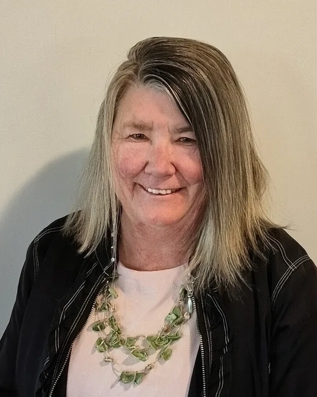MLA · Mid Island-Pacific Rim**BC Green Party**Gracie MacDonald
Researched by voche.meExplore the profile ](https://voche.me/bc/provincial-2026/candidates/gracie-macdonald) [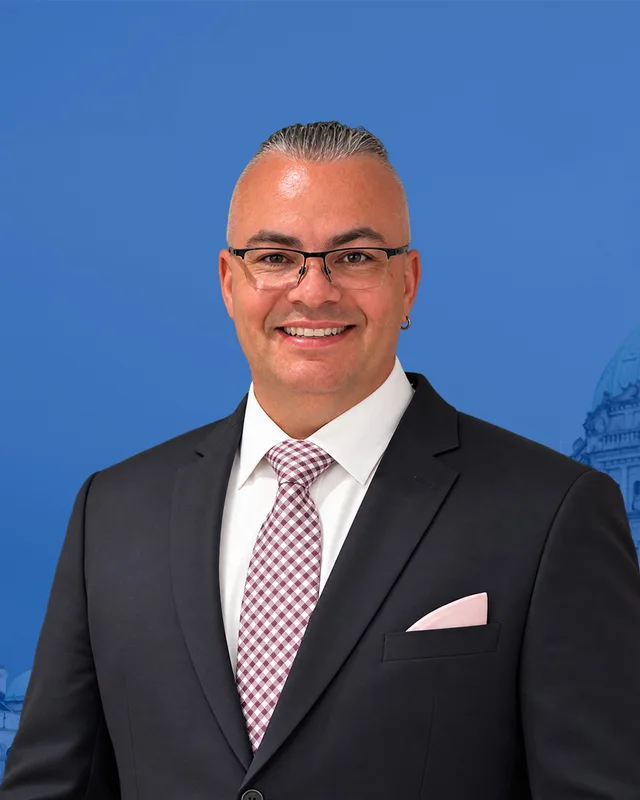MLA · Mid Island-Pacific Rim**Conservative Party of BC**Joshua Dahling
Researched by voche.meExplore the profile ](https://voche.me/bc/provincial-2026/candidates/joshua-dahling) [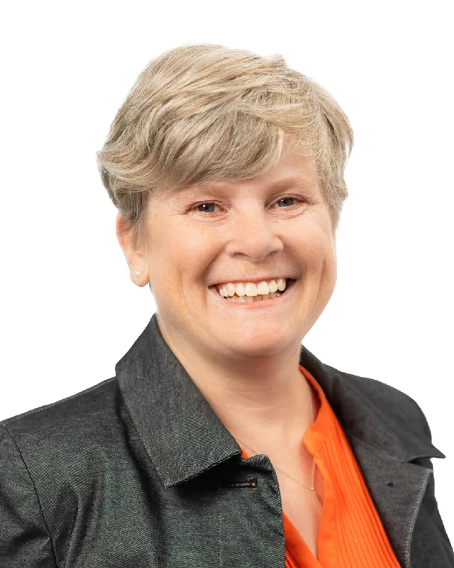MLA · Mid Island-Pacific Rim**BC NDP**Josie Osborne
Researched by voche.meExplore the profile ](https://voche.me/bc/provincial-2026/candidates/josie-osborne)
- People, 2021 census
- 58,795
- Area
- 11,846 km²
- Registered voters, 2024
- 47,816
- Turnout, 2024
- 60.37%
- Median age
- 48.8
- Median household income, 2020
- $70,000
THE DISTRICT
## Where Mid Island-Pacific Rim is
11,846 km² · 58,795 people
Mid Island-Pacific Rim reaches from the Strait of Georgia on the east coast of Vancouver Island to the west coast. The Electoral Boundaries Commission's 2023 final report says it includes Tofino, Ucluelet, Bamfield, Port Alberni, Bowser and Cumberland, as well as Denman and Hornby Islands. The northern boundary follows the borders of the Alberni-Clayoquot Regional District and the Village of Cumberland. In the south, the boundaries follow the Gordon River and the borders of the Cowichan Valley Regional District. The commission gives the district 58,783 people, 9.3% from the average district, and an area of 11,846 square kilometres.
BC Geographical Names places the main communities. Port Alberni is at the head of Alberni Inlet, Tofino is on the south side of Clayoquot Sound, Ucluelet is just north of Barkley Sound and Bamfield is on the south side of Barkley Sound. Cumberland is at the east end of Comox Lake, and the community of Denman Island is on the west side of Denman Island, south of Courtenay. The 2015 commission wrote that Cumberland would act as the main community of the eastern part of the district, in the way that Port Alberni does for the central part and Tofino and Ucluelet do for the west.
Roads, ferries, boats and planes join these places. Horsfield and Kennedy write that the road from Alberni to Tofino and Ucluelet, officially named Highway 4, opened in 1959. The District of Tofino says the town can be reached by road, air or seaplane, and Hesquiaht First Nation says Hot Springs Cove can be reached only by boat or by plane. The Islands Trust gives the ferry route between Hornby Island and Denman Island as 1.2 nautical miles, with a crossing time of 10 minutes.
- Port Alberni
- Tofino
- Ucluelet
- Bamfield
- Cumberland
- Bowser
- Denman Island
- Hornby Island
- Royston
- Fanny Bay
- Sproat Lake
- Coombs
- Errington
- Ahousaht
- Hot Springs Cove (Hesquiaht First Nation)
- Ditidaht
- Ahahswinis (Hupačasath First Nation)
Sources: [British Columbia Electoral Boundaries Commission (opens in a new tab)](https://elections.bc.ca/docs/rpt/BCEBC-Final-Report-April-3-2023.pdf), [British Columbia Electoral Boundaries Commission (opens in a new tab)](https://elections.bc.ca/docs/rpt/BC-EBC_Final_Report-Sept_24,_2015.pdf), [BC Geographical Names Office (opens in a new tab)](https://apps.gov.bc.ca/pub/bcgnws/names/19255.html), [BC Geographical Names Office (opens in a new tab)](https://apps.gov.bc.ca/pub/bcgnws/names/20919.html), [BC Geographical Names Office (opens in a new tab)](https://apps.gov.bc.ca/pub/bcgnws/names/24419.html), [BC Geographical Names Office (opens in a new tab)](https://apps.gov.bc.ca/pub/bcgnws/names/11066.html), [BC Geographical Names Office (opens in a new tab)](https://apps.gov.bc.ca/pub/bcgnws/names/6507.html), [BC Geographical Names Office (opens in a new tab)](https://apps.gov.bc.ca/pub/bcgnws/names/14470.html), [Harbour Publishing (Encyclopedia of BC) (opens in a new tab)](https://www.knowbc.com/limited/Books/Tofino-and-Clayoquot-Sound-A-History/Chapter-19-Lovely-Road), [District of Tofino (opens in a new tab)](https://www.tofino.ca/about-tofino), [Hesquiaht First Nation (opens in a new tab)](https://www.hesquiaht.ca/pages/our-story), [Islands Trust (opens in a new tab)](https://islandstrust.bc.ca/document/hornby-land-use-planning-information-sheet-2023/)
HISTORY
## The history of the area
Checked Thursday, October 8, 2026
### Nuu-chah-nulth Nations and K’ómoks territory, since time immemorial
Parks Canada says Nuu-chah-nulth means along the mountains and sea, and that it names the territories along a 300 km stretch of the west coast of Vancouver Island from Brooks Peninsula to Point-no-Point. The Nuu-chah-nulth are now 14 nations, each with an elected chief and council and with hereditary chiefs. Tseshaht (c̓išaaʔatḥ) says its people were created at c̓išaa, on Benson Island in the Broken Group Islands, and that its lands came to include central Barkley Sound, much of Alberni Inlet and the Alberni Valley. Hupačasath says its territory takes in the Alberni Valley and includes Port Alberni. Its territory page places Ahahswinis IR 1, the main residential reserve, on River Road within the city's boundaries.
Tla-o-qui-aht says its people have occupied Meares Island, Tofino and Long Beach, and the land as far as Sutton Pass on Highway 4 west of Port Alberni. Its administration is in Tofino and it gives its membership as more than 1200. Ahousaht (ʕaaḥuusʔatḥ) describes itself as one of fourteen Nuu-chah-nulth Nations, with more than 2,400 members. Hesquiaht First Nation says Hot Springs Cove is its most inhabited reserve. Ditidaht (diitiid7aa7tx) says its territory stretches from Cowichan Lake down Nitinaht Lake and along the coast between Bonilla Point and Pachena Point. Elections BC's 2024 results list voting places at Ahousaht, Ditidaht and Hot Springs Cove.
Huu-ay-aht keeps an office at Anacla and says that diseases brought by colonizers in the late 1700s and early 1800s reduced its people to fewer than 250. Toquaht (t̓uk̓ʷaaʔatḥ) names Toquaht Bay, Mayne Bay and Macoah Passage in western Barkley Sound as its ancestral lands. The Uchucklesaht Tribe Government describes its home as Uchucklesit Inlet of Barkley Sound. The Yuułuʔiłʔatḥ Government is in the community of Hitacu, on the eastern shore of Ucluelet Inlet.
On the east side, K’ómoks First Nation says its ancestors came to occupy territory from the Salmon River in the north to the Englishman River in the south, including Quadra, Denman and Hornby islands. The Islands Trust describes Hornby Island as the traditional territory of the K’omoks First Nation.
Sources: [Parks Canada (opens in a new tab)](https://parks.canada.ca/pn-np/bc/pacificrim/culture), [Tseshaht First Nation (opens in a new tab)](https://tseshaht.com/history-culture/history/), [Hupacasath First Nation (opens in a new tab)](https://hupacasath.ca/about-us/traditional-territory/), [Tla-o-qui-aht First Nation (opens in a new tab)](https://tla-o-qui-aht.org), [Tla-o-qui-aht First Nation (opens in a new tab)](https://tla-o-qui-aht.org/history), [Ahousaht First Nation (opens in a new tab)](https://ahousaht.ca), [Hesquiaht First Nation (opens in a new tab)](https://www.hesquiaht.ca/pages/our-story), [Ditidaht First Nation (opens in a new tab)](https://nitinaht.com/first-nation/our-history-culture/our-territory/), [Huu-ay-aht First Nations (opens in a new tab)](https://huuayaht.org/history/), [Toquaht Nation (opens in a new tab)](https://toquaht.ca/about/tradition-transcending-time/), [Uchucklesaht Tribe Government (opens in a new tab)](https://uchucklesaht.ca/community-culture/), [Yuułuʔiłʔatḥ Government (opens in a new tab)](https://www.ufn.ca), [K’ómoks First Nation (opens in a new tab)](https://komoks.ca/cultures/), [Islands Trust (opens in a new tab)](https://islandstrust.bc.ca/document/hornby-land-use-planning-information-sheet-2023/), [Elections BC (opens in a new tab)](https://catalogue.data.gov.bc.ca/dataset/44914a35-de9a-4830-ac48-870001ef8935)
### Alberni Inlet and the first sawmill, 1791 to 1912
BC Geographical Names records that Lieutenant Francisco Eliza named the inlet in 1791 after Pedro Alberni, who commanded the soldiers of the Spanish expedition, and that a sawmill was set up at the head of the inlet in 1860. The Dictionary of Canadian Biography says the mill, known as the Anderson mill, was built under Edward Stamp. Construction began in the summer of 1860, the mill was finished in May 1861, and its first export shipment went to Peru.
BC Geographical Names records that the New Alberni post office opened on 1 December 1900, one mile south of Alberni, and was renamed Port Alberni on 1 March 1910. Port Alberni was incorporated as a city on 12 March 1912.
Sources: [BC Geographical Names Office (opens in a new tab)](https://apps.gov.bc.ca/pub/bcgnws/names/19255.html), [Dictionary of Canadian Biography (opens in a new tab)](https://www.biographi.ca/en/bio/stamp_edward_10E.html), [Historica Canada, The Canadian Encyclopedia (opens in a new tab)](https://thecanadianencyclopedia.ca/en/article/port-alberni), [Tseshaht First Nation (opens in a new tab)](https://tseshaht.com/history-culture/history/)
### Union Colliery and Cumberland, 1888 to 1966
The Village of Cumberland says the Dunsmuir family's Union Colliery Company opened its No. 1 mine in 1888 and brought Chinese workers to build and work the mines and to build the Wellington Colliery Railway to the port at Union Bay. BC Geographical Names records that the settlement was first called Union, with a post office from 1 August 1889, and that James Dunsmuir renamed it Cumberland in 1891 after Cumberland County in England. It became a city on 1 January 1898.
The Village says Japanese miners settled west of Union from December 1891 and that No. 1 Japanese Town lasted from 1893 to 1942. In 1942 thirty-one families of that town were ordered to leave and were sent to internment camps. It dates Chinatown to 1888 to 1968 and says it became one of the largest Chinese communities in Canada by the end of the First World War. The Canadian Encyclopedia says Cumberland became a village in 1958 and that the last mine closed in 1966. In 2002 Weldwood Canada gave 104 acres that hold both sites to the Village, which runs them as Coal Creek Historic Park.
Sources: [Village of Cumberland (opens in a new tab)](https://cumberland.ca/coal-creek-historic-park/), [BC Geographical Names Office (opens in a new tab)](https://apps.gov.bc.ca/pub/bcgnws/names/6507.html), [Historica Canada, The Canadian Encyclopedia (opens in a new tab)](https://thecanadianencyclopedia.ca/en/article/cumberland)
### Lighthouses, the cable station and Bamfield, 1873 to 1972
Parks Canada says Canada built the Cape Beale Lighthouse in 1873 and the Carmanah Lighthouse in 1891, and that a telegraph line ran through the traditional territories of the Huu-ay-aht, Ditidaht and Pacheedaht. After the steamship Valencia sank in 1906 with the loss of more than 125 lives, the government built Pachena Lighthouse in 1907, set up lifesaving stations at Cloo-ose and Bamfield, and upgraded the telegraph route to the Dominion Life Saving Trail. In 1973 the lifesaving trail became part of Pacific Rim National Park Reserve as a hiking trail, the West Coast Trail.
The Bamfield Marine Sciences Centre records that the Pacific Cable Board's station at Bamfield, designed by Francis Mawson Rattenbury, was built in 1901 and 1902, and that the first two telegraph messages to go around the world were relayed on 1 November 1902. A new cable station opened in Port Alberni in 1959, and the last messages left Bamfield on 20 June 1959. The property was bought in 1969 and the first summer classes of the marine station ran in 1972. BC Geographical Names says Bamfield is a misspelling of the name of William Eddy Banfield, a trader on this coast who died in 1862.
Sources: [Parks Canada (opens in a new tab)](https://parks.canada.ca/pn-np/bc/pacificrim/activ/sco-wct), [Bamfield Marine Sciences Centre (opens in a new tab)](https://bamfieldmsc.com/bmsc-overview/history/), [BC Geographical Names Office (opens in a new tab)](https://apps.gov.bc.ca/pub/bcgnws/names/11066.html)
### Tofino, Ucluelet and the road from Alberni, 1788 to 1970
The District of Tofino says a Spanish expedition in the late 1700s recorded five large settlements in southern Clayoquot Sound, and that the British trader John Meares wrote of visiting Chief Wickaninnish at Echachist in 1788 and seeing 800 people gathered in one building. Tofino's first post office opened on 1 February 1909. BC Geographical Names records that Tofino became a village on 5 February 1932, and that Ucluelet's post office opened on 1 September 1894 and its village municipality began on 26 February 1952.
Horsfield and Kennedy write that on 22 August 1959 all 74 roadworthy vehicles of Tofino and Ucluelet drove together, carrying 300 passengers, over the new road to Alberni, which logging companies and the Department of Highways had taken five years to patch into a usable route. They write that the isolation of Tofino and Ucluelet effectively ended as traffic grew, and that the Tla-o-qui-aht felt the change most because large areas of their territory could be reached by road for the first time. Parks Canada says Pacific Rim National Park Reserve was established in 1970.
Sources: [District of Tofino (opens in a new tab)](https://www.tofino.ca/about-tofino), [BC Geographical Names Office (opens in a new tab)](https://apps.gov.bc.ca/pub/bcgnws/names/20919.html), [BC Geographical Names Office (opens in a new tab)](https://apps.gov.bc.ca/pub/bcgnws/names/24419.html), [Harbour Publishing (Encyclopedia of BC) (opens in a new tab)](https://www.knowbc.com/limited/Books/Tofino-and-Clayoquot-Sound-A-History/Chapter-19-Lovely-Road), [Parks Canada (opens in a new tab)](https://parks.canada.ca/pn-np/bc/pacificrim/activ/sco-wct)
### The paper mill, the 1964 tsunami and the 1967 merger
The Canadian Encyclopedia says Port Alberni became a major forestry centre after the Second World War and that its paper mill has run since 1947. It says the tsunami from the Good Friday earthquake in Alaska in 1964 moved up Alberni Inlet, washed away 55 houses and caused no deaths. The Alberni Valley Museum says the waves hit the twin cities of Alberni and Port Alberni shortly after midnight, and that dealing with the damage brought the two communities together and led them to amalgamate three years later. BC Geographical Names dates the merger to October 1967 and says the new city kept the name Port Alberni.
The Hesquiaht First Nation says the same earthquake sent waves into its village at Hot Springs Cove, where two of the 18 homes on the shore were not destroyed and nobody died. The people were displaced until 1972, when they moved to the east side of Refuge Cove, where the community remains.
Sources: [Historica Canada, The Canadian Encyclopedia (opens in a new tab)](https://thecanadianencyclopedia.ca/en/article/port-alberni), [Alberni Valley Museum (opens in a new tab)](https://communitystories.ca/projects/the-great-tsunami-of-1964), [BC Geographical Names Office (opens in a new tab)](https://apps.gov.bc.ca/pub/bcgnws/names/19255.html), [Hesquiaht First Nation (opens in a new tab)](https://www.hesquiaht.ca/pages/our-story)
### Meares Island and Clayoquot Sound, 1984 to 2000
Horsfield and Kennedy write that in November 1983 the province gave MacMillan Bloedel permission to log 90 percent of Meares Island. At the Meares Island Easter Festival in Tofino on 21 April 1984, Tla-o-qui-aht chief councillor Moses Martin declared the island a Tribal Park. The Tla-o-qui-aht and Ahousaht filed for their own injunction, and on 27 March 1985 the BC Court of Appeal froze all plans to log the island until First Nations claims could be resolved. The Tla-o-qui-aht say that since 1984 they have extended Tribal Park designations to all of their traditional territory, and that the Tribal Parks Guardians program began in 2008.
On 13 April 1993 Premier Mike Harcourt announced the Clayoquot Sound Land Use Decision, which let companies log 62 percent of the Sound. The Clayoquot Peace Camp opened on 1 July 1993, and the authors describe the protests that followed as the largest in Canadian history and the arrests as the largest mass arrests in the country. On 5 May 2000 a plaque in Pacific Rim National Park announced that the United Nations had designated Clayoquot Sound a biosphere reserve.
Sources: [Harbour Publishing (Encyclopedia of BC) (opens in a new tab)](https://www.knowbc.com/limited/Books/Tofino-and-Clayoquot-Sound-A-History/Chapter-21-The-War-in-the-Woods), [Tla-o-qui-aht Tribal Parks (opens in a new tab)](https://tribalparks.com/our-story)
### The Maa-nulth treaty and the Alberni residential school, 2006 to 2023
Five Nations negotiated the Maa-nulth treaty: Huu-ay-aht, Ka:’yu:’k’t’h’/Che:k’tles7et’h’, Toquaht, Uchucklesaht and Yuułuʔiłʔatḥ. The Maa-nulth timeline records that the treaty was initialled on 9 December 2006, that the Nations voted to enter it in October 2007, that British Columbia ratified it on 29 November 2007 and that Parliament gave Royal Assent on 18 June 2009. It took effect on 1 April 2011.
On 21 February 2023 Tseshaht First Nation released the first results of its search of the grounds of the former Alberni Indian Residential School in Port Alberni. Global News reported that the school operated from 1900 until 1973, that the Nation's records research showed 67 children died while at the school, and that ground-penetrating radar had found 17 geophysical features representing suspected graves in the area surveyed so far. The Tseshaht lead a project called ʔuuʔatumin yaqckʷiimitqin, which means Doing it for our Ancestors.
Sources: [Maa-nulth Treaty Nations (opens in a new tab)](https://maanulth.ca/?p=4701), [Government of British Columbia (opens in a new tab)](https://www2.gov.bc.ca/gov/content/environment/natural-resource-stewardship/consulting-with-first-nations/first-nations-negotiations/first-nations-a-z-listing/maa-nulth-first-nations), [Uchucklesaht Tribe Government (opens in a new tab)](https://uchucklesaht.ca/treaty/), [Toquaht Nation (opens in a new tab)](https://toquaht.ca/about/tradition-transcending-time/), [Global News (opens in a new tab)](https://globalnews.ca/news/9501204/former-alberni-indian-residential-school-children-deaths-tseshaht-first-nation/), [Tseshaht First Nation (opens in a new tab)](https://tseshaht.com/airs-team/)
THE SEAT
## Who has held the seat
Legislative Assembly records, 41st Parliament onward
Elections BC's volume for 1871 to 1986 first lists Alberni at the 1890 election, where Thomas Fletcher won with 29 votes (70.73%) against 12 (29.27%) for John C. Mollet. Howard Richmond McDiarmid of Social Credit won in 1966 with 6,039 votes (55.55%) and in 1969 with 7,209 votes (47.08%). Robert Evans Skelly of the New Democratic Party won in 1972 with 9,439 votes (53.69%) and again in 1975, 1979, 1983 and 1986. He resigned on 10 May 1988, and Gerard Janssen of the New Democratic Party won the by-election of 19 November 1988 with 6,401 votes (57.47%). Janssen won in 1991 with 7,136 votes (53.39%) and in 1996 with 7,398 votes (52.01%).
The volumes print the name Alberni-Qualicum for 2001, when Gillian Trumper of the Liberal Party won with 13,109 votes (53.32%) against 7,395 (30.08%) for Janssen. Scott Fraser of the New Democratic Party won Alberni-Qualicum in 2005 with 13,988 votes (52.60%). The name became Alberni-Pacific Rim in 2009, when Fraser won with 10,488 votes (59.36%), and he won again in 2013 with 10,569 votes (57.55%).
The 2015 commission's final report found Alberni-Pacific Rim to be 18% under the provincial average and the Comox Valley more than 22% over it. It proposed that the part of the Comox Valley Regional District from Royston and Cumberland south, with Hornby and Denman Islands, join the mid-island district, and that the district be named Mid Island-Pacific Rim. The report lists it at 52,833 people and 14,099 square kilometres. Bill 42 of 2015, the Electoral Districts Act, lists Mid Island-Pacific Rim in Schedule 1 and comes into force on the day the 40th Parliament is dissolved. Fraser won the district in 2017 with 12,556 votes (49.05%), and the Legislative Assembly's records list him for the 38th to 41st Parliaments. Josie Osborne of the BC NDP won in 2020 with 14,298 votes (58.22%) and in 2024 with 14,042 votes (48.74%), ahead of Adam Hayduk of the Conservative Party with 11,366 (39.45%). The records list Osborne for the 42nd and 43rd Parliaments.
The commission's 2023 final report proposed no changes to Courtenay-Comox and North Island and minor changes to Mid Island-Pacific Rim. It says it heard of strong ties between Cumberland, Courtenay and Comox as well as Denman and Hornby Islands, and that placing these communities in one district would have raised the population of Courtenay-Comox above the usual range. It also considered moving Coombs and Errington into Ladysmith-Oceanside and decided against it. The report lists the district at 58,783 people and 11,846 square kilometres, where its appendix for the 87 earlier districts lists the same population and 14,099 square kilometres. Elections BC's conversion table lists 81 voting areas in common with the former Mid Island-Pacific Rim, 3 with Courtenay-Comox, 3 with Nanaimo-North Cowichan, and 1 each with Cowichan Valley, North Island and Parksville-Qualicum.
Sources: [Elections BC (opens in a new tab)](https://elections.bc.ca/docs/rpt/1871-1986_ElectoralHistoryofBC.pdf), [Elections BC (opens in a new tab)](https://elections.bc.ca/docs/rpt/1987-2001-ElectionHistory.pdf), [Elections BC (opens in a new tab)](https://elections.bc.ca/docs/rpt/2002-2013-ElectionHistory.pdf), [Elections BC (opens in a new tab)](https://catalogue.data.gov.bc.ca/dataset/44914a35-de9a-4830-ac48-870001ef8935), [Elections BC (opens in a new tab)](https://elections.bc.ca/docs/rpt/statement-of-votes-2024-provincial-election.pdf), [Legislative Assembly of British Columbia (opens in a new tab)](https://www.leg.bc.ca/members), [British Columbia Electoral Boundaries Commission (opens in a new tab)](https://elections.bc.ca/docs/rpt/BC-EBC_Final_Report-Sept_24,_2015.pdf), [Legislative Assembly of British Columbia (opens in a new tab)](https://lims.leg.bc.ca/pdms/ldp/40th4th/1st_read/gov42-1.htm), [British Columbia Electoral Boundaries Commission (opens in a new tab)](https://elections.bc.ca/docs/rpt/BCEBC-Final-Report-April-3-2023.pdf)
Members for Mid Island-Pacific Rim
| Parliament | It sat | Member | Elected as | Party on the legislature’s record |
| --- | --- | --- | --- | --- |
| 43rd | 2025 to 2026 | Josie Osborne | BC NDP | BC NDP |
| 42nd | 2020 to 2024 | Josie Osborne | BC NDP | BC NDP |
| 41st | 2017 to 2020 | Scott Fraser | | BC NDP |
“Elected as” is the affiliation Elections BC printed with the winning result. The last column is the party the legislature’s records give for that parliament, which differs when a member changed party while in office. A row with that column empty is a winner Elections BC prints whom the legislature’s records leave out. Source: [Legislative Assembly of British Columbia (opens in a new tab)](https://www.leg.bc.ca/members)
### Boundaries since 2024
Mid Island-Pacific Rim has 81 voting areas. 81 of them overlap the district of the same name used from 2017 to 2024. Others overlap these districts from 2017 to 2024: Courtenay-Comox (3), Nanaimo-North Cowichan (3), Cowichan Valley (1), North Island (1), Parksville-Qualicum (1).
The commission that drew the boundaries counted 58,783 people in the district, 9.3% above the average for a district, over 11,846 km².
Sources: [British Columbia Electoral Boundaries Commission, Final report, April 3, 2023 (opens in a new tab)](https://elections.bc.ca/docs/rpt/BCEBC-Final-Report-April-3-2023.pdf), [Elections BC, Voting area conversion table, 2017 to 2024 (opens in a new tab)](https://catalogue.data.gov.bc.ca/dataset/fb26db04-780c-4229-a147-da4fd5311d36)
PAST RESULTS
## Every result since 2017
From Elections BC
**2024 Provincial General Election**Josie Osborne, BC NDP, 48.74%
| Candidate | Affiliation | Votes | Share |
| --- | --- | --- | --- |
| Josie OsborneElected | BC NDP | 14,042 | 48.74% |
| Adam Hayduk | Conservative Party | 11,366 | 39.45% |
| Ross Reid | BC Green Party | 3,402 | 11.81% |
28,810 valid votes · 58 rejected ballots · 47,816 registered voters · 60.37% voted
**2020 General Election**Josie Osborne, BC NDP, 58.22%
| Candidate | Affiliation | Votes | Share |
| --- | --- | --- | --- |
| Josie OsborneElected | BC NDP | 14,298 | 58.22% |
| Evan Jolicoeur | BC Green Party | 4,991 | 20.32% |
| Helen Poon | BC Liberal Party | 4,291 | 17.47% |
| Graham Hughes | Independent | 610 | 2.48% |
| Robert Alexander Clarke | Libertarian | 370 | 1.51% |
24,560 valid votes · 262 rejected ballots
**2017 General Election**Scott Kenneth Fraser, BC NDP, 49.05%
| Candidate | Affiliation | Votes | Share |
| --- | --- | --- | --- |
| Scott Kenneth FraserElected | BC NDP | 12,556 | 49.05% |
| Darren Frank DeLuca | BC Liberal Party | 6,576 | 25.69% |
| Alicia La Rue | BC Green Party | 5,208 | 20.35% |
| Julian Fell | Conservative | 878 | 3.43% |
| Robert Alexander Clarke | Libertarian | 294 | 1.15% |
| Dan Cebuliak | BC Refed | 86 | 0.34% |
25,598 valid votes · 119 rejected ballots
The boundaries changed before the 2009, 2017 and 2024 elections, so a result under the same name can cover a different area. Sources: [Elections BC, Provincial Voting Results (opens in a new tab)](https://catalogue.data.gov.bc.ca/dataset/44914a35-de9a-4830-ac48-870001ef8935), [Statement of Votes, 2024 Provincial General Election (opens in a new tab)](https://elections.bc.ca/docs/rpt/statement-of-votes-2024-provincial-election.pdf)
PEOPLE · 2021 CENSUS
## Who lives in Mid Island-Pacific Rim
58,795 residents · British Columbia beside each figure
### Age
- Median age
- 48.8BC 42.8
- Under 1514.2%BC 14.3%
- 15 to 6460.2%BC 65.3%
- 65 and over25.6%BC 20.3%
- 85 and over2.2%BC 2.4%
### Households
- Households
- 25,950
- People per household
- 2.2BC 2.4
#### Who lives together
- Couples with children17.9%BC 22.7%
- Couples without children31.8%BC 26.4%
- One-parent families7.6%BC 7.6%
- Multigenerational households2.3%BC 3.7%
- People living alone30.9%BC 29.4%
#### Household size
- 1 person30.9%BC 29.4%
- 2 persons40.4%BC 35.3%
- 3 persons13.4%BC 14.5%
- 4 persons9.7%BC 12.6%
- 5 or more persons5.5%BC 8.2%
### Homes
- Median home value
- $552,000BC $785,000
- Median monthly rent and utilities
- $990BC $1,370
- Median monthly cost for owners
- $860BC $1,320
#### Own or rent
- Own their home74.4%BC 66.8%
- Rent their home24.5%BC 32.8%
- Home provided by a local government or First Nation1.1%BC 0.5%
#### Type of home
- Single-detached house75.5%BC 42.4%
- Semi-detached house3.1%BC 3.1%
- Row house3.3%BC 8.3%
- Apartment or flat in a duplex4.0%BC 12.2%
- Apartment in a building that has fewer than five storeys6.7%BC 20.4%
- Apartment in a building that has five or more storeys0.5%BC 10.9%
- Other single-attached house0.3%BC 0.2%
- Movable dwelling6.5%BC 2.5%
#### When the home was built
- 1960 or earlier21.6%BC 12.5%
- 1961 to 198029.5%BC 27.0%
- 1981 to 199011.2%BC 14.2%
- 1991 to 200013.7%BC 16.5%
- 2001 to 20055.3%BC 6.0%
- 2006 to 20107.1%BC 8.0%
- 2011 to 20154.9%BC 6.6%
- 2016 to 20216.7%BC 9.1%
### Housing costs
- Renters paying 30% or more of income on housing35.8%BC 37.8%
- Owners paying 30% or more of income on housing14.6%BC 19.3%
- Renters in core housing need25.8%BC 24.7%
- Owners in core housing need6.2%BC 8.0%
- Renters in subsidized housing11.0%BC 11.0%
- Owners with a mortgage53.4%BC 57.5%
### Income
Income is for the year 2020.
- Median household income
- $70,000BC $85,000
- After tax
- $64,000BC $76,000
- Median income per person
- $36,800BC $40,800
#### Living on a low income (after-tax measure)
- All ages13.8%BC 10.8%
- Under 1816.4%BC 11.3%
- 18 to 6412.5%BC 9.7%
- 65 and over15.0%BC 13.8%
### Languages
#### First language learned
- English91.0%BC 67.1%
- French1.7%BC 1.2%
- German1.2%BC 1.0%
- Dutch0.6%BC 0.4%
- Punjabi (Panjabi)0.4%BC 4.9%
- Spanish0.3%BC 1.2%
- Nuu-chah-nulth (Nootka)0.3%BC 0.0%
- Italian0.3%BC 0.4%
- Tagalog (Pilipino, Filipino)0.3%BC 1.7%
- Polish0.2%BC 0.3%
#### Spoken most often at home
- English97.5%BC 78.5%
- French0.5%BC 0.3%
- Punjabi (Panjabi)0.2%BC 3.8%
- Vietnamese0.2%BC 0.4%
- German0.1%BC 0.1%
- Spanish0.1%BC 0.6%
- Korean0.1%BC 0.9%
- Yue (Cantonese)0.1%BC 2.8%
#### English and French
- English only93.2%BC 90.1%
- English and French6.6%BC 6.6%
- Neither English nor French0.2%BC 3.3%
### Immigration
- Born outside Canada (immigrants)
- 10.7%BC 29.0%
- Non-permanent residents
- 0.6%BC 3.5%
#### Where immigrants were born
- United Kingdom28.9%BC 8.2%
- United States of America13.2%BC 4.2%
- Germany8.7%BC 2.2%
- Netherlands5.5%BC 1.1%
- India3.8%BC 13.8%
- Oceania and other places of birth3.1%BC 2.3%
- South Africa, Republic of2.5%BC 1.1%
- Italy2.1%BC 0.9%
- Viet Nam2.0%BC 2.3%
- Philippines1.9%BC 9.2%
#### When immigrants arrived
- Arrived before 198053.6%BC 19.7%
- 1980 to 199012.3%BC 11.5%
- 1991 to 20009.4%BC 21.0%
- 2001 to 201011.0%BC 22.2%
- 2011 to 202113.7%BC 25.6%
#### Generations in Canada
- First generation12.1%BC 33.7%
- Second generation17.8%BC 21.7%
- Third generation or more70.1%BC 44.5%
### Identity and origins
- Indigenous identity
- 14.4%BC 5.9%
- Visible minority
- 4.4%BC 34.4%
#### Visible minority groups
- South Asian1.1%BC 9.6%
- Chinese0.6%BC 11.2%
- Filipino0.5%BC 3.5%
- Black0.5%BC 1.3%
- Latin American0.4%BC 1.3%
- Southeast Asian0.3%BC 1.5%
- Japanese0.3%BC 0.9%
- Korean0.2%BC 1.5%
- Multiple visible minorities0.2%BC 1.2%
- Visible minority (other)0.1%BC 0.4%
- West Asian0.1%BC 1.4%
- Arab0.1%BC 0.6%
#### Ethnic or cultural origins reported most often
- English31.0%BC 20.7%
- Scottish23.1%BC 15.8%
- Irish18.4%BC 12.8%
- German14.1%BC 11.0%
- Canadian12.6%BC 9.3%
- French10.2%BC 6.4%
- First Nations (North American Indian)6.4%BC 2.1%
- Dutch5.8%BC 3.9%
- British Isles4.8%BC 3.9%
- Ukrainian4.7%BC 4.3%
### Religion
- No religion67.9%BC 52.1%
- Christian27.7%BC 34.3%
- Other religions1.6%BC 1.0%
- Traditional Indigenous spirituality1.1%BC 0.2%
- Buddhist0.5%BC 1.7%
- Sikh0.4%BC 5.9%
- Jewish0.3%BC 0.5%
- Hindu0.2%BC 1.7%
- Muslim0.2%BC 2.6%
### Education
Highest level completed, ages 25 to 64.
- No certificate, diploma or degree13.4%BC 8.0%
- High school diploma30.1%BC 25.8%
- College, trades or other certificate below a bachelor’s degree38.2%BC 31.2%
- Bachelor’s degree or higher18.2%BC 35.0%
### Work
- In the labour force
- 56.1%BC 63.3%
- Employed
- 50.9%BC 57.9%
- Unemployment rate at the census
- 9.3%BC 8.4%
#### Industries with the most workers
- Health care and social assistance15.0%BC 12.3%
- Construction11.8%BC 9.0%
- Retail trade11.4%BC 11.6%
- Accommodation and food services8.9%BC 7.0%
- Public administration6.5%BC 5.5%
- Agriculture, forestry, fishing and hunting6.3%BC 2.3%
- Manufacturing5.7%BC 5.9%
- Professional, scientific and technical services5.6%BC 9.2%
#### Kinds of work
- Sales and service occupations26.3%BC 25.6%
- Trades, transport and equipment operators and related occupations22.6%BC 18.0%
- Business, finance and administration occupations11.5%BC 17.1%
- Occupations in education, law and social, community and government services11.0%BC 11.9%
- Health occupations9.0%BC 7.7%
- Natural resources, agriculture and related production occupations5.9%BC 2.8%
- Natural and applied sciences and related occupations5.0%BC 8.0%
- Occupations in manufacturing and utilities4.1%BC 3.4%
- Occupations in art, culture, recreation and sport3.6%BC 4.2%
- Legislative and senior management occupations1.1%BC 1.2%
### Getting to work
#### Where people worked
- Worked at home15.9%BC 22.6%
- Worked outside Canada0.2%BC 0.4%
- No fixed workplace address20.1%BC 15.3%
- Worked at a usual workplace63.8%BC 61.6%
#### How commuters travelled
- Car, truck or van86.2%BC 79.9%
- Public transit1.2%BC 9.3%
- On foot7.2%BC 6.5%
- Bicycle2.2%BC 2.0%
- Other method3.3%BC 2.3%
#### Length of the trip
- Less than 15 minutes52.8%BC 31.8%
- 15 to 29 minutes26.3%BC 34.0%
- 30 to 44 minutes10.7%BC 19.7%
- 45 to 59 minutes3.8%BC 7.3%
- 60 minutes and over6.4%BC 7.2%
### Moving
Where residents lived five years before the census.
- Lived at the same address56.9%BC 56.2%
- Moved within the same municipality11.6%BC 16.1%
- Moved from elsewhere in BC24.9%BC 17.0%
- Moved from another province5.0%BC 4.6%
- Moved from another country1.5%BC 6.1%
Counts in the census are rounded to the nearest 5, and shares are worked out from those counts. Source: [BC Stats, from Statistics Canada tabulations, 2021 Census Profile for BC Provincial Electoral Districts (2023 Redistribution) (opens in a new tab)](https://catalogue.data.gov.bc.ca/dataset/census-profiles-for-bc-provincial-electoral-districts)
QUESTIONS
## Questions about Mid Island-Pacific Rim
11 answers
### Where is Mid Island-Pacific Rim?
Mid Island-Pacific Rim is a provincial electoral district that runs between both coasts of Vancouver Island. The Electoral Boundaries Commission's 2023 final report says it includes Tofino, Ucluelet, Bamfield, Port Alberni, Bowser and Cumberland, as well as Denman and Hornby Islands. The commission gives the district 58,783 people and an area of 11,846 square kilometres.
### Which communities are in Mid Island-Pacific Rim?
According to the commission, Mid Island-Pacific Rim includes Tofino, Ucluelet, Bamfield, Port Alberni, Bowser, Cumberland, Denman Island and Hornby Island. Elections BC's 2024 results list 19 voting places in the district, among them places in Royston, Fanny Bay and Sproat Lake and buildings at Ahousaht, Ditidaht and Hot Springs Cove, which puts those communities inside it.
### Who is the MLA for Mid Island-Pacific Rim?
The Legislative Assembly's records list Josie Osborne of the BC NDP as the member for Mid Island-Pacific Rim in the 43rd Parliament. She won the seat in the 2024 provincial general election with 14,042 votes (48.74%). Adam Hayduk of the Conservative Party received 11,366 votes (39.45%) and Ross Reid of the BC Green Party received 3,402 (11.81%).
### Who held the Mid Island-Pacific Rim seat before Josie Osborne?
Scott Fraser of the BC NDP held the seat before Josie Osborne, under three names. Elections BC's volumes show him winning Alberni-Qualicum in 2005 with 13,988 votes (52.60%) and Alberni-Pacific Rim in 2009 and 2013. He won Mid Island-Pacific Rim in 2017 with 12,556 votes (49.05%). Osborne won the next election, in 2020, with 14,298 votes (58.22%).
### How did Mid Island-Pacific Rim vote in 2024?
In 2024 Josie Osborne of the BC NDP won Mid Island-Pacific Rim with 14,042 votes (48.74%). Adam Hayduk of the Conservative Party received 11,366 (39.45%) and Ross Reid of the BC Green Party received 3,402 (11.81%). Turnout was 60.37% of 47,816 registered voters, and Elections BC counted 28,810 valid votes.
### How did the boundaries of Mid Island-Pacific Rim change in 2023?
The Electoral Boundaries Commission's 2023 final report proposed minor changes to Mid Island-Pacific Rim and kept its name. It lists the district at 58,783 people, 9.3% from the average district, and 11,846 square kilometres. The report's appendix for the 87 earlier districts lists the same population and 14,099 square kilometres. The commission decided against moving Coombs and Errington into Ladysmith-Oceanside.
### What was Mid Island-Pacific Rim called before 2017?
Elections BC's volumes print the area as Alberni until 1996, Alberni-Qualicum in 2001 and 2005, and Alberni-Pacific Rim in 2009 and 2013. Bill 42 of 2015 lists Mid Island-Pacific Rim, and Elections BC's results files list it for the 2017 election. The 2015 commission added the Comox Valley Regional District from Royston and Cumberland south, with Hornby and Denman Islands.
### Whose territory is Mid Island-Pacific Rim on?
Many Nations have territory in Mid Island-Pacific Rim. Parks Canada counts 14 Nuu-chah-nulth nations on the west coast. Tseshaht and Hupačasath describe territory around the Alberni Valley, Tla-o-qui-aht describes territory around Tofino, and Ditidaht describes the coast from Bonilla Point to Pachena Point. K’ómoks First Nation describes territory that includes Denman and Hornby islands.
### Who lives in Mid Island-Pacific Rim?
The 2021 census counted 58,795 people in Mid Island-Pacific Rim. The median age was 48.8 years against 42.8 for British Columbia. Indigenous identity was reported by 14.4% of residents, which is 8,340 people, and 10.7% were immigrants against 29% in the province. In all, 185 residents named Nuu-chah-nulth as a mother tongue.
### What happened in Port Alberni in 1964?
A tsunami from the Good Friday earthquake in Alaska moved up Alberni Inlet in 1964 and struck Port Alberni, a city in Mid Island-Pacific Rim. The Canadian Encyclopedia says 55 houses were washed away and nobody died. The twin cities of Alberni and Port Alberni merged in October 1967, according to BC Geographical Names, and the new city kept the name Port Alberni.
### What is the Maa-nulth treaty?
The Maa-nulth treaty is a modern treaty between Canada, British Columbia and five Nuu-chah-nulth nations: Huu-ay-aht, Ka:’yu:’k’t’h’/Che:k’tles7et’h’, Toquaht, Uchucklesaht and Yuułuʔiłʔatḥ. It took effect on 1 April 2011. Toquaht names western Barkley Sound as its ancestral land, and the Yuułuʔiłʔatḥ Government is in the community of Hitacu on Ucluelet Inlet. Ucluelet and Bamfield, near Barkley Sound, are communities of Mid Island-Pacific Rim.
SOURCES
## Where this page comes from
Figures read Thursday, October 8, 2026
1. [2021 Census Profile for BC Provincial Electoral Districts (2023 Redistribution) (opens in a new tab)](https://catalogue.data.gov.bc.ca/dataset/census-profiles-for-bc-provincial-electoral-districts)BC Stats, from Statistics Canada tabulations · read Thursday, October 8, 2026
2. [Provincial Voting Results (opens in a new tab)](https://catalogue.data.gov.bc.ca/dataset/44914a35-de9a-4830-ac48-870001ef8935)Elections BC · read Thursday, October 8, 2026
3. [Statement of Votes, 2024 Provincial General Election (opens in a new tab)](https://elections.bc.ca/docs/rpt/statement-of-votes-2024-provincial-election.pdf)Elections BC · read Thursday, October 8, 2026
4. [Voting area conversion table, 2017 to 2024 (opens in a new tab)](https://catalogue.data.gov.bc.ca/dataset/fb26db04-780c-4229-a147-da4fd5311d36)Elections BC · read Thursday, October 8, 2026
5. [Final report, April 3, 2023 (opens in a new tab)](https://elections.bc.ca/docs/rpt/BCEBC-Final-Report-April-3-2023.pdf)British Columbia Electoral Boundaries Commission · read Thursday, October 8, 2026
6. [Members of the Legislative Assembly, 35th to 43rd Parliament (opens in a new tab)](https://www.leg.bc.ca/members)Legislative Assembly of British Columbia · read Thursday, October 8, 2026
7. [Final report, April 3, 2023 (opens in a new tab)](https://elections.bc.ca/docs/rpt/BCEBC-Final-Report-April-3-2023.pdf)British Columbia Electoral Boundaries Commission · read Thursday, October 8, 2026
8. [Final Report, September 24, 2015 (opens in a new tab)](https://elections.bc.ca/docs/rpt/BC-EBC_Final_Report-Sept_24,_2015.pdf)British Columbia Electoral Boundaries Commission · read Thursday, October 8, 2026
9. [Bill 42, 2015, Electoral Districts Act, first reading (opens in a new tab)](https://lims.leg.bc.ca/pdms/ldp/40th4th/1st_read/gov42-1.htm)Legislative Assembly of British Columbia · read Thursday, October 8, 2026
10. [Electoral History of British Columbia, 1871 to 1986 (opens in a new tab)](https://elections.bc.ca/docs/rpt/1871-1986_ElectoralHistoryofBC.pdf)Elections BC · read Thursday, October 8, 2026
11. [Electoral History of British Columbia, Supplement, 1987 to 2001 (opens in a new tab)](https://elections.bc.ca/docs/rpt/1987-2001-ElectionHistory.pdf)Elections BC · read Thursday, October 8, 2026
12. [Electoral History of British Columbia, Supplement, 2002 to 2013 (opens in a new tab)](https://elections.bc.ca/docs/rpt/2002-2013-ElectionHistory.pdf)Elections BC · read Thursday, October 8, 2026
13. [Provincial Voting Results (opens in a new tab)](https://catalogue.data.gov.bc.ca/dataset/44914a35-de9a-4830-ac48-870001ef8935)Elections BC · read Thursday, October 8, 2026
14. [Statement of Votes, 2024 Provincial General Election (opens in a new tab)](https://elections.bc.ca/docs/rpt/statement-of-votes-2024-provincial-election.pdf)Elections BC · read Thursday, October 8, 2026
15. [Members of the Legislative Assembly, 35th to 43rd Parliament (opens in a new tab)](https://www.leg.bc.ca/members)Legislative Assembly of British Columbia · read Thursday, October 8, 2026
16. [Culture and history, Pacific Rim National Park Reserve (opens in a new tab)](https://parks.canada.ca/pn-np/bc/pacificrim/culture)Parks Canada · read Thursday, October 8, 2026
17. [West Coast Trail: Hike of a lifetime (opens in a new tab)](https://parks.canada.ca/pn-np/bc/pacificrim/activ/sco-wct)Parks Canada · read Thursday, October 8, 2026
18. [History (opens in a new tab)](https://tseshaht.com/history-culture/history/)Tseshaht First Nation · read Thursday, October 8, 2026
19. [ʔuuʔatumin yaqckʷiimitqin (Doing it for our Ancestors) (opens in a new tab)](https://tseshaht.com/airs-team/)Tseshaht First Nation · read Thursday, October 8, 2026
20. [Traditional Territory (opens in a new tab)](https://hupacasath.ca/about-us/traditional-territory/)Hupacasath First Nation · read Thursday, October 8, 2026
21. [Welcome to Tla-o-qui-aht First Nation (opens in a new tab)](https://tla-o-qui-aht.org)Tla-o-qui-aht First Nation · read Thursday, October 8, 2026
22. [History (opens in a new tab)](https://tla-o-qui-aht.org/history)Tla-o-qui-aht First Nation · read Thursday, October 8, 2026
23. [Our Story (opens in a new tab)](https://tribalparks.com/our-story)Tla-o-qui-aht Tribal Parks · read Thursday, October 8, 2026
24. [Welcome to the official website of the ʕaaḥuusʔatḥ Nation (opens in a new tab)](https://ahousaht.ca)Ahousaht First Nation · read Thursday, October 8, 2026
25. [Hesquiaht First Nation Through Time (opens in a new tab)](https://www.hesquiaht.ca/pages/our-story)Hesquiaht First Nation · read Thursday, October 8, 2026
26. [Our Territory (opens in a new tab)](https://nitinaht.com/first-nation/our-history-culture/our-territory/)Ditidaht First Nation · read Thursday, October 8, 2026
27. [History (opens in a new tab)](https://huuayaht.org/history/)Huu-ay-aht First Nations · read Thursday, October 8, 2026
28. [Tradition Transcending Time (opens in a new tab)](https://toquaht.ca/about/tradition-transcending-time/)Toquaht Nation · read Thursday, October 8, 2026
29. [Community and Culture (opens in a new tab)](https://uchucklesaht.ca/community-culture/)Uchucklesaht Tribe Government · read Thursday, October 8, 2026
30. [Maa-nulth Treaty (opens in a new tab)](https://uchucklesaht.ca/treaty/)Uchucklesaht Tribe Government · read Thursday, October 8, 2026
31. [Yuułuʔiłʔatḥ Government (opens in a new tab)](https://www.ufn.ca)Yuułuʔiłʔatḥ Government · read Thursday, October 8, 2026
32. [K’ómoks First Nation Origin Stories and timeline (opens in a new tab)](https://komoks.ca/cultures/)K’ómoks First Nation · read Thursday, October 8, 2026
33. [Treaty Timeline (opens in a new tab)](https://maanulth.ca/?p=4701)Maa-nulth Treaty Nations · read Thursday, October 8, 2026
34. [Maa-nulth First Nations (opens in a new tab)](https://www2.gov.bc.ca/gov/content/environment/natural-resource-stewardship/consulting-with-first-nations/first-nations-negotiations/first-nations-a-z-listing/maa-nulth-first-nations)Government of British Columbia · read Thursday, October 8, 2026
35. [Hornby Island land use planning information sheet (opens in a new tab)](https://islandstrust.bc.ca/document/hornby-land-use-planning-information-sheet-2023/)Islands Trust · read Thursday, October 8, 2026
36. [Port Alberni, city (opens in a new tab)](https://apps.gov.bc.ca/pub/bcgnws/names/19255.html)BC Geographical Names Office · read Thursday, October 8, 2026
37. [Tofino, district municipality (opens in a new tab)](https://apps.gov.bc.ca/pub/bcgnws/names/20919.html)BC Geographical Names Office · read Thursday, October 8, 2026
38. [Ucluelet, district municipality (opens in a new tab)](https://apps.gov.bc.ca/pub/bcgnws/names/24419.html)BC Geographical Names Office · read Thursday, October 8, 2026
39. [Bamfield, community (opens in a new tab)](https://apps.gov.bc.ca/pub/bcgnws/names/11066.html)BC Geographical Names Office · read Thursday, October 8, 2026
40. [Cumberland, village (opens in a new tab)](https://apps.gov.bc.ca/pub/bcgnws/names/6507.html)BC Geographical Names Office · read Thursday, October 8, 2026
41. [Denman Island, community (opens in a new tab)](https://apps.gov.bc.ca/pub/bcgnws/names/14470.html)BC Geographical Names Office · read Thursday, October 8, 2026
42. [Stamp, Edward (opens in a new tab)](https://www.biographi.ca/en/bio/stamp_edward_10E.html)Dictionary of Canadian Biography · read Thursday, October 8, 2026
43. [Port Alberni (opens in a new tab)](https://thecanadianencyclopedia.ca/en/article/port-alberni)Historica Canada, The Canadian Encyclopedia · read Thursday, October 8, 2026
44. [Cumberland (opens in a new tab)](https://thecanadianencyclopedia.ca/en/article/cumberland)Historica Canada, The Canadian Encyclopedia · read Thursday, October 8, 2026
45. [The Great Tsunami of 1964 (opens in a new tab)](https://communitystories.ca/projects/the-great-tsunami-of-1964)Alberni Valley Museum · read Thursday, October 8, 2026
46. [Tseshaht First Nation’s research says at least 67 children died at Alberni Indian Residential School (opens in a new tab)](https://globalnews.ca/news/9501204/former-alberni-indian-residential-school-children-deaths-tseshaht-first-nation/)Global News · read Thursday, October 8, 2026
47. [Coal Creek Historic Park (opens in a new tab)](https://cumberland.ca/coal-creek-historic-park/)Village of Cumberland · read Thursday, October 8, 2026
48. [About Tofino (opens in a new tab)](https://www.tofino.ca/about-tofino)District of Tofino · read Thursday, October 8, 2026
49. [History (opens in a new tab)](https://bamfieldmsc.com/bmsc-overview/history/)Bamfield Marine Sciences Centre · read Thursday, October 8, 2026
50. [Tofino and Clayoquot Sound: A History, Chapter 19: Lovely Road (opens in a new tab)](https://www.knowbc.com/limited/Books/Tofino-and-Clayoquot-Sound-A-History/Chapter-19-Lovely-Road)Harbour Publishing (Encyclopedia of BC) · read Thursday, October 8, 2026
51. [Tofino and Clayoquot Sound: A History, Chapter 21: The War in the Woods (opens in a new tab)](https://www.knowbc.com/limited/Books/Tofino-and-Clayoquot-Sound-A-History/Chapter-21-The-War-in-the-Woods)Harbour Publishing (Encyclopedia of BC) · read Thursday, October 8, 2026
## Official information
From Elections BC
Your district
### [Check which district an address is in](https://elections.bc.ca/resources/maps/find-your-district/)
Look up your address to be sure this district is yours.
[Look it up (opens in a new tab)](https://elections.bc.ca/resources/maps/find-your-district/)
Candidates
### [The official candidate list](https://www.elections.bc.ca/docs/fin/GE-2026-10-24-Candidate-Website-Report.PDF)
The list this page is built from, published by Elections BC.
[Open the list (opens in a new tab)](https://www.elections.bc.ca/docs/fin/GE-2026-10-24-Candidate-Website-Report.PDF)
Voting
### [Where and when to vote](https://elections.bc.ca/2026-provincial-election/where-to-vote/)
Voting places and hours for general voting day and advance voting.
[Find your voting place (opens in a new tab)](https://elections.bc.ca/2026-provincial-election/where-to-vote/)
## Sitemap
See the full [sitemap](/bc/provincial-2026/sitemap.md) for all pages.