---
title: "Juan de Fuca-Malahat: candidates, history and census, BC provincial 2026 | voche.me"
canonical_url: "https://voche.me/bc/provincial-2026/races/mla/juan-de-fuca-malahat"
last_updated: "2026-10-10T04:05:18.171Z"
meta:
description: "5 candidates in Juan de Fuca-Malahat, BC provincial 2026. Area history, results since 2009, past MLAs and the 2021 census."
"og:description": "5 candidates in Juan de Fuca-Malahat, BC provincial 2026. Area history, results since 2009, past MLAs and the 2021 census."
"og:title": "Juan de Fuca-Malahat: candidates, history and census, BC provincial 2026"
"twitter:description": "5 candidates in Juan de Fuca-Malahat, BC provincial 2026. Area history, results since 2009, past MLAs and the 2021 census."
"twitter:title": "Juan de Fuca-Malahat: candidates, history and census, BC provincial 2026"
---
**
MLA · BC PROVINCIAL 2026
# Juan de Fuca-Malahat.
5 candidates, one seat.
This district elects one MLA. Voters mark one name on Saturday, October 24, 2026, and the candidate with the most votes wins the seat.
Juan de Fuca-Malahat is a provincial electoral district on the southwest coast of Vancouver Island. It runs along the Strait of Juan de Fuca from Metchosin and Sooke to Port Renfrew, and it takes in Shawnigan Lake, Mill Bay and Cobble Hill north of the Malahat Pass. The 2021 census counted 44,980 people in it, and the Electoral Boundaries Commission gives its area as 3,116 square kilometres. The name was first used at the 2024 general election.
## The candidates
In alphabetical order
[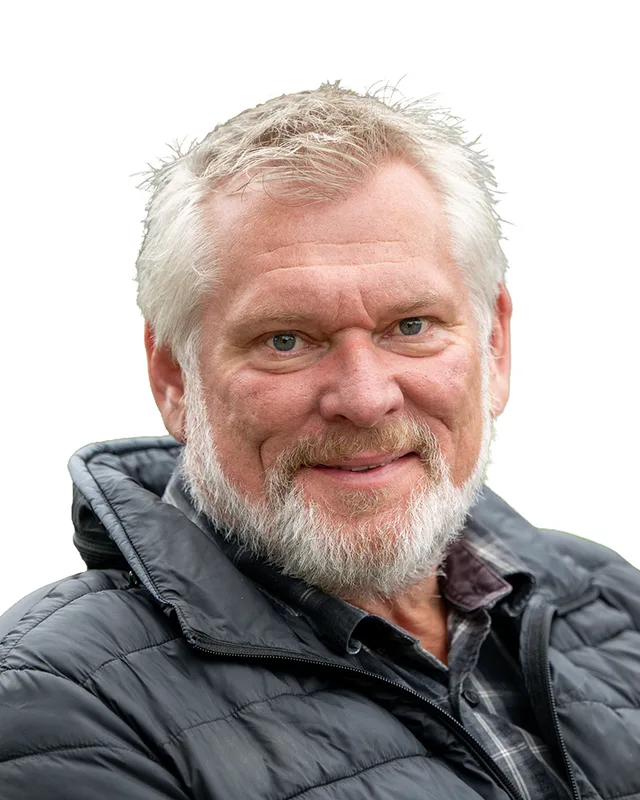MLA · Juan de Fuca-Malahat**BC NDP**Dana Lajeunesse
Researched by voche.meExplore the profile ](https://voche.me/bc/provincial-2026/candidates/dana-lajeunesse) [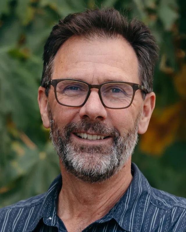MLA · Juan de Fuca-Malahat**BC Green Party**David Evans
Researched by voche.meExplore the profile ](https://voche.me/bc/provincial-2026/candidates/david-evans) [MLA · Juan de Fuca-Malahat**Christian Heritage Party of BC**Jeff Brown
Researched by voche.meExplore the profile ](https://voche.me/bc/provincial-2026/candidates/jeff-brown) [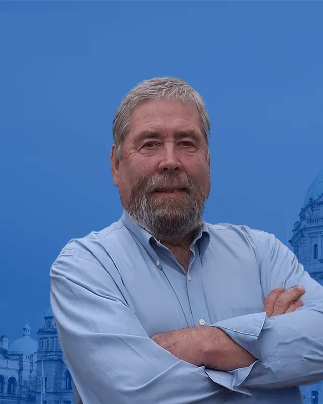MLA · Juan de Fuca-Malahat**Conservative Party of BC**Mike Hicks
Researched by voche.meExplore the profile ](https://voche.me/bc/provincial-2026/candidates/mike-hicks) [MLA · Juan de Fuca-Malahat**OneBC**Shane Friesen
On the official list. Research to come.Explore the profile ](https://voche.me/bc/provincial-2026/candidates/shane-friesen)
- People, 2021 census
- 44,980
- Area
- 3,116 km²
- Registered voters, 2024
- 37,078
- Turnout, 2024
- 64.81%
- Median age
- 48.4
- Median household income, 2020
- $93,000
THE DISTRICT
## Where Juan de Fuca-Malahat is
3,116 km² · 44,980 people
Juan de Fuca-Malahat lies on the southwest coast of Vancouver Island. The Electoral Boundaries Commission's 2023 final report says it includes communities along the Strait of Juan de Fuca and north of the Malahat Pass: Metchosin, Sooke, Port Renfrew, Shawnigan Lake, Mill Bay and Cobble Hill. Its boundary runs along the strait in the south and follows the municipal borders of Colwood, Langford and Highlands in the east. In the north it follows the boundaries of Cowichan Valley Regional District Electoral Area B. The commission gives the district an area of 3,116 square kilometres and a population of 44,980, which is 16.4% below the average district.
The district has two municipalities, the District of Sooke and the District of Metchosin. The Capital Regional District serves the unincorporated coast through its Juan de Fuca Electoral Area, which it places on the southwest coast of Vancouver Island and which includes East Sooke and Shirley. East Sooke Regional Park covers 1,474.04 hectares and has 50 kilometres of trails, among them a Coast Trail of 10 kilometres. Juan de Fuca Park holds the 47-kilometre Juan de Fuca Marine Trail, which runs from China Beach to Botanical Beach, and BC Parks says storm damage has closed parts of it at times.
The Capital Regional District's directions to East Sooke Regional Park say the Old Island Highway turns into Sooke Road, Highway 14. BC Transit route 64, the East Sooke Loop, runs from 17 Mile House to East Sooke Road on weekdays only. The SC’IȺNEW̱ Nation says a BC Transit route linking its community to Langford and East Sooke began in January 2022 and runs on weekdays. BC Geographical Names notes that 3 June 2011 was the 100th anniversary of the first car over the Malahat, the ridge and pass that give the district half of its name.
- Sooke
- Metchosin
- East Sooke
- Shirley
- Port Renfrew
- Shawnigan Lake
- Mill Bay
- Cobble Hill
- T’Sou-ke Nation
- SC’IȺNEW̱ Nation (Beecher Bay First Nation)
- Pacheedaht First Nation
Sources: [British Columbia Electoral Boundaries Commission (opens in a new tab)](https://elections.bc.ca/docs/rpt/BCEBC-Final-Report-April-3-2023.pdf), [Capital Regional District (opens in a new tab)](https://www.crd.ca/your-community/communities/juan-de-fuca), [Capital Regional District (opens in a new tab)](https://www.crd.ca/parks-recreation/find-park-or-trail/east-sooke-regional-park), [BC Parks (opens in a new tab)](https://bcparks.ca/juan-de-fuca-park/), [SC’IȺNEW̱ Nation (opens in a new tab)](https://scianew.com/history/), [BC Geographical Names Office (opens in a new tab)](https://apps.gov.bc.ca/pub/bcgnws/names/4645.html)
HISTORY
## The history of the area
Checked Thursday, October 8, 2026
### The Nations of the strait and the inlet
T’Sou-ke Nation says that in the SENĆOŦEN language T’Sou-ke is the name of the stickleback fish that lives in the estuary of the Sooke River. Its website gives its office as 1000 Soses Snanet Road in Sooke and describes a traditional territory that includes deMamiel, Charters, Ayum and Muir creeks and the Jordan River. BC Geographical Names records that early pioneers spelled the name Soke and Soake, and that T'sou-ke is the preferred form today.
SC’IȺNEW̱ Nation, also known as Beecher Bay First Nation, describes itself as a band government on a 307.70 hectare reserve on southern Vancouver Island. The Te'mexw Treaty Association places the community on Beecher Bay in East Sooke and says the name translates from the Klallam language as the place of the big fish. The Nation recognizes several languages and names SENĆOŦEN as its primary one.
Parks Canada says the Pacheedaht First Nation has used and stewarded the lands and waters of its territory, and places that territory along the southwest coast of Vancouver Island between Bonilla Point and Sheringham Point. It translates the name as People of the Sea Foam. The Capital Regional District writes the Nation's name as paaʔčiidʔatx̣ (Pacheedaht). The BC Treaty Commission lists a Port Renfrew address for the Nation and says its territory overlaps or is shared with that of the Ditidaht, Huu-ay-aht, T’Sou-ke and Lake Cowichan First Nations.
The Te'mexw Treaty Association writes the name of Malahat Nation as MÁLEXEȽ and places its reserve lands south of Mill Bay on the western shore of Saanich Inlet. It calls Malahat one of the five W̱SÁNEĆ Nations, whose ancestors held a territory that included the western shore of Saanich Inlet from Goldstream to Hatch Point. It says the name Malahat comes from the SENĆOŦEN word MÁLEXEȽ and the Hul’q’umi’num’ word Ma’le-‘h’xe’l’, both from the word for caterpillars and recalling a historic infestation. BC Geographical Names records other accounts, among them place of bait.
Sources: [T’Sou-ke First Nation (opens in a new tab)](https://www.tsoukenation.com/), [BC Geographical Names Office (opens in a new tab)](https://apps.gov.bc.ca/pub/bcgnws/names/19762.html), [SC’IȺNEW̱ Nation (opens in a new tab)](https://scianew.com/history/), [Te'mexw Treaty Association (opens in a new tab)](https://temexw.org/?p=341), [Te'mexw Treaty Association (opens in a new tab)](https://temexw.org/about/who-is-tta/), [Parks Canada (opens in a new tab)](https://www.canada.ca/en/parks-canada/news/2023/11/stewardship-of-abes-middle-beach-land-returned-to-pacheedaht-first-nation.html), [Capital Regional District (opens in a new tab)](https://www.crd.ca/projects/current-projects-initiatives/port-renfrew-official-community-plan), [BC Treaty Commission (opens in a new tab)](https://bctreaty.ca/pacheedaht-first-nation/), [Te'mexw Treaty Association (opens in a new tab)](https://temexw.org/about/who-is-tta/malahat/), [BC Geographical Names Office (opens in a new tab)](https://apps.gov.bc.ca/pub/bcgnws/names/4645.html)
### Voyages, a sawmill and a treaty, 1787 to 1864
BC Geographical Names records that Captain Charles William Barkley of the fur trading ship Imperial Eagle named the strait in 1787 after Juan de Fuca, a Greek pilot who, in the 1909 book the record quotes, sailed up it in 1592. The Spanish naval officer Manuel Quimper explored the area in 1790, and Captain Henry Kellett of HMS Herald surveyed Sooke Inlet in 1846 and named it after the people living there. The record for Metchosin says James Douglas of the Hudson's Bay Company mentioned that name after visiting the area in 1842. The Province lists a Douglas Treaty dated 1850 and 1854 for both T’Sou-ke Nation and Malahat Nation.
The Dictionary of Canadian Biography says John Muir, an Ayrshire coal-master recruited by the Hudson's Bay Company, settled at Sooke on farm land that Walter Colquhoun Grant had owned, returned to the Nanaimo coalfield in 1852, and retired to Sooke in 1854. In 1855 Muir, his son Andrew and his nephew Archibald acquired the engines and boilers of a wrecked steamship and built the island's first steam sawmill. By 1859 Muir and Company was exporting 40,000 board feet from its wharf. The family sold the mill in 1864, after a gold rush at Leech River distracted it, bought the mill back in 1867, and closed it in 1892. Muir sat for the Sooke district in the first assembly of Vancouver Island from 1856 to 1861. BC Geographical Names records that the Sooke post office opened on 8 August 1864.
Sources: [BC Geographical Names Office (opens in a new tab)](https://apps.gov.bc.ca/pub/bcgnws/names/25888.html), [BC Geographical Names Office (opens in a new tab)](https://apps.gov.bc.ca/pub/bcgnws/names/19762.html), [BC Geographical Names Office (opens in a new tab)](https://apps.gov.bc.ca/pub/bcgnws/names/38033.html), [Government of British Columbia (opens in a new tab)](https://www2.gov.bc.ca/gov/content/environment/natural-resource-stewardship/consulting-with-first-nations/first-nations-negotiations/first-nations-a-z-listing/t-sou-ke-nation), [Government of British Columbia (opens in a new tab)](https://www2.gov.bc.ca/gov/content/environment/natural-resource-stewardship/consulting-with-first-nations/first-nations-negotiations/first-nations-a-z-listing/malahat-nation), [Dictionary of Canadian Biography (opens in a new tab)](https://www.biographi.ca/en/bio/muir_john_11E.html)
### The railway, Shawnigan Lake and the Malahat road, 1885 to 1943
The Shawnigan Lake Museum says James Morton built Morton House in 1885 as a hunting and fishing lodge in anticipation of the Esquimalt and Nanaimo Railway. BC Geographical Names records that the railway opened in August 1886. The same office records three accounts of how Cobble Hill got its name, among them a note from the railway's own records that it came from nearby gravel hills, and says an 1859 map already labelled the hill.
The museum says the Shawnigan Lake Lumber Company began in the late 1880s beside the railway and that many men of its crew became the first settlers on the lake. The mill burned three times, was rebuilt in 1936 and closed on 14 August 1943. The Strathcona Hotel opened on 19 September 1900 after a fire during construction, and Shawnigan Lake School opened in 1916 with six students. One of them was Frances Margaret Oldham, later known as Dr. Frances Kelsey, and the local high school carries her name. A school built in 1893 was first called Malahat School and took the name Shawnigan School in 1914. The first car crossed the Malahat in 1911.
Sources: [Shawnigan Lake Museum (opens in a new tab)](https://www.shawniganlakemuseum.com/post/shawnigan-schools-hotels-and-stores), [BC Geographical Names Office (opens in a new tab)](https://apps.gov.bc.ca/pub/bcgnws/names/15595.html), [BC Geographical Names Office (opens in a new tab)](https://apps.gov.bc.ca/pub/bcgnws/names/37891.html), [Shawnigan Lake Museum (opens in a new tab)](https://www.shawniganlakemuseum.com/post/shawnigan-lake-lumber-company), [BC Geographical Names Office (opens in a new tab)](https://apps.gov.bc.ca/pub/bcgnws/names/4645.html)
### Botanical Beach, Port Renfrew and the Jordan River, 1895 to 2014
The Encyclopedia of Raincoast Place Names says Europeans settled the San Juan valley in the late 1880s and early 1890s, after the provincial government promised a road from Sooke. The community on Port San Juan was first called San Juan, was so often confused with San Juan Island that it was renamed Port Renfrew in 1895. A BC Parks brochure quoted by BC Geographical Names says the University of Minnesota chose Botanical Beach for a marine station in 1900, that students and researchers came for 7 years, and that the station closed in 1907 because access was difficult.
BC Hydro says the Jordan River Generating Station was built in 1911, was replaced by a new facility in 1971 and has a capacity of 170 megawatts. On 5 December 2014 BC Hydro released a seismic study of the places where its 79 dams stand. It found that the ground motion expected at Jordan River in an extreme earthquake is much greater than previously thought, because the site lies close to the Cascadia subduction zone, and that the Jordan River system has the highest seismic hazard within BC Hydro's system.
Sources: [KnowBC (opens in a new tab)](https://knowbc.com/limited/Books/The-Encyclopedia-of-Raincoast-Place-Names/P/Port-Renfrew), [BC Geographical Names Office (opens in a new tab)](https://apps.gov.bc.ca/pub/bcgnws/names/38561.html), [BC Hydro (opens in a new tab)](https://www.bchydro.com/energy-in-bc/operations/our-facilities/vancouver-island.html), [BC Hydro (opens in a new tab)](https://www.bchydro.com/energy-in-bc/operations/dam-safety/seismic-hazards/jordan-river-options.html)
### Parks and municipalities, 1970 to 1999
The Capital Regional District says East Sooke Regional Park was established in 1970. BC Geographical Names records that Juan de Fuca Marine Trail Park was established by Order in Council 454 on 4 April 1996 as a 47-kilometre corridor linking China Beach, Loss Creek, Parkinson Creek and Botanical Beach parks. A 1997 amendment to the Park Act joined the parks and trails into one Juan de Fuca Park, and a redescription of its boundary in 2004 gave it 1,528 hectares, 1,381 of upland and 147 of foreshore. BC Parks says the marine trail was created as a reminder of the 1994 Victoria Commonwealth Games and was originally part of a trail built to help people who survived shipwrecks.
BC Geographical Names records that the District of Metchosin was incorporated on 3 December 1984, with its boundaries reduced by letters patent on 8 March 2017. The District of Sooke was incorporated under Order in Council 1159 of 2 September 1999, effective 7 December 1999, and a boundary extension in 2004 added the Silver Spray development area on the east side of Sooke Inlet.
Sources: [Capital Regional District (opens in a new tab)](https://www.crd.ca/parks-recreation/find-park-or-trail/east-sooke-regional-park), [BC Geographical Names Office (opens in a new tab)](https://apps.gov.bc.ca/pub/bcgnws/names/54211.html), [BC Parks (opens in a new tab)](https://bcparks.ca/juan-de-fuca-park/), [BC Geographical Names Office (opens in a new tab)](https://apps.gov.bc.ca/pub/bcgnws/names/38033.html), [BC Geographical Names Office (opens in a new tab)](https://apps.gov.bc.ca/pub/bcgnws/names/19762.html)
### Treaty talks, forests deferred and land returned, 2013 to 2023
The Province lists Incremental Treaty Agreements dated 2013 for T’Sou-ke Nation, Malahat Nation and SC’IȺNEW̱ Nation, and a Te'mexw Treaty Association Agreement in Principle dated 2015. It places all three Nations in Stage 5, final agreement negotiations. SC’IȺNEW̱ Nation says it is working on its own treaty and constitution to address topics missed in the Douglas treaties, and that the treaty is expected to include Mary Hill, a 136-hectare piece of land held by the Department of National Defence. T’Sou-ke Nation says its solar projects have made it the most solar intensive community in Canada.
The BC Treaty Commission records a statement of intent from the Pacheedaht dated 4 June 1996 and a Ditidaht and Pacheedaht Agreement in Principle dated 28 June 2019. On 9 June 2021 the Province deferred old-growth logging for two years in the Fairy Creek watershed and the central Walbran area, which together span over 2,000 hectares, after the Pacheedaht, Ditidaht and Huu-ay-aht First Nations issued the Hišuk ma c̕awak Declaration on 7 June 2021. On 15 November 2023 Parks Canada and the Pacheedaht signed an agreement returning the use of Middle Beach, a 2.64-hectare tract of Pacific Rim National Park Reserve that lies between the Nation's reserves Pacheena 1 and Gordon River 2.
Sources: [Government of British Columbia (opens in a new tab)](https://www2.gov.bc.ca/gov/content/environment/natural-resource-stewardship/consulting-with-first-nations/first-nations-negotiations/first-nations-a-z-listing/t-sou-ke-nation), [Government of British Columbia (opens in a new tab)](https://www2.gov.bc.ca/gov/content/environment/natural-resource-stewardship/consulting-with-first-nations/first-nations-negotiations/first-nations-a-z-listing/malahat-nation), [Government of British Columbia (opens in a new tab)](https://www2.gov.bc.ca/gov/content/environment/natural-resource-stewardship/consulting-with-first-nations/first-nations-negotiations/first-nations-a-z-listing/scia-new-beecher-bay-first-nations), [SC’IȺNEW̱ Nation (opens in a new tab)](https://scianew.com/history/), [T’Sou-ke First Nation (opens in a new tab)](https://www.tsoukenation.com/), [BC Treaty Commission (opens in a new tab)](https://bctreaty.ca/pacheedaht-first-nation/), [Government of British Columbia (opens in a new tab)](https://news.gov.bc.ca/24654), [Parks Canada (opens in a new tab)](https://www.canada.ca/en/parks-canada/news/2023/11/stewardship-of-abes-middle-beach-land-returned-to-pacheedaht-first-nation.html)
THE SEAT
## Who has held the seat
Legislative Assembly records, 39th Parliament onward
Juan de Fuca-Malahat first appears on the 2024 ballot. The Electoral Boundaries Commission's 2023 final report recommended the name and said that joining the smaller communities along the Strait of Juan de Fuca (Metchosin, Sooke and Port Renfrew) with those north of the Malahat (Shawnigan Lake, Cobble Hill and Mill Bay) gives them more effective representation. Elections BC's conversion table matches the district's 57 voting areas to 27 in Langford-Juan de Fuca, 26 in Cowichan Valley, 7 in Esquimalt-Metchosin and 1 in Victoria-Beacon Hill, as those districts stood from 2017 to 2024. In 2024 Dana Lajeunesse of the BC NDP won with 9,308 votes (38.79%), ahead of Marina Sapozhnikov of the Conservative Party with 9,167 (38.2%) and David Evans of the BC Green Party with 5,522 (23.01%). Turnout was 64.81% of 37,078 registered voters. The Legislative Assembly's member records list Dana Lajeunesse for the 43rd Parliament, which they date from 18 February 2025 to 22 September 2026.
The name Malahat-Juan de Fuca appears in Elections BC's volume for 1987 to 2001 from the 1991 election. The volume's list of laws shows that the Electoral Districts Act of 1990 (SBC 1990 c. 39) was assented to on 27 July 1990 and set the schedule of 75 single-member districts, which took effect when the 35th Parliament was dissolved on 19 September 1991. Rick Kasper of the NDP won the district in 1991 with 8,579 votes (44.18%) and in 1996 with 10,686 votes (48.63%), and the volume notes that he sat as an Independent as of 10 October 2000. Brian J. Kerr of the Liberal Party won in 2001 with 9,676 votes (42.26%), ahead of Kasper, then listed as an Independent, with 5,164 (22.56%). John Horgan of the NDP won Malahat-Juan de Fuca in 2005 with 12,460 votes (46.09%), ahead of Cathy Basskin of the Liberal Party with 10,528 (38.94%).
According to the volume for 2002 to 2013, Royal Assent for the Electoral Districts Act (S.B.C. 2008, c.14) came on 1 May 2008. The Act established 85 districts, and they took effect on 14 April 2009. The district was named Juan de Fuca at the 2009 election, when Horgan won with 11,520 votes (57.21%), and again in 2013, when he won with 12,338 votes (53.32%). Elections BC's results list it as Langford-Juan de Fuca in 2017 and 2020, when Horgan won with 13,224 votes (52.75%) and then 18,073 votes (67.89%). At a 2023 by-election in Langford-Juan de Fuca, Ravi Parmar of the BC NDP won with 7,279 votes (53.39%).
Sources: [British Columbia Electoral Boundaries Commission (opens in a new tab)](https://elections.bc.ca/docs/rpt/BCEBC-Final-Report-April-3-2023.pdf), [Elections BC (opens in a new tab)](https://catalogue.data.gov.bc.ca/dataset/fb26db04-780c-4229-a147-da4fd5311d36), [Elections BC (opens in a new tab)](https://catalogue.data.gov.bc.ca/dataset/44914a35-de9a-4830-ac48-870001ef8935), [Elections BC (opens in a new tab)](https://elections.bc.ca/docs/rpt/statement-of-votes-2024-provincial-election.pdf), [Legislative Assembly of British Columbia (opens in a new tab)](https://www.leg.bc.ca/members), [Elections BC (opens in a new tab)](https://elections.bc.ca/docs/rpt/1987-2001-ElectionHistory.pdf), [Elections BC (opens in a new tab)](https://elections.bc.ca/docs/rpt/2002-2013-ElectionHistory.pdf)
Members for Juan de Fuca-Malahat
| Parliament | It sat | Member | Elected as | Party on the legislature’s record |
| --- | --- | --- | --- | --- |
| 43rd | 2025 to 2026 | Dana Lajeunesse | BC NDP | BC NDP |
Members for Langford-Juan de Fuca, which covered 27 of this district’s 57 voting areas before 2024
| Parliament | It sat | Member | Elected as | Party on the legislature’s record |
| --- | --- | --- | --- | --- |
| 42nd | 2020 to 2024 | John Horgan | BC NDP | BC NDP |
| 42nd | 2020 to 2024 | Ravi Parmar | BC NDP | BC NDP |
| 41st | 2017 to 2020 | John Horgan | BC NDP | BC NDP |
Members for Cowichan Valley, which covered 26 of this district’s 57 voting areas before 2024
| Parliament | It sat | Member | Elected as | Party on the legislature’s record |
| --- | --- | --- | --- | --- |
| 43rd | 2025 to 2026 | Qwulti'stunaat - Debra Toporowski | | BC NDP |
| 42nd | 2020 to 2024 | Sonia Furstenau | BC Green Party | BC Green Party |
| 41st | 2017 to 2020 | Sonia Furstenau | BC Green Party | BC Green Party |
| 40th | 2013 to 2017 | Bill Routley | BC NDP | BC NDP |
| 39th | 2009 to 2013 | Bill Routley | BC NDP | BC NDP |
“Elected as” is the affiliation Elections BC printed with the winning result. The last column is the party the legislature’s records give for that parliament, which differs when a member changed party while in office. A row with that column empty is a winner Elections BC prints whom the legislature’s records leave out. Source: [Legislative Assembly of British Columbia (opens in a new tab)](https://www.leg.bc.ca/members)
### Boundaries since 2024
Juan de Fuca-Malahat has 57 voting areas. They overlap these districts from 2017 to 2024: Langford-Juan de Fuca (27), Cowichan Valley (26), Esquimalt-Metchosin (7), Victoria-Beacon Hill (1).
The commission that drew the boundaries counted 44,980 people in the district, 16.4% below the average for a district, over 3,116 km².
Sources: [British Columbia Electoral Boundaries Commission, Final report, April 3, 2023 (opens in a new tab)](https://elections.bc.ca/docs/rpt/BCEBC-Final-Report-April-3-2023.pdf), [Elections BC, Voting area conversion table, 2017 to 2024 (opens in a new tab)](https://catalogue.data.gov.bc.ca/dataset/fb26db04-780c-4229-a147-da4fd5311d36)
PAST RESULTS
## Every result since 2009
From Elections BC
**2024 Provincial General Election**Dana Lajeunesse, BC NDP, 38.79%
| Candidate | Affiliation | Votes | Share |
| --- | --- | --- | --- |
| Dana LajeunesseElected | BC NDP | 9,308 | 38.79% |
| Marina Sapozhnikov | Conservative Party | 9,167 | 38.20% |
| David Evans | BC Green Party | 5,522 | 23.01% |
23,997 valid votes · 32 rejected ballots · 37,078 registered voters · 64.81% voted
### Langford-Juan de Fuca, 2017 to 2023
**2023 Langford-Juan de Fuca By-election**Ravi Parmar, BC NDP, 53.39%
| Candidate | Affiliation | Votes | Share |
| --- | --- | --- | --- |
| Ravi ParmarElected | BC NDP | 7,279 | 53.39% |
| Mike Harris | Conservative Party | 2,702 | 19.82% |
| Camille Currie | BC Green Party | 2,405 | 17.64% |
| Elena Lawson | BC United | 1,173 | 8.60% |
| Tyson Riel Strandlund | Communist Party of BC | 74 | 0.54% |
13,633 valid votes · 4 rejected ballots
**2020 General Election**John Horgan, BC NDP, 67.89%
| Candidate | Affiliation | Votes | Share |
| --- | --- | --- | --- |
| John HorganElected | BC NDP | 18,073 | 67.89% |
| Gord Baird | BC Green Party | 4,437 | 16.67% |
| Kelly Darwin | BC Liberal Party | 3,980 | 14.95% |
| Tyson Riel Strandlund | Communist Party of BC | 130 | 0.49% |
26,620 valid votes · 122 rejected ballots
**2017 General Election**John Horgan, BC NDP, 52.75%
| Candidate | Affiliation | Votes | Share |
| --- | --- | --- | --- |
| John HorganElected | BC NDP | 13,224 | 52.75% |
| Cathy Noel | BC Liberal Party | 6,544 | 26.11% |
| Brendan Ralfs | BC Green Party | 4,795 | 19.13% |
| Scott Burton | Libertarian | 262 | 1.05% |
| Willie Nelson | The Vancouver Island Party | 242 | 0.97% |
25,067 valid votes · 108 rejected ballots
### Cowichan Valley, 2009 to 2024
**2024 Provincial General Election**Debra Toporowski, BC NDP, 40.51%
| Candidate | Affiliation | Votes | Share |
| --- | --- | --- | --- |
| Debra ToporowskiElected | BC NDP | 11,795 | 40.51% |
| John Koury | Conservative Party | 10,946 | 37.59% |
| Cammy Lockwood | BC Green Party | 5,773 | 19.83% |
| Eden Haythornthwaite | Independent | 341 | 1.17% |
| Jon Coleman | No affiliation | 263 | 0.90% |
29,118 valid votes · 39 rejected ballots
**2020 General Election**Sonia Furstenau, BC Green Party, 44.21%
| Candidate | Affiliation | Votes | Share |
| --- | --- | --- | --- |
| Sonia FurstenauElected | BC Green Party | 13,059 | 44.21% |
| Rob Douglas | BC NDP | 11,875 | 40.20% |
| Tanya Kaul | BC Liberal Party | 4,606 | 15.59% |
29,540 valid votes · 150 rejected ballots
**2017 General Election**Sonia Furstenau, BC Green Party, 37.24%
| Candidate | Affiliation | Votes | Share |
| --- | --- | --- | --- |
| Sonia FurstenauElected | BC Green Party | 11,449 | 37.24% |
| Lori Lynn Iannidinardo | BC NDP | 9,723 | 31.63% |
| Steve Housser | BC Liberal Party | 8,502 | 27.66% |
| Ian Morrison | Independent | 502 | 1.63% |
| James Robert Anderson | Libertarian | 302 | 0.98% |
| Samuel Lockhart | Independent | 145 | 0.47% |
| Eden Haythornthwaite | Independent | 119 | 0.39% |
30,742 valid votes · 100 rejected ballots
**2013 General Election**Bill Routley, BC NDP, 40.14%
| Candidate | Affiliation | Votes | Share |
| --- | --- | --- | --- |
| Bill RoutleyElected | BC NDP | 10,696 | 40.14% |
| Steve Housser | BC Liberal Party | 9,299 | 34.90% |
| Kerry Davis | BC Green Party | 5,102 | 19.15% |
| Damir Wallener | Conservative | 1,223 | 4.59% |
| Heather Alanna Campbell | Independent | 326 | 1.22% |
26,646 valid votes · 86 rejected ballots
**2009 General Election**Bill Routley, BC NDP, 48.40%
| Candidate | Affiliation | Votes | Share |
| --- | --- | --- | --- |
| Bill RoutleyElected | BC NDP | 12,548 | 48.40% |
| Cathy Basskin | BC Liberal Party | 9,258 | 35.71% |
| Simon Lindley | BC Green Party | 3,058 | 11.79% |
| Stewart Jason Murray | Conservative | 924 | 3.56% |
| Michial Rupert Moore | BC Refed | 139 | 0.54% |
25,927 valid votes · 97 rejected ballots
The boundaries changed before the 2009, 2017 and 2024 elections, so a result under the same name can cover a different area. Sources: [Elections BC, Provincial Voting Results (opens in a new tab)](https://catalogue.data.gov.bc.ca/dataset/44914a35-de9a-4830-ac48-870001ef8935), [Statement of Votes, 2024 Provincial General Election (opens in a new tab)](https://elections.bc.ca/docs/rpt/statement-of-votes-2024-provincial-election.pdf)
PEOPLE · 2021 CENSUS
## Who lives in Juan de Fuca-Malahat
44,980 residents · British Columbia beside each figure
### Age
- Median age
- 48.4BC 42.8
- Under 1514.4%BC 14.3%
- 15 to 6462.0%BC 65.3%
- 65 and over23.6%BC 20.3%
- 85 and over1.9%BC 2.4%
### Households
- Households
- 18,155
- People per household
- 2.4BC 2.4
#### Who lives together
- Couples with children22.7%BC 22.7%
- Couples without children35.4%BC 26.4%
- One-parent families6.4%BC 7.6%
- Multigenerational households3.2%BC 3.7%
- People living alone22.9%BC 29.4%
#### Household size
- 1 person22.9%BC 29.4%
- 2 persons42.1%BC 35.3%
- 3 persons14.7%BC 14.5%
- 4 persons12.7%BC 12.6%
- 5 or more persons7.5%BC 8.2%
### Homes
- Median home value
- $750,000BC $785,000
- Median monthly rent and utilities
- $1,290BC $1,370
- Median monthly cost for owners
- $1,350BC $1,320
#### Own or rent
- Own their home84.1%BC 66.8%
- Rent their home15.4%BC 32.8%
- Home provided by a local government or First Nation0.5%BC 0.5%
#### Type of home
- Single-detached house76.9%BC 42.4%
- Semi-detached house3.6%BC 3.1%
- Row house2.3%BC 8.3%
- Apartment or flat in a duplex7.2%BC 12.2%
- Apartment in a building that has fewer than five storeys2.9%BC 20.4%
- Apartment in a building that has five or more storeys0.1%BC 10.9%
- Other single-attached house0.2%BC 0.2%
- Movable dwelling6.8%BC 2.5%
#### When the home was built
- 1960 or earlier8.3%BC 12.5%
- 1961 to 198024.7%BC 27.0%
- 1981 to 199015.8%BC 14.2%
- 1991 to 200018.1%BC 16.5%
- 2001 to 20057.0%BC 6.0%
- 2006 to 20109.7%BC 8.0%
- 2011 to 20158.1%BC 6.6%
- 2016 to 20218.5%BC 9.1%
### Housing costs
- Renters paying 30% or more of income on housing38.6%BC 37.8%
- Owners paying 30% or more of income on housing16.9%BC 19.3%
- Renters in core housing need25.0%BC 24.7%
- Owners in core housing need5.1%BC 8.0%
- Renters in subsidized housing6.4%BC 11.0%
- Owners with a mortgage59.7%BC 57.5%
### Income
Income is for the year 2020.
- Median household income
- $93,000BC $85,000
- After tax
- $82,000BC $76,000
- Median income per person
- $43,600BC $40,800
#### Living on a low income (after-tax measure)
- All ages8.3%BC 10.8%
- Under 188.7%BC 11.3%
- 18 to 647.4%BC 9.7%
- 65 and over10.1%BC 13.8%
### Languages
#### First language learned
- English92.1%BC 67.1%
- French1.4%BC 1.2%
- German1.2%BC 1.0%
- Dutch0.5%BC 0.4%
- Spanish0.4%BC 1.2%
- Polish0.2%BC 0.3%
- Tagalog (Pilipino, Filipino)0.2%BC 1.7%
- Mandarin0.2%BC 4.1%
- Japanese0.2%BC 0.4%
- Russian0.2%BC 0.6%
#### Spoken most often at home
- English98.0%BC 78.5%
- French0.3%BC 0.3%
- German0.2%BC 0.1%
- Spanish0.2%BC 0.6%
- Korean0.1%BC 0.9%
- Yue (Cantonese)0.1%BC 2.8%
- American Sign Language0.1%BC 0.0%
- Dutch0.1%BC 0.0%
#### English and French
- English only91.8%BC 90.1%
- English and French8.0%BC 6.6%
- Neither English nor French0.1%BC 3.3%
### Immigration
- Born outside Canada (immigrants)
- 12.7%BC 29.0%
- Non-permanent residents
- 0.4%BC 3.5%
#### Where immigrants were born
- United Kingdom36.1%BC 8.2%
- United States of America14.2%BC 4.2%
- Germany7.7%BC 2.2%
- Netherlands4.8%BC 1.1%
- Oceania and other places of birth3.6%BC 2.3%
- Philippines2.7%BC 9.2%
- China1.9%BC 15.3%
- Poland1.6%BC 1.0%
- South Africa, Republic of1.6%BC 1.1%
- India1.5%BC 13.8%
#### When immigrants arrived
- Arrived before 198048.9%BC 19.7%
- 1980 to 199011.8%BC 11.5%
- 1991 to 200010.6%BC 21.0%
- 2001 to 201015.4%BC 22.2%
- 2011 to 202113.2%BC 25.6%
#### Generations in Canada
- First generation14.5%BC 33.7%
- Second generation18.8%BC 21.7%
- Third generation or more66.8%BC 44.5%
### Identity and origins
- Indigenous identity
- 7.3%BC 5.9%
- Visible minority
- 4.4%BC 34.4%
#### Visible minority groups
- Chinese0.8%BC 11.2%
- South Asian0.6%BC 9.6%
- Black0.6%BC 1.3%
- Filipino0.6%BC 3.5%
- Latin American0.4%BC 1.3%
- Japanese0.4%BC 0.9%
- Multiple visible minorities0.3%BC 1.2%
- Southeast Asian0.3%BC 1.5%
- Visible minority (other)0.2%BC 0.4%
- West Asian0.1%BC 1.4%
- Korean0.1%BC 1.5%
- Arab0.0%BC 0.6%
#### Ethnic or cultural origins reported most often
- English36.5%BC 20.7%
- Scottish27.3%BC 15.8%
- Irish20.4%BC 12.8%
- German13.5%BC 11.0%
- Canadian12.7%BC 9.3%
- French9.5%BC 6.4%
- British Isles6.3%BC 3.9%
- Dutch5.5%BC 3.9%
- Ukrainian5.1%BC 4.3%
- Norwegian3.9%BC 2.8%
### Religion
- No religion65.7%BC 52.1%
- Christian31.4%BC 34.3%
- Other religions1.5%BC 1.0%
- Buddhist0.5%BC 1.7%
- Jewish0.3%BC 0.5%
- Muslim0.2%BC 2.6%
- Sikh0.2%BC 5.9%
- Traditional Indigenous spirituality0.2%BC 0.2%
- Hindu0.0%BC 1.7%
### Education
Highest level completed, ages 25 to 64.
- No certificate, diploma or degree9.5%BC 8.0%
- High school diploma28.9%BC 25.8%
- College, trades or other certificate below a bachelor’s degree40.0%BC 31.2%
- Bachelor’s degree or higher21.6%BC 35.0%
### Work
- In the labour force
- 60.0%BC 63.3%
- Employed
- 56.0%BC 57.9%
- Unemployment rate at the census
- 6.5%BC 8.4%
#### Industries with the most workers
- Construction14.1%BC 9.0%
- Health care and social assistance12.2%BC 12.3%
- Public administration10.5%BC 5.5%
- Retail trade10.4%BC 11.6%
- Educational services8.2%BC 7.4%
- Professional, scientific and technical services7.3%BC 9.2%
- Administrative and support, waste management and remediation services5.5%BC 4.2%
- Accommodation and food services5.2%BC 7.0%
#### Kinds of work
- Trades, transport and equipment operators and related occupations23.8%BC 18.0%
- Sales and service occupations21.9%BC 25.6%
- Business, finance and administration occupations15.1%BC 17.1%
- Occupations in education, law and social, community and government services13.1%BC 11.9%
- Health occupations7.7%BC 7.7%
- Natural and applied sciences and related occupations6.5%BC 8.0%
- Natural resources, agriculture and related production occupations4.5%BC 2.8%
- Occupations in art, culture, recreation and sport3.5%BC 4.2%
- Occupations in manufacturing and utilities2.4%BC 3.4%
- Legislative and senior management occupations1.6%BC 1.2%
### Getting to work
#### Where people worked
- Worked at home23.1%BC 22.6%
- Worked outside Canada0.2%BC 0.4%
- No fixed workplace address19.2%BC 15.3%
- Worked at a usual workplace57.5%BC 61.6%
#### How commuters travelled
- Car, truck or van90.8%BC 79.9%
- Public transit2.3%BC 9.3%
- On foot3.6%BC 6.5%
- Bicycle1.0%BC 2.0%
- Other method2.4%BC 2.3%
#### Length of the trip
- Less than 15 minutes24.1%BC 31.8%
- 15 to 29 minutes23.6%BC 34.0%
- 30 to 44 minutes24.9%BC 19.7%
- 45 to 59 minutes15.7%BC 7.3%
- 60 minutes and over11.8%BC 7.2%
### Moving
Where residents lived five years before the census.
- Lived at the same address58.3%BC 56.2%
- Moved within the same municipality8.1%BC 16.1%
- Moved from elsewhere in BC25.1%BC 17.0%
- Moved from another province6.9%BC 4.6%
- Moved from another country1.7%BC 6.1%
Counts in the census are rounded to the nearest 5, and shares are worked out from those counts. Source: [BC Stats, from Statistics Canada tabulations, 2021 Census Profile for BC Provincial Electoral Districts (2023 Redistribution) (opens in a new tab)](https://catalogue.data.gov.bc.ca/dataset/census-profiles-for-bc-provincial-electoral-districts)
QUESTIONS
## Questions about Juan de Fuca-Malahat
10 answers
### Where is Juan de Fuca-Malahat?
Juan de Fuca-Malahat is a provincial electoral district on the southwest coast of Vancouver Island, British Columbia. The Electoral Boundaries Commission's 2023 final report says it includes communities along the Strait of Juan de Fuca and north of the Malahat Pass. It covers 3,116 square kilometres, and the 2021 census counted 44,980 people in it. Its southern boundary runs along the strait.
### Which communities are in Juan de Fuca-Malahat?
Juan de Fuca-Malahat includes Metchosin, Sooke, Port Renfrew, Shawnigan Lake, Mill Bay and Cobble Hill, according to the Electoral Boundaries Commission's 2023 final report. Elections BC's 2024 statement of votes also lists voting places in East Sooke and Shirley. Three First Nations have communities there: T’Sou-ke Nation near Sooke, SC’IȺNEW̱ Nation in East Sooke and the Pacheedaht First Nation, which lists a Port Renfrew address.
### Who is the MLA for Juan de Fuca-Malahat?
Dana Lajeunesse of the BC NDP won Juan de Fuca-Malahat at the 2024 general election with 9,308 votes. The Legislative Assembly's member records list Dana Lajeunesse for the 43rd Parliament, which they date from 18 February 2025 to 22 September 2026. Marina Sapozhnikov of the Conservative Party came second with 9,167 votes, and David Evans of the BC Green Party third with 5,522.
### Who held the seat before Dana Lajeunesse?
Juan de Fuca-Malahat first appeared on the 2024 ballot, so no earlier member held it under this name. Elections BC's conversion table matches 27 of its voting areas to Langford-Juan de Fuca, where John Horgan of the BC NDP won in 2017 and 2020, and 26 to Cowichan Valley. Ravi Parmar of the BC NDP won a 2023 by-election in Langford-Juan de Fuca.
### How did Juan de Fuca-Malahat vote in 2024?
At the 2024 provincial general election Dana Lajeunesse of the BC NDP received 9,308 votes in Juan de Fuca-Malahat, or 38.79%. Marina Sapozhnikov of the Conservative Party received 9,167 votes, or 38.2%, and David Evans of the BC Green Party received 5,522 votes, or 23.01%. Elections BC records a turnout of 64.81% of the 37,078 registered voters.
### How did the 2023 boundary change affect Juan de Fuca-Malahat?
The Electoral Boundaries Commission's 2023 final report joined the smaller communities along the Strait of Juan de Fuca with those north of the Malahat into the new district of Juan de Fuca-Malahat. Elections BC's conversion table matches its 57 voting areas to 27 in Langford-Juan de Fuca, 26 in Cowichan Valley, 7 in Esquimalt-Metchosin and 1 in Victoria-Beacon Hill, as those districts stood from 2017 to 2024.
### Whose territory is Juan de Fuca-Malahat on?
Juan de Fuca-Malahat lies in the territories of several Nations, and each describes its own on its website. T’Sou-ke Nation is near Sooke and SC’IȺNEW̱ Nation is in East Sooke. Parks Canada places Pacheedaht territory along the southwest coast between Bonilla Point and Sheringham Point. The Te'mexw Treaty Association places Malahat Nation south of Mill Bay, on the western shore of Saanich Inlet.
### Who lives in Juan de Fuca-Malahat?
The 2021 census counted 44,980 people in Juan de Fuca-Malahat, with a median age of 48.4 against 42.8 for British Columbia. Owners live in 84.1% of homes and renters in 15.4%. Immigrants are 12.7% of residents, compared with 29% in the province, and 7.3% of residents identify as Indigenous. The United Kingdom is the most common country of birth among immigrants, with 2,025 people.
### Where does the name Juan de Fuca-Malahat come from?
Juan de Fuca-Malahat joins the names of the Strait of Juan de Fuca and the Malahat. BC Geographical Names records that Captain Charles William Barkley named the strait in 1787 after the Greek pilot Juan de Fuca. The Te'mexw Treaty Association says Malahat comes from the SENĆOŦEN word MÁLEXEȽ and the Hul’q’umi’num’ word Ma’le-‘h’xe’l’, both from the word for caterpillars.
### Was there a district called Malahat-Juan de Fuca before 2024?
Yes. Elections BC's volume for 1987 to 2001 prints Malahat-Juan de Fuca from the 1991 election. Rick Kasper of the NDP won it in 1991 and 1996, Brian J. Kerr of the Liberal Party won in 2001, and John Horgan of the NDP won in 2005. The district was named Juan de Fuca in 2009 and 2013, and Langford-Juan de Fuca in 2017 and 2020.
SOURCES
## Where this page comes from
Figures read Thursday, October 8, 2026
1. [2021 Census Profile for BC Provincial Electoral Districts (2023 Redistribution) (opens in a new tab)](https://catalogue.data.gov.bc.ca/dataset/census-profiles-for-bc-provincial-electoral-districts)BC Stats, from Statistics Canada tabulations · read Thursday, October 8, 2026
2. [Provincial Voting Results (opens in a new tab)](https://catalogue.data.gov.bc.ca/dataset/44914a35-de9a-4830-ac48-870001ef8935)Elections BC · read Thursday, October 8, 2026
3. [Statement of Votes, 2024 Provincial General Election (opens in a new tab)](https://elections.bc.ca/docs/rpt/statement-of-votes-2024-provincial-election.pdf)Elections BC · read Thursday, October 8, 2026
4. [Voting area conversion table, 2017 to 2024 (opens in a new tab)](https://catalogue.data.gov.bc.ca/dataset/fb26db04-780c-4229-a147-da4fd5311d36)Elections BC · read Thursday, October 8, 2026
5. [Final report, April 3, 2023 (opens in a new tab)](https://elections.bc.ca/docs/rpt/BCEBC-Final-Report-April-3-2023.pdf)British Columbia Electoral Boundaries Commission · read Thursday, October 8, 2026
6. [Members of the Legislative Assembly, 35th to 43rd Parliament (opens in a new tab)](https://www.leg.bc.ca/members)Legislative Assembly of British Columbia · read Thursday, October 8, 2026
7. [Final report, April 3, 2023 (opens in a new tab)](https://elections.bc.ca/docs/rpt/BCEBC-Final-Report-April-3-2023.pdf)British Columbia Electoral Boundaries Commission · read Thursday, October 8, 2026
8. [Electoral History of British Columbia, Supplement, 1987 to 2001 (opens in a new tab)](https://elections.bc.ca/docs/rpt/1987-2001-ElectionHistory.pdf)Elections BC · read Thursday, October 8, 2026
9. [Electoral History of British Columbia, Supplement, 2002 to 2013 (opens in a new tab)](https://elections.bc.ca/docs/rpt/2002-2013-ElectionHistory.pdf)Elections BC · read Thursday, October 8, 2026
10. [Provincial Voting Results (opens in a new tab)](https://catalogue.data.gov.bc.ca/dataset/44914a35-de9a-4830-ac48-870001ef8935)Elections BC · read Thursday, October 8, 2026
11. [Statement of Votes, 2024 Provincial General Election (opens in a new tab)](https://elections.bc.ca/docs/rpt/statement-of-votes-2024-provincial-election.pdf)Elections BC · read Thursday, October 8, 2026
12. [Voting area conversion table, 2017 to 2024 (opens in a new tab)](https://catalogue.data.gov.bc.ca/dataset/fb26db04-780c-4229-a147-da4fd5311d36)Elections BC · read Thursday, October 8, 2026
13. [Members of the Legislative Assembly, 35th to 43rd Parliament (opens in a new tab)](https://www.leg.bc.ca/members)Legislative Assembly of British Columbia · read Thursday, October 8, 2026
14. [Home page (opens in a new tab)](https://www.tsoukenation.com/)T’Sou-ke First Nation · read Thursday, October 8, 2026
15. [Our History & Accomplishments (opens in a new tab)](https://scianew.com/history/)SC’IȺNEW̱ Nation · read Thursday, October 8, 2026
16. [Who We Are (opens in a new tab)](https://temexw.org/about/who-is-tta/)Te'mexw Treaty Association · read Thursday, October 8, 2026
17. [Beecher Bay (SC’IȺNEW̱) (opens in a new tab)](https://temexw.org/?p=341)Te'mexw Treaty Association · read Thursday, October 8, 2026
18. [Malahat Nation (MÁLEXEȽ) (opens in a new tab)](https://temexw.org/about/who-is-tta/malahat/)Te'mexw Treaty Association · read Thursday, October 8, 2026
19. [Pacheedaht First Nation (opens in a new tab)](https://bctreaty.ca/pacheedaht-first-nation/)BC Treaty Commission · read Thursday, October 8, 2026
20. [T'Sou-ke Nation (opens in a new tab)](https://www2.gov.bc.ca/gov/content/environment/natural-resource-stewardship/consulting-with-first-nations/first-nations-negotiations/first-nations-a-z-listing/t-sou-ke-nation)Government of British Columbia · read Thursday, October 8, 2026
21. [Malahat Nation (opens in a new tab)](https://www2.gov.bc.ca/gov/content/environment/natural-resource-stewardship/consulting-with-first-nations/first-nations-negotiations/first-nations-a-z-listing/malahat-nation)Government of British Columbia · read Thursday, October 8, 2026
22. [Sc'ianew (Beecher Bay) First Nation (opens in a new tab)](https://www2.gov.bc.ca/gov/content/environment/natural-resource-stewardship/consulting-with-first-nations/first-nations-negotiations/first-nations-a-z-listing/scia-new-beecher-bay-first-nations)Government of British Columbia · read Thursday, October 8, 2026
23. [Old growth harvesting deferred in Fairy Creek, Walbran areas (opens in a new tab)](https://news.gov.bc.ca/24654)Government of British Columbia · read Thursday, October 8, 2026
24. [Stewardship of Middle Beach land returned to Pacheedaht First Nation (opens in a new tab)](https://www.canada.ca/en/parks-canada/news/2023/11/stewardship-of-abes-middle-beach-land-returned-to-pacheedaht-first-nation.html)Parks Canada · read Thursday, October 8, 2026
25. [Port Renfrew Official Community Plan (opens in a new tab)](https://www.crd.ca/projects/current-projects-initiatives/port-renfrew-official-community-plan)Capital Regional District · read Thursday, October 8, 2026
26. [Juan de Fuca (opens in a new tab)](https://www.crd.ca/your-community/communities/juan-de-fuca)Capital Regional District · read Thursday, October 8, 2026
27. [East Sooke Regional Park (opens in a new tab)](https://www.crd.ca/parks-recreation/find-park-or-trail/east-sooke-regional-park)Capital Regional District · read Thursday, October 8, 2026
28. [Sooke (opens in a new tab)](https://apps.gov.bc.ca/pub/bcgnws/names/19762.html)BC Geographical Names Office · read Thursday, October 8, 2026
29. [Metchosin (opens in a new tab)](https://apps.gov.bc.ca/pub/bcgnws/names/38033.html)BC Geographical Names Office · read Thursday, October 8, 2026
30. [Malahat (opens in a new tab)](https://apps.gov.bc.ca/pub/bcgnws/names/4645.html)BC Geographical Names Office · read Thursday, October 8, 2026
31. [Cobble Hill (opens in a new tab)](https://apps.gov.bc.ca/pub/bcgnws/names/37891.html)BC Geographical Names Office · read Thursday, October 8, 2026
32. [Duncan (opens in a new tab)](https://apps.gov.bc.ca/pub/bcgnws/names/15595.html)BC Geographical Names Office · read Thursday, October 8, 2026
33. [Botanical Beach (opens in a new tab)](https://apps.gov.bc.ca/pub/bcgnws/names/38561.html)BC Geographical Names Office · read Thursday, October 8, 2026
34. [Juan de Fuca Park (opens in a new tab)](https://apps.gov.bc.ca/pub/bcgnws/names/54211.html)BC Geographical Names Office · read Thursday, October 8, 2026
35. [Juan de Fuca Strait (opens in a new tab)](https://apps.gov.bc.ca/pub/bcgnws/names/25888.html)BC Geographical Names Office · read Thursday, October 8, 2026
36. [Juan de Fuca Park (opens in a new tab)](https://bcparks.ca/juan-de-fuca-park/)BC Parks · read Thursday, October 8, 2026
37. [Vancouver Island facilities (opens in a new tab)](https://www.bchydro.com/energy-in-bc/operations/our-facilities/vancouver-island.html)BC Hydro · read Thursday, October 8, 2026
38. [Seismic hazard at Jordan River (opens in a new tab)](https://www.bchydro.com/energy-in-bc/operations/dam-safety/seismic-hazards/jordan-river-options.html)BC Hydro · read Thursday, October 8, 2026
39. [Muir, John (opens in a new tab)](https://www.biographi.ca/en/bio/muir_john_11E.html)Dictionary of Canadian Biography · read Thursday, October 8, 2026
40. [Shawnigan Lake Lumber Company (opens in a new tab)](https://www.shawniganlakemuseum.com/post/shawnigan-lake-lumber-company)Shawnigan Lake Museum · read Thursday, October 8, 2026
41. [Shawnigan Schools, Hotels and Stores (opens in a new tab)](https://www.shawniganlakemuseum.com/post/shawnigan-schools-hotels-and-stores)Shawnigan Lake Museum · read Thursday, October 8, 2026
42. [Port Renfrew, The Encyclopedia of Raincoast Place Names (opens in a new tab)](https://knowbc.com/limited/Books/The-Encyclopedia-of-Raincoast-Place-Names/P/Port-Renfrew)KnowBC · read Thursday, October 8, 2026
## Official information
From Elections BC
Your district
### [Check which district an address is in](https://elections.bc.ca/resources/maps/find-your-district/)
Look up your address to be sure this district is yours.
[Look it up (opens in a new tab)](https://elections.bc.ca/resources/maps/find-your-district/)
Candidates
### [The official candidate list](https://www.elections.bc.ca/docs/fin/GE-2026-10-24-Candidate-Website-Report.PDF)
The list this page is built from, published by Elections BC.
[Open the list (opens in a new tab)](https://www.elections.bc.ca/docs/fin/GE-2026-10-24-Candidate-Website-Report.PDF)
Voting
### [Where and when to vote](https://elections.bc.ca/2026-provincial-election/where-to-vote/)
Voting places and hours for general voting day and advance voting.
[Find your voting place (opens in a new tab)](https://elections.bc.ca/2026-provincial-election/where-to-vote/)
## Sitemap
See the full [sitemap](/bc/provincial-2026/sitemap.md) for all pages.