---
title: "Columbia River-Revelstoke: candidates and history, BC provincial 2026 | voche.me"
canonical_url: "https://voche.me/bc/provincial-2026/races/mla/columbia-river-revelstoke"
last_updated: "2026-10-10T04:05:16.870Z"
meta:
description: "3 candidates in Columbia River-Revelstoke, BC provincial 2026. Area history, results since 2005, past MLAs and the 2021 census."
"og:description": "3 candidates in Columbia River-Revelstoke, BC provincial 2026. Area history, results since 2005, past MLAs and the 2021 census."
"og:title": "Columbia River-Revelstoke: candidates and history, BC provincial 2026"
"twitter:description": "3 candidates in Columbia River-Revelstoke, BC provincial 2026. Area history, results since 2005, past MLAs and the 2021 census."
"twitter:title": "Columbia River-Revelstoke: candidates and history, BC provincial 2026"
---
**
MLA · BC PROVINCIAL 2026
# Columbia River-Revelstoke.
3 candidates, one seat.
This district elects one MLA. Voters mark one name on Saturday, October 24, 2026, and the candidate with the most votes wins the seat.
Columbia River-Revelstoke is a provincial electoral district in the southeast of British Columbia. It stretches along the Columbia Valley and takes in Revelstoke, Golden, Invermere, Radium Hot Springs, Canal Flats and Kimberley, with the western outskirts of Cranbrook. The 2021 census counted 40,810 people in it, and the Electoral Boundaries Commission gives its area as 39,719 square kilometres.
## The candidates
In alphabetical order
[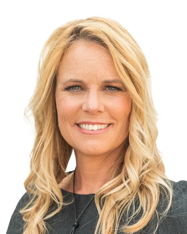MLA · Columbia River-Revelstoke**BC NDP**Andrea Dunlop
Researched by voche.meExplore the profile ](https://voche.me/bc/provincial-2026/candidates/andrea-dunlop) [MLA · Columbia River-Revelstoke**BC Green Party**Rana Nelson
Researched by voche.meExplore the profile ](https://voche.me/bc/provincial-2026/candidates/rana-nelson) [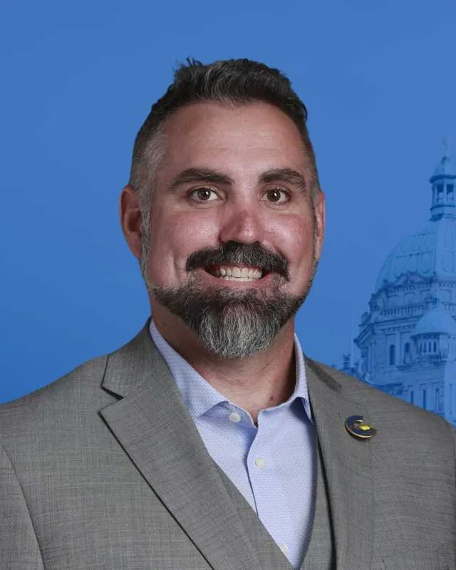MLA · Columbia River-Revelstoke**Conservative Party of BC**Scott McInnis
Researched by voche.meExplore the profile ](https://voche.me/bc/provincial-2026/candidates/scott-mcinnis)
- People, 2021 census
- 40,810
- Area
- 39,719 km²
- Registered voters, 2024
- 31,366
- Turnout, 2024
- 58.46%
- Median age
- 44.0
- Median household income, 2020
- $86,000
THE DISTRICT
## Where Columbia River-Revelstoke is
39,719 km² · 40,810 people
Columbia River-Revelstoke lies in the Kootenays, in the southeast corner of British Columbia. The Electoral Boundaries Commission's 2023 final report says the district stretches along the Columbia Valley and includes Kimberley, Invermere, Canal Flats, Radium Hot Springs and Golden. To the west it includes Revelstoke, Trout Lake and Galena Bay, and to the east it follows Highway 1 as far as Field. The Alberta border forms the eastern boundary, and the Columbia Shuswap Regional District forms the northern and western boundary. In the south the district reaches the western outskirts of Cranbrook along Hidden Valley Road.
The commission gave the district's population as 40,904, which is 23.9% below the average district, and its area as 39,719 square kilometres. The report describes the Kootenays as an area of mountain ranges and large bodies of water that make transport difficult. The commission considered moving Revelstoke and Golden into the Salmon Arm-Shuswap district. It did not propose that change, because the communities have limited transportation options and a mountain pass lies between them.
BC Geographical Names places Golden where the Kicking Horse River joins the Columbia River, Invermere at the north end of Windermere Lake and Canal Flats at the south end of Columbia Lake. The same office places Rogers Pass on Highway 1 between Golden and Revelstoke, inside Glacier National Park. The commission's map labels Revelstoke Lake, Glacier National Park, Yoho National Park, Blaeberry, Nicholson and Field. Elections BC's 2024 results file lists voting places at Brisco, Edgewater, Wasa, Fairmont, Windermere, Parson and Trout Lake, among others in the district.
- Revelstoke
- Trout Lake
- Galena Bay
- Nicholson
- Parson
- Golden
- Blaeberry
- Field
- Brisco
- Edgewater
- Radium Hot Springs
- Invermere
- Windermere
- Shuswap Band (Kenpesq̓t) community near Invermere
- ʔakisq̓nuk First Nation community at Windermere
- Canal Flats
- Fairmont
- Wasa
- Kimberley
- Cranbrook (western outskirts)
Sources: [British Columbia Electoral Boundaries Commission (opens in a new tab)](https://elections.bc.ca/docs/rpt/BCEBC-Final-Report-April-3-2023.pdf), [BC Geographical Names Office (opens in a new tab)](https://apps.gov.bc.ca/pub/bcgnws/names/28894.html), [BC Geographical Names Office (opens in a new tab)](https://apps.gov.bc.ca/pub/bcgnws/names/1792.html), [BC Geographical Names Office (opens in a new tab)](https://apps.gov.bc.ca/pub/bcgnws/names/29163.html), [BC Geographical Names Office (opens in a new tab)](https://apps.gov.bc.ca/pub/bcgnws/names/24081.html), [Elections BC (opens in a new tab)](https://catalogue.data.gov.bc.ca/dataset/44914a35-de9a-4830-ac48-870001ef8935)
HISTORY
## The history of the area
Checked Thursday, October 8, 2026
### Ktunaxa, Secwépemc and Sinixt homelands
Several Nations describe this land as their own, each in its own words. The Ktunaxa Nation says its territory, ʔamakʔis Ktunaxa, covers 70,000 square kilometres beside the Kootenay and Columbia Rivers and the Arrow Lakes, and that the Ktunaxa have occupied these lands for more than 10,000 years. The Nation's map page lists ʔaknuqⱡuk as the Ktunaxa name for Golden. ʔakisq̓nuk First Nation, a Ktunaxa community, describes itself as living in its traditional, unceded territory at Windermere, and says its name means land between two lakes. The Ktunaxa describe Qat'muk, in the Jumbo-Toby Creek watershed 55 kilometres west of Invermere, as a sacred place where the Grizzly Bear Spirit was born.
The Shuswap Band, Kenpesq̓t, belongs to the Secwépemc Nation. Its website places the Band's main community on a reserve near Invermere, on the east bank of the Columbia River, and says that the pithouses across the valley show Secwépemc occupation for thousands of years. Parks Canada states that the Secwépemc have used the areas now inside Yoho, Kootenay, Mount Revelstoke, Glacier, Banff and Jasper national parks from the earliest times.
In Revelstoke, the Revelstoke Museum and Archives says the city stands on the homeland of the Sinixt and within the territories of the Secwépemc, the Syilx and the Ktunaxa. The Town of Golden says it lies on the traditional unceded territory of the Ktunaxa and Secwépemc peoples, and is the chosen home of the Métis Nation Columbia River Society. The 2021 census counted 2,740 people with Indigenous identity in the district, of whom 1,025 identified as First Nations and 1,555 as Métis.
Sources: [Ktunaxa Nation (opens in a new tab)](https://ktunaxa.org/about/map/), [ʔakisq̓nuk First Nation (opens in a new tab)](https://akisqnuk.org/who-we-are/), [Ktunaxa Nation (opens in a new tab)](https://ktunaxa.org/lands-and-resources/stewardship/qatmuk/), [Shuswap Band (Kenpesq̓t) (opens in a new tab)](https://shuswapband.net/about-shuswap-band), [Parks Canada (opens in a new tab)](https://parks.canada.ca/pn-np/bc/yoho/autochtone-indigenous), [Revelstoke Museum & Archives (opens in a new tab)](https://www.revelstokemuseum.ca/history-of-revelstoke), [Town of Golden (opens in a new tab)](https://www.golden.ca/header/about-golden)
### Kootenae House and the Columbia fur trade, 1807
BC Geographical Names records that Kootenae House was built in August 1807 by David Thompson of the North West Company. It calls the post the first non-native trading post on the Columbia River or its tributaries. Parks Canada says the North West Company built it to start the fur trade with the Ktunaxa, and a national historic site marks the place on Westside Road near Invermere. The Columbia Valley Chamber of Commerce's history page adds that Thompson traded goods for pelts with First Nations and mapped the mountains and streams of the area.
At the south end of Columbia Lake, the same geographical names office says Thompson called the place McGillivray's Portage, presumably after the fur trader Duncan McGillivray. Its record for Canal Flats also quotes the account of the missionary Father Pierre Jean de Smet from 1845 to 1846. De Smet wrote of baptisms there and of a large cross put up on the plain, which from then on was called the Plain of the Nativity.
Sources: [BC Geographical Names Office (opens in a new tab)](https://apps.gov.bc.ca/pub/bcgnws/names/1792.html), [Parks Canada (opens in a new tab)](https://parks.canada.ca/pn-np/bc/kootenay/culture/kootenae), [Columbia Valley Chamber of Commerce (opens in a new tab)](https://cvchamber.ca/valley-history), [BC Geographical Names Office (opens in a new tab)](https://apps.gov.bc.ca/pub/bcgnws/names/29163.html)
### The Canadian Pacific Railway arrives, 1881 to 1887
Parks Canada says that in 1881 the Canadian Pacific Railway chose Kicking Horse Pass as its route through the Rockies, and that Field began as a base for building the line through the pass. BC Geographical Names records that railway officials named Field in 1884 after Cyrus West Field, an American merchant who had laid the first Atlantic cable, and that the Field post office opened in 1886. The same office says Major A.B. Rogers located the pass through the Selkirk Mountains in 1881, and Parks Canada records that Glacier National Park was established in 1886.
Golden began as a base for the railway surveyors. BC Geographical Names says surveyors called it the Big Cache in the early 1880s, and that in 1883 the engineer F.W. Aylmer changed the name to Golden City, in rivalry with a construction camp called Silver City. The Golden post office opened on 1 April 1887.
Revelstoke dates from the railway as well. The Revelstoke Museum and Archives says Europeans settled the area in 1885, during construction of the railway. The surveyor A.S. Farwell had laid out a townsite in 1880, and the settlement was called Farwell until the railway placed its station on higher ground to the east. BC Geographical Names records that the station was named for the first Baron Revelstoke, head of the banking house Baring Brothers, and that the Farwell post office became the Revelstoke post office on 1 June 1886. The City of Revelstoke says the railway was completed at Craigellachie on 7 November 1885.
Sources: [Parks Canada (opens in a new tab)](https://parks.canada.ca/pn-np/bc/yoho/gestion-mgmt/plandirecteur-mgmtplan/plan-2022), [BC Geographical Names Office (opens in a new tab)](https://apps.gov.bc.ca/pub/bcgnws/names/11971.html), [BC Geographical Names Office (opens in a new tab)](https://apps.gov.bc.ca/pub/bcgnws/names/24081.html), [Parks Canada (opens in a new tab)](https://parks.canada.ca/pn-np/bc/glacier/activ/edu/faits-facts), [BC Geographical Names Office (opens in a new tab)](https://apps.gov.bc.ca/pub/bcgnws/names/28894.html), [Revelstoke Museum & Archives (opens in a new tab)](https://www.revelstokemuseum.ca/history-of-revelstoke), [BC Geographical Names Office (opens in a new tab)](https://apps.gov.bc.ca/pub/bcgnws/names/19010.html), [City of Revelstoke (opens in a new tab)](https://revelstoke.ca/2284/Revelstokes-History)
### A canal, fruit lands and roads in the Columbia Valley, 1883 to 1951
BC Geographical Names records that William Adolph Baillie-Grohman, an English investor, built a canal between Columbia Lake and the Kootenay River from 1883 to 1888. The plan was to divert part of the Kootenay River into the Columbia system and so lower the level of Kootenay Lake. One boat passed through before the project was abandoned in 1889, and the record quotes a later account saying that the steamer Gwendoline crossed in 1894 and the North Star in 1902. Canal Flats takes its name from the canal and became a village municipality on 29 June 2004.
Invermere has had four names. In 1890 Edmund T. Johnson laid out a townsite called Copper City, and in 1900 the Canterbury Townsite Company renamed it Canterbury. After the Columbia Valley Irrigation Fruit Lands Company acquired the site, the name Invermere came from Robert Randolph Bruce, later the 13th Lieutenant Governor of British Columbia, whom BC Geographical Names credits with choosing it, and dates the choice to circa 1911. The Geographic Board of Canada adopted Invermere on 31 March 1924, and the village was incorporated on 22 May 1951. The Columbia Valley Chamber of Commerce says Bruce founded the Columbia Valley Irrigated Fruitlands Company in 1911, which drew hundreds of farmers from England and Scotland. It adds that the Kootenay Central Railway ran a regular train between Golden and Cranbrook from 1915 and that the Banff-Windermere Highway was completed in 1923.
Radium Hot Springs began as the Sinclair post office, opened on 1 April 1898 and renamed on 1 March 1915 after the high radium content of the hot springs nearby. It became a village municipality on 10 December 1990.
Sources: [BC Geographical Names Office (opens in a new tab)](https://apps.gov.bc.ca/pub/bcgnws/names/29163.html), [BC Geographical Names Office (opens in a new tab)](https://apps.gov.bc.ca/pub/bcgnws/names/1792.html), [Columbia Valley Chamber of Commerce (opens in a new tab)](https://cvchamber.ca/valley-history), [BC Geographical Names Office (opens in a new tab)](https://apps.gov.bc.ca/pub/bcgnws/names/23207.html)
### The Sullivan Mine and Kimberley, 1891 to 2001
BC Geographical Names reproduces the City of Kimberley's account of its beginnings. Galena was found at the North Star Mine in 1891. A year later four prospectors, Walter Burchett, E.C. Smith, John Cleaver and Pat Sullivan, staked claims on what is now Sullivan Mountain. A settlement called Mark Creek Crossing, and then Clark City, was renamed Kimberley in 1896, in the hope that the mine would be as rich as the diamond mines of Kimberley, South Africa. The Kimberley post office opened on 1 January 1899.
Teck says that its predecessor, the Consolidated Mining and Smelting Company, acquired the Sullivan Mine in 1909. By Teck's account the mine operated from 1909 to 2001 and produced 26 million tonnes of lead, zinc and silver concentrates. At the closure in 2001 it was the largest single contributor to Kimberley's tax base and the city's largest employer. The City's account says a smelter at Marysville operated from 1903 to 1907 and that large-scale production began in 1923, after researchers at Trail developed a flotation process for the complex ore. In November 1968 the boundary of Kimberley grew to include the Village of Marysville.
Sources: [BC Geographical Names Office (opens in a new tab)](https://apps.gov.bc.ca/pub/bcgnws/names/3865.html), [Teck Resources (opens in a new tab)](https://www.teck.com/operations/canada/legacy/sullivan-mine/)
### Revelstoke from 1899 to 2007
The Revelstoke Museum and Archives says landowners could not get clear title to their property until 1897, and that the City of Revelstoke was incorporated in 1899. BC Geographical Names gives the date as 1 March 1899. The City says that by 1910 Revelstoke was among the three largest centres in the interior of the province. The museum also records a gold rush along the Columbia River just north of Revelstoke in the 1860s, before the townsite existed, and estimates that more than $3,000,000 in gold was mined in two years.
The City says skiing has been a part of life in Revelstoke since the early 1890s and that Mount Revelstoke held an internationally recognized ski jump from 1916 until the 1970s. The museum says the local ski hero Nels Nelsen set a world record in 1925 with a jump of 250 feet. The City says Revelstoke Mountain Resort opened in 2007. BC Geographical Names records that on 22 November 2007 the city boundary grew by 537 hectares, southward past the base area of the Mount Mackenzie ski hill.
Sources: [Revelstoke Museum & Archives (opens in a new tab)](https://www.revelstokemuseum.ca/history-of-revelstoke), [BC Geographical Names Office (opens in a new tab)](https://apps.gov.bc.ca/pub/bcgnws/names/19010.html), [City of Revelstoke (opens in a new tab)](https://revelstoke.ca/2284/Revelstokes-History)
### Avalanches at Rogers Pass and the Trans-Canada Highway, 1910 to 1962
Parks Canada records that on 4 March 1910 an avalanche killed 58 railway workers who were clearing the site of an earlier slide in Rogers Pass. The surface route over the pass was abandoned in 1917, after the 9 km Connaught Tunnel reduced the danger from avalanches. Parks Canada gives the area of Glacier National Park as 1,350 square kilometres and says that on average 10 metres of snow falls in Rogers Pass each year.
The highway followed later. BC Geographical Names says that modern engineering and new methods of avalanche control and snow removal made a highway through the pass possible, and that this part of the Trans-Canada Highway opened in the summer of 1962. Parks Canada gives the date of the opening ceremonies at Rogers Pass as 3 September 1962, when Prime Minister John Diefenbaker and representatives of all ten provinces attended. Parks Canada says the highway across the country took two decades to build.
Sources: [Parks Canada (opens in a new tab)](https://parks.canada.ca/lhn-nhs/bc/rogers/decouvrir-discover/natcul7), [Parks Canada (opens in a new tab)](https://parks.canada.ca/pn-np/bc/glacier/activ/edu/faits-facts), [BC Geographical Names Office (opens in a new tab)](https://apps.gov.bc.ca/pub/bcgnws/names/24081.html), [Parks Canada (opens in a new tab)](https://parks.canada.ca/pn-np/bc/glacier/culture/histoire-history/transcanadienne-transcanada)
### Dams on the Columbia and the Kicking Horse Canyon, 1973 to 2024
BC Hydro lists two large generating stations in its Columbia Region, whose large dams were built as part of the Columbia River Treaty. Mica was built in 1973 and has a capacity of 2,746 MW. Revelstoke was built in 1984 and has a capacity of 2,480 MW. BC Hydro says the Revelstoke Generating Station stands on the Columbia River, 5 km upstream from the City of Revelstoke. It was designed for six generating units, four were installed first, and the fifth was added in 2010.
East of Golden, the provincial government has upgraded the Trans-Canada Highway through the Kicking Horse Canyon in four phases. It reports that Phases 1 to 3 improved over 21 of the 26 kilometres and that Phase 4 was completed on 31 July 2024, when the section opened to four-lane use with a posted speed limit of 100 km/h.
Sources: [BC Hydro (opens in a new tab)](https://www.bchydro.com/energy-in-bc/operations/our-facilities/columbia.html), [BC Hydro (opens in a new tab)](https://www.bchydro.com/energy-in-bc/projects/revelstoke-unit-6.html), [Government of British Columbia (opens in a new tab)](https://www2.gov.bc.ca/gov/content/transportation-projects/highway1-kamloops-alberta/completed-projects)
THE SEAT
## Who has held the seat
Legislative Assembly records, 35th Parliament onward
Elections BC's volume for 1987 to 2001 first prints Columbia River-Revelstoke at the 35th general election, held on 17 October 1991. The Electoral Districts Act (SBC 1990 c. 39), assented to on 27 July 1990, set out 75 single-member districts. The Act came into force when the 35th Parliament ended on 19 September 1991. Jim Doyle of the New Democratic Party won the district in 1991 with 6,241 votes (45.08%), ahead of Duene Crandall of the Social Credit Party with 4,362 (31.51%) and Margaret R. Mellor of the Liberal Party with 3,241 (23.41%).
Elections BC's volume for 1871 to 1986 prints the name Columbia-Revelstoke, without River, at the 18th general election in 1933. William Henry Sutherland of the Liberal Party won it with 1,947 votes (72.27%), ahead of Vincent Segur of the CCF with 747 (27.73%). The Constitution Amendment Act of 1966 (SBC 1966 c. 11), which received royal assent on 1 April 1966, created the districts of Columbia River and Revelstoke-Slocan. The Constitution (Amendment) Act of 1978 (SBC 1978 c. 14) created Shuswap-Revelstoke. James Roland Chabot of the Social Credit Party won Columbia in 1963 and Columbia River in every general election from 1966 to 1983. Duane Delton Crandall of the Social Credit Party won Columbia River in 1986 with 5,178 votes (48.98%).
Doyle won again in 1996 with 6,264 votes (42.52%), ahead of Brian Allan Mcmahon of the Liberal Party with 5,172 (35.11%). Wendy McMahon of the Liberal Party won in 2001 with 7,804 votes (53.95%), while Doyle received 4,551 (31.46%). Norm Macdonald of the BC NDP won in 2005 with 7,460 votes (51.71%), and again in 2009 and 2013. Doug Clovechok of the BC Liberal Party won in 2017 with 6,620 votes (45.44%) and in 2020 with 7,034 (48.03%). In 2024 Scott McInnis of the Conservative Party won with 8,768 votes (47.92%), ahead of Andrea Dunlop of the BC NDP with 8,098 (44.26%).
The commission's 2023 final report keeps the name and moves the western outskirts of Cranbrook into the district along Hidden Valley Road. It says this balances the populations of Columbia River-Revelstoke and the neighbouring Kootenay-Rockies district, and that the boundary follows municipal borders. Elections BC's conversion table matches the district's 61 voting areas to the 2017 to 2024 districts. It shows overlap with Columbia River-Revelstoke in 57 voting areas, with Kootenay East in 7 and with Kootenay West in 1.
Sources: [Elections BC (opens in a new tab)](https://elections.bc.ca/docs/rpt/1987-2001-ElectionHistory.pdf), [Elections BC (opens in a new tab)](https://elections.bc.ca/docs/rpt/1871-1986_ElectoralHistoryofBC.pdf), [Elections BC (opens in a new tab)](https://elections.bc.ca/docs/rpt/2002-2013-ElectionHistory.pdf), [Elections BC (opens in a new tab)](https://catalogue.data.gov.bc.ca/dataset/44914a35-de9a-4830-ac48-870001ef8935), [British Columbia Electoral Boundaries Commission (opens in a new tab)](https://elections.bc.ca/docs/rpt/BCEBC-Final-Report-April-3-2023.pdf)
Members for Columbia River-Revelstoke
| Parliament | It sat | Member | Elected as | Party on the legislature’s record |
| --- | --- | --- | --- | --- |
| 43rd | 2025 to 2026 | Scott McInnis | Conservative Party | Conservative Party of BC |
| 42nd | 2020 to 2024 | Doug Clovechok | BC Liberal Party | BC United |
| 41st | 2017 to 2020 | Doug Clovechok | BC Liberal Party | BC Liberal Party |
| 40th | 2013 to 2017 | Norm Macdonald | BC NDP | BC NDP |
| 39th | 2009 to 2013 | Norm Macdonald | BC NDP | BC NDP |
| 38th | 2005 to 2009 | Norm Macdonald | BC NDP | BC NDP |
| 37th | 2001 to 2005 | Wendy McMahon | | BC Liberal Party |
| 36th | 1996 to 2001 | Jim Doyle | | BC NDP |
| 35th | 1992 to 1996 | Jim Doyle | | BC NDP |
“Elected as” is the affiliation Elections BC printed with the winning result. The last column is the party the legislature’s records give for that parliament, which differs when a member changed party while in office. A row with that column empty is a winner Elections BC prints whom the legislature’s records leave out. Source: [Legislative Assembly of British Columbia (opens in a new tab)](https://www.leg.bc.ca/members)
### Boundaries since 2024
Columbia River-Revelstoke has 61 voting areas. 57 of them overlap the district of the same name used from 2017 to 2024. Others overlap these districts from 2017 to 2024: Kootenay East (7), Kootenay West (1).
The commission that drew the boundaries counted 40,904 people in the district, 23.9% below the average for a district, over 39,719 km².
Sources: [British Columbia Electoral Boundaries Commission, Final report, April 3, 2023 (opens in a new tab)](https://elections.bc.ca/docs/rpt/BCEBC-Final-Report-April-3-2023.pdf), [Elections BC, Voting area conversion table, 2017 to 2024 (opens in a new tab)](https://catalogue.data.gov.bc.ca/dataset/fb26db04-780c-4229-a147-da4fd5311d36)
PAST RESULTS
## Every result since 2005
From Elections BC
**2024 Provincial General Election**Scott McInnis, Conservative Party, 47.92%
| Candidate | Affiliation | Votes | Share |
| --- | --- | --- | --- |
| Scott McInnisElected | Conservative Party | 8,768 | 47.92% |
| Andrea Dunlop | BC NDP | 8,098 | 44.26% |
| Calvin Beauchesne | BC Green Party | 1,430 | 7.82% |
18,296 valid votes · 41 rejected ballots · 31,366 registered voters · 58.46% voted
**2020 General Election**Doug Clovechok, BC Liberal Party, 48.03%
| Candidate | Affiliation | Votes | Share |
| --- | --- | --- | --- |
| Doug ClovechokElected | BC Liberal Party | 7,034 | 48.03% |
| Nicole Cherlet | BC NDP | 5,708 | 38.97% |
| Samson Boyer | BC Green Party | 1,904 | 13.00% |
14,646 valid votes · 102 rejected ballots
**2017 General Election**Doug Clovechok, BC Liberal Party, 45.44%
| Candidate | Affiliation | Votes | Share |
| --- | --- | --- | --- |
| Doug ClovechokElected | BC Liberal Party | 6,620 | 45.44% |
| Gerry Taft | BC NDP | 5,248 | 36.02% |
| Samson Boyer | BC Green Party | 1,708 | 11.72% |
| Duncan Boyd MacLeod | Independent | 469 | 3.22% |
| Justin James Hooles | Independent | 371 | 2.55% |
| Rylan Kashuba | Libertarian | 154 | 1.06% |
14,570 valid votes · 66 rejected ballots
**2013 General Election**Norm Macdonald, BC NDP, 48.26%
| Candidate | Affiliation | Votes | Share |
| --- | --- | --- | --- |
| Norm MacdonaldElected | BC NDP | 6,463 | 48.26% |
| Doug Clovechok | BC Liberal Party | 4,847 | 36.19% |
| Earl Olsen | Conservative | 1,162 | 8.68% |
| Laurel Ralston | BC Green Party | 921 | 6.88% |
13,393 valid votes · 45 rejected ballots
**2009 General Election**Norm Macdonald, BC NDP, 55.29%
| Candidate | Affiliation | Votes | Share |
| --- | --- | --- | --- |
| Norm MacdonaldElected | BC NDP | 7,419 | 55.29% |
| Mark McKee | BC Liberal Party | 5,093 | 37.95% |
| Sarah Svensson | BC Green Party | 907 | 6.76% |
13,419 valid votes · 101 rejected ballots
**2005 General Election**Norm Macdonald, BC NDP, 51.71%
| Candidate | Affiliation | Votes | Share |
| --- | --- | --- | --- |
| Norm MacdonaldElected | BC NDP | 7,460 | 51.71% |
| Wendy McMahon | BC Liberal Party | 5,750 | 39.86% |
| Andy Shadrack | BC Green Party | 1,217 | 8.44% |
14,427 valid votes · 104 rejected ballots
The boundaries changed before the 2009, 2017 and 2024 elections, so a result under the same name can cover a different area. Sources: [Elections BC, Provincial Voting Results (opens in a new tab)](https://catalogue.data.gov.bc.ca/dataset/44914a35-de9a-4830-ac48-870001ef8935), [Statement of Votes, 2024 Provincial General Election (opens in a new tab)](https://elections.bc.ca/docs/rpt/statement-of-votes-2024-provincial-election.pdf)
PEOPLE · 2021 CENSUS
## Who lives in Columbia River-Revelstoke
40,810 residents · British Columbia beside each figure
### Age
- Median age
- 44.0BC 42.8
- Under 1514.9%BC 14.3%
- 15 to 6463.7%BC 65.3%
- 65 and over21.4%BC 20.3%
- 85 and over1.9%BC 2.4%
### Households
- Households
- 17,640
- People per household
- 2.3BC 2.4
#### Who lives together
- Couples with children21.4%BC 22.7%
- Couples without children33.6%BC 26.4%
- One-parent families6.0%BC 7.6%
- Multigenerational households1.3%BC 3.7%
- People living alone28.4%BC 29.4%
#### Household size
- 1 person28.3%BC 29.4%
- 2 persons41.0%BC 35.3%
- 3 persons13.4%BC 14.5%
- 4 persons11.9%BC 12.6%
- 5 or more persons5.3%BC 8.2%
### Homes
- Median home value
- $500,000BC $785,000
- Median monthly rent and utilities
- $1,070BC $1,370
- Median monthly cost for owners
- $940BC $1,320
#### Own or rent
- Own their home78.8%BC 66.8%
- Rent their home21.0%BC 32.8%
- Home provided by a local government or First Nation0.2%BC 0.5%
#### Type of home
- Single-detached house74.4%BC 42.4%
- Semi-detached house4.0%BC 3.1%
- Row house4.3%BC 8.3%
- Apartment or flat in a duplex2.2%BC 12.2%
- Apartment in a building that has fewer than five storeys9.2%BC 20.4%
- Apartment in a building that has five or more storeys0.2%BC 10.9%
- Other single-attached house0.5%BC 0.2%
- Movable dwelling5.2%BC 2.5%
#### When the home was built
- 1960 or earlier18.8%BC 12.5%
- 1961 to 198033.1%BC 27.0%
- 1981 to 199010.5%BC 14.2%
- 1991 to 200014.0%BC 16.5%
- 2001 to 20055.8%BC 6.0%
- 2006 to 20107.7%BC 8.0%
- 2011 to 20154.0%BC 6.6%
- 2016 to 20216.0%BC 9.1%
### Housing costs
- Renters paying 30% or more of income on housing26.6%BC 37.8%
- Owners paying 30% or more of income on housing11.6%BC 19.3%
- Renters in core housing need16.3%BC 24.7%
- Owners in core housing need4.9%BC 8.0%
- Renters in subsidized housing8.2%BC 11.0%
- Owners with a mortgage52.6%BC 57.5%
### Income
Income is for the year 2020.
- Median household income
- $86,000BC $85,000
- After tax
- $76,000BC $76,000
- Median income per person
- $42,800BC $40,800
#### Living on a low income (after-tax measure)
- All ages8.1%BC 10.8%
- Under 187.4%BC 11.3%
- 18 to 646.9%BC 9.7%
- 65 and over12.2%BC 13.8%
### Languages
#### First language learned
- English88.7%BC 67.1%
- French3.1%BC 1.2%
- German1.7%BC 1.0%
- Tagalog (Pilipino, Filipino)0.6%BC 1.7%
- Punjabi (Panjabi)0.5%BC 4.9%
- Italian0.4%BC 0.4%
- Dutch0.3%BC 0.4%
- Czech0.3%BC 0.1%
- Spanish0.2%BC 1.2%
- Swiss German0.2%BC 0.0%
#### Spoken most often at home
- English95.2%BC 78.5%
- French1.2%BC 0.3%
- Punjabi (Panjabi)0.5%BC 3.8%
- German0.5%BC 0.1%
- Tagalog (Pilipino, Filipino)0.2%BC 0.9%
- Czech0.2%BC 0.0%
- Dutch0.1%BC 0.0%
- Spanish0.1%BC 0.6%
#### English and French
- English only90.7%BC 90.1%
- French only0.1%BC 0.0%
- English and French9.1%BC 6.6%
- Neither English nor French0.2%BC 3.3%
### Immigration
- Born outside Canada (immigrants)
- 10.8%BC 29.0%
- Non-permanent residents
- 1.9%BC 3.5%
#### Where immigrants were born
- United Kingdom22.6%BC 8.2%
- United States of America12.8%BC 4.2%
- Germany10.8%BC 2.2%
- Oceania and other places of birth8.8%BC 2.3%
- Philippines7.3%BC 9.2%
- Netherlands3.5%BC 1.1%
- India3.3%BC 13.8%
- Italy2.7%BC 0.9%
- France1.5%BC 0.5%
- Korea, South1.4%BC 3.3%
#### When immigrants arrived
- Arrived before 198035.5%BC 19.7%
- 1980 to 19909.2%BC 11.5%
- 1991 to 200010.2%BC 21.0%
- 2001 to 201015.0%BC 22.2%
- 2011 to 202130.0%BC 25.6%
#### Generations in Canada
- First generation13.9%BC 33.7%
- Second generation16.5%BC 21.7%
- Third generation or more69.6%BC 44.5%
### Identity and origins
- Indigenous identity
- 6.9%BC 5.9%
- Visible minority
- 4.9%BC 34.4%
#### Visible minority groups
- South Asian1.6%BC 9.6%
- Filipino1.1%BC 3.5%
- Chinese0.4%BC 11.2%
- Japanese0.4%BC 0.9%
- Black0.3%BC 1.3%
- Latin American0.3%BC 1.3%
- Korean0.3%BC 1.5%
- Southeast Asian0.2%BC 1.5%
- Arab0.2%BC 0.6%
- Multiple visible minorities0.1%BC 1.2%
- Visible minority (other)0.1%BC 0.4%
- West Asian0.1%BC 1.4%
#### Ethnic or cultural origins reported most often
- English30.6%BC 20.7%
- Scottish24.1%BC 15.8%
- Irish18.8%BC 12.8%
- German16.0%BC 11.0%
- Canadian13.6%BC 9.3%
- French11.1%BC 6.4%
- Ukrainian6.4%BC 4.3%
- British Isles5.1%BC 3.9%
- Norwegian5.1%BC 2.8%
- Dutch5.0%BC 3.9%
### Religion
- No religion64.1%BC 52.1%
- Christian32.8%BC 34.3%
- Other religions1.1%BC 1.0%
- Sikh0.8%BC 5.9%
- Buddhist0.4%BC 1.7%
- Hindu0.4%BC 1.7%
- Muslim0.2%BC 2.6%
- Jewish0.1%BC 0.5%
- Traditional Indigenous spirituality0.1%BC 0.2%
### Education
Highest level completed, ages 25 to 64.
- No certificate, diploma or degree7.2%BC 8.0%
- High school diploma28.7%BC 25.8%
- College, trades or other certificate below a bachelor’s degree39.5%BC 31.2%
- Bachelor’s degree or higher24.7%BC 35.0%
### Work
- In the labour force
- 64.3%BC 63.3%
- Employed
- 58.8%BC 57.9%
- Unemployment rate at the census
- 8.6%BC 8.4%
#### Industries with the most workers
- Accommodation and food services12.2%BC 7.0%
- Construction10.9%BC 9.0%
- Retail trade10.7%BC 11.6%
- Health care and social assistance10.1%BC 12.3%
- Manufacturing7.6%BC 5.9%
- Arts, entertainment and recreation6.0%BC 2.3%
- Professional, scientific and technical services5.7%BC 9.2%
- Educational services5.6%BC 7.4%
#### Kinds of work
- Sales and service occupations27.6%BC 25.6%
- Trades, transport and equipment operators and related occupations24.3%BC 18.0%
- Business, finance and administration occupations12.6%BC 17.1%
- Occupations in education, law and social, community and government services9.3%BC 11.9%
- Health occupations6.5%BC 7.7%
- Natural and applied sciences and related occupations5.9%BC 8.0%
- Natural resources, agriculture and related production occupations5.2%BC 2.8%
- Occupations in manufacturing and utilities5.0%BC 3.4%
- Occupations in art, culture, recreation and sport2.8%BC 4.2%
- Legislative and senior management occupations0.7%BC 1.2%
### Getting to work
#### Where people worked
- Worked at home14.5%BC 22.6%
- Worked outside Canada0.3%BC 0.4%
- No fixed workplace address18.2%BC 15.3%
- Worked at a usual workplace66.9%BC 61.6%
#### How commuters travelled
- Car, truck or van84.0%BC 79.9%
- Public transit0.6%BC 9.3%
- On foot8.7%BC 6.5%
- Bicycle4.3%BC 2.0%
- Other method2.4%BC 2.3%
#### Length of the trip
- Less than 15 minutes56.5%BC 31.8%
- 15 to 29 minutes25.4%BC 34.0%
- 30 to 44 minutes9.8%BC 19.7%
- 45 to 59 minutes2.1%BC 7.3%
- 60 minutes and over6.2%BC 7.2%
### Moving
Where residents lived five years before the census.
- Lived at the same address56.4%BC 56.2%
- Moved within the same municipality12.7%BC 16.1%
- Moved from elsewhere in BC15.0%BC 17.0%
- Moved from another province12.6%BC 4.6%
- Moved from another country3.3%BC 6.1%
Counts in the census are rounded to the nearest 5, and shares are worked out from those counts. Source: [BC Stats, from Statistics Canada tabulations, 2021 Census Profile for BC Provincial Electoral Districts (2023 Redistribution) (opens in a new tab)](https://catalogue.data.gov.bc.ca/dataset/census-profiles-for-bc-provincial-electoral-districts)
QUESTIONS
## Questions about Columbia River-Revelstoke
10 answers
### Where is Columbia River-Revelstoke?
Columbia River-Revelstoke is a provincial electoral district in the Kootenays, in the southeast of British Columbia. The Electoral Boundaries Commission's 2023 final report says it stretches along the Columbia Valley and gives its area as 39,719 square kilometres. The Alberta border forms its eastern boundary, and to the west it takes in Revelstoke, Trout Lake and Galena Bay.
### Which communities are in Columbia River-Revelstoke?
Columbia River-Revelstoke includes Kimberley, Invermere, Canal Flats, Radium Hot Springs, Golden, Revelstoke, Trout Lake, Galena Bay and Field, according to the commission's 2023 final report. The report also adds the western outskirts of Cranbrook. Elections BC's 2024 results file lists voting places in Brisco, Edgewater, Wasa, Fairmont, Windermere, Parson and Nicholson as well.
### Who won Columbia River-Revelstoke in the 2024 provincial election?
Scott McInnis of the Conservative Party won Columbia River-Revelstoke in 2024 with 8,768 votes, 47.92% of the valid vote. Andrea Dunlop of the BC NDP received 8,098 votes and Calvin Beauchesne of the BC Green Party received 1,430. Turnout was 58.46% of 31,366 registered voters, according to Elections BC.
### Who represented Columbia River-Revelstoke before 2024?
Doug Clovechok represented Columbia River-Revelstoke from 2017 until 2024. He won in 2017 for the BC Liberal Party with 6,620 votes, 45.44%, and again in 2020 with 7,034 votes, 48.03%. Before him Norm Macdonald of the BC NDP held the seat after the 2005, 2009 and 2013 elections. Elections BC prints each result.
### When was the name Columbia River-Revelstoke first used?
Elections BC first prints Columbia River-Revelstoke at the 35th general election on 17 October 1991, under the Electoral Districts Act of 1990, which set out 75 single-member districts. Jim Doyle of the New Democratic Party won that election in Columbia River-Revelstoke with 6,241 votes, 45.08%. A district called Columbia-Revelstoke, without River, appears in the 1933 results.
### How did the boundaries of Columbia River-Revelstoke change in 2023?
The commission's 2023 final report moved the western outskirts of Cranbrook into Columbia River-Revelstoke along Hidden Valley Road, to balance its population with Kootenay-Rockies. The report counts 40,904 people in the district, 23.9% below the average. Elections BC's conversion table shows overlap with Columbia River-Revelstoke in 57 voting areas, with Kootenay East in 7 and Kootenay West in 1.
### How many people live in Columbia River-Revelstoke?
The 2021 census counted 40,810 people in Columbia River-Revelstoke, with a median age of 44 compared with 42.8 across British Columbia. English was the first language of 88.7% of residents and French of 3.1%. Immigrants made up 10.8% of the population, and the median household income was $86,000.
### Whose traditional territory is Columbia River-Revelstoke on?
Columbia River-Revelstoke lies on lands that several Nations describe as their own. The Ktunaxa Nation names Golden as ʔaknuqⱡuk. The Shuswap Band, Kenpesq̓t, belongs to the Secwépemc Nation and has a reserve near Invermere. The Revelstoke Museum and Archives says Revelstoke is on the Sinixt homeland and within Secwépemc, Syilx and Ktunaxa territories.
### Where does the name Revelstoke come from?
Revelstoke, a city in Columbia River-Revelstoke, was named for the first Baron Revelstoke, head of the banking house Baring Brothers. BC Geographical Names says his firm took over $15,000,000 of the first Canadian Pacific Railway bond issue. The settlement had been called Farwell, and the Farwell post office became the Revelstoke post office on 1 June 1886.
### When did the Trans-Canada Highway open through Rogers Pass?
The Trans-Canada Highway through Rogers Pass, between Golden and Revelstoke in Columbia River-Revelstoke, opened in the summer of 1962. Parks Canada gives 3 September 1962 as the date of the opening ceremonies, attended by Prime Minister John Diefenbaker and representatives of all ten provinces. The pass lies inside Glacier National Park, which was established in 1886.
SOURCES
## Where this page comes from
Figures read Thursday, October 8, 2026
1. [2021 Census Profile for BC Provincial Electoral Districts (2023 Redistribution) (opens in a new tab)](https://catalogue.data.gov.bc.ca/dataset/census-profiles-for-bc-provincial-electoral-districts)BC Stats, from Statistics Canada tabulations · read Thursday, October 8, 2026
2. [Provincial Voting Results (opens in a new tab)](https://catalogue.data.gov.bc.ca/dataset/44914a35-de9a-4830-ac48-870001ef8935)Elections BC · read Thursday, October 8, 2026
3. [Statement of Votes, 2024 Provincial General Election (opens in a new tab)](https://elections.bc.ca/docs/rpt/statement-of-votes-2024-provincial-election.pdf)Elections BC · read Thursday, October 8, 2026
4. [Voting area conversion table, 2017 to 2024 (opens in a new tab)](https://catalogue.data.gov.bc.ca/dataset/fb26db04-780c-4229-a147-da4fd5311d36)Elections BC · read Thursday, October 8, 2026
5. [Final report, April 3, 2023 (opens in a new tab)](https://elections.bc.ca/docs/rpt/BCEBC-Final-Report-April-3-2023.pdf)British Columbia Electoral Boundaries Commission · read Thursday, October 8, 2026
6. [Members of the Legislative Assembly, 35th to 43rd Parliament (opens in a new tab)](https://www.leg.bc.ca/members)Legislative Assembly of British Columbia · read Thursday, October 8, 2026
7. [Final report, April 3, 2023 (opens in a new tab)](https://elections.bc.ca/docs/rpt/BCEBC-Final-Report-April-3-2023.pdf)British Columbia Electoral Boundaries Commission · read Thursday, October 8, 2026
8. [Electoral History of British Columbia, 1871 to 1986 (opens in a new tab)](https://elections.bc.ca/docs/rpt/1871-1986_ElectoralHistoryofBC.pdf)Elections BC · read Thursday, October 8, 2026
9. [Electoral History of British Columbia, Supplement, 1987 to 2001 (opens in a new tab)](https://elections.bc.ca/docs/rpt/1987-2001-ElectionHistory.pdf)Elections BC · read Thursday, October 8, 2026
10. [Electoral History of British Columbia, Supplement, 2002 to 2013 (opens in a new tab)](https://elections.bc.ca/docs/rpt/2002-2013-ElectionHistory.pdf)Elections BC · read Thursday, October 8, 2026
11. [Provincial Voting Results (opens in a new tab)](https://catalogue.data.gov.bc.ca/dataset/44914a35-de9a-4830-ac48-870001ef8935)Elections BC · read Thursday, October 8, 2026
12. [ʔamakʔis Ktunaxa (opens in a new tab)](https://ktunaxa.org/about/map/)Ktunaxa Nation · read Thursday, October 8, 2026
13. [Qat'muk (opens in a new tab)](https://ktunaxa.org/lands-and-resources/stewardship/qatmuk/)Ktunaxa Nation · read Thursday, October 8, 2026
14. [Who We Are (opens in a new tab)](https://akisqnuk.org/who-we-are/)ʔakisq̓nuk First Nation · read Thursday, October 8, 2026
15. [About Shuswap Band (opens in a new tab)](https://shuswapband.net/about-shuswap-band)Shuswap Band (Kenpesq̓t) · read Thursday, October 8, 2026
16. [Indigenous Connections, Yoho National Park (opens in a new tab)](https://parks.canada.ca/pn-np/bc/yoho/autochtone-indigenous)Parks Canada · read Thursday, October 8, 2026
17. [Yoho National Park of Canada Management Plan, 2022 (opens in a new tab)](https://parks.canada.ca/pn-np/bc/yoho/gestion-mgmt/plandirecteur-mgmtplan/plan-2022)Parks Canada · read Thursday, October 8, 2026
18. [Kootenae House National Historic Site (opens in a new tab)](https://parks.canada.ca/pn-np/bc/kootenay/culture/kootenae)Parks Canada · read Thursday, October 8, 2026
19. [Fast facts, Glacier National Park (opens in a new tab)](https://parks.canada.ca/pn-np/bc/glacier/activ/edu/faits-facts)Parks Canada · read Thursday, October 8, 2026
20. [The end of the line, Rogers Pass National Historic Site (opens in a new tab)](https://parks.canada.ca/lhn-nhs/bc/rogers/decouvrir-discover/natcul7)Parks Canada · read Thursday, October 8, 2026
21. [The Trans-Canada highway, Glacier National Park (opens in a new tab)](https://parks.canada.ca/pn-np/bc/glacier/culture/histoire-history/transcanadienne-transcanada)Parks Canada · read Thursday, October 8, 2026
22. [Revelstoke, BC Geographical Names record (opens in a new tab)](https://apps.gov.bc.ca/pub/bcgnws/names/19010.html)BC Geographical Names Office · read Thursday, October 8, 2026
23. [Golden, BC Geographical Names record (opens in a new tab)](https://apps.gov.bc.ca/pub/bcgnws/names/28894.html)BC Geographical Names Office · read Thursday, October 8, 2026
24. [Kimberley, BC Geographical Names record (opens in a new tab)](https://apps.gov.bc.ca/pub/bcgnws/names/3865.html)BC Geographical Names Office · read Thursday, October 8, 2026
25. [Invermere, BC Geographical Names record (opens in a new tab)](https://apps.gov.bc.ca/pub/bcgnws/names/1792.html)BC Geographical Names Office · read Thursday, October 8, 2026
26. [Radium Hot Springs, BC Geographical Names record (opens in a new tab)](https://apps.gov.bc.ca/pub/bcgnws/names/23207.html)BC Geographical Names Office · read Thursday, October 8, 2026
27. [Canal Flats, BC Geographical Names record (opens in a new tab)](https://apps.gov.bc.ca/pub/bcgnws/names/29163.html)BC Geographical Names Office · read Thursday, October 8, 2026
28. [Field, BC Geographical Names record (opens in a new tab)](https://apps.gov.bc.ca/pub/bcgnws/names/11971.html)BC Geographical Names Office · read Thursday, October 8, 2026
29. [Rogers Pass, BC Geographical Names record (opens in a new tab)](https://apps.gov.bc.ca/pub/bcgnws/names/24081.html)BC Geographical Names Office · read Thursday, October 8, 2026
30. [History of Revelstoke (opens in a new tab)](https://www.revelstokemuseum.ca/history-of-revelstoke)Revelstoke Museum & Archives · read Thursday, October 8, 2026
31. [Revelstoke's History (opens in a new tab)](https://revelstoke.ca/2284/Revelstokes-History)City of Revelstoke · read Thursday, October 8, 2026
32. [About Golden (opens in a new tab)](https://www.golden.ca/header/about-golden)Town of Golden · read Thursday, October 8, 2026
33. [Valley History (opens in a new tab)](https://cvchamber.ca/valley-history)Columbia Valley Chamber of Commerce · read Thursday, October 8, 2026
34. [Sullivan Mine (opens in a new tab)](https://www.teck.com/operations/canada/legacy/sullivan-mine/)Teck Resources · read Thursday, October 8, 2026
35. [Columbia Region (opens in a new tab)](https://www.bchydro.com/energy-in-bc/operations/our-facilities/columbia.html)BC Hydro · read Thursday, October 8, 2026
36. [Revelstoke Generating Station Unit 6 Project (opens in a new tab)](https://www.bchydro.com/energy-in-bc/projects/revelstoke-unit-6.html)BC Hydro · read Thursday, October 8, 2026
37. [Highway 1, Kamloops to Alberta: completed projects (opens in a new tab)](https://www2.gov.bc.ca/gov/content/transportation-projects/highway1-kamloops-alberta/completed-projects)Government of British Columbia · read Thursday, October 8, 2026
## Official information
From Elections BC
Your district
### [Check which district an address is in](https://elections.bc.ca/resources/maps/find-your-district/)
Look up your address to be sure this district is yours.
[Look it up (opens in a new tab)](https://elections.bc.ca/resources/maps/find-your-district/)
Candidates
### [The official candidate list](https://www.elections.bc.ca/docs/fin/GE-2026-10-24-Candidate-Website-Report.PDF)
The list this page is built from, published by Elections BC.
[Open the list (opens in a new tab)](https://www.elections.bc.ca/docs/fin/GE-2026-10-24-Candidate-Website-Report.PDF)
Voting
### [Where and when to vote](https://elections.bc.ca/2026-provincial-election/where-to-vote/)
Voting places and hours for general voting day and advance voting.
[Find your voting place (opens in a new tab)](https://elections.bc.ca/2026-provincial-election/where-to-vote/)
## Sitemap
See the full [sitemap](/bc/provincial-2026/sitemap.md) for all pages.