---
title: "Chilliwack North: candidates, history and census, BC provincial 2026 | voche.me"
canonical_url: "https://voche.me/bc/provincial-2026/races/mla/chilliwack-north"
last_updated: "2026-10-10T04:05:16.750Z"
meta:
description: "3 candidates in Chilliwack North for the BC provincial 2026 election. The history of the area, every result since 2009, past MLAs and the 2021 census profile."
"og:description": "3 candidates in Chilliwack North for the BC provincial 2026 election. The history of the area, every result since 2009, past MLAs and the 2021 census profile."
"og:title": "Chilliwack North: candidates, history and census, BC provincial 2026"
"twitter:description": "3 candidates in Chilliwack North for the BC provincial 2026 election. The history of the area, every result since 2009, past MLAs and the 2021 census profile."
"twitter:title": "Chilliwack North: candidates, history and census, BC provincial 2026"
---
**
MLA · BC PROVINCIAL 2026
# Chilliwack North.
3 candidates, one seat.
This district elects one MLA. Voters mark one name on Saturday, October 24, 2026, and the candidate with the most votes wins the seat.
Chilliwack North is a provincial electoral district in the Fraser Valley. The Electoral Boundaries Commission says it consists of downtown Chilliwack and the nearby communities of Greendale, Popkum and Rosedale. The 2021 census counted 52,530 people in it, and the commission gives its area as 245 square kilometres.
## The candidates
In alphabetical order
[MLA · Chilliwack North**BC NDP**Adila Shaukat
Researched by voche.meExplore the profile ](https://voche.me/bc/provincial-2026/candidates/adila-shaukat) [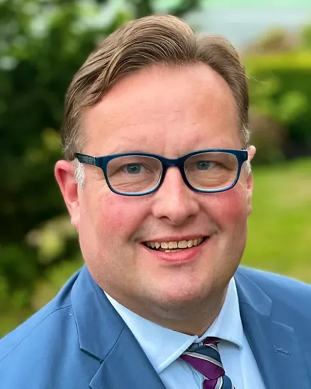MLA · Chilliwack North**Centre BC**Dan Grice
Researched by voche.meExplore the profile ](https://voche.me/bc/provincial-2026/candidates/dan-grice) [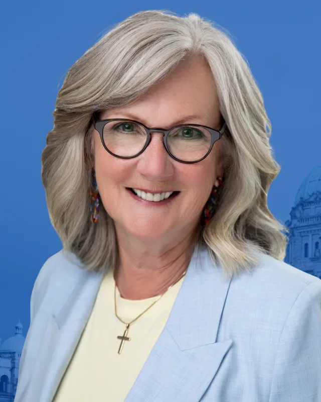MLA · Chilliwack North**Conservative Party of BC**Heather Maahs
Researched by voche.meExplore the profile ](https://voche.me/bc/provincial-2026/candidates/heather-maahs)
- People, 2021 census
- 52,530
- Area
- 245 km²
- Registered voters, 2024
- 39,227
- Turnout, 2024
- 55.07%
- Median age
- 42.0
- Median household income, 2020
- $72,000
THE DISTRICT
## Where Chilliwack North is
245 km² · 52,530 people
Chilliwack North covers the northern and eastern parts of the City of Chilliwack and reaches east to Popkum. The Electoral Boundaries Commission's 2023 final report says it is centred on downtown Chilliwack and extends from Sumas Mountain Road in the west to Popkum in the east. The western boundary follows Sumas Mountain Road and the Vedder Canal, and the northern boundary follows the Fraser River. To the south and east the boundary follows the Vedder River, the Southern Railway and Highway 1, as well as Lickman, South Sumas, Evans and Vedder Roads. The commission gives the district an area of 245 square kilometres and a population of 52,440, which is 2.5% below the average district.
The City of Chilliwack divides its land into urban, hillside and rural neighbourhoods. Its neighbourhood planning page lists Chilliwack Proper and Fairfield Island and the Downtown as urban neighbourhood plans, and the Eastern Hillsides as a hillside plan. The same page says that most of the city's land lies in the Agricultural Land Reserve, a provincial zone that limits building, so the city directs growth into the areas that already have services. Elections BC counted 72 voting areas in the district, and in 2024 voters used schools, churches and halls in the city centre, Fairfield Island, East Chilliwack, Greendale and Rosedale, according to its results file. Yale Road, Highway 1 and the Highway 9 bridge to Agassiz are the main routes.
- Downtown Chilliwack
- Fairfield Island
- East Chilliwack
- Greendale
- Rosedale
- Popkum
Sources: [British Columbia Electoral Boundaries Commission (opens in a new tab)](https://elections.bc.ca/docs/rpt/BCEBC-Final-Report-April-3-2023.pdf), [City of Chilliwack (opens in a new tab)](https://chilliwack.com/main/page.cfm?id=1618), [Elections BC (opens in a new tab)](https://catalogue.data.gov.bc.ca/dataset/44914a35-de9a-4830-ac48-870001ef8935), [Province of British Columbia (opens in a new tab)](https://www2.gov.bc.ca/gov/content/transportation-projects/other-transportation-projects/agassiz-rosedale-bridge)
HISTORY
## The history of the area
Checked Thursday, October 8, 2026
### Stó:lō territory, Cheam and Popkum
The Province of British Columbia lists the Stó:lō Nation as 11 member bands in the Fraser Valley, among them Popkum, Skowkale, Tzeachten and Yakweakwioose, with a population of 2,742. It says all 11 bands are negotiating land and resource issues outside the British Columbia treaty process. For Popkum Indian Band the Province gives a population of 14. BC Geographical Names records Popkum as a community south of the Fraser River.
Cheam First Nation, in its own spelling Xwchíyò:m, has its office at 52161 Victor Drive in Rosedale, and the Province gives its population as 585 and its location as near Rosedale. The Nation's land base page lists two reserves: Cheam 1 of 332.6 hectares and Tseatah 2 of 93.4 hectares, 426.0 hectares in all. Its home page states: "We have never ceded or surrendered title to our lands, rights to our resources, or authority to make decisions within our territory." The Chilliwack Museum and Archives says archaeological sites near Mount Shannon show that Stó:lō people lived in and travelled through the Cheam area before settlers came. The museum's timeline records that in 1991 the Cheam Band shut down the Canadian National main line to draw attention to a dispute with fisheries.
BC Geographical Names says the name Chilliwack comes from Tcil'Qe'uk, a Halkomelem word meaning valley of many streams, and that it is also the name of the tribe of this area.
Sources: [Province of British Columbia (opens in a new tab)](https://www2.gov.bc.ca/gov/content/environment/natural-resource-stewardship/consulting-with-first-nations/first-nations-negotiations/first-nations-a-z-listing/st-lo-nation1), [Province of British Columbia (opens in a new tab)](https://www2.gov.bc.ca/gov/content/environment/natural-resource-stewardship/consulting-with-first-nations/first-nations-negotiations/first-nations-a-z-listing/popkum-indian-band), [BC Geographical Names Office (opens in a new tab)](https://apps.gov.bc.ca/pub/bcgnws/names/34730.html), [Province of British Columbia (opens in a new tab)](https://www2.gov.bc.ca/gov/content/environment/natural-resource-stewardship/consulting-with-first-nations/first-nations-negotiations/first-nations-a-z-listing/cheam-first-nation), [Cheam First Nation (Xwchíyò:m) (opens in a new tab)](https://cheam.ca/about/land-base/), [Cheam First Nation (Xwchíyò:m) (opens in a new tab)](https://cheam.ca), [Chilliwack Museum and Archives (opens in a new tab)](https://epe.lac-bac.gc.ca/100/205/301/ic/cdc/chilliwack/history/cov/cheam.htm), [Chilliwack Museum and Archives (opens in a new tab)](https://epe.lac-bac.gc.ca/100/205/301/ic/cdc/chilliwack/history/timelines/1990.htm), [BC Geographical Names Office (opens in a new tab)](https://apps.gov.bc.ca/pub/bcgnws/names/38675.html)
### Chilliwack Landing and Five Corners, 1858 to 1887
The Chilliwack Museum and Archives says the first businesses of Chilliwack stood at Chilliwack Landing, at the foot of Wellington Avenue on the Fraser River. From 1858, the year of the Fraser River gold rush, riverboats landed there and served a small farming community. In the early 1860s Jonathon Reece, John Lawrence, William Teague, and Isaac and James Kipp pre-empted land east of the Landing on a large clearing known as Chilliwack Prairie. A First Nations reserve laid out after 1867 surrounded the Landing, and the land beside it flooded, so a new commercial centre was needed.
A road and a church supplied the reason. By 1873 work had started on Yale Road, which joined the coast to the interior. On a promise from Bishop Hills, a frame building from Port Douglas on Harrison Lake was moved to the place where Landing Road met Yale Road, and it became St. Thomas' Church. A blacksmith shop, a school, houses, a flour mill, a general store and McKeever's Hotel then gathered around it. The museum says the post office moved from the Landing to this centre, called Five Corners, in 1887. The place had been known as Centreville, and the post office adopted the name Chilliwack that year. The museum describes Five Corners today as a heritage district.
Sources: [Chilliwack Museum and Archives (opens in a new tab)](https://epe.lac-bac.gc.ca/100/205/301/ic/cdc/chilliwack/history/cov/chilliwack.htm), [Chilliwack Museum and Archives (opens in a new tab)](https://epe.lac-bac.gc.ca/100/205/301/ic/cdc/chilliwack/history/timelines/1800.htm)
### Rosedale, East Chilliwack and Fairfield Island, 1869 to 1961
The museum says the completion of the Yale to New Westminster wagon road in 1873 or 1874 led directly to the settlement of Rosedale. J.C. Henderson and T.H. Henderson acquired land near the town site in the early 1880s. By 1890 a one-room school with fifteen students stood at the corner of Yale and McGrath Roads, and that corner became the commercial centre. Population grew for more than thirty years from the 1890s, fuelled by logging, the railway and farming, and farms replaced sawmills. A Methodist church (now United, 1908), a hotel (1910), an Anglican church (1912) and a four-room school (1914) were built in that period.
In East Chilliwack the museum names Charles Brown and D. Wedler as the first settlers, who arrived in 1869 or 1870. Banford Road dates from 1879, Upper Prairie Road from 1886 and Gibson Road from 1896, and a school was built by 1890. The museum calls the East Chilliwack Women's Institute Hall the first Women's Institute hall in British Columbia owned and built by a Women's Institute. On Fairfield Island, between the Fraser River and Hope Slough, the Province created the School District of Fairfield Island on May 11, 1892. Strathcona Elementary opened there as a two-room school in 1909, sat unused for some years in the late 1950s, and reopened in September 1961 as the area became residential. Strathcona Elementary and East Chilliwack Elementary were both voting places in 2024.
Sources: [Chilliwack Museum and Archives (opens in a new tab)](https://epe.lac-bac.gc.ca/100/205/301/ic/cdc/chilliwack/history/cov/rosedale.htm), [Chilliwack Museum and Archives (opens in a new tab)](https://epe.lac-bac.gc.ca/100/205/301/ic/cdc/chilliwack/history/cov/echilli.htm), [Chilliwack Museum and Archives (opens in a new tab)](https://epe.lac-bac.gc.ca/100/205/301/ic/cdc/chilliwack/history/cov/fairfield.htm), [Elections BC (opens in a new tab)](https://catalogue.data.gov.bc.ca/dataset/44914a35-de9a-4830-ac48-870001ef8935)
### Sumas becomes Greendale, 1858 to 1971
The museum says Greendale was called Sumas until 1951, when the name was changed because too many towns had the same name. In 1858 the Royal Engineers of the Boundary Survey set up a camp at Sumas, and a supply hut and a Hudson's Bay Company saltery near the mouth of the Sumas River were the first colonial buildings there. A colonial post office opened in 1867 in David W. Miller's store at Miller's Landing. The Sumas School District was created on October 13, 1871, and a new school opened in spring 1873 on land given by George Chadsey. Chadsey also gave the land for the Sumas Methodist Church, built in 1886. The church closed in 1971 when its members joined Carman United Church in Sardis.
Mennonite families came to Sumas as the bed of Sumas Lake was turned into farmland. In April 1930 a wooded lot of 686 acres owned by the Northern Construction Company was divided into 28 lots of 18 to 25 acres each, offered at $42.00 per acre to Mennonite families only. The museum says this sale led to the commercial core of Sumas, and that businesses later grew along the Trans-Canada Highway, which ran through the area after the Vedder Canal bridge was finished in 1925. Greendale Elementary Community School was a voting place in the district in 2024.
Sources: [Chilliwack Museum and Archives (opens in a new tab)](https://epe.lac-bac.gc.ca/100/205/301/ic/cdc/chilliwack/history/cov/sumas.htm), [Elections BC (opens in a new tab)](https://catalogue.data.gov.bc.ca/dataset/44914a35-de9a-4830-ac48-870001ef8935)
### The floods of 1894 and 1948 and the dykes
The Chilliwack Museum and Archives says the Fraser River began to rise on May 19, 1894 after a hot spell in the interior, and reached its maximum height of 25.75 feet on the Mission gauge on June 6. The whole Chilliwack community was under water and crops and livestock were badly damaged. The only flood control measure at the time was a dam across Hope Slough at Rosedale, built in 1892. The museum's timeline records that the dyking contract was completed in 1903 after three years, at a cost of $265,000. The museum's history of downtown says the dykes extend from Rosedale to Sumas Mountain.
In 1948 the dyke at Agassiz broke on May 26, and the river peaked in early June at 24.73 feet on the Mission gauge, one foot lower than in 1894. People were evacuated from Greendale and Herrling Island. The museum says civilian crews and troops from the army base at Vedder Crossing reinforced the old dykes, and that the dyke broke at Greendale. Its timeline records that the first survey of the damage found two thousand homes flooded. Federal and provincial governments spent $1,359,745 on the Sumas and Chilliwack dykes after the flood. At the end of February 1951 a winter flood covered most of downtown Chilliwack.
Sources: [Chilliwack Museum and Archives (opens in a new tab)](https://chilliwackmuseum.ca/floods/Flood_3.html), [Chilliwack Museum and Archives (opens in a new tab)](https://chilliwackmuseum.ca/floods/Flood_5.html), [Chilliwack Museum and Archives (opens in a new tab)](https://epe.lac-bac.gc.ca/100/205/301/ic/cdc/chilliwack/history/timelines/1900.htm), [Chilliwack Museum and Archives (opens in a new tab)](https://epe.lac-bac.gc.ca/100/205/301/ic/cdc/chilliwack/history/timelines/1940.htm), [Chilliwack Museum and Archives (opens in a new tab)](https://epe.lac-bac.gc.ca/100/205/301/ic/cdc/chilliwack/history/timelines/1950.htm), [Chilliwack Museum and Archives (opens in a new tab)](https://epe.lac-bac.gc.ca/100/205/301/ic/cdc/chilliwack/history/cov/chilliwack.htm), [Chilliwack Museum and Archives (opens in a new tab)](https://epe.lac-bac.gc.ca/100/205/301/ic/cdc/chilliwack/history/cov/sumas.htm)
### A city of its own, 1891 to 1999
The Chilliwack Progress says it was founded in 1891 by W.T. Jackman. BC Geographical Names records that the Township of Chilliwhack was incorporated on April 26, 1873 and the City of Chilliwack on February 21, 1908, and the museum's timeline lists the first city council, with Samuel A. Cawley as mayor by acclamation. A fire in 1906 wiped out seven stores on the north side of Wellington Avenue. The first British Columbia Electric Railway train entered Chilliwack in 1910, and the museum says the steamboat era ended when it did. A new post office opened in 1911, and the hospital, City Hall and Chilliwack High School in 1912.
The Canadian Register of Historic Places says Chilliwack City Hall, designed by Thomas Hooper and built from 1910 to 1912, is the only pre-1930 Canadian municipal hall constructed entirely of reinforced concrete. It was recognized as a National Historic Site on November 23, 1984. The building stopped serving as the municipal hall in 1980 and now houses the Chilliwack Museum at 45820 Spadina Avenue. A war cenotaph on the grounds dates from 1923. On January 1, 1980 the City and the Township merged into the District of Chilliwack, which became the City of Chilliwack again in 1999.
Sources: [Chilliwack Progress (opens in a new tab)](https://www.theprogress.com/community/chilliwack-progress-130th-a-place-for-accurate-and-trustworthy-news-says-former-publisher/), [BC Geographical Names Office (opens in a new tab)](https://apps.gov.bc.ca/pub/bcgnws/names/38675.html), [Chilliwack Museum and Archives (opens in a new tab)](https://epe.lac-bac.gc.ca/100/205/301/ic/cdc/chilliwack/history/timelines/1900.htm), [Chilliwack Museum and Archives (opens in a new tab)](https://epe.lac-bac.gc.ca/100/205/301/ic/cdc/chilliwack/history/timelines/1910.htm), [Chilliwack Museum and Archives (opens in a new tab)](https://epe.lac-bac.gc.ca/100/205/301/ic/cdc/chilliwack/history/cov/chilliwack.htm), [Canadian Register of Historic Places (opens in a new tab)](https://historicplaces.ca/en/rep-reg/place-lieu.aspx?id=7408)
### Yale Road, the highway and the Rosedale bridge, 1873 to 1956
Yale Road was the first long road through the district. The museum says work on it had started by 1873. Its timeline records that in 1931 it was officially announced that the Trans-Canada Highway would follow the old Yale Road south of the Fraser River. In the Greendale area the museum says the highway ran through the community after the Vedder Canal bridge was completed in 1925, and that a few cement mileage markers from the old highway can still be seen along Yale Road.
East of Rosedale the Fraser River was crossed by the Agassiz-Rosedale Bridge, which opened in 1956. The museum's timeline says the city was in a gala mood for the opening. The Province gives the bridge a length of 1,870 metres and says it lies on the Fraser River between Agassiz and Rosedale and Bridal Falls, and carries two lanes of Highway 9 between Highway 1 and Highway 7.
Sources: [Chilliwack Museum and Archives (opens in a new tab)](https://epe.lac-bac.gc.ca/100/205/301/ic/cdc/chilliwack/history/cov/chilliwack.htm), [Chilliwack Museum and Archives (opens in a new tab)](https://epe.lac-bac.gc.ca/100/205/301/ic/cdc/chilliwack/history/timelines/1800.htm), [Chilliwack Museum and Archives (opens in a new tab)](https://epe.lac-bac.gc.ca/100/205/301/ic/cdc/chilliwack/history/timelines/1930.htm), [Chilliwack Museum and Archives (opens in a new tab)](https://epe.lac-bac.gc.ca/100/205/301/ic/cdc/chilliwack/history/cov/sumas.htm), [Chilliwack Museum and Archives (opens in a new tab)](https://epe.lac-bac.gc.ca/100/205/301/ic/cdc/chilliwack/history/timelines/1950.htm), [Province of British Columbia (opens in a new tab)](https://www2.gov.bc.ca/gov/content/transportation-projects/other-transportation-projects/agassiz-rosedale-bridge)
THE SEAT
## Who has held the seat
Legislative Assembly records, 35th Parliament onward
Chilliwack North is a district created by the Electoral Boundaries Commission's final report of April 3, 2023, and the 2024 provincial general election is the only one held under its name. The two Chilliwack districts were renamed and had their boundaries adjusted. The commission's preliminary report had put the north bank Fraser communities of Durieu, Dewdney, Deroche, Lake Errock and Harrison Mills in Chilliwack North. The commission heard that those communities have limited service connections and transportation links with the rest of the riding, and moved them to Fraser-Nicola. It also moved Popkum into Chilliwack North and Yarrow into Chilliwack-Cultus Lake. Elections BC counts 72 voting areas in the district and lists overlaps with the 2017 to 2024 districts of 63 with Chilliwack, 6 with Chilliwack-Kent, 1 with Abbotsford-Mission and 1 with Fraser-Nicola.
The district has a predecessor called Chilliwack. Elections BC's volume for 1871 to 1986 prints Westminster-Chilliwhack Riding at the general election of 1898, won by Charles William Munro with 301 votes (55.03%), and Chilliwhack in 1903, won by Munro as a Liberal with 330 votes (55.28%). Samuel Arthur Cawley won in 1909 with 604 votes (54.07%) and was acclaimed in 1912. The volume prints the spelling Chilliwack from 1916, when Edward Dodsley Barrow won with 987 votes (55.64%).
Elections BC's volume for 1987 to 2001 lists Robert Chisholm of the Liberal Party as elected for Chilliwack in 1991. Barry Penner of the Liberal Party won Chilliwack in 1996 with 9,273 votes (37.90%). At the 2001 election the volume prints Chilliwack-Kent and Chilliwack-Sumas, and the 2002 to 2013 volume lists John Les as the winner of Chilliwack-Sumas in 2005. Chilliwack returns at the 2009 election, which Les won with 8,138 votes (44.61%). John Martin of the BC Liberal Party won Chilliwack in 2013 with 9,989 votes (47.56%) and in 2017 with 9,280 (48.42%). Dan Coulter of the BC NDP won it in 2020 with 7,349 votes (41.56%).
In 2024 Heather Maahs of the Conservative Party won Chilliwack North with 11,776 votes (54.58%). Dan Coulter of the BC NDP received 8,125 (37.66%), Tim Cooper of the BC Green Party 1,187 (5.5%) and Dan Grice, an independent, 487 (2.26%). Turnout was 55.07% of 39,227 registered voters, and 21,575 valid votes were counted.
Sources: [British Columbia Electoral Boundaries Commission (opens in a new tab)](https://elections.bc.ca/docs/rpt/BCEBC-Final-Report-April-3-2023.pdf), [Elections BC (opens in a new tab)](https://elections.bc.ca/docs/rpt/1871-1986_ElectoralHistoryofBC.pdf), [Elections BC (opens in a new tab)](https://elections.bc.ca/docs/rpt/1987-2001-ElectionHistory.pdf), [Elections BC (opens in a new tab)](https://elections.bc.ca/docs/rpt/2002-2013-ElectionHistory.pdf), [Elections BC (opens in a new tab)](https://catalogue.data.gov.bc.ca/dataset/44914a35-de9a-4830-ac48-870001ef8935)
Members for Chilliwack North
| Parliament | It sat | Member | Elected as | Party on the legislature’s record |
| --- | --- | --- | --- | --- |
| 43rd | 2025 to 2026 | Heather Maahs | Conservative Party | Conservative Party of BC |
Members for Chilliwack, which covered 63 of this district’s 72 voting areas before 2024
| Parliament | It sat | Member | Elected as | Party on the legislature’s record |
| --- | --- | --- | --- | --- |
| 42nd | 2020 to 2024 | Dan Coulter | BC NDP | BC NDP |
| 41st | 2017 to 2020 | John Martin | BC Liberal Party | BC Liberal Party |
| 40th | 2013 to 2017 | John Martin | BC Liberal Party | BC Liberal Party |
| 39th | 2009 to 2013 | John Les | BC Liberal Party | BC Liberal Party |
| 36th | 1996 to 2001 | Barry Penner | | BC Liberal Party |
| 35th | 1992 to 1996 | Robert Chisholm | | BC Liberal Party |
“Elected as” is the affiliation Elections BC printed with the winning result. The last column is the party the legislature’s records give for that parliament, which differs when a member changed party while in office. A row with that column empty is a winner Elections BC prints whom the legislature’s records leave out. Source: [Legislative Assembly of British Columbia (opens in a new tab)](https://www.leg.bc.ca/members)
### Boundaries since 2024
Chilliwack North has 72 voting areas. They overlap these districts from 2017 to 2024: Chilliwack (63), Chilliwack-Kent (6), Abbotsford-Mission (1), Fraser-Nicola (1).
The commission that drew the boundaries counted 52,440 people in the district, 2.5% below the average for a district, over 245 km².
Sources: [British Columbia Electoral Boundaries Commission, Final report, April 3, 2023 (opens in a new tab)](https://elections.bc.ca/docs/rpt/BCEBC-Final-Report-April-3-2023.pdf), [Elections BC, Voting area conversion table, 2017 to 2024 (opens in a new tab)](https://catalogue.data.gov.bc.ca/dataset/fb26db04-780c-4229-a147-da4fd5311d36)
PAST RESULTS
## Every result since 2009
From Elections BC
**2024 Provincial General Election**Heather Maahs, Conservative Party, 54.58%
| Candidate | Affiliation | Votes | Share |
| --- | --- | --- | --- |
| Heather MaahsElected | Conservative Party | 11,776 | 54.58% |
| Dan Coulter | BC NDP | 8,125 | 37.66% |
| Tim Cooper | BC Green Party | 1,187 | 5.50% |
| Dan Grice | Independent | 487 | 2.26% |
21,575 valid votes · 26 rejected ballots · 39,227 registered voters · 55.07% voted
### Chilliwack, 2009 to 2020
**2020 General Election**Dan Coulter, BC NDP, 41.56%
| Candidate | Affiliation | Votes | Share |
| --- | --- | --- | --- |
| Dan CoulterElected | BC NDP | 7,349 | 41.56% |
| John Martin | BC Liberal Party | 5,102 | 28.85% |
| Diane Janzen | Conservative | 2,910 | 16.46% |
| Tim Cooper | BC Green Party | 1,888 | 10.68% |
| Josue Anderson | Independent | 257 | 1.45% |
| Andrew Coombes | Libertarian | 177 | 1.00% |
17,683 valid votes · 216 rejected ballots
**2017 General Election**John Martin, BC Liberal Party, 48.42%
| Candidate | Affiliation | Votes | Share |
| --- | --- | --- | --- |
| John MartinElected | BC Liberal Party | 9,280 | 48.42% |
| Tracey Lorrean O'Hara | BC NDP | 6,207 | 32.39% |
| Wayne Froese | BC Green Party | 3,277 | 17.10% |
| Ryan McKinnon | Independent | 402 | 2.10% |
19,166 valid votes · 139 rejected ballots
**2013 General Election**John Martin, BC Liberal Party, 47.56%
| Candidate | Affiliation | Votes | Share |
| --- | --- | --- | --- |
| John MartinElected | BC Liberal Party | 9,989 | 47.56% |
| Patti MacAhonic | BC NDP | 6,551 | 31.19% |
| Chad Elton Eros | Conservative | 2,515 | 11.98% |
| Kim Reimer | BC Green Party | 1,766 | 8.41% |
| Michael Raymond Halliday | BC Excalibur Party | 181 | 0.86% |
21,002 valid votes · 101 rejected ballots
**2009 General Election**John Les, BC Liberal Party, 44.61%
| Candidate | Affiliation | Votes | Share |
| --- | --- | --- | --- |
| John LesElected | BC Liberal Party | 8,138 | 44.61% |
| Mason Goulden | BC NDP | 5,908 | 32.39% |
| Benjamin Besler | Conservative | 2,672 | 14.65% |
| Fraea Bolding | BC Green Party | 1,523 | 8.35% |
18,241 valid votes · 141 rejected ballots
The boundaries changed before the 2009, 2017 and 2024 elections, so a result under the same name can cover a different area. Sources: [Elections BC, Provincial Voting Results (opens in a new tab)](https://catalogue.data.gov.bc.ca/dataset/44914a35-de9a-4830-ac48-870001ef8935), [Statement of Votes, 2024 Provincial General Election (opens in a new tab)](https://elections.bc.ca/docs/rpt/statement-of-votes-2024-provincial-election.pdf)
PEOPLE · 2021 CENSUS
## Who lives in Chilliwack North
52,530 residents · British Columbia beside each figure
### Age
- Median age
- 42.0BC 42.8
- Under 1517.7%BC 14.3%
- 15 to 6461.0%BC 65.3%
- 65 and over21.3%BC 20.3%
- 85 and over3.4%BC 2.4%
### Households
- Households
- 21,255
- People per household
- 2.4BC 2.4
#### Who lives together
- Couples with children21.1%BC 22.7%
- Couples without children24.8%BC 26.4%
- One-parent families9.0%BC 7.6%
- Multigenerational households3.1%BC 3.7%
- People living alone31.6%BC 29.4%
#### Household size
- 1 person31.6%BC 29.4%
- 2 persons33.9%BC 35.3%
- 3 persons13.4%BC 14.5%
- 4 persons11.1%BC 12.6%
- 5 or more persons10.0%BC 8.2%
### Homes
- Median home value
- $695,000BC $785,000
- Median monthly rent and utilities
- $1,090BC $1,370
- Median monthly cost for owners
- $1,190BC $1,320
#### Own or rent
- Own their home65.9%BC 66.8%
- Rent their home33.5%BC 32.8%
- Home provided by a local government or First Nation0.6%BC 0.5%
#### Type of home
- Single-detached house50.1%BC 42.4%
- Semi-detached house4.0%BC 3.1%
- Row house11.2%BC 8.3%
- Apartment or flat in a duplex3.4%BC 12.2%
- Apartment in a building that has fewer than five storeys28.3%BC 20.4%
- Apartment in a building that has five or more storeys1.1%BC 10.9%
- Other single-attached house0.1%BC 0.2%
- Movable dwelling1.8%BC 2.5%
#### When the home was built
- 1960 or earlier15.0%BC 12.5%
- 1961 to 198029.1%BC 27.0%
- 1981 to 199014.0%BC 14.2%
- 1991 to 200018.4%BC 16.5%
- 2001 to 20054.8%BC 6.0%
- 2006 to 20107.5%BC 8.0%
- 2011 to 20153.9%BC 6.6%
- 2016 to 20217.2%BC 9.1%
### Housing costs
- Renters paying 30% or more of income on housing38.9%BC 37.8%
- Owners paying 30% or more of income on housing15.9%BC 19.3%
- Renters in core housing need27.5%BC 24.7%
- Owners in core housing need5.5%BC 8.0%
- Renters in subsidized housing11.8%BC 11.0%
- Owners with a mortgage61.8%BC 57.5%
### Income
Income is for the year 2020.
- Median household income
- $72,000BC $85,000
- After tax
- $65,500BC $76,000
- Median income per person
- $37,200BC $40,800
#### Living on a low income (after-tax measure)
- All ages12.9%BC 10.8%
- Under 1813.0%BC 11.3%
- 18 to 6410.2%BC 9.7%
- 65 and over20.4%BC 13.8%
### Languages
#### First language learned
- English85.2%BC 67.1%
- German1.9%BC 1.0%
- Dutch1.6%BC 0.4%
- Punjabi (Panjabi)1.2%BC 4.9%
- French1.0%BC 1.2%
- Spanish0.9%BC 1.2%
- Tagalog (Pilipino, Filipino)0.7%BC 1.7%
- Vietnamese0.6%BC 0.7%
- Mandarin0.4%BC 4.1%
- Korean0.3%BC 1.2%
#### Spoken most often at home
- English93.5%BC 78.5%
- Punjabi (Panjabi)0.9%BC 3.8%
- Spanish0.4%BC 0.6%
- Vietnamese0.4%BC 0.4%
- German0.3%BC 0.1%
- French0.3%BC 0.3%
- Mandarin0.2%BC 3.3%
- Tagalog (Pilipino, Filipino)0.2%BC 0.9%
#### English and French
- English only95.1%BC 90.1%
- English and French4.0%BC 6.6%
- Neither English nor French0.9%BC 3.3%
### Immigration
- Born outside Canada (immigrants)
- 14.7%BC 29.0%
- Non-permanent residents
- 0.7%BC 3.5%
#### Where immigrants were born
- United Kingdom14.1%BC 8.2%
- Netherlands11.7%BC 1.1%
- India7.8%BC 13.8%
- Philippines7.7%BC 9.2%
- United States of America7.7%BC 4.2%
- Germany6.0%BC 2.2%
- Viet Nam4.0%BC 2.3%
- China3.2%BC 15.3%
- South Africa, Republic of1.9%BC 1.1%
- Oceania and other places of birth1.8%BC 2.3%
#### When immigrants arrived
- Arrived before 198035.9%BC 19.7%
- 1980 to 199012.7%BC 11.5%
- 1991 to 200011.3%BC 21.0%
- 2001 to 201018.2%BC 22.2%
- 2011 to 202122.0%BC 25.6%
#### Generations in Canada
- First generation16.4%BC 33.7%
- Second generation20.1%BC 21.7%
- Third generation or more63.4%BC 44.5%
### Identity and origins
- Indigenous identity
- 10.7%BC 5.9%
- Visible minority
- 11.0%BC 34.4%
#### Visible minority groups
- South Asian3.0%BC 9.6%
- Filipino1.7%BC 3.5%
- Chinese1.2%BC 11.2%
- Latin American1.2%BC 1.3%
- Southeast Asian1.1%BC 1.5%
- Black1.1%BC 1.3%
- Multiple visible minorities0.4%BC 1.2%
- Arab0.3%BC 0.6%
- Japanese0.3%BC 0.9%
- Korean0.3%BC 1.5%
- Visible minority (other)0.3%BC 0.4%
- West Asian0.2%BC 1.4%
#### Ethnic or cultural origins reported most often
- English23.3%BC 20.7%
- Scottish18.8%BC 15.8%
- German16.9%BC 11.0%
- Irish14.7%BC 12.8%
- Canadian13.2%BC 9.3%
- Dutch12.8%BC 3.9%
- French7.8%BC 6.4%
- Ukrainian5.2%BC 4.3%
- First Nations (North American Indian)4.9%BC 2.1%
- British Isles3.7%BC 3.9%
### Religion
- No religion48.8%BC 52.1%
- Christian46.1%BC 34.3%
- Sikh1.5%BC 5.9%
- Other religions1.2%BC 1.0%
- Muslim0.8%BC 2.6%
- Buddhist0.6%BC 1.7%
- Hindu0.5%BC 1.7%
- Traditional Indigenous spirituality0.4%BC 0.2%
- Jewish0.1%BC 0.5%
### Education
Highest level completed, ages 25 to 64.
- No certificate, diploma or degree13.4%BC 8.0%
- High school diploma36.7%BC 25.8%
- College, trades or other certificate below a bachelor’s degree34.9%BC 31.2%
- Bachelor’s degree or higher15.0%BC 35.0%
### Work
- In the labour force
- 60.2%BC 63.3%
- Employed
- 55.9%BC 57.9%
- Unemployment rate at the census
- 7.1%BC 8.4%
#### Industries with the most workers
- Construction12.9%BC 9.0%
- Retail trade12.6%BC 11.6%
- Health care and social assistance11.5%BC 12.3%
- Manufacturing9.2%BC 5.9%
- Agriculture, forestry, fishing and hunting6.6%BC 2.3%
- Accommodation and food services6.6%BC 7.0%
- Educational services6.4%BC 7.4%
- Other services (except public administration)5.5%BC 4.4%
#### Kinds of work
- Sales and service occupations26.4%BC 25.6%
- Trades, transport and equipment operators and related occupations23.5%BC 18.0%
- Business, finance and administration occupations13.6%BC 17.1%
- Occupations in education, law and social, community and government services11.5%BC 11.9%
- Health occupations6.4%BC 7.7%
- Natural resources, agriculture and related production occupations6.3%BC 2.8%
- Occupations in manufacturing and utilities5.5%BC 3.4%
- Natural and applied sciences and related occupations3.7%BC 8.0%
- Occupations in art, culture, recreation and sport2.3%BC 4.2%
- Legislative and senior management occupations0.9%BC 1.2%
### Getting to work
#### Where people worked
- Worked at home13.6%BC 22.6%
- Worked outside Canada0.2%BC 0.4%
- No fixed workplace address19.2%BC 15.3%
- Worked at a usual workplace67.0%BC 61.6%
#### How commuters travelled
- Car, truck or van90.2%BC 79.9%
- Public transit1.7%BC 9.3%
- On foot5.0%BC 6.5%
- Bicycle1.2%BC 2.0%
- Other method2.0%BC 2.3%
#### Length of the trip
- Less than 15 minutes41.3%BC 31.8%
- 15 to 29 minutes28.3%BC 34.0%
- 30 to 44 minutes15.5%BC 19.7%
- 45 to 59 minutes5.8%BC 7.3%
- 60 minutes and over9.2%BC 7.2%
### Moving
Where residents lived five years before the census.
- Lived at the same address52.6%BC 56.2%
- Moved within the same municipality21.7%BC 16.1%
- Moved from elsewhere in BC20.1%BC 17.0%
- Moved from another province3.6%BC 4.6%
- Moved from another country2.0%BC 6.1%
Counts in the census are rounded to the nearest 5, and shares are worked out from those counts. Source: [BC Stats, from Statistics Canada tabulations, 2021 Census Profile for BC Provincial Electoral Districts (2023 Redistribution) (opens in a new tab)](https://catalogue.data.gov.bc.ca/dataset/census-profiles-for-bc-provincial-electoral-districts)
QUESTIONS
## Questions about Chilliwack North
10 answers
### Where is Chilliwack North?
Chilliwack North is a provincial electoral district in the Fraser Valley of British Columbia. The Electoral Boundaries Commission's 2023 final report says it is centred on downtown Chilliwack and extends from Sumas Mountain Road in the west to Popkum in the east. The Fraser River forms its northern boundary. The commission gives its area as 245 square kilometres.
### Which communities are in Chilliwack North?
Chilliwack North consists of downtown Chilliwack and the nearby communities of Greendale, Popkum and Rosedale, according to the Electoral Boundaries Commission's 2023 final report. In 2024 Elections BC also placed voting places in the district on Fairfield Island and in East Chilliwack, at Strathcona Elementary and East Chilliwack Elementary. Cheam First Nation has its office in Rosedale.
### Who won Chilliwack North in the 2024 provincial election?
Heather Maahs of the Conservative Party won Chilliwack North in 2024 with 11,776 votes, 54.58% of the valid vote. Dan Coulter of the BC NDP received 8,125 votes, 37.66%. Turnout was 55.07% of 39,227 registered voters, and 21,575 valid votes were counted in the district.
### Who represented this area before 2024?
Dan Coulter of the BC NDP represented the earlier district of Chilliwack from 2020 to 2024, and 63 of Chilliwack North's 72 voting areas overlap with it. Coulter won Chilliwack in 2020 with 7,349 votes, 41.56%. John Martin of the BC Liberal Party held Chilliwack from 2013 to 2020, and John Les held it from 2009 to 2013.
### When was Chilliwack North created?
Chilliwack North was created by the Electoral Boundaries Commission's final report of April 3, 2023, and the 2024 provincial general election was the first held under the name. The commission also moved Popkum into Chilliwack North and Yarrow into Chilliwack-Cultus Lake. It counts 52,440 people in Chilliwack North, which is 2.5% below the average district.
### How many people live in Chilliwack North?
The 2021 census counted 52,530 people in Chilliwack North, with a median age of 42 compared with 42.8 across British Columbia. Of households, 65.9% own their home and 33.5% rent. The median household income is $72,000, the median home value is $695,000, and the median rent is $1,090. English is the first language of 85.2%.
### Which First Nations are connected to Chilliwack North?
Cheam First Nation (Xwchíyò:m) has its office in Rosedale, in Chilliwack North, and the Province gives its location as near Rosedale. Popkum Indian Band is a member of the Stó:lō Nation. Cheam's home page says its people have lived in S'ólh Téméxw for thousands of years. The Province lists the Stó:lō Nation as 11 bands in the Fraser Valley.
### When was the City of Chilliwack incorporated?
BC Geographical Names records that the City of Chilliwack was incorporated on February 21, 1908, and that the Township of Chilliwhack had been incorporated on April 26, 1873. The two merged on January 1, 1980 as the District of Chilliwack. Downtown Chilliwack lies in Chilliwack North.
### Why was Greendale evacuated in 1948?
Greendale, a community in Chilliwack North, was evacuated in 1948 because the Fraser River was in flood. The Chilliwack Museum and Archives says the Agassiz dyke broke on May 26, other dykes broke later, and people were evacuated from Greendale and Herrling Island. The river peaked in early June at 24.73 feet on the Mission gauge, one foot lower than in 1894.
### What is Chilliwack City Hall?
Chilliwack City Hall is a National Historic Site at 45820 Spadina Avenue in downtown Chilliwack, inside Chilliwack North. It was designed by Thomas Hooper and built from 1910 to 1912. The Canadian Register of Historic Places says it is the only pre-1930 Canadian municipal hall made entirely of reinforced concrete. It now houses the Chilliwack Museum.
SOURCES
## Where this page comes from
Figures read Thursday, October 8, 2026
1. [2021 Census Profile for BC Provincial Electoral Districts (2023 Redistribution) (opens in a new tab)](https://catalogue.data.gov.bc.ca/dataset/census-profiles-for-bc-provincial-electoral-districts)BC Stats, from Statistics Canada tabulations · read Thursday, October 8, 2026
2. [Provincial Voting Results (opens in a new tab)](https://catalogue.data.gov.bc.ca/dataset/44914a35-de9a-4830-ac48-870001ef8935)Elections BC · read Thursday, October 8, 2026
3. [Statement of Votes, 2024 Provincial General Election (opens in a new tab)](https://elections.bc.ca/docs/rpt/statement-of-votes-2024-provincial-election.pdf)Elections BC · read Thursday, October 8, 2026
4. [Voting area conversion table, 2017 to 2024 (opens in a new tab)](https://catalogue.data.gov.bc.ca/dataset/fb26db04-780c-4229-a147-da4fd5311d36)Elections BC · read Thursday, October 8, 2026
5. [Final report, April 3, 2023 (opens in a new tab)](https://elections.bc.ca/docs/rpt/BCEBC-Final-Report-April-3-2023.pdf)British Columbia Electoral Boundaries Commission · read Thursday, October 8, 2026
6. [Members of the Legislative Assembly, 35th to 43rd Parliament (opens in a new tab)](https://www.leg.bc.ca/members)Legislative Assembly of British Columbia · read Thursday, October 8, 2026
7. [Final report, April 3, 2023 (opens in a new tab)](https://elections.bc.ca/docs/rpt/BCEBC-Final-Report-April-3-2023.pdf)British Columbia Electoral Boundaries Commission · read Thursday, October 8, 2026
8. [Electoral History of British Columbia, 1871 to 1986 (opens in a new tab)](https://elections.bc.ca/docs/rpt/1871-1986_ElectoralHistoryofBC.pdf)Elections BC · read Thursday, October 8, 2026
9. [Electoral History of British Columbia, Supplement, 1987 to 2001 (opens in a new tab)](https://elections.bc.ca/docs/rpt/1987-2001-ElectionHistory.pdf)Elections BC · read Thursday, October 8, 2026
10. [Electoral History of British Columbia, Supplement, 2002 to 2013 (opens in a new tab)](https://elections.bc.ca/docs/rpt/2002-2013-ElectionHistory.pdf)Elections BC · read Thursday, October 8, 2026
11. [Provincial Voting Results (opens in a new tab)](https://catalogue.data.gov.bc.ca/dataset/44914a35-de9a-4830-ac48-870001ef8935)Elections BC · read Thursday, October 8, 2026
12. [Stó:lo Nation (opens in a new tab)](https://www2.gov.bc.ca/gov/content/environment/natural-resource-stewardship/consulting-with-first-nations/first-nations-negotiations/first-nations-a-z-listing/st-lo-nation1)Province of British Columbia · read Thursday, October 8, 2026
13. [Popkum Indian Band (opens in a new tab)](https://www2.gov.bc.ca/gov/content/environment/natural-resource-stewardship/consulting-with-first-nations/first-nations-negotiations/first-nations-a-z-listing/popkum-indian-band)Province of British Columbia · read Thursday, October 8, 2026
14. [Cheam First Nation (opens in a new tab)](https://www2.gov.bc.ca/gov/content/environment/natural-resource-stewardship/consulting-with-first-nations/first-nations-negotiations/first-nations-a-z-listing/cheam-first-nation)Province of British Columbia · read Thursday, October 8, 2026
15. [Agassiz Rosedale Bridge (opens in a new tab)](https://www2.gov.bc.ca/gov/content/transportation-projects/other-transportation-projects/agassiz-rosedale-bridge)Province of British Columbia · read Thursday, October 8, 2026
16. [Cheam First Nation home page (opens in a new tab)](https://cheam.ca)Cheam First Nation (Xwchíyò:m) · read Thursday, October 8, 2026
17. [Land Base (opens in a new tab)](https://cheam.ca/about/land-base/)Cheam First Nation (Xwchíyò:m) · read Thursday, October 8, 2026
18. [Chilliwack, BC Geographical Names record (opens in a new tab)](https://apps.gov.bc.ca/pub/bcgnws/names/38675.html)BC Geographical Names Office · read Thursday, October 8, 2026
19. [Popkum, BC Geographical Names record (opens in a new tab)](https://apps.gov.bc.ca/pub/bcgnws/names/34730.html)BC Geographical Names Office · read Thursday, October 8, 2026
20. [Neighbourhood Planning (opens in a new tab)](https://chilliwack.com/main/page.cfm?id=1618)City of Chilliwack · read Thursday, October 8, 2026
21. [Community of Villages: Chilliwack (opens in a new tab)](https://epe.lac-bac.gc.ca/100/205/301/ic/cdc/chilliwack/history/cov/chilliwack.htm)Chilliwack Museum and Archives · read Thursday, October 8, 2026
22. [Community of Villages: Rosedale (opens in a new tab)](https://epe.lac-bac.gc.ca/100/205/301/ic/cdc/chilliwack/history/cov/rosedale.htm)Chilliwack Museum and Archives · read Thursday, October 8, 2026
23. [Community of Villages: Cheam (opens in a new tab)](https://epe.lac-bac.gc.ca/100/205/301/ic/cdc/chilliwack/history/cov/cheam.htm)Chilliwack Museum and Archives · read Thursday, October 8, 2026
24. [Community of Villages: East Chilliwack (opens in a new tab)](https://epe.lac-bac.gc.ca/100/205/301/ic/cdc/chilliwack/history/cov/echilli.htm)Chilliwack Museum and Archives · read Thursday, October 8, 2026
25. [Community of Villages: Fairfield Island (opens in a new tab)](https://epe.lac-bac.gc.ca/100/205/301/ic/cdc/chilliwack/history/cov/fairfield.htm)Chilliwack Museum and Archives · read Thursday, October 8, 2026
26. [Community of Villages: Sumas-Greendale (opens in a new tab)](https://epe.lac-bac.gc.ca/100/205/301/ic/cdc/chilliwack/history/cov/sumas.htm)Chilliwack Museum and Archives · read Thursday, October 8, 2026
27. [Timelines: 1800 to 1899 (opens in a new tab)](https://epe.lac-bac.gc.ca/100/205/301/ic/cdc/chilliwack/history/timelines/1800.htm)Chilliwack Museum and Archives · read Thursday, October 8, 2026
28. [Timelines: 1900 to 1909 (opens in a new tab)](https://epe.lac-bac.gc.ca/100/205/301/ic/cdc/chilliwack/history/timelines/1900.htm)Chilliwack Museum and Archives · read Thursday, October 8, 2026
29. [Timelines: 1910 to 1919 (opens in a new tab)](https://epe.lac-bac.gc.ca/100/205/301/ic/cdc/chilliwack/history/timelines/1910.htm)Chilliwack Museum and Archives · read Thursday, October 8, 2026
30. [Timelines: 1930 to 1939 (opens in a new tab)](https://epe.lac-bac.gc.ca/100/205/301/ic/cdc/chilliwack/history/timelines/1930.htm)Chilliwack Museum and Archives · read Thursday, October 8, 2026
31. [Timelines: 1940 to 1949 (opens in a new tab)](https://epe.lac-bac.gc.ca/100/205/301/ic/cdc/chilliwack/history/timelines/1940.htm)Chilliwack Museum and Archives · read Thursday, October 8, 2026
32. [Timelines: 1950 to 1959 (opens in a new tab)](https://epe.lac-bac.gc.ca/100/205/301/ic/cdc/chilliwack/history/timelines/1950.htm)Chilliwack Museum and Archives · read Thursday, October 8, 2026
33. [Timelines: 1990 to 1999 (opens in a new tab)](https://epe.lac-bac.gc.ca/100/205/301/ic/cdc/chilliwack/history/timelines/1990.htm)Chilliwack Museum and Archives · read Thursday, October 8, 2026
34. [Flooding in Chilliwack: the flood of 1894 (opens in a new tab)](https://chilliwackmuseum.ca/floods/Flood_3.html)Chilliwack Museum and Archives · read Thursday, October 8, 2026
35. [Flooding in Chilliwack: lead up to the flood of 1948 (opens in a new tab)](https://chilliwackmuseum.ca/floods/Flood_5.html)Chilliwack Museum and Archives · read Thursday, October 8, 2026
36. [Chilliwack City Hall National Historic Site of Canada (opens in a new tab)](https://historicplaces.ca/en/rep-reg/place-lieu.aspx?id=7408)Canadian Register of Historic Places · read Thursday, October 8, 2026
37. [Chilliwack Progress 130th (opens in a new tab)](https://www.theprogress.com/community/chilliwack-progress-130th-a-place-for-accurate-and-trustworthy-news-says-former-publisher/)Chilliwack Progress · read Thursday, October 8, 2026
## Official information
From Elections BC
Your district
### [Check which district an address is in](https://elections.bc.ca/resources/maps/find-your-district/)
Look up your address to be sure this district is yours.
[Look it up (opens in a new tab)](https://elections.bc.ca/resources/maps/find-your-district/)
Candidates
### [The official candidate list](https://www.elections.bc.ca/docs/fin/GE-2026-10-24-Candidate-Website-Report.PDF)
The list this page is built from, published by Elections BC.
[Open the list (opens in a new tab)](https://www.elections.bc.ca/docs/fin/GE-2026-10-24-Candidate-Website-Report.PDF)
Voting
### [Where and when to vote](https://elections.bc.ca/2026-provincial-election/where-to-vote/)
Voting places and hours for general voting day and advance voting.
[Find your voting place (opens in a new tab)](https://elections.bc.ca/2026-provincial-election/where-to-vote/)
## Sitemap
See the full [sitemap](/bc/provincial-2026/sitemap.md) for all pages.