---
title: "Cariboo-Chilcotin: candidates, history and census, BC provincial 2026 | voche.me"
canonical_url: "https://voche.me/bc/provincial-2026/races/mla/cariboo-chilcotin"
last_updated: "2026-10-10T04:05:16.645Z"
meta:
description: "3 candidates in Cariboo-Chilcotin, BC provincial 2026. Area history, results since 2009, past MLAs and the 2021 census."
"og:description": "3 candidates in Cariboo-Chilcotin, BC provincial 2026. Area history, results since 2009, past MLAs and the 2021 census."
"og:title": "Cariboo-Chilcotin: candidates, history and census, BC provincial 2026"
"twitter:description": "3 candidates in Cariboo-Chilcotin, BC provincial 2026. Area history, results since 2009, past MLAs and the 2021 census."
"twitter:title": "Cariboo-Chilcotin: candidates, history and census, BC provincial 2026"
---
**
MLA · BC PROVINCIAL 2026
# Cariboo-Chilcotin.
3 candidates, one seat.
This district elects one MLA. Voters mark one name on Saturday, October 24, 2026, and the candidate with the most votes wins the seat.
Cariboo-Chilcotin is a provincial electoral district in the southern Cariboo and on the Chilcotin Plateau of central British Columbia. It takes in Williams Lake, 100 Mile House, Clinton, Cache Creek, Ashcroft and Anahim Lake, together with Tŝilhqot'in, Secwépemc and Dakelh communities. The 2021 census counted 41,310 people in it, and the Electoral Boundaries Commission gives its area as 55,800 square kilometres.
## The candidates
In alphabetical order
[MLA · Cariboo-Chilcotin**BC Green Party**Douglas Gook
Researched by voche.meExplore the profile ](https://voche.me/bc/provincial-2026/candidates/douglas-gook) [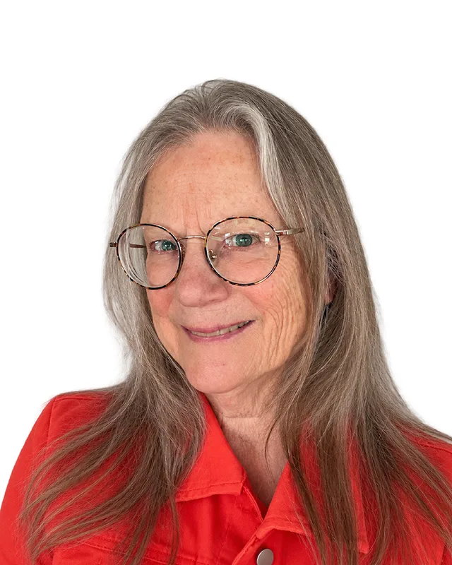MLA · Cariboo-Chilcotin**BC NDP**Kathryn Askew
Researched by voche.meExplore the profile ](https://voche.me/bc/provincial-2026/candidates/kathryn-askew) [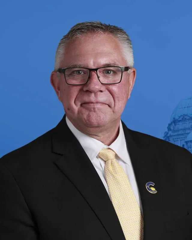MLA · Cariboo-Chilcotin**Conservative Party of BC**Lorne Doerkson
Researched by voche.meExplore the profile ](https://voche.me/bc/provincial-2026/candidates/lorne-doerkson)
- People, 2021 census
- 41,310
- Area
- 55,800 km²
- Registered voters, 2024
- 32,975
- Turnout, 2024
- 60.04%
- Median age
- 50.8
- Median household income, 2020
- $69,000
THE DISTRICT
## Where Cariboo-Chilcotin is
55,800 km² · 41,310 people
Cariboo-Chilcotin covers 55,800 square kilometres of the southern Cariboo and the Chilcotin Plateau, and the Electoral Boundaries Commission's 2023 final report counts 41,302 people in it. The report names Williams Lake, Clinton, 100 Mile House, Cache Creek and Ashcroft as communities along Highway 97, and Anahim Lake as a community along Highway 20. It says the district is bounded to the north by Cariboo Regional District Electoral Area K, to the west by the Cariboo Regional District, and to the south and east by the borders of Ashcroft and Thompson-Nicola Regional District Electoral Area J.
BC Geographical Names places Williams Lake on the east side of the Fraser River between 100 Mile House and Quesnel, and Clinton on the west side of the Bonaparte River between Cache Creek and 70 Mile House. Ashcroft lies on the east side of the Thompson River, below Kamloops Lake. The Chilcotin River flows southeast into the Fraser River south of Williams Lake. The commission extended the district south to Cache Creek and Ashcroft because they share Highway 97 with 100 Mile House and Williams Lake. It left Barriere and Clearwater in a Kamloops district, because reaching Cariboo-Chilcotin from there means crossing a mountain pass on secondary highways.
Elections BC's 2024 results file lists voting places across the district, from Ashcroft, Savona and Walhachin in the south to Anahim Lake and Tatla Lake in the west. They include the Bonaparte First Nation Band Office, the Canim Lake Band Office, the Skeetchestn Band Admin Bldg, the Toosey Admin Office, the Tsideldel Cultural Centre, the Yunesit’in Health Centre and the Naghtaneqed Elem-Jr Sec School. The school district says that school stands in the Nemiah Valley, three hours southwest of Williams Lake.
- Williams Lake
- 100 Mile House
- 108 Mile Ranch
- 150 Mile House
- 70 Mile House
- Interlakes
- Forest Grove
- Lone Butte
- Canim Lake
- Clinton
- Cache Creek
- Ashcroft
- Savona
- Walhachin
- Loon Lake
- Lac Le Jeune
- Dog Creek
- Anahim Lake
- Tatla Lake
- Nemiah Valley
- Tl'etinqox (Anaham)
- Tsi Del Del (Alexis Creek and Redstone)
- Yunesit'in (Stone)
- Tl'esqox (Toosey)
- Xeni Gwet'in (Nemiah)
- Tsq'escen' (Canim Lake)
- Skeetchestn
- Bonaparte
Sources: [British Columbia Electoral Boundaries Commission (opens in a new tab)](https://elections.bc.ca/docs/rpt/BCEBC-Final-Report-April-3-2023.pdf), [BC Geographical Names Office (opens in a new tab)](https://apps.gov.bc.ca/pub/bcgnws/names/25533.html), [BC Geographical Names Office (opens in a new tab)](https://apps.gov.bc.ca/pub/bcgnws/names/29466.html), [BC Geographical Names Office (opens in a new tab)](https://apps.gov.bc.ca/pub/bcgnws/names/27623.html), [BC Geographical Names Office (opens in a new tab)](https://apps.gov.bc.ca/pub/bcgnws/names/5858.html), [Elections BC (opens in a new tab)](https://catalogue.data.gov.bc.ca/dataset/44914a35-de9a-4830-ac48-870001ef8935), [School District 27 Cariboo-Chilcotin (opens in a new tab)](https://ngh.sd27.bc.ca/about-us)
HISTORY
## The history of the area
Checked Thursday, October 8, 2026
### Tŝilhqot'in, Secwépemc and Dakelh homelands
Several Nations describe parts of this district as their homeland, each in its own words. The Tŝilhqot'in Nation has six communities. The Tŝilhqot'in Stewardship Agreement for 2024 to 2027 is signed by the Province, the Nation and the Tŝilhqot'in National Government, and it lists the six as Xeni Gwet'in First Nations Government, Tsideldel First Nation, Tl'etinqox Government, ʔEsdilagh First Nation, Toosey First Nation and Yunesit'in Government. A 2017 release of the Government of Canada names the same six with their common English names, including Anaham for Tl'etinqox, Stone for Yunesit'in and Nemiah for Xeni Gwet'in. BC Geographical Names records that the name Chilcotin River comes from the Tŝilhqot'in language and gives more than one proposed meaning, including "ochre river people".
Williams Lake First Nation calls its people T'exelcemc and says they are members of the Secwépemc Nation who have lived across Secwepemcul'ecw for over 6500 years. Tsq'escen' First Nation, formerly the Canim Lake Band, says the Secwepemc (Shuswap) Nation consists of 17 Nations, and it gives its traditional area in the Cariboo as 21,260 square kilometres. Its reserve land lies east of 100 Mile House on the Canim-Hendrix Lake Road. The Skeetchestn Indian Band, at Deadman's Creek near Savona, says its ancestors wintered in pit house villages on both sides of Kamloops Lake before its reserve was established in 1877. The Province lists the Bonaparte Indian Band, west of Cache Creek, as a member of the Shuswap Nation Tribal Council.
In the west of the district, Ulkatcho First Nation describes its people as belonging to the Dakelh (Carrier) Nation. Its name refers to the people of the high country. It says its ancestral lands include the Anahim Lake area, the Itcha-Ilgachuz ranges and the Dean River watershed, and that its community is centred in Anahim Lake. The Nation's history page says Ulkatcho Village was a trading and potlatch centre where trails met, with routes to the Fraser River, the Central Coast and the Chilcotin Plateau.
Sources: [Government of British Columbia (opens in a new tab)](https://www2.gov.bc.ca/assets/gov/environment/natural-resource-stewardship/consulting-with-first-nations/agreements/tng_stewardship_agreement_2024_to_2027_renewal.pdf), [Government of Canada (opens in a new tab)](https://www.canada.ca/en/indigenous-northern-affairs/news/2017/01/tsilhqot-canada-take-first-steps-towards-reconciliation-signing-letter-understanding.html), [BC Geographical Names Office (opens in a new tab)](https://apps.gov.bc.ca/pub/bcgnws/names/5858.html), [Williams Lake First Nation (T'exelc) (opens in a new tab)](https://www.wlfn.ca/about-wlfn/culture-language/), [Tsq̓éscen̓ First Nation (opens in a new tab)](https://tsqescen.ca/), [Skeetchestn Indian Band (opens in a new tab)](https://skeetchestn.ca/about-2/), [Government of British Columbia (opens in a new tab)](https://www2.gov.bc.ca/gov/content/environment/natural-resource-stewardship/consulting-with-first-nations/first-nations-negotiations/first-nations-a-z-listing/bonaparte-indian-band), [Ulkatcho First Nation (opens in a new tab)](https://ulkatcho.ca/about), [Ulkatcho First Nation (opens in a new tab)](https://ulkatcho.ca/history)
### The Cariboo Road and its roadhouses, 1861 to 1868
Gold found in the Cariboo led the colony to build a road. The Canadian Encyclopedia says the Cariboo Road, 650 km long between Yale and Barkerville, was begun in 1862 and opened in 1865. Royal Engineers built the hardest sections and private contractors built the rest. Ashcroft became the third starting point of the road, after Yale and Lillooet.
Roadhouses along the route grew into towns. BC Geographical Names records that the first building at what is now Clinton opened on New Year's Day 1861 and was called 47 Mile House. After the Cariboo Wagon Road was completed in 1863, the place was renamed for Henry Pelham Clinton, 5th Duke of Newcastle, who was Colonial Secretary. The record also notes an Indigenous village called Pil-te-'uk, meaning white earth, on nearby Junction Creek, shown on George Dawson's 1895 survey map. 100 Mile House grew around a roadhouse 100 miles north of Lillooet on the Cariboo Road. Clement Francis Cornwall and Henry Pennant Cornwall started the ranch near Ashcroft in 1862 and named it after their family village in Gloucestershire, England. Cache Creek's post office opened on 4 January 1868, with Charles Augustus Semlin, a future Premier of British Columbia, as postmaster.
Williams Lake takes its name from Chief William of the Sugar Cane reserve. BC Geographical Names gives the earlier Indigenous name as Columetza, meaning the gathering place of the lordly ones, and says the present name was in use by 28 April 1860, when John Telfer received a pre-emption at Williams Lake.
Sources: [The Canadian Encyclopedia (opens in a new tab)](https://thecanadianencyclopedia.ca/en/article/cariboo-road), [The Canadian Encyclopedia (opens in a new tab)](https://thecanadianencyclopedia.ca/en/article/ashcroft), [BC Geographical Names Office (opens in a new tab)](https://apps.gov.bc.ca/pub/bcgnws/names/29466.html), [BC Geographical Names Office (opens in a new tab)](https://apps.gov.bc.ca/pub/bcgnws/names/30137.html), [BC Geographical Names Office (opens in a new tab)](https://apps.gov.bc.ca/pub/bcgnws/names/27623.html), [BC Geographical Names Office (opens in a new tab)](https://apps.gov.bc.ca/pub/bcgnws/names/27638.html), [BC Geographical Names Office (opens in a new tab)](https://apps.gov.bc.ca/pub/bcgnws/names/25533.html)
### The Chilcotin War and the six chiefs, 1864 to 2018
The Prime Minister's statement of 26 March 2018 says that in the spring of 1864 the Tsilhqot'in chiefs led a war party in defence of their homelands against a colonial road crew that wanted to build a road through Tsilhqot'in territory. It says the chiefs were invited under false pretenses to negotiate peace, then arrested and convicted. Five chiefs were hanged on 26 October 1864, and a sixth, Chief Ahan, was hanged later.
In the House of Commons the Prime Minister said: "We confirm without reservation that Chief Lhats'assin, Chief Biyil, Chief Tilaghed, Chief Taqed, Chief Chayses, and Chief Ahan are fully exonerated of any crime or wrongdoing." The statement describes the six as leaders and warriors of the Tsilhqot'in Nation who acted in accordance with their laws and traditions.
Sources: [Prime Minister of Canada (opens in a new tab)](https://www.pm.gc.ca/en/news/news-releases/2018/03/26/prime-minister-delivers-statement-exoneration-six-tsilhqotin-chiefs), [Prime Minister of Canada (opens in a new tab)](https://pm.gc.ca/en/node/484)
### The railways and the new municipalities, 1884 to 1991
The Canadian Pacific Railway reached Ashcroft in 1884, and the Canadian Encyclopedia says the town then served as a major supply centre for the goldfields in the north. The Pacific Great Eastern Railway was incorporated in Vancouver in 1912, and the Clinton and District Historical and Cultural Museum says it reached Clinton in 1916, when the company was bankrupt. In 1918 the government of Premier John Oliver took responsibility for it. The first work train reached Williams Lake on 15 September 1919. The line reached Quesnel in 1921 and Prince George in 1952.
The Government of Canada says the first Williams Lake Stampede, held in 1919, coincided with the building of the railway through the area. Municipal status came later. BC Geographical Names records Williams Lake as a village on 15 March 1929, a town on 15 February 1965 and a city on 5 November 1981. Ashcroft became a village on 27 June 1952, Cache Creek a local district on 25 February 1959, and Clinton a village on 16 July 1963. 100 Mile House became a village on 27 July 1965 and a district municipality on 13 June 1991.
Sources: [The Canadian Encyclopedia (opens in a new tab)](https://thecanadianencyclopedia.ca/en/article/ashcroft), [Clinton and District Historical and Cultural Museum (opens in a new tab)](https://www.clintonmuseumbc.org/gallery/pacific-greater-eastern-railroad-near-clinton), [Canadian Heritage (opens in a new tab)](https://www.canada.ca/en/canadian-heritage/news/2019/08/the-government-of-canada-supports-a-commemorative-project-to-mark-the-100th-anniversary-of-the-williams-lake-stampede.html), [BC Geographical Names Office (opens in a new tab)](https://apps.gov.bc.ca/pub/bcgnws/names/25533.html), [BC Geographical Names Office (opens in a new tab)](https://apps.gov.bc.ca/pub/bcgnws/names/27623.html), [BC Geographical Names Office (opens in a new tab)](https://apps.gov.bc.ca/pub/bcgnws/names/27638.html), [BC Geographical Names Office (opens in a new tab)](https://apps.gov.bc.ca/pub/bcgnws/names/29466.html), [BC Geographical Names Office (opens in a new tab)](https://apps.gov.bc.ca/pub/bcgnws/names/30137.html)
### St. Joseph's Mission, 1886 to 1981, and the investigation of 2021 to 2023
Williams Lake First Nation says St. Joseph's Mission operated as an Indian Residential School between 1886 and 1981. The Catholic Oblates administered it as part of the residential school system set up by the Government of Canada, and it stood near T'exelc, the community core of the First Nation. The Province lists the First Nation's community as 8 km south of Williams Lake.
The First Nation began an investigation of the site in July 2021, using ground penetrating radar, magnetometry and terrestrial LiDAR, along with archival research and 21 survivor interviews. It announced the first phase on 25 January 2022: a survey of 14 hectares found 93 reflections with characteristics indicative of human burials. It announced the second phase on 25 January 2023, which found 66 reflections with characteristics indicative of potential human remains.
Sources: [Williams Lake First Nation (T'exelc) (opens in a new tab)](https://www.wlfn.ca/about-wlfn/sjm-investigation/), [Government of British Columbia (opens in a new tab)](https://www2.gov.bc.ca/gov/content/environment/natural-resource-stewardship/consulting-with-first-nations/first-nations-negotiations/first-nations-a-z-listing/williams-lake-first-nation)
### Tŝilhqot'in title and the agreements, 2014 to 2024
A release of the Government of Canada says that on 26 June 2014 the Supreme Court of Canada declared that the Tsilhqot'in have Aboriginal title over 1,750 square kilometres in the interior of British Columbia near Williams Lake. On 27 January 2017 Canada and the Tsilhqot'in Nation signed a Letter of Understanding as a first step towards reconciliation. The Province and the Nation had already agreed the Nenqay Deni Accord, a reconciliation framework agreement dated 11 February 2016.
The current Tŝilhqot'in Stewardship Agreement is dated 1 April 2024 and replaces the earlier stewardship agreements. It sets out how the Province and the Nation take part in decisions about land and resources, and it lists Aboriginal title among the rights recognized and affirmed by section 35(1) of the Constitution Act, 1982. The Province acknowledges in it that Aboriginal Rights exist within the agreement area.
Williams Lake First Nation follows a separate path. The Province lists it at Stage 5 of the British Columbia treaty process, final agreement negotiations, after an Incremental Treaty Agreement in 2016 and an Agreement-in-Principle signed with the Province and Canada in July 2018.
Sources: [Government of Canada (opens in a new tab)](https://www.canada.ca/en/indigenous-northern-affairs/news/2017/01/tsilhqot-canada-take-first-steps-towards-reconciliation-signing-letter-understanding.html), [Government of British Columbia (opens in a new tab)](https://www2.gov.bc.ca/assets/gov/environment/natural-resource-stewardship/consulting-with-first-nations/agreements/tng_stewardship_agreement_2024_to_2027_renewal.pdf), [Government of British Columbia (opens in a new tab)](https://www2.gov.bc.ca/gov/content/environment/natural-resource-stewardship/consulting-with-first-nations/first-nations-negotiations/first-nations-a-z-listing/williams-lake-first-nation)
### The wildfires of July 2017
The independent BC Flood and Wildfire Review reports that more than 160 new fires began on 7 July 2017, mostly from lightning, in the Cariboo and Kamloops Fire Centre areas. The Province declared a state of emergency that day and lifted it on 15 September. Across British Columbia the 2017 fires burned 1,216,046 hectares and cost $568,000,000 to fight, and the review puts the number of evacuees at 65,000.
In this district the review lists the Plateau Complex on the Chilcotin Plateau, a group of separate fires that merged into 545,151 hectares and became the largest fire in the province's recorded history. It lists the Hanceville Complex at 241,160 hectares and the Central Cariboo Complex around Williams Lake and Soda Creek at 31,181 hectares. Williams Lake was under an evacuation order from 15 July to 27 July. The Gustafsen fire burned 5,700 hectares just west of 100 Mile House. The Elephant Hill fire, found on 6 July, reached 191,865 hectares between Ashcroft and Highway 24. It burned properties on the Ashcroft Indian Band and in the Boston Flats mobile home park, and the entire village of Cache Creek was evacuated.
Sources: [BC Flood and Wildfire Review, Government of British Columbia (opens in a new tab)](https://www2.gov.bc.ca/assets/gov/public-safety-and-emergency-services/emergency-preparedness-response-recovery/embc/bc-flood-and-wildfire-review-addressing-the-new-normal-21st-century-disaster-management-in-bc-web.pdf)
THE SEAT
## Who has held the seat
Legislative Assembly records, 39th Parliament onward
Elections BC's volume for 1871 to 1986 lists a district named Cariboo from the first general election of 1871. Alexander Vaughan Fraser of the Social Credit Party won it in 1969, 1972, 1975, 1979, 1983 and 1986. In 1975 he received 14,194 votes (69.87%), ahead of Grethyll Verda Adams of the New Democratic Party with 6,122 (30.13%). In 1986 Cariboo elected two members, and the volume prints Fraser (14,594 votes, 30.31%) and T. Neil Vant (12,715 votes, 26.40%) as the winners, both for Social Credit.
Multi-member districts ended with the Electoral Districts Act (SBC 1990 c. 39), assented to on 27 July 1990 and in effect from 19 September 1991, which set out 75 single-member districts. David Zirnhelt of the NDP won a by-election in Cariboo on 20 September 1989 with 14,091 votes (56.26%), ahead of Joe Wark of Social Credit with 9,292 (37.10%). From 1991 the volumes list Cariboo North and Cariboo South instead. In Cariboo South Zirnhelt won in 1991 with 6,369 votes (45.37%) and in 1996 with 6,372 (41.45%). Walt Cobb of the Liberal Party won in 2001 with 10,259 (62.21%). Charlie Wyse of the NDP won in 2005 with 7,277 (45.99%) against Cobb's 7,163 (45.27%).
The Electoral Districts Act of 2008 (SBC 2008 c. 14), assented to on 1 May 2008, raised the number of districts from 79 to 85 and took effect on 14 April 2009. The name Cariboo-Chilcotin first appears in the volumes at the 2009 general election. Donna Barnett of the BC Liberal Party won it in 2009 with 6,259 votes (47.85%), ahead of Charlie Wyse of the BC NDP with 6,171 (47.18%). She won again in 2013 with 7,679 (56.18%) and in 2017 with 8,517 (58.77%). Lorne Doerkson won in 2020 for the BC Liberal Party with 6,600 votes (51.25%) and in 2024 for the Conservative Party with 13,714 (69.59%), against Michael Moses of the BC NDP with 5,992 (30.41%).
The commission's 2023 final report extended Cariboo-Chilcotin south to include Cache Creek and Ashcroft, which were in Fraser-Nicola. Its table of the 87 current districts gives the earlier Cariboo-Chilcotin 33,987 people and 44,512 square kilometres. Its table of the proposed districts gives the new one 41,302 people and 55,800 square kilometres. The report shows that its preliminary proposal called the district Cariboo-North Thompson, and the final report changed the name to Cariboo-Chilcotin. Elections BC's conversion table lists the earlier districts that overlap the new one: Cariboo-Chilcotin with 58 voting areas, Fraser-Nicola with 19, Cariboo North with 6, and Kamloops-North Thompson and Kamloops-South Thompson with 3 each.
Sources: [Elections BC (opens in a new tab)](https://elections.bc.ca/docs/rpt/1871-1986_ElectoralHistoryofBC.pdf), [Elections BC (opens in a new tab)](https://elections.bc.ca/docs/rpt/1987-2001-ElectionHistory.pdf), [Elections BC (opens in a new tab)](https://elections.bc.ca/docs/rpt/2002-2013-ElectionHistory.pdf), [Elections BC (opens in a new tab)](https://catalogue.data.gov.bc.ca/dataset/44914a35-de9a-4830-ac48-870001ef8935), [British Columbia Electoral Boundaries Commission (opens in a new tab)](https://elections.bc.ca/docs/rpt/BCEBC-Final-Report-April-3-2023.pdf)
Members for Cariboo-Chilcotin
| Parliament | It sat | Member | Elected as | Party on the legislature’s record |
| --- | --- | --- | --- | --- |
| 43rd | 2025 to 2026 | Lorne Doerkson | Conservative Party | Conservative Party of BC |
| 42nd | 2020 to 2024 | Lorne Doerkson | BC Liberal Party | Conservative Party of BC |
| 41st | 2017 to 2020 | Donna Barnett | BC Liberal Party | BC Liberal Party |
| 40th | 2013 to 2017 | Donna Barnett | BC Liberal Party | BC Liberal Party |
| 39th | 2009 to 2013 | Donna Barnett | BC Liberal Party | BC Liberal Party |
Members for Fraser-Nicola, which covered 19 of this district’s 79 voting areas before 2024
| Parliament | It sat | Member | Elected as | Party on the legislature’s record |
| --- | --- | --- | --- | --- |
| 43rd | 2025 to 2026 | Tony Luck | Conservative Party | Conservative Party of BC |
| 42nd | 2020 to 2024 | Jackie Tegart | BC Liberal Party | BC United |
| 41st | 2017 to 2020 | Jackie Tegart | | BC Liberal Party |
| 40th | 2013 to 2017 | Jackie Tegart | BC Liberal Party | BC Liberal Party |
| 39th | 2009 to 2013 | Harry Lali | BC NDP | BC NDP |
“Elected as” is the affiliation Elections BC printed with the winning result. The last column is the party the legislature’s records give for that parliament, which differs when a member changed party while in office. A row with that column empty is a winner Elections BC prints whom the legislature’s records leave out. Source: [Legislative Assembly of British Columbia (opens in a new tab)](https://www.leg.bc.ca/members)
### Boundaries since 2024
Cariboo-Chilcotin has 79 voting areas. 58 of them overlap the district of the same name used from 2017 to 2024. Others overlap these districts from 2017 to 2024: Fraser-Nicola (19), Cariboo North (6), Kamloops-North Thompson (3), Kamloops-South Thompson (3).
The commission that drew the boundaries counted 41,302 people in the district, 23.2% below the average for a district, over 55,800 km².
Sources: [British Columbia Electoral Boundaries Commission, Final report, April 3, 2023 (opens in a new tab)](https://elections.bc.ca/docs/rpt/BCEBC-Final-Report-April-3-2023.pdf), [Elections BC, Voting area conversion table, 2017 to 2024 (opens in a new tab)](https://catalogue.data.gov.bc.ca/dataset/fb26db04-780c-4229-a147-da4fd5311d36)
PAST RESULTS
## Every result since 2009
From Elections BC
**2024 Provincial General Election**Lorne Doerkson, Conservative Party, 69.59%
| Candidate | Affiliation | Votes | Share |
| --- | --- | --- | --- |
| Lorne DoerksonElected | Conservative Party | 13,714 | 69.59% |
| Michael Moses | BC NDP | 5,992 | 30.41% |
19,706 valid votes · 92 rejected ballots · 32,975 registered voters · 60.04% voted
**2020 General Election**Lorne Doerkson, BC Liberal Party, 51.25%
| Candidate | Affiliation | Votes | Share |
| --- | --- | --- | --- |
| Lorne DoerksonElected | BC Liberal Party | 6,600 | 51.25% |
| Scott Andrews | BC NDP | 4,180 | 32.46% |
| David Laing | BC Green Party | 1,379 | 10.71% |
| Katya Potekhina | Independent | 457 | 3.55% |
| James Buckley | Libertarian | 263 | 2.04% |
12,879 valid votes · 72 rejected ballots
**2017 General Election**Donna Barnett, BC Liberal Party, 58.77%
| Candidate | Affiliation | Votes | Share |
| --- | --- | --- | --- |
| Donna BarnettElected | BC Liberal Party | 8,517 | 58.77% |
| Sally Watson | BC NDP | 3,801 | 26.23% |
| Rita Helen Giesbrecht | BC Green Party | 2,175 | 15.01% |
14,493 valid votes · 103 rejected ballots
**2013 General Election**Donna Barnett, BC Liberal Party, 56.18%
| Candidate | Affiliation | Votes | Share |
| --- | --- | --- | --- |
| Donna BarnettElected | BC Liberal Party | 7,679 | 56.18% |
| Charlie Wyse | BC NDP | 4,740 | 34.68% |
| Dustin Victor Price | BC Green Party | 747 | 5.46% |
| Gary Young | Independent | 503 | 3.68% |
13,669 valid votes · 68 rejected ballots
**2009 General Election**Donna Barnett, BC Liberal Party, 47.85%
| Candidate | Affiliation | Votes | Share |
| --- | --- | --- | --- |
| Donna BarnettElected | BC Liberal Party | 6,259 | 47.85% |
| Charlie Wyse | BC NDP | 6,171 | 47.18% |
| Elli Taylor | BC Green Party | 650 | 4.97% |
13,080 valid votes · 66 rejected ballots
### Fraser-Nicola, 2009 to 2024
**2024 Provincial General Election**Tony Luck, Conservative Party, 54.34%
| Candidate | Affiliation | Votes | Share |
| --- | --- | --- | --- |
| Tony LuckElected | Conservative Party | 10,326 | 54.34% |
| Francyne Joe | BC NDP | 6,917 | 36.40% |
| Jonah Timms | BC Green Party | 1,761 | 9.27% |
19,004 valid votes · 27 rejected ballots
**2020 General Election**Jackie Tegart, BC Liberal Party, 41.64%
| Candidate | Affiliation | Votes | Share |
| --- | --- | --- | --- |
| Jackie TegartElected | BC Liberal Party | 5,696 | 41.64% |
| Aaron Sumexheltza | BC NDP | 5,414 | 39.58% |
| Jonah Timms | BC Green Party | 1,788 | 13.07% |
| Dennis Adamson | Independent | 438 | 3.20% |
| Mike Bhangu | Independent | 343 | 2.51% |
13,679 valid votes · 89 rejected ballots
**2017 General Election**Jackie L. Tegart, BC Liberal Party, 41.79%
| Candidate | Affiliation | Votes | Share |
| --- | --- | --- | --- |
| Jackie L. TegartElected | BC Liberal Party | 6,597 | 41.79% |
| Harry Lali | BC NDP | 6,073 | 38.47% |
| Arthur Alexander Green | BC Green Party | 2,519 | 15.96% |
| Michael Henshall | BC Social Credit Party | 596 | 3.78% |
15,785 valid votes · 69 rejected ballots
**2013 General Election**Jackie Tegart, BC Liberal Party, 44.14%
| Candidate | Affiliation | Votes | Share |
| --- | --- | --- | --- |
| Jackie TegartElected | BC Liberal Party | 6,002 | 44.14% |
| Harry Lali | BC NDP | 5,388 | 39.62% |
| John Kidder | BC Green Party | 1,314 | 9.66% |
| Michael Beauclair | Conservative | 895 | 6.58% |
13,599 valid votes · 51 rejected ballots
**2009 General Election**Harry Lali, BC NDP, 49.12%
| Candidate | Affiliation | Votes | Share |
| --- | --- | --- | --- |
| Harry LaliElected | BC NDP | 6,703 | 49.12% |
| Ella Brown | BC Liberal Party | 5,830 | 42.72% |
| Desiree Maher-Schley | BC Green Party | 891 | 6.53% |
| Dian Joan Brooks | BC Refed | 223 | 1.63% |
13,647 valid votes · 82 rejected ballots
The boundaries changed before the 2009, 2017 and 2024 elections, so a result under the same name can cover a different area. Sources: [Elections BC, Provincial Voting Results (opens in a new tab)](https://catalogue.data.gov.bc.ca/dataset/44914a35-de9a-4830-ac48-870001ef8935), [Statement of Votes, 2024 Provincial General Election (opens in a new tab)](https://elections.bc.ca/docs/rpt/statement-of-votes-2024-provincial-election.pdf)
PEOPLE · 2021 CENSUS
## Who lives in Cariboo-Chilcotin
41,310 residents · British Columbia beside each figure
### Age
- Median age
- 50.8BC 42.8
- Under 1514.4%BC 14.3%
- 15 to 6458.7%BC 65.3%
- 65 and over26.9%BC 20.3%
- 85 and over2.4%BC 2.4%
### Households
- Households
- 18,340
- People per household
- 2.2BC 2.4
#### Who lives together
- Couples with children17.2%BC 22.7%
- Couples without children34.1%BC 26.4%
- One-parent families7.5%BC 7.6%
- Multigenerational households2.3%BC 3.7%
- People living alone30.6%BC 29.4%
#### Household size
- 1 person30.6%BC 29.4%
- 2 persons42.5%BC 35.3%
- 3 persons11.7%BC 14.5%
- 4 persons8.9%BC 12.6%
- 5 or more persons6.3%BC 8.2%
### Homes
- Median home value
- $348,000BC $785,000
- Median monthly rent and utilities
- $880BC $1,370
- Median monthly cost for owners
- $620BC $1,320
#### Own or rent
- Own their home75.8%BC 66.8%
- Rent their home20.9%BC 32.8%
- Home provided by a local government or First Nation3.4%BC 0.5%
#### Type of home
- Single-detached house72.2%BC 42.4%
- Semi-detached house2.8%BC 3.1%
- Row house3.6%BC 8.3%
- Apartment or flat in a duplex3.6%BC 12.2%
- Apartment in a building that has fewer than five storeys7.1%BC 20.4%
- Other single-attached house0.3%BC 0.2%
- Movable dwelling10.4%BC 2.5%
#### When the home was built
- 1960 or earlier9.7%BC 12.5%
- 1961 to 198042.8%BC 27.0%
- 1981 to 199013.5%BC 14.2%
- 1991 to 200016.7%BC 16.5%
- 2001 to 20053.8%BC 6.0%
- 2006 to 20105.7%BC 8.0%
- 2011 to 20153.4%BC 6.6%
- 2016 to 20214.5%BC 9.1%
### Housing costs
- Renters paying 30% or more of income on housing27.4%BC 37.8%
- Owners paying 30% or more of income on housing10.4%BC 19.3%
- Renters in core housing need16.4%BC 24.7%
- Owners in core housing need7.4%BC 8.0%
- Renters in subsidized housing14.9%BC 11.0%
- Owners with a mortgage47.3%BC 57.5%
### Income
Income is for the year 2020.
- Median household income
- $69,000BC $85,000
- After tax
- $62,800BC $76,000
- Median income per person
- $35,600BC $40,800
#### Living on a low income (after-tax measure)
- All ages14.8%BC 10.8%
- Under 1815.4%BC 11.3%
- 18 to 6413.5%BC 9.7%
- 65 and over17.0%BC 13.8%
### Languages
#### First language learned
- English89.5%BC 67.1%
- German1.8%BC 1.0%
- French1.0%BC 1.2%
- Tsilhqot'in (Chilcotin)1.0%BC 0.0%
- Punjabi (Panjabi)0.9%BC 4.9%
- Secwepemctsin (Shuswap)0.4%BC 0.0%
- Dutch0.4%BC 0.4%
- Swiss German0.3%BC 0.0%
- Tagalog (Pilipino, Filipino)0.3%BC 1.7%
- Spanish0.2%BC 1.2%
#### Spoken most often at home
- English95.8%BC 78.5%
- Punjabi (Panjabi)0.8%BC 3.8%
- German0.5%BC 0.1%
- Tsilhqot'in (Chilcotin)0.4%BC 0.0%
- Korean0.2%BC 0.9%
- Secwepemctsin (Shuswap)0.2%BC 0.0%
- French0.1%BC 0.3%
- Afrikaans0.1%BC 0.0%
#### English and French
- English only96.1%BC 90.1%
- English and French3.7%BC 6.6%
- Neither English nor French0.3%BC 3.3%
### Immigration
- Born outside Canada (immigrants)
- 9.0%BC 29.0%
- Non-permanent residents
- 0.5%BC 3.5%
#### Where immigrants were born
- United States of America17.8%BC 4.2%
- United Kingdom16.5%BC 8.2%
- Germany12.5%BC 2.2%
- India8.9%BC 13.8%
- Netherlands5.2%BC 1.1%
- Philippines4.5%BC 9.2%
- Oceania and other places of birth3.0%BC 2.3%
- South Africa, Republic of2.3%BC 1.1%
- Korea, South1.8%BC 3.3%
- Portugal1.6%BC 0.5%
#### When immigrants arrived
- Arrived before 198050.0%BC 19.7%
- 1980 to 199011.9%BC 11.5%
- 1991 to 200011.6%BC 21.0%
- 2001 to 201010.6%BC 22.2%
- 2011 to 202115.9%BC 25.6%
#### Generations in Canada
- First generation10.1%BC 33.7%
- Second generation14.8%BC 21.7%
- Third generation or more75.2%BC 44.5%
### Identity and origins
- Indigenous identity
- 20.6%BC 5.9%
- Visible minority
- 4.2%BC 34.4%
#### Visible minority groups
- South Asian1.5%BC 9.6%
- Filipino0.6%BC 3.5%
- Chinese0.4%BC 11.2%
- Black0.4%BC 1.3%
- Japanese0.3%BC 0.9%
- Latin American0.2%BC 1.3%
- Southeast Asian0.2%BC 1.5%
- Korean0.2%BC 1.5%
- Multiple visible minorities0.2%BC 1.2%
- Visible minority (other)0.1%BC 0.4%
- Arab0.0%BC 0.6%
#### Ethnic or cultural origins reported most often
- English27.3%BC 20.7%
- Scottish19.8%BC 15.8%
- Irish16.0%BC 12.8%
- German15.4%BC 11.0%
- Canadian13.6%BC 9.3%
- French8.2%BC 6.4%
- First Nations (North American Indian)6.2%BC 2.1%
- Dutch5.5%BC 3.9%
- Ukrainian5.0%BC 4.3%
- Norwegian4.2%BC 2.8%
### Religion
- No religion61.3%BC 52.1%
- Christian35.0%BC 34.3%
- Other religions1.3%BC 1.0%
- Sikh1.1%BC 5.9%
- Traditional Indigenous spirituality0.8%BC 0.2%
- Hindu0.2%BC 1.7%
- Buddhist0.1%BC 1.7%
- Jewish0.1%BC 0.5%
- Muslim0.1%BC 2.6%
### Education
Highest level completed, ages 25 to 64.
- No certificate, diploma or degree17.3%BC 8.0%
- High school diploma34.2%BC 25.8%
- College, trades or other certificate below a bachelor’s degree36.4%BC 31.2%
- Bachelor’s degree or higher12.1%BC 35.0%
### Work
- In the labour force
- 53.1%BC 63.3%
- Employed
- 47.8%BC 57.9%
- Unemployment rate at the census
- 9.9%BC 8.4%
#### Industries with the most workers
- Retail trade12.0%BC 11.6%
- Health care and social assistance11.7%BC 12.3%
- Construction10.1%BC 9.0%
- Agriculture, forestry, fishing and hunting9.4%BC 2.3%
- Manufacturing7.8%BC 5.9%
- Public administration6.7%BC 5.5%
- Accommodation and food services6.6%BC 7.0%
- Educational services6.1%BC 7.4%
#### Kinds of work
- Trades, transport and equipment operators and related occupations24.9%BC 18.0%
- Sales and service occupations24.1%BC 25.6%
- Business, finance and administration occupations12.6%BC 17.1%
- Occupations in education, law and social, community and government services10.0%BC 11.9%
- Natural resources, agriculture and related production occupations8.3%BC 2.8%
- Health occupations6.8%BC 7.7%
- Occupations in manufacturing and utilities5.8%BC 3.4%
- Natural and applied sciences and related occupations4.5%BC 8.0%
- Occupations in art, culture, recreation and sport1.9%BC 4.2%
- Legislative and senior management occupations0.9%BC 1.2%
### Getting to work
#### Where people worked
- Worked at home12.3%BC 22.6%
- Worked outside Canada0.1%BC 0.4%
- No fixed workplace address17.3%BC 15.3%
- Worked at a usual workplace70.2%BC 61.6%
#### How commuters travelled
- Car, truck or van89.6%BC 79.9%
- Public transit1.6%BC 9.3%
- On foot6.0%BC 6.5%
- Bicycle0.5%BC 2.0%
- Other method2.4%BC 2.3%
#### Length of the trip
- Less than 15 minutes50.4%BC 31.8%
- 15 to 29 minutes26.5%BC 34.0%
- 30 to 44 minutes10.5%BC 19.7%
- 45 to 59 minutes4.3%BC 7.3%
- 60 minutes and over8.1%BC 7.2%
### Moving
Where residents lived five years before the census.
- Lived at the same address56.6%BC 56.2%
- Moved within the same municipality10.5%BC 16.1%
- Moved from elsewhere in BC28.2%BC 17.0%
- Moved from another province3.5%BC 4.6%
- Moved from another country1.2%BC 6.1%
Counts in the census are rounded to the nearest 5, and shares are worked out from those counts. Source: [BC Stats, from Statistics Canada tabulations, 2021 Census Profile for BC Provincial Electoral Districts (2023 Redistribution) (opens in a new tab)](https://catalogue.data.gov.bc.ca/dataset/census-profiles-for-bc-provincial-electoral-districts)
QUESTIONS
## Questions about Cariboo-Chilcotin
10 answers
### Where is Cariboo-Chilcotin?
Cariboo-Chilcotin is a provincial electoral district in the southern Cariboo and on the Chilcotin Plateau of central British Columbia. The Electoral Boundaries Commission's 2023 final report gives its area as 55,800 square kilometres and its population as 41,302. It includes communities along Highway 97 such as Williams Lake, Clinton, 100 Mile House, Cache Creek and Ashcroft, and Anahim Lake on Highway 20.
### Which communities are in Cariboo-Chilcotin?
Cariboo-Chilcotin includes Williams Lake, 100 Mile House, Clinton, Cache Creek, Ashcroft and Anahim Lake, according to the commission's 2023 final report. Elections BC's 2024 results file also places voting places in 108 Mile Ranch, 150 Mile House, 70 Mile House, Canim Lake, Dog Creek, Tatla Lake, Savona and Walhachin, and at the offices of Bonaparte, Skeetchestn, Toosey and Tsideldel.
### Who won Cariboo-Chilcotin in the 2024 provincial election?
Lorne Doerkson of the Conservative Party won Cariboo-Chilcotin in 2024 with 13,714 votes, 69.59% of the valid vote. Michael Moses of the BC NDP received 5,992 votes, 30.41%. Turnout was 60.04% of 32,975 registered voters. Doerkson also won the district in 2020, and Donna Barnett of the BC Liberal Party won it in 2009, 2013 and 2017.
### Who represented the Cariboo before the name Cariboo-Chilcotin?
Alexander Vaughan Fraser of Social Credit won the Cariboo district in 1969, 1972, 1975, 1979, 1983 and 1986, according to Elections BC's volume for 1871 to 1986. In 1975 he received 14,194 votes, 69.87%. David Zirnhelt of the NDP won a Cariboo by-election on 20 September 1989 with 14,091 votes, 56.26%, and then won Cariboo South in 1991 and 1996.
### When was the name Cariboo-Chilcotin first used?
The name Cariboo-Chilcotin first appears in Elections BC's volumes at the 2009 general election, held under the Electoral Districts Act of 2008, which raised the number of districts from 79 to 85. Donna Barnett of the BC Liberal Party won it with 6,259 votes, 47.85%. From 1991 to 2005 the volumes list districts named Cariboo North and Cariboo South.
### How did the boundaries of Cariboo-Chilcotin change in 2023?
The commission's 2023 final report extended Cariboo-Chilcotin south to include Cache Creek and Ashcroft, which were in Fraser-Nicola. The district's population rose from 33,987 to 41,302 and its area from 44,512 to 55,800 square kilometres. The preliminary proposal called the district Cariboo-North Thompson, and the final report changed the name to Cariboo-Chilcotin.
### How many people live in Cariboo-Chilcotin?
The 2021 census counted 41,310 people in Cariboo-Chilcotin, with a median age of 50.8 compared with 42.8 across British Columbia. English was the first language of 89.5% of residents, German of 1.8% and French of 1%. Tsilhqot'in (Chilcotin) was the first language of 1%. People with Indigenous identity made up 20.6% of the population, which is 8,390 people.
### Whose traditional territory is Cariboo-Chilcotin on?
Several Nations describe territory in Cariboo-Chilcotin in their own words. The Tŝilhqot'in Nation has six communities, and Williams Lake First Nation, Tsq'escen' First Nation and Skeetchestn Indian Band belong to the Secwépemc Nation. Ulkatcho First Nation, centred in Anahim Lake, is a Dakelh (Carrier) Nation. The sources below link to the pages where each Nation speaks for itself.
### What did the Supreme Court decide about Tsilhqot'in title?
Cariboo-Chilcotin includes Tŝilhqot'in communities such as Tl'etinqox and Yunesit'in. A Government of Canada release says that on 26 June 2014 the Supreme Court of Canada declared that the Tsilhqot'in have Aboriginal title over 1,750 square kilometres in the interior of British Columbia near Williams Lake. The Province and the Nation signed the Nenqay Deni Accord, dated 11 February 2016.
### What happened in Cariboo-Chilcotin during the 2017 wildfires?
Cariboo-Chilcotin lay under the largest fire in British Columbia's recorded history in 2017. The BC Flood and Wildfire Review reports that the Plateau Complex on the Chilcotin Plateau covered 545,151 hectares, and that Williams Lake was under an evacuation order from 15 July to 27 July. The Province declared a state of emergency on 7 July and lifted it on 15 September.
SOURCES
## Where this page comes from
Figures read Thursday, October 8, 2026
1. [2021 Census Profile for BC Provincial Electoral Districts (2023 Redistribution) (opens in a new tab)](https://catalogue.data.gov.bc.ca/dataset/census-profiles-for-bc-provincial-electoral-districts)BC Stats, from Statistics Canada tabulations · read Thursday, October 8, 2026
2. [Provincial Voting Results (opens in a new tab)](https://catalogue.data.gov.bc.ca/dataset/44914a35-de9a-4830-ac48-870001ef8935)Elections BC · read Thursday, October 8, 2026
3. [Statement of Votes, 2024 Provincial General Election (opens in a new tab)](https://elections.bc.ca/docs/rpt/statement-of-votes-2024-provincial-election.pdf)Elections BC · read Thursday, October 8, 2026
4. [Voting area conversion table, 2017 to 2024 (opens in a new tab)](https://catalogue.data.gov.bc.ca/dataset/fb26db04-780c-4229-a147-da4fd5311d36)Elections BC · read Thursday, October 8, 2026
5. [Final report, April 3, 2023 (opens in a new tab)](https://elections.bc.ca/docs/rpt/BCEBC-Final-Report-April-3-2023.pdf)British Columbia Electoral Boundaries Commission · read Thursday, October 8, 2026
6. [Members of the Legislative Assembly, 35th to 43rd Parliament (opens in a new tab)](https://www.leg.bc.ca/members)Legislative Assembly of British Columbia · read Thursday, October 8, 2026
7. [Final report, April 3, 2023 (opens in a new tab)](https://elections.bc.ca/docs/rpt/BCEBC-Final-Report-April-3-2023.pdf)British Columbia Electoral Boundaries Commission · read Thursday, October 8, 2026
8. [Electoral History of British Columbia, 1871 to 1986 (opens in a new tab)](https://elections.bc.ca/docs/rpt/1871-1986_ElectoralHistoryofBC.pdf)Elections BC · read Thursday, October 8, 2026
9. [Electoral History of British Columbia, Supplement, 1987 to 2001 (opens in a new tab)](https://elections.bc.ca/docs/rpt/1987-2001-ElectionHistory.pdf)Elections BC · read Thursday, October 8, 2026
10. [Electoral History of British Columbia, Supplement, 2002 to 2013 (opens in a new tab)](https://elections.bc.ca/docs/rpt/2002-2013-ElectionHistory.pdf)Elections BC · read Thursday, October 8, 2026
11. [Provincial Voting Results (opens in a new tab)](https://catalogue.data.gov.bc.ca/dataset/44914a35-de9a-4830-ac48-870001ef8935)Elections BC · read Thursday, October 8, 2026
12. [Tŝilhqot'in Stewardship Agreement, 2024 to 2027 (opens in a new tab)](https://www2.gov.bc.ca/assets/gov/environment/natural-resource-stewardship/consulting-with-first-nations/agreements/tng_stewardship_agreement_2024_to_2027_renewal.pdf)Government of British Columbia · read Thursday, October 8, 2026
13. [Tsilhqot'in and Canada take first steps towards reconciliation with signing of Letter of Understanding (opens in a new tab)](https://www.canada.ca/en/indigenous-northern-affairs/news/2017/01/tsilhqot-canada-take-first-steps-towards-reconciliation-signing-letter-understanding.html)Government of Canada · read Thursday, October 8, 2026
14. [Prime Minister delivers statement of exoneration for six Tsilhqot'in Chiefs (opens in a new tab)](https://www.pm.gc.ca/en/news/news-releases/2018/03/26/prime-minister-delivers-statement-exoneration-six-tsilhqotin-chiefs)Prime Minister of Canada · read Thursday, October 8, 2026
15. [Transcript: Prime Minister Trudeau delivers a statement of exoneration for six Tsilhqot'in Chiefs (opens in a new tab)](https://pm.gc.ca/en/node/484)Prime Minister of Canada · read Thursday, October 8, 2026
16. [Chilcotin River, BC Geographical Names record (opens in a new tab)](https://apps.gov.bc.ca/pub/bcgnws/names/5858.html)BC Geographical Names Office · read Thursday, October 8, 2026
17. [Williams Lake, BC Geographical Names record (opens in a new tab)](https://apps.gov.bc.ca/pub/bcgnws/names/25533.html)BC Geographical Names Office · read Thursday, October 8, 2026
18. [100 Mile House, BC Geographical Names record (opens in a new tab)](https://apps.gov.bc.ca/pub/bcgnws/names/30137.html)BC Geographical Names Office · read Thursday, October 8, 2026
19. [Cache Creek, BC Geographical Names record (opens in a new tab)](https://apps.gov.bc.ca/pub/bcgnws/names/27638.html)BC Geographical Names Office · read Thursday, October 8, 2026
20. [Clinton, BC Geographical Names record (opens in a new tab)](https://apps.gov.bc.ca/pub/bcgnws/names/29466.html)BC Geographical Names Office · read Thursday, October 8, 2026
21. [Ashcroft, BC Geographical Names record (opens in a new tab)](https://apps.gov.bc.ca/pub/bcgnws/names/27623.html)BC Geographical Names Office · read Thursday, October 8, 2026
22. [Culture and Language (opens in a new tab)](https://www.wlfn.ca/about-wlfn/culture-language/)Williams Lake First Nation (T'exelc) · read Thursday, October 8, 2026
23. [St. Joseph's Mission Investigation (opens in a new tab)](https://www.wlfn.ca/about-wlfn/sjm-investigation/)Williams Lake First Nation (T'exelc) · read Thursday, October 8, 2026
24. [Tsq̓éscen̓ First Nation (opens in a new tab)](https://tsqescen.ca/)Tsq̓éscen̓ First Nation · read Thursday, October 8, 2026
25. [About (opens in a new tab)](https://skeetchestn.ca/about-2/)Skeetchestn Indian Band · read Thursday, October 8, 2026
26. [Our Nation, Our Story (opens in a new tab)](https://ulkatcho.ca/about)Ulkatcho First Nation · read Thursday, October 8, 2026
27. [History (opens in a new tab)](https://ulkatcho.ca/history)Ulkatcho First Nation · read Thursday, October 8, 2026
28. [Williams Lake First Nation (T'exelc), First Nations A-Z listing (opens in a new tab)](https://www2.gov.bc.ca/gov/content/environment/natural-resource-stewardship/consulting-with-first-nations/first-nations-negotiations/first-nations-a-z-listing/williams-lake-first-nation)Government of British Columbia · read Thursday, October 8, 2026
29. [Bonaparte Indian Band, First Nations A-Z listing (opens in a new tab)](https://www2.gov.bc.ca/gov/content/environment/natural-resource-stewardship/consulting-with-first-nations/first-nations-negotiations/first-nations-a-z-listing/bonaparte-indian-band)Government of British Columbia · read Thursday, October 8, 2026
30. [Cariboo Road (opens in a new tab)](https://thecanadianencyclopedia.ca/en/article/cariboo-road)The Canadian Encyclopedia · read Thursday, October 8, 2026
31. [Ashcroft (opens in a new tab)](https://thecanadianencyclopedia.ca/en/article/ashcroft)The Canadian Encyclopedia · read Thursday, October 8, 2026
32. [On to Williams Lake (opens in a new tab)](https://www.clintonmuseumbc.org/gallery/pacific-greater-eastern-railroad-near-clinton)Clinton and District Historical and Cultural Museum · read Thursday, October 8, 2026
33. [The Government of Canada supports a commemorative project to mark the 100th anniversary of the Williams Lake Stampede (opens in a new tab)](https://www.canada.ca/en/canadian-heritage/news/2019/08/the-government-of-canada-supports-a-commemorative-project-to-mark-the-100th-anniversary-of-the-williams-lake-stampede.html)Canadian Heritage · read Thursday, October 8, 2026
34. [Addressing the New Normal: 21st Century Disaster Management in British Columbia (opens in a new tab)](https://www2.gov.bc.ca/assets/gov/public-safety-and-emergency-services/emergency-preparedness-response-recovery/embc/bc-flood-and-wildfire-review-addressing-the-new-normal-21st-century-disaster-management-in-bc-web.pdf)BC Flood and Wildfire Review, Government of British Columbia · read Thursday, October 8, 2026
35. [About us, Naghtaneqed Elementary/Junior Secondary School (opens in a new tab)](https://ngh.sd27.bc.ca/about-us)School District 27 Cariboo-Chilcotin · read Thursday, October 8, 2026
## Official information
From Elections BC
Your district
### [Check which district an address is in](https://elections.bc.ca/resources/maps/find-your-district/)
Look up your address to be sure this district is yours.
[Look it up (opens in a new tab)](https://elections.bc.ca/resources/maps/find-your-district/)
Candidates
### [The official candidate list](https://www.elections.bc.ca/docs/fin/GE-2026-10-24-Candidate-Website-Report.PDF)
The list this page is built from, published by Elections BC.
[Open the list (opens in a new tab)](https://www.elections.bc.ca/docs/fin/GE-2026-10-24-Candidate-Website-Report.PDF)
Voting
### [Where and when to vote](https://elections.bc.ca/2026-provincial-election/where-to-vote/)
Voting places and hours for general voting day and advance voting.
[Find your voting place (opens in a new tab)](https://elections.bc.ca/2026-provincial-election/where-to-vote/)
## Sitemap
See the full [sitemap](/bc/provincial-2026/sitemap.md) for all pages.